
The Croesus Track is located in the Southern Paparoa Range in the West coast region. This track is one of finest surviving examples of a miners’ track (1881) on the West Coast.
A group of 12 from WTMC, lead by Matt and assisted by Catherine started our adventure on Thursday night of Easter weekend 2016.
Thursday- Wellington to Murchison
Meeting time was at 3.30 at Wellington Station catch the 5.00pm ferry.
The Cook Strait crossing was surprising calm and relaxing.
Once arriving in Picton we drove to Murchison’s Riverside Holiday Park for the night.
Friday-Murchison-Blackball-Ces Clark Hut
After a comfortable nights sleep we start the drive to Blackball. We arrive at Blackball and park at the Smoke-ho car park. We are on the track by 10.00am to start our walk to Ces Clark hut, which is a 4-5 hour walk. In the first hour we passed through a mixture of podocarp and beech forest and crossed The Garden Gully Bridge over Smoke-ho Creek. Here we passed the remnants of the battery for crushing quarts. The track then zigzags up the dividing ridge between Blackball Creek and roaring Meg catchments for the next hour until you turn off to Battery Track. The track then climbs more steeply into subalpine forest here we saw a variety of subalpine plants.
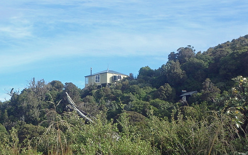
The final climb towards Ces Clark Hut on a good day you can see views of lake Brunner and the main divide down to Aoraki Mount Cook, unfortunately there was too much cloud cover for us to see these views. Ces Clarke Hut sleeps 16, when we arrived there was only two other people in the hut, which was very fortuitous as there are no tent sites close to the hut.
We settled down for the evening, started preparing dinner…mushroom rice risotto…yum!
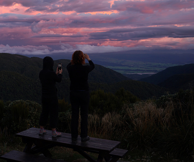
As the sun started to go down the West Coast presented us with a beautiful sunset. The sky was a glorious a ray of multilayered red hues intertwined by the cotton wool balls of clouds.
Saturday-26th March
We woke to light rain. We decide to wait until the rain abated. About 10.00 we headed to Croesus knob, an appropriately named formation, a couple of us attempted climb to the top. Then we headed to Moonlight route passing many alpine plants along the way. However, the weather closed in, making it pointless to go any further.
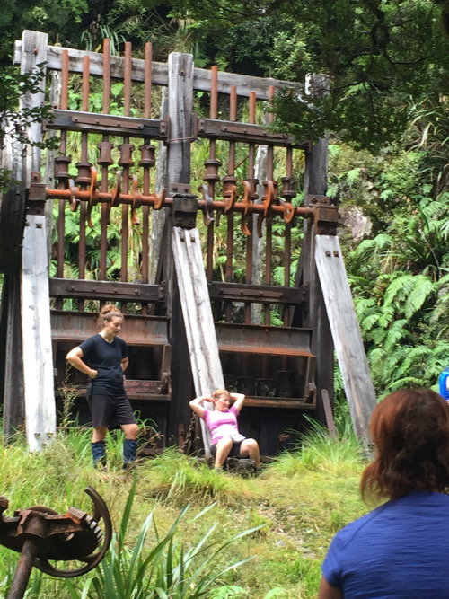
On our way back we attempted to look for mine openings that were noted on the maps as being there. Although we did find more remains of the bucket conveyer system, which was used to transport the quartz.
We got back the hut at about 5.30pm. Tonight’s dinner was a Moroccan dish with feta chees, sultanas, cashews and couscous…yummy
Another beautiful sunset to end a perfect day.
Sunday 27th March
A bit of drizzle in the morning, we headed out for the day at about 11.00. Climbing mount Croesus again in search of the elusive mine openings. We however, we came across more remains of the mining days. Despite the cloudbanks we forged along the ridge to Mount Ryall hoping there would be breaks in the cloud cover. We were not disappointed once at the top we got glimpses of the West coast shoreline.
We got back to the hut at 5.30.
Monday 28th march
An early start this morning to walk out to ensure we had ample time to make the early evening ferry.
Summary
This was an excellent weekend away with the WTMC, well organized at an awesome location with spectacular scenery.