
What a trip, what a weekend, what a day!
We had a wonderfully smooth sail on the Interislander, and used the time to scour our maps and discuss where we would go! It’s a wonderful feeling to pour over topo maps and evaluate track options when possibilities abound! So exciting! We had been informed by Interislander staff that our ferry trip on Monday might be cancelled due to a big swell in Cook Strait. As luck would have it, the club trips for both groups heading away this weekend could be completed in two days. We did not want to get stuck in the South Island, and hence decided to cut our three-day long weekend trip down to two days. With track options discussed and tramping plans finalised we sat back and enjoyed the calm sailing to Picton.
Our options were;
1. Lake Chalice car park, up to Mt Patriarch, and then either backtrack and drop to Mid Goulter Hut OR …..
2. Smash Mt Patriarch, carry on over the majestical open tops and then finish the day with an exhilarating, exciting, adventurous bush-bash down to Lower Goulter Hut. Being the adventurous spirits we are, we chose the latter! Why on earth not!
After arriving in Picton at around 19.30, we drove to Onamalatu campsite – a wonderful expansive DOC campground ($10 pp) with the usual facilities. Friday nights usually involve a bit of pitching tents in the dark. And while some of us pitched tents, Emily got bivved up, and we (Jamie and I), opted to have a faff-free morning the next day and slept in the van (which I have to say was incredibly comfortable). No packing up a wet tent with cold hands for us!
Day one
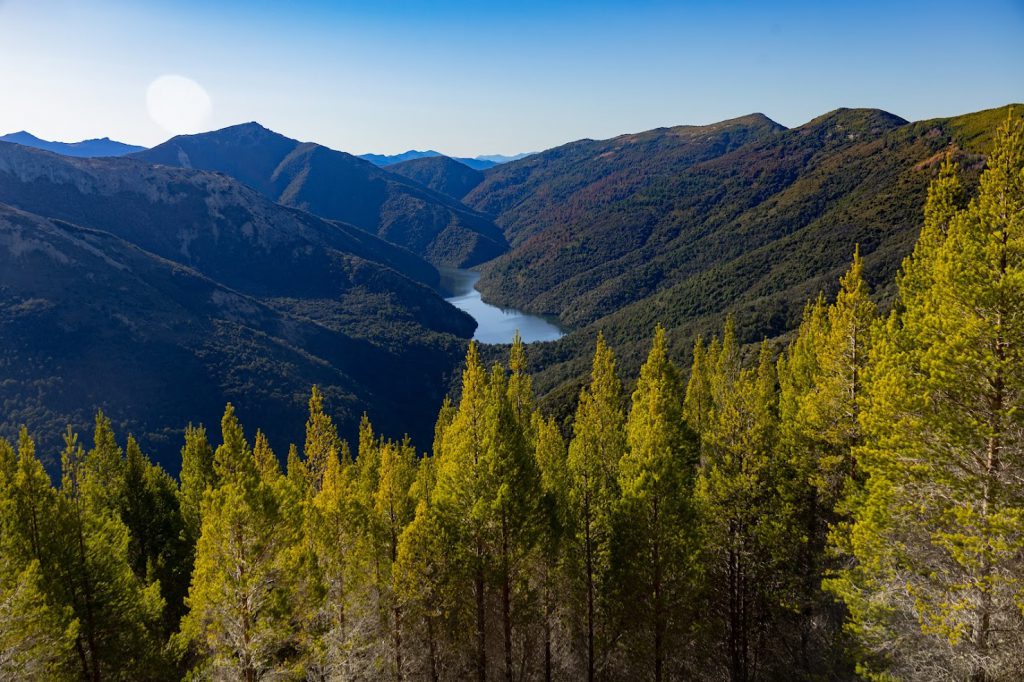
The next morning we dropped the other club group off at the start of the Mount Richmond track (smugly celebrating the fact we did not have a frigid river crossing to start the day off like they did!). We then started our windy drive, up Staircase Road to Lake Chalice car park. It was a crisp bluebird morning as we set off up a rather uninspiring four-wheel-drive track. Having said that, the views were spectacular. It’s not often that you can park up and get straight into the good views so soon. As we headed up, we passed high over Lake Chalice. We would be going to Lake Chalice tomorrow afternoon.
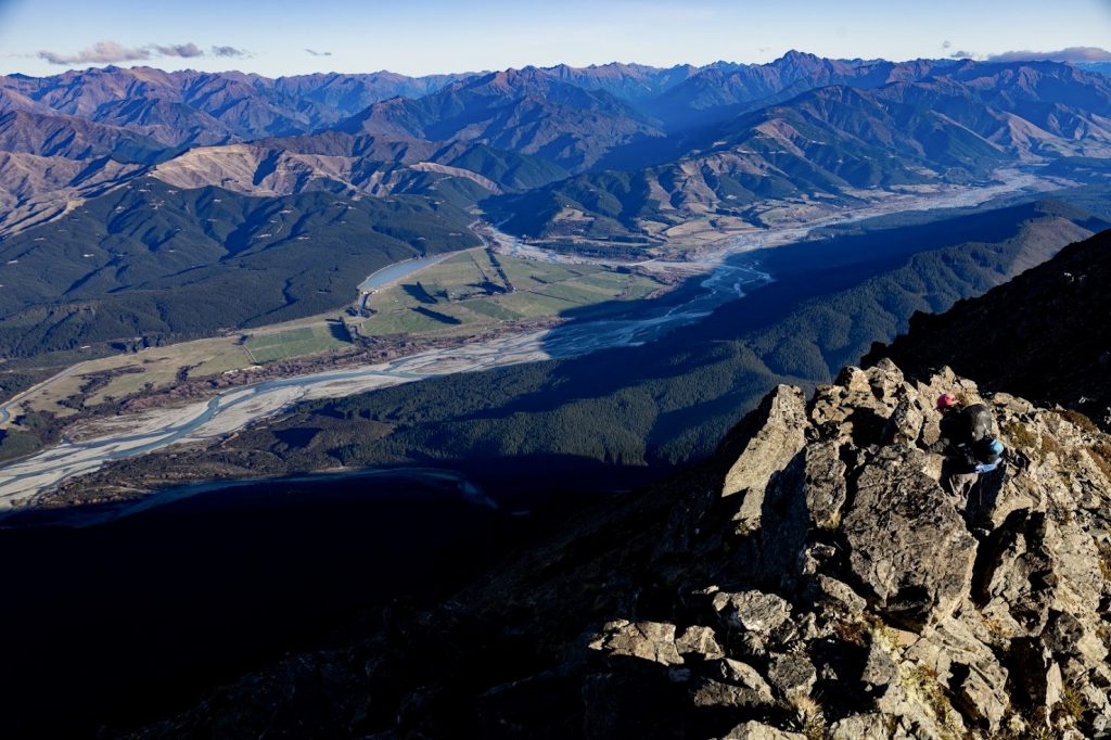
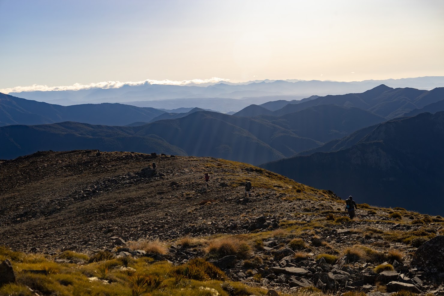
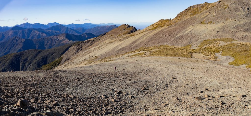
A couple of four-wheel-drive vehicles passed us on the way up, but we largely had the hills to ourselves. As we looked to our left, we saw the Wairau Valley below, braided rivers and the hills of the Kaikouras topped with snow. To the right, we saw the dense forested Richmond Ranges and Kahurangi National Park far in the distance. It was a cracker day on the open tops, bathed in sunshine and no wind. Winding our way up the mountain was relatively easy/non-technical, with the track narrowing as we approached the last third of our ascent. Winding up, and around, we reached a wide scree slope, embraced in a craggy basin. We followed the poled route up to the summit and reached the Trig point at around 3pm. After the obligatory selfies, snacks and 1 million 360-degree panorama photos, we huddled around the map to work out our route down and how we would approach the bush-bash. As Jamie had recently done a navigation course, we nominated her to lead the way (which she did for the whole evening).
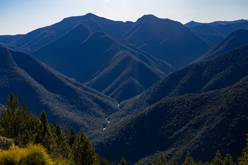
The first part of our descent involved crossing more open tops and was a bit more technical – with some rock scrambling up and over or sidling around. I really enjoyed this part – it was a bit slow going with some steep drop-offs, so we had to be careful. We came across a delightful fairy ring – a circle of stones that looked like they had been laid down by druids. This marked the end of the open panoramas as we flirted with the beginning of the bush line.
The line I remember hearing before we descended into the bush: “this doesn’t look too bad” would echo. In fact, it wasn’t too bad for at least the first hour – a nice bimble through mountain beech as we found our descent line. We decided to stay within the slightly less dense (less dark green) bush (as indicated on the topo map), hoping our travel would be more manageable (spoiler alert, it wasn’t).
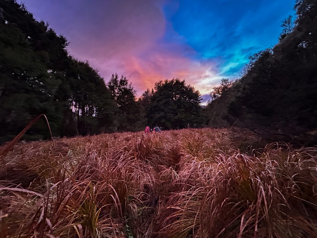
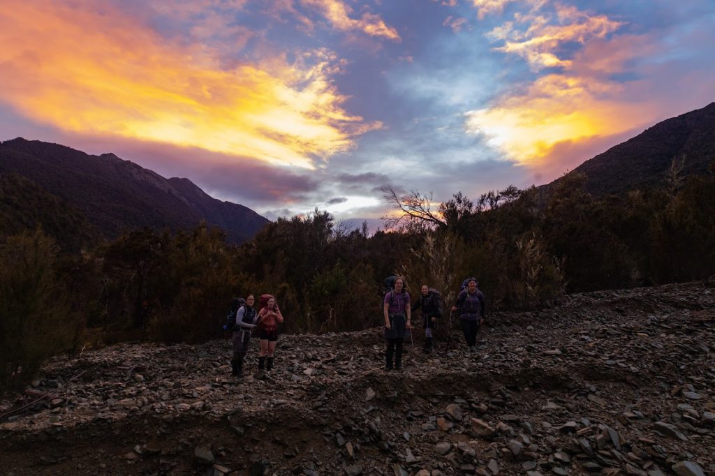
As the sun went down, the bush became dense quite quickly. Hats and backpacks were snagged regularly, but our spirits were high, and we were excited for the adventure. At this point we could still see the Goulter River below us and saw glimpses of the valley bathed in the setting sun when we emerged into patches of open scree. We decided to descend these scree patches for a while – thinking it was probably an efficient way of descending. However, at times it was a bit hair raising, with the sheer steepness of the scree slopes and the unstable rocks that gave way with each step. Rocks were sent crashing down to the valley below.
We soon veered off the scree slope, back into the bush and made our way very slowly through manuka trees and scrub. At times even the bush was on a really steep and slippery angle and a lot of concentration was required to get through it. In fact, we were so slow moving through the dense bush that my GPS watch wasn’t picking up any movement, and it had stopped tracking me! I was grateful for our chief navigators who veered us away from a bluff!
We ventured downhill, long into the night, guided by our head torches. We pushed branches aside as we went. I needed to remove twigs from my undies (I had ripped a hole in my pants) and was also poked in the eye twice by mountain scrub. Slowly, with increasing fatigue, we descended.
It took us 8 long, slow hours to travel from the bush line to the river below. It was a beautiful warm moonlit night with not a whisper of wind. At around midnight, the mountain spat us out onto the rocky shores of the Goulter River. We had never been so happy to be on flat ground! The last half hour, walking on the formed track to Lower Goulter Hut, was hard after we’d been on our feet for nearly 15 hours. We were ecstatic to find nobody at the Hut and we quickly got into warm clothes and started to make dinner. Our trip leader decided she was “bushed” and retreated to her sleeping bag almost straight away. We set our alarms for an early start and got some much needed sleep.
Day 2
At 6am the billy went on and we packed up and left the Hut at around 7 am. As we backtracked up Goulter River, we marvelled at the sight of the hill and dense bush we had come down the previous night. I congratulated myself on graduating from the Shrosbee school of bush-bashing and I would definitely like to do some more of that….just not yet!
It was a relatively easy 2 1/2 hour tramp on river flats to reach Mid Goulter Hut, and we knocked this section off quickly despite our fatigue and sleep deprivation. It was another 5 hours walk to reach Lake Chalice Hut – this section of track was much more undulating and tough due to our big day the previous day.
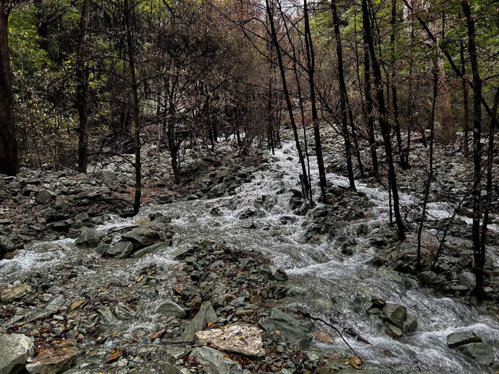
As we moved closer to the saddle near Lake Chalice, we came across some rather fast-flowing streams that were not apparent on our topo map. We crossed them with no problem, however we did need to be careful.
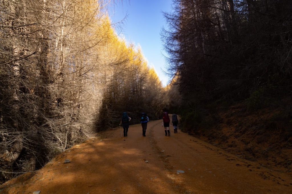
As we descended the saddle around the Lake Chalice Loop track, we arrived at the hut. We fuelled up for the last 400m grunty ascent up a pine flanked 4-wheel drive track back to the car park. This was tough going after two big days. As we reached the carpark it started to rain.
It was blissful to sit in the car as we set off to meet up with the other group. We were tired and wet, but I was so thankful to have had this experience. It was a very memorable weekend.
Timings:
Saturday
Lake Chalice carpark to Mt Patriarch summit – 6 hrs
Mt Patriarch summit to Lower Goulter Hut (off track bush-bash) – 9 hrs
21.09 km, 982 m ascent
Sunday
Lower Goulter Hut to Mid Goulter Hut – 2.5 hrs
Mid Goulter Hut to Lake Chalice Hut – 5.5 hrs
Lake Chalice Hut to Lake Chalice carpark – 1 hr
21.17 km, 1356 m ascent