
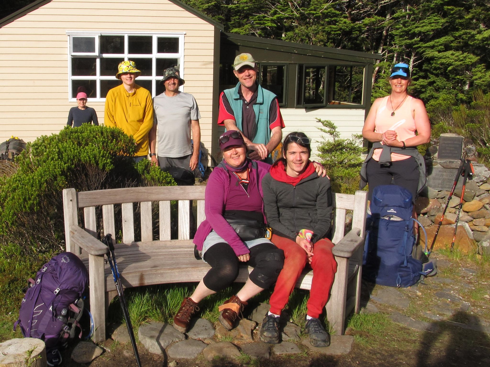
Nine people signed up for the club’s New Year Round The Mountain – Ruapehu trip. The group featured a few people new to multi-day walks, a few new to the club, as well as some very experienced club members and trampers. The distance and demanding terrain mean that an excellent baseline fitness is a prerequisite, as well as the ability to carry on for several consecutive days. Without this RTM can quickly become a gruelling ordeal.
At 66km, the tramp features a variety of challenges: long stretches of desert walking on hard earth, multiple rock clambering ascents and descents in and out of large valleys, vertigo-inducing traverses across narrow swing bridges and a short, sharp negotiation of the open rock face of the Cascade section. It’s common for some people’s favourite part of the trip to be other peoples’ least favourite, and vice versa. It’s the variety of terrain and experiences that made this a memorable and satisfying trip, even as it pushed people out of their comfort zone.
There were a number of organisation and logistical issues to sort before we set foot on the track. These were capably handled by trip leaders, Jo and Debbie. Debbie, Jo, Carolyn, Harry and Tony met at Wellington Train Station and departed at 4.15pm. Debbie’s expert driving had us pulling into the Mangawhero campsite with plenty of daylight to spare and we had time to enjoy an aromatic and spicy meal at Magic Chilli. The Chana Saag was cooked to perfection and the poppadums really popped. Meanwhile, Harry prepared his own three course meal back at the campsite.
Day 1 – Ohakune Mountain Road to Mangaturuturu Hut (via Lake Surprise) (6.5km/ 8 hrs approx)
The Wellington group had arranged to meet up with the other trip members at 8am. Nicci, Wyatt, Archer and Toby were long-time members of the club’s family groups section and were familiar with the area from frequent trips to the club lodge. We all drove up the unrelentingly steep Ohakune Mountain Road and sighted an elite cyclist nearing the finish line of her strenuous training routine.
Weather conditions were bleak, the cutting wind being served with layers of thick fog. The presence of a nearby mountain had to be taken on trust. Debbie and Wyatt completed the shuttle of shifting one vehicle to our end point of the Blyth Hut track. Meanwhile, Debbie earned multiple karma points sparing a group of four RTM trampers the road walk.
We were all set to go at 9am, our destination being Whakapapaiti Hut. The 13.3km walk was estimated by DOC to take 7.5hrs, so we were all set for a public service 9-5pm workday.
We began the walk with the sidle track leading to Sunset Ridge. It was a rocky descent requiring agility on unstable ground and good judgement about the best scrambling route through volcanic boulders. The track soon aligned with one of the tributaries of the Mangaeturuturu Stream. The boys, Archer and Toby, were agile and able to descend quickly. Harry was also fleet of foot and had no trouble moving swiftly through difficult terrain.
After about an hour of tramping, the cloud lifted slightly to reveal Mt Ruapehu directly to the east. The two visible peaks being Paretetaitonga and Tahurangi. We began to track to the west following the stream, with some in the group hoping the worst of the rock scrambling was out of the way. But we’d only just reached the Cascades.
The route now followed a narrow, rocky ridge, high above the stream. Eventually all of the group shuffled along the narrow ridge and congregated on the other side of the stream, gazing in wonder at the undulating rock slide through which the teeming water billowed.


Below us lay the 60m of open rock face that we needed to scramble down. The Cascades for Harry, used to far gnarlier rock scrambles in the South Island backcountry, was old rope. He disappeared over the side and was seen at the base in a couple of minutes. Archer and Toby, likewise, accessed their inner mountain goat and took a route that veered sharply right, following a fissure in the rock that at least offered the semblance of handholds. Jo, Wyatt and Carolyn duly followed, and emerged at the base a few minutes later. Meanwhile Tony, Debbie and Nicci opted to zigzag back towards the marker poles and take a route far closer to the cascading stream. And so began the painstaking business of securing every foot and handhold, searching for the elusive sense of safety. Finally, all emerged safely at the base of what is a somewhat unique section of track.
The route continued in a westerly direction. Harry pushed ahead to access the old route that threaded through a strand of forest. The rest of the group followed the poled route, as it dropped into a narrow stream bed. We then began another short scramble over river boulders, emerged at another stream crossing, and reached a hard-earned boardwalk. This led us to Mangaeturuturu Hut. We’d travelled 2.5km in 2 1/2 hrs.
The hut was closed to trampers, and a diligent working party of three was carrying out extensive maintenance of it. Debbie asked one of them how long he’d been working on the hut and he replied 30 years; 30 years or 3 days.
After a 30 min break, we started began walking with a crossing of the main tributary of the Mangaturuturu River. The drop of the riverbank presented its own challenges with its lack of footholds.
We climbed up a short scree and boulder slope and began picking our way through another greasy stream bed to reach Lake Surprise. This spot was where we had planned to have lunch. We’d now travelled 3.5 km in 4 1/2 hrs. At this rate, it would take another 10 hrs to reach the hut. We still had the huge river valleys of the Manganuioteao River, Makatote River and Whakapapiti Stream to go – all of it above 1,400m.
The group had a conversation about what to do next. There was talk about arriving at the hut at 10pm or setting up camp somewhere off track at 8pm or turning back to camp in the vicinity of Mangaturuturu Hut. The first option would be a 13 hr day. The second, an 11 hr day. In a bid to increase the group’s speed we redistributed pack contents to see if this would make a difference. Debbie was already carrying the club billy and her packed weighed well over 22 kg – a big load in unforgiving terrain.
We set out in a line across the wetlands boardwalk, before starting up a long sequence of steps. Once the steps gave way to the tops, we moved through eroded banks, across boulder fields and onto a ridge. The ridge would lead us to a point where we would start sidling at 1,400 m. We were about to complete the 400 m to the crossing point, when Harry suggested we wait for the rest of the group.
By now it was mid afternoon and we’d been walking for 5 1/2 hrs. Our pace was too slow to make Whakapapaiti Hut by nightfall. When the group finally came together, it was confirmed that the only hut we could make at this rate was Mangaturuturu Hut.
We spent the next 2 hrs slowly making our way back to Mangaturuturu Hut. Harry walked at the back of the group, while Tony and Debbie accompanied Nicci. The group at the front had time to travel to the hut, drop their packs and return to complete the pack haul.
We got back to Mangaturuturu Hut at 5pm. We’d had the 9 to 5pm tramp we were expecting, but were just at a different hut. There were several other trampers at the hut sitting on a seat with watching the partly unveiled Mt Ruapehu. One of them was solo tramper Emily from Perth, who was reading a copy of Hazel Phillips’ book Solo (about solo tramping). Hazel has given a talk on a WTMC club night about the experiences she has written about in the book. She’d be pleased that her book’s being carried around by some of the young solo walkers she’s inspired.
The builders were still busy with bandsaws thrumming and hammers banging; they definitely weren’t on a 9 to 5pm schedule. The bunk room only had one space available, but we were able to utilise the large kitchen and verandah area – which was set up with seats and a dining table. Most of our group set up tents around the hut, with some opting to sleep on the hut floor once the cooking had been completed.


We’d all been assigned ingredients to bring for a group dessert, a rather large trifle. After Jo got the custard ready, Nicci applied lashings of strawberry jam onto the trifle sponge and smooshed it all into the large billy. Fruit salad was disgorged into the pot, followed by a steady flow of thick cream. This was followed by fully immersing the concoction into the chilled waters of the nearby stream. The final touch was some chocolate flakes sprinkled on top – and we had enough to feed the WTMC group, the through walkers and the workers.
We then had a group meeting to go over plans for the following day. Debbie had been diligently gathering information from the workers about route options from the hut. Returning to the Ohakune Mountain Road, though demanding, would get us to the car the following morning. We’d then travel to Whakapapa Village and resume walking.
Day 2 – Mangaturuturu Hut to Ohakune Mountain Road; Whakapapa Village to Waihohonu Hut area (2.5kms & 14.3kms / 9 hours approx)
The workers were up at dawn, stamping out any possibility of a sleep in, packing up for their own walk out. Fortuitously, the cloud around Mt Ruapehu had lifted and we got some of the best views of the trip in the early morning and on the walk out. We were ready to go by 8am, though there were mixed levels of enthusiasm for the notion of revisiting the Cascades rock scramble.
The highlight of the walk out was discovering a Whio bird relaxing on a stream boulder at one of the crossings. It was quite indifferent to our presence and happy to pose for photos. We were soon at the base of the Cascades. Harry was quick to begin the climb and smart trampers, like Carolyn, scrambled to follow his route, while some of the rest of us clambered to keep up. This time we stuck to the poled route on open rock – it seemed steeper than the down route and veered queasily close to the waterfalls coursing downriver.


Jo and Debbie carefully coached Nicci up each of the rock sections and Archer bound down the rounded face to collect his mum’s pack. Our slow pace ensured that we had plenty of time for nature photography and to just generally take in the scenery. After a short rest, everyone safely negotiated the tricky transition onto the narrow ridge just above the waterfall. We then focused on retracing our steps from yesterday morning. We had everyone back at the cars by midday.


A productive morning of strenuous physical activity was rewarded with a visit to Johnny Nation’s Chocolate Eclair Shop. Equanimity restored, we commenced our Round The Mountain drive to Whakapapa Village. The plan from here was for Nicci, Wyatt, Archer and Toby to visit the WTMC lodge and have a couple of days of day walks, while the rest of us completed the RTM track. We’d all reconvene in a few days back on Mountain Road.
We resumed our walk just after 2pm with over 15kms to complete before we’d be able to access an off-track camping site. Starting from the village it felt like we were on a different walk to the one we’d just come off, with long stretches of boardwalk allowing us to stride out in a way that never happens in the Tararua Range. It made for a pleasant novelty.
We downed our packs at the turn off to Taranaki Falls and joined the tourist trail to the viewing points. The Falls are an attractive fantail shape and they ware framed by some attractive white flowers that were in full bloom. We then returned to our packs and set off again, stopping only when we reached the juncture to the Tama Lakes. Most of the group visited the top of the basin holding Lower Tama Lake. The coolish weather now had an edge when combined with a whippy wind.
After Jo completed some running repairs to a blister, we set course for the days’ final leg to an as yet undecided campsite. We encountered another group on the way who suggested there might be some good camping sites on this side of Waihohonu Hut. After a further one hour walk at a brisk pace, we located a sheltered spot which was out of the wind, where we could take a food break. We’d been on the go for 10 hrs and the group was keen to set up camp. We considered the bank of an open creek – but it was a sandy, exposed and bleak area so we pushed on. Harry and Carolyn found a side track that led to a sheltered area next to the river. There was a large area that would suit the club tarpaulin that Carolyn and Jo were sleeping under. Soft and downy sphagnum moss also offered comfortable camping spots after some readjustment of river rocks.
As per the camping requirements of the area, we set up camp 200 m from the track and situated on one of the many streams coursing through the area. Mt Tama was obscured by a heavy cloak of cloud – which gave us pause as to what the weather gods had in store. The winds eased off and we’d chosen our sheltered spot well, allowing for a convivial gathering after a long and unscheduled day that had gotten us back on track.
Day 3 – Old Waihohonu Hut to Rangipo Hut (12.5km / 7 hrs approx)
Our luck with the weather held, as it didn’t rain despite there being dark clouds obscuring the view of Mt Ngauruhoe and Mt Ruapehu. Specks of rain began to fall as we set off at 8am for the 20 min walk to Old Waihohunu Hut. The hut was interesting – it had a women’s quarters (which was an unheated tin shed) and a bloke’s quarters (which was rustic, but had a fireplace and what would have passed as mod cons back in the day). It made for a scenic breakfast spot and there was much lively conversation.


Five minutes later we visited (the new) Waihohunu Hut – a fancy Great Walks standard residence with multiple rooms and generous decking. It was a construction that Harry dismissed as not being in the spirit of a traditional NZ back country hut. It provided creature comforts for neophyte trampers, but we were pleased to be heading for something a little more in the austerely functional mould.
After a short descent down ever-present wooden steps, we travelled through some loamy banks, crossed a squat bridge and soon arrived at Ohinepango Springs. We did the 5 min walk to have a look at the water outlet that supplied some of the water in the stream and were joined by a DOC ranger. Their daily task was to collect a large container of the pure stuff for the sipping pleasure of the punters at Waihohunu Hut.
We were now ready for the main part of the walk to Rangipo Hut. After spending the better part of 2 days slogging up and down the Cascades and on steep steps or badly eroded and rutted trails, through boulders, followed by half a day on flat boardwalks, we were unsure what to expect. What we got was a variety of terrain and topography. Some of it on relatively flat ground with short, sharp hill climbs. The ground underfoot was predominantly hard, rocky earth, with some sections on sandier ground.
We were walking through the only desert in the North Island. The track notes appeared to attribute this to the desert being sited in the rain shadow of Mt Ruapehu, but the soil composition seemed altered by longstanding volcanic activity. There were long stretches of walking barren flats, the shadows of ghostly riverbeds suggested by the contours. There were some ridgelines to climb. After an hour of walking, we arrived at our morning tea stop on the Mangatoetoenui River. The fast-flowing water made a picturesque contrast to the stark and denuded desert.
We then set out for a section that culminated in a climb to the Tukino Mountain Road. It wasn’t too steep and had a well-formed scrambling track. Walking poles were perfect to help you clamber up the face. It was quite windy at the top and we quickly hunkered down into a sheltered gully for lunch.
After lunch we climbed to the start of the Lahar area, where there were several signs warning us not to stop: “Lahars destroyed bridges at this site in 1975, 1995 and 1999. We advise that you move quickly through this area”. We dropped into a gorge and each of us took our turn on the narrow swing bridge. The sight of the bright blue water flowing through the smooth boulders of Whangaehue Stream was one of the most attractive views of the trip. But no one was going to be stopping on the rickety bridge to attempt a photo. Even when we got to the other side, we kept moving, aiming to get clear of the Lahar zone. This was the most exhilarating part of the walk.


The next section dragged on as the route continued to sidle. Then Rangipo Hut appeared, seemingly out of nowhere, nestled into the side of the mountain. It is located at an elevation higher than the highest point of the Tararua Ranges.
This would be our first proper hut for the trip. We had quite a few hours of daylight to fill and the time went convivially, with cups of tea, food, playing cards, chatting and fire making. Harry’s facility with getting the fire up and running took the edge off a cool evening. We were sharing the hut with Emily, the Australian (from Perth) who was travelling in the opposite direction from us. It was good to reflect on the day, particularly the visual highlights of the Lahar area. The day had certainly been hard on both feet and legs.
Day 4 – Rangipo Hut to Mangahuehu Hut (8.5 km /7 hrs approx)


The forecast was for heavy rain later in the afternoon. Our mountain hut was shrouded in mist as we departed. After about 2 km, the track came to Wahainoa Valley, which required a steep descent into a riverbed and a long sidle along a narrow, rocky track with a steep drop on the underside. There was one long swingbridge, but it was slightly wider than the one across the Lahar. The climb topped out with some good views of Karioi Forest and the plains below. There was no sign of Mt Ruapehu, but the rain was holding off.
At about midday, we reached the start of a dune-like section of sculpted earth formations. This section was less demanding than the up and down of the deep valleys and tended to undulate. It made for pleasant tramping. The cloud hung low on the horizon but did not diffuse into fog, which meant that we had good medium distance views.


Shortly afterwards, we reached the treeline and began to move through some light forest. It was close to 12.30 pm, so we stopped for lunch. Carolyn photographed the plant-life so that she could study it later. A few spots of rain could be felt and it was time to move on. The final 3 km of the day took 2 hrs. There was some scrambling through deeply rutted tracks, skirting bogs and finally getting onto a boardwalk. We first spotted the outdoor toilet, then Mangaehuehu Hut.
Our original plan had been to push onto Blyth Hut, but given it had taken us 7 hrs to walk from Rangipo Hut, pushing on to Blyth Hut would have made for a grim 10 hr day. So we took the afternoon to relax and enjoy some down-time. Given the energy that had gone into salvaging the walk, this was well deserved.
The flanks of Mt Ruapehu were showing through occasionally, through the fog higher up the mountain. Enough to make sitting on the porch a good option. At about 4pm a solo tramper from Napier turned up, while some of our group took the opportunity to wash in a nearby stream.
Day 5 – Mangaehuehu Hut to Ohakune Mountain Road (8.9 km/ 3 hrs approx)
The following morning, the hut was suffused with the burnished light of a cloudless sunrise. Mt Ruapehu towered above the hut, the peaks of Turangi and Girdlestone framing the Mangahuehu and Wahianoa Glaciers.


We were scheduled to meet Nicci, Wyatt, Archer and Toby at the road end at 11am, so we made an early start, while dew was still on the grass. There were a number of swing bridges to cross, which slowed our progress a little and there were more rutted tracks with boggy bottoms to be skirted. Jo spotted a number of Rifleman in the trees, branch hopping and flitting about.
It took us just over an hour to walk the 4 km to Waitonga Falls. We still had an hour to go before meeting the others at the road end, so we dropped our packs and scooted over the stream. Jo had the dexterity to clamber up a large boulder, while some of the group scrambled through streambeds and along an overgrown path to get closer to the falls.
Soon after, we reached the tourist boardwalks that showed off Mt Ruapehu, framed by a tarn. It was a very bright day, meaning the mountain had less mystique than on cloudier days. Carolyn commented that she was glad we hadn’t come this way – as we would have been presented with the mountain 20 mins into the tramp. Why do something in 20 mins when you can take 5 days – which pretty much sums up the tramping ethos.


Archer and Wyatt came and greeted us on the track. Nicci had kindly arranged for cold drinks and cherries for when we came off the track, making the perfect way to finish the tramp. The two groups swapped stories from our three days of separate activities, and we said our goodbyes for the return trip to Wellington. Various stops at the éclair shop and a series of BPs kept up hydrated and sated and Debbie went beyond the call to provide suburb drops for Carolyn, Tony, Harry and Jo.
Though we’d skipped one section of the track we’d still managed a satisfying five-day trip and overcome a series of tricky challenges. Decisions were made to ensure the safety and comfort of all the group, and we were all keen to come back for more.
Archer and Wyatt came and greeted us on the track. Nicci had kindly arranged for cold drinks and cherries for when we came off the track – the perfect way to finish the tramp. The two groups swapped stories from 3 days of separate activities and we said our goodbyes before the return trip to Wellington.
Various stops on the way back, at the éclair shop and a series of BPs kept us hydrated and sated. Debbie went beyond the call, providing suburb drop-offs for Carolyn, Tony, Harry and Jo.
Although we’d skipped one section of the track, we’d still managed a satisfying 5-day trip and had overcome a series of tricky challenges. Decisions were made to ensure the safety and comfort of all members of the group, and we were all keen to go back for more.