
Stumpy Stream
a winter tramp in the Hakatere Conservation Park
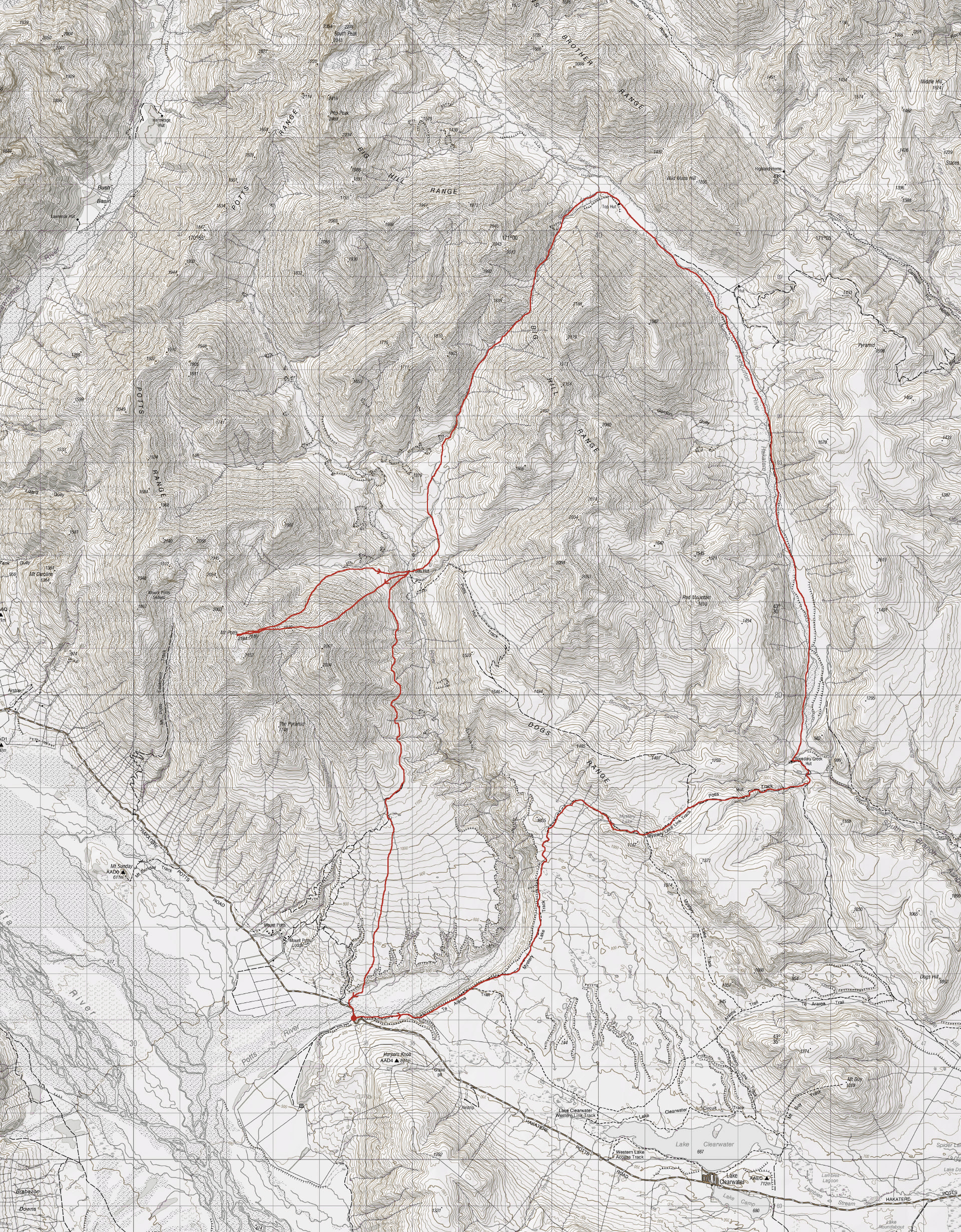
A 5 day winter hiking loop trip through the Hakatere Conservation Park and a climb to the summit of Mt Potts
Since moving to Christchurch at the beginning of the year the Hakatere Conservation Park between the Rakaia and Rangitata Rivers has become one of my favourite tramping destinations. The peaks and open tussock lands provide plenty of options for great tramping in summer, as well as alpine activities (including snowshoeing) in winter. So, when Tony contacted me a few weekends ago to see if I was interested in joining him on a five-day trip in the area, I immediately said yes.
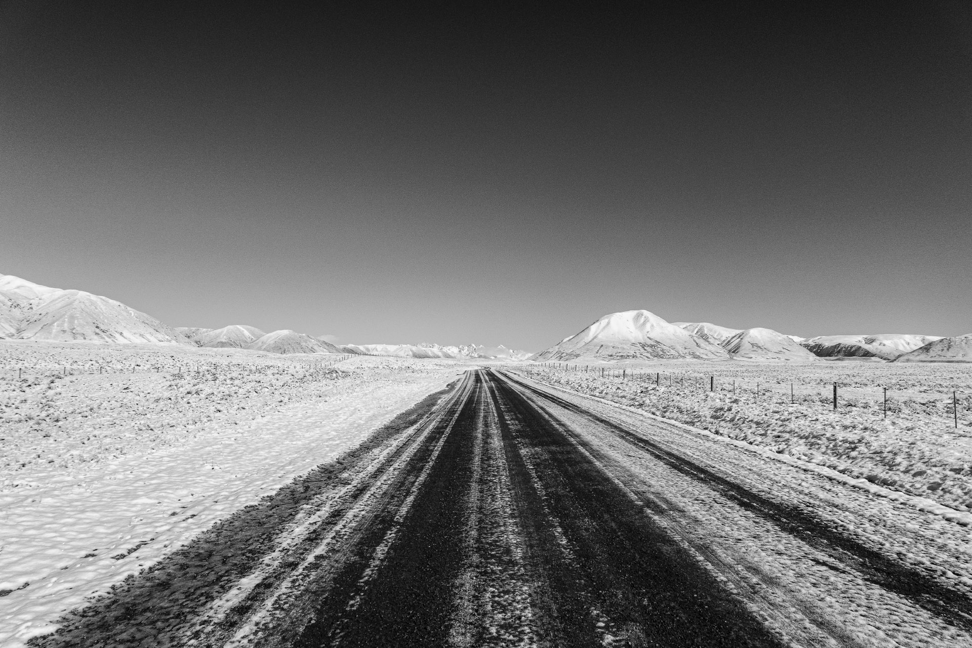
There were of course a few logistics to work out (including getting leave) but once that was all sorted, I picked Tony up on a fine calm Wednesday morning in Ashburton and we headed off to Lake Clearwater. A southerly had come through the night before, leaving a good covering of fresh snow right down to the lake, so of course we had to stop to take some photos before continuing on to the Potts River Bridge carpark and setting off.
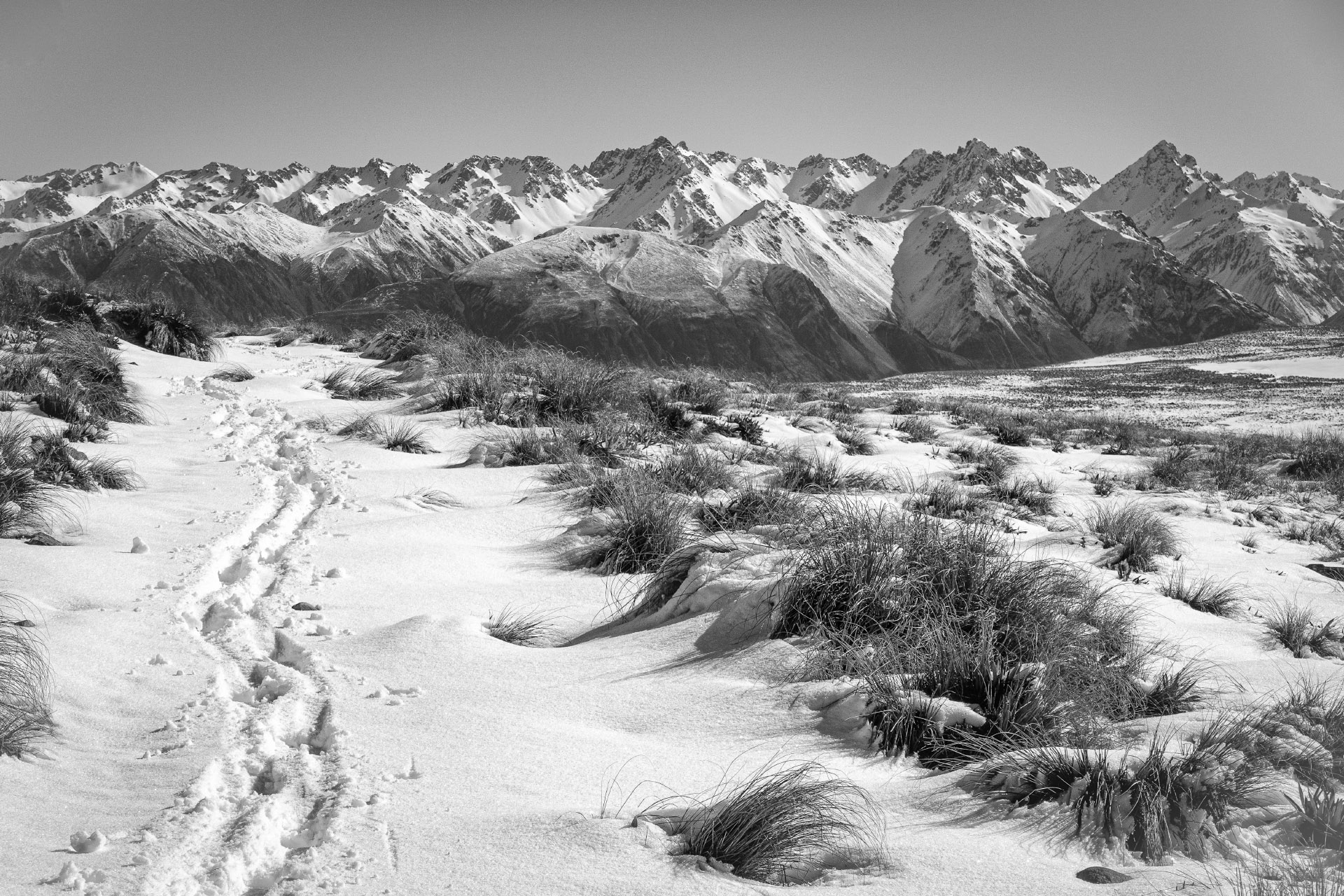
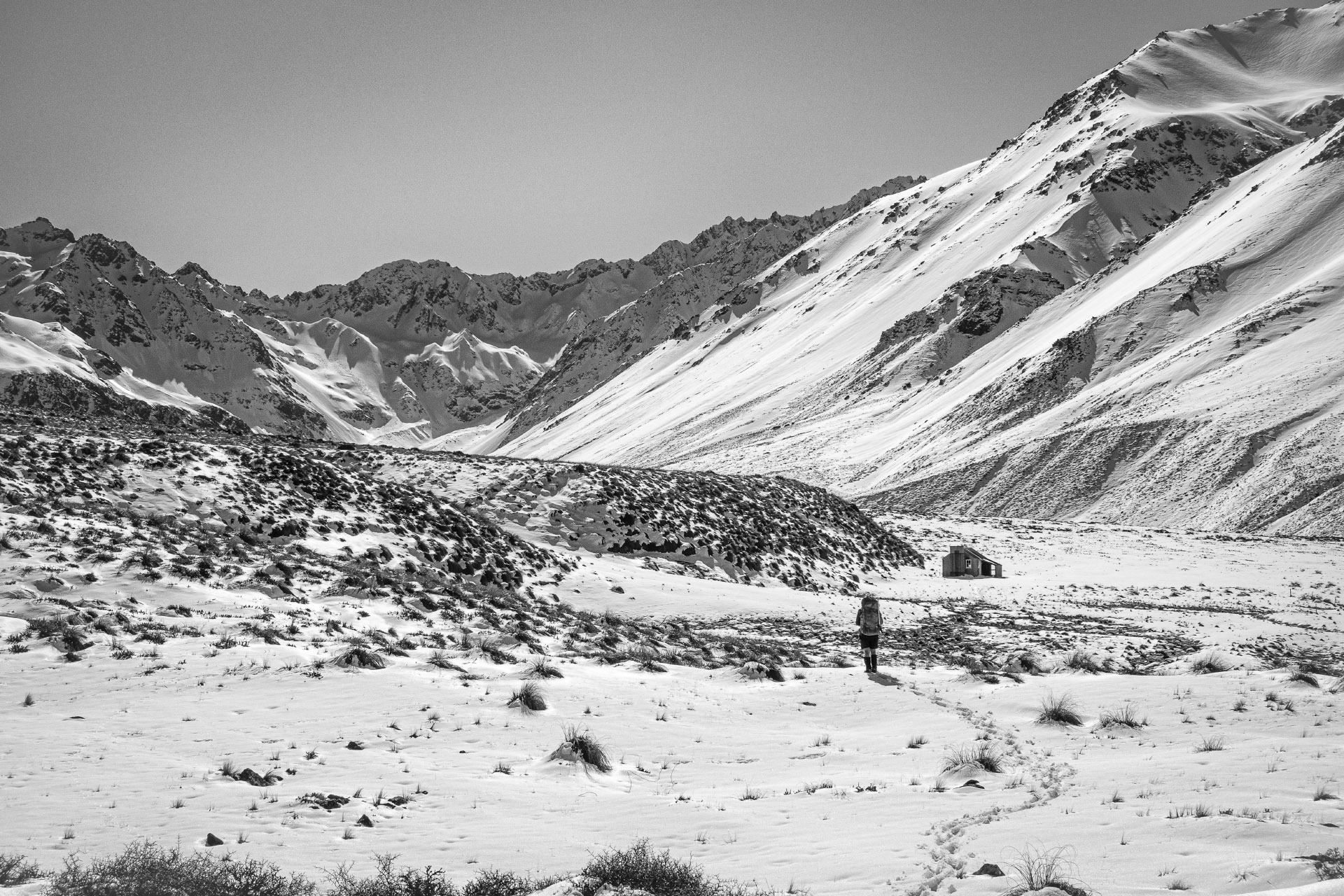
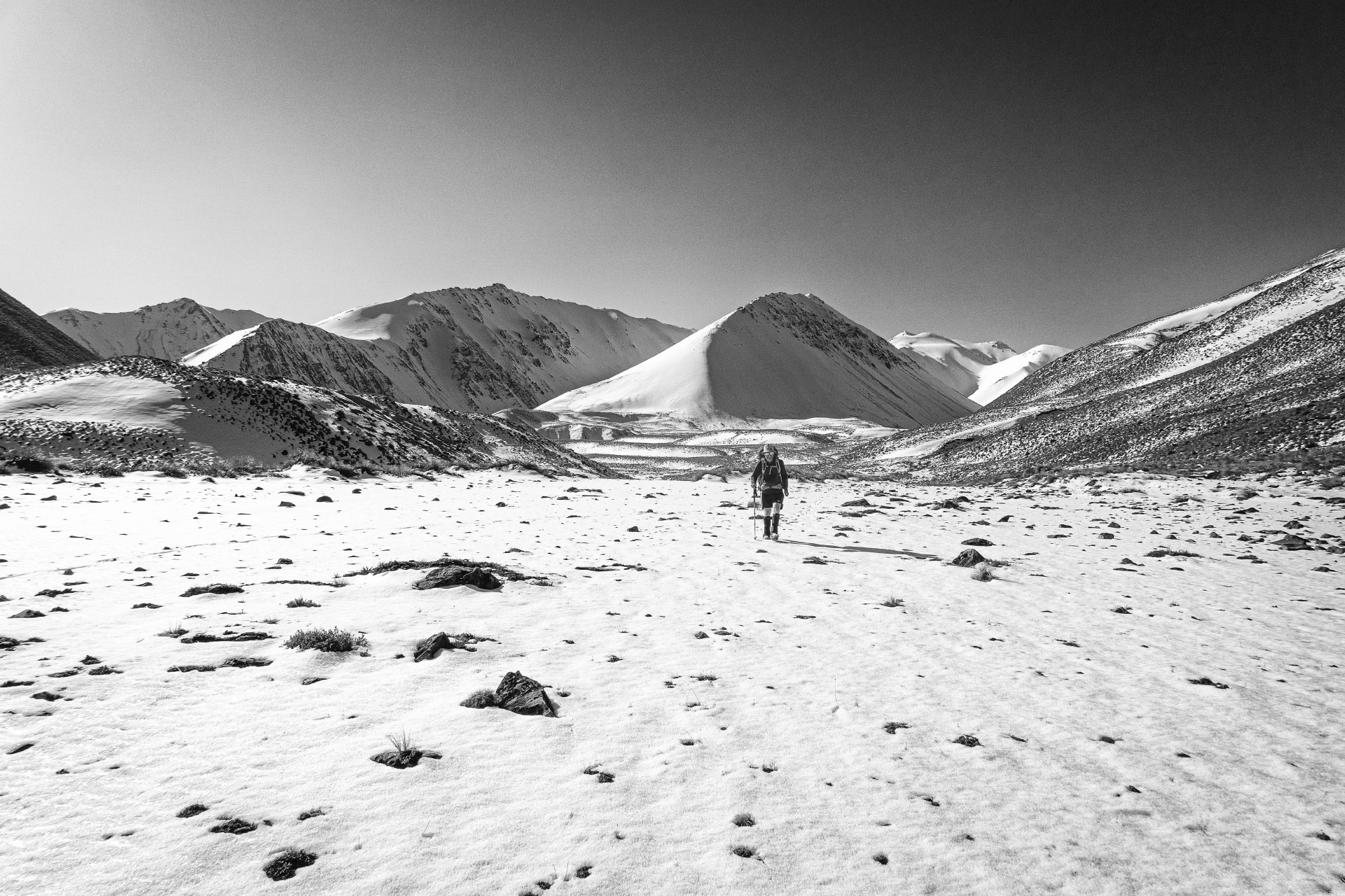
After crossing the Potts River and climbing up onto a higher terrace it was a relatively leisurely walk along the Mystery Lake Track with frequent stops to take photos. On the way up to Mystery Lake we hadn’t seen any footprints, apart from numerous animal tracks in the snow. However, when we got to the junction with the track down to Lake Clearwater, there were lots of recent boot prints which all appeared to be heading in the same direction as us.
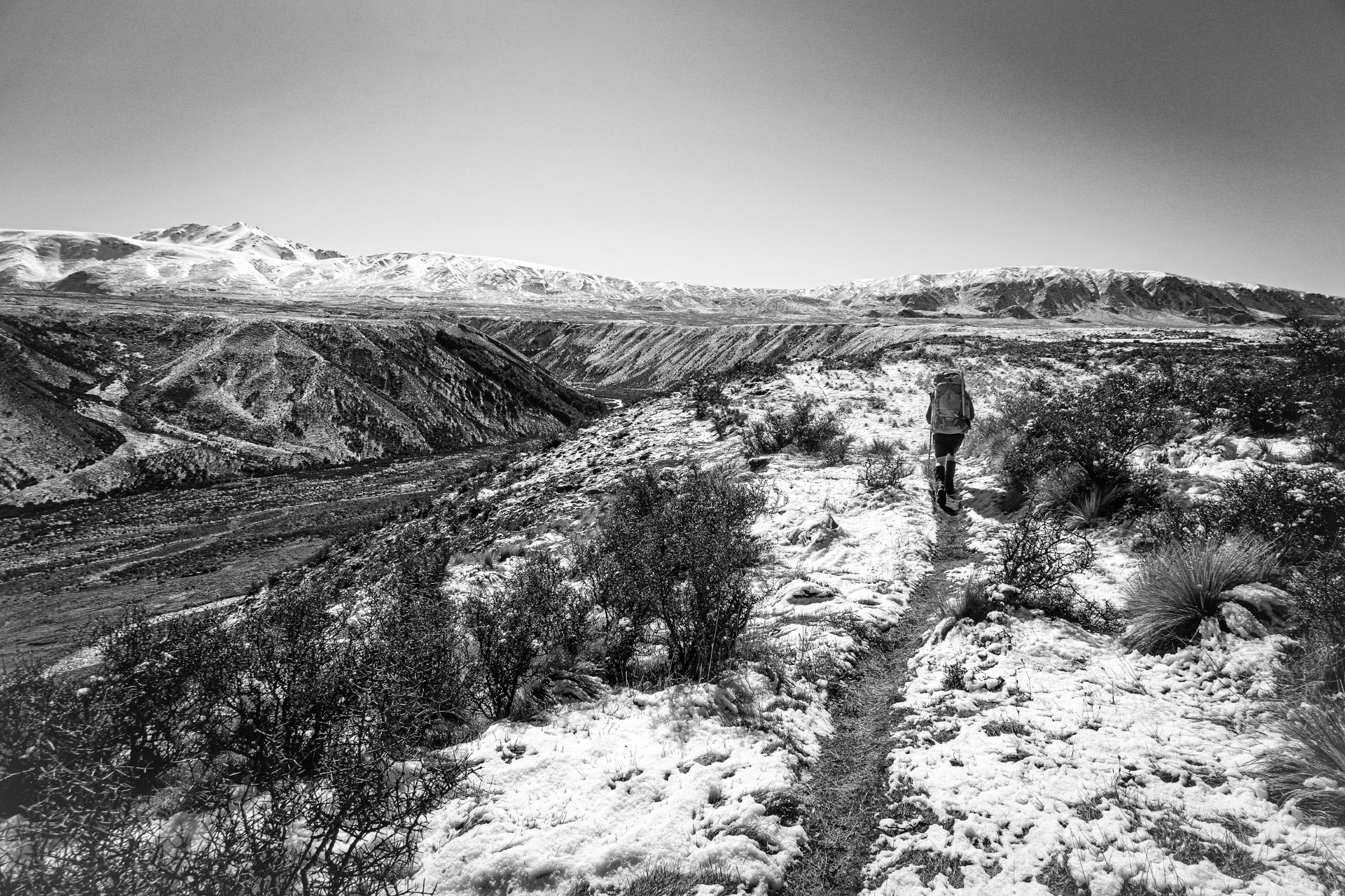
This of course led us to speculate about how many people there were, and if they were headed to Boundary Creek Hut like us. We followed the footprints along the track until the next track junction where they appeared to head off towards Potts Hut and we saw a group of people heading along the track towards the Dog Range. We did encounter them later on, and they were the only people we saw during the whole trip. It took another hour and a bit to get down to Boundary Creek Hut just before the sun disappeared behind the hill. It was a cold and clear night, so we got the fire going and settled in for the evening. From the Potts River Bridge, it was just under 16 km and took us just over six hours.
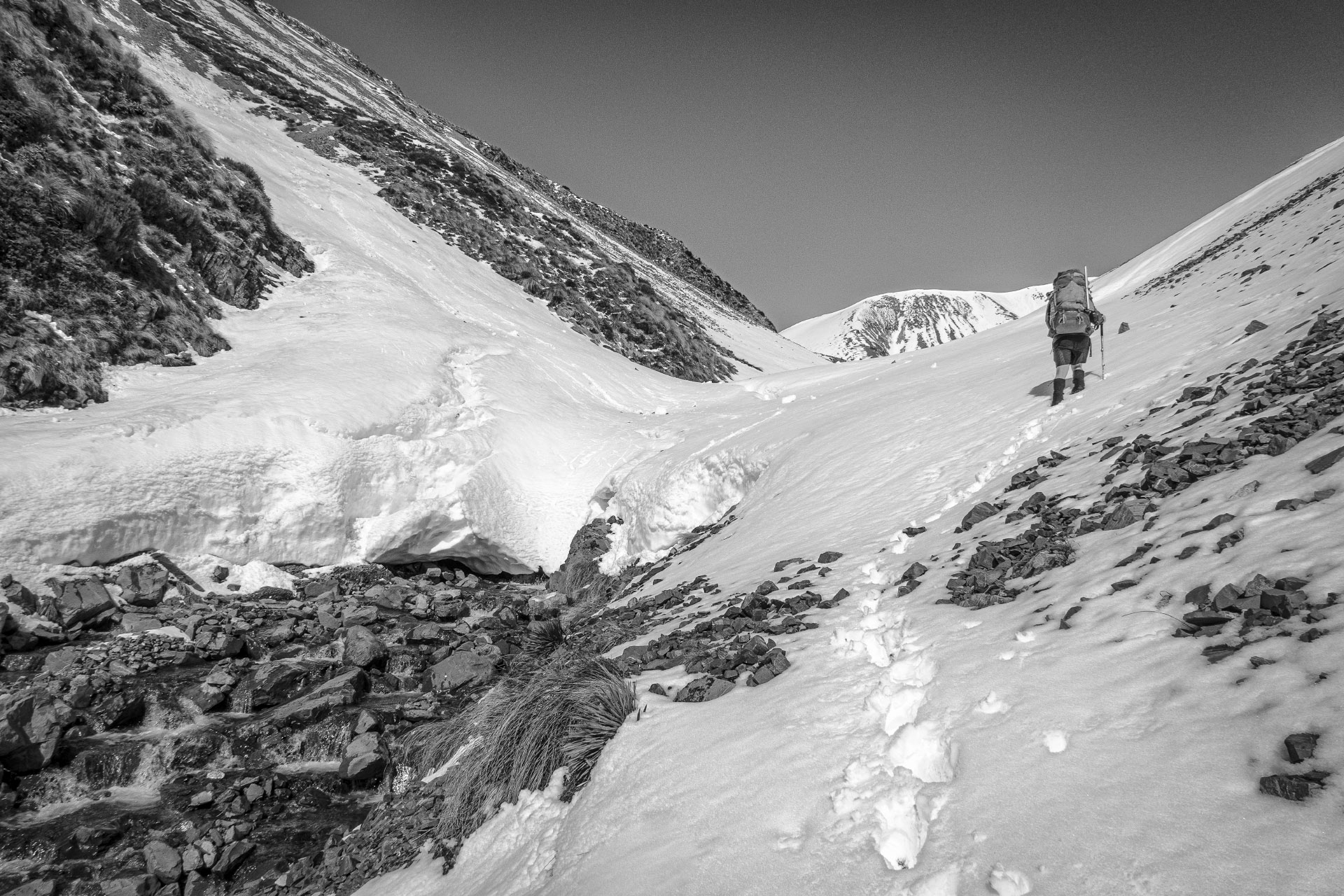
The next morning dawned calm and clear, and we woke to frozen boots and socks, and frozen water bottles. So it was a fairly leisurely start while we waited for the sun to rise enough to thaw everything out. The destination for the day was Top Hut, further up the South Branch of the Ashburton/ Hakatere River valley. DoC lists a walking time of 2–3 hours from Boundary Creek Hut to Top Hut, but as Tony noted it is a map distance of about 15 km, so it would have to be a very brisk walking pace to be able to match the DoC time. It actually took us just over six hours to cover the 15 km in the snow and as it was a fine and calm day, it was a very enjoyable six hours.
The new snow from a couple of days earlier hadn’t melted so we were walking though snow the whole day. There were lots of animal tracks and while we saw a few hares during the trip this was the only day we saw a large animal, a chamois on a north-facing slope about halfway between the two huts. We had Top Hut to ourselves that night after Tony had removed a dead possum from the porch. As it was another clear night and there was no firewood around the hut, it was a quick dinner and an early night.
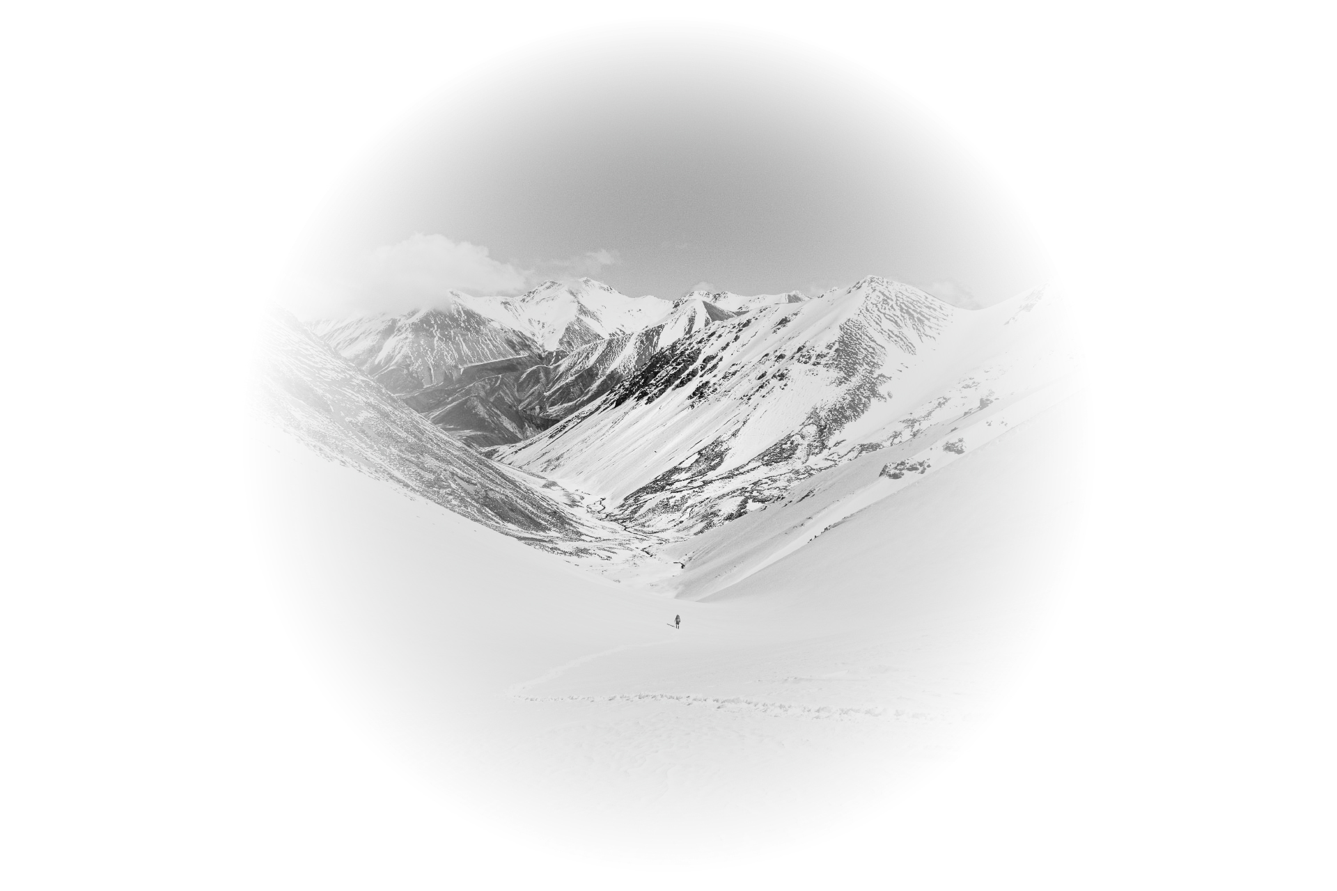
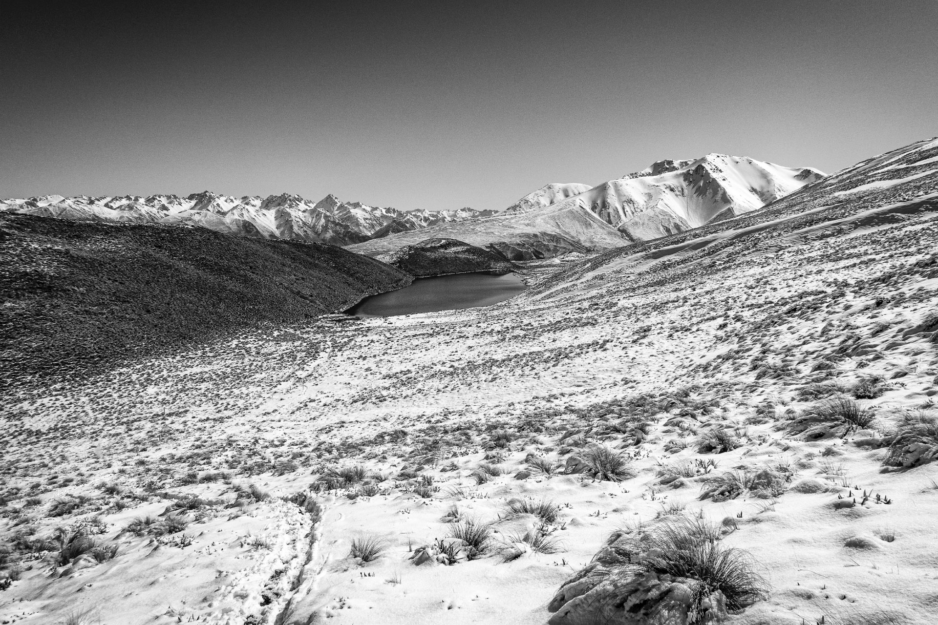
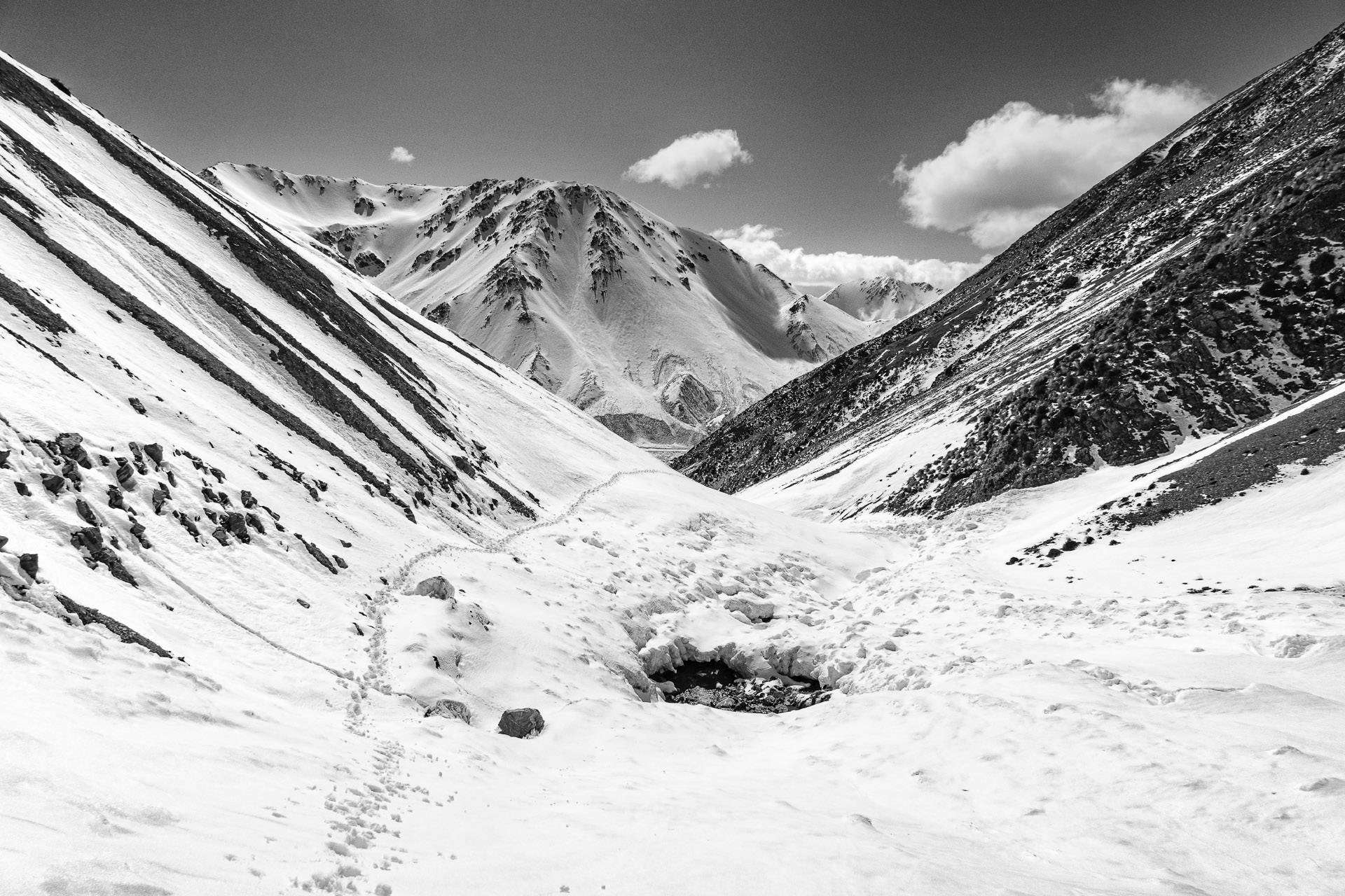
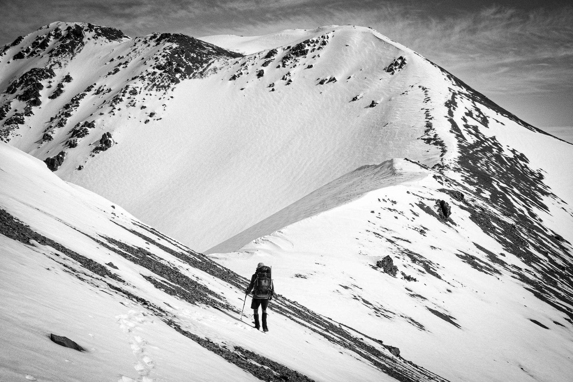
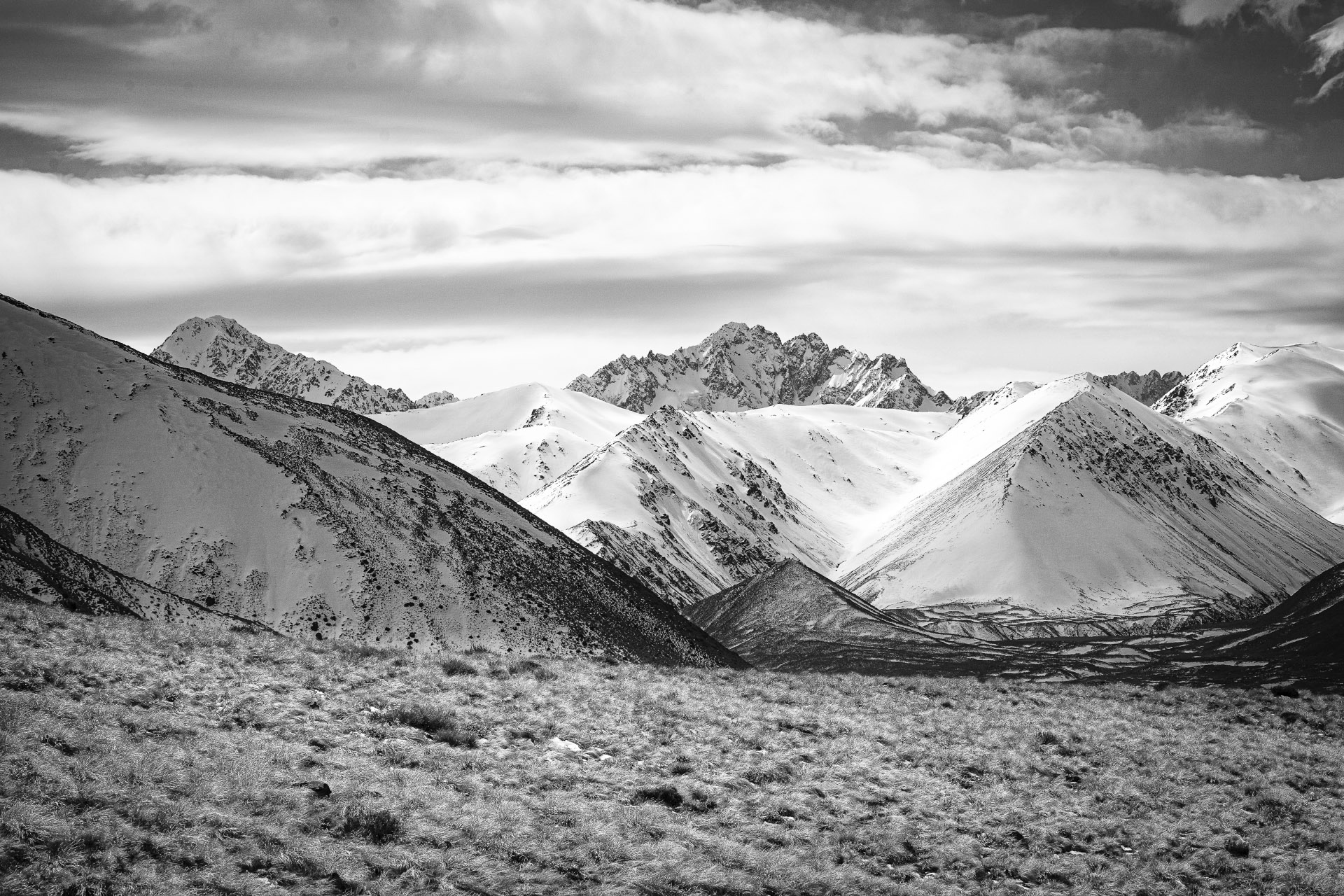
The next morning’s routine was the same as the day before, waiting for the sun to hit the hut to thaw out boots and socks before setting off. The route for the day was up Stumpy Stream, somewhere I had wanted to visit for a while just because of the name, and then down to Potts Hut. It was another sunny, calm day.
Reaching the saddle at the head of the stream, we got a look at our objective for the following day, Mt Potts. Some of the snow that we had seen a couple of days earlier had melted but there was still a reasonably good covering.

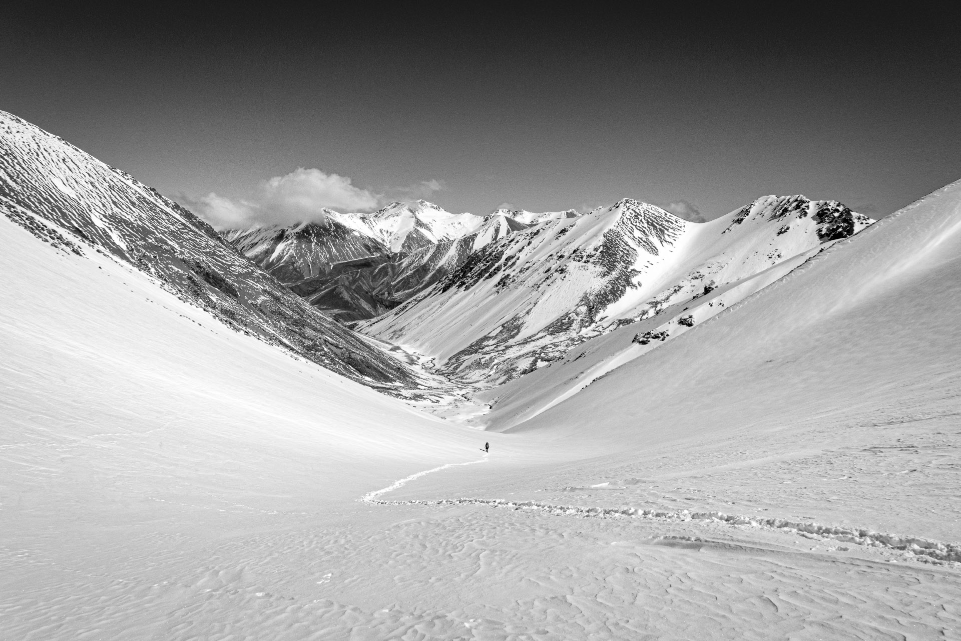
The rest of the walk down to Potts Hut was relatively uneventful, but about halfway between the saddle and the hut we did encounter the people we had seen on the first day. It was a group from the National Outdoor Leadership School (NOLS), a US organisation that has a New Zealand base in Nelson. They were setting up camp for the night and we found out that they were on an extensive trip in the area. Their next stop Top Hut where they would spend a few days before heading on to Cameron Hut where they would base themselves for a few more days.
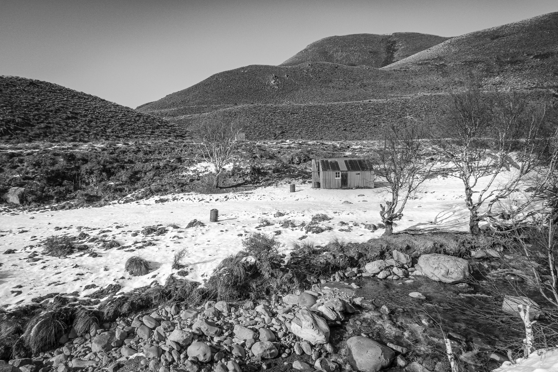
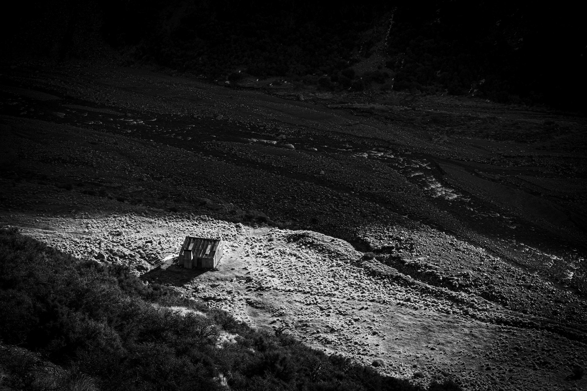
When we got to Potts Hut there was a good supply of dead matagouri, so we were able to get a fire going that evening. There was also a lot of rodent droppings in the hut, and quite a few references to them in the hut book, so we spent a little bit of time doing some cleaning as well. And we definitely hung up our food that night. I thought that I heard something scurrying around a couple of times during the night but Tony didn’t hear anything so it could have just been my imagination.
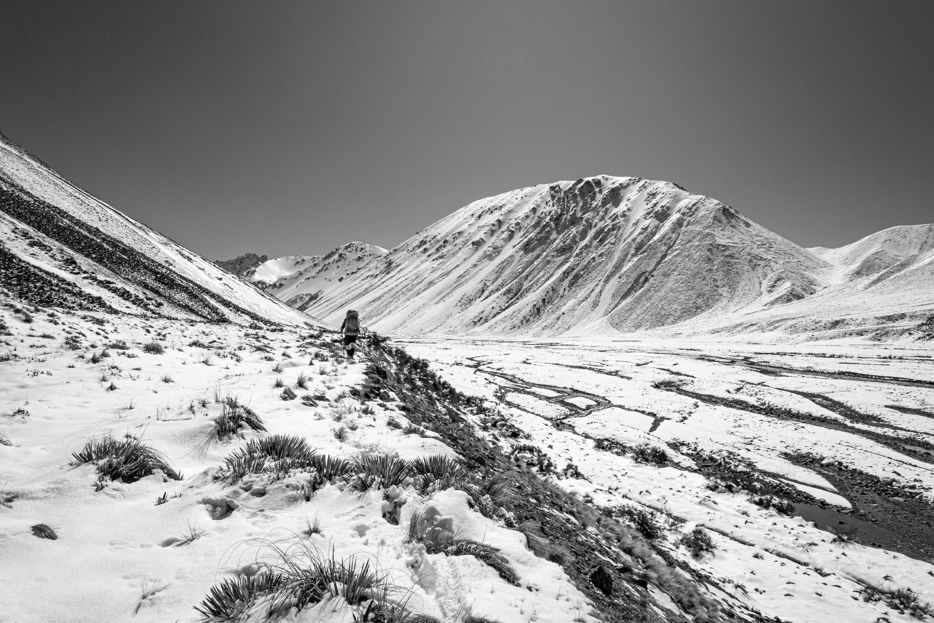
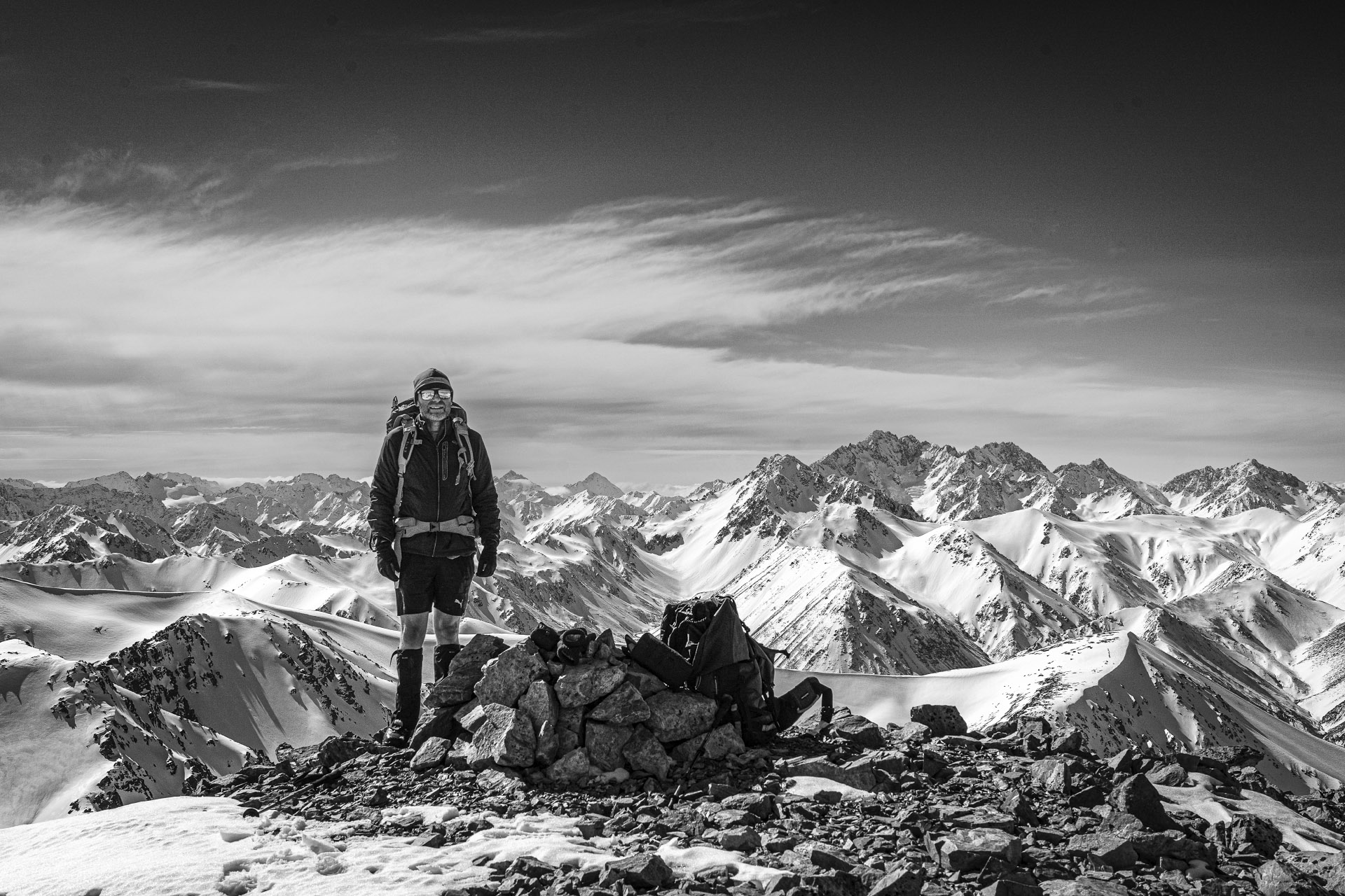
The next morning, while it was fine and calm once again there was a slight change from the previous two day’s routine for thawing out boots, as the position of Potts Hut meant that we were unlikely to get the sun until after we wanted to leave. So after using some warm water to thaw things out we got our boots on and headed off, leaving most of our gear behind as the objective for the day was to get to the summit of Mt Potts and return to the hut for the night.
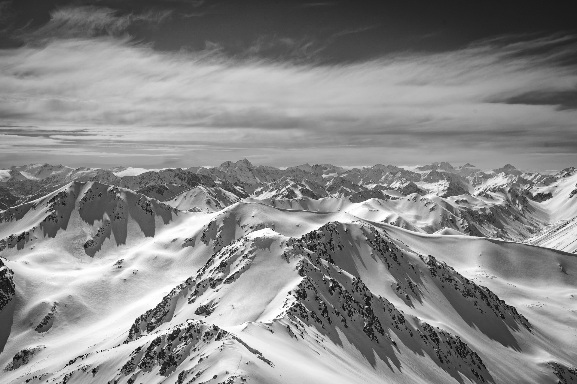
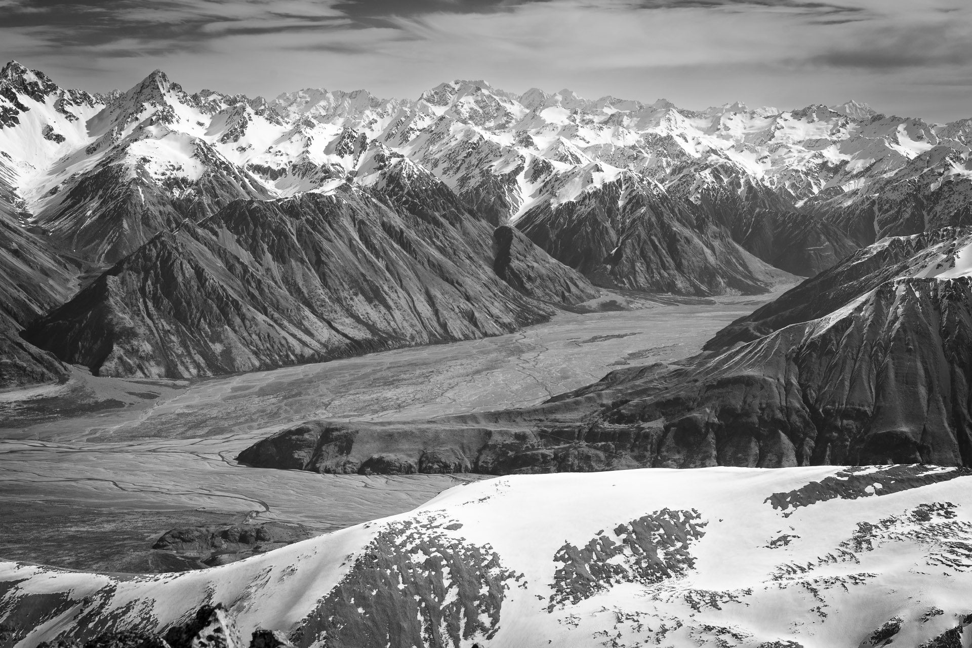
Our route was fairly straightforward and involved crossing the Potts River and then climbing the slope opposite the hut and then following the ridge past point 1930 and then up to the summit. The scree on the slope made the first few hours a little bit of a slog, but once we got up onto the ridge the going was more straightforward apart from the last steep slope up to point 2146 which was also slow going because of some deep snow. However, when we got to the top it was definitely worth the effort with views south across the Rangitata with Aoraki/ Mt Cook in the background, west across the main divide and north towards Mt Arrowsmith.
The summit of Mt Potts was one of the few places that Tony had never been to before, plus it was on his list of 24 new peaks to climb over 24 months, so he was very happy to able to tick off one of the main objectives for the trip.
While the only people we met on the trip where the group from NOLS, when Tony checked his photos after the trip, he noticed that there were a couple of people skiing below us in the old Erewhon ski field, that we hadn’t noticed when we were up there. Of course, Tony had been skiing there when the ski field was operating many years ago and remembered driving up the ‘very basic’ track in his old Ford Cortina wagon. I have also walked up the old track, and while you certainly wouldn’t be able to drive up it anymore, it is still mostly intact and is an easy way to walk up to the old ski field basin.
After a bit of time taking photographs we headed back down to Potts Hut, taking a slightly different route down the scree and snow slopes just north of point 1930 to the stream and then back round to the hut. We covered 10 kms over the day, which took us just over 10 hours.
We had heard a couple of rifle shots during the day and as it was a Saturday we were half expecting other people to be at the hut. But when we got back there we had it to ourselves again for the night.
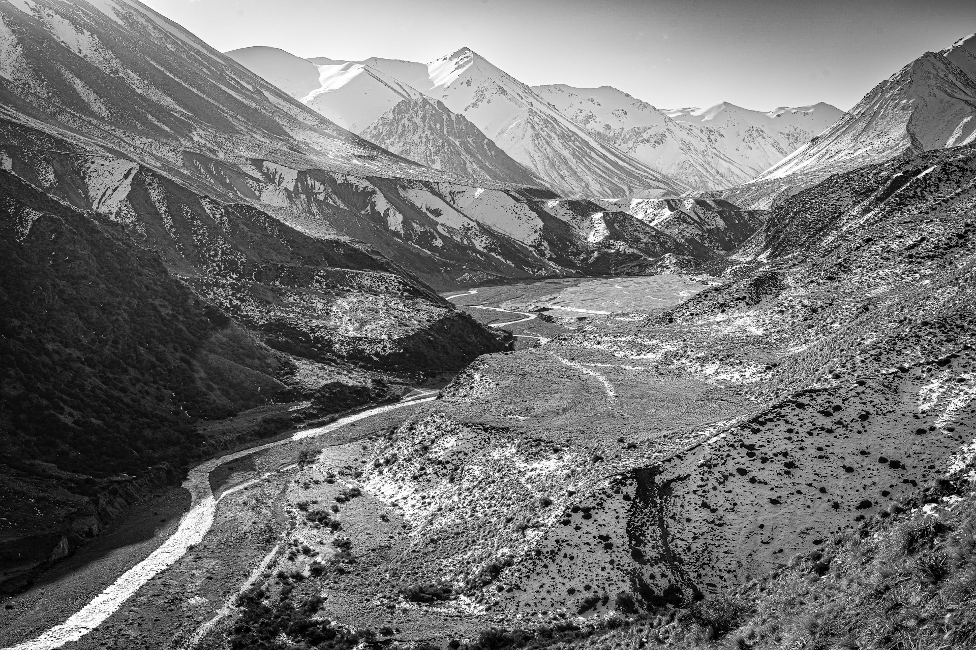
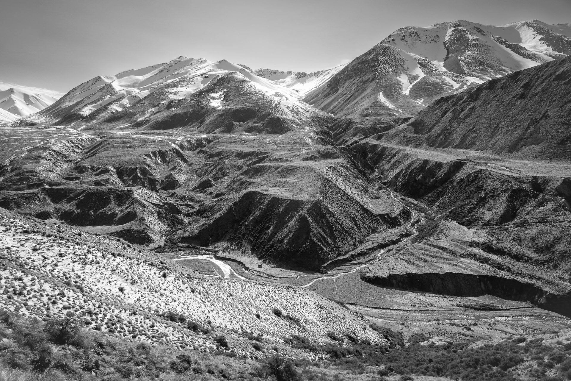
It was a little warmer overnight and the next day we didn’t need to follow the routine of the previous three mornings of thawing out boots and socks. The track back to the Potts River carpark climbs up onto the Dogs Range and winds its way around Mystery Lake before dropping back down to the river—21kms taking nine hours according to the DOC time. Back at Top Hut we had seen a map where someone had written that taking the track was the ‘hard’ way back out, but crossing the river and sidling along the ridge above the true right of the Potts River and then heading down the slope north of the bridge was the ‘easy’ way. It was also mostly the way that I had come into Potts Hut on an earlier trip, so we decided to try this route.
It was mostly good going, apart from a bit of bashing through patches of matagouri and spaniard grass in some of the gullies. Once we got to the slope down to the river it was easy going and we made good time. The route is quicker and shorter than following the track, as it was 12.5 km following this route and took us 7 hours and 40 minutes to get back to the car.
After four days of perfect weather, there was now increasing high cloud and more wind during the day. When we got back to the car, we could see some impressive lenticular clouds forming over the main divide and could also see the wind whipping up dust further up the Rangitata Valley. So Tony had picked the perfect 5-day weather window for the trip.
It was certainly a fantastic five days and we are already thinking about another trip to tick off a couple more of the ’24 peaks’ peaks that are in the area.
Matts photos: https://www.flickr.com/photos/132651318@N02/albums/72177720302268869
More Tony’s photos: www.tararuaphotos.com
Another alpine tramp: Ball Pass
And another alpine tramp: Cameron to Ashburton Circuit