
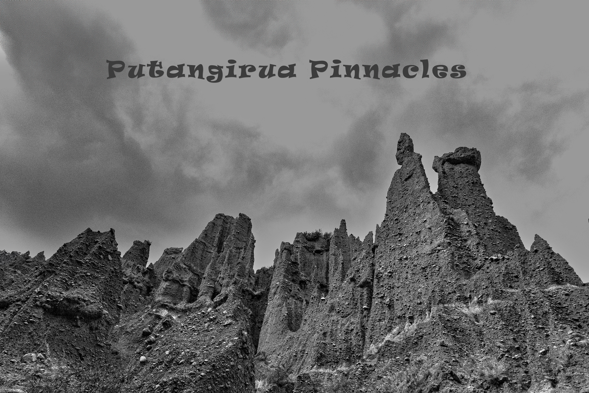
Putangirua Pinnacles track open or closed? – it was open in 1948
The Putangirua Pinnacles – the story of a WTMC trip to the Putangirua Pinnacles in 1948 with added photos taken in 2024.
As at February 2024 the track from the campsite and carpark into the Putangirua Pinnacles is closed because of a dangerous slip (refer comments below on DOC’s legal ability to close tracks).
However, on a recent mid-week day there were 15 cars plus four campervans in the carpark, a lot of shoe prints in the sand past the warning sign, and not a person to be seen. Clearly the Putangirua Pinnacles track is being well used anyway.
If you did want to get around the slip that would be no problem, but what is probably being overlooked by visitors is the unstable ground remaining in and above the slip scarp that is possibly ready to fail—which would not be a happy situation for anyone on the track beneath when it falls. This seems to be DOC’s concern—not the existing slip but the possibility of another.
To avoid the closure and the danger you can presumably still happily use the Te Kopi track which would bring you to the observation deck and then the track down to the stream well above the slip.
Regardless of all this it is interesting to read a Putangirua Pinnacles WTMC trip report of April 1948, written when the club was less than a year old and had about 60 members. Here is their story with a few of the photos that would have been included if DSLR cameras and web publishing were available at the time [TG.]
PUTANGIRUA PINNACLES – APRIL 1948
Two trucks left Wellington Saturday morning and off over the Rimutakas to Palliser Bay and the Putangarua Pinnacles. A club hunting party had gone ahead the night before and on our arrival we were greeted by Des lying on a stretcher. Des had had an argument, which he lost, with a large loose rock on a scree slide. The truck driver took him back to Wellington and fortunately he fully recovered.
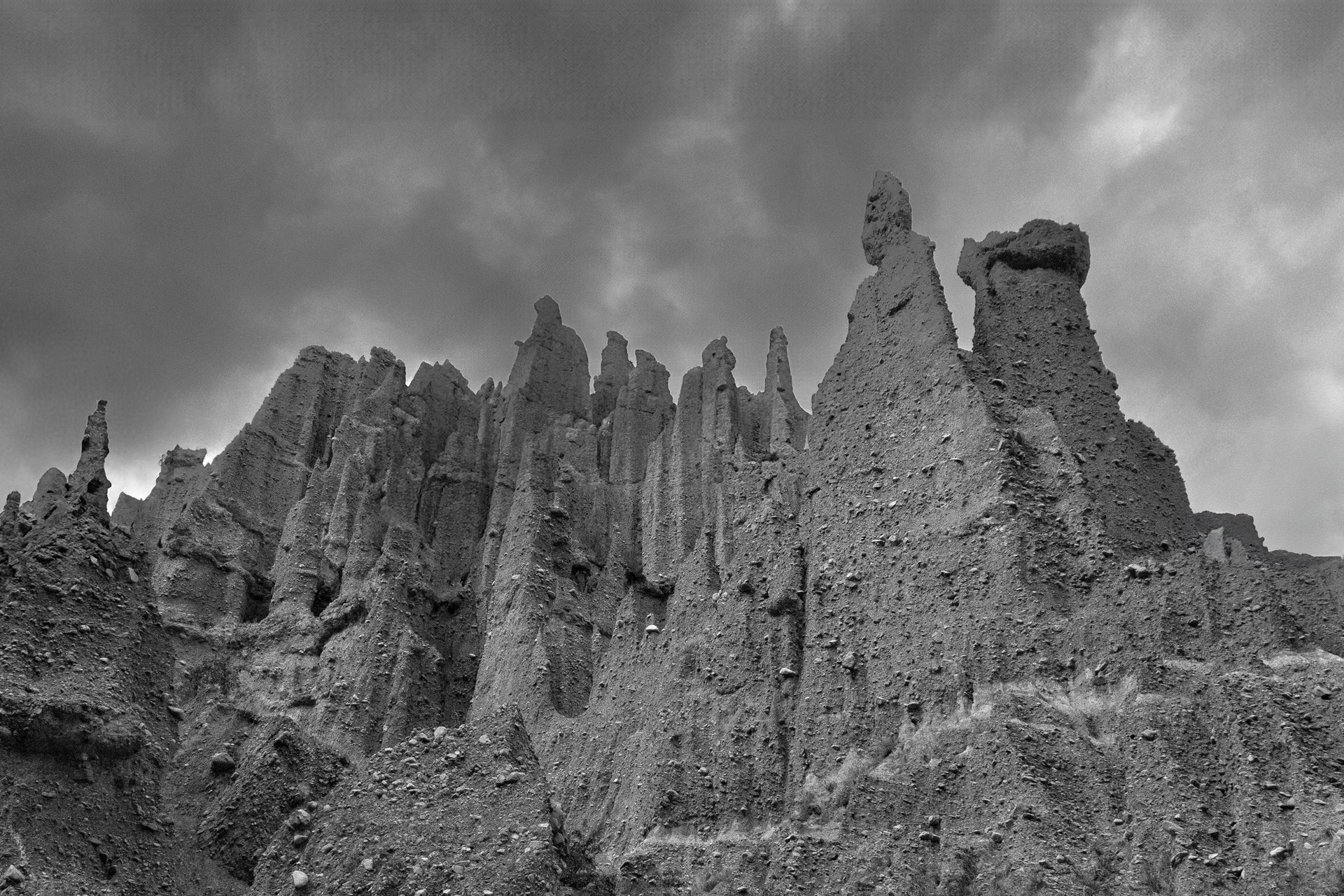
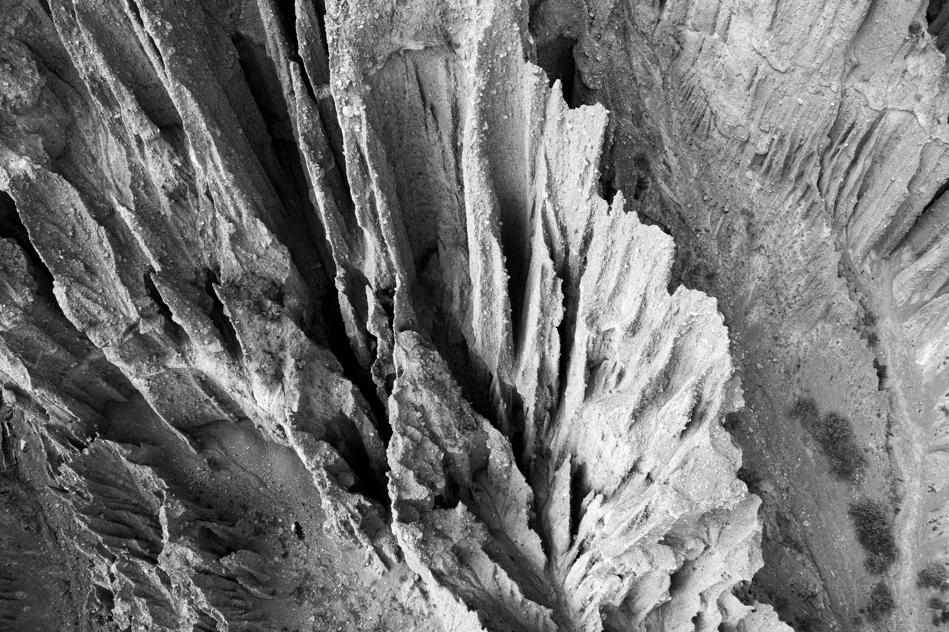
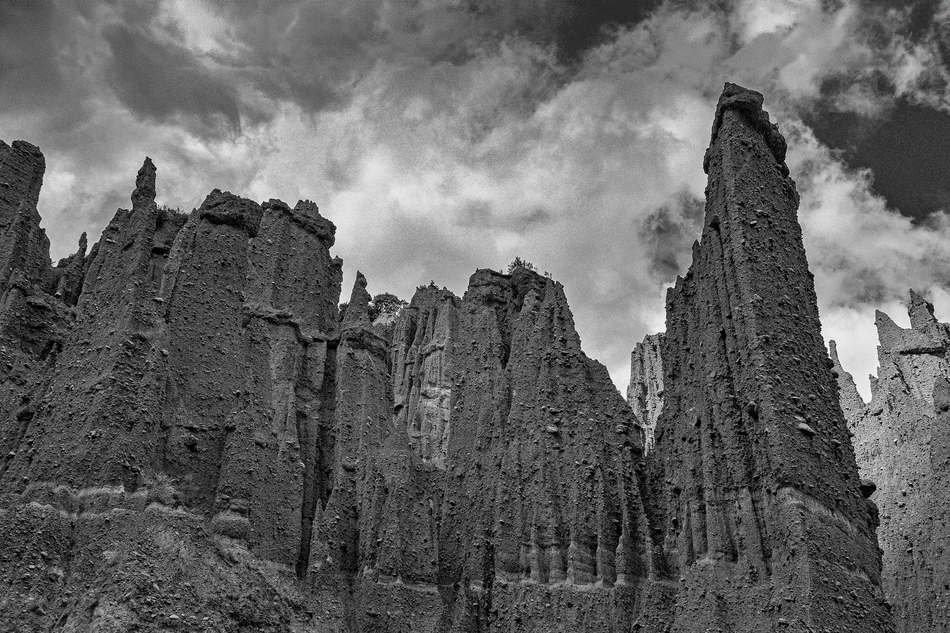
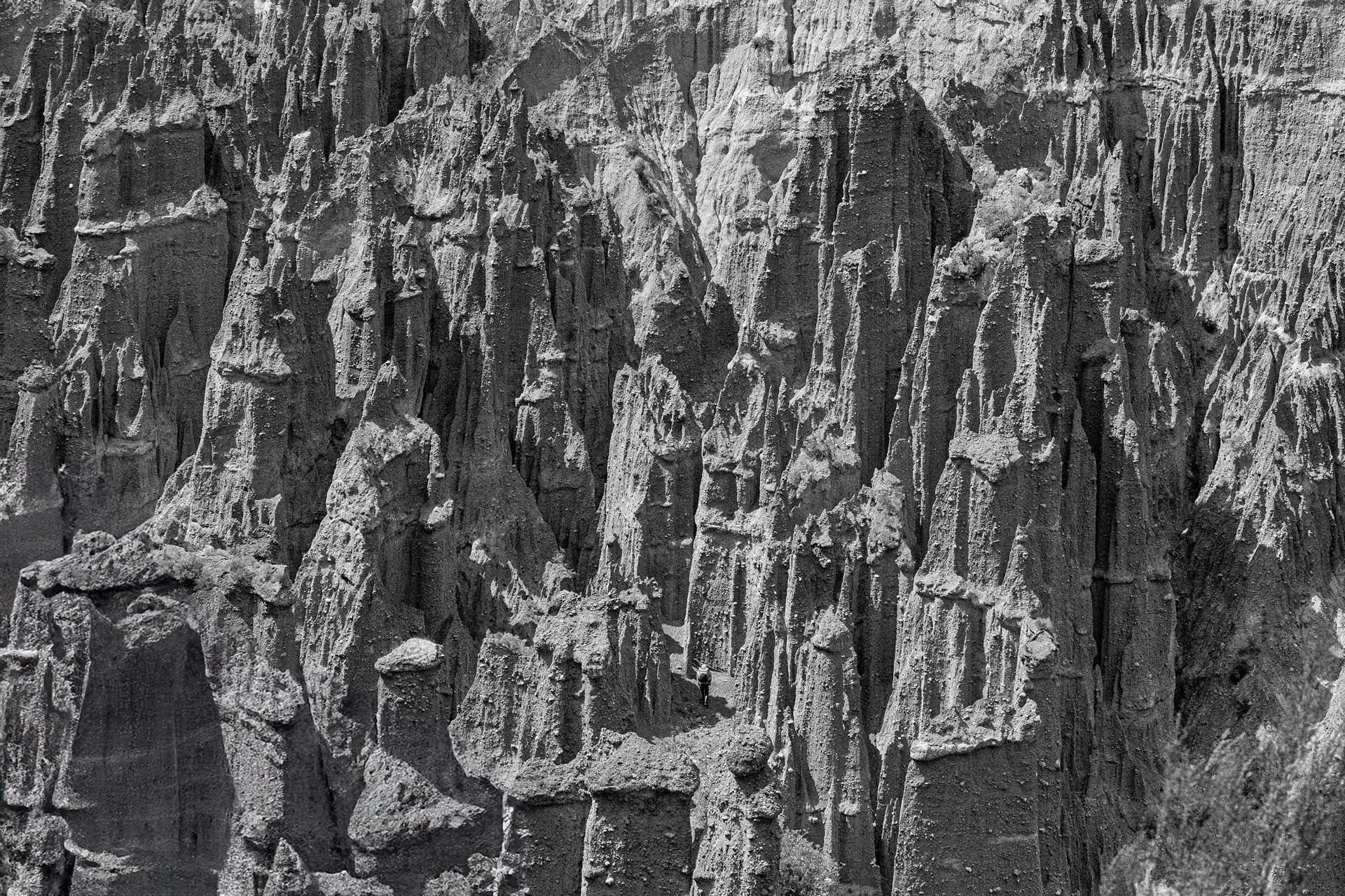
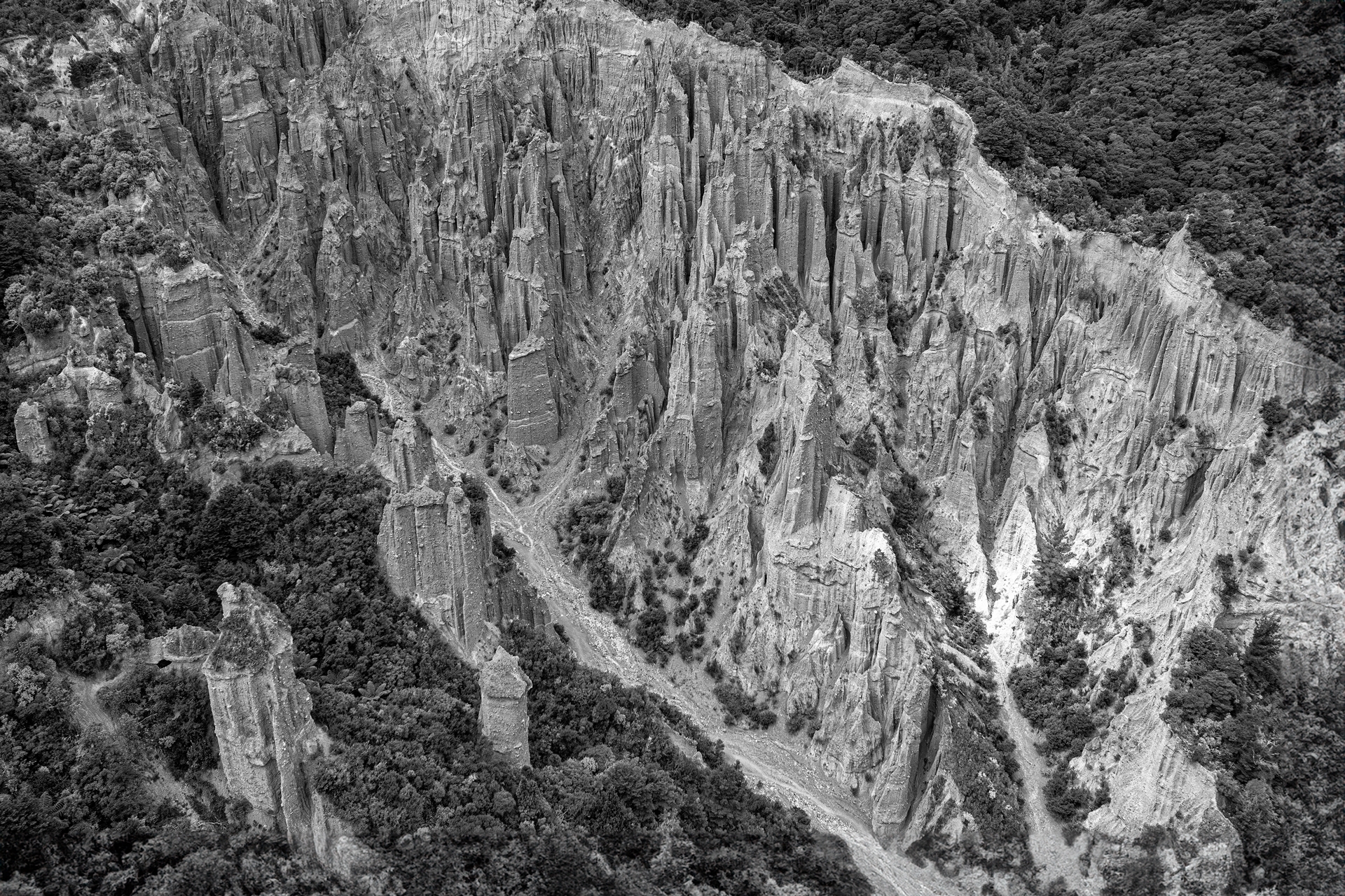
The pinnacles are a unique sight, being carved out by wind and rain from the comparatively soft papa composite. They stretch from the floor of the valley to about twenty feet [6 m, but actually many are taller than this – TG.] The shapes they take on are determined by the position of the rocks that form part of the composite. The whole area in this part of the bay is well eroded, and covered with scraggy scrub when there is any – although there are some surprising bushed valleys near the coast.
The climb among the pinnacles is unique. Between them are narrow guts the height of the valley, and the floor covered with wet papa and stone something like a coarse concrete mix.
Although the pinnacles themselves cannot be climbed the party went to the head of the valley with some returning via the Putagarua Creek, and others crossing into the next valley.
The usual stew featured for tea with Laurie and Albert arriving just as the camp fire was lit. They had come the hard way—Orongorongo River, Wharekahau Saddle and Lake Ferry [about 35 km over the Remutakas and somehow crossed Lake Onoke – TG.]
Sunday was a comparatively quiet day for a variety of reasons but a party visited the pinnacles again and crossed over to the next valley. On both days some keen types took advantage of the nearness of an inviting cliff face, making climbs up, over, and down it with perseverance if not skill.
Hello Harry
Here is the final word from a reliable legal source
Yes, DOC can close tracks on public conservation land. But only for good reasons. Examples of past closures are for a 1080 drop, and after a major storm to protect DOC staff and the public from harm.
The power to close
For conservation areas see: section 13 Conservation Act 1987.
For reserves, it depends on the type of reserve, but they all have some provision to the effect of “do such other things as may be considered desirable or necessary for the proper and beneficial management, administration, and control of the reserve”, which when read with the purpose of the reserve, will tell you in what circumstances you can close. See for example recreation reserves s53(1)(o) and s17(2)(a) Reserves Act 1977.
For national parks, it is likely to be a combination of s 51A(1) and s4(2)(e) National Parks Act 1980.
Making it an offence
Each Act will then make entering the land while closed an offence, either explicitly (see for example s39(1)(a) Conservation Act 1987) or under a more general provision (see for example s 60(1)(l) National Parks Act 1980).
Penalties
You then need to go to the penalties section of each Act to work out which penalty applies (e.g. for s39(1)(a) Conservation Act 1987, it’s s44).
Bear in mind that the circumstances of the case dictate whether a decision is taken to prosecute, and what penalty should be applied if the person is convicted.
So, Harry, there you have it. If you are planning to deliberately walk through a ‘track closed’ sign as a protest keep in mind you could be liable for up to $100,000 fine or 1 year in jail – or both.
Yes, they may have some legal powers under the Conservation Act and the National Parks Act, but my strong impression is that most of the time when DOC announce that some track is “closed” they are not acting under any such powers and the “closure” has no legal basis – they are simply declaring it “closed” for their own convenience or because they perceive there to be some slight danger to the public, and they are hoping that the public will be unaware of their rights and will go along with it. But since there is no legal basis for the “closure” the public are still perfectly free to make their own decision and use the track if they want to, at their own risk. I strongly suspect that this is the case with the current closure at the Pinnacles. Personally I think every person with an interest in the outdoors and with public access to the outdoors should immediately schedule a trip to the Pinnacles and deliberately walk in up the track (or the streambed, which they also say is closed) just to make a point.
I know FMC has had concerns about DOC arbitrarily declaring tracks “closed” and was trying to get them to change their practice.
Mike used to run a really good blog called Windy Hilltops at windy.gen.nz but that domain name now seems to be vacant. There is still an old version at windyhilltops.wordpress.com but that only goes up to 2007.
Yes it seems they can under the Conservation Act and others e.g. OSH.
I think Mike blogged under the name izogi – he’s what he wrote in a 2019 post:
Yeah I don’t know what the OSH laws would be. That might be what counts here. DOC can use this to keep people out of structures, like huts, that are under construction. Can it do the same for wider areas of land? Maybe there’s some untested legal stuff around that.
As for conservation-specific laws, I think section 13 of the Conservation Act only covers Conservation Areas, which encompasses Conservation Parks and Stewardship Land and Marginal Strips and a few other bits and pieces. It doesn’t cover National Parks, as National Parks are NOT Conservation Areas. Neither are Reserves (administered under the Reserves Act).
Is the whole walk in the National Park or is there a fringe within something else that this might be referring to?
For National Parks, the National Parks Act guarantees public access to the whole park by default. To restrict access there’s s56 of the NPA which allows the Minister to create bylaws to enable areas in parks to be closed for various reasons, including public safety. Most National Parks have a set of bylaws, and many have bylaws which allow closing for certain reasons. eg. Here’s Kahurangi’s section on Access: http://www.legislation.govt.nz/regulation/public/2009/0014/latest/whole.html#DLM3693553 It’s all meant to be consistent with the Management Plans, but I’ve personally struggled to find any clear guidance in management plans about how a Minister or DOC should be considering any closure.
But interestingly enough Paparoa National Park doesn’t have any bylaws. Seemingly nobody’s gotten around to making any yet?
It’ll probably be reviewed soon, because it’s the bylaws in all the other parks that govern the camping restrictions within 500 metres of Great Walk tracks. (The Freedom Camping Act also, for some reason, separately prohibits camping within 200 metres of any Great Walk, but funnily enough still doesn’t include the Pike29 track in its Schedule 1 definition of what’s considered a Great Walk.)
I’m not a lawyer. If someone can show me where I’m wrong, if I am, then I’ll learn something.
Can DOC “close” a track? They do this all the time, but what does it mean to say that a track is “closed” and what legal authority do they have? I remember Mike McGavin, a club member (or former club member), wrote an article about this some years ago on his Windy Hilltops blog, but that blog no longer seems to exist.