
Two Akatarawa Daywalks
Two easy daywalks in the Akatarawa Forest close to Wellington City
 Karapoti Road
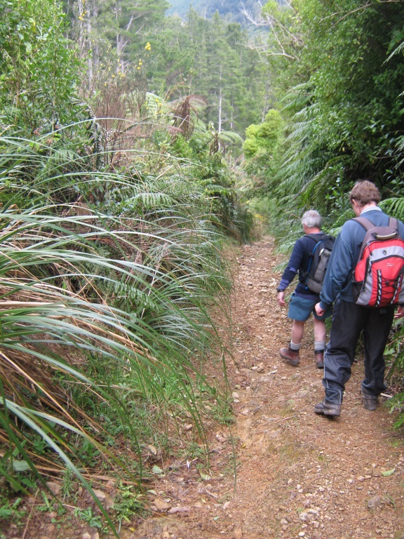
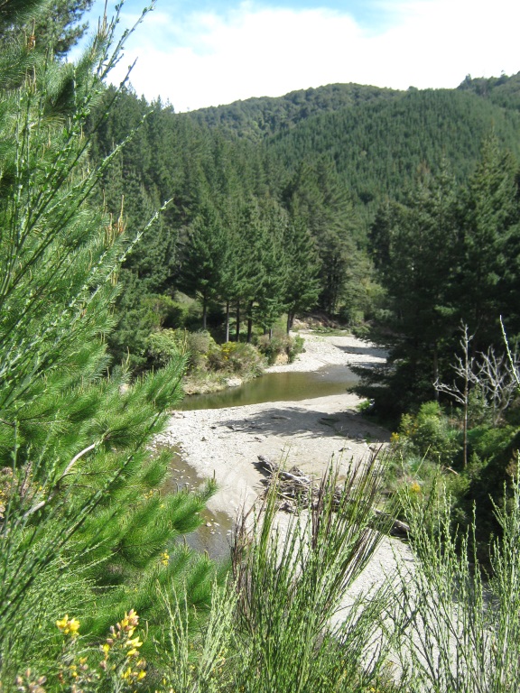
The starting point of this walk is a short way down Karapoti Road, which is accessed from Akatarawa Road a few kilometres from Upper Hutt. From the carpark, the walk is through Karapoti Gorge which has really nice native bush next to the Akatarawa River. The track is wide and flat, but had lots of puddles to avoid. After about an hour we got to McGhies Bridge, and turned onto Hukinga Road. From here the bush became a mixture of native bush and pine trees. Again we enjoyed a wide and flat road for about an hour, and then we stopped and used Pete’s GPS to locate a turn off to the right. Here we climbed a short distance and stopped for lunch.
 Our objective was to head towards a large tree, which apparently was the objective of a previous Easy club trip starting at the same road end but taking a shorter and much more difficult route. From the lunch stop the track became a rough unmarked path through the bush, and we realised getting to the tree would be better done in two days. So we turned around and headed out.
Peter has a great ability to keep the conversation going and going, and many subjects were talked about. The roads we walked are popular with motorised vehicles – there were quite a few quad bikes, motor bikes and 4WDs that passed us. But there weren’t so many that it became annoying – we could hear them coming so there were no frights.

Wainui Peak
A few weeks before the Karapoti walk, I was on the other side of the Akatarawa Forest, starting at the Paekakariki train station. From the station I walked through the town, which took longer than expected. Then I walked the Yankee Trail through Queen Elizabeth Park, so named because of the US soldiers that used the track to get from their camp to the town during WW2. I was trying to imagine turning the corner and seeing a group of American soldiers coming towards me in WW2 uniform!
At MacKays Crossing I entered Whareroa Farm which is run by DOC. After a short flat section, there are three tracks up the hill, and I took the most direct and steepest. This takes you onto the isolated Campbells Mill Road, this is really starting to get away from it all. The road continues south to Wainui Peak. When I was well down the road about two and a half hours after leaving the train station, I decided to turn around, conscious of the fact I had to walk all the way back to the Station. Looking out towards the town, Kapiti Coast and Kapiti Island, I thought this was pretty good for a trip involving the use of public transport only.
A few years ago I saw Wainui come up in the draft or final Trip Schedule, but I don’t think the trip actually happened. Possibly everyone thought the trip involved walking through the streets of Wainuiomata! In future schedules it would be a good idea to call it Wainui Peak, or Mt Wainui. It would be best to start the walk at MacKays Crossing, and from there my guess is that it would be a Medium level daywalk.
As I walked down the hill and back across the open flats, it was good to be able to look back and see exactly where I had gone, at the significant distance traveled.
For another Akatarawa Forest daywalk go to Akatarawa Forest – the Secret Seven and the quest to find 73
Thanks for the useful update on the track Tim. I’m keen to get up there. Is it clear at the top i.e. do you get good views?
Went up Mt Wainui yesterday. Campbells Mill Road now passes through what appears to be 10 year old pine forest with pasture still in place but, unlike last time I was up there in circa 2011 visibility is much reduced due to the growth in the trees. Stallions create dung heaps and these are in evidence through this young forest so you might see a stallion if you are lucky, we didn’t. When you hit the more mature pine forest turn right and head downhill about 1.0km until you hit the stockyards. There are OTs marking a track into the pines and after a short distance you enter bush and follow that to the top. Fairly rough track with slippery steep section requiring boots except in the driest summer conditions. Bush appears to have been cut over but evidence of larger tree species emerging (tawa, miro, totora but no rimu interestingly). You know you are at the top as there is a trig. The track appears to have been cut to continue to the south which I followed about 150m but this is not marked on DOC maps – I wonder whether they are cutting a track to meet with the saddle of the Transmission Gully road?? We took 6 hours from Whareroa Farm carpark but we turned left at the pine forest and had to cut back so it would probably take 5 hours return.
Happy tramping Tim Julian