

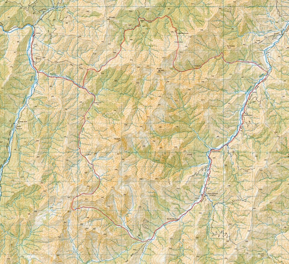
Bounds Circuit – 6 days in the Leatham Conservation Area
A 6 day hiking loop trip through spectacular mountain scenery in the Leatham Conservation Area passing through Boulder Stream, Wye Route, Turkeys Nest, Gosling Hut, Waihopai River, Waterfall Stream, and Boulder Stream
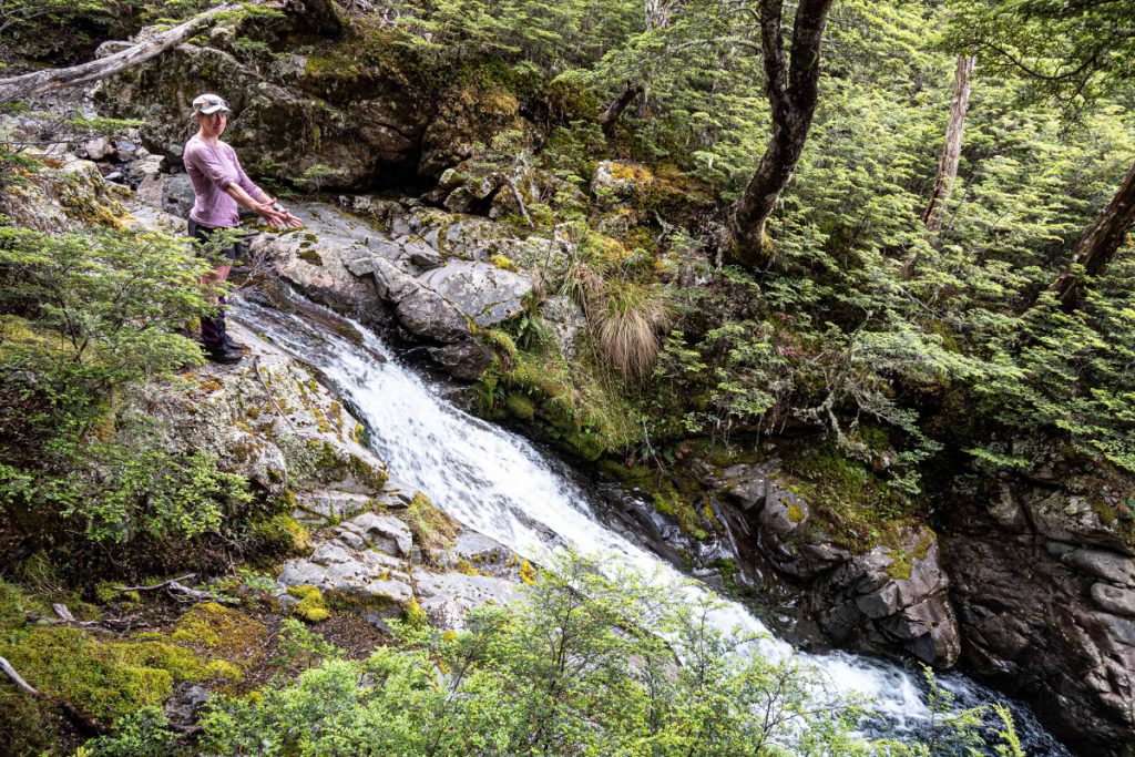
Day 1 – Leatham Road end to Hidden Hut via Boulder Stream and Wye Track
Start 9.15am, Finish 5.45pm
We left our cars on the grassy patch next to the farmer’s gate, in case the ford (about 10-15 minutes further walk along the 4WD track) was too difficult to cross. We followed the 4WD track until it forked up Boulder Stream. During this time Aimee ate and coughed on a bug that made it hard to talk!
From the fork we carried along the 4WD track up Boulder Stream until we were almost opposite the fence line. Before the 4WD track curved right and up a small hill, there was a wide grassy patch which Emily correctly selected as the best place to get down into the river. There was still a 3-4 metre drop to get down. Tony found the way down then we all passed packs, except Illona who just went down with her pack on.
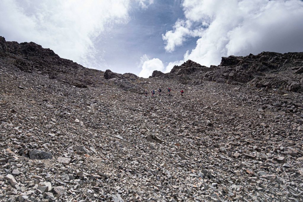
At 11.30 am we started climbing up the fence line. Illona set a great pace and found good little rock/dirt footpads to step on. It was very hot. We mostly kept close to the fence. After a lunch stop, we got to the top at 1.30 pm.
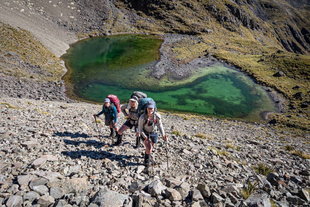
We followed a poled route along the ridge down into the headwaters of Station Creek. Emily pointed out a nice flat area where she had camped on a previous attempt to climb Bounds. Up the creek we went, occasionally seeing a DOC pole. We got to the saddle between points 1430 and 1810 at 3.15 pm. It was at this point we decided to aim for Hidden Hut, rather than the Turkey’s Nest Biv.
The descent from the saddle into the bush was a bit scratchy, but well-marked. By this point the insoles in my shoes (which were already on their last legs) began to bunch up in painful ways (later fixed by Illona with her magic duct tape!) I struggled a bit along the track to the hut, but we still arrived at the reasonable time of 5.45 pm.
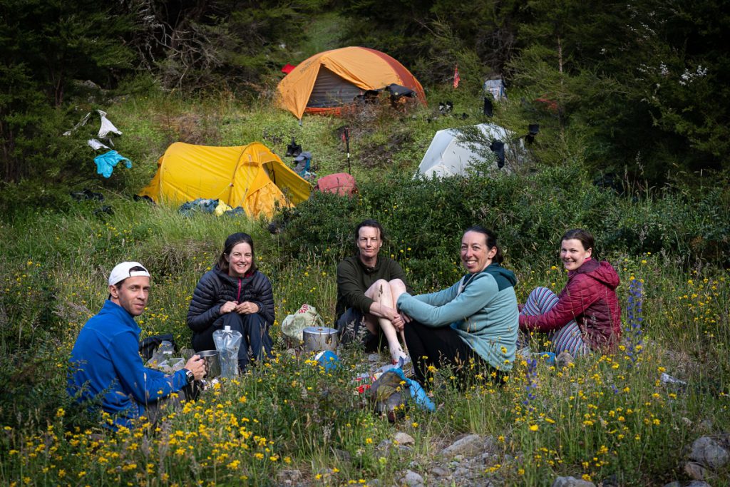
Hidden Hut had one other occupant that night. We ate Aimee’s pasta, and Illona’s Turkey Mole (which should’ve been eaten at Turkey’s Nest Biv!) The Turkey Mole and salsa was a great success, and must be made again.
Google question of the day: who ate the bug (not Aimee’s bug) and where did the bug come from and what happened to the guy?
Day 2 – Hidden Hut to Gosling Hut via the Bounds Ridge
Start 7am, Finish 5.45pm (for Aimee and Tony, others quicker)
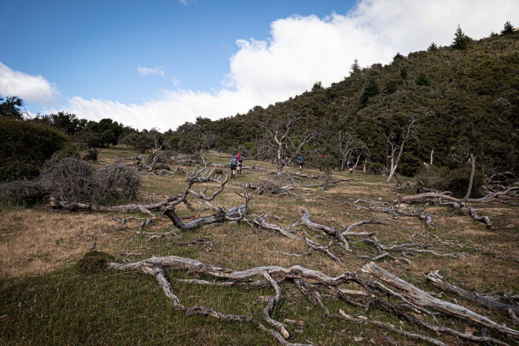
After a 7am departure, we followed the track up the first little hill and down into the creek where Aimee downed copious amounts of water. Then Megan and Stuart set a cracking pace up the 500 m climb to Turkey’s Nest Biv. We arrived there at 9.40am and were delighted with the cute little hut. However, we decided it was a good thing we stayed at Hidden Hut because there wasn’t really enough room for six people to sleep around the
bivvy (it is only a 2-person bivvy and it is on a steep slope).
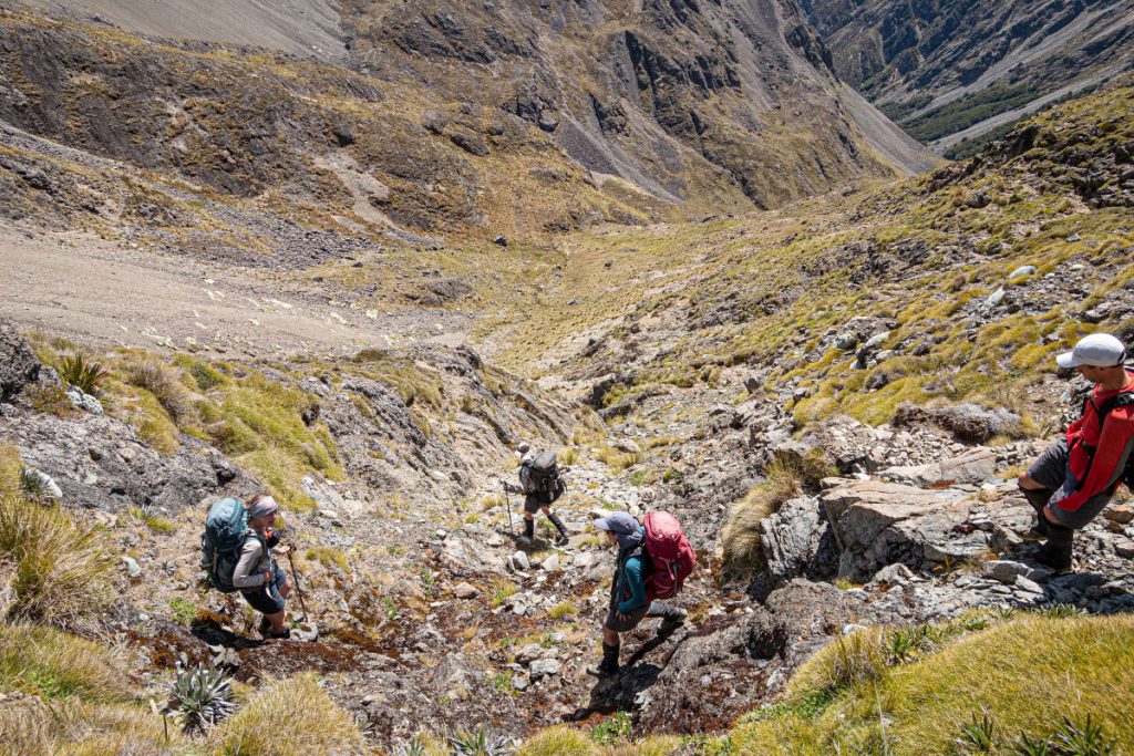
We followed the ridge up behind the hut for 20-30 metres, then got in the creek. We filled up our water bottles, not knowing how long it would be to get to the next water source, Gosling Stream, on the other side. Then it was off up the creek, following it until it disappeared and turned into wide rocky channels. The going was very hot, and the team helped me greatly by taking weight out of my pack. We arrived at the top of the ridge at 12.30pm.
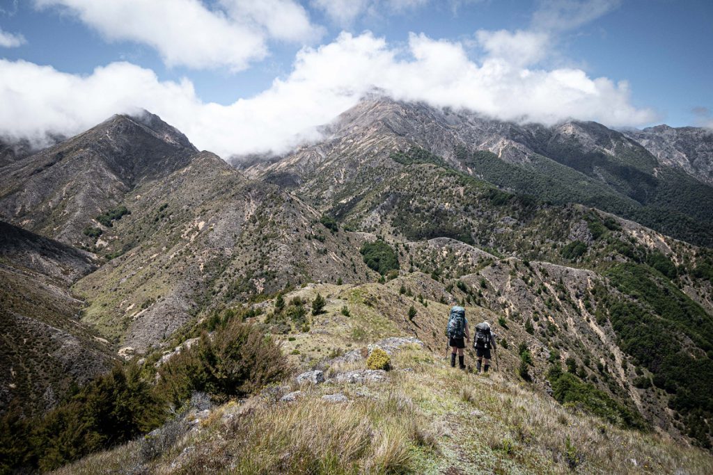
After scanning the ridge along to Bounds, we decided that it wasn’t for us (at least not that day). It is quite a rocky ridge, and would take some care to travel along. We had lunch perched behind a rock for shelter from the wind and enjoyed the nice views in the ‘Little-Big Country’.

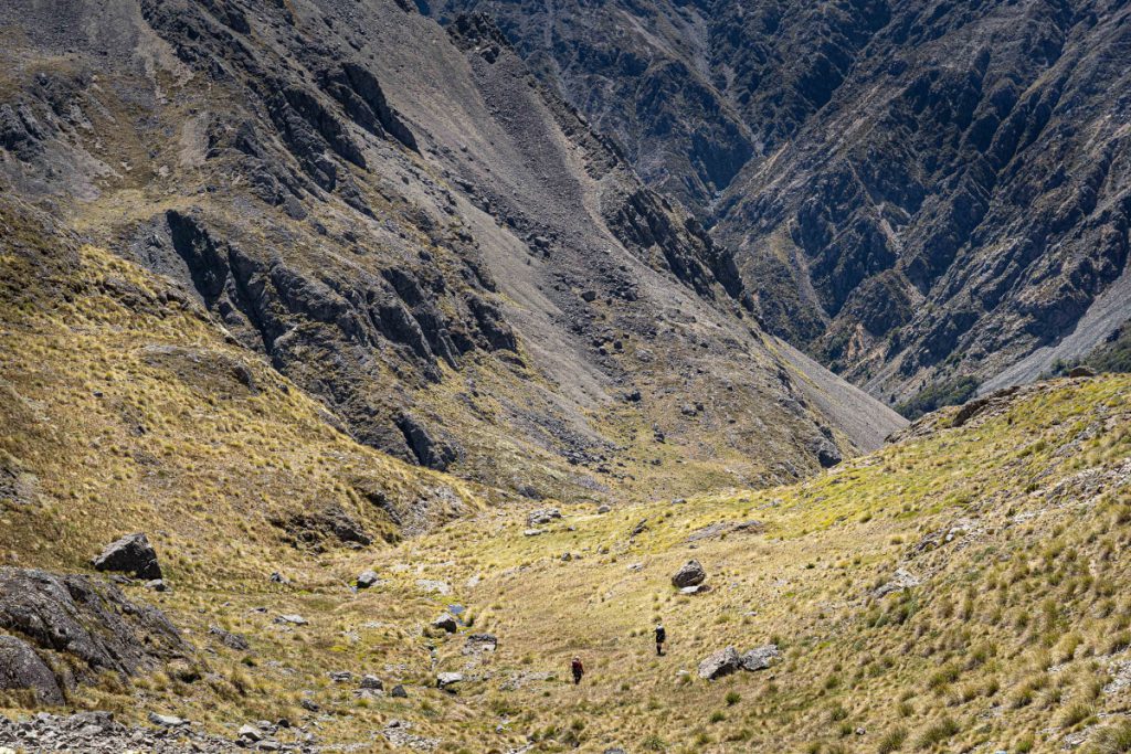
After finding a good place to get off the ridge, we arrived on scree slopes—a perfect chance to practice ‘screeing’! The scree led all the way down to a grassy meadow, where we thought one could possibly camp if one were making an 11th attempt on Bounds peak. I led the next bit, down through the tree clump, across the stream, and sidling left across the hill to find my tree—Tony and my high point from Tony’s 10th attempt at Bounds. I then led us down the slope, curving around a rocky channel by following the edge of the bush, into a side stream that led to the main Gosling Stream. I was rather proud of myself for remembering the way down.
At this point the others, who had been bunched up behind me, were free to go down Gosling Stream at their own pace. Tony stuck with me, and we plodded slowly, retracing our steps from three weeks before! At one point you have to do a small sidle on the true right around a waterfall, ending up in another branch of the Gosling Stream. Soon we were at the little cliff with the tell-tale peach paint, marking the track up to the hut. It has a rope to make getting up easier.
It was rather funny to be back at Gosling Hut so soon, given it hardly gets any visitors! But it is a nice little hut, and we are very grateful to the Marlborough Tramping Club for maintaining it. The story in the front of the hut book about how one man got the mattresses up there was very entertaining.
Google question of the day: vegetable sheep—do they grow in other countries?
Day 3 – Gosling Hut to Blue Mountain Hut along the long boring 4WD track
Start 8 am, Finish 3.45 pm
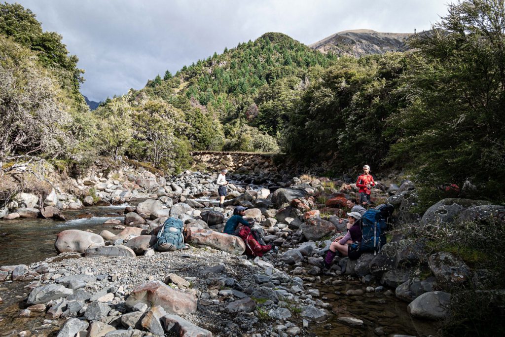
Apart from a short detour up into the bushes on the true right of Gosling Stream, about 50 m down from the hut, the walking was an easy dawdle down the stream. We arrived at the junction with the Waihopai River at 11am. There happened to be a good crossing spot just around the corner from the junction, and we found a place to get up onto the 4WD track. Here began the long, monotonous walk along the 4WD track to Blue Mountain Hut, broken occasionally by herds of cows that watched us with much trepidation.
Along the way there were two diversions on a poled DOC route to avoid buildings and Glazebrook Station. After crossing the Waihopai River just before Blue Mountain Hut, the 4WD track becomes less obvious and more grassy. We arrived at the hut at 3.45 pm, and had time to lounge in the sun, or do some washing!
Blue Mountain Hut reminded me of a little schoolhouse, complete with little blue wooden ‘naughty chair’. It was nice to have some time at the hut to snooze, drink and eat. It had been a while since I had done a multi-day tramp!
Here there was lots of discussion about what to do next, given our pace, the weather and the unknown terrain up Waterfall Stream. After requesting an extended forecast from our weatherman David via the In-Reach, we decided we would prepare ourselves for potentially an extra night out, and ration our snacks and food accordingly.
Google question of the day: how many species of nursery spider are there? Do they occur overseas? Are the stone ones different? How many babies in a nursery?
Aimee was relying on hut book pens for making notes about this trip—that means we have good notes up until Day 4 when we left Blue Mountain Hut. This is Emily taking over writing up days 4, 5 and 6 with no notes which could mean a less accurate end to this trip report!
Day 4 – Blue Mountain Hut to high camp next to unnamed tarn at head of the true right branch of Waterfall Stream
Start 8 am, Finish 4 pm
A number of decades ago the farmer from one of the stations in the vicinity had mentioned to Tony that the best scenery in the area was to be found in Waterfall Stream. That’s partly why we have come here—although most of the group didn’t know it until somewhere along yesterday’s four-wheel-drive road march when we were starting to question why we were tramping amongst cows. So, I am excited about today—it is unknown territory for all of us and it involves ascending a stream with ‘waterfall’ in the name—it is going to be a fun day!
First, we have a few more kilometres of four-wheel-drive track to get out of the way, but after an hour or so we turn off into Waterfall Stream to start our ascent. It is another fine weather day, although there are some showers and slightly stronger winds forecast which we hope aren’t going to ruin high camp plans.


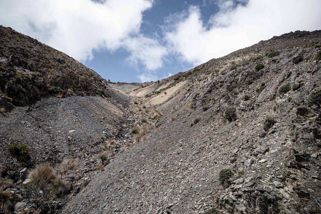
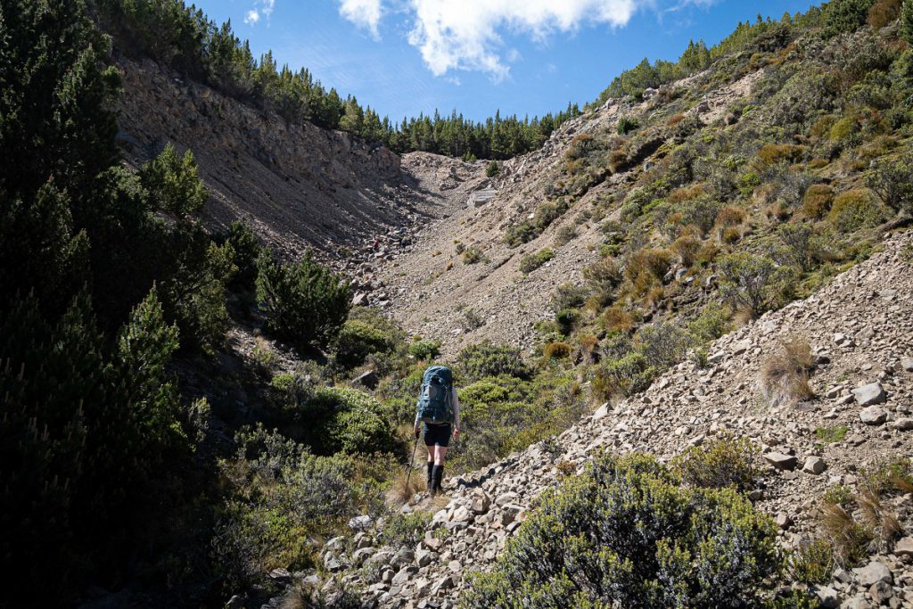
The true right branch is running completely dry enough of the way up that we start to wonder if we’ll ever be able to fill up our water bottles. We’ve boiled enough at the hut last night to get us part of the way and at least past any cattle, but were not expecting a dry stream bed. Just as we are starting to get thirsty, I spot a flume of white water upstream—or is it a mirage? We have to get a bit closer before we confirm. By this point we have already negotiated several learner boulder sections (we have now taken to treating this trip as practice for future West Coast trips) which are hidden amongst widely-spread contour lines in the first few kilometres of the stream.
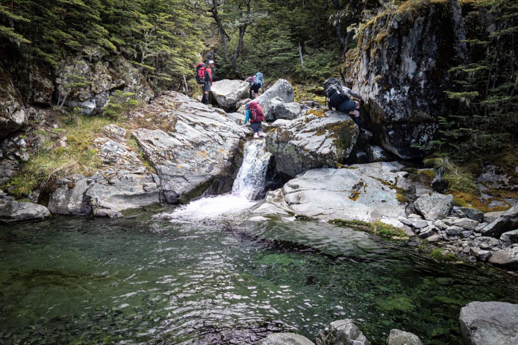
As the valley narrows and steepens, we come across about eight impassable (unless you happen to have brought your canyoning gear) waterfalls. We find easy sidles through the bush around all of them, and pause for lunch above one of the more visible ones. In between the sidles there is lots of fun stream travel with pools, boulders, logs and the odd slimy surface to be negotiated.
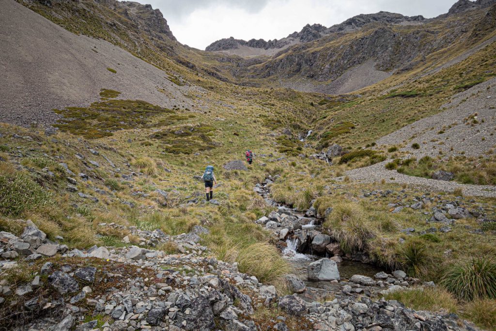
Sometime early afternoon we pop out of the bush onto a scree slope and get a good view up the valley. It’s one of those alpine basins which at first looks like a wall of bluffs but after a little consideration one can start to see a route up between them. We could see the outlet of the tarn we were headed for still some 400 m vertical ahead of us. Unfortunately, we could also see wilding pines scattered all the way up the valley. After an hour or so of tussock-grabbing, speargrass-avoiding zig-zagging between the bluffy bits we reach the tarn.
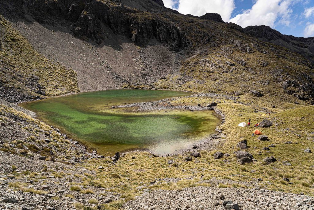
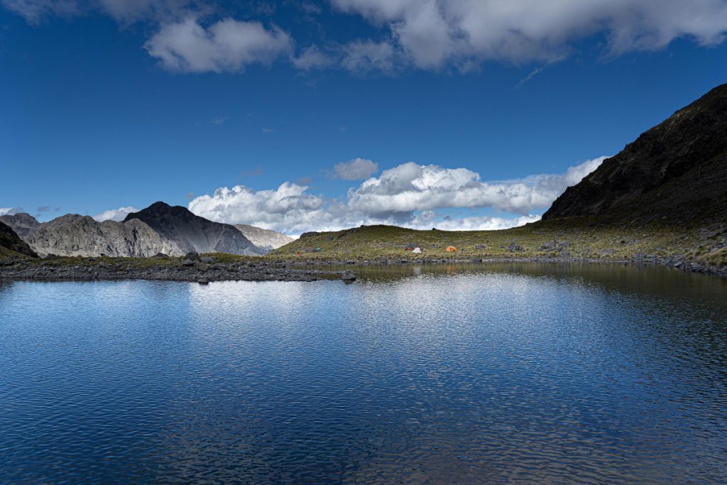
Before we put our minds to finding the flattest spot for each of our three tents, we watch a group of Canada geese and their goslings waddle up the scree slope on the far side of the tarn and into a cave high above us which appears to be their home. Bizarre. Tents pitched, tarn swims complete (for some of us anyway), the group conversation turns to dinner. By this point, we’ve pretty much decided that we will stay out an extra night and calculated we have enough calories to keep us sustained for that so the decision we need to make is how to divvy out those calories across the remaining two nights. We opt for eating the last full dehy meal tonight, expecting a longish day tomorrow.
The forecast showers never eventuate, but the wind keeps the temperatures down. It’s a lovely spot and the long daylight hours mean no head torch required for in-tent reading until after 9 pm which is way past Tramper’s Bedtime anyway.
Day 5 – High camp to low camp south of Point 807 in Boulder Stream
Start 9am, Finish 5:30pm
Having agreed to our usual departure time of 8am, somehow, it’s too lovely a morning to move quickly and we are not ready until 9am. This is a tramping holiday after all, and it’s quite special to linger at the places we put so much physical effort into getting ourselves to.
Today’s challenge was to climb up out of the Waterfall Stream valley and over into the Boulder Stream valley. Given this was a last-minute alternative to our original West Coast trip plan, we have done very little research on the route. Tony has read one account where somebody travels between the two valleys by topping out over the ridge north of Point 2019 and then sidling to the west of Point 1989 before dropping into Boulder Stream from the north of that spot height. This seems like a long and complicated route when we can see a nice grassy slope north of the tarn heading up to the W-E ridge that divides the headwaters of the two streams.
But for some reason, we opt for the long and complicated route, perhaps because it’s the only ‘known’ one. Suffice to say over the next couple of hours we do a full tour of the scree slopes at the very top of the basin, only to end up at the top of the grassy slopes on the northern side which provide an easy transition between the two valleys after all. We never found a good route over to the west side of Point 1989, although it could well be doable for a party comfortable with some extended scrambling. The highlights of our full basin tour included clear views of Tapuae-o-Uenuku and Mt Alarm to the east, flowering penwiper plants surviving amongst the scree, fresh mountain air for an extended period and the general joy of being high in the hills on a fine day. I was not at all disgruntled to have gone the long way round.
Looking down into the headwaters of Boulder Stream, travel from here appears like a similar challenge of small bluff zig-zagging and speargrass avoidance to yesterday. The six of us find our way down in six different ways (with the exception of a common narrow shelf that gets us all through the ‘crux’) to a prearranged lunch spot next to the biggest boulder in the valley. Having found waterfalls in Waterfall Stream, expectations are now high for boulders in Boulder Stream.
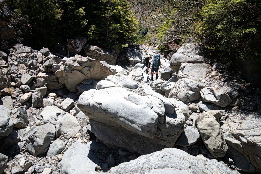
After lunch we fill up our water bottles in anticipation of the stream going underground like we’d come across the day before. A few hundred metres later it did exactly that for a good few kilometres. Our Boulder Stream descent was an interesting mix of flat river bed travel, large dry boulders on short sections where the stream dropped steeply (these were great for sliding down but travel would be tricky if there was water flowing) and middle-sized wet and dry boulder/rock- hopping (the definition of boulder vs rock was debated during the descent). In one section downstream of Krushen Stream, where the stream narrows and steepens, there are multiple waterfalls in a row. While a slimy descent of the first one may be possible it would be very difficult to climb out of the ravine to avoid the following ones so we stayed high and dry cutting over a low spur into the next side stream to re-enter Boulder Stream clear of the falls.
We had agreed to look for a camping spot before we hit the relative civilisation of Boulder Forks Hut and its four-wheel-drive access so we could enjoy our bonus night out in the hills. Just before the side-stream south of Point 807 we found a couple of flat terraces suitable for three tents. We could have pushed on, but a symbolic fence crossed the stream just ahead of us which we interpreted as the line between our wilderness and certain human contact. The deciding factor was the personal bath-tubs that the side stream provided. Up went the tents, and out came the pot-luck dinner of whatever each of us had left to share. Dinner was a surprisingly good feast, with the opportunity to try multiple types of Tararua biscuit,
variations on dehy hummus and a lot of chocolate.
Day 6 – Low camp to Leatham
Start 8am, Finish 11am
The last day dawned fine again, and this time we were ready for our agreed 8am departure, no doubt motivated by brunch in St Arnaud. We had a kilometre or so more stream travel before finding the ribboned track which cut the corner of McCallum Stream to lead us to Boulder Forks Huts, both new and historic. We spent a few minutes at the historic hut where Sir Edmund Hillary stayed before his climb of Pinnacle—his name can be found graffitied on the hut ceiling. Then it was a couple of hours of steady marching along the four-wheel-drive track to Leatham where we’d left the cars six days prior. Brunch and a look at the weather forecast settled us into an easy decision to head back to Wellington rather than try to fit in
another short trip before the end of the Christmas holidays.
Reports of other WTMC trips in the Leatham Conservation Area:
For a Lees Hellfire Circuit trip go to Lees Hellfire Circuit – The Bounds of Hades
For a Leatham Molesworth Circuit trip go to Finding dinosaurs and magic on the Leatham – Molesworth Circuit
For Tararua Range photos go to www.tararuaphotos.com