

INTRODUCTION
This is a great place to go if you’re training for a bike-packing mission like the Old Ghost Road, getting into mountain biking but tired of the crowds at Makara Peak, or just out to explore some beautiful coastal forest. It has great variety of track, challenging ups, exciting downs, lovely forest, stunning views and all for just a few hours’ cycling.
The overall grade would probably be intermediate, with a mix of a little paved road, ‘family style’ cycle track, single-track, rugged 4WD tracks, some river crossings, good hills to climb and some even better hills to whizz down.
WHERE WAS IT
The Akatarawa Forest Park is at the south end of the Tararua Ranges. It’s easy to get there by train up the Kāpiti Coast, so if you’re starting from Wellington I recommend getting the train up to Paekakariki and then back from Paraparaumu. Paekakakariki also has some great cafes to get you fuelled up for the day!
I’ve marked up a map here and will talk about each stage of it :
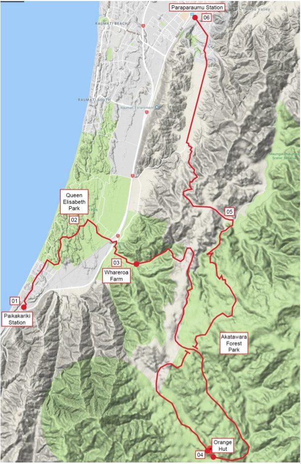
THE ADVENTURE
From Paekakariki main street (01), heading north into Queen Elisabeth Park (02) is pretty easy and you’re soon onto some cruisy ‘family style’ tracks, but there are some more tricky ones hidden away in there too if you’d prefer.
About halfway through the park you turn east and pootle along to Whareroa Farm (03) – a DOC-managed recreation reserve.
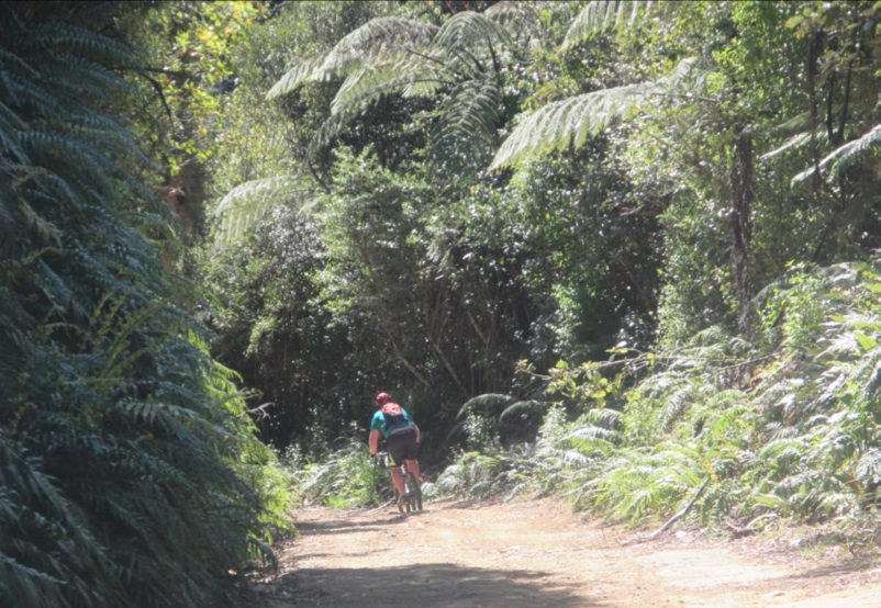
Here’s where you experience your first hill, which is a lovely and well-graded single-track. There’s a picnic table near the top where you get a great view out towards the Kāpiti Island.
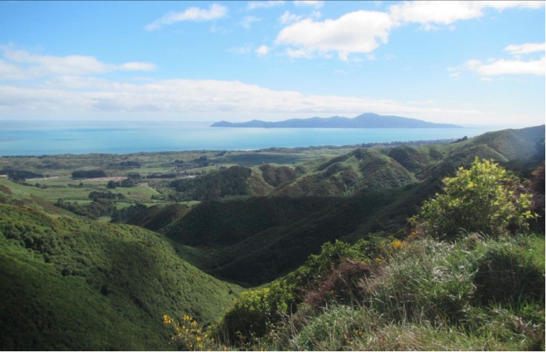
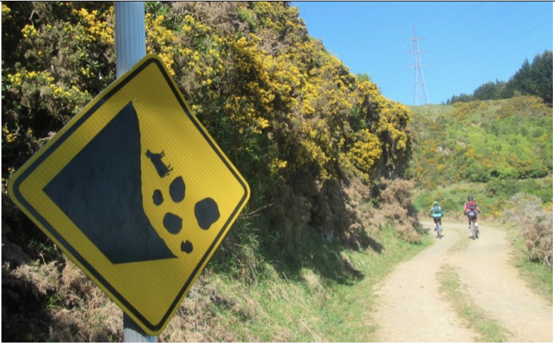
A bit further on passed the picnic table, you hit the 4WD track that leads you to the high point before entering the forest proper. It has great views all along it, and some interesting signs.
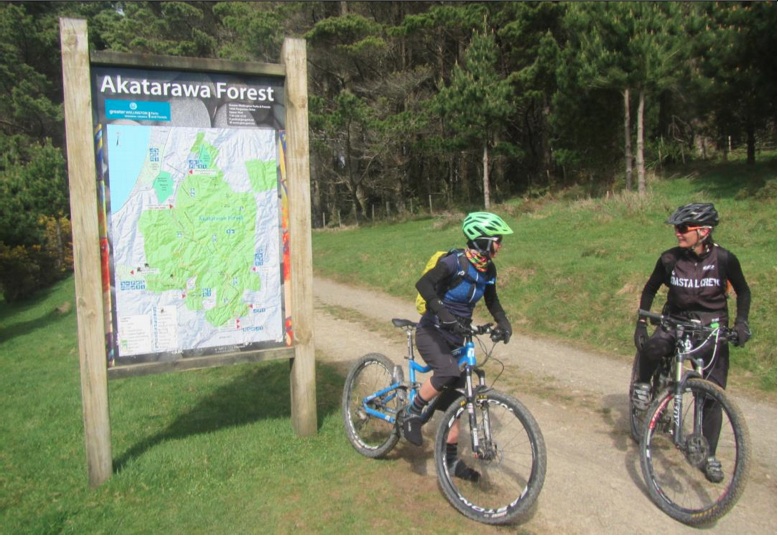
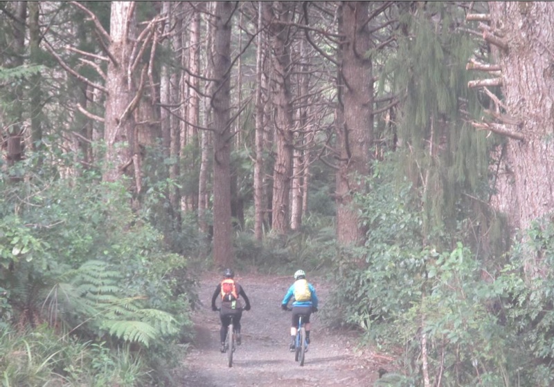
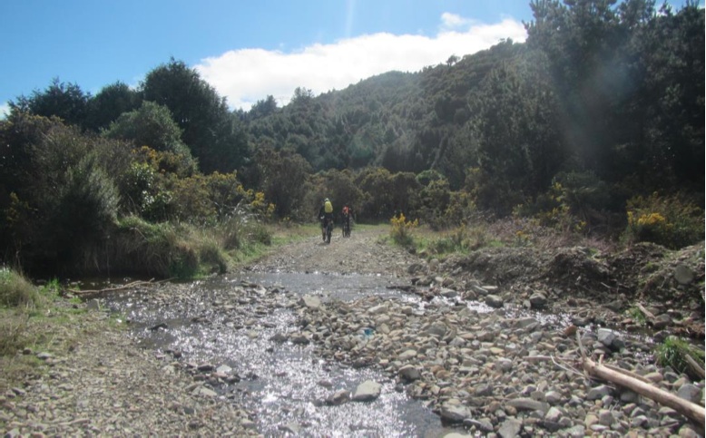
You then plunge into the forest, and while still on 4WD tracks, you can’t help but think that not all 4WDs are equal, and some may never get that far!
The first river crossing is a good gauge for the rest of the trip; if it is crossable (and not in an extreme way) then you should be good for the rest of the river crossings to come.
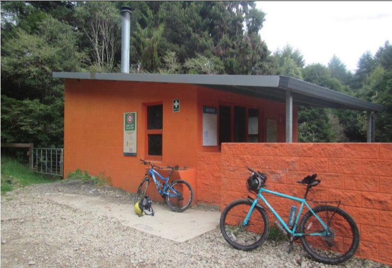
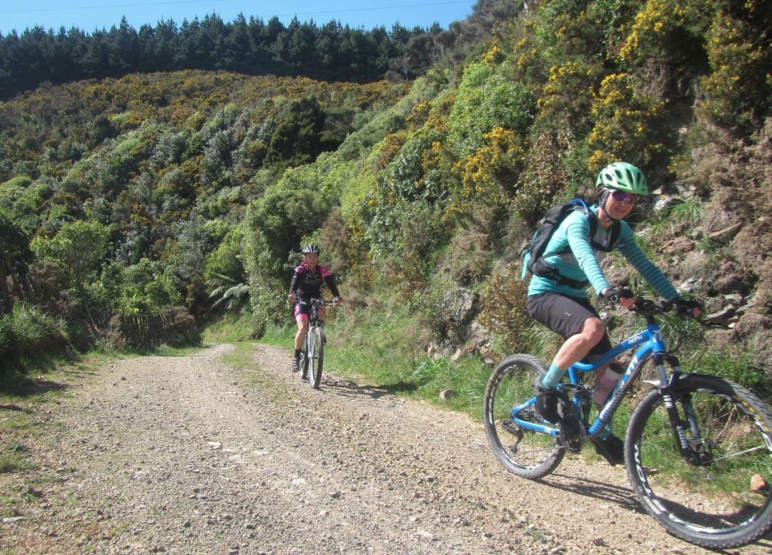
After a few steady ups and really fun downs you wind your way to Orange Hut (04), a popular 4WD enthusiasts destination and a good place to have some lunch.
Don’t stop for too long, though, as there are some lovely hills to climb, and some big forest to check out.
Completing the figure-of-eight track on my map leads you down Perham’s Road (still a bit of a knarly 4WD track), onto Maungakotukutuku Road (mostly paved) (05), then north along Valley Road – possibly the straightest bit of road outside the Roman Empire – and then into Paraparaumu where you grab a pastry and can catch your train (06).
If you can stay on your bike on the ups (you are from Wellington, so I assume you can!) and are intermediate on the downs, I would allow 4 or 5 hours for this loop including lots of breaks and photo stops and all that stuff. It’s probably around 45km, or a bit more.
Enjoy!