
“I think they’re looking for escaped rebel dinosaurs who are on the run from work…….”
“I bet they were surprised to see all our tents in the middle of nowhere!”
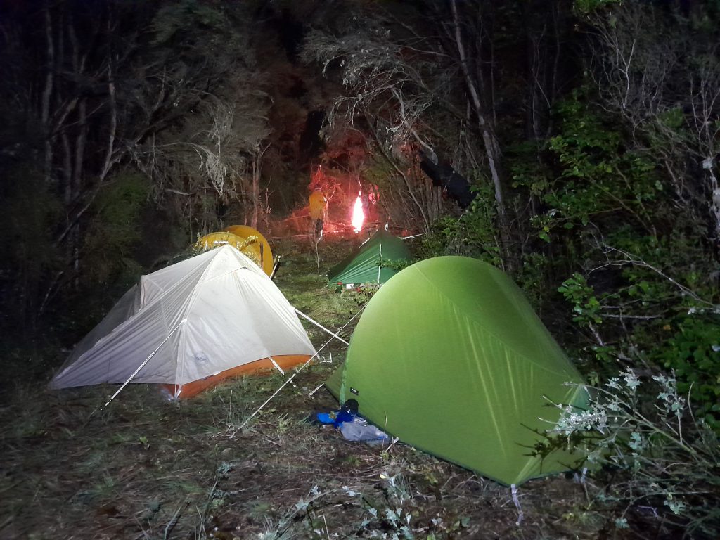
This was our conversation the next morning after an Airforce helicopter circled over our campsite the night before with search lights on, presumably doing a practice exercise.
This was the second half of my week in the Seaward Kaikōura Range with Emily, Megan, Matt and Tony. The first half had consisted of a climb up Te ao Whekere (trip report here) and we had spent one night at the campground in Kaikōura doing laundry and prepping for the next trip as well as some obligatory shop browsing while waiting out the rain. Tony had a climbing book that mentioned spot height 1984 at the top of Snowflake Spur – this book called it “Shattered Peak.” It seemed a bit strange as one would naturally assume Snowflake Peak would be at the top of Snowflake Spur but the slightly lower Snowflake Peak was actually along the ridge to the south-west. Our mission, we decided, was to have an attempt at climbing both.
Eventually the rain eased and we headed into the Mt Fyffe carpark to start our 3 night tramp. We headed up the Kōwhai River – there is a trail through the bush next to the river that makes it quick work rather than having to rock hop the whole way. We had an Airforce helicopter go zooming over us as we made our way up the river. Tony said he wanted a 10/10 campsite. No pressure! Eventually we found a nice one under the trees at the base of Snowflake Spur but on the other side of the Snowflake Stream. We all set about gathering firewood and soon we had a nice fire going which we used to toast our dinner tortillas for home-made Mexican dehy (courtesy of Illona who unfortunately couldn’t come on the trip in the end!) followed by some marshmallows.

The next morning, we started our climb up Snowflake Spur just before 6:30am. Emily had spotted a cairn the night before when she had done a quick recce. This put us on a bit of a pig trail but there were still low hanging branches that my ice-axe kept getting ensnared on. I would take one step forward only to be pulled back because I was caught. Luckily it wasn’t just me suffering from this frustration. At one point, Tony and I were trying to get under some low hanging branches and were simultaneously getting our ice-axes ensnared while sliding back down the hill in the mud. Watching Tony was rather hilarious although I think Tony was far from impressed judging by the muttered words I heard.
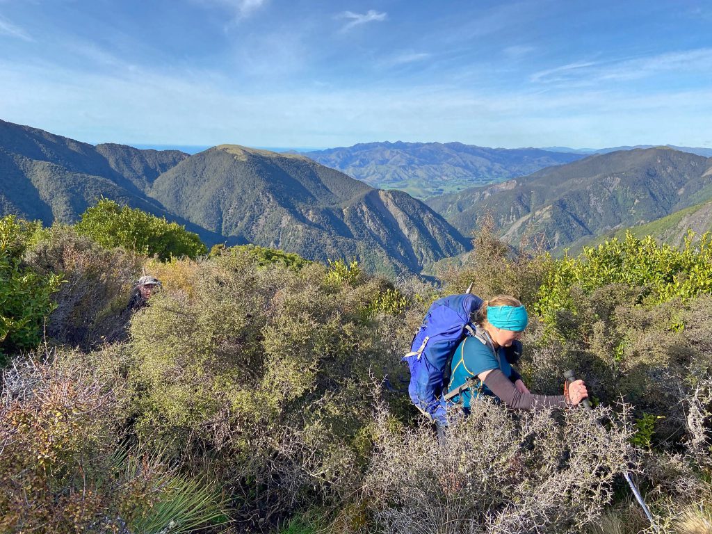
It was a relief to get out of the bush as we climbed but not before we got caught in the middle of what I call ‘trampers’ hell.’ A triple whammy of bush lawyer, matagouri, and spaniards altogether that we had to bash through. Even though I had gaiters on, my legs were getting ripped to shreds between the line of my shorts and gaiters. The matagouri continued for the rest of the day. It’s such friendly stuff and I’ve had a great time with it before (see this trip report on when I went looking for a Needle in the Haystack on the 1,000 Acre Plateau)
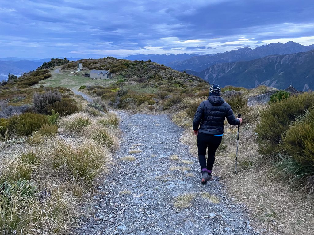
Finally, the matagouri started to thin out and we got to a clearer patch on the ridgeline. Soon a conversation started on the weather station we could see ahead. Megan joked that it was actually a “spy station.” Or at least that is what Emily and Matt heard her say. Tony and I were absolutely convinced she had called it a “fire station.” Possibly my brain wasn’t functioning properly yet with the early start as Megan had laughed earlier in the day about me stumbling over trying to find the word “picnic table” when we could see one down at Kōwhai Hut. I had eventually just given up and called it a “square grid” much to her amusement. I blame it on the early start and matagouri trauma…….
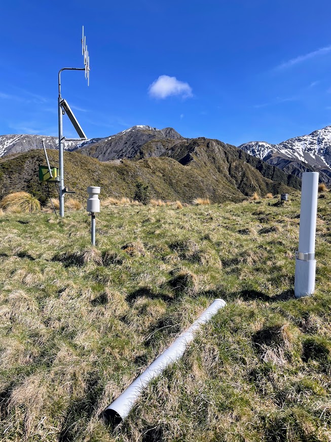
We stopped not far from the ‘fire station’ for a break and as we went past I felt obliged to make fire truck noises. The name ‘fire station’ stuck for the rest of the day after that.
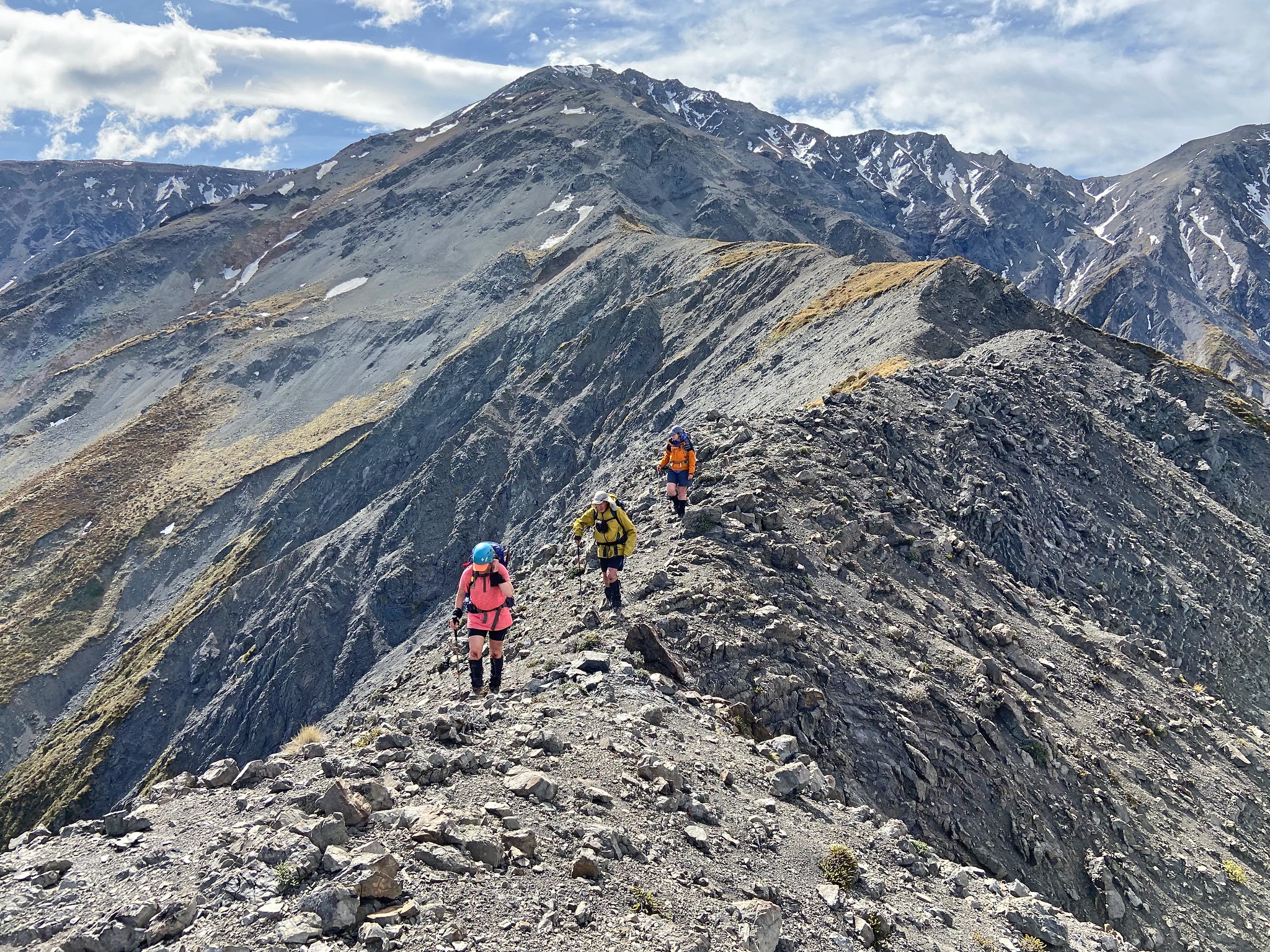
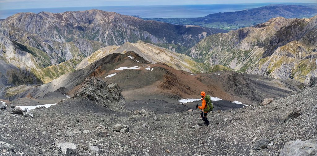
Tony’s book had mentioned a razor back, but it was actually very tame – possibly covered in snow it might be more gnarly but we were still only seeing the occasional patches of snow. Further up the spur we had a discussion and it was decided that Emily and I would venture on ahead to try and get to the summit of Snowflake while the others would just climb at a more leisurely pace to Shattered Peak. As Emily and I climbed up higher, the rock got a little more tricky – more shattered! We diverted around a narrow part of the ridge, got to just under 10m under the summit of Shattered Peak, before taking a look at what was in front of us and deciding we didn’t like the look of it. The rock was just too shattered for those who like their foot and handholds to stay attached to the mountain. It just looked a bit too risky and gnarly.

By now the others had caught us up and were waiting at the other side of the gnarly section we had just crossed. We knew getting back might be pretty challenging as going back the way we had come up wasn’t a good option. We eventually just had to straddle the ridge and then climb down very carefully – Tony, Matt and Megan helped us out by allowing us to pass down our packs to them and Tony helped with identifying good foot and handholds for us. By now both my knees were covered in blood. While I hadn’t fallen at any point, I must have banged and scraped them against the rocks pretty hard without realising. Tony thought they were so impressive that he needed a photo of them.
On the descent, I think all our legs moaned in pain with the constant spiking from matagouri. Matt, Emily and Tony had sensibly decided to put on thermal pants to protect their legs a bit more but Megan and I bravely decided that we would just grin and bear it as the damage was already done and it was still pretty warm!
We spent another night at our Snowflake Stream campsite and it was about 10pm that night the Airforce helicopter came flying over us with its search light on and circled over our tent city. We reckon they had seen our tents as the next time they flew over us, they had turned off their search light as they passed over. We probably gave them quite the surprise as it would have seemed like we were in the middle of nowhere to them! The next morning we came up with all sorts of theories of what they had been doing. Tony, sensibly suggested that they were probably doing a training exercise while Matt and I thought they may have been looking for escaped rebel dinosaurs who were trying to outrun work! (see this trip report on the origin of Alpine Dinosaurs).
We split again that morning with Emily and I having an earlier departure as we were going to walk to Mt Fyffe Hut via the longer route of Kōwhai Saddle while the others decided they would take the shorter and more direct route up Spaniard Spur Track to the hut. I didn’t even want to go near that track just based on its name!! My legs were still burning from the prickly horrors of the day before.
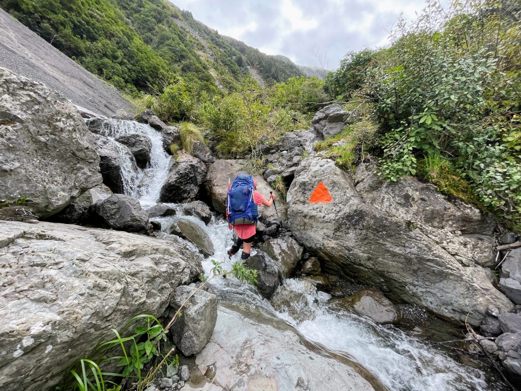
Emily and I bagged Kōwhai Hut and had a quick break at one of my “square grid” picnic tables. As we left the hut we got a strong smell of sulfur near our next crossing of the Kōwhai River. We haven’t yet solved the mystery of that one. The climb up to Kōwhai Saddle followed the stream – sometimes we were on a trail and other times we were climbing directly up the stream itself. It’s categorised as just a route by DoC but it was all well-marked with big orange triangles painted on the rocks or marker poles.
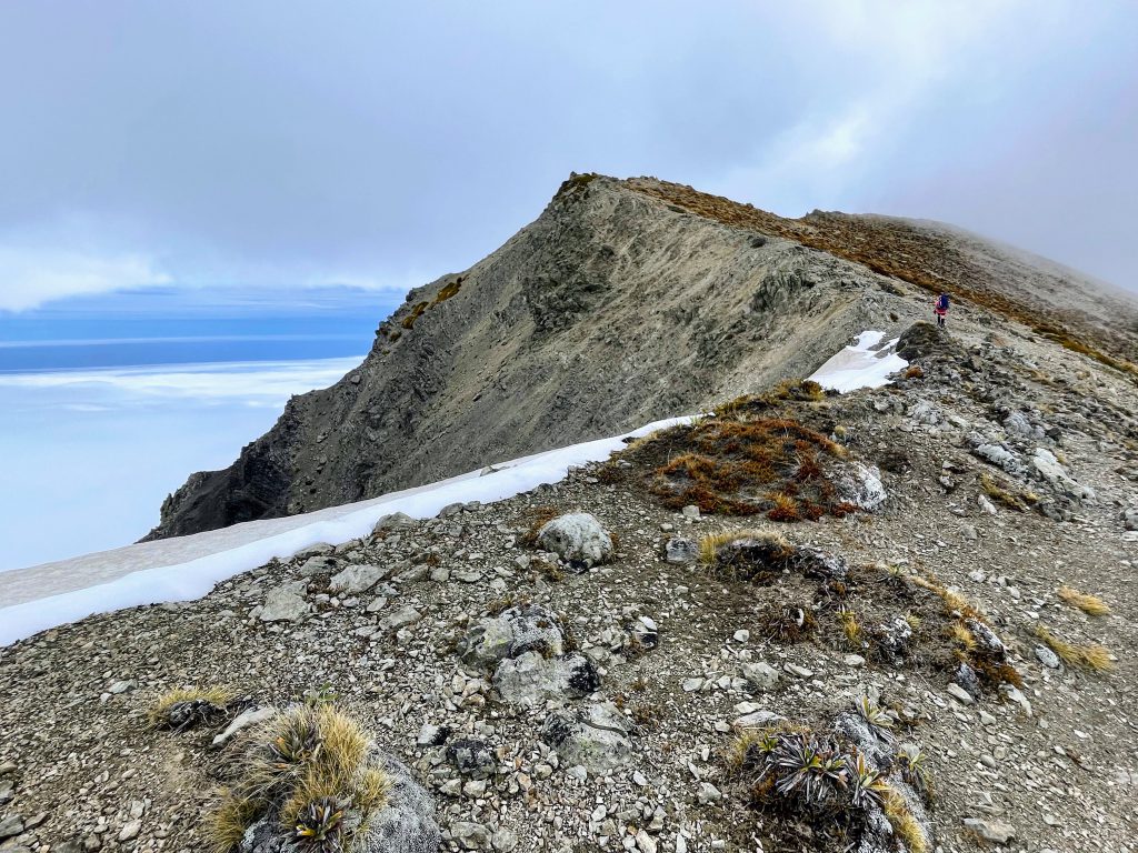
I managed to have some fun snailing and came across a wainuia edwardsi snail and rescued it off the track to somewhere a bit safer so it wouldn’t get squashed by a trampers’ boot although we didn’t see anyone else until we got up Mt Fyffe. Just before Kōwhai Saddle, I came across a single notothlapsi rosulatum, more commonly known as a ‘pen wiper’ in the scree. Up on the saddle we enjoyed looking back down the valley we had just climbed up; our view in the other direction was just of typical clag though! It was a long climb up to Gables End at 1592m. Emily and I said we would have a break at the two poles we could see on the skyline that we thought was the top of the climb but some cheeky dinosaurs came along and kept moving those poles higher and higher so we just had to keep climbing! It was a steep climb on scree so I was trying to find the most efficient way of climbing up for both of us. I kept myself entertained by looking at all the vegetable sheep (raoulia).
Eventually we made it to the top and got a break with some reasonably flat walking along the ridge before dropping down and beginning the final climb up to My Fyffe. The clag was rolling through intermittently making it all very dramatic. Reaching Mt Fyffe was when we saw our first people of the day. We were above the cloud on Mt Fyffe so the cloud cover looked like fluffy snow we could just walk across with our crampons (we hadn’t used any of our alpine gear on this trip!).
We got to Mt Fyffe hut to find only two other people in the hut. We all took turns to cut firewood with a blunt handsaw – at least it warmed us all up quickly. I got up during the night to check out the stars as that is one of my favourite things to do on tramps; and to see the sunrise (there wasn’t much of one) but the glimmering lights of Kaikōura and early morning light was still beautiful.
Tony had decided to spend the night in his tent so the next morning he got a surprise to wake up and find I had cheekily left a wildering pine outside his tent and then an audio of rooster noises. He actually packed the pine tree up and attached it to his bag and we all thought he was going to carry it all the way back down to the carpark but he decided it weighed a bit too much and left it in the wood shed. Unfortunately those pine trees are a serious problem on Mt Fyffe and will take a lot of work to eradicate them.
It was an easy walk back down the 4-wheel drive road to the carpark. Matt & Megan started the drive back to Christchurch while Emily, Tony and I had some time to use before our ferry in Picton so we headed back into Kaikōura to check out the Peninsula walkway – we saw lots of seals and went up a little peak on the beach that on his last trip Tony and Aimee had named Te ao Whekere-iti.
Stats from Sarah’s watch
Day 1 Mt Fyffe Carpark – Snowflake Stream Campsite
Elapsed Time: 2h
Elevation: 196m
Distance: 6km
Day 2 Snowflake Spur to Shattered peak (just under the summit)
Elapsed Time: 13h
Elevation: 2,000m
Distance: 15km
Day 3 Snowflake Stream Campsite to Mt Fyffe Hut via Kōwhai Saddle
Elapsed Time: 8.5h
Elevation: 1,539m
Distance: 14.8km
Day 4 Mt Fyffe Hut to the carpark
Elapsed Time: 1.5h
Elevation: 12m
Distance: 5.8km