
The allure of
Rakiura’s
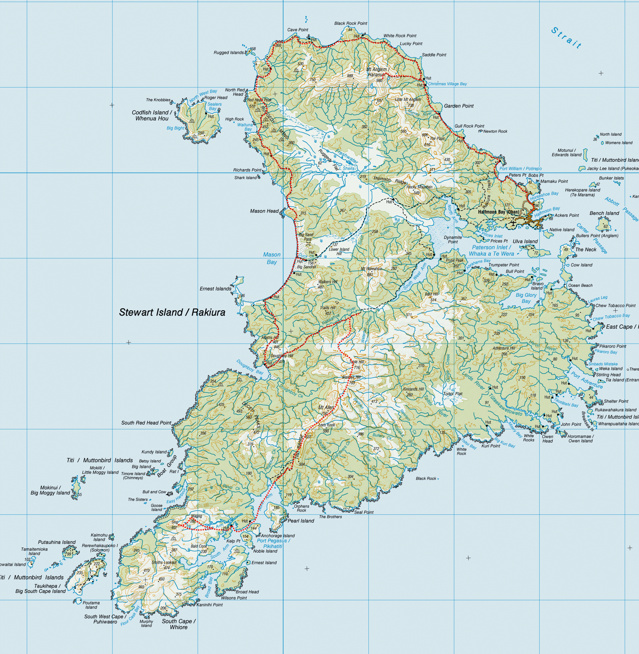
Tin Range
A solo expedition to rugged southern Rakiura including an ascent of the granite peak Gog, partly funded by a Simon Bell scholarship with the FMC New Zealand.
Rakiura anchors more than Maui’s canoe. It anchors in its rocks, rivers and rugged shores, and in its garnishment of plants and animals, the hope of generations unborn that places like this will always exist – Neville Peat
Southern Rakiura is a magical place. It is wild and untamed. A place where nature has truly been left in charge. In a world that is constantly changing and developing, places like this are becoming increasingly rare. A desire to go tramping somewhere so wild that it would challenge my skills was one of my reasons for choosing Southern Rakiura for my scholarship expedition.
I had previously done a 12 day solo tramp on Rakiura around the North-Western and Southern Circuit and had fallen in love with the island and its wilderness. I think Rakiura is probably the only place in Aotearoa where you see more kiwi (the bird, that is) than people in a day.
“We must retain our wilderness areas where nature can develop in its own calm way and where only those humans who are prepared to walk and sweat a little qualify to go.
-Sir Edmund Hillary
Southern Rakiura, especially the Tin Range and Port Pegasus, has a reputation for its isolation and harsh weather. It was also the last place on the mainland for kākāpō to exist in the wild, which was one reason for my fascination with it since the kākāpō is one of my favourite birds.
I had also been fascinated with the Pegasus area because FMC has been advocating for it to be gazetted as a Wilderness Area since the 1981 Wilderness Conference.
I had previously done tramps around the Hauhungatahi and Te Tatau Pounamu Wilderness Areas in the North Island and thought they were really special places because they embody the values of remoteness, challenge, solitude, self-reliance and discovery.
NZ has 11 of these wilderness areas—they are part of our heritage with areas of our natural environment preserved as close as possible to their original state. They are like a living, forever evolving museum.
I wanted to do this trip to raise awareness of the Pegasus area and be an advocate for Southern Rakiura having that protection enshrined in legislation so its wilderness can remain just that.
While you are busy doubting yourself, someone else is admiring your strength.
I left Oban late afternoon on board Aurora Charters with Ian, who was heading down to pick up a group of hunters from South Pegasus Hunters Hut. The boat ride was a couple hours though rough seas which seemed to reflect my internal storm of nerves and self-doubt.
I was wondering if I had what it took to embark on such a big journey solo. I had spoken to my friend and tramping mentor, Tony, just before leaving and he had spent a long time reassuring me that I would be absolutely fine.
I was disappointed he wasn’t coming with me as had been our original plan but an injury on a tramp a few weeks earlier had left him stuck at home. My original trip plan had been to take a packraft and paddle the inlets but with going solo I decided it would be safer to walk.
Arriving at South Pegasus I immediately spotted a Fiordland Crested Penguin which helped settle my nerves as I wrestled my very heavy pack off the boat—I was carrying food for 15 days and everything I needed to be completely self-sufficient. South Pegasus Hut was full of hunters so I set up camp, in the most sheltered place I could find from the persistent wind. I spent some time talking to some of the hunters.
They were mostly encouraging but there were one or two who tried to convince me to go back to Oban with them on the boat the next day because “I definitely wouldn’t make it.” I tried not to take this to heart and remind myself that they had no knowledge of my skills or experience. I did wonder if I would have been told this if I was male.
The last time I tramped solo on Rakiura I was stopped and asked why I was by myself by a hunter. Encouraging women in sport is something I am particularly passionate about, as research shows a high drop out from sport for women once they hit their teenage years.
I had experienced this in running and had come across a negative attitude just the year before when I had come out from a tramp into Maungahuka Hut to fix the water tap and had been told I didn’t look like a mountain goat by someone in the carpark.
While this comment made me absolutely furious, it also made me even more determined to challenge these misconceptions and I’m very lucky that I’m surrounded by a group of strong and inspiring women through running, tramping and work who have always encouraged me.
The first day I did some exploring behind South Pegasus Hut as it was forecasted for heavy rain and thunderstorms later in the afternoon.
I found a good foot trail behind the hut up through the bush to the sub alpine scrub. It always amazes me how the level of the bushline changes across the country with it lowering the further south in the country you get.
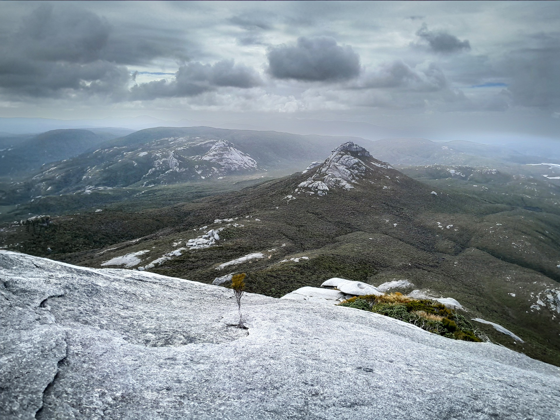
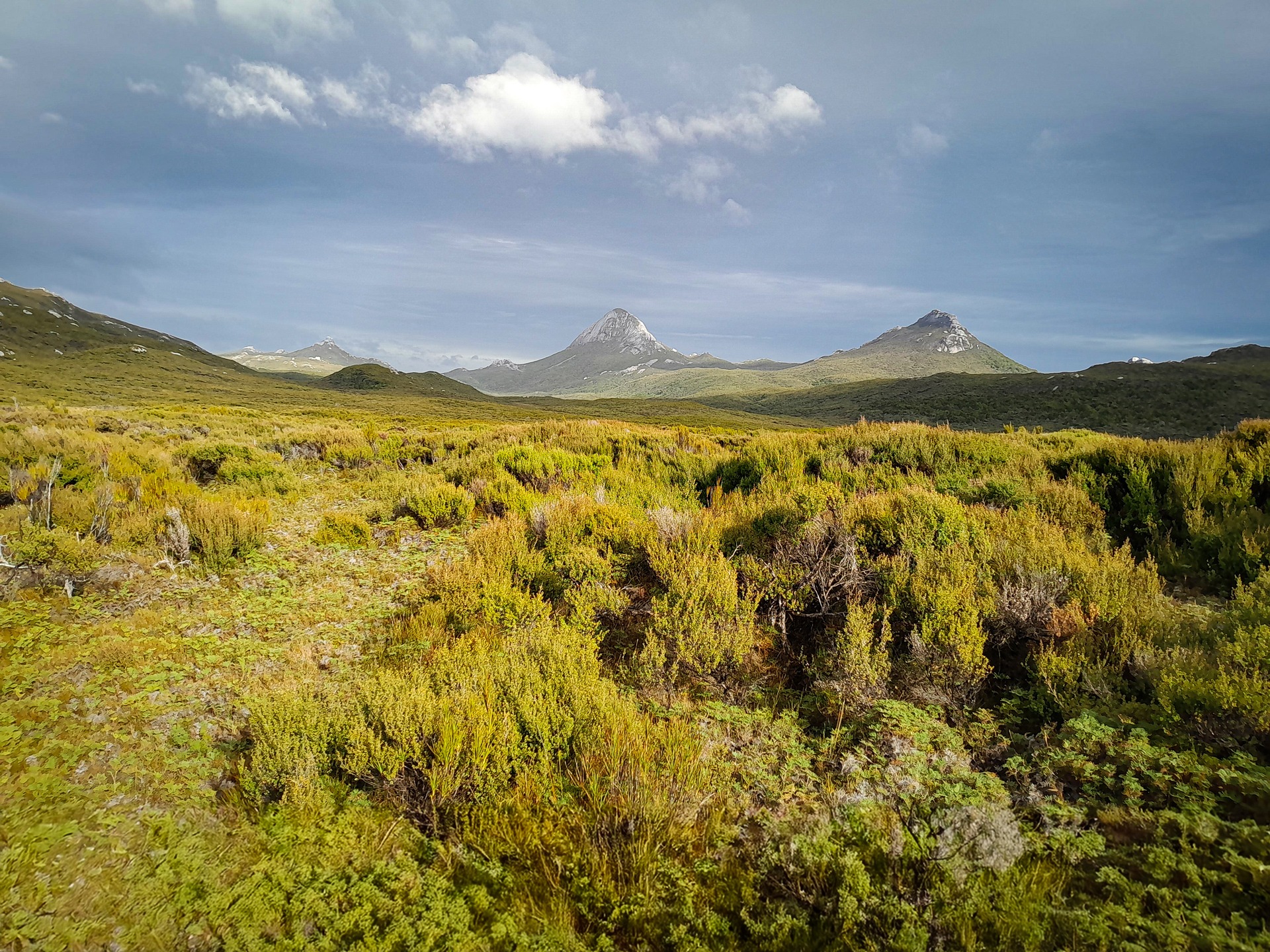
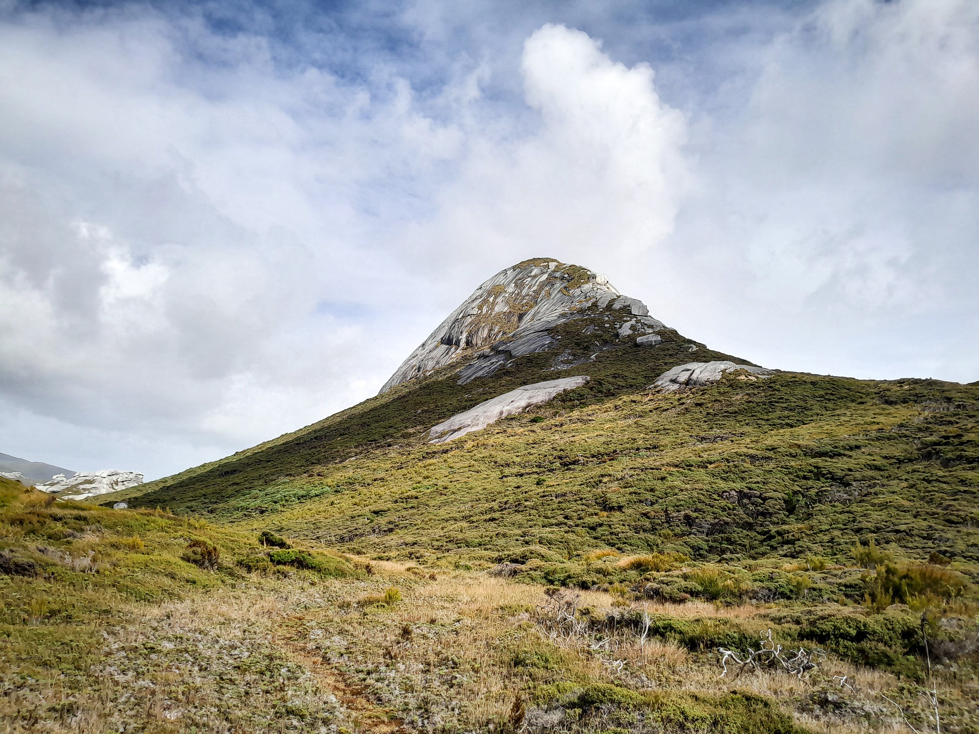
I emerged out of the bush and got my first proper sighting of Gog and Magog which was very exciting! I found a few faint trails that I took note of. Despite having done a lot of research, Gog and Magog weren’t written about as much as the Tin Range and it was very much find your own route to them.
Having done a lot of bush bashing on trips with Tony I knew this had the potential to be very hard and slow and had mentally prepared myself for it. I left that as a problem for tomorrow and spent the afternoon reading in my tent listening to the heavy rain on the roof while also enjoying the loud chorus of resident korimako/bellbirds.
The next day I started off for a day trip to Gog. I was making good progress thanks to my exploring the previous day but realised as the terrain became more swampy it looked like it would be easier to head north to get out of it.
Getting there proved a bit of a challenge. The scrub was thick and dropping down into the creek took a few attempts but it still wasn’t the worst off-track travel I have done over the years thankfully.
Once on the other side of the creek I started climbing and pushing through the leatherwood slowly before I stumbled onto a bit of a foot trail by pure chance. I wasn’t quite sure where this would go but instinct told me it would lead me close enough to Gog.
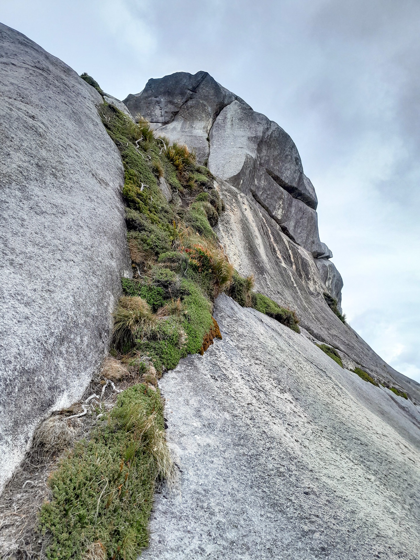
I followed it through a few short sections of bush before I found myself right at the base of the north-eastern side of Gog with just a scramble up the granite.
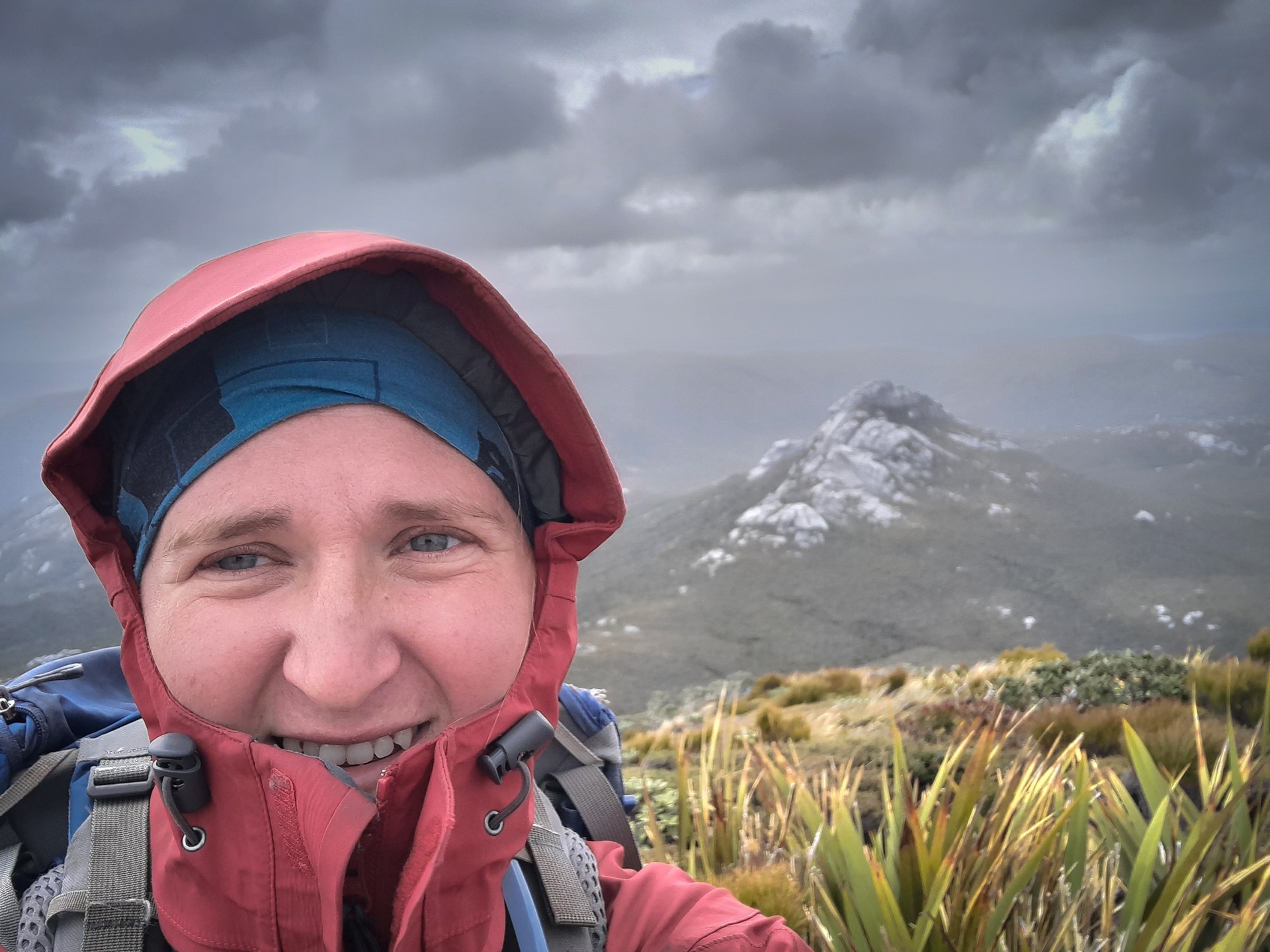
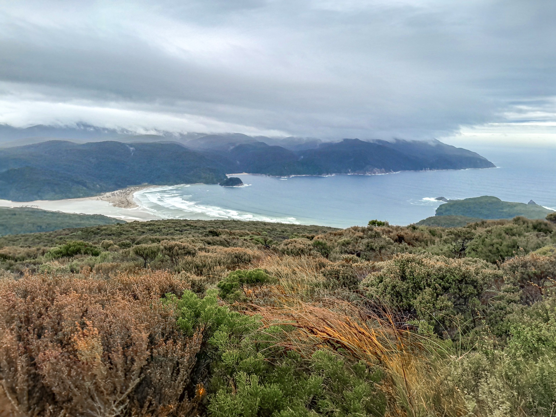
At first the granite looks rather intimidating but like most things in tramping it is easier than it looks once closer. Suddenly I was standing on the summit of Gog getting buffeted by the wind. It was a hazy day but the vista was incredible, very remote and wild. I could see all the way back down to Cook Arm, over towards the granite dome of Bald Cone and Titi/Muttonbird Islands and over to the Tin Range that I would eventually traverse.
It felt a bit odd looking at both the Tasman Sea and Pacific Ocean at the same time. The landscape felt untouched by human development. I sent Tony a message from my Inreach saying I was “feeling goggy” knowing that he would get my GPS location with the message and know I had made it to Gog.
I had originally planned to visit Magog the next day but I realised I could do both in the same day if I continued to have success with my route finding.
I retraced my steps down Gog and then saw a ribbon tied to some scrub. Again my instinct was that this would take me roughly in the direction of Magog. There was a bit more bush bashing in this route and I got hit hard enough in the eye by a tree branch that I had to stop for several minutes before continuing.
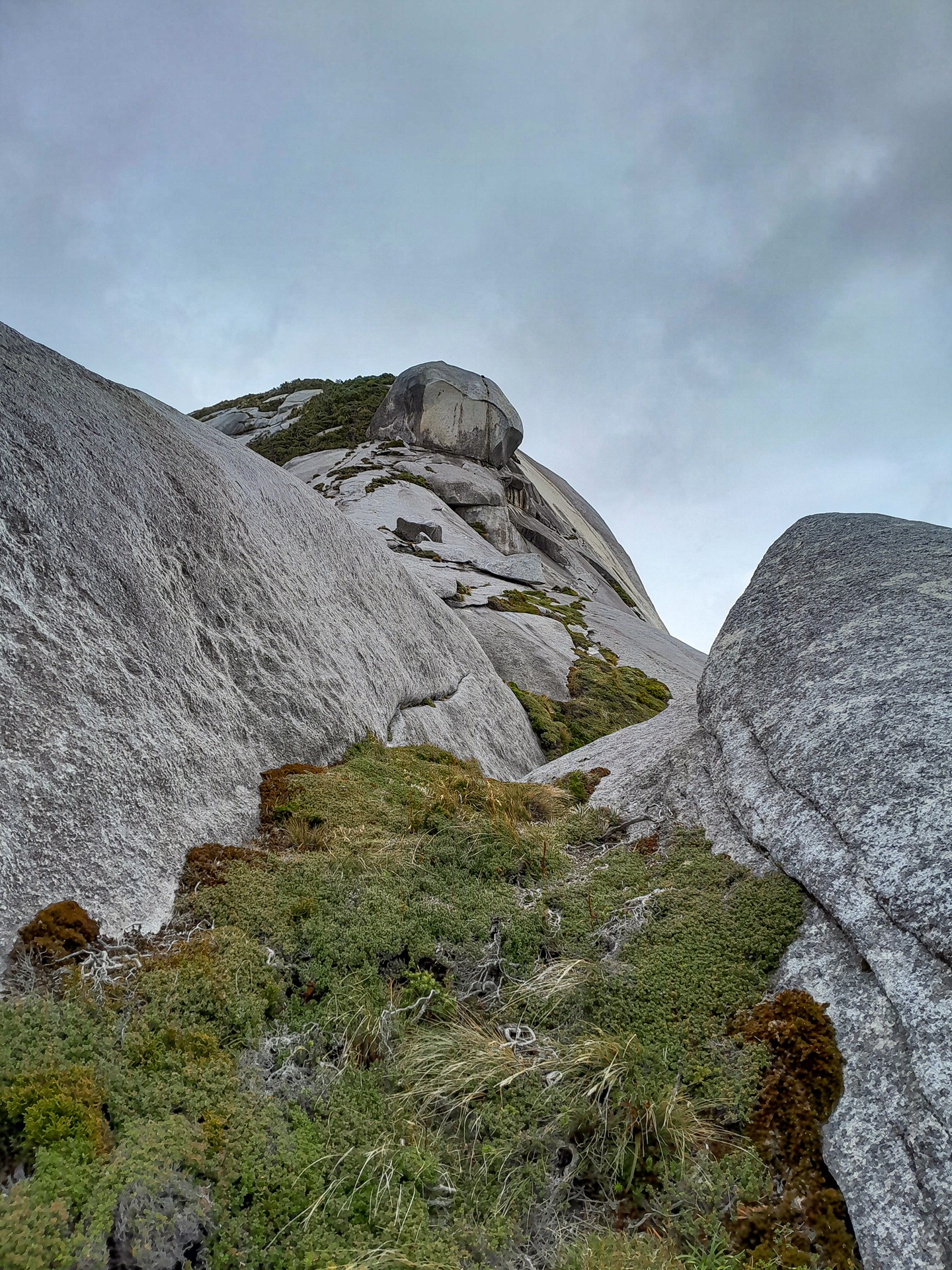
I finally made it to the base of Magog and neighbouring Hielanmann. It was a climb up through bush on a surprisingly easy foot trail followed by a scramble up granite again.
The granite was steeper this time and there were enough handholds from the surrounding scrub but it took some careful route finding. The granite was full of weathered potholes which made me feel like I was walking on the moon as I climbed to the curved top of Magog.
The wind had picked up significantly by now and I was struggling to stand while I was getting blasted by it so I didn’t stick around. Getting back down was a little more tricky and I realised I should have tracked my route up to make my descent easier.
Clag started to roll in so I took a compass bearing and used my GPS to verify that I was walking in the correct direction to get me back to the bushline. I was elated by the time I got back to camp having climbed both Gog and Magog.
My plan after climbing Gog and Magog had been to walk up Cook Arm and find my way towards Bens Bay and Albion Inlet and eventually around to Belltopper Falls.
However, the new group of hunters at South Pegasus Hut that night offered me a ride right around to Diprose Bay in their boat. I debated whether I should accept their offer. It would certainly save me two days of hard bush bashing although I was prepared for that challenge and was actually looking forward to it.
But ultimately the deciding factor for me was the weather. There was a good weather window and I wanted to get across the Tin Range while I could as that was very exposed, otherwise I could be stuck for days.
I got dropped off at Diprose Bay just before 11am after waiting for the high tide so the hunters could float their boat. I was glad of the later start as I was experiencing a splitting headache and sore eye after the whack from the tree branch the day before.
Thankfully by the time we got to Diprose Bay the pain had started to ease off. I was now truly on my own about to face whatever the Tin Range would throw at me and as far as I knew there would be no one on the Range at the same time as me.
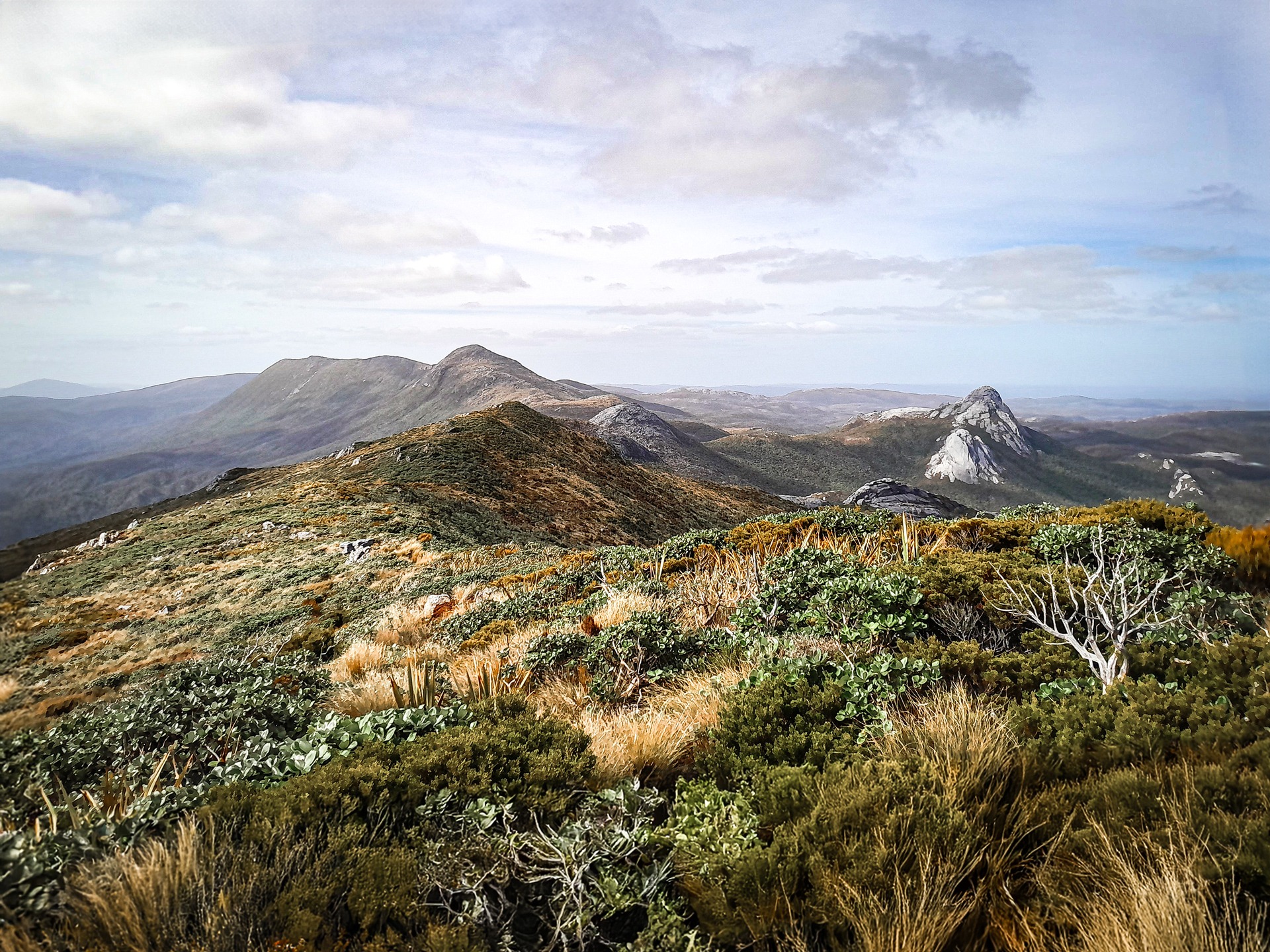
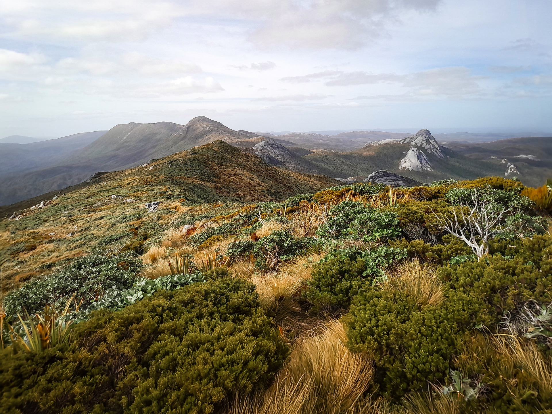
The Tin Range has an infamous reputation that precedes it. It lies between the latitudes 46 and 48 degrees south. The prevailing westerly winds travel a huge distance unimpeded by any other land mass, increasing in both strength and moisture before they hit the exposed tops of the Tin Range leaving the weather both unpredictable and atrocious a large portion of the time.
I started up the tramway track which was a nice easy gradient that I greatly appreciated with my heavy pack. This part of the track was well marked and I followed this past the junction with the surveyor’s track to the miner’s dam.
The tramway track and miners dam are remnants from the unsuccessful tin mining that was attempted in the 1880s and continued sporadically until the 1930s.
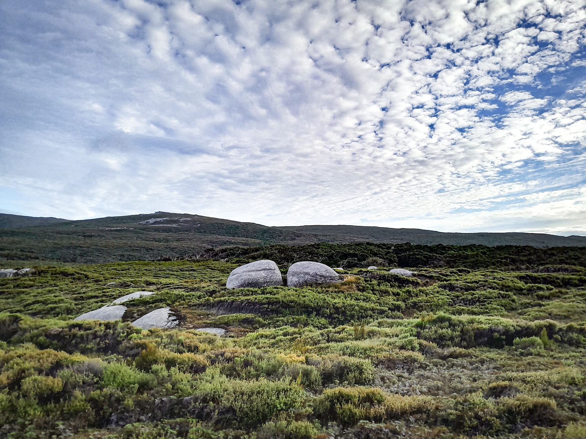
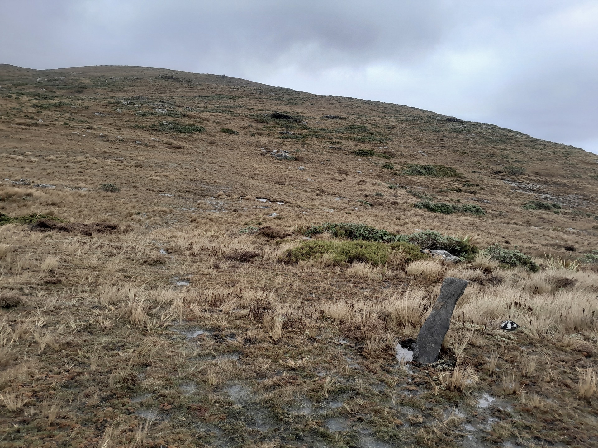
The track ran out not long after here and I realised there were a few rock cairns indicating I was about to start the climb up to the main Tin Range ridge.
The climb up to the ridge went very quickly as I was constantly distracted by the views. I could see all the way back to the Gogs and all the way along the Tin Range. I knew I was incredibly lucky to get such clear visibility like this so I took my time to enjoy it. The granite landscape was so different to anything I had seen before.
The visibility made for easy navigation so I rarely had to look at my map and compass. Just before Granite Knob I saw a rare harlequin gecko scuttle under the leatherwood.
The wind started to pick up as I sidled under the eastern flanks of Mt Allen which ruled out camping by the tarn. I had thought about making a detour up Mt Allen but time was ticking by and I needed to make Kopeka River for the night as it was meant to be more sheltered.
From my research I had known that the Tin Range route had occasional markers with sticks in the ground or rocks. To my overactive imagination the rocks looked like tombstones and I wondered why Tony, who has walked the Tin Range three times, had failed to mention I would be following tombstones of all things?
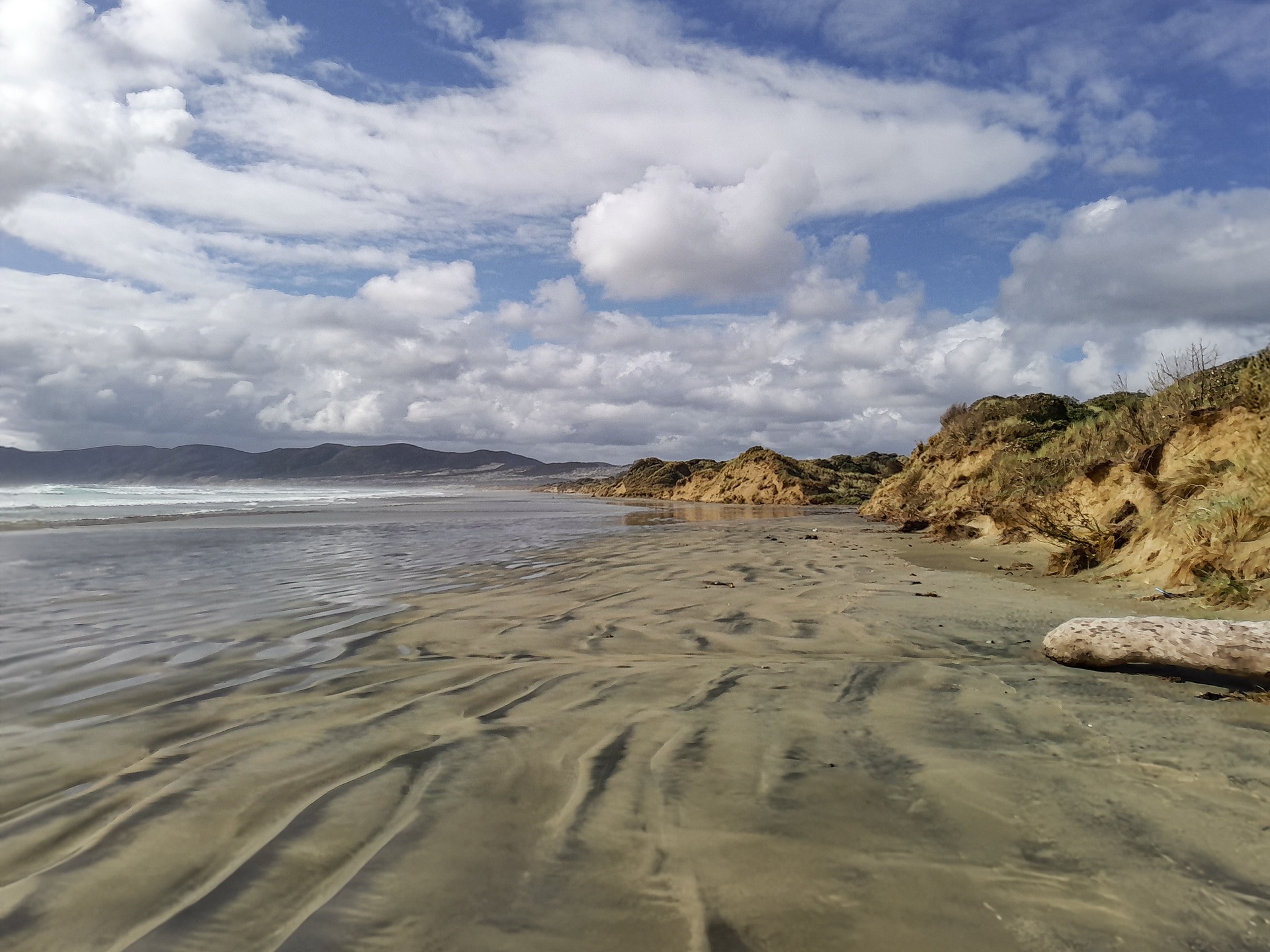
As I started to drop down towards Kopeka River I completely lost the faint foot trail. Despite my best effort to find it by walking around in what felt like circles for ages, I eventually gave up and decided to just bushbash down to the river. My legs were heavily scratched and bleeding by the time I emerged next to the river. Kopeka River, a chocolate brown colour from the tannin, was easy to cross after a few days with no rain.
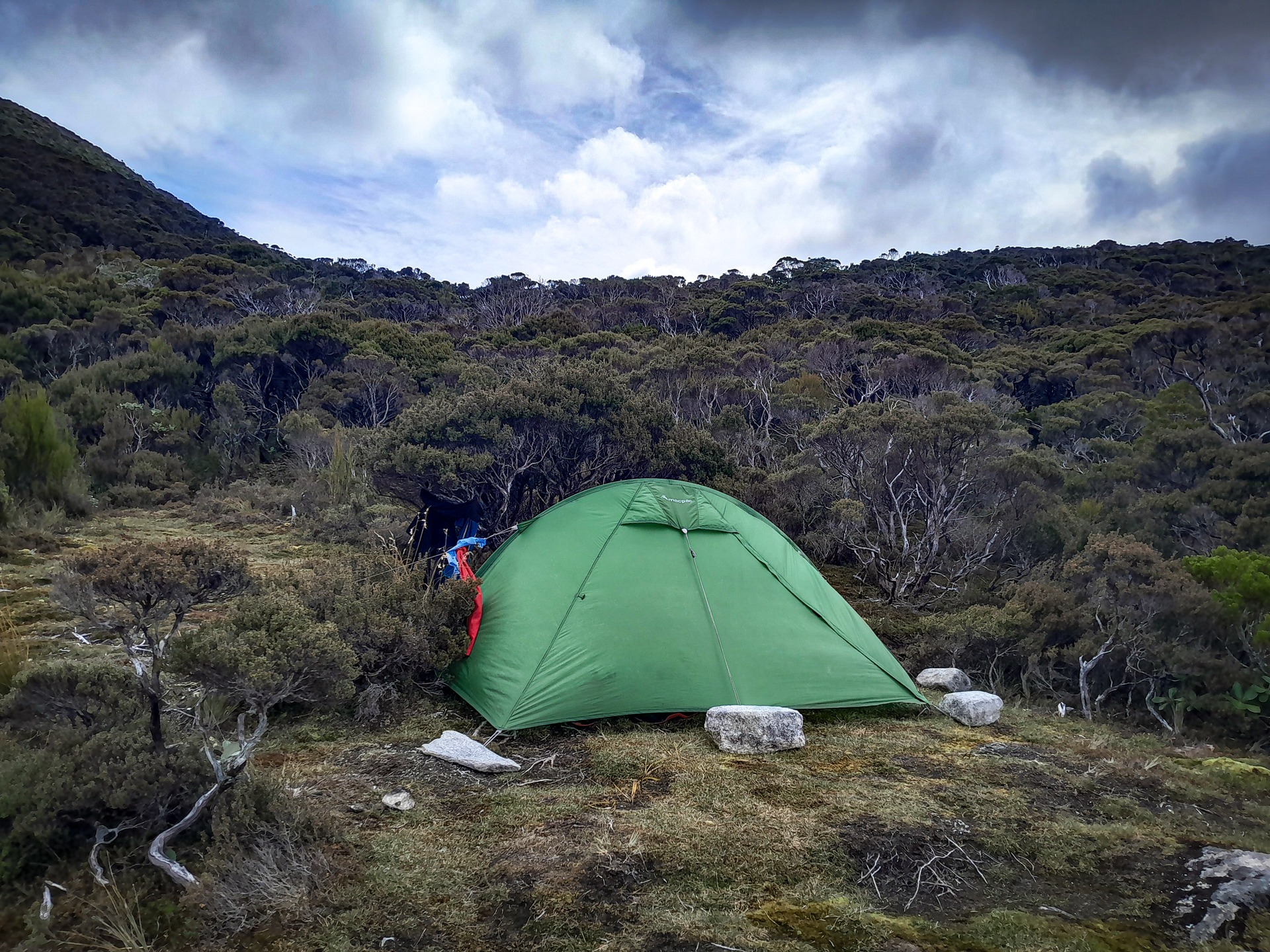
On the other side I dropped my pack and investigated all the possible campsites. There wasn’t much shelter aside from next to a bush about 1 metre high. Everywhere else was too swampy.
I received a weather update from Tony who advised me there was a severe weather warning for gale force winds for Rakiura the next day, and that winds would worsen throughout the day. I settled into my little campsite enjoying the total solitude—it was empowering to think I was possibly the only person out there on the Tin Range at that time.
The next morning I got ready by torchlight and left camp by 7am. It was raining and the wind already felt strong in the shelter of the gully.
As I climbed up the hill the wind got progressively stronger and colder. The visibility was down to a few metres in front of me. I struggled onwards but as my direction of travel changed to walk north, I was suddenly getting the full strength of the wind.
I was struggling to stand up and getting cold dangerously quickly and losing energy rapidly fighting the vicious wind. I had to make a critical decision—continue forward in atrocious conditions or head back to camp and wait out the storm with limited shelter at the Kopeka River campsite.
I quickly made the decision to turn back—I knew I couldn’t walk for hours safely in those conditions without putting my life in danger from hypothermia.
My single bush back at camp didn’t provide much protection from the howling wind. It was a stark contrast from the day before. I was seeing the Tin Range at its best and worst. I tightened all my guy ropes and placed rocks to provide more reinforcement. I was prepared for a battle.
The wind got progressively stronger throughout the day until each gust sounded like it was a turbo jet coming at me all the while I was wondering if my tent could withstand it all.
I would hear the roar of the wind coming down the gully before it actually hit my tent and I realised each time I was holding my breath wondering if the next gust would rip my tent to shreds as has happened to other trampers on the Tin Range.
I had messaged Tony to let him know I had turned around and was now sitting out the storm. I think he realised how bad it was when he got a message asking how long until the wind dropped in response to his question that he hoped I was settled in somewhere sheltered.
Heavy rain broke up the afternoon and by midnight the wind had started to ease—it had been a very long day by then.
The next morning the wind was still there but nowhere as bad as the previous day and while it was cold, it was manageable. There’s not many tramps where I have had to keep all my waterproof layers and warm hat on while walking up a hill in summer but on the Tin Range that’s how cold the wind chill was.
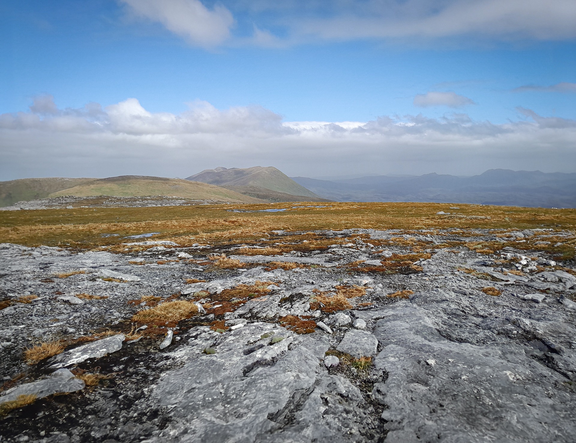
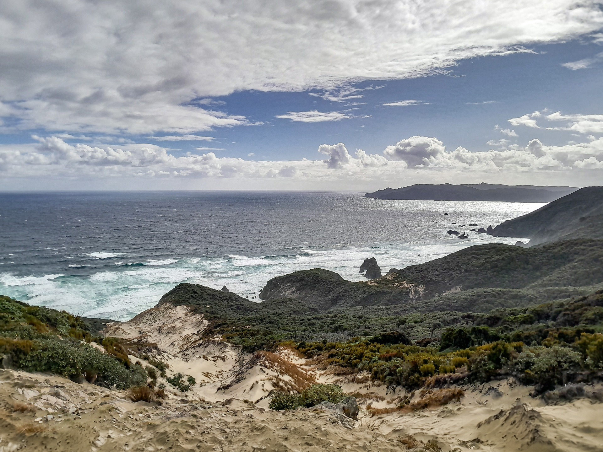
I stopped on Table Hill to enjoy the views of Mt Rakeahua and Mt Anglem/Hananui that I had climbed on my previous trip and the view down to Paterson Inlet and Mason Bay.
As I descended from Table Hill I saw many of the critically endangered southern dotterels fluttering around. I took interest in the feral cat traps as I have been volunteering doing mustelid traplines for a number of years. Unfortunately the feral cat population is the biggest threat to Rakiura’s biodiversity.
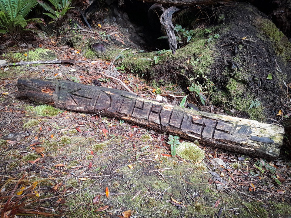
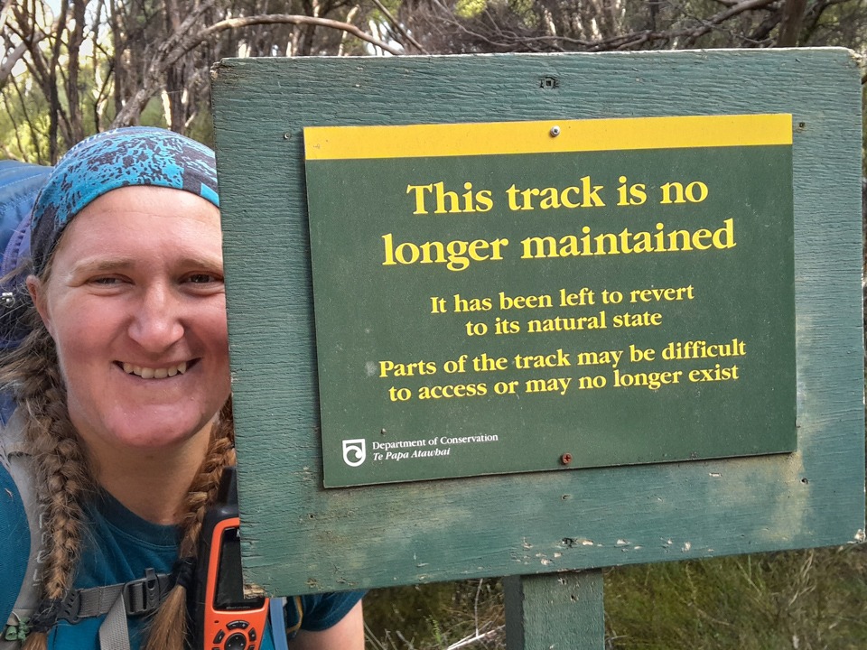
It was a muddy descent down into the bushline but easy navigation before I hit the old track. I finally made it to the iconic “Track not maintained” sign on the Southern Circuit track with a sense of elation. I had survived not only the Tin Range but also sitting out a storm on it in my tent.
There were a few happy tears as I wandered along to the familiar Rakeahua Hut. I expected to find people there but it was surprisingly empty and hadn’t had any visitors for a few days.
I took advantage of the empty hut to spread out all my wet gear to dry. The next day I decided to head back towards Doughboy and I would make a decision at Mason Bay about whether I got a water taxi out from Freshwater or walk out via the North-West Circuit again.
I found a solid mud monster up on Doughboy Hill in the heavy rain but arrived down at Doughboy Hut just as it cleared. Last time I had camped at Doughboy Hut but again I arrived to find the hut empty. I was starting to wonder if there was actually anyone else on Rakiura! I noticed the hut had a sea-lion gate which I didn’t recall from my last visit.
Of course with my overactive imagination I wondered what would happen if a sealion parked itself right in front of the gate. Would I be stuck in the hut for as long as the sealion was parked?
Luckily this never eventuated and the only sealion I later saw was on Ulva Island. I had seen plenty of them when visiting the Sub-Antarctic Islands and always found it surprising how far inland they could be and suddenly pop out from behind a tree.
On my walk to Mason Bay I found myself stuck in a waist deep mud hole on Adams Hill. I was experienced enough with Rakiura’s mud to test the depth of the mud before I stepped but I got a little complacent and went straight in without thinking.
What followed was a few tense moments of trying to extract myself with difficulty, complicated by a heavy pack. I eventually crawled out, flopping a bit like those sealions I kept thinking of. Maybe they had taught me one or two things.
Near the beach I bumped into my first pair of trampers in 5 days who were heading towards Doughboy Hut.
I enjoyed watching all the dotterels fluttering around the beach. However, it was disheartening to see how much rubbish had washed up from the sea. Mason Bay Hut was a bit of a shock to the system with so many people there when I arrived.
I went out for a night walk, spotting many kiwi and enjoyed just sitting listening to the different calls of the male and female kiwi. I decided I had enough food and energy to take the long way out around the North-West Circuit but I would take a rest day at Mason Bay because I liked the area so much and the weather was looking a bit miserable the next day.
As I started towards Big Hellfire Hut a day later I experienced a Southerly blast coming through complete with a hailstorm. I had a laugh as it seemed strange to be walking along a beach with it hailing.
This time I took the low tide route rather than the high tide Type 2 fun route! Big Hellfire Hut was one of my favourite huts on the North-Western Circuit as it has an opening on the sand dunes where you can look in one direction down to the crashing waves far below and other across to the swampy plains of Ruggedy Flat; and it is surrounded by moss and crown ferns of so many different shades of green. Green therapy at its best.
Not to mention that on a pre-dawn trip to the toilet you have a kiwi wander up the track in front of you.
My other favourite section on the walk out via the North-West Circuit was heading towards Long Harry Hut. It’s a good mix of beaches and bush, with spectacular sea views and a real bird and kiwi hotspot.
I even had a kiwi run right up to me and investigate me, probably mistaking me for a worm since I was covered in so much mud, before it toddled off seemingly unperturbed by me.
The korimako, tūī, kākāriki and kākā were a very welcome and rowdy bunch. On my side trip up Mt Anglem I decided I would like to come back to explore that area more and camp beside the tarn. I spent my last night of the trip in Bungaree Hut with a few other trampers and a group of friendly hunters who made us feel very welcome and even cooked dinner for us all.
I met a number of fantastic and inspiring people along the North-West Circuit. A tramper who was celebrating her 80th Birthday at Mason Bay; a couple from Canterbury who I spent a lot of time chatting to about tramping; and a couple from the States who took every summer off to have adventures (I immediately decided I wanted to adopt their idea).
Some days she is a warrior.
Some days she is a broken mess.
Most days she is a bit both.
But everyday she is there.
Standing. Fighting. Trying.
Last year I stumbled across this quote and it really resonated with me. I thought about it multiple times on the trip after a year where I had struggled but had also challenged me in different ways—running the Northburn Miler; crevasse jumping on the Ashburton glacier; completing postgraduate study and making the big decision to resign from my permanent work contract so I would not miss out doing the things I love and get a much needed break over summer because I realised the work stress was starting to get overwhelming and I was burnt out.
I needed to find a better work-life balance that would work for me. I want to be that woman—the woman that is both a warrior and also acknowledges that she struggles, yet still shows up each day trying. And I think this tramp showed me that I am capable of this.
This journey challenged me—I went into the tramp with a lot of unknowns and uncertainty which is something that I find hard to manage. Having to postpone my trip in February due to weather was disappointing and was a good reminder that I can’t control everything regardless of how hard I work or how organised I am. I can only control how I react to these unexpected things.
In the 15 days during my trip I experienced some challenging weather—gale-force winds, hail storms, heavy rain and unexpected cold temperatures but I really didn’t want the trip to end.
Sometimes going back to life after time in the bush, especially a longer trip, can be a difficult adjustment with all the challenges of daily life, the noise and stress.
Life in the bush is really very simple and I found the immersion in nature for 15 days to be very healing. Green therapy does wonders and I believe I came away from the trip with more resilience and confidence not just in my navigational and tramping skills but also in myself.
It also made me even more passionate about New Zealand’s unique biodiversity. Like the takahē that is an icon of resilience for one of the most successful conservation programmes in the world, I hope we can do the same with our critically endangered dotterel and kākāpō population.
I hope that one day Pegasus will be gazetted as New Zealand’s 12th Wilderness Area and that the kākāpō may eventually return from Whenua Hou onto mainland so their booms can echo around Pegasus once more.
Acknowledgements
Colin & Jeni Bell: Thank you so much for creating this special scholarship in Simon’s memory to give trampers like me the opportunity to explore wild places, develop their tramping skills and gain more confidence. It was such a pleasure to speak to you both and talk about my trip.
FMC: Thank you so much for this opportunity and for all the advocacy work you have done for the Pegasus area. It’s a truly special area and one the tramping community needs to fiercely protect.
Tony: Thank you for being such an amazing tramping mentor who has dared me to dream big and shown me that these dreams are not only possible but well within my reach. Thank you so much for being my tramping buddy on so many amazing trips over the last few years and teaching me so much. Your encouragement and knowledge were invaluable for this trip. I missed not having your company for the trip but am so glad you still got to be a part of the trip following along with my progress through the Inreach. To many more trips together!
Wellington Tramping & Mountaineering Club (WTMC): Thank you for giving me a home for the last 13 years; a place where I could learn and grow as a tramper and more importantly for all the friendships I have made.
7 North Senior Team (CNM Ruth & ACNM/Nurse Educator team – Jackie, Jane, Sarah, Eleanor, Christie, Susan & Charm) at Wellington Hospital: Thank you for all the support with scholarship reference letters, contract flexibility, kindness and encouragement you gave me; and never minding the photo trail of native birdies or Powelliphanta snails that always turned up in your office. Jackie, thank you especially for the times you kindly reminded me that when I was busy doubting myself, someone else was admiring my strength; and reminding me to always believe in myself and pursue my dreams.
A short video including clips of kiwi
For more on the Tin Range try Fighting for the underbird – helping out on the Tin Range.
What an awesome trip Sarah – you are amazing and an inspiration!