
This trip was to be one of many firsts: my first as a trip leader, and the first club trip for both Aaron and Ellis who had recently joined the WTMC. The other ‘first’ was the red lining planned. The primary goal of the trip was to get to Arete Forks Hut via Table Ridge, using old NZ Fire Service (NZFS) tracks between Cow Creek and Arete Forks.
A club trip earlier in the year to Dorset Ridge using NZFS tracks had gone surprisingly smoothly, so I was quietly confident the tracks would be easy to follow. Although it was difficult to find recent information on the state of the Table Ridge tracks.
We departed Wellington Train Station at 5 pm on Friday and drove to Kiriwhakapapa road end, stopping at the Olive Branch in Carterton for kebabs along the way. We were relieved to see there were no other cars at the road end, which gave us confidence we wouldn’t be sleeping in tents on what would be a very cold night. We made short work of the 600 m ascent to Blue Range Hut, which was perhaps aided by the fact we were wearing headlamps, focussing on where our feet were going and not on the elevation left to gain.
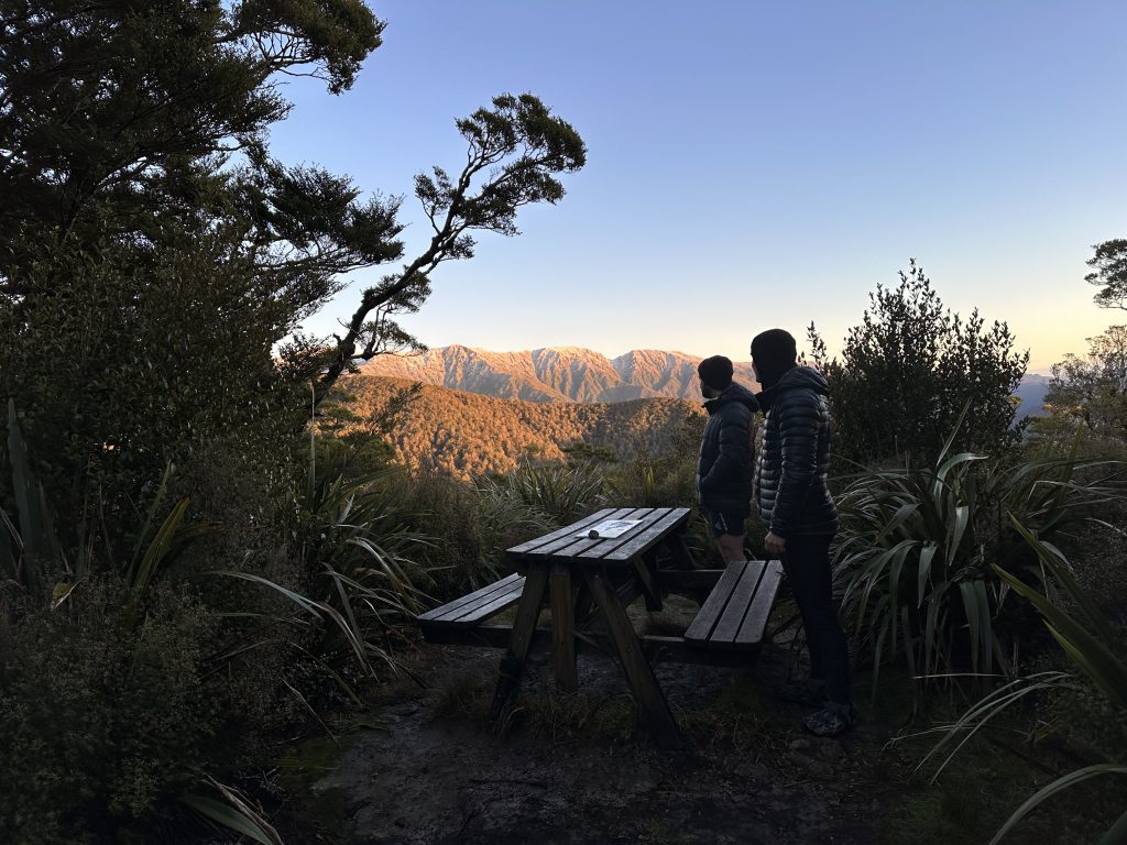
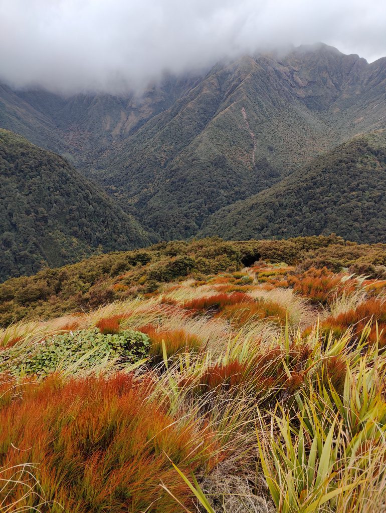
We all woke up early on the Saturday morning to glorious orange light streaming through the windows of the hut. It was enough to lure us out of the warmth of our sleeping bags and to step outside, where we were greeted by incredible views of Waingawa, Bannister, Arete (all being high points along the Tararua Range), Waiohine Pinnacles, and looming slightly larger in the foreground, Table Ridge. All had received a light dusting of snow the day before, confirming how cold it had been.
We were off walking not long after 7am, and headed to Cow Creek Hut, where we stopped for a short break and refilled our water bladders from the Waingawa River. I noted Aaron had been walking at the back of the group in the morning, then realised this was so he could film parts of the trip as we went on his GoPro! He played the role of documentarian for the weekend, capturing interesting sections of the trip for his youtube channel, without breaking pace. See: https://www.youtube.com/watch?v=d-373LZLO_0.
The route up to Table Ridge from Cow Creek Hut followed the DOC track at first, which rose steeply to a signposted junction at around 730m elevation. The sign post marked the turnoffs to Table Ridge and the Arete Forks sidle track.
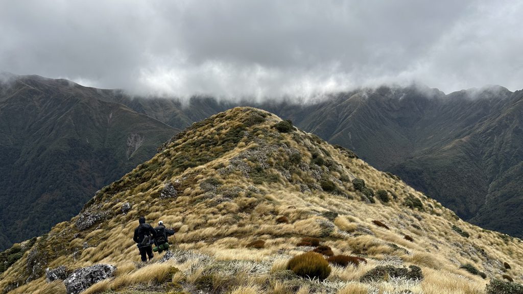
The route up to the tree line from here was well-marked with DOC orange triangles, along with occasional permolat, rusted tin can lids, and where there was a lack of other track markers, blue flagging tape. The route was therefore easy to follow, although old tree-fall required the odd detour and to regain the track further up. Above the treeline, Ellis led us up through tussock, doing well to stick to a faint foot trail which was hard to see beneath the overgrowth. Approaching pt 1390, we found a lunch spot partially sheltered from the cold wind.
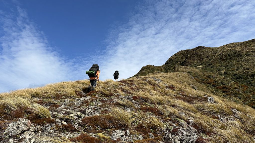
After lunch we walked quickly along the ridge to pt 1478, wary of cloud slowly rolling in around both Mitre (Peak) and Bannister. We did not notice any cairn markers for the turnoff point down to Arete Forks, and had to backtrack slightly to gain the spur.
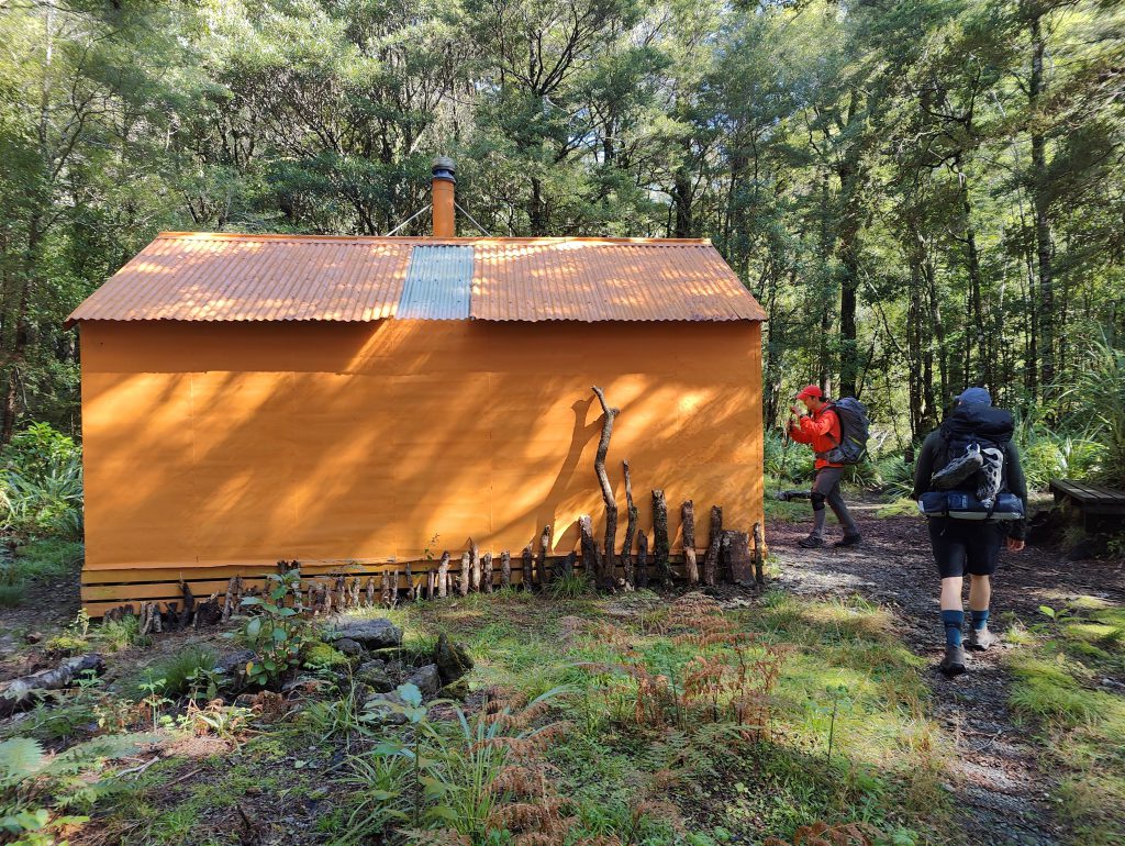
Once on the correct spur, however, it was straightforward to descend. At around the 1260m elevation mark, the spur forked in three different directions. Here, cairns became more frequent, guiding us down the middle of the three spurs. Looking ahead, the spurs coming off the range on the opposite side of the Waingawa River formed an aesthetic arrow, making the direction of travel particularly obvious: Pinnacle Spur, the spur descending from pt 1513 south of Bannister, and the spur descending from northwest of Waingawa, all converge towards Arete Forks. Passing cairns as we went, we approached the bushline at 1000 m. Here, we noticed a small gap in the trees. As we got closer to it, we could see there was a permolat-marked start of the track down to Arete Forks Hut.
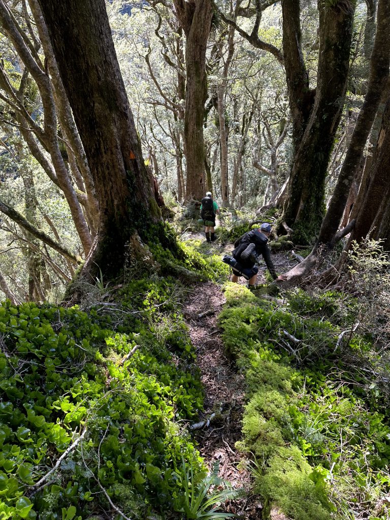
The track has been recently cut and cleared, and fresh permolat track markers have been placed at regular intervals, making the descent to Arete Forks easy to follow. Although we didn’t find any mention of it in the Arete Forks Hut book, the excellent track maintenance had all the hallmarks of Derrick Field and the Greater Wellington Backcountry Network (GWBN). In places, four permolat markers could be seen at once, despite the relatively dense nature of the surrounding bush. For those attempting the route in the uphill direction, permolat markers are more sparse, but the route should be easy to follow given that it has been cleared and you can check you are still on the track by peering behind you to see the ‘sea’ of downhill permolats.
The track delivered us to the DOC sidle track at around 740 m elevation. The terminus of this NZFS track is not as obvious as the one on the Cow Creek side, as it is not signposted. It is, however, marked with a small cairn and when traveling up from Arete Forks Hut, the permolats are easy to spot.
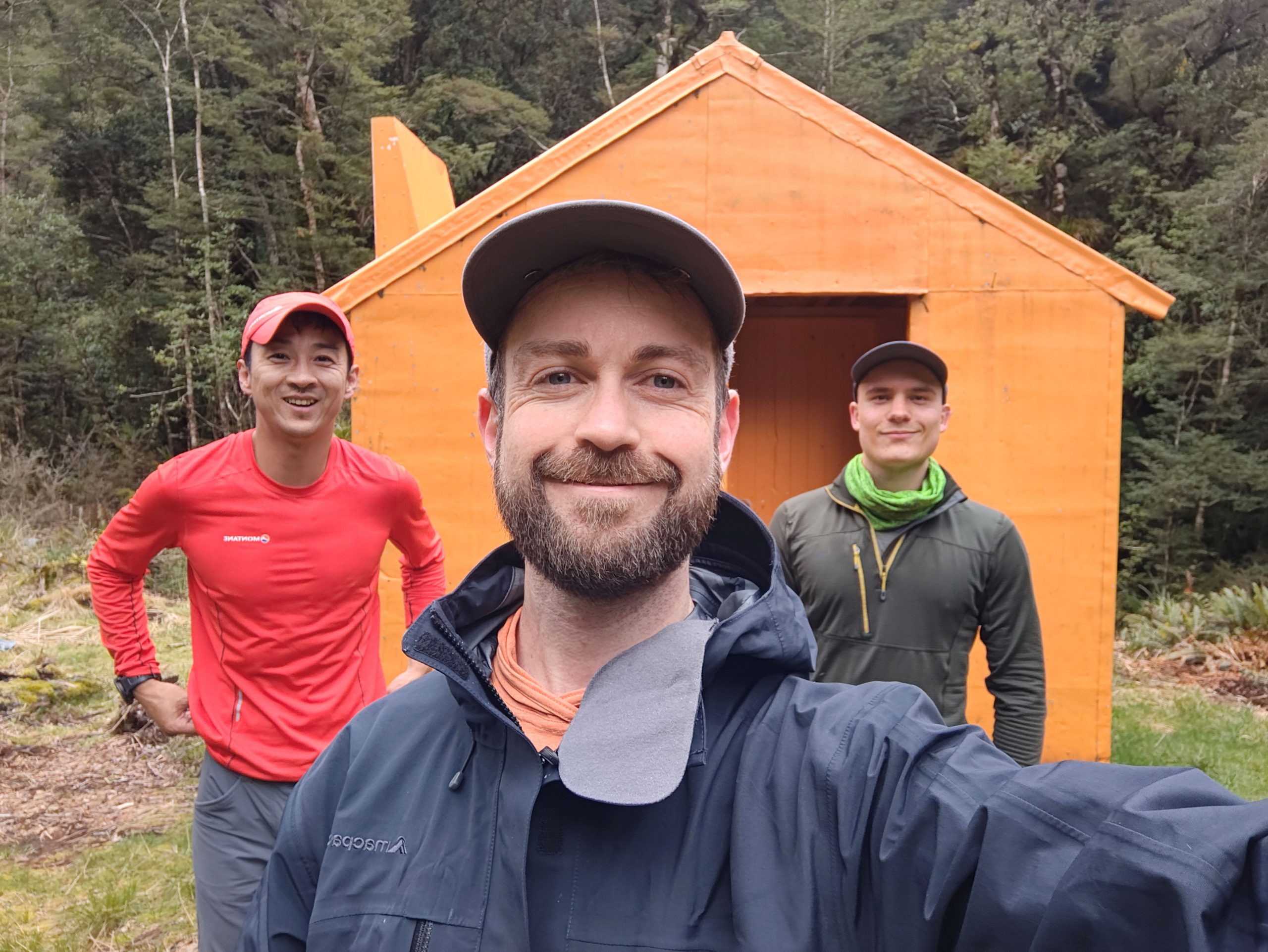
We made it to Arete Forks Hut at around 3pm, giving us time to relax and clean in the frigid Waingawa River (which might be the coldest Tararua dip I’ve ever had). Aaron got to work chopping up wood for a fire using JEM, but noted the wood was extremely wet. He laid an impressive bed of kindling and with great patience managed to get a steady fire going. We didn’t get much warmth from the fire as the open fire place requires open windows/doors to avoid filling the hut with smoke. But Aaron did use the heat to dry out some bits of wood for the next visitor.
We had satay noodles for dinner (a plussed up version of the WTMC recipe) and then went to bed early in anticipation of an early start and an hour lost to daylight savings.
On Sunday morning we woke up at 6am and left Arete Forks Hut shortly after 7am. It was another clear sky morning, and the sidle track was still in good condition, having undergone maintenance by the GWBN in 2022. [see: https://gwbn.org.nz/]. Despite the many ups and downs, steady progress was made and we ticked off the ‘6’ mapped side streams (a few minor creeks must be crossed near Arete Forks Hut, but don’t appear on the map).
We made it to the signposted Table Ridge/sidle track junction in 3 hrs 1 min. We had all agreed the day before that the 3 hr time estimate on this sign to Arete Forks seemed much too quick in light of the online DOC estimate of 4-5 hrs – but we proved ourselves wrong.
Perhaps the title of ‘worst track in the Tararuas’ is no longer warranted for the sidle track. It is indeed physically demanding and at times steep, narrow or exposed, but it was fairly enjoyable and the most notable moment of this section of the trip was a pair of Ruru which I startled from a nearby branch. I can, however, see how it would be a challenging track in wet and slippery conditions.
The steep descent to Cow Creek Hut featured the most accidental falls of the trip – I slipped on my bum, then slipped again while trying to stand back up. Ellis, having seen me slip over, proceeded cautiously but ended up doing the same. Aaron, taking up the rear and probably hoping he had caught the moment on his GoPro, learnt from our mistakes and made it through unscathed.
The 400 m ascent on the other side of the river was tough on our weary legs, but we pushed on with the goal of getting back to Wellington before dinner. On the way out, we passed a tramper on the side of the track making a tomato and cheese toasted sandwich for lunch, using a small burner and frying pan. How good!
After the slog across the ridge and down to Kiriwhakapapa road end, I light-heartedly asked if we should do the 1.7 km loop track before returning to the car. The answer was an unequivocal “no!”.
The drive back to Wellington included a stop in Masterton to get the post-tramp essentials: coke for me, chocolate milk for Ellis. We were also honoured to share with Aaron his first ever Subway order, which Ellis guided him through. We made it back to Wellington shortly after 5pm, all a little stiff and sore, but stoked to have spent the weekend in the hills with awesome views and company.
Statistics
Cow Creek Hut to Arete Forks Hut via Table Ridge – 4 h not including lunch stop, 6.8 km
Arete Forks Hut to Cow Creek Hut via sidle track – 3 h 15 min, 5.6 km
3250 m elevation gain and loss for the weekend