Gunsight Pass – a nice daywalk from the North to the South Temple,
Ruataniwha Conservation Park
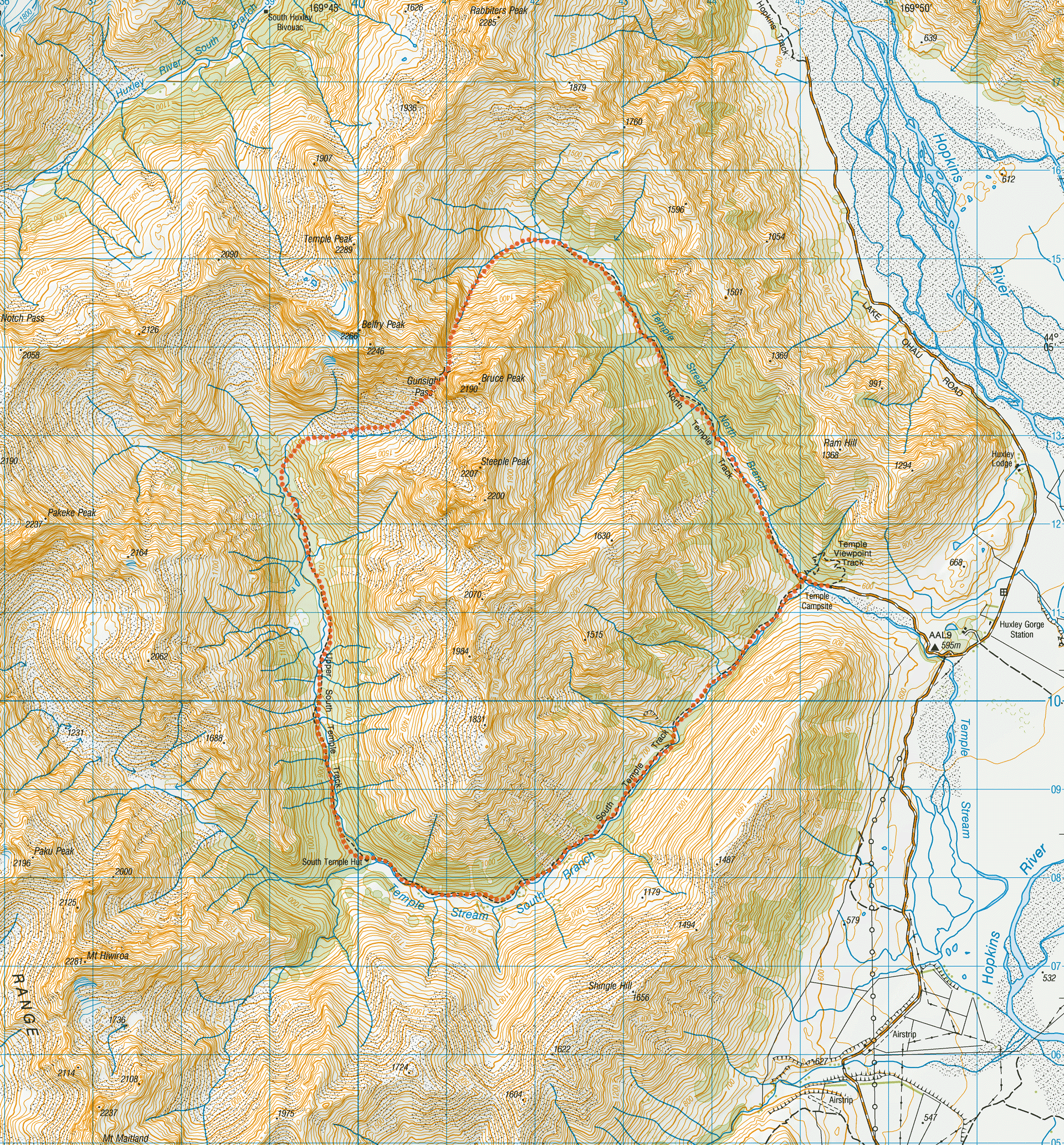
A day loop hike over Gunsight Pass from the North Temple to the South Temple starting and ending at the DOC Temple Campsite.
Matt and I had been thinking about Gunsight Pass for over a year after our trip to the Temple Valley when we went over Maitland Pass and past the Banana Tarns (see here.)
Finally, our time off work and weather lined up and Matt picked me from Cavalcade in Twizel to head around towards Lake Ohau and the Temple Valley.
We camped at the Temple Campsite for the night before heading off the next morning with daypacks.
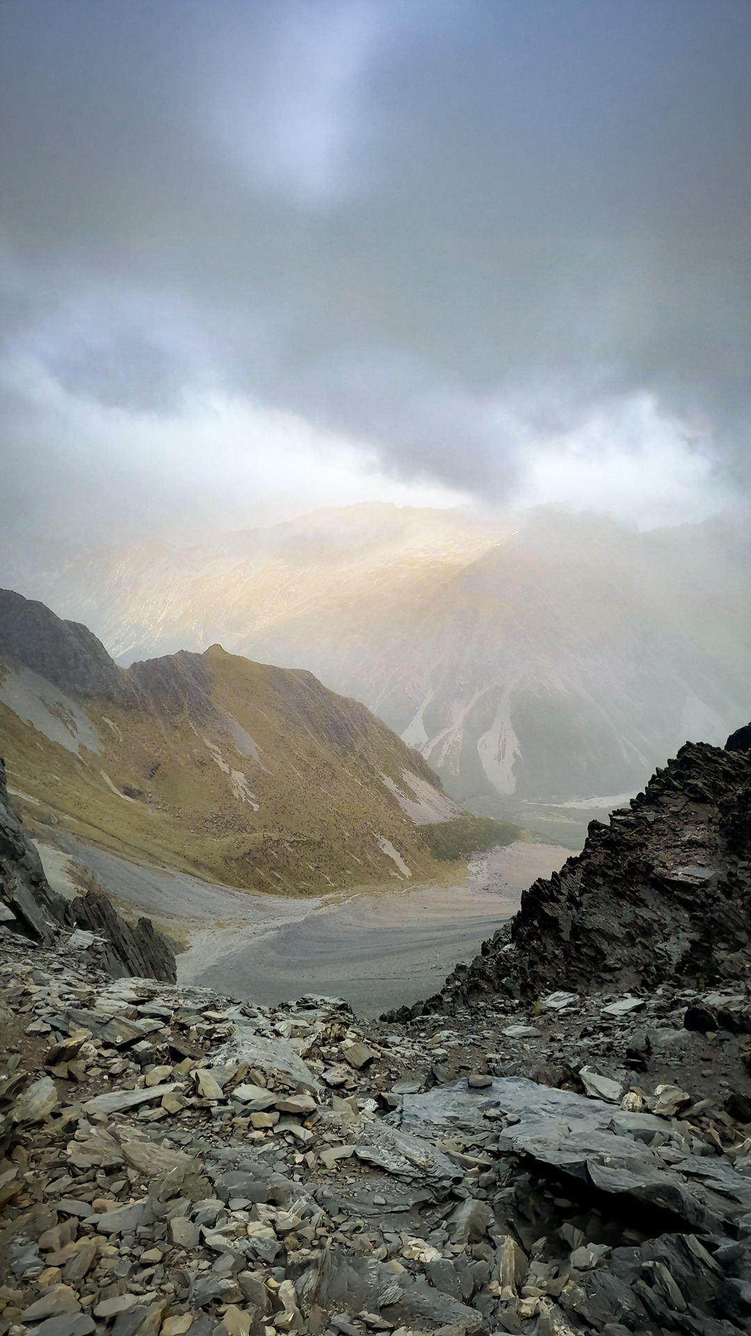
We had woken up to clag and light drizzle that had not been predicted on the weather forecast but we decided to head up the North Temple Valley track anyway and see if the weather improved and how we felt.
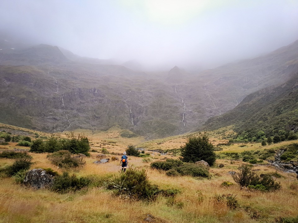
The track was easy going and we both enjoyed emerging out of the bush at the head of the valley to a beautiful basin that was full of many waterfalls and felt a bit like Fiordland.
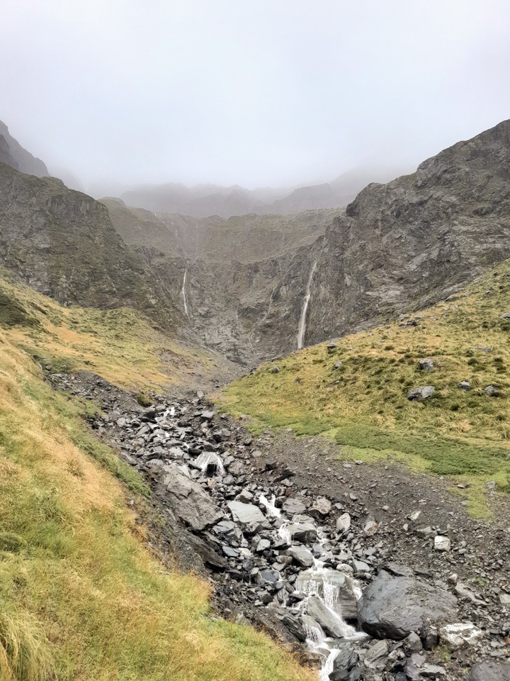
We followed the stream branch towards Gunsight Pass in the distance. The Pass was still shrouded in mist which was very atmospheric.
The mist appeared to be clearing intermittently so we decided to continue. Matt had a laugh when he saw me pull out a bag of chips to have in my peanut butter wrap. I stole the idea from Lynsey for a bit of variety.
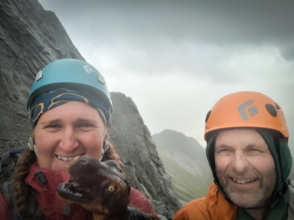
The climb up to Gunsight Pass was relatively straightforward—up scree and boulders. We both were cautious about our lines and the stability of the boulders to ensure we didn’t knock anything down on each other.
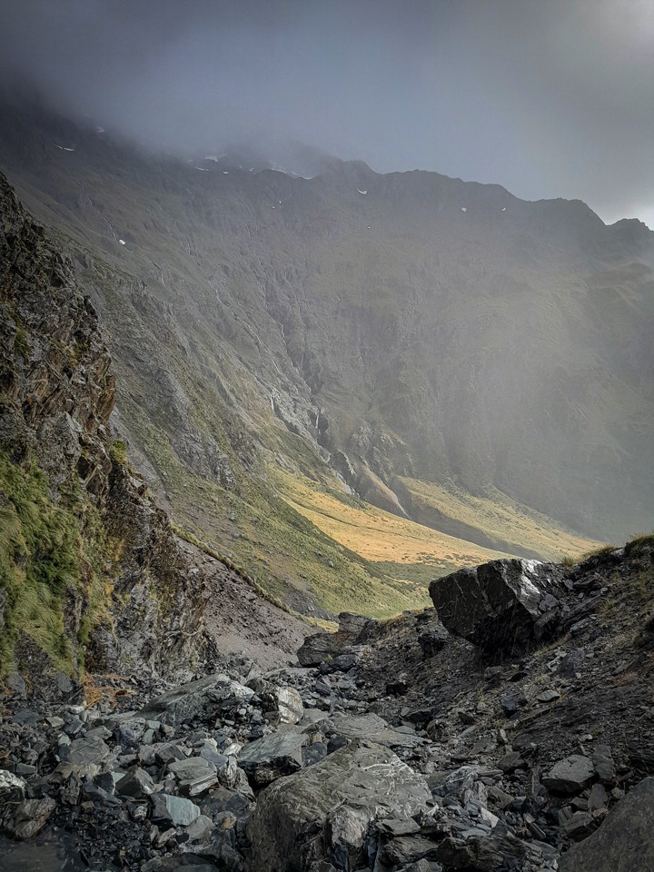
A cold wind was whistling through Gunsight Pass so we quickly started the descent into the South Temple Valley down a fun scree slope.
There weren’t many views down the Valley but we had already been down there before on our previous tramp so we weren’t disappointed.
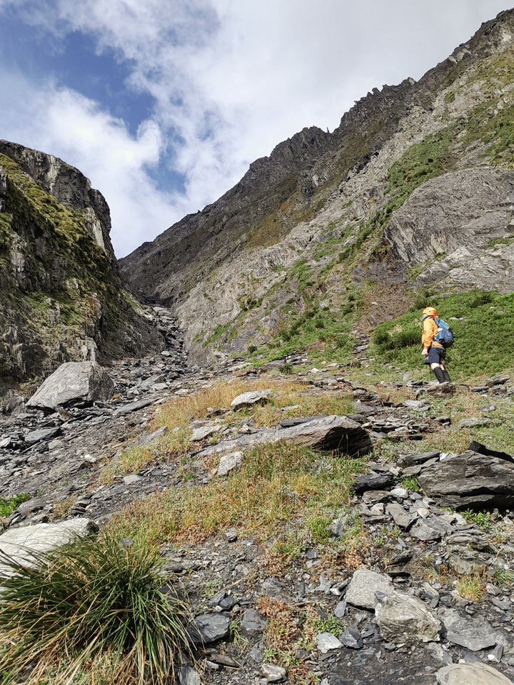
After the scree we hit a boulder field that slowed our pace a little. There were rock cairns through here that sent us down a branch of the stream.
Our progress through this branch was quick, unlike when we had come down into the South Temple Stream from Ahuriri River and progress down the river was slow.
We came out into the South Temple Stream right where the track starts. It is worth gaiters for this section as it is a bit overgrown at times.
At South Temple Hut we emerged into the hot sunshine and stopped to have a read of the Hut book. Matt saw the Over 40s Tramping Club he often goes on trips with had come through a few weeks earlier doing a similar trip.
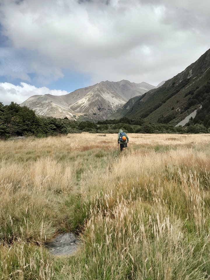
Even though we had both walked the South Temple Track twice a year ago, we both enjoyed it. It’s a nice flowing track and we enjoyed seeing all the tītipounamu/rifleman fluttering around.
Helpful Info:
Distance: 25km
Elevation: 1,587m
Time: 10-11 hrs.
Direction: Go up North Branch Track first as the boulders are easier to climb and the scree on the South side is easier and quicker to come down rather than trying to climb up.
Recommend helmets if in a group due to the risk of moveable rocks.