
Maitland Pass –
with a llama and bananas
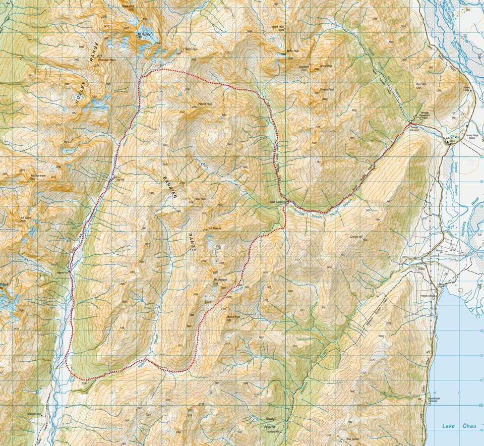
A 4 day hiking loop trip crossing over Maitland Pass in the Ruataniwha Conservation Park passing a llama and bananas
Listen:
“We thought the llama would be carrying your packs!”
I laughed at what seemed like a good joke from some mountain bikers we had bumped into in the Ahuriri Valley. Half a minute later I realised the joke was on me and there really WAS a llama out for a walkies!
After a postponed Stewart Island trip and a long week at work I was desperate to get away to go tramping. I got home from a late shift on Friday and immediately booked a flight to Christchurch for Sunday. Matt got a message at 1 o’clock next morning saying I had just booked a flight, and would be in the area if he was interested in going tramping. Luckily Matt doesn’t mind stray dinosaurs, especially a Sarahsaurus that had landed in Christchurch at very short notice. In fact he was flying back from Auckland later that day so I went out and ran around Mount Oxford before meeting him on Sunday night at the airport.
Day 1
On Monday we drove down to Ohau. It was humid with intermittent showers and our transition at the Temple Campsite roadend was hurried along by a very large sandfly population that immediately pounced on us. It was an easy and mostly flat two-hour walk into South Temple Hut which we had to ourselves for the night. The highlight for the day was seeing a couple of riflemen fluttering around. These small birds weigh only 7 grams and are one of the two surviving wren species in New Zealand. It was testament to the large number of traps we saw as we walked up the valley.
Day 2
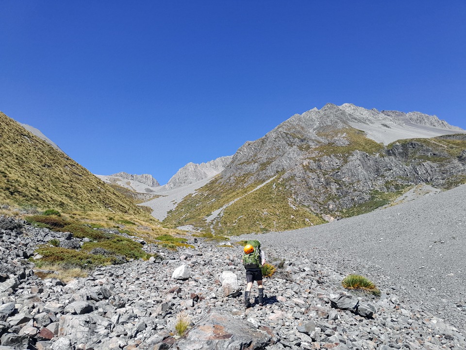
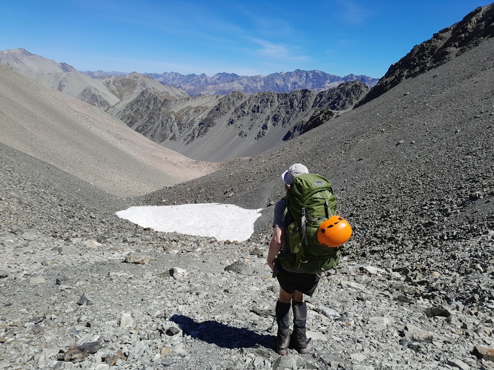
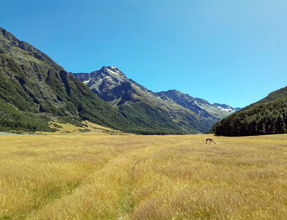
The next morning we backtracked to the stream just south of the hut and started to climb up the grassy spur. Unfortunately my enthusiasm for a good climb led us a bit too high and we quickly realised that if we tried to traverse we were probably going to get bluffed out or have very exposed travel. We decided to take the sensible option and dropped back to the bushline, where we found the odd rock cairn through the trees as we wandered along next to the stream. From there we just continued to follow the stream up the valley under the hot sun. There was some scree on the final climb up to the tarns to slow down our progress but there were some lines you could take through the tussock to make an easier ascent.
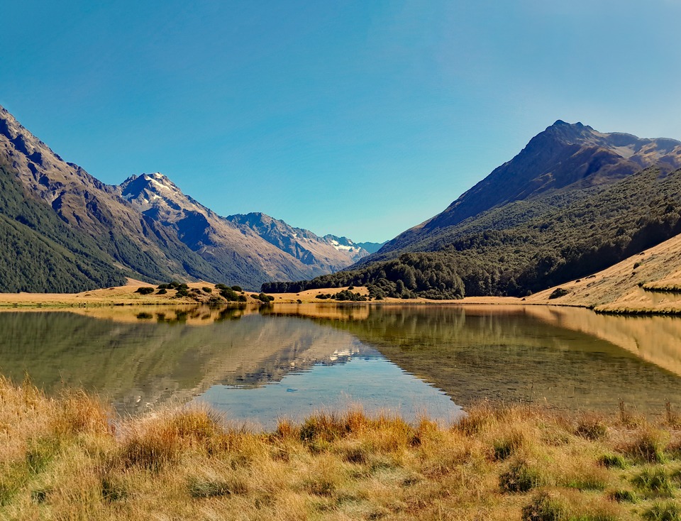
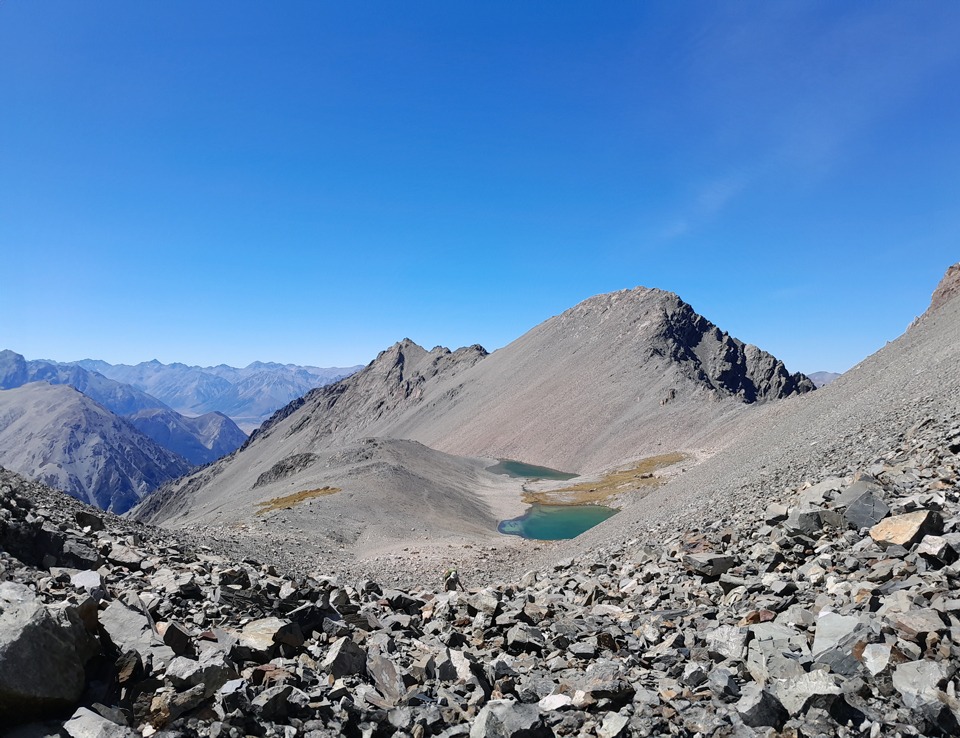
We stopped for lunch at the tarns and at the top of the climb we were rewarded with amazing views back down the valley. The pass itself, between points 2222 and 2090, is not named but is informally referred to as ‘Maitland Pass’ because of nearby Mount Maitland.
We were not expecting a biting cold wind on the other side–we had to quickly layer up and even put gloves on. We went from a hot summer with just t-shirts to multiple layers within minutes. It was slow progress down the other side over a boulder field that did not seem to diminish in size the longer we were on it. Having done many trips recently clambering over boulders and I was silently wishing for there to be an end to it. Finally the boulder field wilted out only for it to be replaced by villages of ‘friendly’ spaniards and matagouri. I was starting to wonder if I was being punished.
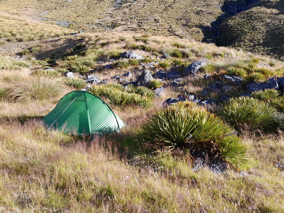
Time was passing by and we had a chat about looking for somewhere to camp as we had already decided to split the route into more cruisy days than the Wilderness route guide. We decided to camp at around the 1,200 metre contour line among a village of spaniards of all places. Suddenly these friendly spaniards took on another use when I pitched my tent next to a giant one that could offer me some protection from the wind that was filtering through the valley.
Day 3
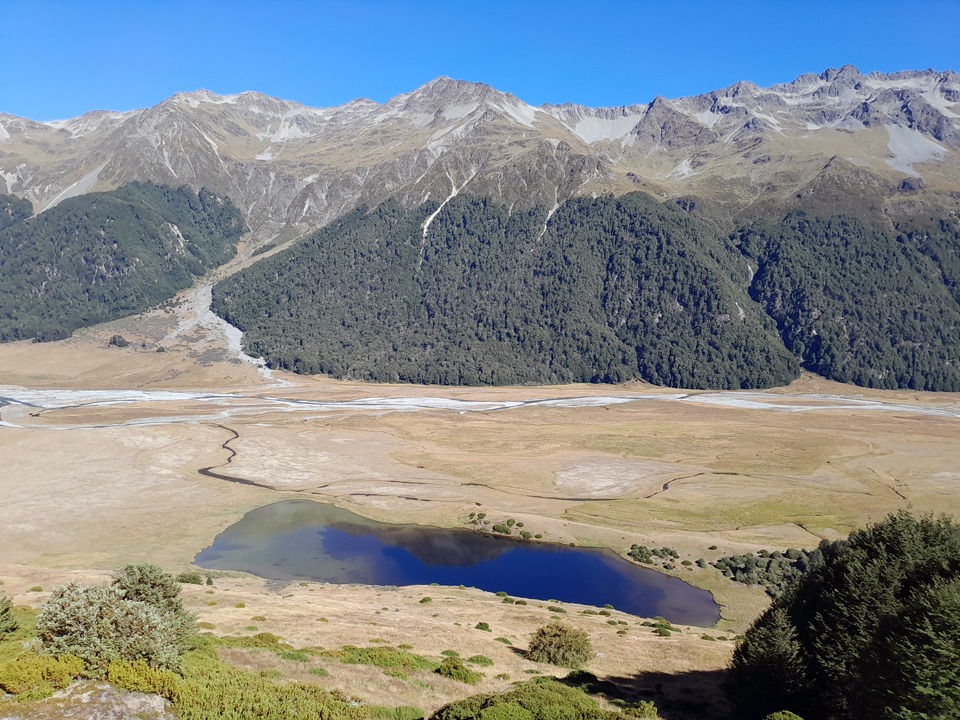
We had a cold start next morning but the sun finally found us just as we hit Watson Stream and entered the bush. We had a bit of a bushbash through here on the true right of the stream—we think there’s probably a foot trail that we missed because we possibly intersected with one east of point 1003. The tarn marked on the map northeast of this spot height was dried out and all that remained was very boggy ground. The bush edge was just after this and it was an easy and open descent into the Ahuriri valley.
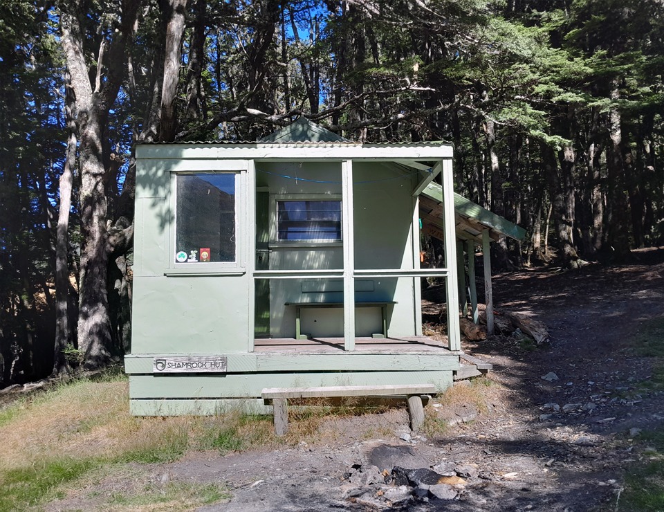
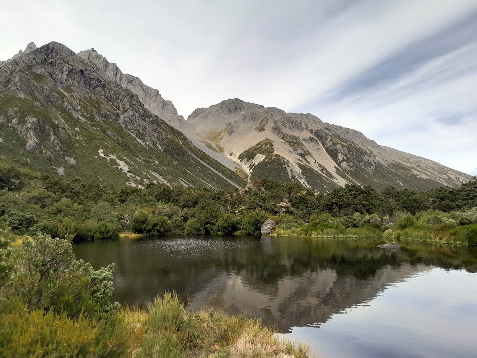
We stopped to admire the reflections in the lake and I convinced Matt that we should drop our packs and to check out Shamrock Hut because with a name like Shamrock why wouldn’t you. And it was the closest I was going to get to Ireland for a while! It was in the hut book here that I found that the 2021 Cavalcade runners had come through here and gone over Maitland Pass—coincidentally I was headed to Cavalcade when I got out from this trip.
Returning to our packs we started up the valley when a couple on e-mountain bikes passed us. We stopped for a chat and that’s when they made the comment that they thought the llama would be carrying our packs. It turned out that they had seen a person taking a llama out for a walk in the Ahuriri Valley and thought we were all one party. They also pointed out some paragliders further up the valley to us. We hadn’t even noticed them as they were well camouflaged into the mountains. It seemed like it was all happening in the Ahuriri today.
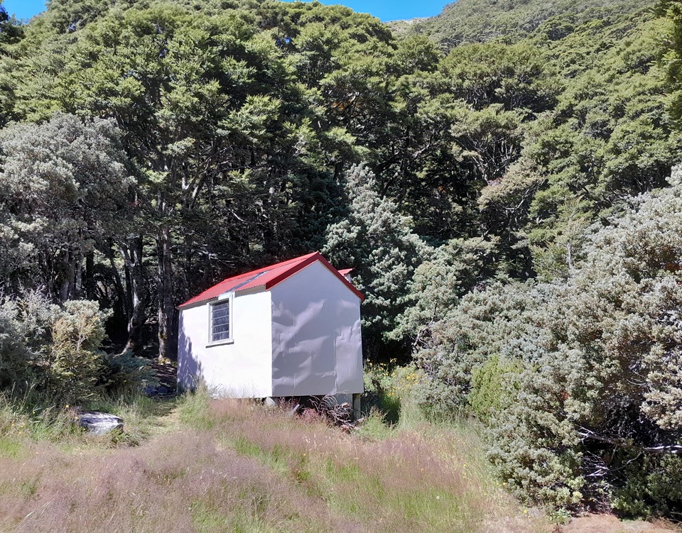
We took off towards Hagens Hut for lunch, leap frogging with the mountain bikers. I was very distracted keeping my eyes peeled for any signs of this llama out for a walkie so it was very lucky it was an easy 4-wheel drive track to the hut. We continued up the valley towards Top Hut with the 4-wheel drive track disappearing and some more route finding required but nothing technical. Top Hut was a cute little 2-person biv and as much as I wanted to spend the night there, we thought the mountain bikers would probably turn up so we would offer it to them first.
They eventually arrived having stashed their bikes further down the valley when it became tedious pushing them. They wanted to sleep outside so we ended up in the cute little biv after all. I still had not seen the llama, not for a lack of trying; and had been talking about it all afternoon. I had even said to Matt that it would be great if we just woke up in the morning to find the llama outside in the designated horse paddock!
Day 4
Unfortunately there was no llama the next morning in the horse paddock but there had been a beautiful starry night instead so I had wandered out to spend some time quietly stargazing. I enjoyed sweeping the biv out with the broom that was really old-style that looked like it could fly and be a reliable source of transportation for trampers like me who have a hyped imagination. We continued up to the head of the valley and just before the scree slopes under the towering Mount Huxley, we climbed up a steep grassy spur. We quickly realised that the route marked on the map in the Wilderness Route guide was slightly off so we picked a different route and found some rock cairns at the top of our climb.
Our route finding had been on the money, or at least got us up to the right place. We followed up the southernmost stream in the branch of three that flow from the tarns. It was another hot climb on a bluebird day through some broad terraces up towards the pass.
I looked across to Mount Huxley that Joe and his dog, Floyd, had stood on. Tony and I had come across Joe and Floyd, in many hut books around the top of the South Island and North Island and it was incredible to think he had got up Mount Huxley with him. We had seen in the book at Top Hut that Joe had been through in January doing Floyd’s last long trip as he was retiring from longer trips at 12 years old.
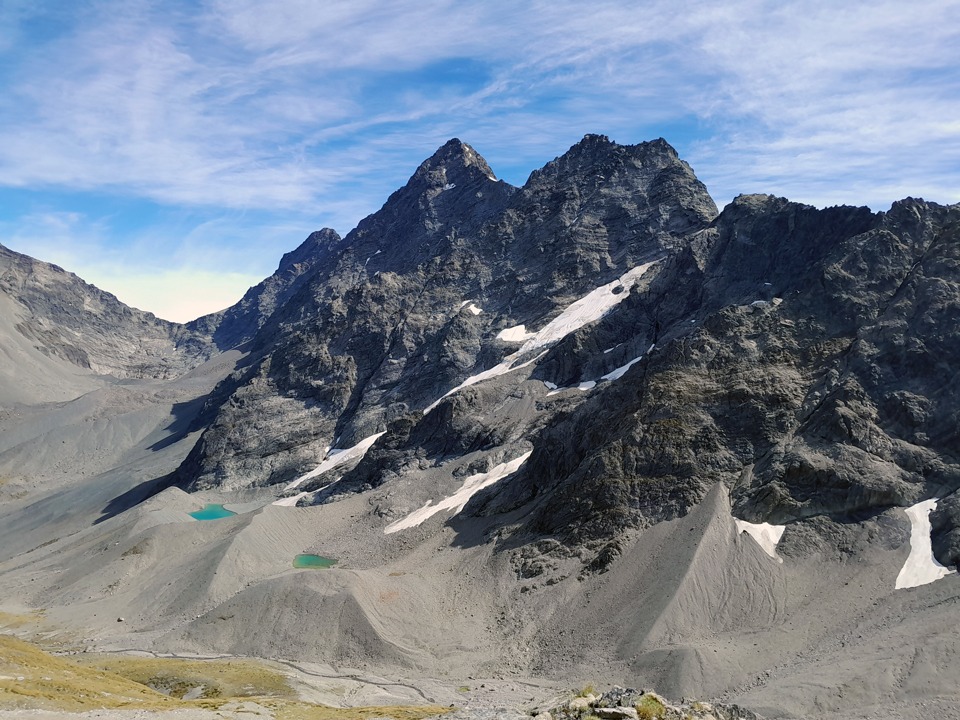
As we climbed higher on these broad terraces, we looked down on two tarns that are often referred to as Banana Tarns. Depending on the snow cover, sometimes they look like banana shapes apparently. I wasn’t seeing the banana shape but I liked the name regardless. We could see V-Notch Pass—that will be a future mission for sure. There would be good high camping here as there is a stream running through this valley.
We finally got to our pass between points 2058 and 2190 and started to drop down into the valley, being careful with our lines so that we didn’t send boulders onto each other. As we dropped into Temple Stream South Branch we could look up at Gunsight Pass which will be another trip. We found the beginning of a route up to the pass and saw a lovely tarn at the base of it.
We continued down Temple Stream—noting that after heavy rain this would be impassable as there were many crossings and much clambering over boulders. At one point we had to drop and pass packs around a boulder. After more boulder hopping through the stream we finally hit the track that took us back to South Temple Hut again for the night, and a very short walk out the next day.
More alpine tramping trips:
I hope Floyd is working hard on his golf swing in his retirement! Maybe he could aim the golf balls into his Floyd Pond in the Tararua Range?
I’ve never actually met Floyd and you in person but I have really enjoyed following all the adventures you have had with Floyd & Sushi in all the different hut books. You popped up in all sorts of places! I’ve always enjoyed seeing the little pawprint in the hut books. Both Floyd & Sushi had impressive resumes as mountain dogs.
Thanks so much for your comment – it really made my day that you saw this and also the update on Floyd!
Say hi to Floyd from me 🙂
Hi Sarah, it’s Joe here.
Paul McCredie sent me this.
I’m so sorry, but I don’t recall meeting you -but I do have a rotten memory, so my bad!
Floyd does shorter trips with Casey these days. His final two big climbs were Hakatere Peak in the Arrowsmiths, and Mt Graf Spee up the Havelock.
But his finest climb, he reckons, was his summiting of Mt.Greenlaw via the E ridge two years ago. Pretty stressful for him, on a rarely climbed peak.
I think wants to take up golf now…
Cheers Sarah!
Joe & Floyd