
The Bounds of Hades – Lees, Misery and Hellfire
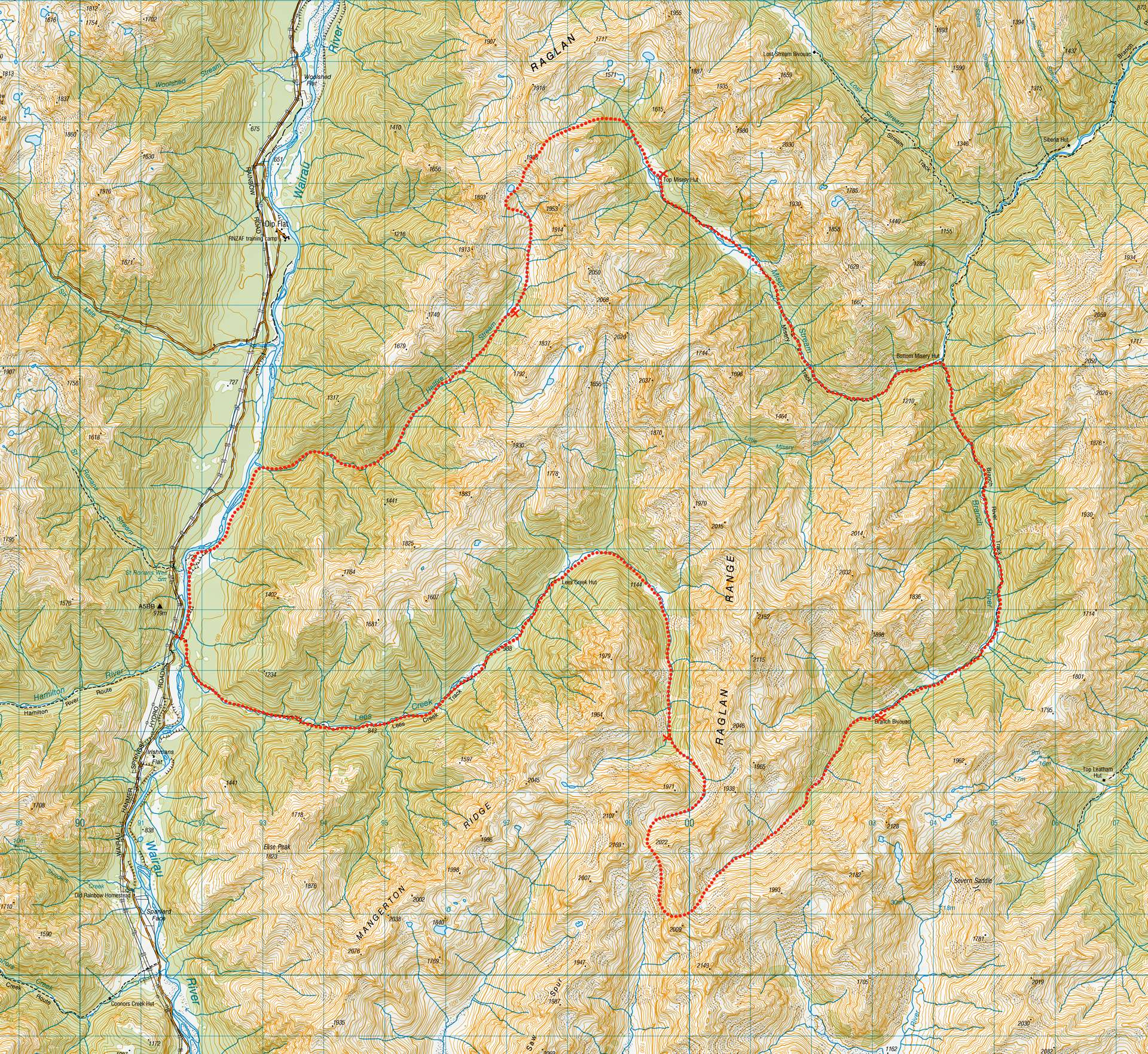
A 5 day hiking loop trip through spectacular mountain scenery from Lees Creek to Misery Stream and Hellfire Stream in the Raglan Range – an area once called The Bounds of Hades

Carrying two tents. Spaniards on steroids. Endless tree-fall. Slow bushbash through dense beech forest. Sleeping on the hard ground. The Bounds of Hades.
All these things sound fitting for the Lees-Misery-Hellfire Circuit where a bit of misery and hellfire seems to be a requirement of any trip to this part of the Raglan Range. Perhaps that is why an early name for the Raglan Range was the ‘Bounds of Hades’ and having done a Classics major I could appreciate the meaning behind this.
The Lees-Hellfire Circuit had been on my wish list for a few years and with a good weather window approaching Tony and I decided to finally go for it.
Day 1
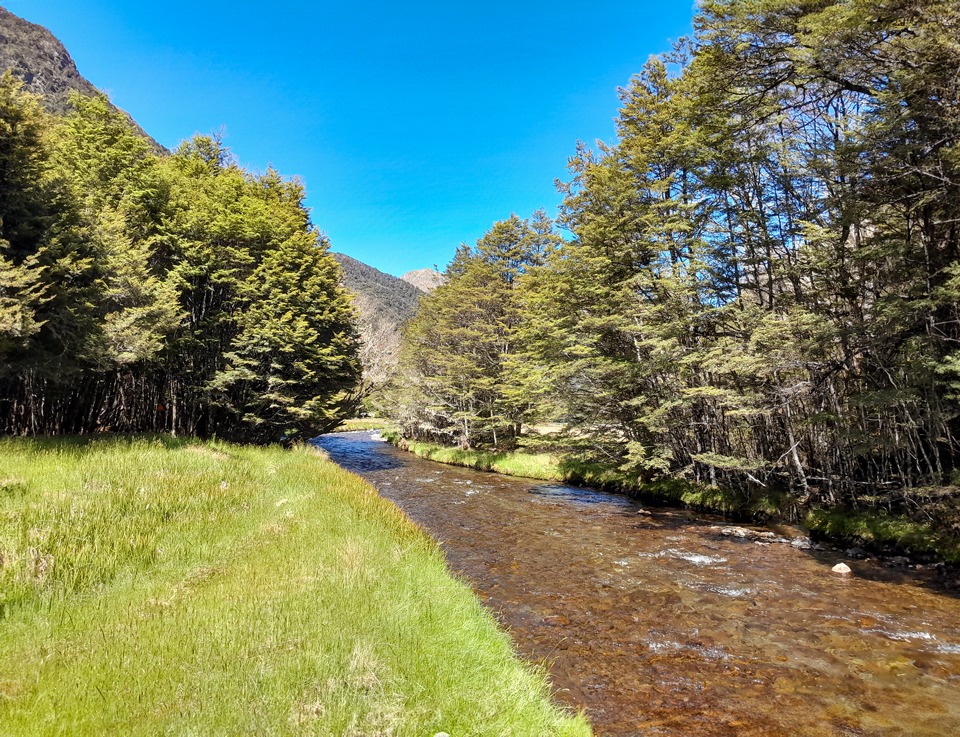
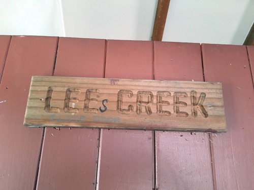
We had a relaxed start from the Rainbow Road. Tony had sought permission from the Rainbow Station owner and got the key to the road gate so we could drive to the start of the track. It began with a high swing bridge across the Wairau River followed by an easy walk up the valley through regenerating bush to Lees Creek Hut. Interestingly, the ‘s’ had been left off the hut’s name on the door.
Someone failed the hut name spelling test.
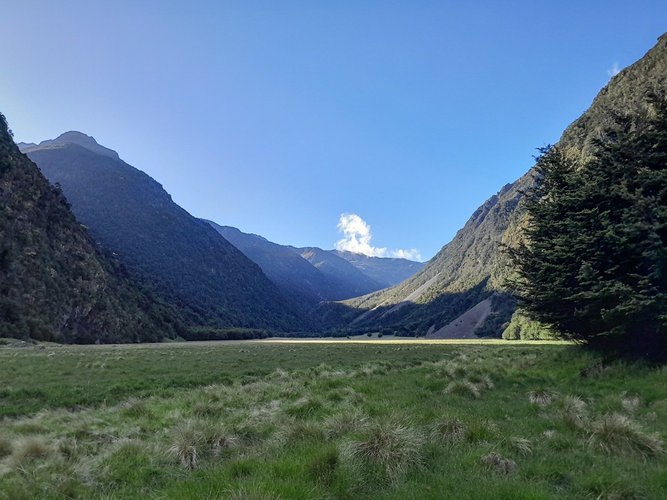
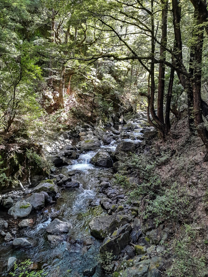
After the hut we had a short bush bash before we found a foot trail on the true left of Lees Creek. Much to my surprise the creek disappeared underground when we came out of the bush into a beautiful little meadow. Tony assured me I didn’t have to worry about water availability as it would appear again and it was not uncommon for streams to run totally underground where there was deep alluvium.
It did indeed appear again as we climbed up the valley. We had a long discussion about the use of the phrase ‘not uncommon’ that Shaun Barnett had mentioned in his Wilderness trip report for this circuit. The double negative just about caused my head to explode and Tony had fun saying sentences with double double negatives incorporated to see if I could work out what he was actually talking about.
We came to a bit of a clearing that was around the 1,300m contour line and decided to set up camp there for the night. We toasted some marshmallows and I went for a quick swim in the cold creek before coming back and getting warm by trying to repair my sleeping mattress that had annoyingly gone flat.
I tried everything but the mat seemed to be as determined as me. After previously having had many repairs, I had to call it a day and resign myself to the fact that my mattress wasn’t going to be inflating anytime soon. I made a ‘mattress’ out of my pack and the spare clothes I had instead.
During the night I got up to find Tony’s bag of muesli several metres away from his tent which I thought was a bit odd. I thought perhaps he had left it there by accident—and put it back under his tent fly. In the morning I found out that a possum had stuck its head in Tony’s tent and pilfered the bag while he was sleeping. Annoying pests—just another reason to get rid of the possums aside from the huge amount of damage they do to our native flora and fauna.
Day 2
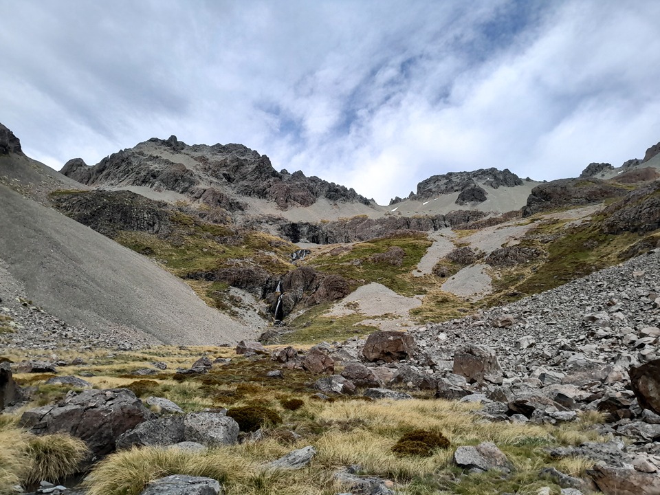
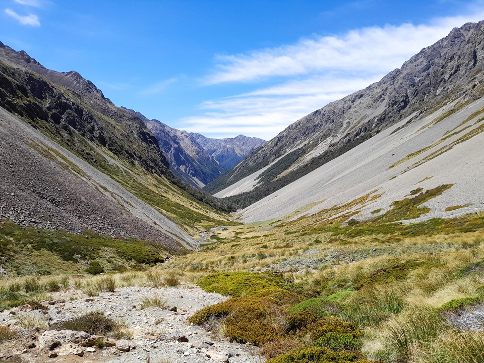
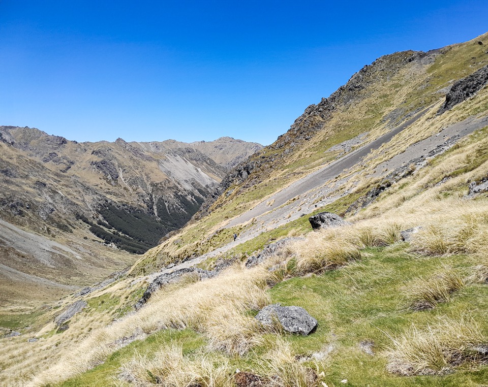
We had an early start the next morning. There was a rock cairn next to our campsite and we began with a bit of a foot trail but then we had a bushbash before we found it again. Emerging out of the trees next with a tall waterfall cascading down next to us, we found ourselves in a beautiful alpine valley surrounded by native tussocks with no invasive species anywhere.
There was another towering waterfall at the head of the valley and the water was pristine clear. We looked around in wonder before climbing up the true left of the waterfall and crossing over at the top.
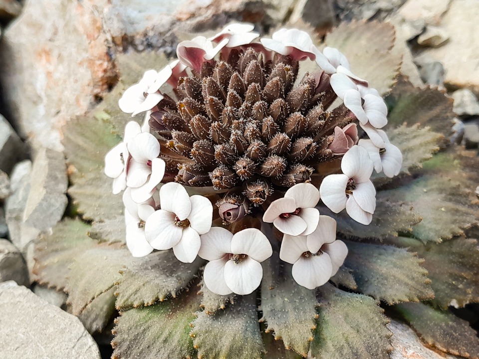
As we continued the climb, Tony found another surprise. A bunch of penwipers in full flower on the scree slope. This is something that is a rarity to see so we both felt very privileged. It’s amazing to think anything can grow in such a harsh environment that is both exposed to the summer droughts and snow over winter.
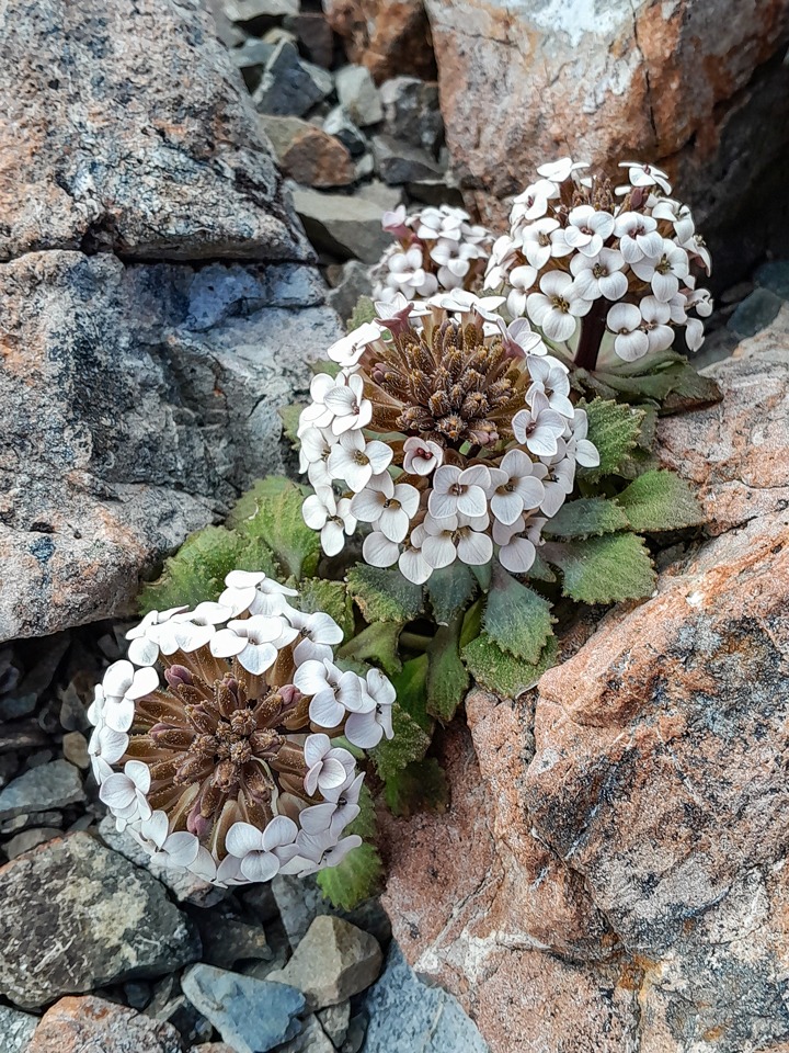
Penwiper, Notothlapsi rosulatum, are found only on screes on the eastern side of the Southern Alps between Marlborough and Canterbury. Their habitat is extremely harsh, with hot desert-like conditions by day, freezing cold conditions at night, and a constantly moving shingle substrate. They grow where mostly no other plants can survive and then generally not in large numbers. We were just so lucky to see fields of them.
At the top of Lees Valley we had a fun descent down the scree into the head of the Judges Valley, taking care not to drop too low and did a rising sidle across to the start our long climb. There were more penwipers on this scree slope—so many we had to be careful not to trample them.
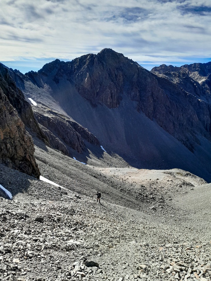
Nearing the top of this climb I looked up and thought it looked impassable. We decided I would drop my pack and go have a look. I got up the part that had stalled me and found another way around it before hitting the top where there was a narrow ‘notch’ for us to pass through to the Branch Valley.
On the other side I found a way down but then found a different way that was much easier and safer, so much that Tony called it our ‘get out of jail card’ route since it delivered us right onto a scree run down in the Branch Valley. We got caught in what I termed a ‘gravel hailstorm’ as the wind picked up and the vicious gusts picked up all the nearby dust and grit with force and blew it straight in our faces like painful hail that saw us spinning around constantly to shelter ourselves from it.
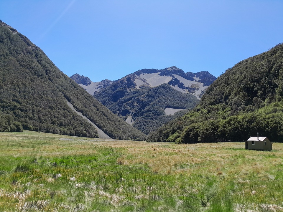
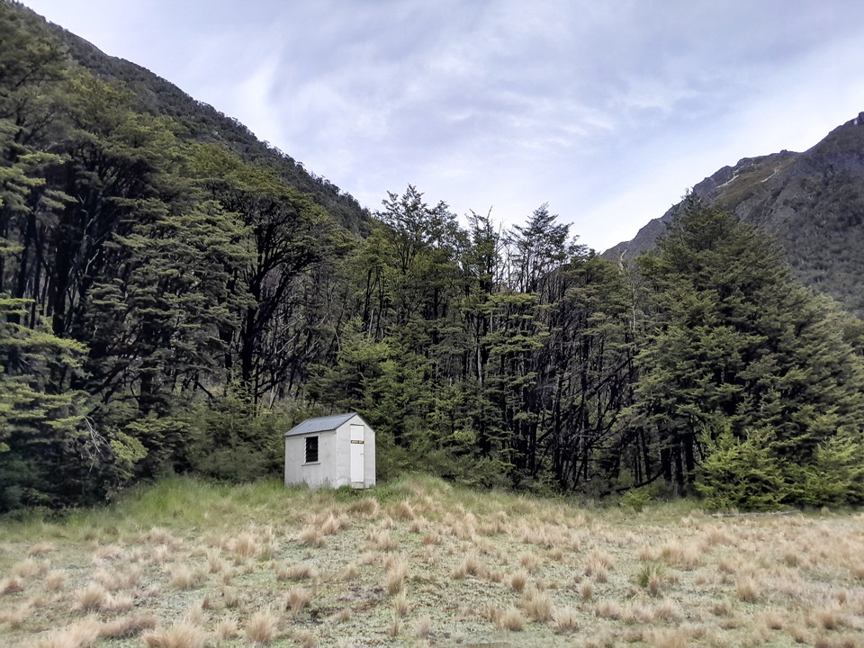
Once back in the bush we found an animal trail but above the gorge this disappeared and we had an extremely slow bushbash that I would categorise as Type 2 fun to Branch Bivvy. Never have I been so grateful to see a hut!
Day 3
As forecasted some heavy rain came in the next morning so we had a later start until it eased. The DoC website had an alert out for the section of the track between Branch Biv and Bottom Misery Hut and Top Misery Hut for tree fall.
We, possibly naively, thought how bad could it really be. But then we read an entry from someone who had done the loop in reverse to us a few weeks earlier and it really did sound bad—they wrote there was tree fall every 10m, plus a gnarly slip and to expect to take 1½ times the DoC time to the hut.
We started down what seemed like a very clear track but it wasn’t long before the tree fall started. There really was a lot, and we were endlessly climbing over, under, and around tree fall and trying to re-find the track at times. Luckily there were a few patches that were free of tree fall but it seemed like this track might indeed be the ‘misery’ component of the trip.
It wasn’t long down this track that I said to Tony that I could see what I thought was a dog in front of me. We assumed it must be with a hunter so we immediately started making as much noise as possible, which because it was December involved singing Christmas carols loudly. We came around the corner to find what looked like a sleigh of dogs in front of us—three young women with four dogs.
They were doing an epic off track mission going from the Branch, up and over into the Leatham. They mentioned to us that they had squeezed two of them plus three dogs into one tent after they had lost their tent somewhere in the treefall. I took their contact number and said if we found it we would let them know. I knew if I did find it, I was going to make a real effort to reunite it with them because they were really inspiring—strong, cheerful young women out for an epic off-track adventure.
After endless tree fall the sun eventually came out and I stumbled across the missing tent hanging from a tree like a punchbag. I loaded it on my pack to carry it out for them. I got the feeling they weren’t locals so wouldn’t be able to go back to a hut easily to retrieve and I could see it was a tent that had seen many good adventures (Once out I sent the tent back to them in Dunedin—I like to think that the tramping community look after each other and this was my way of doing this).
We eventually came to the slip just before Bottom Misery Hut—there is a high sidle track above the slip that I would recommend. Going across the slip would not be recommended because of the serious consequences of a slip.
At Bottom Misery Hut we enjoyed the hot sun, and had to really motivate ourselves to get moving again knowing that more tree fall was coming. It was slow going at times and a bit later we found the track had washed away and when we were searching around for it I called out to Tony that I had found a ‘tree.’ ‘Yes, there’s plenty of those,’ was his reply. Wondering about his seemingly unexpected response, I immediately realised my mistake and corrected myself to say I had found a track marker.
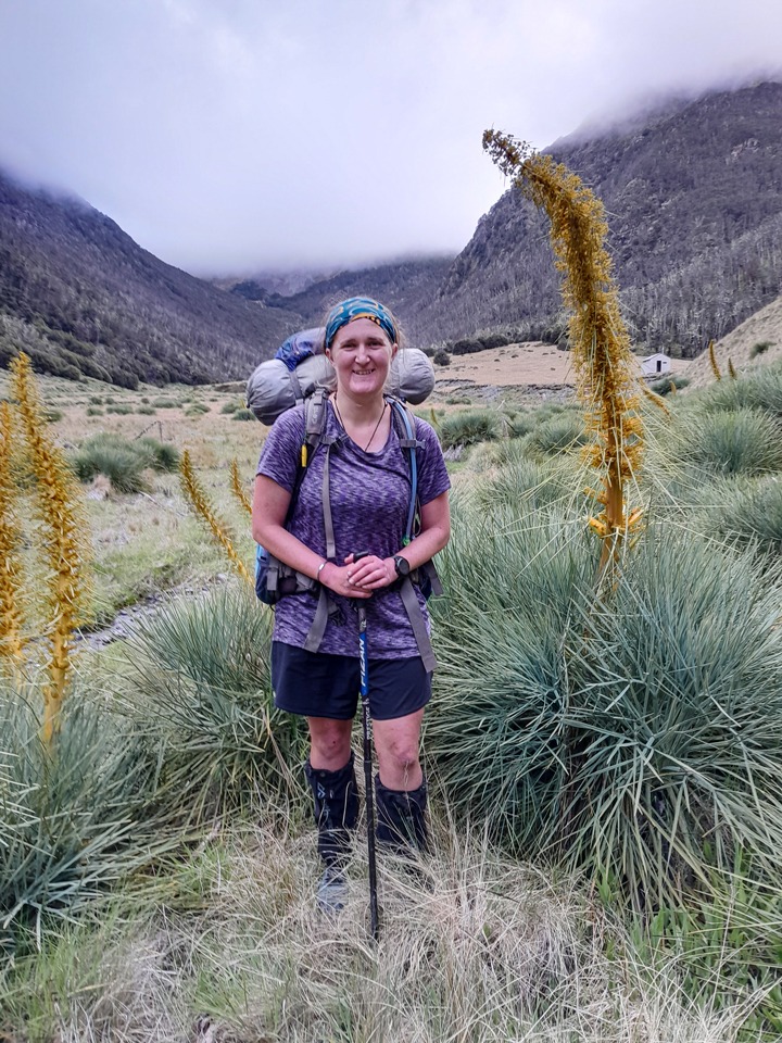
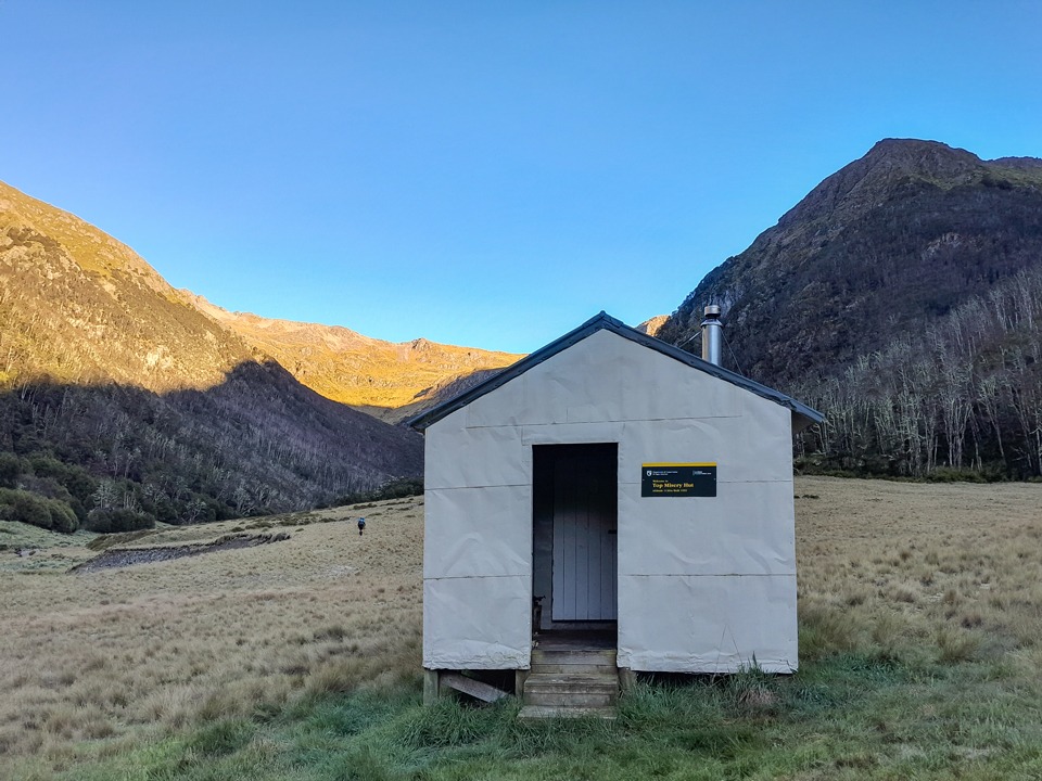
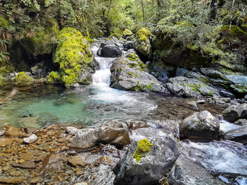
There was another beautiful alpine meadow where the creek disappeared underground again—and we followed its progress through the meadow. Tony had promised me the best spaniards at Top Misery Hut and he wasn’t wrong. We got to the basin where Top Misery Hut was to find the spaniard population had been having a good year. These were spaniards on steroids. Many were over 2m tall and Tony took a picture of one towering over me. Luckily the final part of our day did not involve having to navigate through them as there was a good foot trail that skirted around them all.
Day 4
After some clag overnight and early morning cloud in the valley, it cleared into a bluebird day. We originally tried to bushbash up the true left of Misery Stream before crossing and going up the true right where it was much easier travel. It was a hot climb through the tussock basin and up to the ridge but we both enjoyed the different colours of the tussock.
The notch to pass through has rock cairns on either side. We sat and had a break before climbing over as there was a very noticeable temperature drop on the other side. The climb down from the notch required some concentration and care but wasn’t any problem.
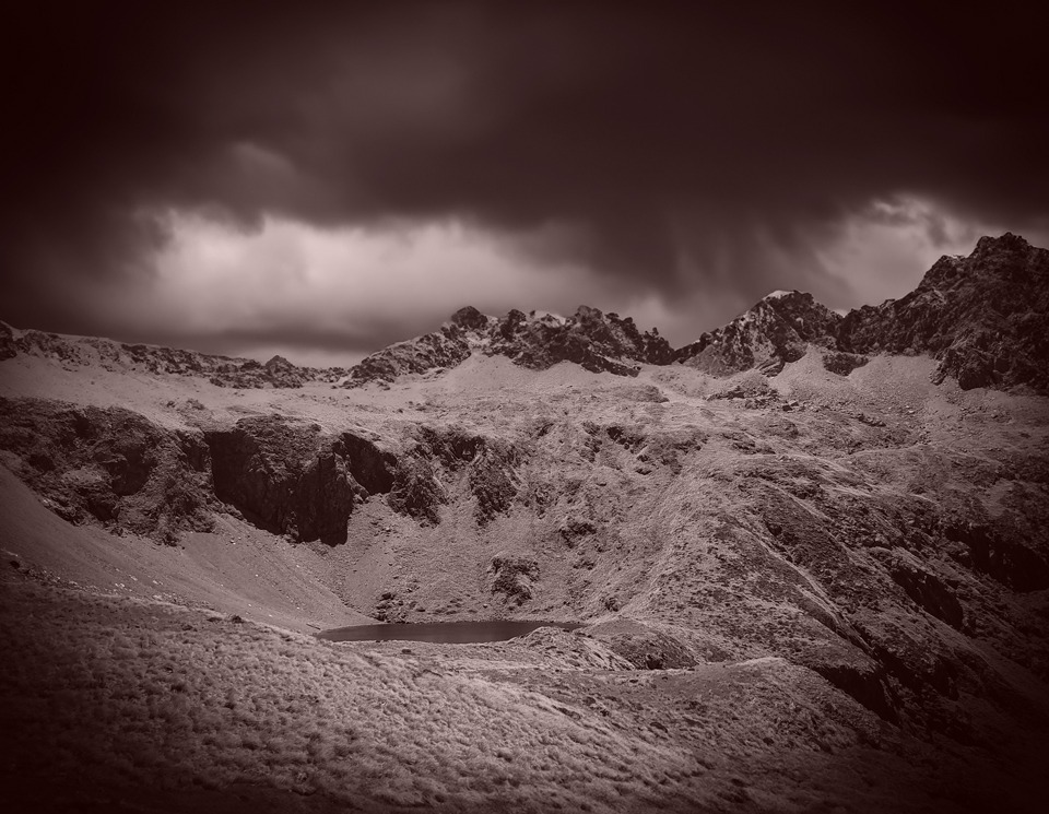
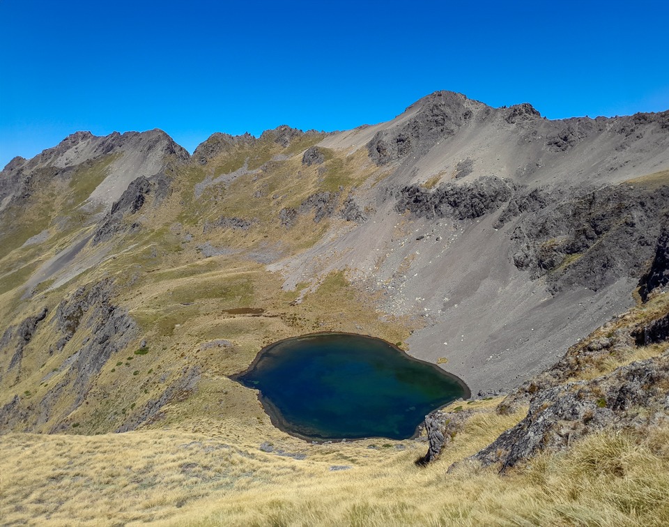
We passed by a large snow patch and continued to drop rapidly to Hellfire Tarn that was glimmering invitingly in the sun. We decided that a lunch stop next to the tarn was needed and I went for a quick swim. From the tarn there are several ways that can be taken down to the creek but they are all quite steep and care would be required if the snowgrass was wet.
Travel down the Hellfire Valley was quite slow—the tussocks often hid large holes between them and when I was at the front I would get the pleasure of finding them all. Tony would see me in front of him and then he wouldn’t—and occasionally had to come haul me out.
Once at the bush-edge we knew there was a trail marked by the Nelson Tramping Club. We initially missed it but then found it but staying on it proved difficult at times. We thought the trail was marked for people heading up Hellfire Valley rather than coming down.
Regardless, we still found it incredibly helpful and were very appreciative of their effort. Rather than getting out super later, we decided to have another night camping and stopped early before we got lower down the valley and into the gorge where there would be no camping spots. We enjoyed drying the tents, including the extra one, in the warm sunshine and then going for a swim.
I teased Tony after he said he was trying to find some ‘impetus’ to get moving and the wording made me giggle. I spent the rest of the tramp trying to use the word ‘impetus’ wherever possible.
Day 5
On our final day we continued down the trail next to Hellfire Stream. The track was high above the gorge and there was one steep bit with an uncomfortable drop-off where we passed packs down for safety. Tony pointed out the old blazes in the trees to me.
Back at the Wairau River, we had a walk back up the valley to link up to the swing-bridge to complete our circuit. Again, Nelson Tramping Club has marked this but we didn’t know this at the time and ended up having to crawl through some matagouri that turned out to be right next to the track—it seemed a fitting way to end having just come from places named both Hellfire and Misery.
The Raglan Range may have had the early name of the ‘Bounds of Hades,’ but it is truly a gem that is worth exploring—a tramper’s paradise with beautiful camping spots; quiet huts and challenging off track travel. The Lees-Hellfire Circuit, Turkey’s Nest and Leatham Circuit are still some of my favourite tramps to date.
Useful Information
Access to the Rainbow Road requires permission from Rainbow Station owner and a key for the gate except for the few weeks in summer when it is open to public access.
There are multiple ways of crossing over the tops from Lees Creek to Branch Bivvy. We chose to drop into the Judges Valley but it is possible to avoid doing that.
As at summer 2024 expect slow travel between Branch Bivvy and Bottom Misery Hut (approx. 1½ times the DoC time) and immediately after Bottom Misery Hut towards Top Misery Hut. Look for the sidle track above the slip 1½km from Bottom Misery Hut.
Wasps can be very problematic over summer in this area.
Hellfire Valley has a roughly marked track from the bushedge down to Wairau River—expect tree fall after the gorge. There is also a marked track back to the swingbridge to make it a loop but you also just follow the Wairau River up to the bridge to save crossing the river and walking the road.
Day 1 – To Campsite at 1,300m contour line: 5hr; 14km; 709m elevation
Day 2 – Campsite to Branch Bivvy via Judges Valley: 9-10hr; 10.4km; 1,290m elevation
Day 3 – Branch Bivvy to Top Misery Hut: 8-9½hr; 16km; 578m elevation
Day 4 – Top Misery Hut to Hellfire River campsite at just under 1,100m contour line: 8-9 hrs; 10km; 954m elevation
Day 5 – Hellfire Campsite to Rainbow Road carpark: 4hr; 9km; 194m elevation.
Recommended:
Reports of other WTMC trips in the Leatham Conservation Area:
For a Bounds Circuit trip trip go to Bounds Circuit – 6 days in the Leatham Conservation Area
For a Leatham Molesworth Circuit trip go to Finding dinosaurs and magic on the Leatham – Molesworth Circuit
For a Restorative Retreat Weekend at Gosling Hut go to Restorative Retreat Weekend at Gosling Hut – Leatham Conservation Area
Hi Sarah,
Joe Nawalaniec here. Your story was forwarded to me by John Rhodes, who was with me on the earlier trip that you referred to, along with Andy Dennis and Shaun Barnett. It’s a lovely part of the world, and your account brought back some very rosy memories.
So thanks for that
Cheers!
Joe