
I almost pulled the pin on this trip. By the Thursday evening before we were due to leave, the weather forecast had changed daily, if not hourly, for the past few days. And the Interislander had already bumped our outbound sail to a less convenient time for everyone. I was weighing up whether it was worth driving all the way to Lewis Pass, camping in the rain, and tramping up and down the Cannibal Gorge track only to see the inside of some fast-moving clouds from nowhere near the top of Gloriana Peak!
A last look at the weather on Thursday evening showed a gap in the clouds potentially wide enough for us to sneak in an attempt at the climb, so I decided we’d make a go of it. With a back-up plan of tramping around the St James Walkway and bagging a few new huts if the weather decided to change again.
So Friday lunchtime we boarded a quiet ferry, bagging front view seats. The huge pod of dolphins that crossed our path just as we came out into the Strait was a sign that this was going to be a good trip. None of the group chose to partake in the full emergency drill the crew ran – which was both reassuring and unnerving at the same time.
The good thing about the change in ferry time was that we made it to the DoC campsite at Marble Hill not long after 9pm, so there was plenty of sleeping time.
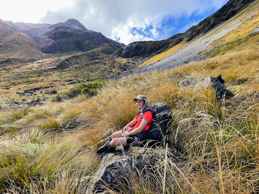
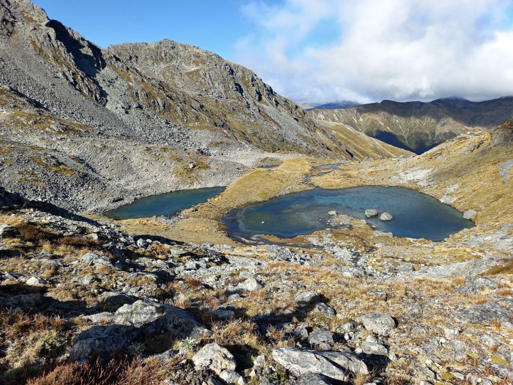
On Saturday morning we had an early start and reached Ada Pass Hut fairly quickly – where we had lunch. We had only stopped on the way for a quick morning tea break at Cannibal Gorge Hut. We stayed dry the whole way and it was even a bit sunny. After lunch, we took a bearing from the hut and bush-bashed through relatively passable bush up to the ridge of the spur that bends round directly in front of the hut. From there, we followed animal tracks on and off up the ridge until we popped out at the bushline (which was at around 1300m). From here, we crossed the basin, dodging (or attempting to dodge) some of the spikiest speargrass I have ever come across, and trying not to fall into too many holes under the tussock. Then it was a zig-zag through bluffs up to the 1600m elevation mark, where we set up camp directly between two tarns.
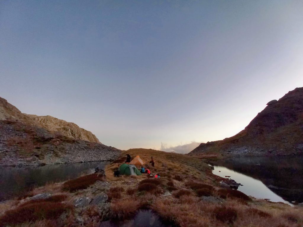
We were careful in our tent placement, anticipating the southerly that was due to come in sometime on Sunday. It was around 4pm, so the climb from the hut had taken approximately 3 hours. Hot drinks and dinner were efficiently prepared, and we discussed plans for our summit attempt over a very practical but tasty alpine meal of tomato pasta. Wanting to give ourselves the best chance of making the summit, while also not getting caught out up high with the windy weather that was due to come in, we made the decision to set alarms for 3:30am, and to be climbing by 4:30am.
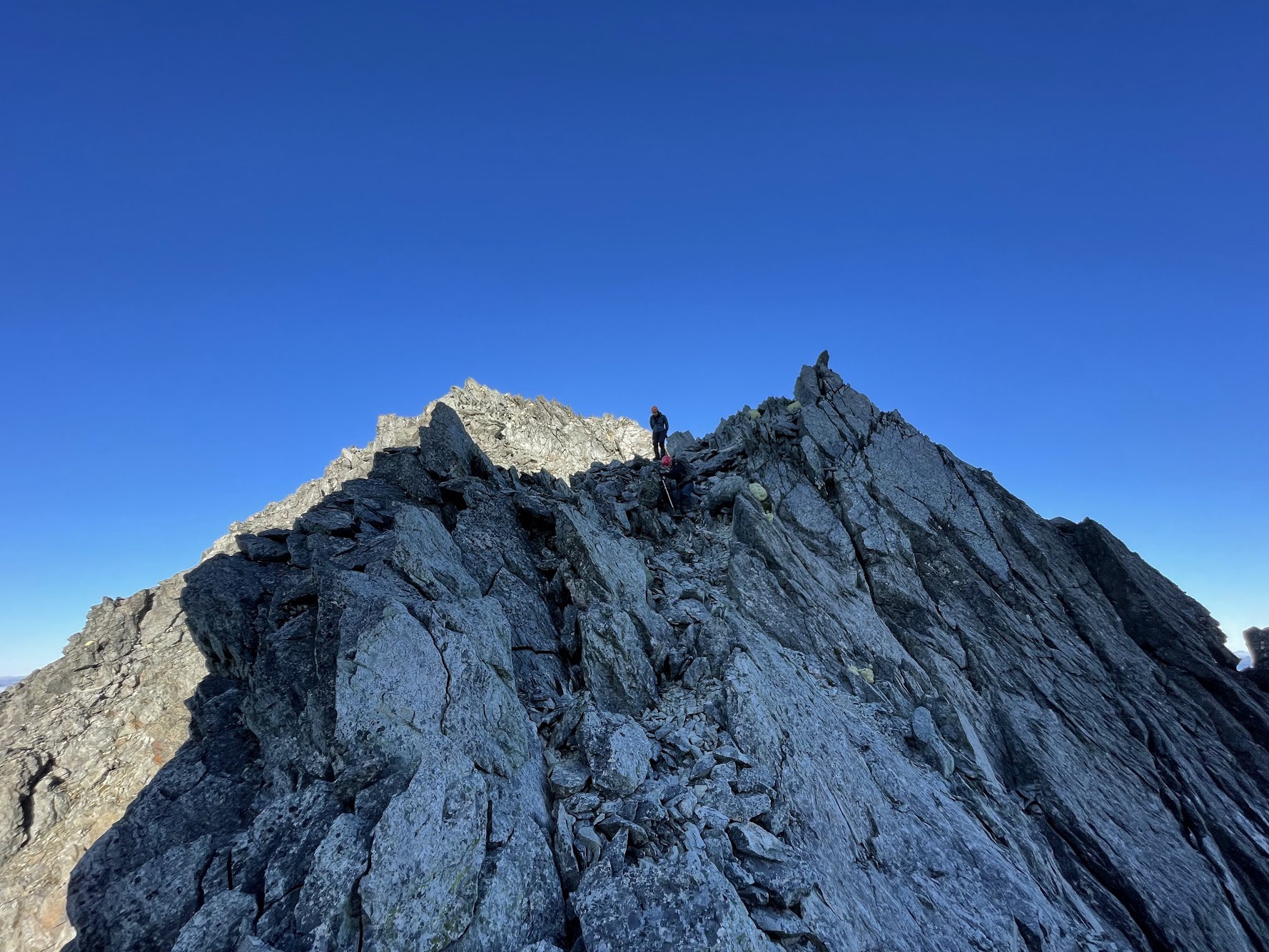
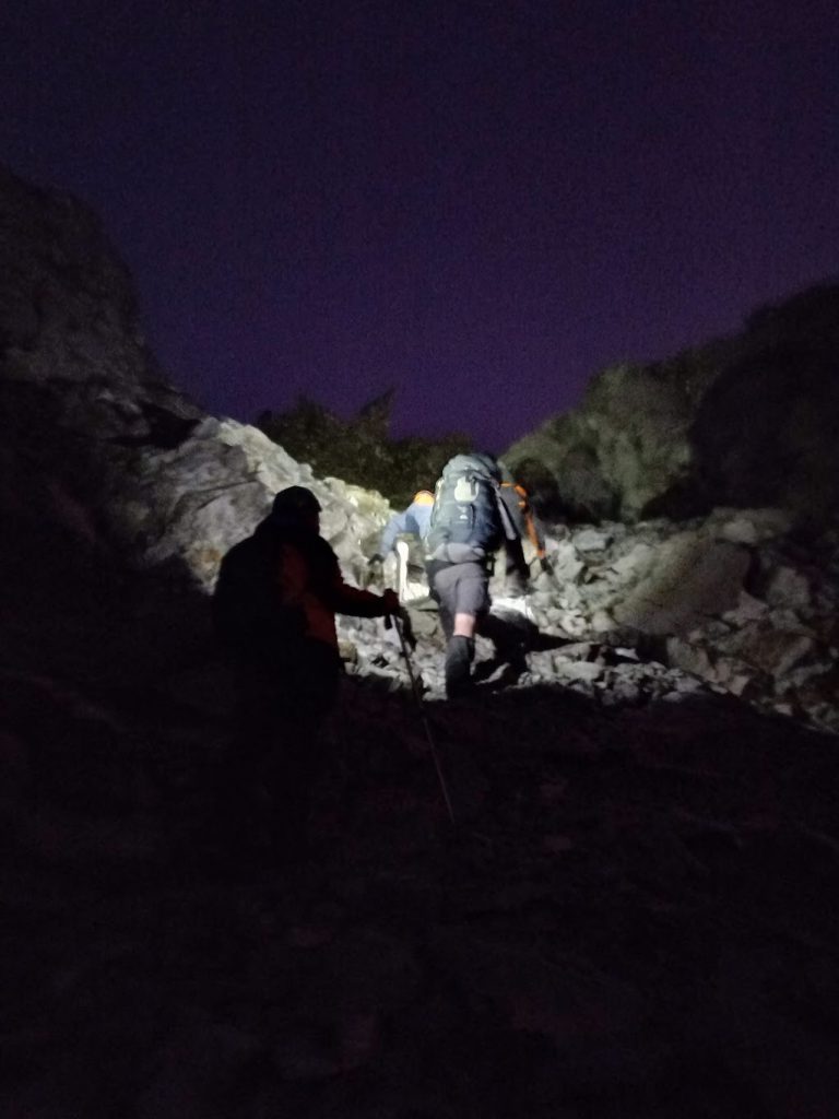
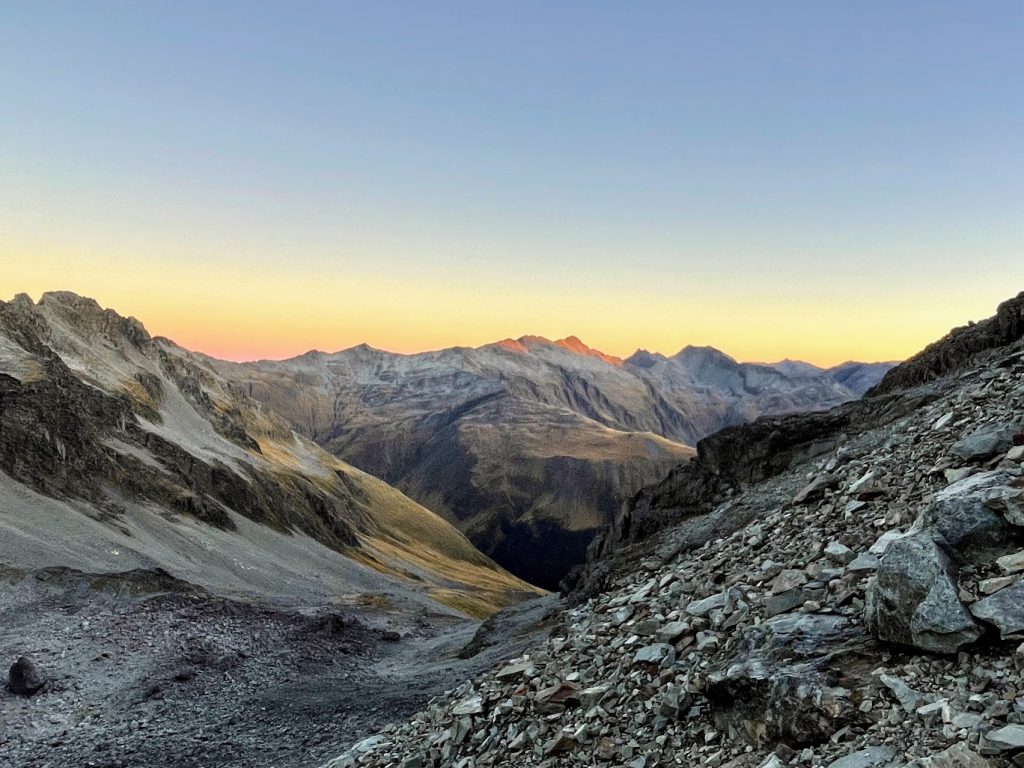
When the alarms went off, I was very prepared to hear a howling gale, and to open the tent door to rain clouds. But no, it was a clear, still and wonderfully beautiful night. Yay! Time to climb! With headtorches on, we made our way up to a large tarn at 1670m, and around to its left, before taking a bearing up to the Col (which was just below 2087m elevation). While it was still dark, we could make out the silhouette of the Col to aim for. It was a 340m climb away, which we covered in about an hour, mostly rock-hopping on slightly wobbly but generally stable terrain. The slope really kicked upwards in the last hundred metres and there was still some snow in the gully – but we were able to avoid (which was good as it was very hard and icy). There was a particularly steep section which Jamie expertly led us through just before we reached the Col at 6:30am. Colour was starting to show in the sky, so it was magical to be so high up in the mountains in still and clear weather as the light changed and gradually revealed our route.
(Editor’s note: Col – the lowest point of a ridge or saddle between two peaks, typically providing a pass from one side of a mountain range to another (Source: Oxford Dictionary https://languages.oup.com/google-dictionary-en/)
From the Col, we descended 120m or so of our well-won altitude, and traversed our way up and across some chunky scree to the flat saddle on the spur to the south-west of Gloriana Peak.
Despite the descending and ascending, this only took us an hour. We were happy to be at a distance of less than 200m vertical to the summit and still at the right side of our turnaround time. Even more of a bonus was there was no sign of the impending southerly change. We climbed on up the steepening scree to the summit ridgeline and enjoyed views in all directions, including down to the tarn and along the Faerie Queene ridge that myself, Caryl and Mike had so enjoyed clambering along on this glorious climb of Faerie Queene https://wtmc.org.nz/uncategorized/faerie-queene-climbing-a-peak-near-lewis-pass/ in February 2021.
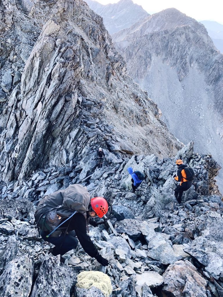
The summit ridge of Gloriana Peak got a bit too scrambly, so we decided not to push it any further – I think we’ll call it a ‘Fairytale climb of Gloriana’! We were mostly pretty satisfied with the conditions we’d been dealt – having almost not even left Wellington. At 8:30am we started our descent, then the impossible-looking, but actually very doable ascent back to the col – where we had a 10am morning tea break and noted a few clouds on the horizon.
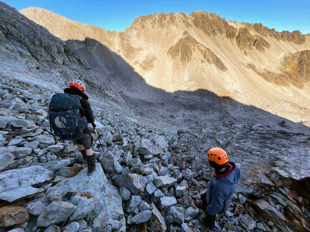
A little bit of bum-sliding ensued to get us all safely down the steepest section just below the Col. It was fun to be now experiencing, in broad daylight, what we’d climbed in the dark. By 11:15am we were back at our tents looking back up at the Col, which now had clouds racing across it. We were feeling pretty chuffed at having timed our adventure perfectly!
After a quick lunch we packed up camp and headed back down to Ada Pass Hut for a well-deserved afternoon nap. We cooked a delicious risotto with a lot of cheese, which Caryl then spent ages scrubbing off the billy (thank you Caryl! And note to self not to use this recipe again unless there are pre-declared over-enthusiastic washer-uppers on the trip!).
It was only Sunday evening. We’d had a great climb, and we still had two days until the ferry home…what to do?!
Nobody fancied a couple of long days of flat-ish track to complete the St James Walkway, so, with snow-dusted peaks above us, we walked back out to the van at Lewis Pass first thing on Monday morning. We drove to Springs Junction to get phone signal, only to call Interislander and discover that there was no chance of an earlier ferry. A pie from the service station was needed for each of us, to help re-set our minds and do some map-searching for a suitable overnight tramp to pass the time. Turns out most huts within a few hours walk of the road end are now bookable, and we ruled quite a few fully-booked options out, along with a few more that people had already been to. We settled on a warm-down trip to Magdalen Hut from Boyle Village at the other end of the St James Walkway. We’d all opted to stay in our tramping clothes until we had a plan, which I think helped our ability to get straight back out tramping again. I would’ve needed another pie if I’d had to pull my clothes out of pack perjury!
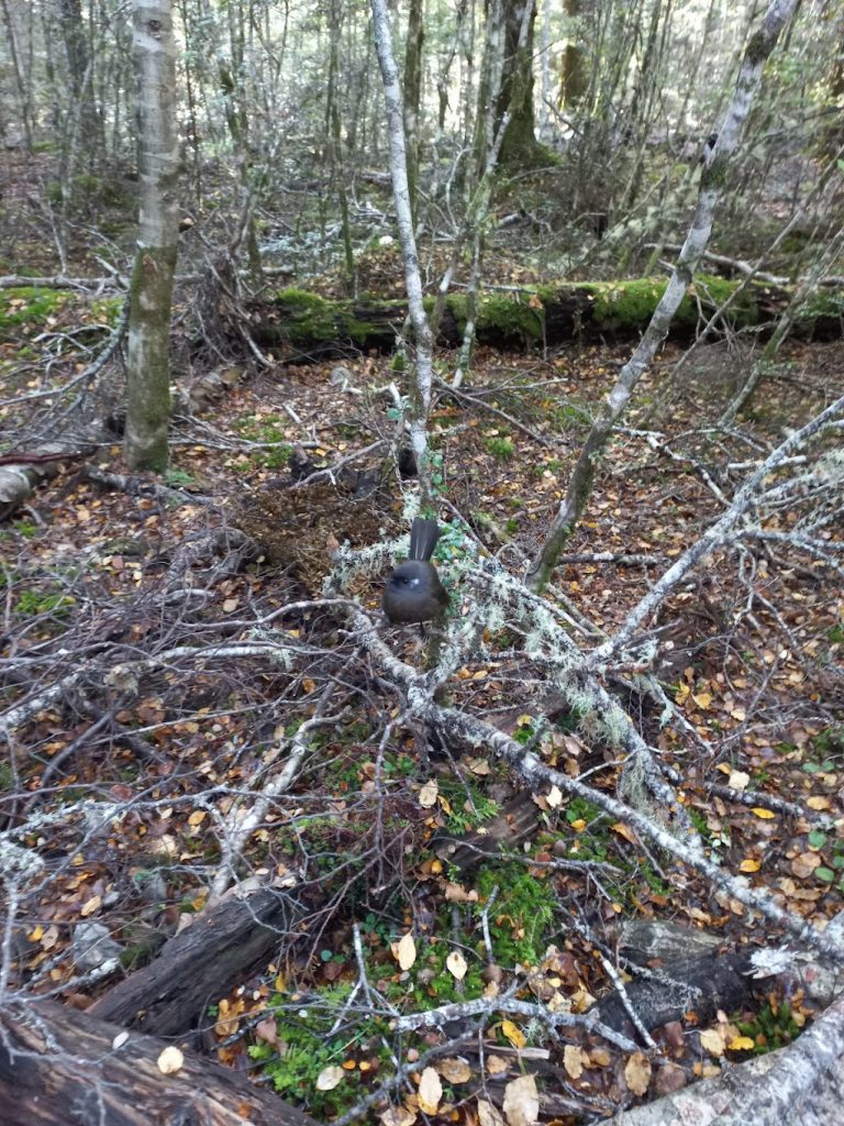
At 1:15pm we left Boyle River carpark for a lovely stroll along the river to Magdalen Hut. It was warm and sunny, with the bad weather having passed through overnight. We spent a bit of time attempting to photograph a black fantail, and more successfully capturing the array of fungi.
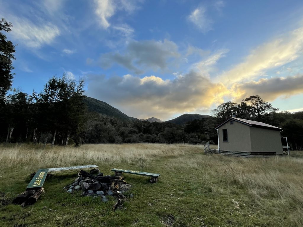
We arrived to a full hut, so camped amongst the trees, avoiding the cow pats.
The walk out the next morning took us a fair bit less time than expected, so about an hour from the road end talk of a visit to the hot pools started. A hot soak, interspersed with cold plunges, and time in the steam room was everything our bodies needed. And would probably benefit our fellow ferry passengers as well – given we would be the cleanest, shiniest trampers ever to return from a four day trip.
Summary:
Sat 22/04
Lewis Pass Shelter to Cannibal Gorge Hut – 2hrs 45mins
Cannibal Gorge Hut to Ada Pass Hut – 1hr
Ada Pass Hut to camp at tarns at 1600m – 3hrs
Sun 23/04
Camp to Col – 2hrs
Col to Gloriana – 2hrs
Gloriana to Col – 1hr 30mins
Col to camp – 1hr 25mins
Camp to Ada Pass Hut – 2hrs 15mins
Mon 24/04
Ada Pass Hut to Lewis Pass Shelter – 3hrs 45mins
Boyle Village to Magdalen Hut – 3hrs 30mins
Tues 25/04
Magdalen Hut to Boyle Village – 3hrs
Hi, I’m Bruce who remembers greatly the time of climbing the summit of the peak– Gloriana, but that was back in the 80s. I was doing a lot of climbing around Reefton as I was DP at the school. Would you be able to tell me the altitude in feet asl of Gloriana? I’m pretty sure that it was higher than Mt St Bathans on the Dunstan range in C.Otago. I am keen to get the record straight of the highest peak in my little world of mtn. climbing. Much obliged if U could reveal the height, please. Blessings, Bruce Tregonning.
Hello Bruce
The height of Gloriana Peak is 7,277 ft.
Mt St Bathans is lower at 6,850 ft.
So well done with Gloriana, topped the 7,000 ft mark.
tonyg