
Mt Richmond is on my aging list of ‘50 Best Tramping Peaks’ from the Wilderness magazine, way back, hence why I suggested it for the WTMC trip schedule. And on this weekend, it did indeed turn out to be a spectacular tramping peak.
There were six of us, plus three from the EM group, on the very quiet ferry across to Picton. The ferry was short on staff so there was no hot food, but at least they had warned us, so everyone could bring their own dinner along. We camped under the trees at Onamalutu Campsite for the night, which turned out to be less chilly than we all thought it would be.
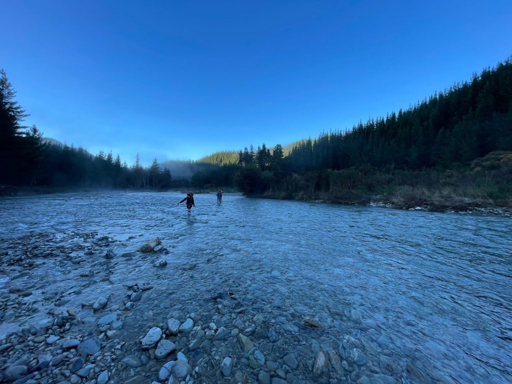
With the van parked up on Top Valley Road, we crossed the river, albeit begrudgingly, getting our feet wet for the first and only time, right at the start of the tramp.
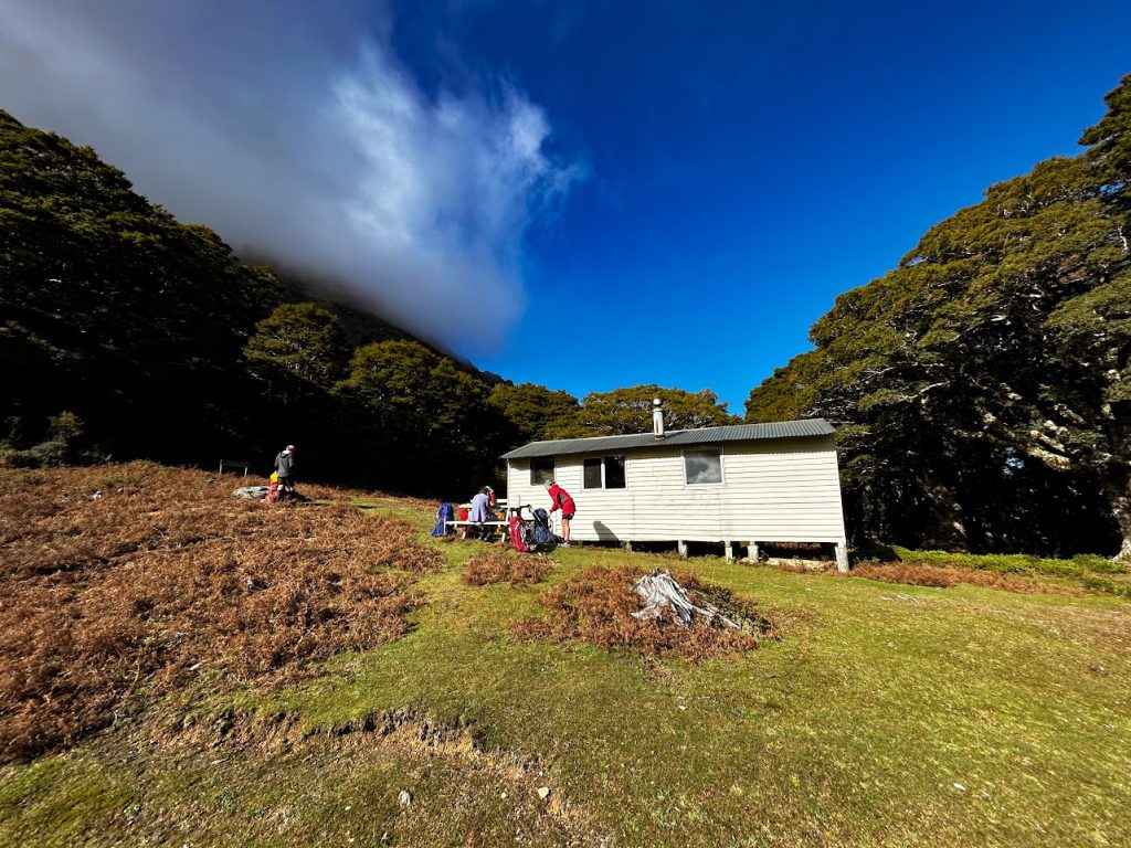
Then it was an hour up the 4WD track to the start of the track proper, where we climbed 700m up the spur, and then sidled across to Richmond Saddle Hut, where we enjoyed lunch in the sunshine.
Lynsey had baked some amazing rocky-road type sugar hit which gave us all a boost for the climb to the summit still to come. A possum crawled out from under the hut in broad daylight – strange behaviour. We did wonder whether the EM group, who would be staying at the hut for the night, would be disturbed by it. But they later reported there had been no sign of it.
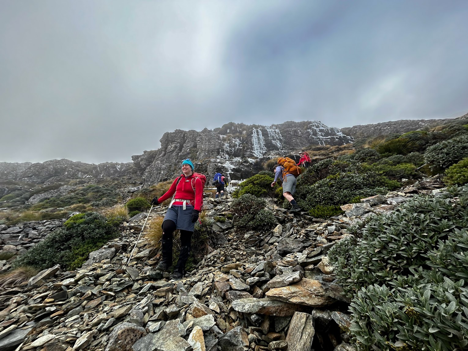
After lunch we climbed a further 500m up chunky scree to the summit of Mt Richmond. On the way, we looked up to see what Sarah interpreted to be penguin guano on the bluffs above – prompting much imaginary hilarity. On further inspection, the whitish flows were frozen waterfalls – probably created during the southerly storm that had hit the ranges the day before. On even closer inspection, the icy floes appeared to be covered in crawling insects – a trick of the water moving slowly underneath them.
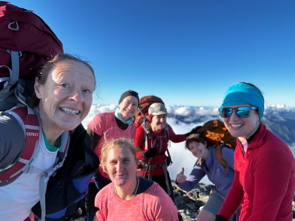
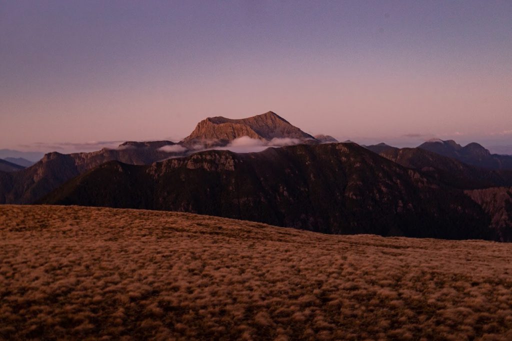
Our climb from the hut to the summit was mostly in cloud, so we had almost given up on any views. But at the top, the cloud was all behind us – with blue skies over the Wairau Valley beneath us.
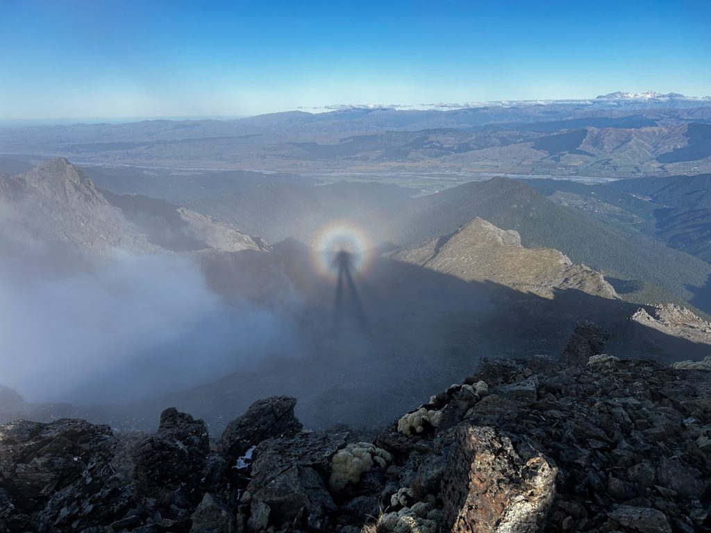
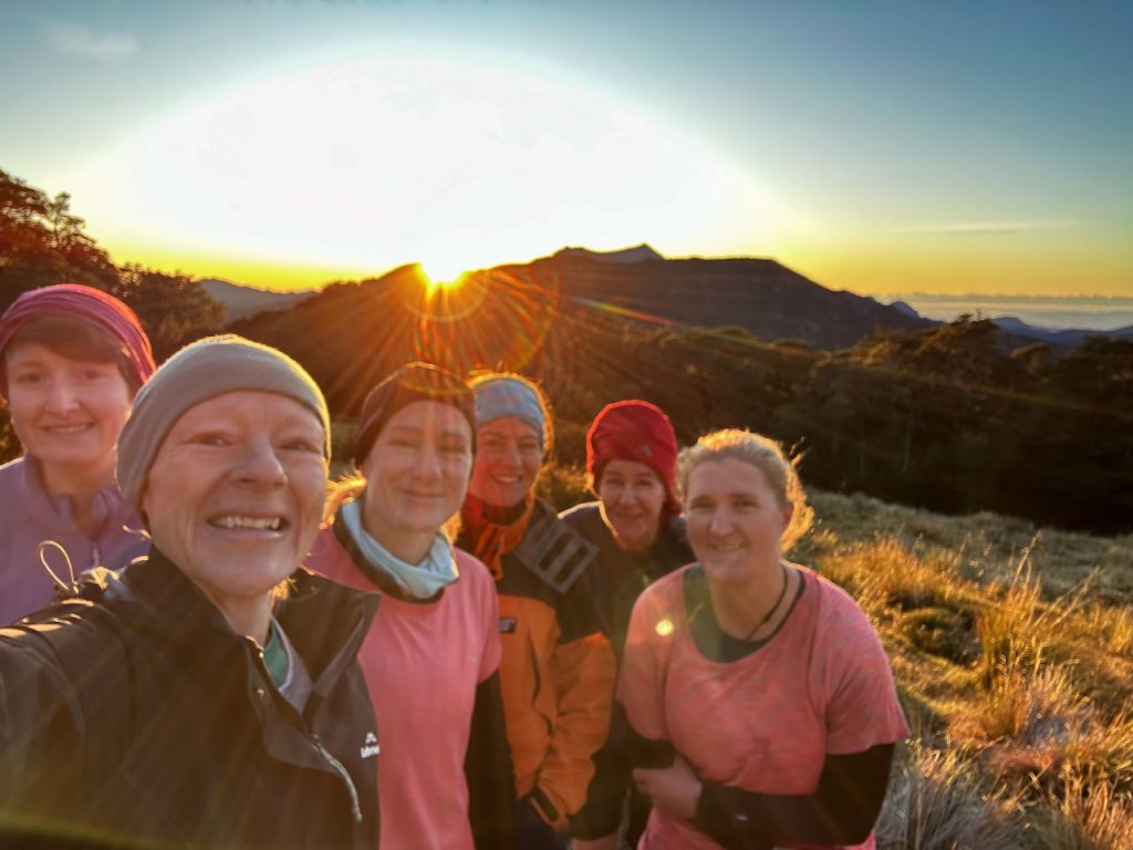
The angle of the sun and the clouds created the necessary conditions for everyone in the group to enjoy a brocken spectre or two.
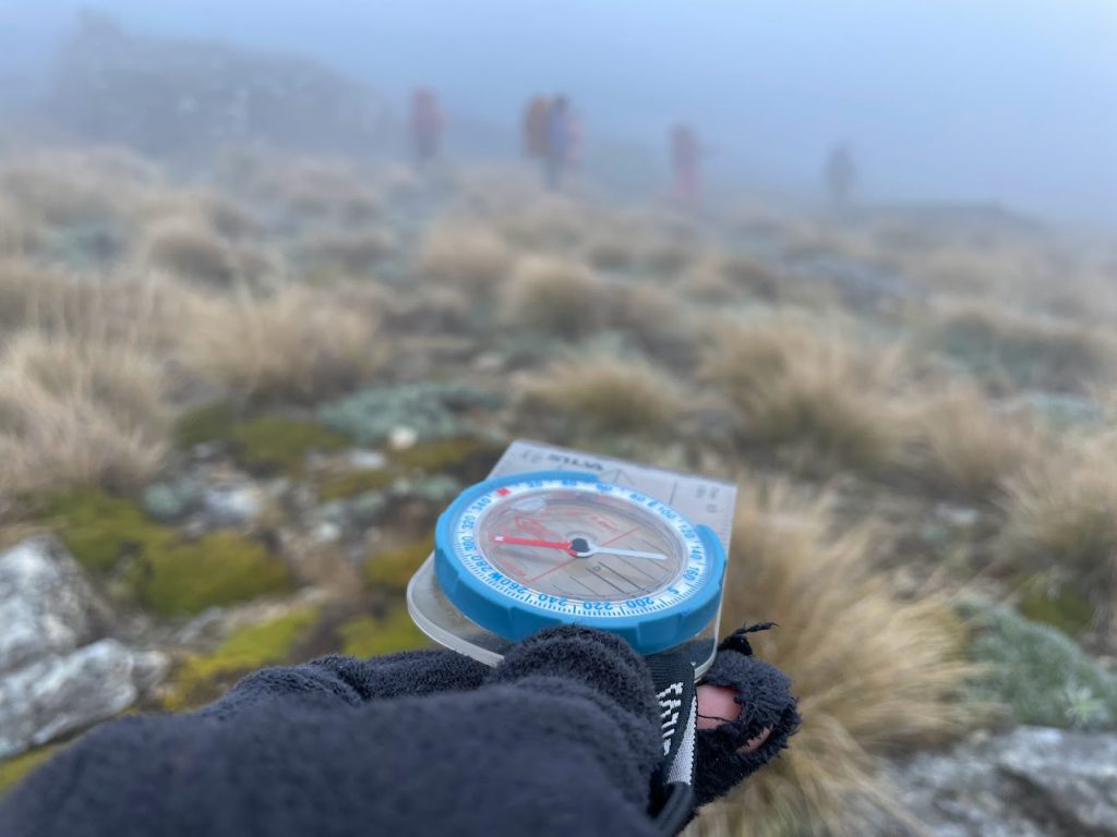
It was already 3:30pm, so we pressed on down from the summit and into the clag. It was thick enough that we had to get the compass out to keep us on track between the warratahs.
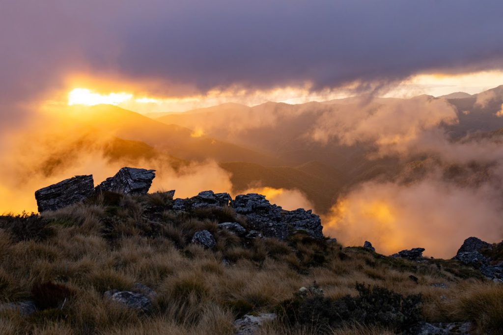
This section was very rocky and quite slow going. But it worked out well as we then found ourselves on the last bit of the ridgeline during golden hour. We all enjoyed a beautiful display of fiery colours as the sun went down, accompanied by an ongoing debate about whether Mt Fishtail actually looks like a fishtail or not.
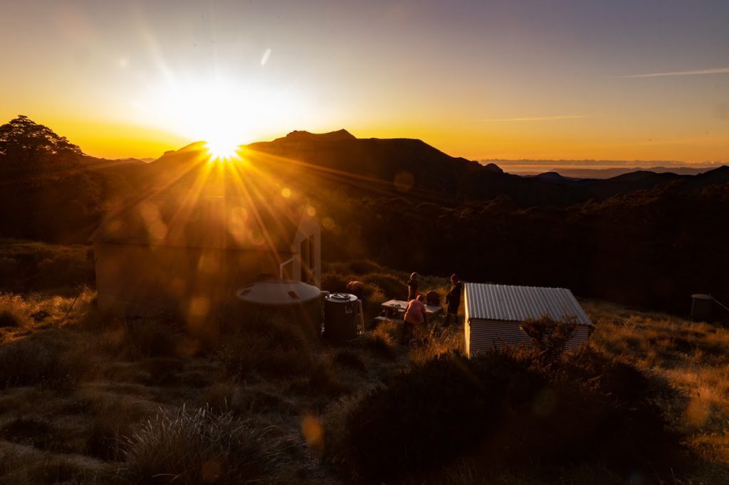
Headtorches came out for the last 20 mins or so down to Mt Fell Hut, where we smelt smoke as we arrived. Luckily for us (and perhaps unfortunate for him) there was just one guy at the hut – who was attempting to start the fire. So all six of us were able to squeeze inside for the night.
A lot of carrots were chopped for the rather spicy chickpea and carrot tagine dinner (maybe tone down the cayenne pepper in that recipe). Over dinner we debated whether to go and look for the plane wreck that was noted at both huts, and we settled on a plan to leave early enough the next day to give us some searching time.
Sunday morning brought a wonderful sunrise to help us out of bed. And we were off by 7:45am on a plane wreck hunt.
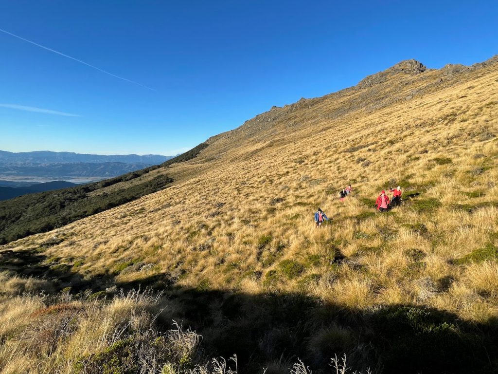
We dropped our packs on the track and scoured the hillside where some instructions appeared to point to plane debris – but we found nothing. It’d be worth doing a dedicated trip to have a more extensive look another time, but we had a ferry to catch, so we had to push on.
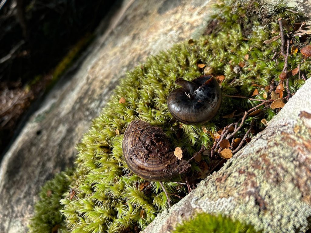
In the hut there had been a few snail shells, which Sarah had found very exciting. And on a short section of the track down to Timms Creek suddenly we all began finding more shells – and some in very good condition. Most of the descent was spent discussing the snails and whether finding lots of empty shells was a good or bad sign. This discussion was a good distraction from the knee-testing 1000m descent that we completed before lunchtime.
At this point, we strategically split the group to make sure that the EM group, potentially already waiting for us at the road end, didn’t start to get worried. Three people pushed ahead at a faster pace, and the other three stuck to a steady medium pace – still arriving at the road end just past the 3pm time we’d arranged to meet.
Other than learning from the Transport Officer that the ferry departure was delayed by 45mins, we had an uneventful drive back to Picton and sail to Wellington. A great little weekend trip to the South Island.
Trip summary:
Sat 13/05/23:
Top Valley Road to Richmond Saddle Hut – 4hrs
Richmond Saddle Hut to Mt Fell Hut – 4hrs
Sun 14/05/23:
Mt Fell Hut to Te Rou Road (incl 1hr plane wreck search) – 7hrs 30 mins