
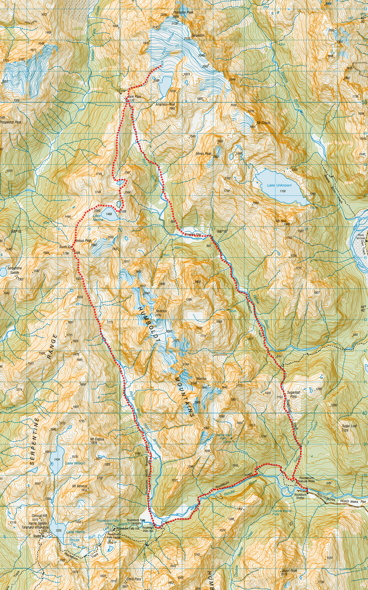
Lake Nerine – Routeburn North Branch and Park Pass
A 3 day hiking loop trip through spectacular mountain scenery of the Humboldt Mountains, Aspiring National Park, New Zealand, from the Routeburn North Branch, to Park Pass and the Rock Burn.
Sidle unpleasantly steep snowgrass and hard earth slopes on the Rockburn side.
Our imaginations run wild with this description from Geoff Spearpoint’s Guide especially after reading a few trip reports where people had written about hanging onto snowgrass with both hands.
Well, it turned out to be nothing traumatic like our minds thought it was going to be, and we found it very easy.
After saying hello to every tramper on the way to Routeburn Flats Hut, I was glad to be leaving the Routeburn Track and heading into the quietness of the Routeburn North Branch.
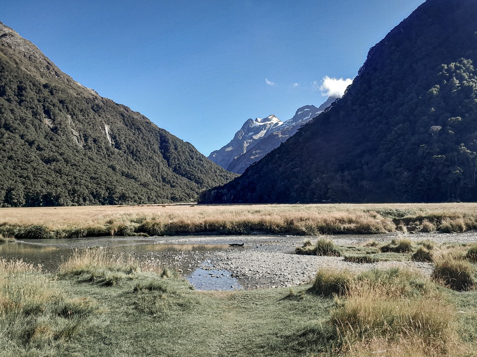
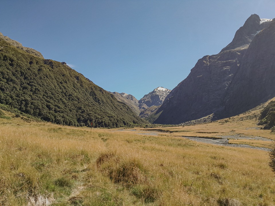
Matt and I headed up the Routeburn North Branch. There is a poled route up the valley and some excellent campsites along the way. We headed through a mixture of grassy flats and lush bush.
Once we hit the end of the track, it was sometimes easier just to walk up the stream to avoid the boulder fields and scrub. At the end of some gravel flats, there was an old mossy rock cairn. We both missed that this was directing us above the stream on the true left and we ended up going straight up the stream, clambering over, around and under big boulders.
It was rather slow going and I had a laugh when a while later we came across a ribbon and cairn at the top of this climb where the bypass foot trail rejoined the stream.
It was good fun though and I actually really enjoyed the problem solving in that section since I was leading up through the boulders and a few times we had to pass packs.
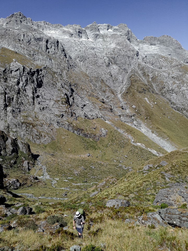
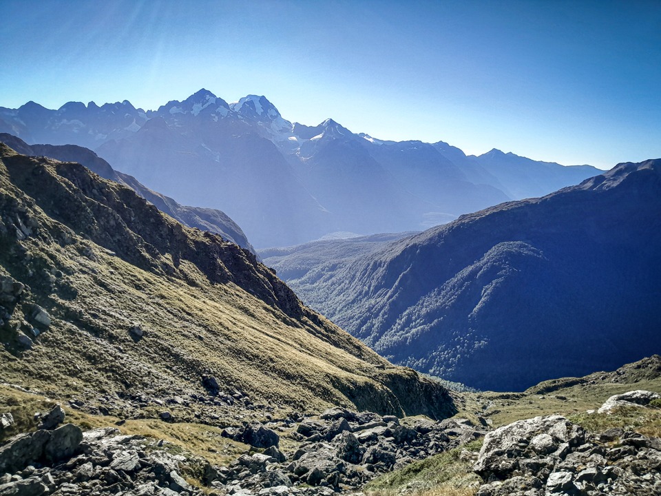
After this the stream opened out again, it was easy going. We eventually came to more rock cairns that marked where we climbed away NW from the stream to head towards North Col. North Col started to loom closer as we climbed and I enjoyed turning around to look back down the valley where we had come.
As we got closer to North Col, the rocks got bigger and moveable so like Gunsight Pass we had to pick our lines carefully and be aware of what each other was doing.
Other trip reports had reported hard snow near North Col over summer in previous years so we had both carried microspikes just in case but there was no snow there for us.
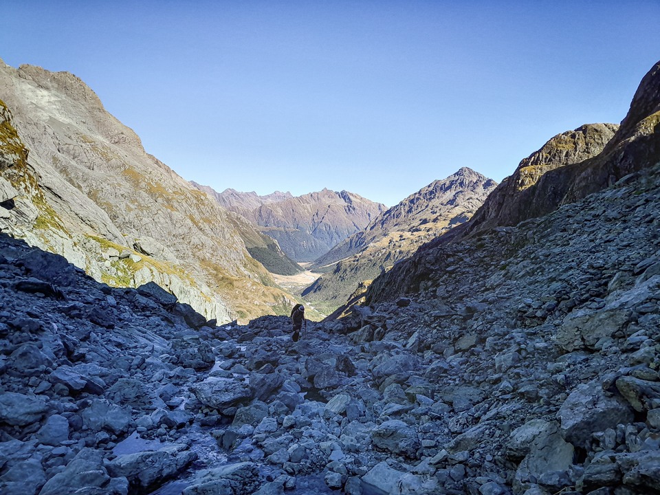
North Col had epic views across to the Hollyford Valley and would be a great place to camp. There are some flat places for a tent and a stream nearby although I suspect it wouldn’t be very sheltered from the wind.
From North Col, the easier way forward is to do a descending sidle to the 1,400m contour where it is less steep. This is where the rock cairns were but you can go up and over apparently.
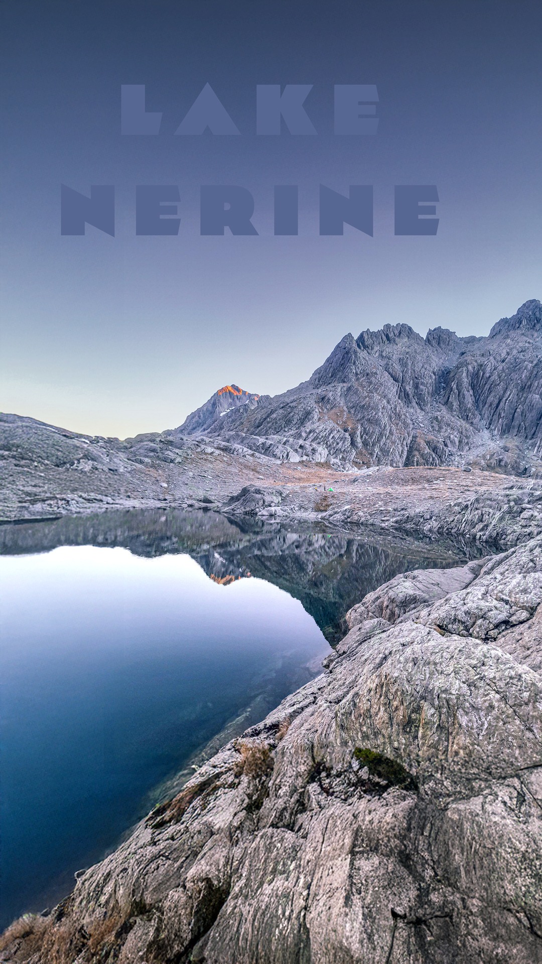
Eventually the rock cairns led us up a short and steep climb where we got our first view of Lake Nerine.
It’s beautiful and much bigger than I thought it was going to be. We saw two blokes camped down near the lake. The footwear of one of them was a single Croc and we realised he must have been the owner of the odd Croc we had come across earlier in the day among the boulders.
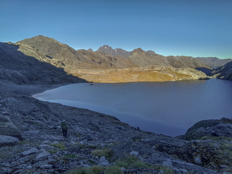
We continued around the lake to the north and found a sheltered spot next to the upper lake.
This appeared to be the perfect spot as we were sheltered from the wind and the lake’s surface was completely flat and offered us some lovely reflections. That night even the stars were reflected on the surface of the water. It was magical.
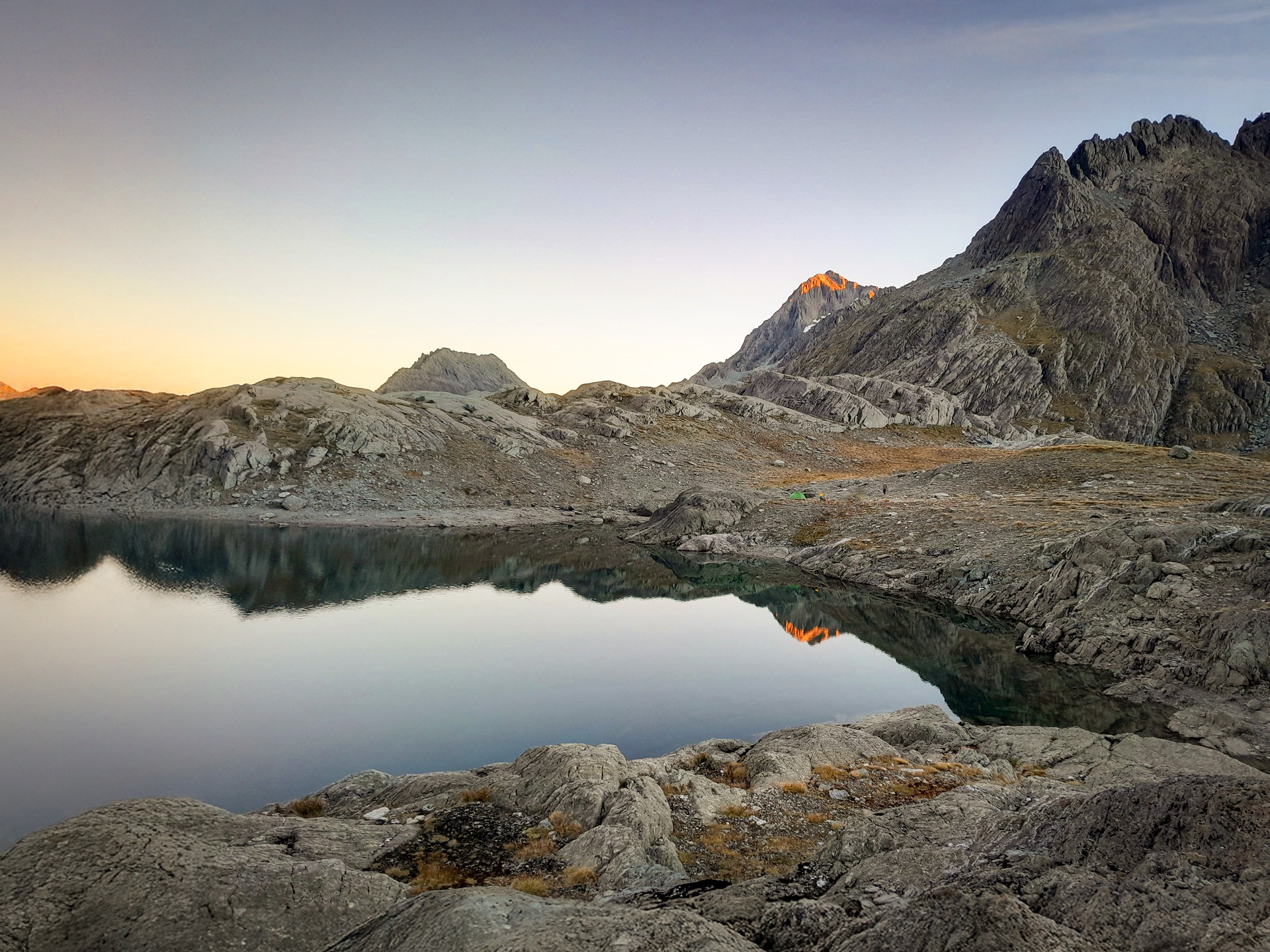
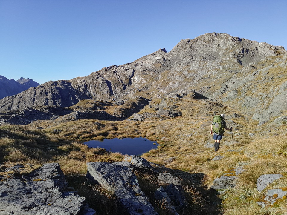
The next morning we climbed up the rock slabs at the north end of this lake. From here we followed north to the tarns between pts 1561 and 1594 (there’s an extra tarn that is not marked on the map).
Again there were cairns to follow that lead you around the head of the stream to get to the snowgrass slopes that were mentioned in Spearpoint’s Guide.
I imagine since the guide was published the loop has increased in popularity so this section is now a lot easier than what it was at the time of writing.
There is a good foot trail on these snowgrass slopes so even though they are high above the Rock Burn Valley and steep, they didn’t feel exposed to us at all and nothing traumatic like what they had sounded.
As always with snowgrass though, you would want to take extreme care in rainy conditions as snow grass can be lethal when wet. The cairns and foot trail lead us all the way to Park Pass.
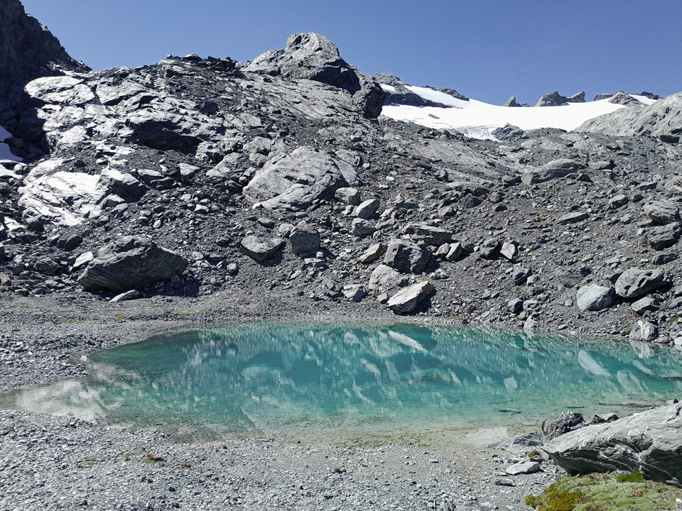
At Park Pass I decided to drop my pack and take a day pack up to the Park Pass Glacier. The glacial lakes up there were a beautiful turquoise colour. The last time I have seen water that colour was on the Annette Plateau in Aoraki NP. There was a faint ground trail and cairns that led the way up to the glacier. I met two trampers heading up there to camp for the night.
Once back down at the pass I made my way to Theatre Flat to meet up with Matt who had gone ahead to have a swim in the river.
The next morning was cold at Theatre Flat and it wasn’t until about 10am that the sun finally hit us as we made our way up the valley towards Sugarloaf Pass.
A highlight was seeing a group of whio in the river – both swimming and then flying back up the river.
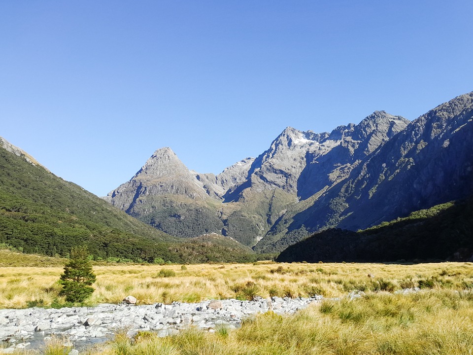
Sugarloaf Pass was a bit boggy like always, before we hit the tree line for an easy descent to the Routeburn Track. Matt and I had fun counting down the trap numbers before we got completely befuddled when they started jumping around in no logical order.
Useful Info:
Day 1: Routeburn Carpark to Lake Nerine via North Col
Time: 9 -10 hours
Elevation: 1,554m
Distance: 21.2km
Day 2: Lake Nerine to Theatre Flat with side trip up to Park Pass Glacier
Time: 7- 8 hours
Elevation: 973m
Distance: 15.8km
Day 3: Theatre Flat to Routeburn Carpark
Time: 5-6 hours
Elevation: 678m
Distance: 12.3km.