
As many a good trip began, our group assembled at Wellington Train Station at 4.30 pm on Friday, along with the group of 3 people who planned to head up Mitre Peak on Saturday. Our plan was to head into Atiwhakatu Hut on Friday night. On Saturday we would make our way onto the tops to hit a few key points – Baldy, South King, Mid King Biv, the Broken Axe Pinnacles and McGregor Biv. On Sunday we would return to the road end via Angle Knob and Jumbo Hut.
Our walk to Atiwhakatu Hut was smooth and we arrived at around 8 pm to a nearly empty hut (note: the water tanks at the hut are very low. But there is plenty of water in the stream). James cooked up his favourite meal (a Backcountry cooked breakfast), while Jess had tea. Bedtime followed not long after – in anticipation of a big day tomorrow.
On Saturday we left the Hut at around 8 am and headed towards Mitre Flats Hut. We took the Baldy turnoff to make our way onto the tops. The weather was looking great for our day of tops travel! We were passed by a stealthy runner just before we got to the bushline. Baldy was a key feature, and was the reason I had planned this trip. I got my baldy on Baldy photo while we stopped for a snack and looked for Josh’s group on Mitre Peak (we didn’t see them).
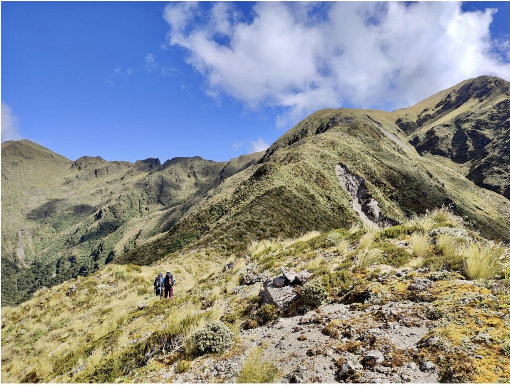
We then climbed to South King and along to Middle King. On our way up we saw two figures meet, chat and then pass each other on the Broken Axe Pinnacles. The descent down to Mid King Biv was steep and overgrown. The footpad was mostly easy to follow, but there was a lot of Leatherwood to push through!
Mid King Biv was our lunch spot. We refilled our water bottles from the stream and checked out the Biv. It was a great spot in the nice weather, but the Biv itself was a bit mouldy. There was a bit of room to set up a couple of tents in front to the Biv.
Backtracking up to Middle King was, as Jess put it afterwards, ‘a good challenge’ (for Jess, all challenges are good). We pushed back through the Leatherwood, regaining 400 m of elevation. It took just as long going up as it had coming down. James wondered whether there would be an easier route from Middle King Biv directly up to South King. If there was, we would potentially be able to skip the Leatherwood and it’d be a gentler climb (look out for a trip to do this if the outcome of James’s research is positive! ).
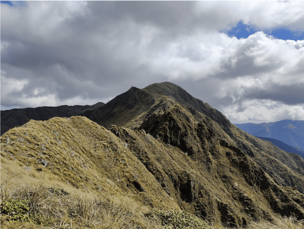
The going was substantially easier from there, as we took off towards the Broken Axe Pinnacles. After a bit of hesitation, we decided to sidle the near vertical face at the start of the Pinnacles. With the good weather and visibility, navigating the Pinnacles was easy going and, other than the one section we sidled, there weren’t any sections that posed a problem.
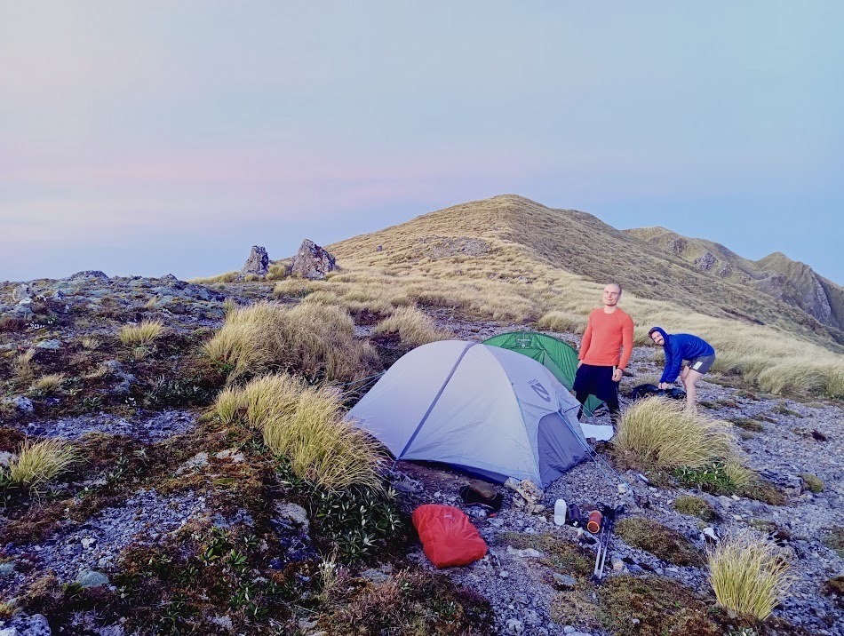
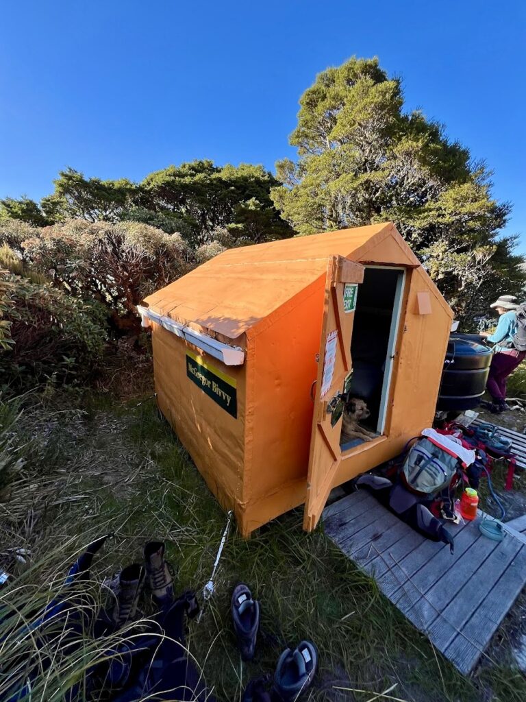
Part way along, we passed two boys who were heading to McGregor Biv as well – they didn’t have tents so we said we would save the Biv for them. We lost the footpad part way up McGregor, so we bashed through some tussock to the top before we found the path again. We saw another group of 3 people heading down to the biv. This would make 8 people trying to stay at the 2 person Biv. We decided to keep an eye out for any good campsites and fortunately found a pre-cleared spot on the ridge between the McGregor Biv turnoff and Angle Knob.
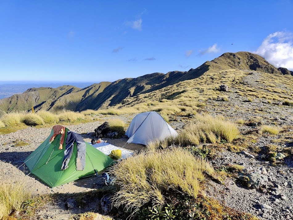
We set up our tents and then Jess and I decided we would take all of our water bottles/bladders to McGregor Biv and refill them, so we would have enough water for dinner and breakfast. It took around 30 minutes to get down the spur to McGregor Biv, which the boys had claimed, and the others camped nearby.
There was room for 2 tents, but no more. I was mildly disappointed that the toilet was not the thunderbox I was hoping for. After a quick chat and with a backpack full of water, we set off back up to our campsite.
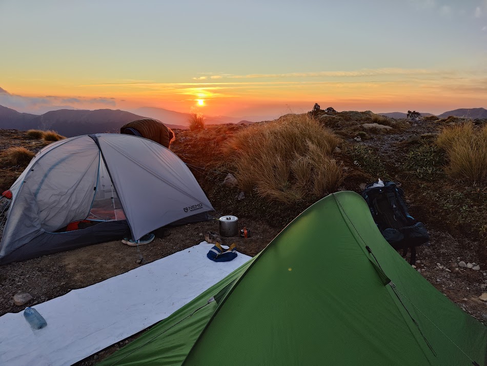
We enjoyed our dinners with an amazing view. Tired after a big day, we all held on until sunset before we crawled into bed. The waiting was definitely worth it, as the sunset was beautiful!
On Sunday we woke up to a beautiful dawn, but unfortunately not to a stunning sunrise. We packed up our tents after a modified breakfast – all of us forgoing coffee and milk products in the hope of delaying our morning ablutions until we reached Jumbo Hut. The walk over Angle Knob and along the ridge to Jumbo Hut was easy going.
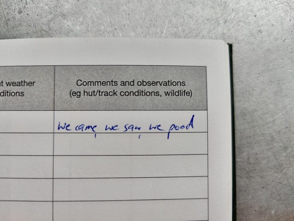
Jumbo Hut was a welcome site. We all made use of the facilities and James’s hut book entry below sums it up perfectly!
We then had our first ‘major’ navigation error of the weekend – as the sign for Raingauge Spur took us 20 meters in the wrong direction. We had to backtrack a little to get back onto the track. James’s memory of the track was not quite as good as he had thought and the old sign we had seen at Jumbo Hut had led us astray. The track is actually very clear – just take the obvious track rather than following the signage placed on the corner of the Jumbo Hut.
Our descent along the spur was smooth and Jess pointed out that going up would be a ‘good challenge’.
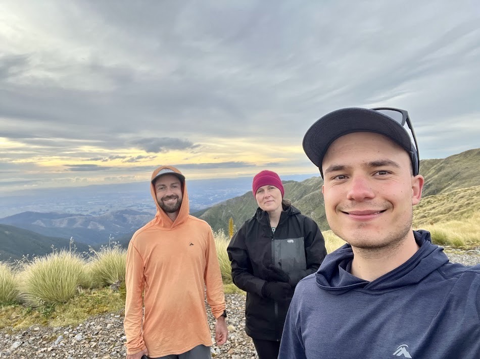
We picked up Jess’s tent and had a brief snack at Atiwhakatu Hut before continuing on to the road end. Josh and the EM group had just arrived when we stepped out of the bush, talk about perfect timing! We enjoyed pies (of course) and other baked goods at Carterton and I had my customary chocolate milk.
Overall we couldn’t have asked for a better weekend in the Tararuas. The tops were stunning, the company was great, we had some ‘good challenges’. And we most definitely caught the Tararua Fever (also the name of a new podcast online – check it out!).
Stats/Times (note that this was a MF group with good weather):
Friday:
Roadend to Atiwhakatu Hut: 1 h 40min
Total Stats: 7.38 km, 272 m gain, 105 m loss
Saturday:
Atiwhakatu Hut to Baldy: 2 h 30 min
Baldy to South King: 50 min
South King to Mid King Biv: 1 h 20 min
Mid King Biv to Middle King: 1 h
Middle King to McGregor Highpoint: 1 h 40 min
McGregor to McGregor Biv junction/campsite: 15 min
McGregor Biv Junction to McGregor Biv: 30 min
McGregor Biv to McGregor Biv Junction: 40 min
Total Stats: 13.36 km, 1859 m gain, 886 m loss (excluding trip to McGregor Biv)
Sunday:
Campsite to Jumbo Hut: 1 h 15 min
Jumbo Hut to Atiwhakatu Hut (via Raingauge Spur): 1 h 15 min
Atiwhakatu Hut to road end: 2 h
Total Stats: 13.08 km, 285 m gain, 1423 m loss