
Friday
This trip was all about the pizza. The plane wreck as well, but mostly the pizza. The pizza can be found at the secret Mill Bakery, just near Holdsworth Road End on Friday nights. We’d pre-ordered bases and had a table for 7pm. The traffic up the Hutt Valley on SH2 was crawling even more than a normal Friday evening and we started nervously looking at our watches. We put in a phone call to secure our pizzas and then all relaxed for the rest of the journey as the traffic eased.
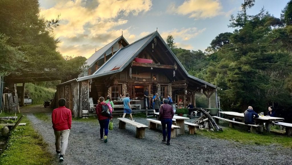
Within minutes of arriving at The Mill Bakery, we’d put in our orders, all ready for our dinner by then. The pizza did not disappoint. I can recommend the Spicy one and the Blue Cheese one. Only a couple in the group resisted eating their whole pizza and stashed some away for Saturday’s breakfast.
By 9:15pm we were leaving Holdsworth carpark, headed into Atiwhakatu Hut for the night, which took us 1hr 45mins. With only one other party already there, we managed to sneak in quietly without disturbing them. I imagine quite a few people had been put off by the multiple emails from DoC to those with hut bookings, warning that they couldn’t be sure of track conditions after Cyclone Gabrielle. As it was, the track and bush were very damp, but no tree fall or slips of note.
Saturday
Pizza excitement gone, this trip was now all about the plane wreck. The wreck is marked on the map just under Shingle Slip Knob and is well worth a look. I have seen it many times shining in the sun when tramping between Powell and Jumbo Huts, but this was the first time I was going to see it up close.
We left Atiwhakatu Hut at 8am, and climbed the Rain Gauge Spur track to Jumbo Hut, arriving at 9:45am. Here we had a short break to off-load overnight gear, as we’d be back at the hut later that day and had bunks booked for the night.
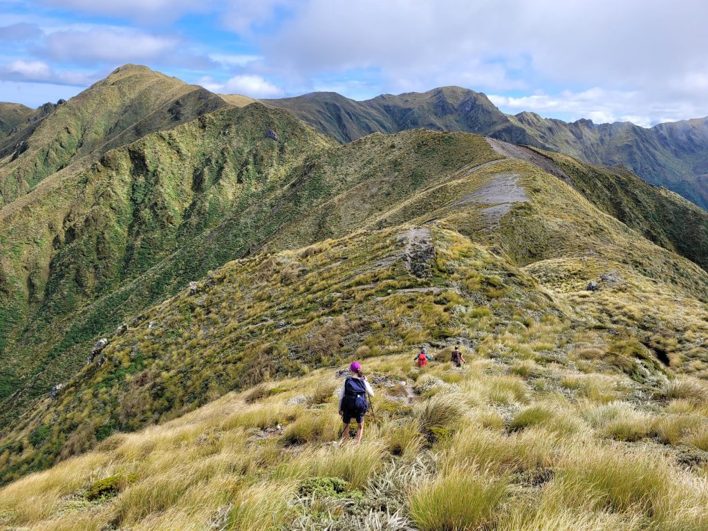
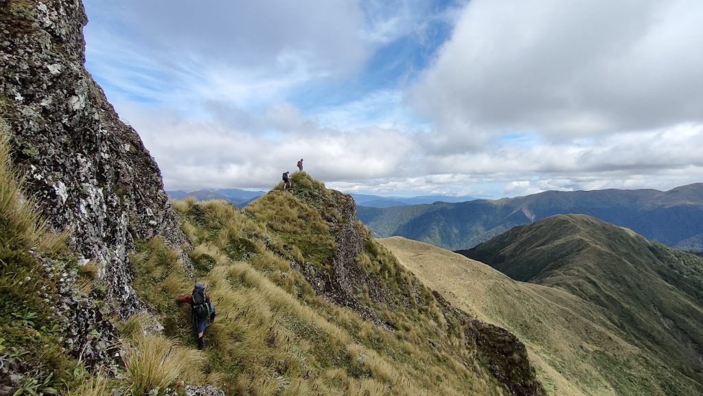
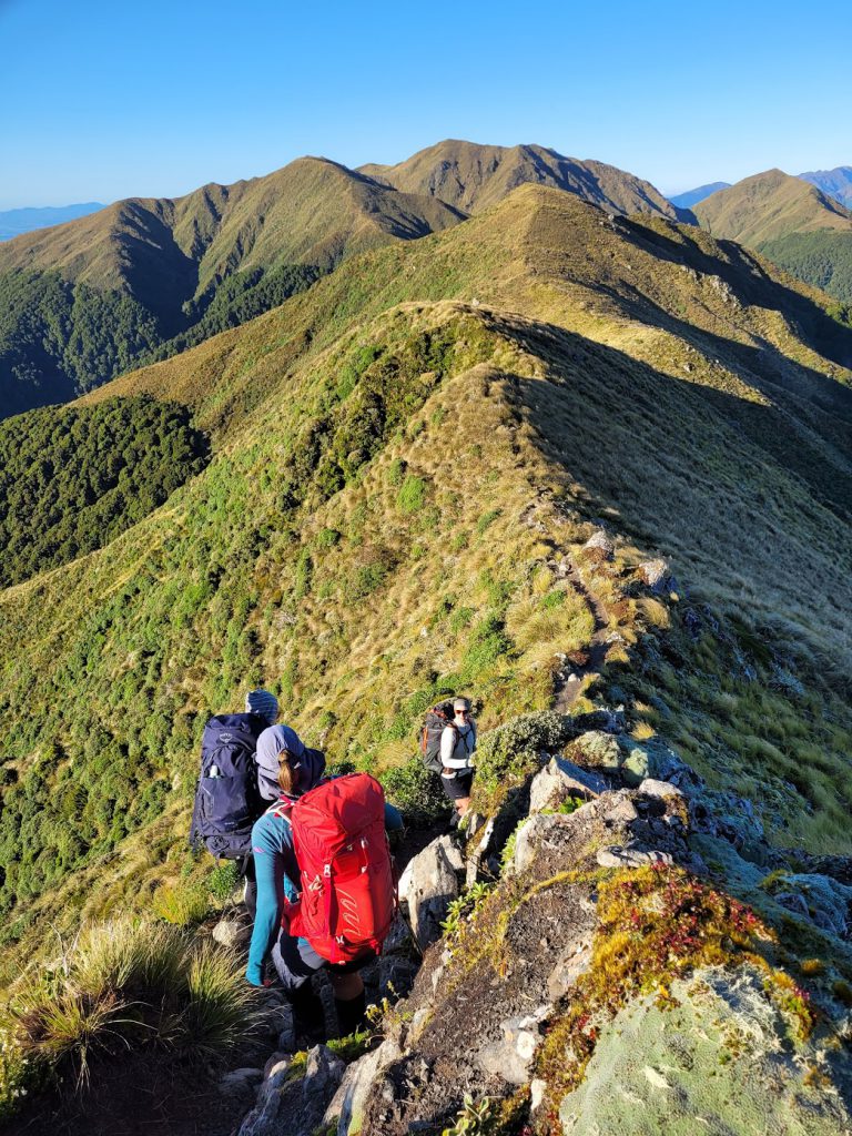
We left Jumbo Hut at 10:20am, and made quick progress to Angle Knob along the well-worn footpath. We had great visibility, so it was easy to see where we were heading. The tricky bit was working our way down and around the rather spiny rock at the top of the spur. Descriptions from previous club trips came in handy and with just a little bit of scouting, we managed to identify the small tongue of scree that we needed to descend on the right (north-eastern) side of the spur – in order to make our way round, avoiding the rather exposed ridge line. It took a bit of concentrated footwork and some good tussock holds, but soon we were safely on the gentler part of the spur, with an open route to the wreck.
We stopped for lunch just beyond Point 1412 and enjoyed good views in all directions. It was fun to spot Dorset Ridge Hut as well as Nichols Hut and point out how everything fits together with the different trips we’d been on.
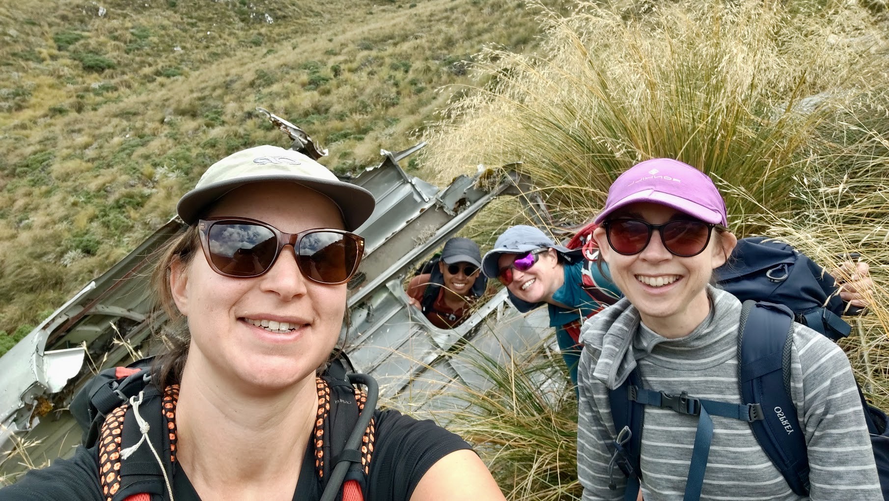
From our lunch spot, travel was through tussock, often with a ground trail, until Shingle Slip Knob at Point 1438. Here we stopped to look down and very soon spotted an unnatural-looking shape that we all agreed was very likely the plane wreck we had come looking for. Within 15 mins we’d all made our way down the steep slope to the wreck, and we spent quite a while manoeuvring ourselves around it to explore the different sections. It’s still very recognisable as a plane, and in some places the wings appear to now be knitted to the slope with tussock. It’s been there since 1955, so plenty of time for nature to grow around it. We think it was previously described as a shelter on some maps, but we all agreed it wouldn’t be a very comfortable one, not least because you’d likely spend some of any time spent sheltering wondering when the whole thing would slide off further down the hill.
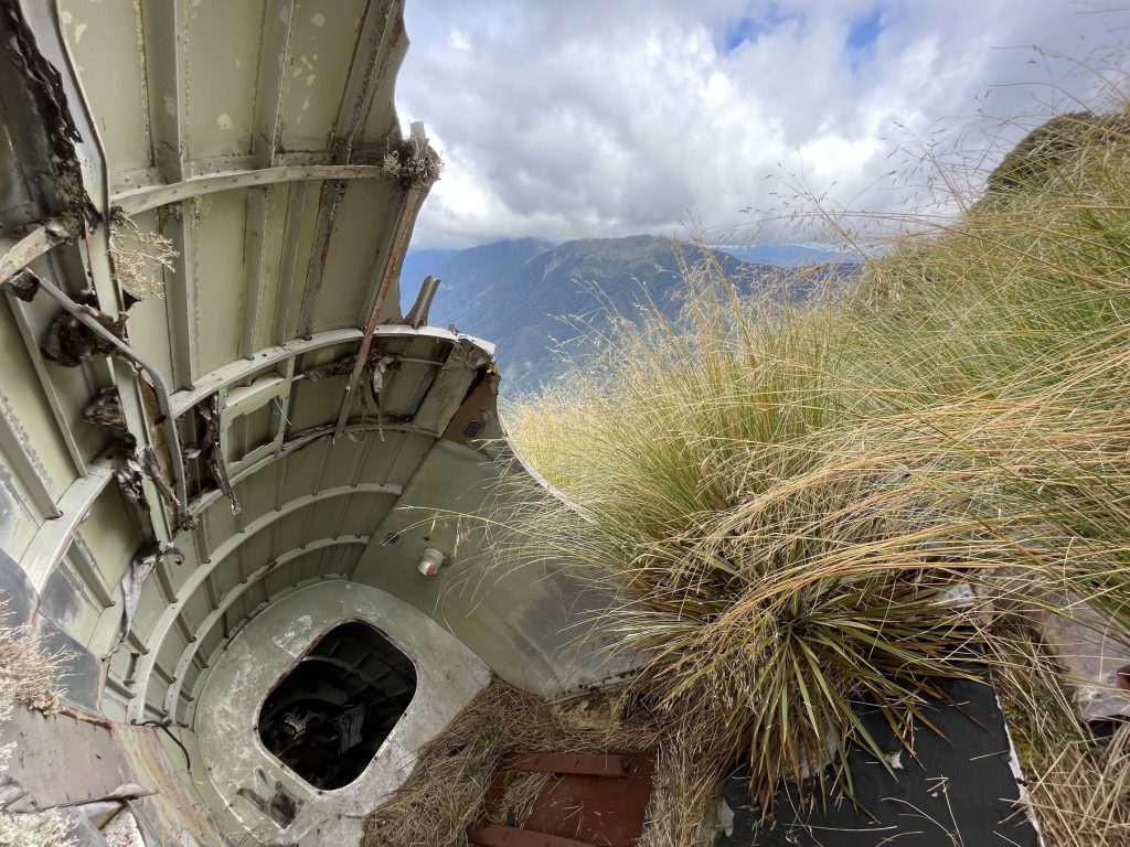
After fully exploring the wreck, we climbed back to the main ridge to find the two memorial crosses for the two men who died in the crash. There is a bit more information here https://www.baaa-acro.com/crash/crash-de-havilland-dh104-devon-mt-shingle-slip-knob-2-killed
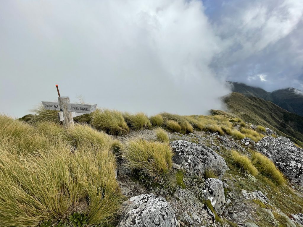
We paused for a snack, enjoying the afternoon sunshine and not really wanting to have to climb back up to Angle Knob just yet. We had great views across to Kapiti Island, and Mt Holdsworth was ducking in and out of cloud. The walk back to Jumbo Hut was uneventful – we found our way back to the scree section below Angle Knob without difficulty and enjoyed the phenomenon of walking along a ridge with cloud banked up on one side, and sunny and clear on the other. At Pukeahurangi/Jumbo, we stopped for another snack and spied a large group of trampers heading towards us from Mt Holdsworth. We were at Jumbo Hut less than 30 mins later.
The evening was spent cooking and eating a delicious one-pot pasta dish with spinach, while chatting to the other hut occupants. Of course, between the four different parties there were some connections – everyone in the hills knows everyone else somehow! Trampers bed time was respected and all was quiet before 9pm.
Sunday
We ate breakfast in the warm morning light, wondering what the wind would be like on the tops, given it had clearly got up a bit overnight. Not enough to stop us heading back up to Pukeahurang/Jumbo to see what it was like though, which we did at 8am. The wind was noticeable but fine to walk in for the 2-3hrs it took us to make our way over to Powell Hut (it was forecast to be 45km/h). It was getting stronger though, so we were glad to be out of it and on our way into the bush by 10:30am-ish. It was a step-hop and a roll down to Mountain House Shelter, where we discussed whether it was still too early for lunch. We agreed it was, so spent a few minutes giving the shelter a quick sweep instead, and picked up the bits of rubbish that inevitably end up in the sweepings. WTMC built Mountain House Shelter way back, and we have an agreement with DoC to help maintain it.

Lunchtime was declared as we arrived at the Rocky Lookout, a great spot to view the ridgelines we’d made our way over during the morning. We lunched with the many day walkers at the Lookout – it was really warming up by then and a few of us were starting to think about a swim. Just opposite the Lodge we found the perfect pool for a post-tramp refreshing dip. Not only did we end this great summer tramp with a swim, but we also stopped for a real fruit ice-cream on the way home, rubber-stamping the gourmet status of the trip!
Approximate times (including plenty of breaks)
Friday
To Atiwhakatu Hut: 1h 45
Saturday (10h)
To Jumbo Hut: under 2h
30min break at the hut
To plane wreck via Angle Knob: 4h (including lunch)
30min break/ investigating the plane wreck
Back to Jumbo Hut the same way: 3h
Sunday (6h)
Jumbo Hut to Mt Holdsworth: 2h
To Mountain House shelter via Powell: 1h 30
To road end: 2h 30 (including lunch)