
Arcus Dam – a pleasant day walk to the lake that’s almost in Tararua Forest Park
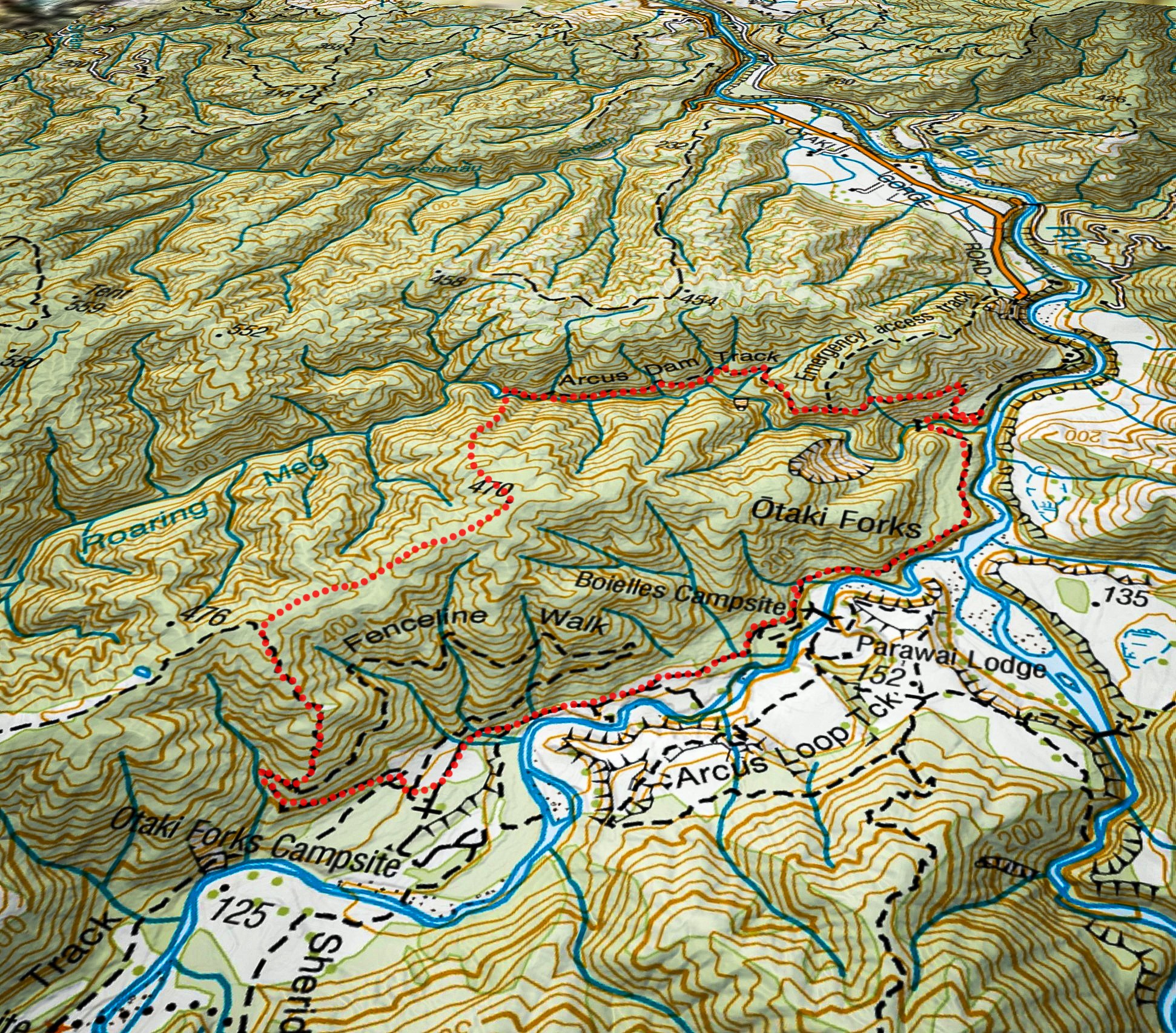
An easy hike to a lake created by the Arcus Dam followed by some more difficult off-track walking connecting to tracks at Otaki Forks, including a route map.
There are many tarns on the ridge tops of the Tararua Forest Park—some are quite large such as that on Dorset Ridge, and some very small like the one on the summit of Mt Hector. But there is only one natural lake—the pretty pond in the bush near Roaring Stag Hut known as Hapua Korari (refer WTMC 2016 Journal),
However, there is one hydro-lake—the Mangahao No 1 Reservoir just inside the park boundary, plus another abandoned hydro-lake—the Arcus Dam—just outside the boundary.
In the 1990s Charles Arcus and his business partner built an earth dam and natural rock spillway in Roaring Meg (aka Pukeatua Stream) near Ōtaki Forks just outside the Tararua Forest Park boundary. The dam formed a lake that was to store water for a small 1.5 MW hydro power plant.
They were to build the powerhouse for the scheme near the junction of Roaring Meg and the Ōtaki River, but a large slip and flood destroyed the building before it could be completed, and the project was abandoned. All that remains today is the spillway and lake.
Megan wanted to visit the lake so organised a day walk, including getting permission from the landowners. Then she injured herself and couldn’t go. Feeling sympathetic but undeterred the two of us went anyway.
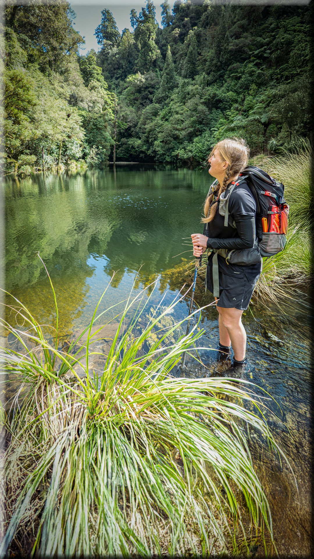
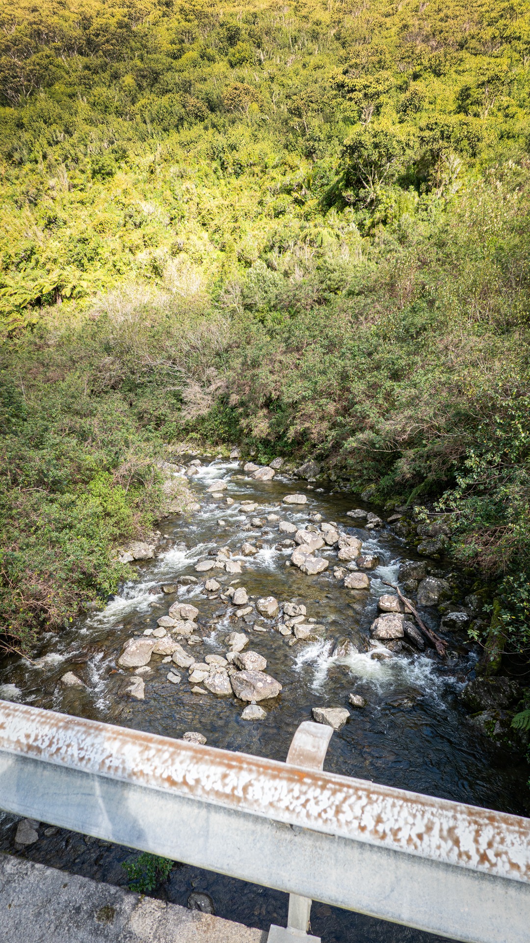
We left the car at Ōtaki Forks and walked the short distance to Roaring Meg. Then it was a very easy wander along the track to the dam—which had an impressive amount of water flowing over the spillway from the recent heavy rain.
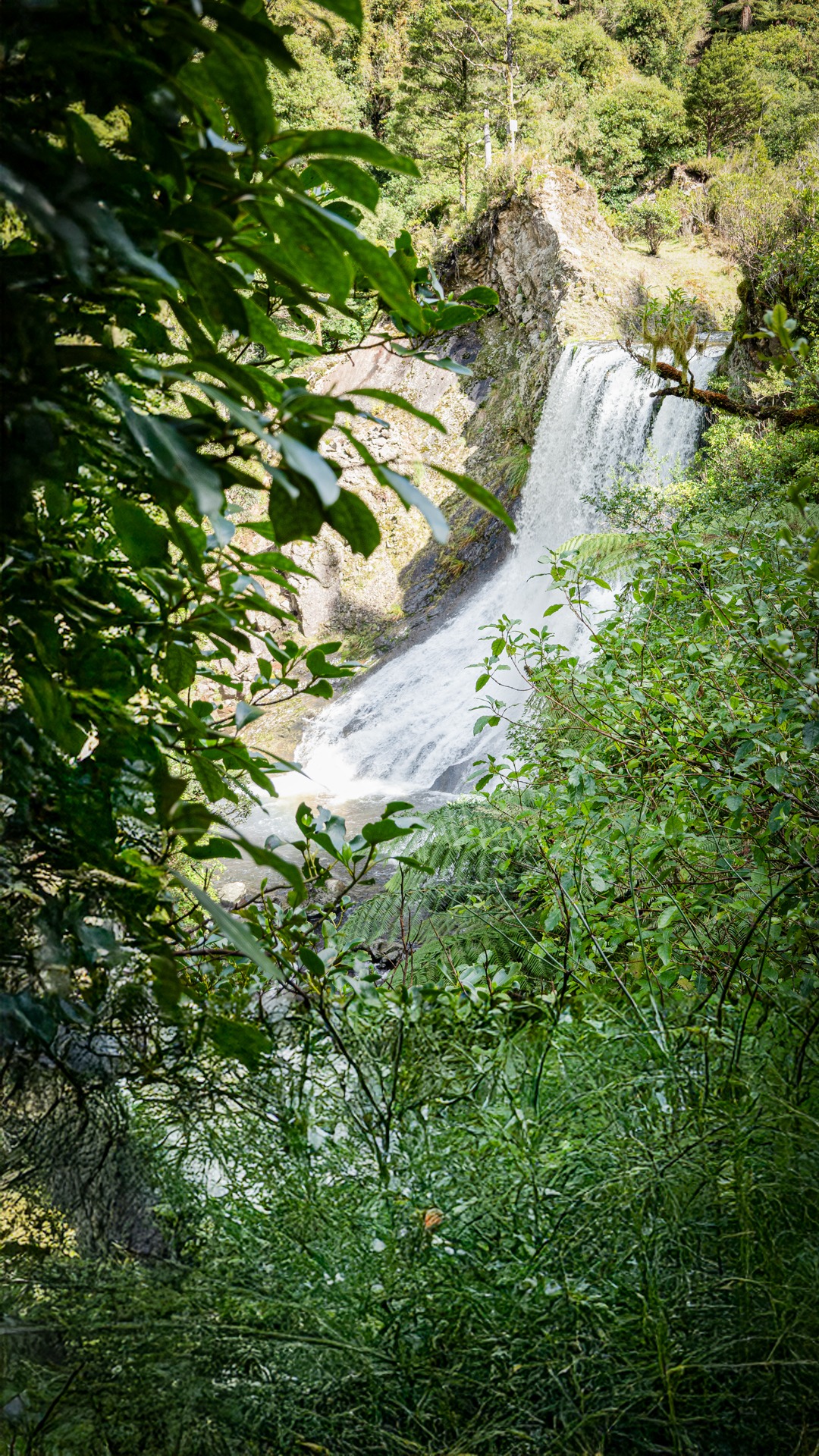
We crossed the stream below the lake mindful that a slip could mean being washed over the spillway with certainly unhealthy consequences.
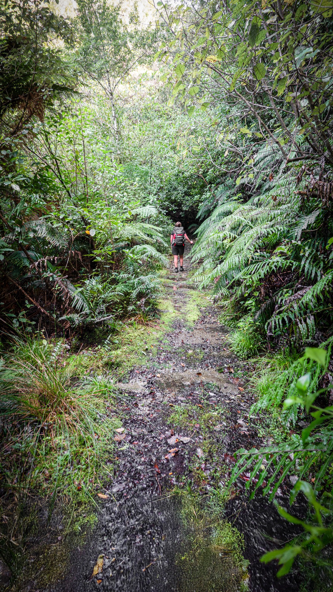
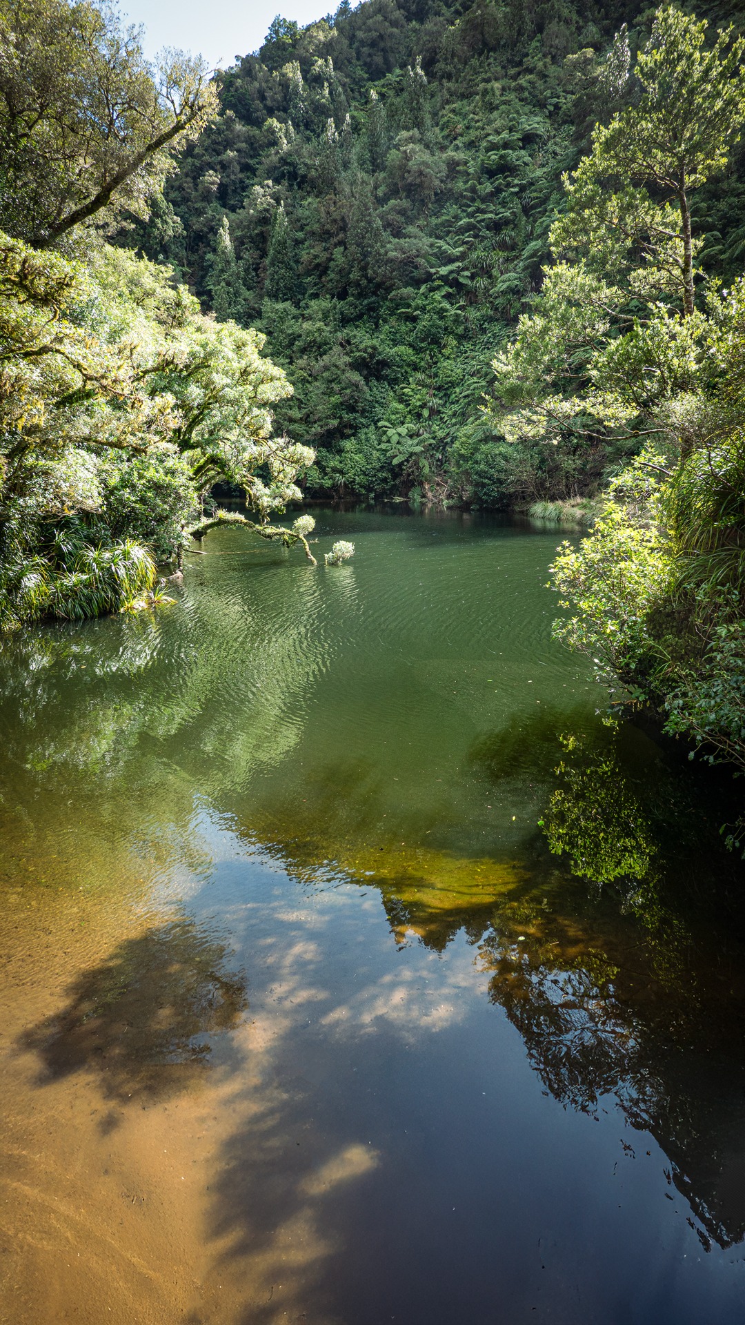
We enjoyed some time in the warm sunshine on a grassy ledge above the lake before heading up a spur with plentiful supplejack directly to Pt 470.
At the summit we were surprised to be met with a mazelike array of orange tape and metal reflective markers.
Someone had decorated seemingly every second tree with either one or often both. Some markers were clearly heading in the direction we wanted to go—towards Pt 476—so off we went staggered by whoever’s enthusiasm for trail marking.
Then after about 15 minutes the markers just stopped—had the taggers run out of tape or energy we wondered. But actually, it was pleasant to be free from the OTT markers and just make our own way along the ridge to the Pukeatua Track then down to the Ōtaki Road and the short walk back to the car.
A nice short and fairly easy day loop trip of about 5 hours to a pretty lake in an historically interesting area of the (mostly) Tararua Forest Park.