

Thursday 6th Feb
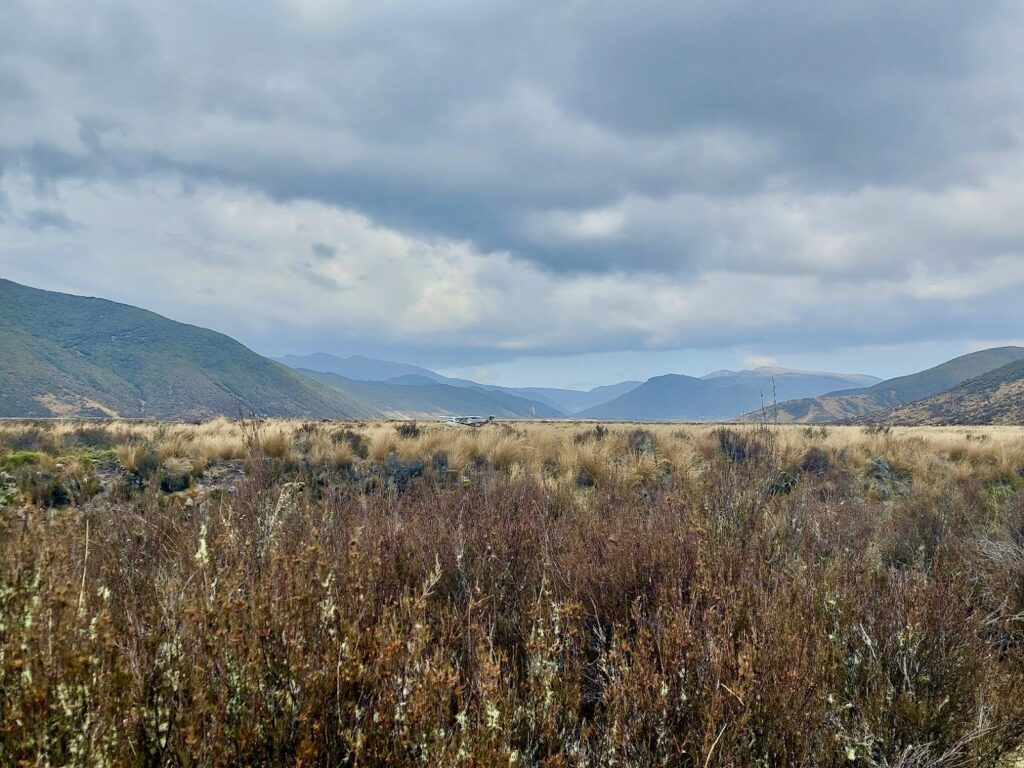
Making the most of a 4-day weekend, we set off early from Wellington and enjoyed a scenic drive up to Helisika (Poronui Station) on Taharua Rd, off SH5. This location is in Hawke’s Bay, near Taupo. With the Desert Road closed for maintenance, we made detoured through Tongariro National Park and enjoyed the opportunity to view the Central Plateau from the western side along quiet roads.
I was lured briefly off-course by the orange glow of Popeyes (a Louisianna Fried Chicken fast food restaurant) near the SH1/SH5 junction in Taupo.
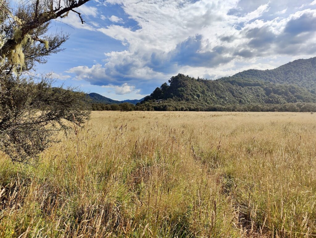
We reached the Taharua Road end at around 2 pm and set off for Oamaru Hut via the Poronui access route. This route is well-travelled and passes through Poronui Station (which is privately owned land). While at 12.8 km it may seem long for an access route into public land, it is flat and allows for quick travel (2 h 40 min at a speedy pace). Our sense of urgency to reach the hut was stoked by our desire to grab a bed ahead of the large groups we passed on the way in – fishermen, pack rafters, trampers and hunters – and the possibility of a swim in the Oamaru River on what was a hot day with little tree cover.
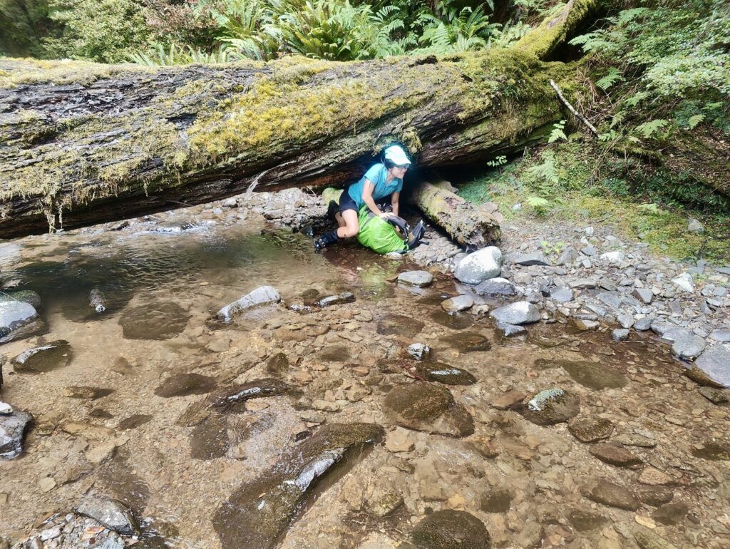
Shortly before reaching Oamaru Hut, you need to cross the Oamaru River. This didn’t pose any issues as there was low water flow. The track here has been re-routed in recent years and was fairly obvious on our way in to the Hut, but was slightly less obvious on our return to the road end.
Te Iringa Track offers alternative access to Oamaru Hut (a 6 – 8 hour walk) from Clements Mill Rd in the north. This track was cleared of tree fall after Cyclone Gabrielle by volunteers from the Backcountry Trust. However one tramper we met suggested slips along the track meant the route was still fairly challenging to follow at times.
That night we were fortunate to have one of the two bunk rooms to ourselves (and plush new mattresses). Many of the later arrivals opted to camp on the grassy flats below the Hut. We went for a short reccy trip to find a good swimming spot, but found the lower Kaipo River nearly dry and settled instead for a waist deep pool in the Oamaru River below the Hut. In the evening, we saw distant lightning towards the southeast – an omen of the weather that was forecast for the next day.
Friday 7th Feb
Leaving Oamaru Hut at 8 am, we set out for our first destination of the day – Boyd Hut. The Oamaru-Boyd Track starts across wide river flats and is poled. However, occasional head-high grass can make the route hard to follow in places.
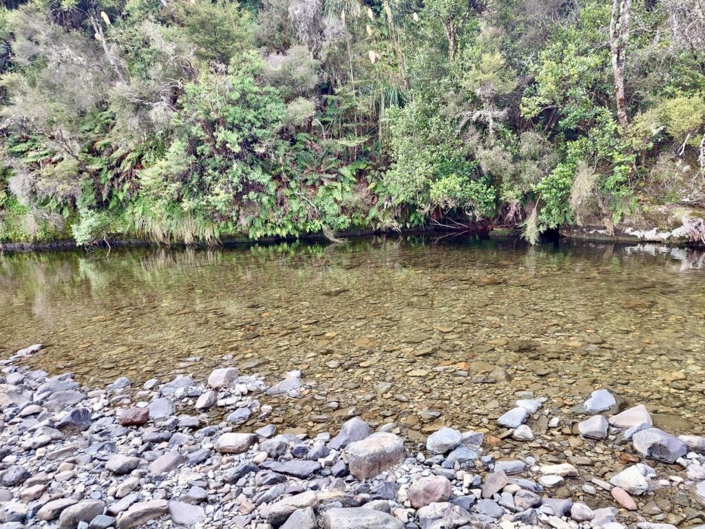
A little over 500 m from Oamaru Hut, the track briefly passes through a section of bush above the river where we saw two fly fishermen, one very cautious trout, and a much better swimming hole than the one we had used the day before. We dropped a pin in our NZ Topo50 offline apps for future reference, then carried on through grass flats until we reached the bush proper some 3 km from Oamaru Hut. We were struck by how extensive the deer browsing was here. Fortunately, as we made our way up river, the bush gradually became more varied and lush, with some impressively buttressed Beech giants to stare up at. We also noted extensive trapping efforts along the valley to protect Whio, although we failed to sight any of these birds in the dry low water flow conditions.
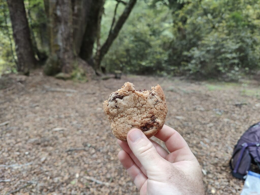
Near the Oamaru-Otorehinaiti confluence, we found a well-used campsite and stopped for morning tea. Ashley pulled out a bag of homemade chocolate chip cookies to share. Knowing we would pass back through this campsite on our return to Oamaru Hut the next day, I dropped a second pin in my Topo50 app with the hope of manifesting a future cookie break here.
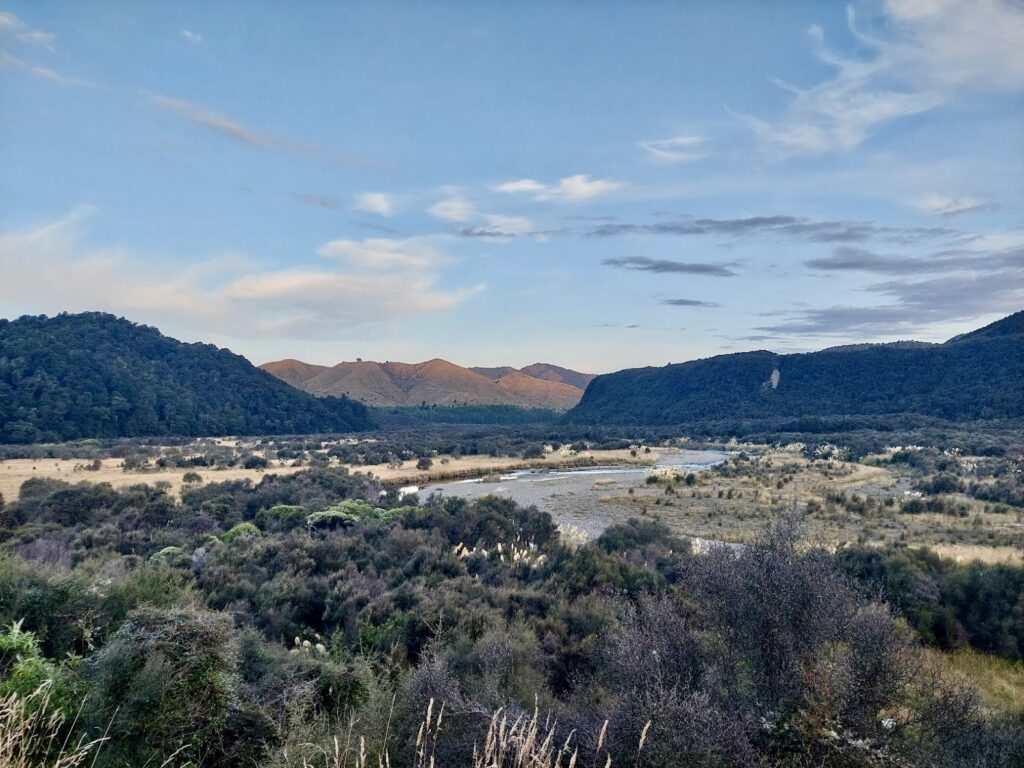
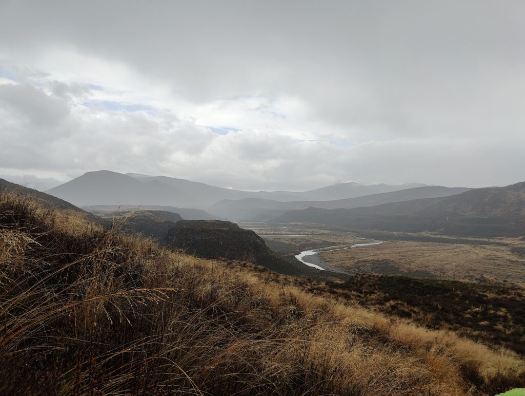
We turned south at the Cascade-Boyd junction to head up the Waitewhero Stream. The track here climbs gently at first, and then finishes with a short but steep section up to the saddle. Here we were greeted with expansive views over the Ngaruroro Valley. The broad tussocked valley and steep sided banks makes for a sharp contrast to the Beech forest we had just travelled through.
As we descended into the valley and crossed the river, we were surrounded by golden-orange butterflies. Approaching the spur behind which Boyd Hut is tucked, we saw a fixed wing plane parked at the end of an air strip. Carrying on up to Boyd Hut, we found a family who had flown in on a different plane and were enjoying a weekend of hunting and fishing.
Boyd Hut is picturesquely situated on the edge of Beech forest, beneath the impressive Boyd rocks. With 16 luxurious beds (also new mattresses) enticing us, we required another cookie each to gather the motivation to carry on to Tussock Hut.
The route down the valley is only sporadically poled, but the foot pad is well worn and can be followed beneath the overgrown tussock with some care. The beginnings of rain gave us just enough time to don rain jackets and put rain covers on our packs before we were caught in a heavy downpour. There was thunder that followed each lightning strike more quickly than we would have liked.
Crossing the Ngaruroro River for a second time was straightforward, as we were doing so at a shallow section of the river. After crossing the river we came across a stamped metal sign informing us that we had traversed into Kaweka Forest Park. From here we gained 300 m elevation quickly, which took us past the owners of the fixed-wing plane we had seen, out of the Ngaruroro Valley and then down to Tussock Hut for the evening.
We found two hunters at Tusssock Hut on their final night of a week-long stay in the area. They were pleased to see some fresh faces and proved to be experts on central and lower North Island backcountry. They had helped place new waratahs on the Kaweka main range during the Studholme Saddle-North Whetu Biv relocation. They also gave us helpful intel about the route ahead of us and for future trips (including information about a hut whose location appears to be a carefully guarded secret!).
Saturday 8th Feb
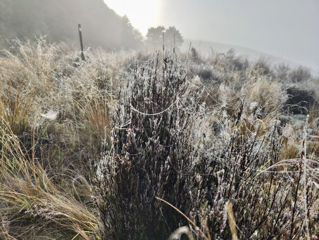
We pulled on our still damp clothes and set off into the Harkness Valley, where we were further soaked from the wet tussock. The spiders here are prolific and the tussock was covered in cobwebs of all patterns, which were stunning in the misty morning light. Following advice from the hunters at Tussock Hut, we followed the poled route up the Harkness Valley until the track swings east and crosses the Ngaawapurua Stream. Instead of following this track further, we headed north up the valley towards Otore Biv. Sticking to the east side of the valley, we avoided the boggiest sections of tussock and were able to follow deer tracks through the scrub (sticking close to the true right of the stream). Shortly before the bush edge we reached a confluence in the stream. From here, we headed up between the two branches and found another deer track that entered the bush.
The climb up to Otore Biv is a gentle one and the surrounding topography gives little indication about which direction to travel in. Fortunately, the biv is close to due north, making navigation simple (we noted one piece of flagging tape on the way, but this did not lead to further markers or any obvious track).
Bathed in morning light, we followed deer tracks which provided good routes over side creeks with minimal effort. The side creeks became more frequent and the ground became boggier, indicating we were approaching the biv (as it is located at the southern end of a marshy basin below Otorehinaiti Saddle).
After checking our GPS position, we quickly found Otore Biv (a 1 h 45 min walk from Tussock Hut), which has been kept clean and tidy by the occasional hunter or hut bagger who visits. The Hut sits on a concrete pad and has a flap door. The wooden bench inside the Hut is perhaps meant to double as a surface to sleep on, but is too narrow for a comfortable night’s sleep. The clearing around the biv would make for an ideal campsite instead.
After a short break, where we shared the last remaining cookie, we continued on to find Otorehinaiti Stream. We noted blue metal markers at the bush edge to the west of the biv, however we opted to head directly north, across the marsh and tussock, which was straightforward to traverse.
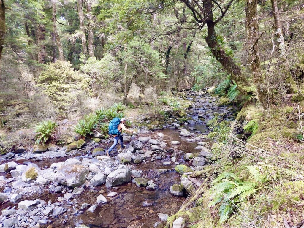
Reaching Otorehinaiti Saddle, we dropped south down through more open bush until we reached Otorehinaiti Stream. Travel was better through the bush rather than in the stream itself. We slowly made our way down, taking deer tracks where possible and crossing the stream frequently, until the stream widened near the Oamaru confluence and walking in the stream became easier.
After a 3 hour walk from Otore Biv, we reached the Oamaru River. We followed it upriver briefly until we saw orange track markers above on the true left. After a quick scramble up the bank, we were back on the Boyd-Oamaru Track.
We stopped for lunch at the previous day’s cookie stop (alas, no more cookies were to be had) and then continued our way back to Oamaru Hut, where we found the same fly fishers from the day before. There were also some new faces. We enjoyed a swim in the swimming hole we had scouted from the track.
Sunday 9th Feb
After some unexpected rain overnight, we were hesitant about river levels, but found that the Oamaru River was still low and easy to cross. We returned to the road end via the Poronui access route and reached the carpark after just under a 3 hr walk
After a long drive we were back in Wellington by dinner time.
The 4-day trip had provided some excellent tramping with varied and impressive views that didn’t require long arduous climbs to attain. It is easy to see how the area is popular with people from all over the North Island and would make for a great trip any time of year – just remember to bring lots of cookies!
Approximate times/distances:
Poronui Station to Oamaru Hut: 2 h 40 min, 13 km
Oamaru Hut to Boyd Hut: 5 h, 17 km
Boyd Hut to Tussock Hut: 1 h 50 min, 6.5 km
Tussock Hut to Otore Biv: 1 h 45 min, 3.5 km
Otore Biv to Oamaru-Otorehinaiti confluence: 3 h, 6.5 km
Oamaru-Otorehinaiti confluence to Oamaru Hut: 1 h 50 min, 7 km
Oamaru Hut to Poronui Station: 2 h 50 min, 13 km.