

Ōtaki Forks temporary walking access, and Ōtaki Forks Road reinstatement
A guide to DOC’s Emergency Access Track that provides a walking track to Ōtaki Forks bypassing the slip at Blue Bluff that has closed the road, and a photo story of the Otaki Forks Road reinstatement at Blue Bluff.
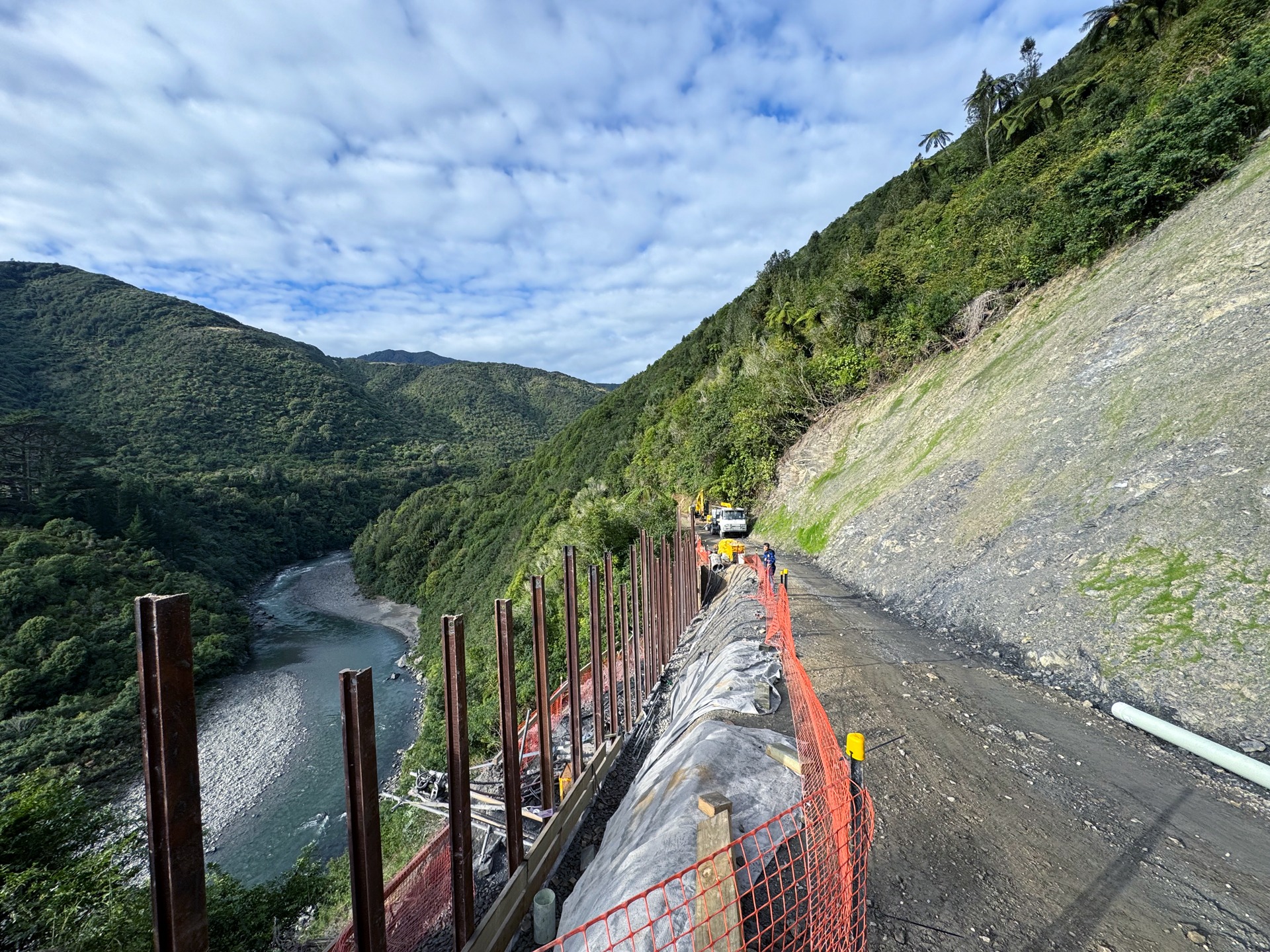
Update 9 July 2025
Forget everything below – KCDC have announced today that the Otaki Forks Road will open to vehicular traffic as far as the ranger’s house on Friday 11 July 2025
Update 9 July 2025
Forget everything below – KCDC have announced today that the Otaki Forks Road will open to vehicular traffic as far as the ranger’s house on Friday 11 July 2025
DOC Emergency Access Track
As of 21 December 2020 DOC has opened an Ōtaki Forks temporary walking access track.
Strangely they called it an ‘Emergency Access Track’. But anyway it is good news for trampers wanting to use the Field or Waitewaewae Tracks given the road is unlikely to be open for some time. So where does the track go?
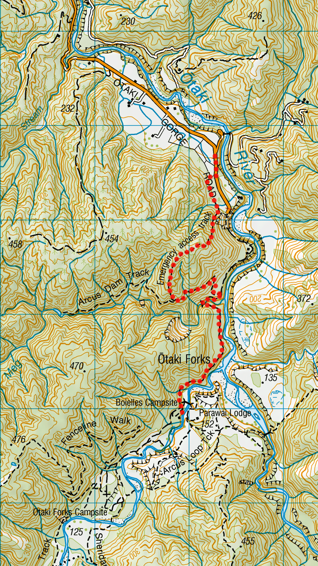
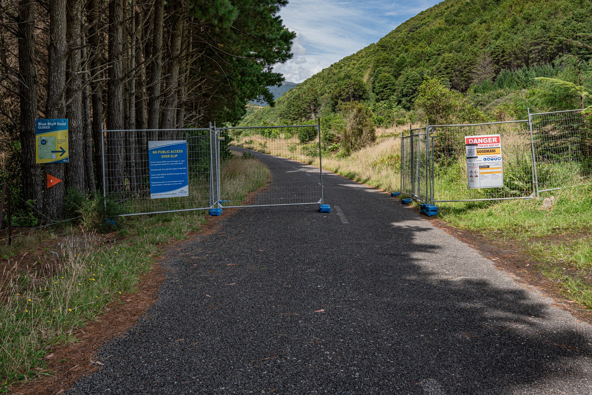
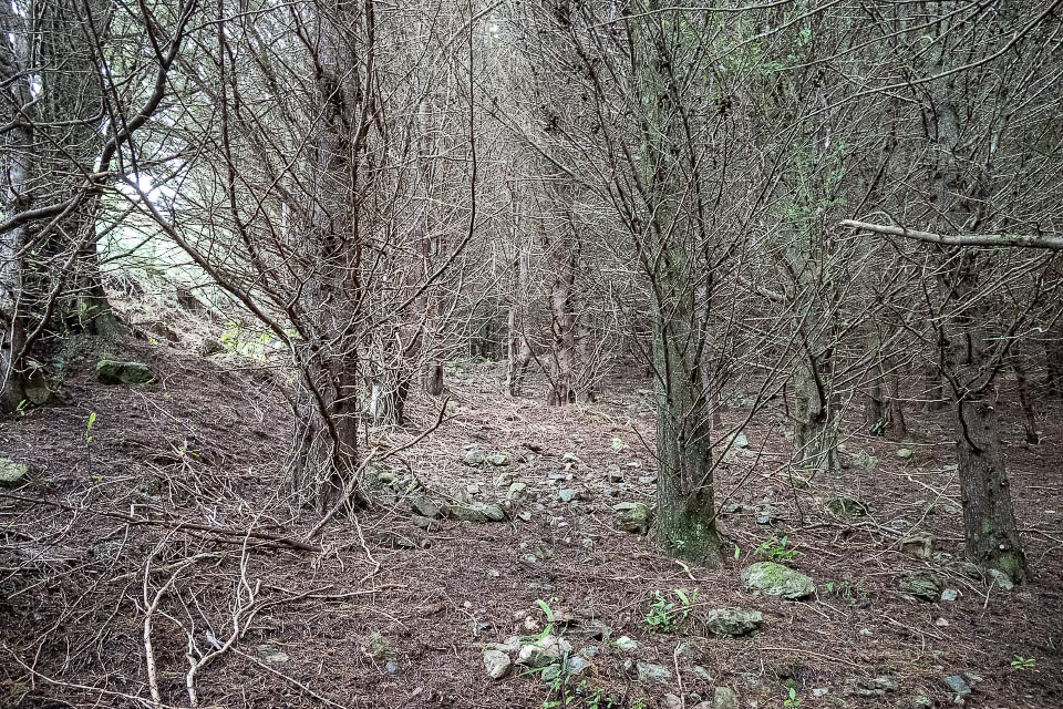
Park your car in the parking area on the Ōtaki Forks Road just beyond Shields Flat. Then walk past the warning signs for 350 m along the road to the gate marking the perimeter of the construction site and an orange triangle and sign on your left directing you to another gate on your right signed as the emergency track. As at 25 March this gate and the section of 4WD road before the track turns left is used by the dump-trucks so take care.
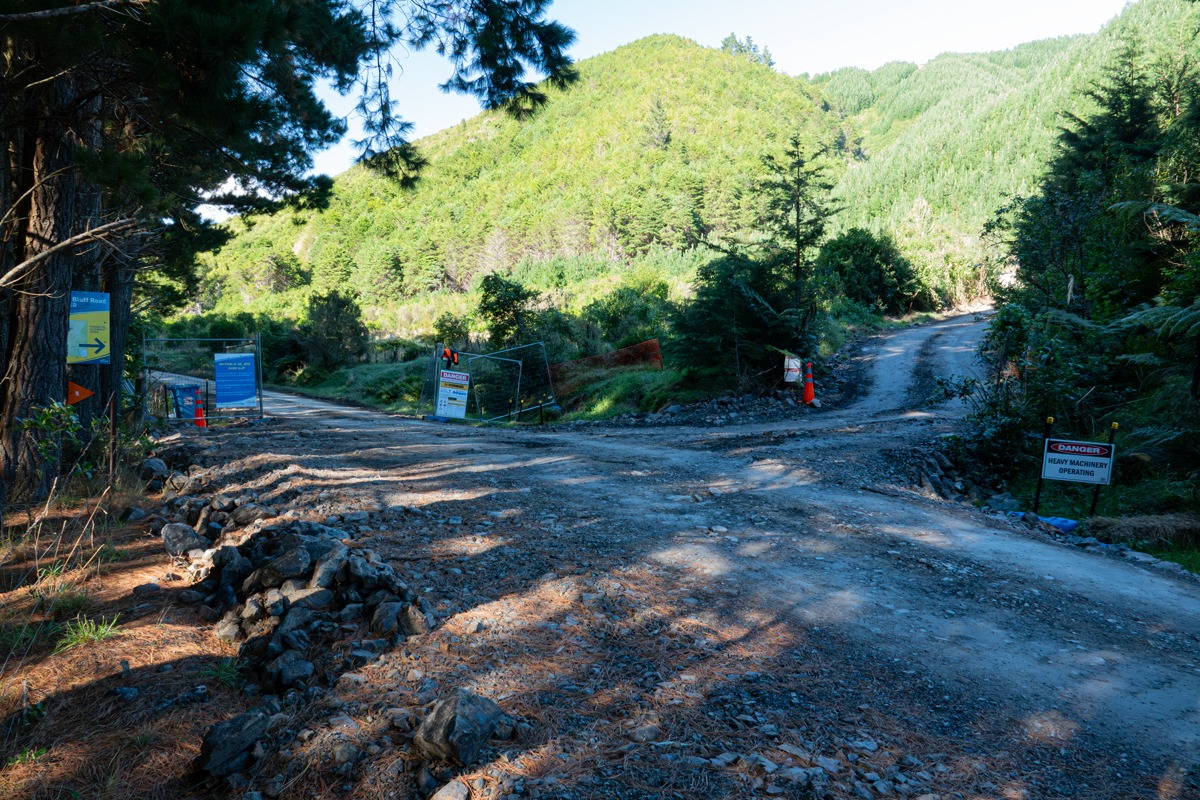
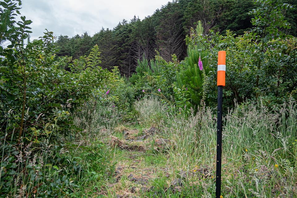
You follow a short section of 4WD road before a rough track heads parallel to the road through some scrub for about 250 m.
Then the serious business begins—the track heads directly up a spur beneath the pines. And it is quite steep. But there are plenty of orange triangles to mark the way and a ground trail is gradually being formed.
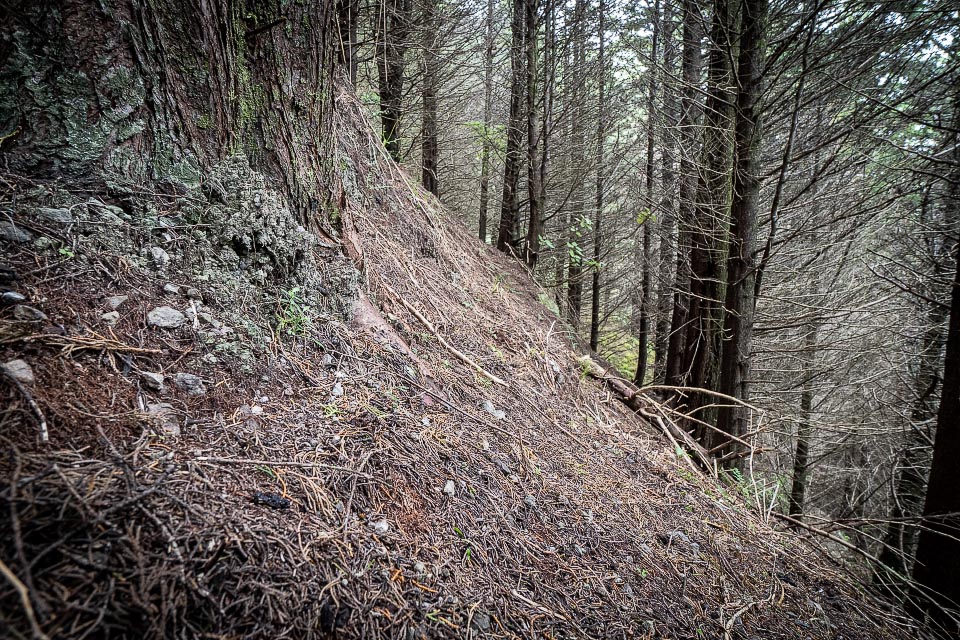
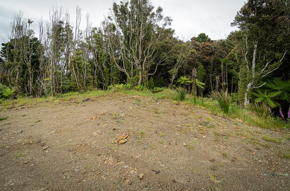
About 30 minutes of solid climbing ends on an open ridge and a 5 minute gentle 4WD track to the old logging skid of the 2016 temporary track.
From here the track follows the 2016 track down through pleasant native bush to the old 4WD road that led to the failed hydro dam, and then finally down to the Ōtaki Forks Road again. Another approximately 2 km along the road and you are at the Forks.
Compared to the 2016 temporary track the new one is shorter but steeper so the times from the carpark to the Forks will likely be about the same—somewhere between 2 to 2½ hours each way.
For average level trampers the track won’t be an issue, other than extra time, however, it could be quite difficult and slow for family groups with young children. But with this in mind it’s still nice having a reliable access route to Otaki Forks.
Note 27 January 2025: Once the Blue Bluff area is a construction site for the road works there will be no access to the KCDC track across the slip, and the DOC Emergency Track will be the only walking access from the Shields Flat carpark to Otaki Forks.
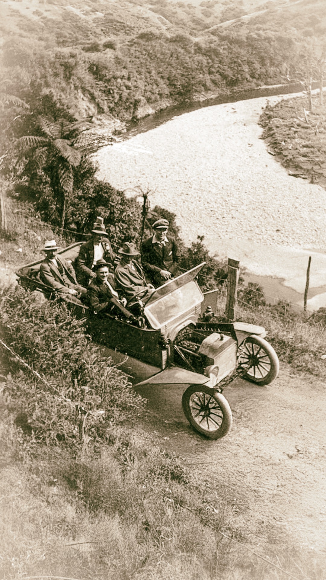
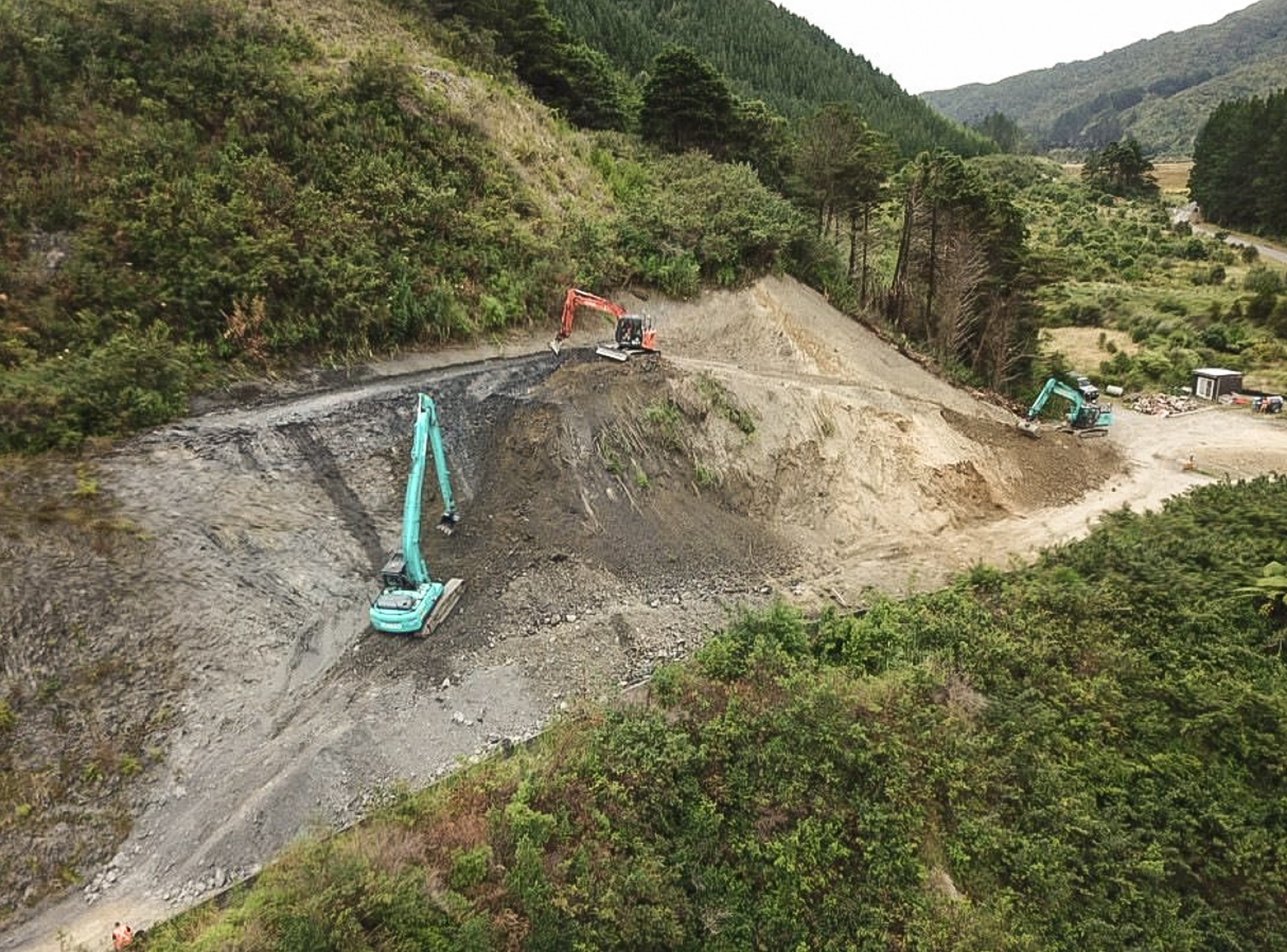
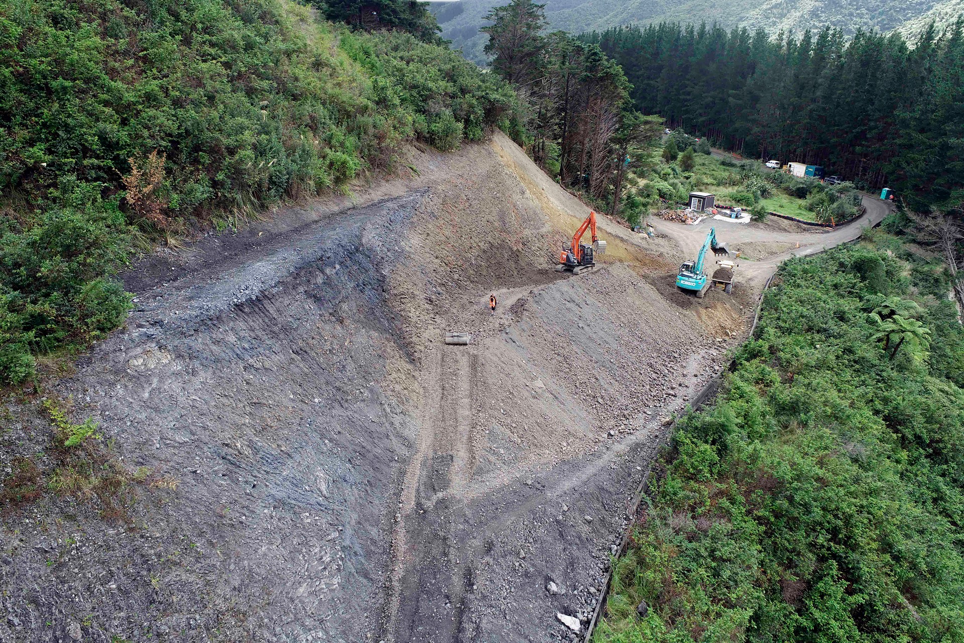
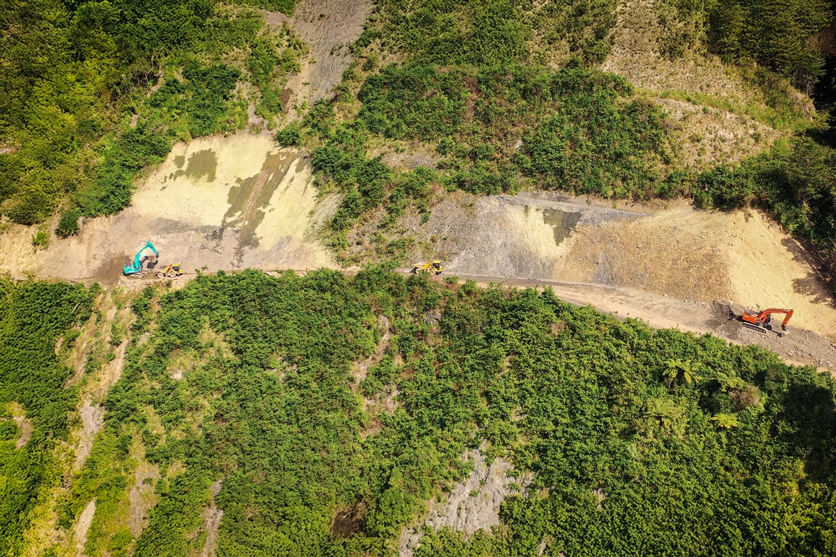
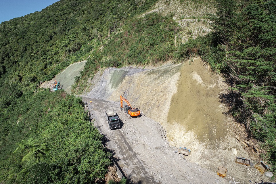
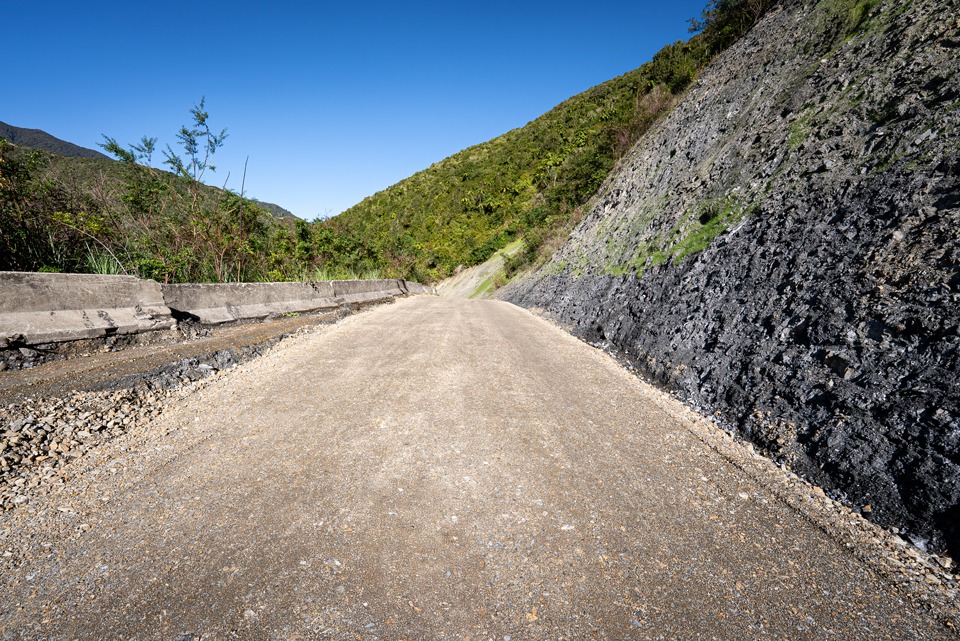
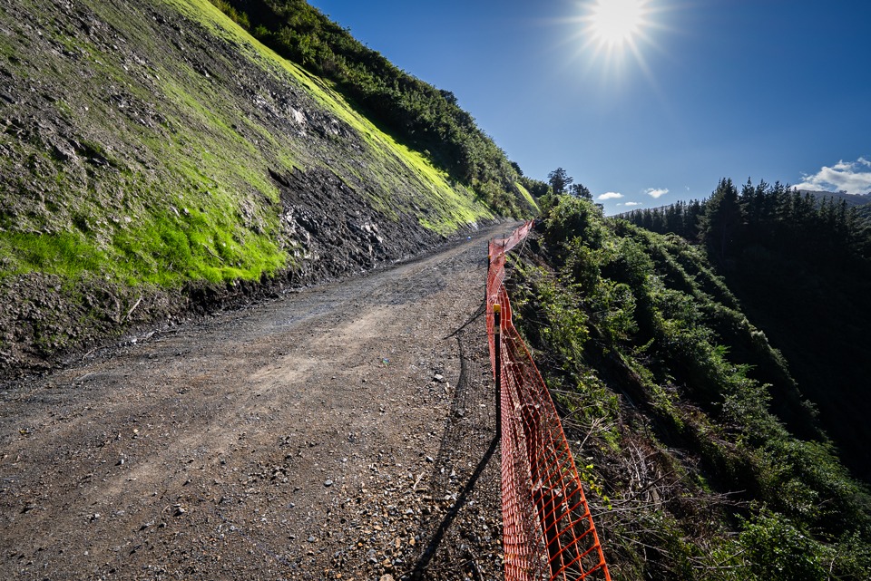
Blue Bluff road reinstatement 2025
KCDC Option A – Open the Road
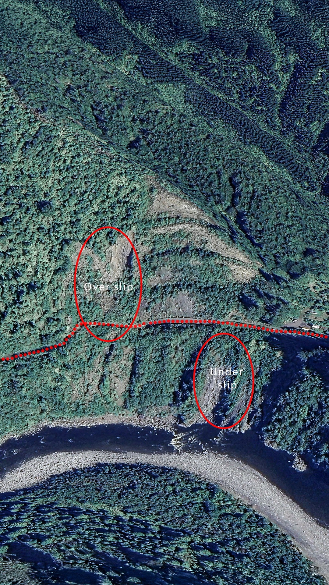
6 There are two slips which require repair, the under slip and the over slip.
7 Feedback from the community received to date is that vehicle access to the Otaki Forks campground is the most desired option. This provides a level of accessibility for all of the community, especially families, to experience the Tararua Ranges and campground facilities.
8 We recently met onsite with representatives from an earthmoving company experienced in working on complex slip faces to discuss constructability, especially with regards to safety. After viewing the site they advised they believe they could complete the earthworks to repair both slips within 4-6 months and did not have any specific concerns regarding safety. Their methodology involves:
8.1 Cutting the northern end of the 2016 bottom bench to allow digger and truck access past the under slip to the northern end of the over slip.
8.2 Removing the slip face of the over slip, working up the slip from the road in sections, battering at approx. 1:1 ratio.
8.3 After reinstating the road, safety mesh and / or a rockfall catch fence would be installed.
8.4 Complete realignment of the road above the under slip, by benching back into the 2016 repairs. This is seen as a straightforward process with little risk.
9 This construction methodology for the over slip satisfies Council officers concerns regarding safety as the process minimises risk of slippage and provides an identified escape route for the contractor during construction. It is to be noted the site contains unknowns and at any point the works may need to stop if safety concerns are raised.
10 The methodology is also cost effective for Council as it deals with the area with the most uncertainty first, e.g. the over slip and uncertainty regarding the roads existing retaining wall. Using this methodology, we are able to refine the upper limit of expected costs and hold the project should the existing road retaining wall present issues.
11 Following repairs to the over slip, and while the under slip road is being realigned, we can complete repairs to the road corridor from just beyond the over slip to the DOC camp site. This includes safety repairs to the Pukeatua bridge barriers (bringing up to code), repair of minor under slip near Pukeatua bridge and replacement of 3 stormwater culverts. Estimated construction is 1-2 months and can be completed any time after the over slip works are completed.
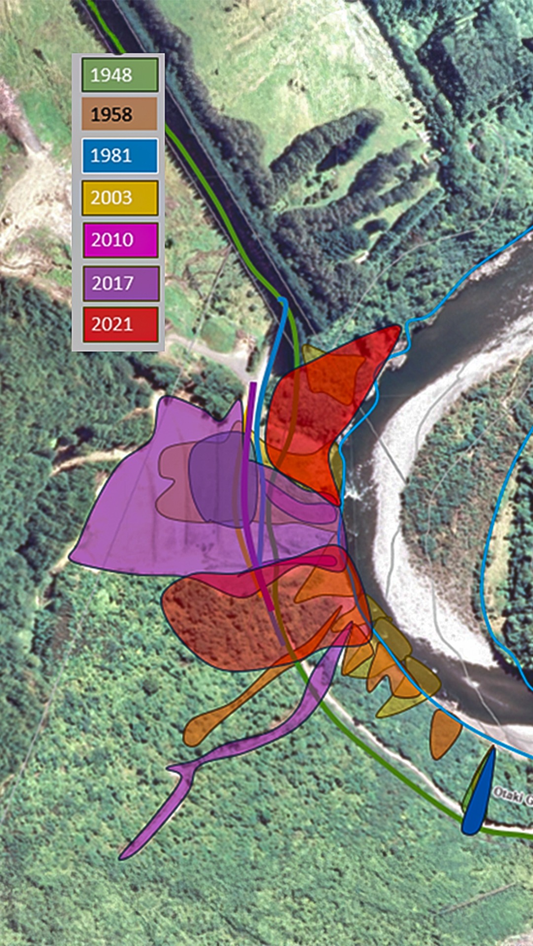
12 The immediate vicinity of the over slip site is part of a larger older landslide that has since healed and re-vegetated with no obvious signs from aerial imagery that it deteriorating further upslope of the road to the south. It is unknown when this landslide initially occurred, however available aerial photography indicates it was prior to 1948. The historical landslide site is approximately 97,000m2 and has since progressed through cycles of small/moderately sized active landslides which form and then heal.
13 Around 1981 the Otaki Gorge Road was realigned (assuming this was due to the developing loss of land from underslips at Blue Bluff) with the formation of benches cut on the northern hillslope above the road (excavation method to form a series of horizontal steps – this is to protect workers from cave-ins.) Around 2003 an overslip in the area of blue bluff was cleared and the road realigned again. The 2015 blue bluff slip was cleared and the benches recut in the current formation. The 2020 underslip and 2021 overslip are yet to be resolved.
14 No one can predict when the next landslide will occur, however based on historical evidence of 4 significant slips since 1981, we could expect return period of 10 years for similar events into the future.
15 Known slips:
16 The 2015 slip repair was cut into stable material (fractured greywacke) and is performing well. We would be able to cut a similar formation for the 2020 underslip repair and expect similar performance. It is unlikely that similar material will be found in the 2021 overslip area, however the head of the slope has a good shape and moderate stability should be able to be achieved by removing the overburden.
17 The further south we go along the historical slip scar the size of historical slips are smaller and have been able to be managed by general slip removal and retaining walls. While a large event is possible, the return period is expected to be longer.
18 Acquisition of private property is required to realign the road, and potentially allow access for construction / earthworks and material disposal.
19 ESTIMATED COST to Council is $2.235m
20 We estimate an ongoing cost to Council for repairs to large slips is potentially $1,000,000 every ten years, with current Waka Kotahi subsidy levels; plus annual cost of $75,000 for ongoing maintenance of the road corridor.
21 PROS access is restored to Kapiti’s main entrance to the Tararua’s, and DOC’s Otaki forks campsite and properties located beyond the slip. Likely the quickest solution.
22 CONS condition of road retaining wall located under the over slip is unknown, risk of further slips occurring in the future.
Did it today and just under 90 minutes to the Forks – but it is defintely steep.
Fantastic guide! Thanks for getting this up so quickly after the official word from DOC