

Thinking of a loop daytrip in the Tararua Range that is a bit different? Well, why not try Ozzie’s Track?
Ozzie’s Track is one of those mostly-forgotten routes in the Tararua Forest Park that doesn’t appear on today’s topomaps but lives on in trampers’ conversations—particularly those of the members of the Manawatu Tramping and Skiing Club (MTSC) who have adopted the track and now maintain it.
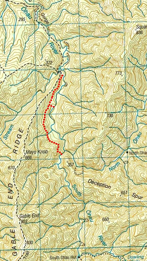
Tucked into the Ōhau River valley on the western side of the range, this informal track sidles above the river and offers a drier, more exploratory alternative to wading up towards North or South Ōhau Huts.
Like many Tararua routes, it carries a name but little written history—and that mystery is very much part of its appeal. And it does make a nice day out—up the track and then down the river. About six hours without hurrying.
The 1959 topomap shows Ozzie’s Track (un-named on the map) on the western side of the Ōhau River starting just beyond the junction with the Gable End Ridge track and continuing to the North Ōhau River junction, and then further on the eastern side to the present South Ōhau Hut and beyond.
The main Ōhau River track now passes through a grassy clearing where the Ōhau Hut once stood and continues to the Gable End DOC signposted junction. Ozzie’s Track starts just beyond there.
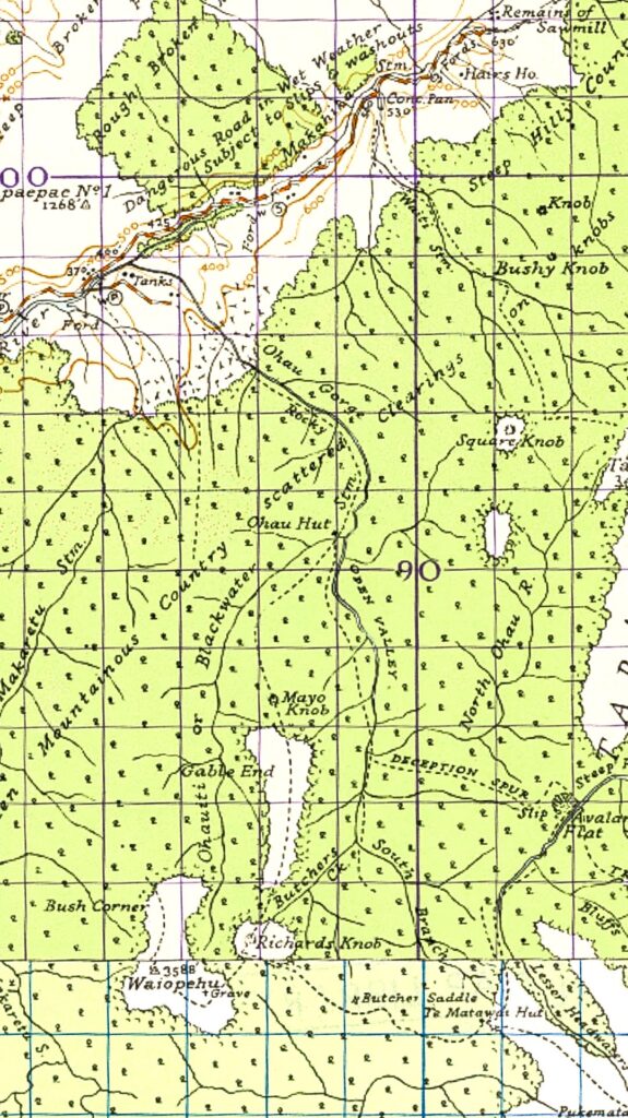
The sign marking the start of Ozzie’s Track is obvious once you have found it, but can easily be missed.
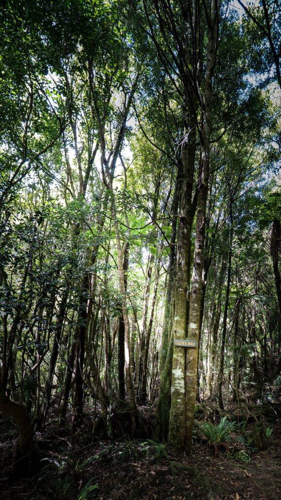
Ozzie made a great effort with his track and it is mostly benched and graded and easy walking although there are a few slower, but not too difficult, sections.
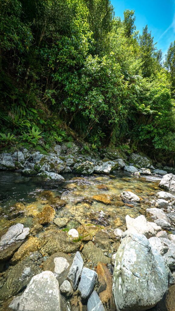
The upper end of Ozzie’s Track is not where the 1959 map shows but is in the South Branch of the Ōhau River about 100 m above the junction with the North Ōhau. It is only marked with some red and blue tape (just visible in the centre of the photo).
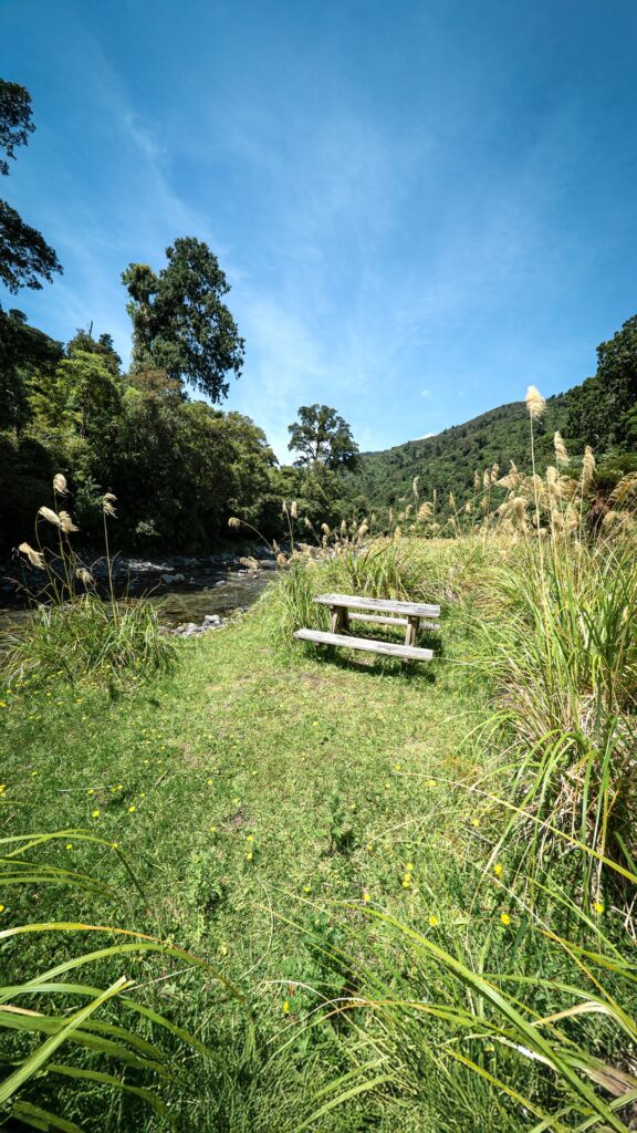
The famous Picnic Table at a grassy flat in the Ōhau River (how did this get here?) There is a taped route from here to Ozzie’s Track. The area has recently been tidied by MTSC members and a load of rubbish flown out by DOC, and would now be a pleasant camp site.
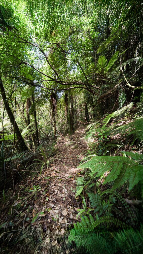
Ozzie’s Track sidling the Ōhau River, and the taped route to the picnic table.
Ozzie’s Track Q&A
❓ Where is Ozzie’s Track?
Ozzie’s Track is in the Tararua Range along the western side of the Ōhau River, branching off close to the Waiopehu Track junction and sidling above the river to just beyond the North Ōhau River junction.
❓ Is Ozzie’s Track an official DOC track?
No. Ozzie’s Track is an informal route that is now voluntarily maintained by some members of the Manawatu Tramping and Skiing Club (MTSC). The track does not appear on current topomaps.
❓ How difficult is Ozzie’s Track?
Ozzie’s Track is mostly well benched and graded and has recently been cleared and marked by the MTSC, so as of early-2026 apart from a few slower sections it is easy and pleasant walking.
❓ Why would you choose Ozzie’s Track instead of following the river?
About halfway between the start of the river travel up the Ōhau and the North Branch junction is the famous Picnic Table on a grassy flat. If you are considering travel times then given a low river flow the time between the start of the track and the table would likely be faster on the track, but faster in the river for the top section. So, it is mix and match—and you will get there eventually either way. And having the options makes for a nice day-trip loop.
❓ Who was “Ozzie”?
Ozzie’s Track is named after a local who it is known to have single-handedly cut and benched the track with just his pick and shovel perhaps sometime in the 1950s. But it seems no written record of Ozzie’s actual identity has survived.