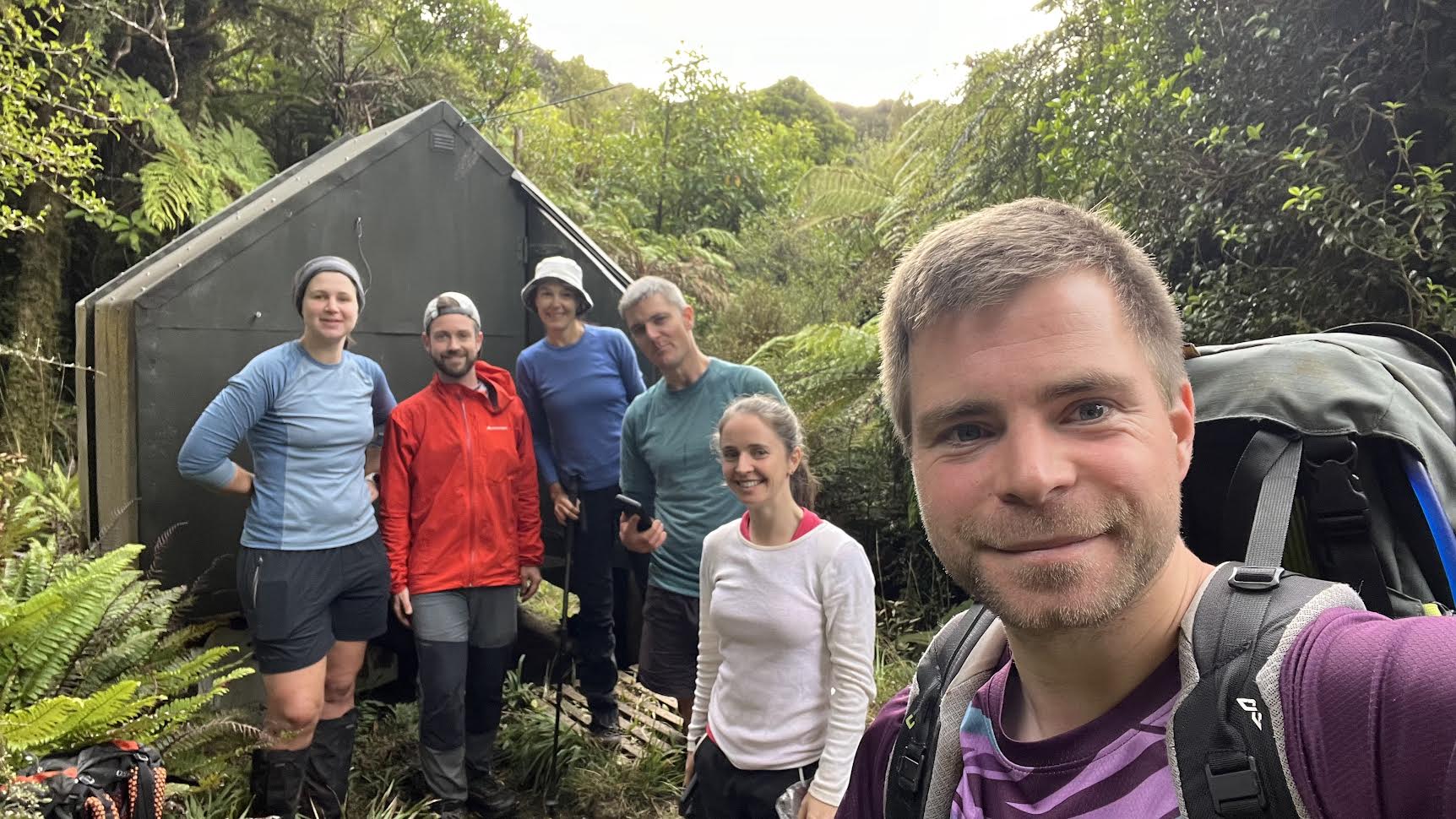
The six of us met at Wellington Train Station at 7.30 am, with the intention of bagging a few huts that weekend: Te Whare o Moturimu, Punga Hut, and North Mangahao Biv.
I had come to the area less than a year before with the same plan, but had yet to bag the Biv. On that occasion it had been the middle of winter, and we had wisely decided to turn back after 2 hours of thick bush-bashing – as we were running out of daylight. I knew what to expect and my level of enthusiasm oscillated between low and moderate. But I was looking forward to a weekend in the bush in good company, and to hopefully get to the Biv this time.
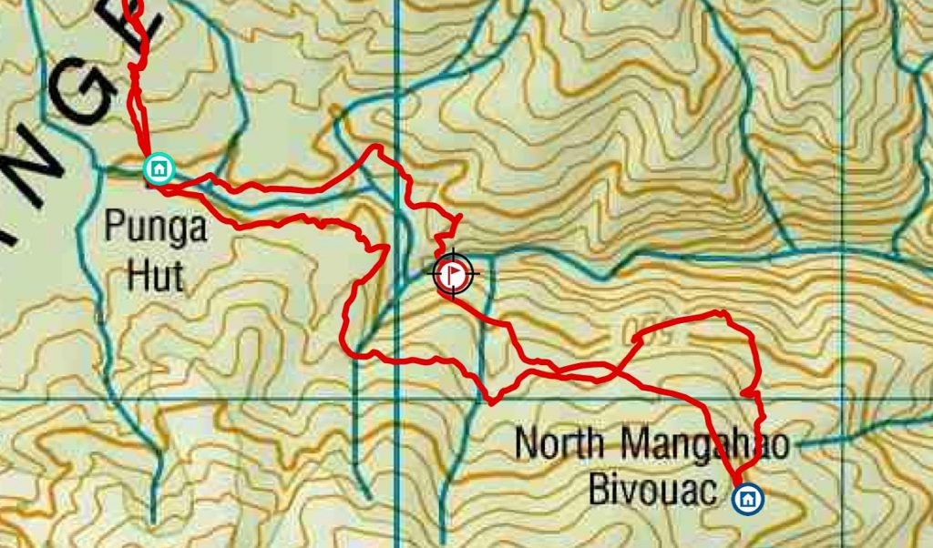
We all had different ideas, had read different reports and had different GPX files for getting to the Biv. Surely one of these would get us there! We intended to get to the Biv and then backtrack to stay the night at Punga Hut, before an easy walk out on Sunday morning.
We started walking at about 9.45am and made good time up the gravel road. Richard hadn’t been tramping for the past 8 months and couldn’t contain his enthusiasm: raving about the beautiful pine trees, commenting on the excellent pruning and dead branches, and exclaiming with delight at the sight of the countless dead possums that punctuated our way up the hill.
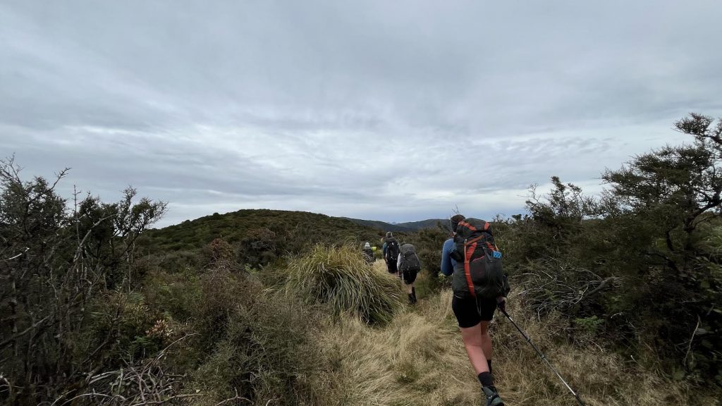
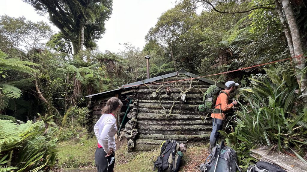
The gravel road turned into a grassy road, and we quickly got to a clearing and the beginning of the track – hidden in the high vegetation. The track along the ridgeline to pt 686 elevation had been cut and was easy to travel on. Triangles appeared and quickly took us down a spur and below the bushline, in deep squishy mud at times. We reached Punga Hut and had a quick lunch. We met a hunter and his partner there, who were regulars to Punga Hut and were there for the day to do some light maintenance and to top up the firewood. They gave us directions to North Mangahao Biv: they said half the track had been cut and they guestimated it would take 1 to 6 hrs to reach the Biv(!).
After lightening our packs and leaving tents and overnight gear at Punga Hut, we headed behind the hut and opted to cross the stream to join the cut track on the other side. The travel was fast and we made good progress along the stream for about 600m. The plan was to head up the spur between the two side streams on the true right of the river and go up to the 500m contour line. However, in front of us was a near vertical and unappealing muddy, rooty face, about 20m high.
After a bit of to-ing and fro-ing, we backtracked up the stream a little and found a marginally better way up. It took us a while, a few acrobatic moves and sketchy handholds to get all of us up to the top of it. The ground was unstable, half of the trees you’d want to hold on to were dead, and the exposure was real, with a serious drop below us. It was up this muddy face that the boot-hold technique came into being – one person sits securely and lowers their leg and boot for the other person to grab onto and use as a hold to help make their way up. There was also a fair bit of passing packs and walking poles around as we climbed up the mud.
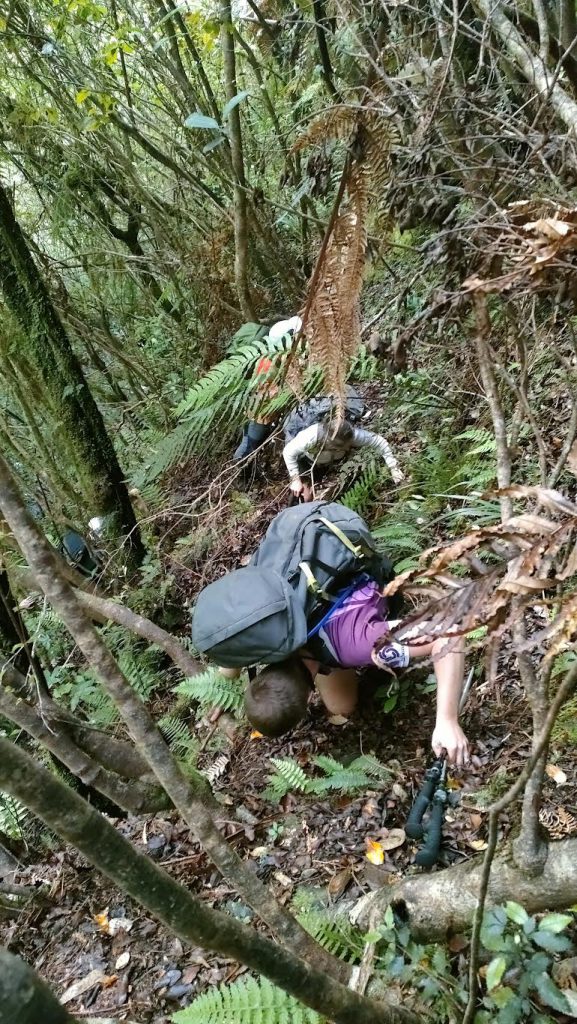
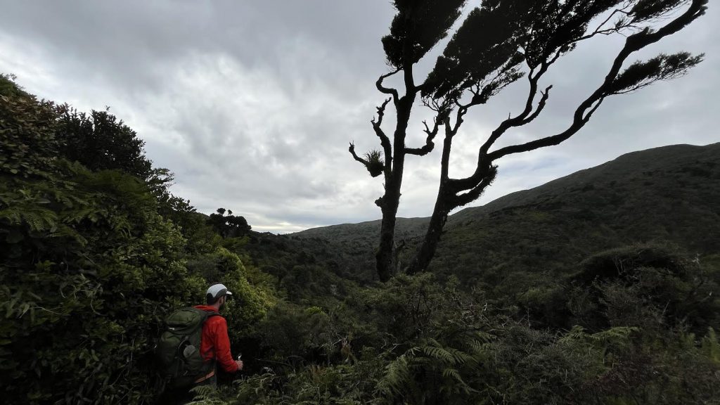
This wasn’t enough to dampen Richard’s enthusiasm, who found his way to the top first. “There is a well worn track here! We’re all good!” The well worn track was more of a faint animal trail in between dense ferns. But it was indeed easy to follow. Soon enough we found more open vegetation and made our way up to the 500m contour line as planned.
The top of the ridge was known to be covered with thick vegetation and leatherwood. So our intention was to sidle, until we were more or less below the Biv, and then head up towards it. In practice, it turned into a more pragmatic approach of picking the path of least resistance, following or ignoring pink tape depending on the mood, and trying to move in the overall right direction but not overthinking too much at what elevation we were travelling. This turned out to be effective, thanks to James’ internal compass that seemed to pick up on good ground trails that we would lose at times, but then find again. We found ourselves higher than intended, where the vegetation was very thick. Expert movements on all fours, crawling skills, and Sarah’s squatting-shuffling technique came in handy as we made our way under the thick bush. Richard’s enthusiastic phrase “We’ll just plow on through!” also helped buoy our spirits.
Eventually we inched our way closer to the Biv, and finally made made it there after 3 hrs of bushbashing, covering a distance of about 2km. The Biv’s hut book was sparse, but we did spot a few familiar names and made sure to leave a WTMC sticker in it. We were all stoked to bag North Mangahao Biv despite agreeing that none of us would probably come back anytime soon.
After a 15 min break and a few jet plane sweets, we headed back. All were in agreement that staying low and avoiding the muddy cliff face on the way back were our top priorities. We decided to try to follow one of our GPX files: to head down the creek next to the Biv (which was not marked on the map) until the 500m contour line, and then sidle all the way back to Punga Hut. Execution of this plan went fairly well, although it felt like we were travelling slower than we had been on our way in. Fatigue started to set in and there were a few more slips and falls as we ploughed through the bush – but luckily without any serious consequences.
About 2 hrs after leaving the Mangahao Biv, the headtorches came out – while the sun wasn’t setting yet, it was getting dark in the dense bush. We carried on and stumbled upon a spot we thought we had been at on the way in. From there we more or less followed the 530-540m contour line – sometimes above it, sometimes below it – and all agreed this was a much better method than the low crawl and thick vegetation around the higher contour lines. On the GPX map we could see that the contour lines on this side of the stream were more gentle, but there were still some good gullies to descend and scramble back up.
Finally, about 500m from the Punga Hut, we spotted some tape leading down a spur and decided it made sense to follow it. It was a nice partly formed track which lead us back to the Hut.
We reached Punga Hut just after 6pm and met a family of four with two young kids and a dog, who were planning to stay a couple of nights. We had tents and they did too, but camping space was limited. We quickly decided to have a quick snack and head back to Te Whare o Moturimu. Leaving Punga Hut at 6.30pm, we made our way back without any issues in the dark, spotting the occasional big spider and successfully avoiding stepping on any dead possums.
Once at Te Whare shelter we had another chat, to discuss whether to stay the night there or to walk another 20 mins to the road end and head home. The thought of a hot shower and a good night’s sleep quickly took over, and in the blink of an eye we were on the road back to Wellington at approx 8.30pm, covered in mud and dry blood, having lost a contact lens, tired, scratched (lots of bush lawyer!) and a bit sore, but happy. We made it to Burger King in Levin just before they closed and were back in Wellington shortly after 11 pm. A successful day walk in the Tararuas.
Trip stats (approx times with breaks):
Road end to Punga Hut: 2 hrs each way
Punga Hut to North Mangahao Biv: 3 hrs each way