
Mt Owen –
and some thoughts on trundling*
A 3 day hike to the summit of Mt Owen via Bulmer Lake in Kahurangi National Park.
Below me, Tony jumped as a rock went whizzing past him at head height, missing him by a few inches.
He looked up to see where the rock had come from. ‘It’s the kea,’ I called down to him.
I watched as a juvenile kea cleverly pushed another rock over the edge of the steep slope we were on and sent it bouncing down towards Tony while all the other kea screeched in enjoyment.
Kea trundling!
Day 1
I had been wanting to visit Mt Owen for a few years and my two previous planned trips had to be cancelled due to weather. Tony suggested a trip there but by a different route to the usual one from Wangapeka Valley. I was all about this as I like getting off the well-trodden path and it sounded like a good adventure. This route to Bulmer Lake is sometimes used by cavers as some interesting caving systems are found there.
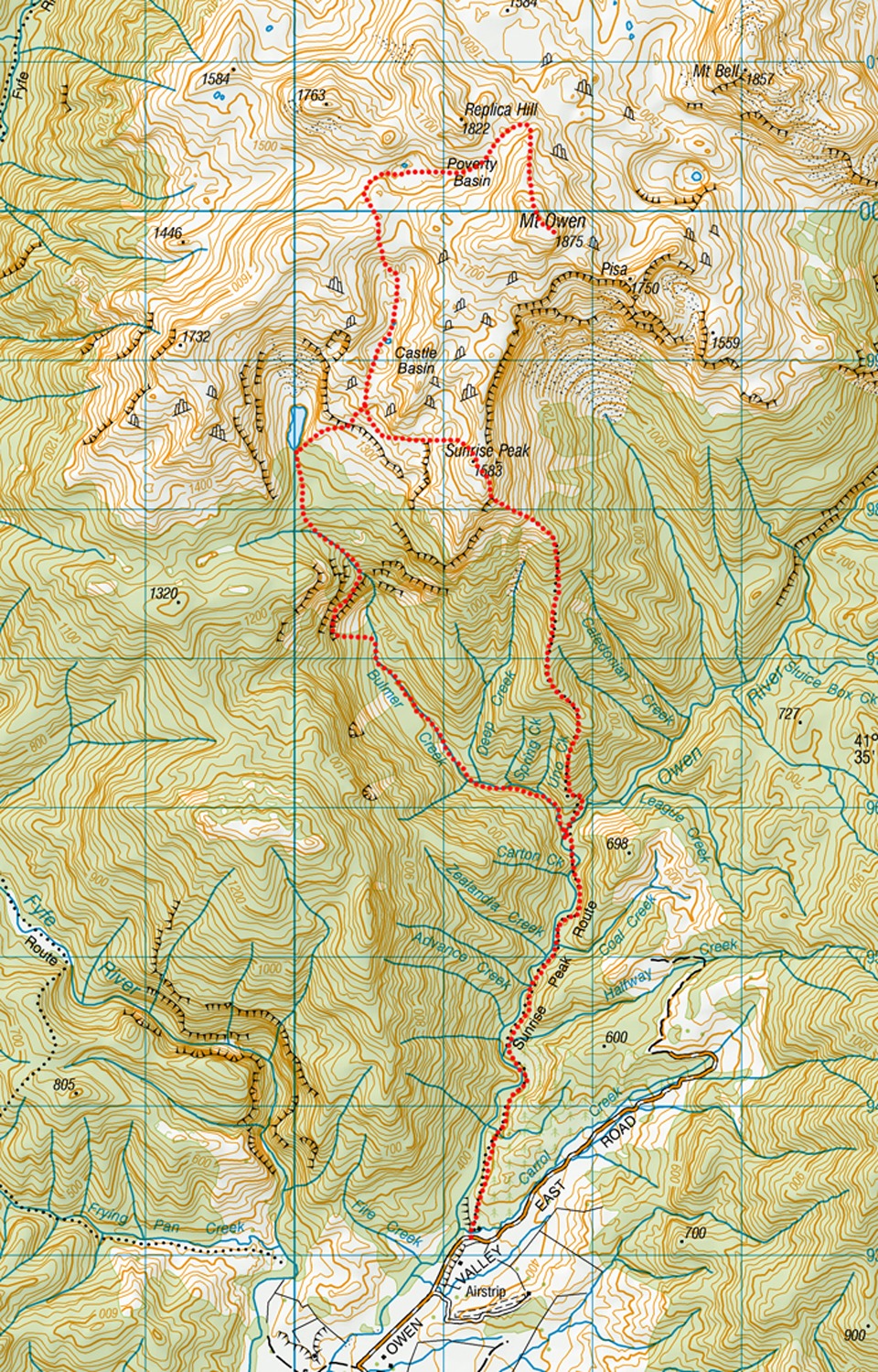
We started along the Sunrise Peak Route that was surrounded by plenty of blackberry plants— unfortunately we were a few months early to get them in fruit but Tony has previously been through in the height of blackberry season and enjoyed them. There were multiple stream crossings before we left the track at Bulmer Creek. We followed the creek up— there was a good foot trail and some ribbon markers.
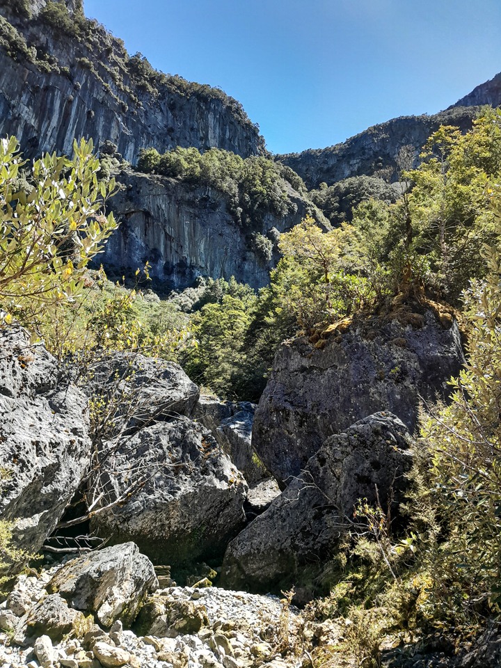
As we climbed higher, the boulders got progressively bigger to the point where they became the size of a house. There were some towering bluffs in front of us that looked completely impassable. I couldn’t envisage how we were going to get through them and I was starting to wonder if flying was a mandatory skill requirement for this trip. But Tony assured me it was all possible.
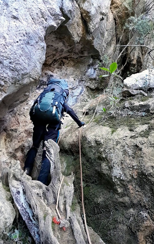
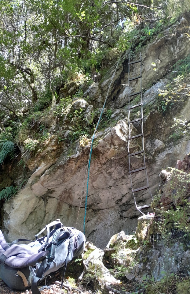
Up we continued and there were some ropes in place on some of the steeper sections to haul ourselves up that brought us directly to the base of these steep bluffs. The ropes led us along a rock ledge where sometimes crawling was necessary.
We were eventually led to a steep section with only one way—directly up. Fortunately there is a caver’s ladder that is well anchored to provide a safe route up this particularly steep section of the bluff. This rope ladder was a little trickier than it looked because unlike the Tararua steel ladder this one was rope and would swing around while climbing up it—this happened to Tony as he started up the ladder and he was nearly flipped backwards.
We decided that it would be easiest to go up without packs on and to haul packs up on the extra rope. Tony got up the ladder and then I tied his pack on and he started hauling his pack up—the only problem was that it got caught on the rocky bluff so I had to climb up the ladder a bit and support his pack over the rocks while balancing on the ladder.
I realised that this wouldn’t be an easy option with my pack as no one would be there to get it over the rocks. I would have to go up the ladder with my pack on. I took it slowly and carefully, rung by rung at a time to stop the ladder flipping over and used the additional rope to get off the ladder and just haul myself up the bluff as soon as I could.
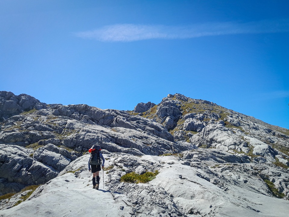
After that excitement it was back into an easy climb on a good foot trail up all the way to Bulmer Lake.
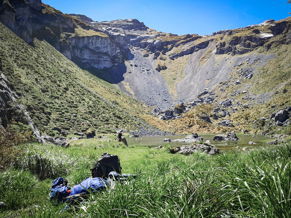
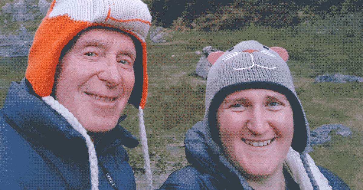
Bulmer Lake was beautiful. Situated in an ice-age glacial cirque the water was clear and it was surrounded by towering bluffs. We set up camp and had fun taking some silly selfies with the animal hats I carried in my pack for a laugh.
That night we had the memorable experience of a duet of the croaking frogs in Bulmer Lake and the calls of kea flying high above the lake. It was truly special and not something that one would come across too often. A resident weka was wandering around so we ensured we tucked up everything in our tents so it couldn’t steal anything, and once we were in bed we heard the weka noisily calling and I teased Tony that it was coming for him.
Day 2
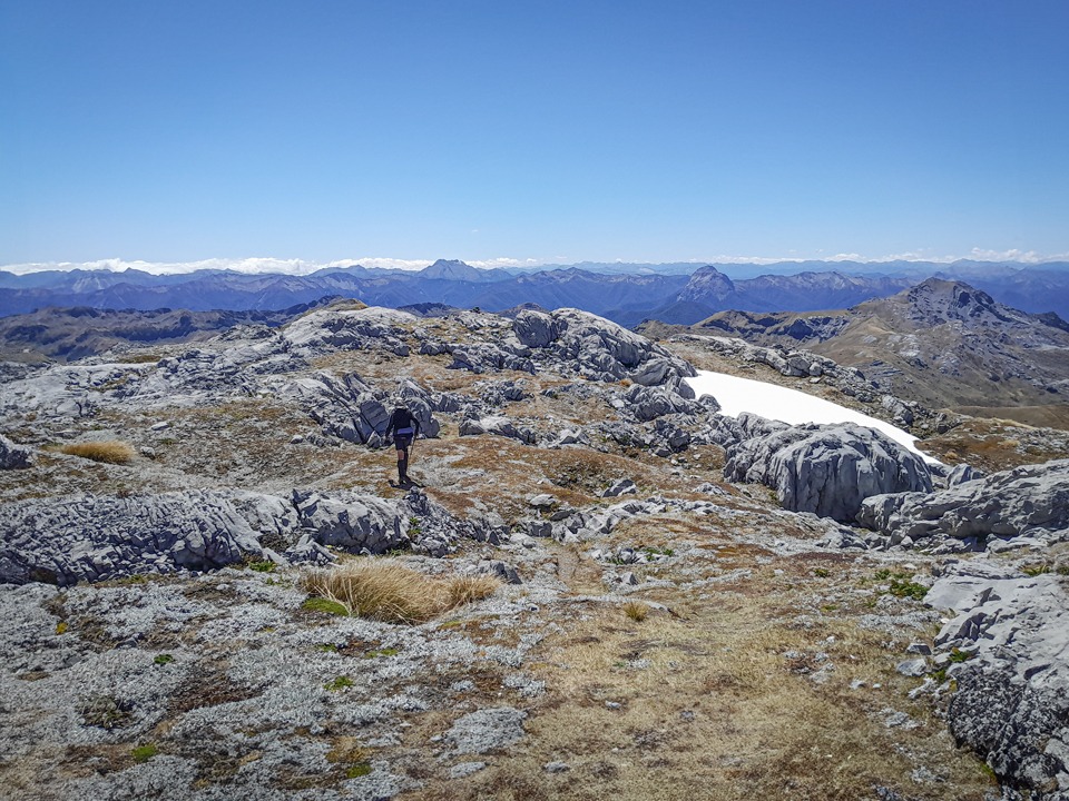
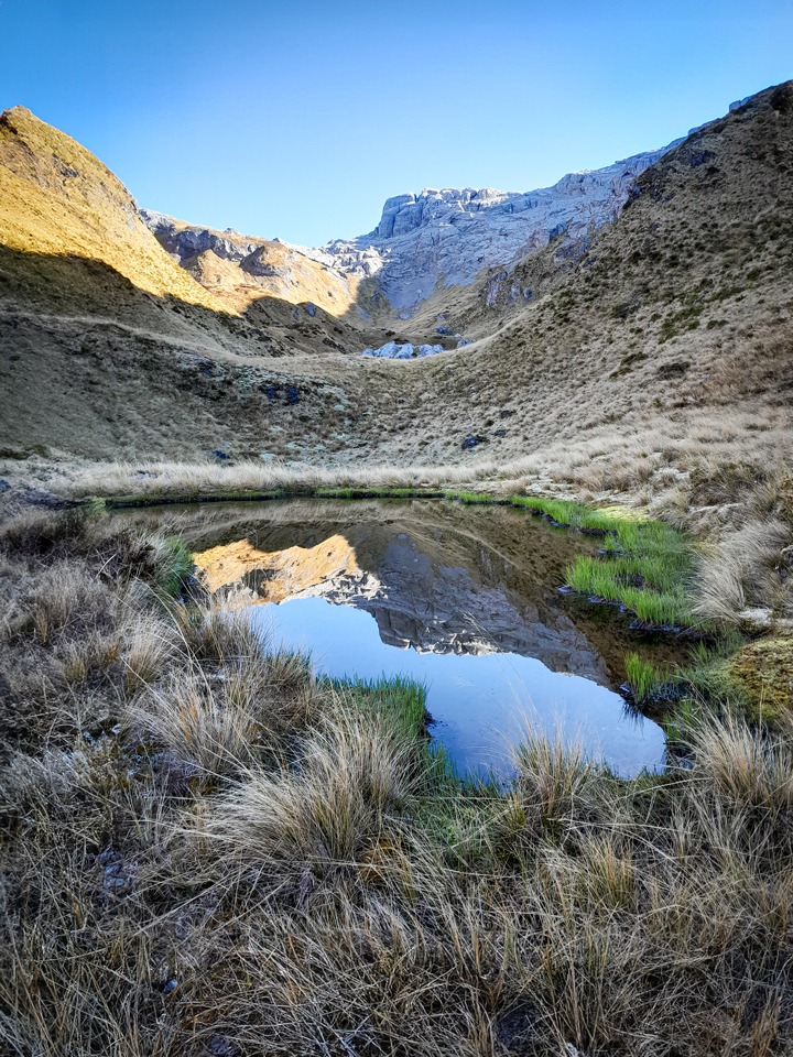
The next morning we climbed up above the Bulmer Lake campsite through the karst. There were some rock cairns but it was largely finding your own route, taking care not to fall into any of the deep rock crevasses. We dropped down into Castle Basin where we were surprised by finding a tarn in the most unlikely place—on top of a mound. With the tarns there, we thought it would be a fantastic camping spot and kept it in the back of our minds since we would be returning near here.
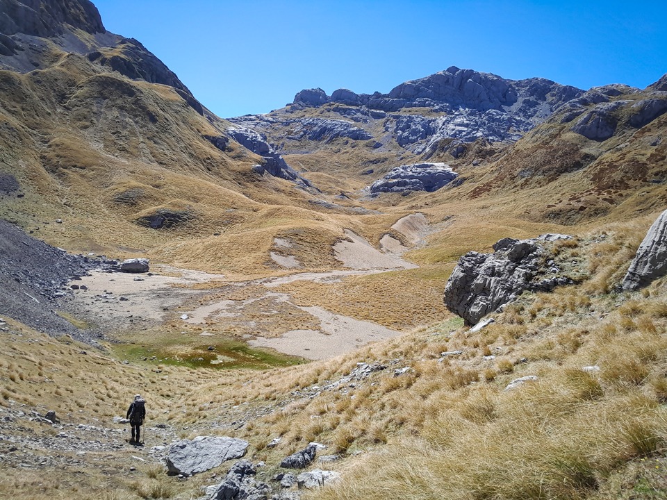
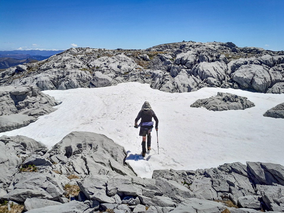
There was a steep climb out of the Basin—so steep I wondered if I might just roll back down the slope. We then traversed across to Poverty Basin, enjoying all the yellow hairy alpine buttercups. The tarn that was marked on the map had all dried up but there was some snow in the basin that we could top up our water supplies with. I, of course, grabbed a handful to make a snowball and took aim at an unsuspecting Tony. Well, I think he knew something was up by the minute of silence followed by some giggles before the snow came flying at him.
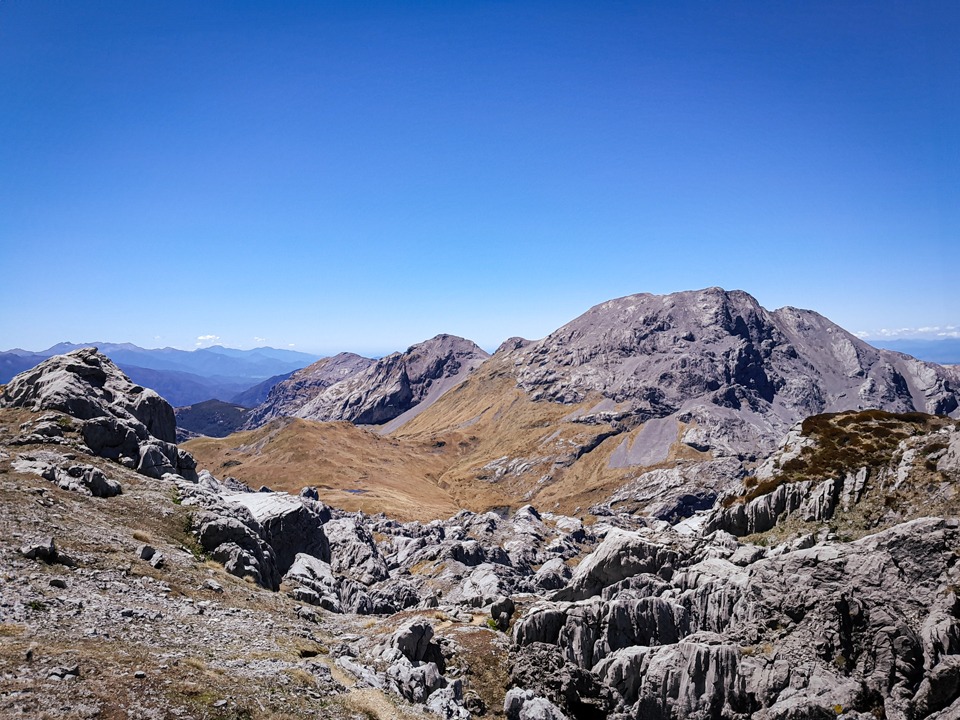
We could now easily see the summit of Mt Owen—so close yet so far away as we got ensnared in the maze of karst—we came to dead-ends and impassable sections so that we ended up walking around in what felt like circles for ages, possibly a little misplaced for a while, before Tony found us a route through and truly saved the day. We put our packs into a small doline just before we joined up to the track that led to the summit. We passed another large patch of snow and I couldn’t resist making a snow angel and then having some fun sliding down. We passed a few people on their way down from the summit.

Finally, we were on the summit of Mt Owen, which is the highest peak in Kahurangi National Park, at 1875m. We had clear views over to Nelson Lakes National Park, Tasman Bay and the Matiri Range where we had previously done a trip to the Haystack and Needle. We stayed a good while admiring the view on a perfect summit day.
It was still hot on the way down so we gathered some snow and made ice blocks. We came across an unexpected weka among the snow when we were filling our water bottles. We were quite surprised to find it in an alpine environment where food availability would be more scarce given they mainly live on invertebrates and fruit—but weka seem remarkably resilient.
As we traversed back across from Poverty Basin to Castle Basin we discussed where to camp. There were some tarns before Castle Basin but the wind had picked up a little. We decided to make a longer day of it and head for Castle Basin that would be more sheltered. This turned out to be a fantastic decision because when we took a break before the drop into the basin, a kea turned up.
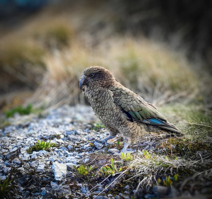
This kea investigated us thoroughly and then went away and turned up with some of its mates after nearly jumping in my pack when I turned around to offer Tony some baking. There were 12 kea with a mixture of adult and juveniles (easily identified by the yellow colouration around their eyes and cere). I love kea—their intelligence, cheekiness, and distinctive call. I also like the fact that the collective noun for kea is a ‘circus.’ After sitting around watching this circus of kea play, we decided it was time to move down the hill into Castle Basin and this was when the kea really showed us up.
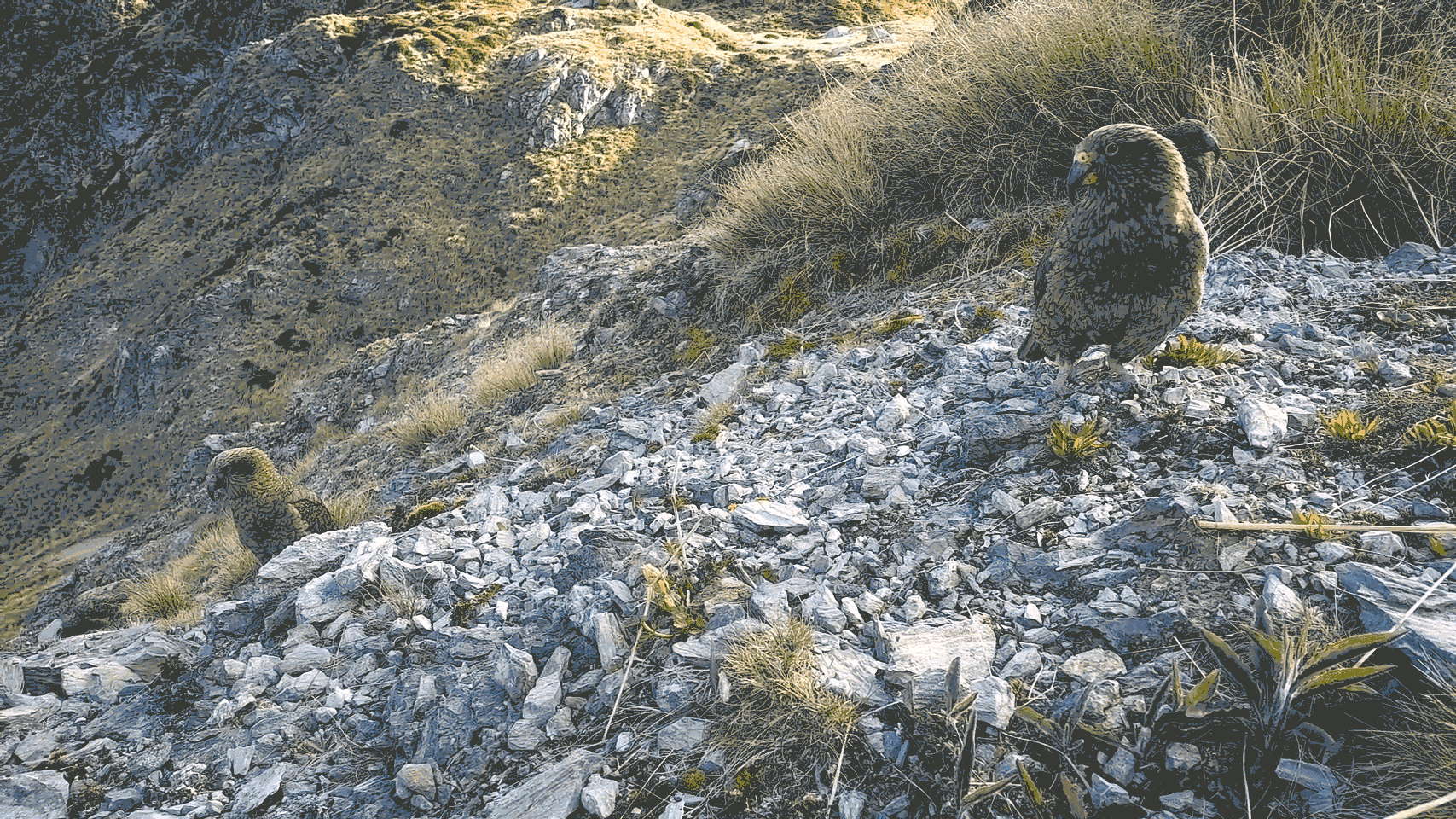
Tony started down the steep slope first as I wanted to sit and watch the kea just a bit longer. Suddenly rocks were flying down the hill at Tony and he was yelling at me but I wasn’t even moving! It was then I realised that the cheeky circus of kea had started a new game—trundling rocks down the hill on poor unsuspecting trampers below them—and they were nailing their accuracy sending quite large stones flying past Tony at head-height.
When it was my turn to go down the slope, I was also pelted by rocks. Once at the base of the basin we looked back to see the biggest rock yet come bouncing down the slope we had just been on. When the kea realised we were now out of range they gave up their game and flew away.
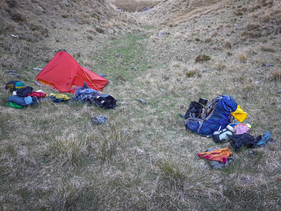
We eventually found a nice camp spot that provided good shelter from the wind and wasn’t far from a tarn and it was well out of the kea’s firing zone. We heard the kea flying overhead but thankfully they didn’t come down and use our tents as their new playground. That night there was a melody of frogs again and a very bright full moon that tricked me into thinking it was time to get up when it was only 2am. I sat outside for a while just enjoying the sounds of the kea and frogs, and watching the moon and stars.
Day 3
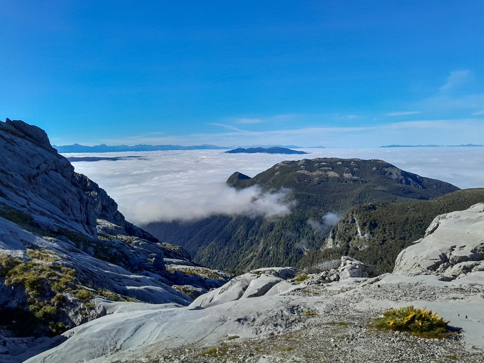
The next morning we woke up to find our tents covered in frost and I found I was lying on the hard ground after my mattress had deflated during the night (this seemed to be a recurring theme over summer). After climbing out of Castle Basin we were greeted with a spectacular inversion layer that looked like we could just put crampons on and walk across all the clouds. We wandered through the karst maze again towards Sunrise Peak.
Tony had been this way before and he promised me the route included a big cave and he wasn’t wrong—the cave was so big that you could fit a double-decker bus in it. The climb to Sunrise Peak involved passing through a spaniard city of course.
Here Tony and I chose different routes. My route was probably shorter but a high energy one that involved hauling myself up multiple times.
We had lunch just south of Sunrise Peak where the poled route back into the bush started. It was a steep descent back towards the bush.
Unfortunately, I lost the poled route at one point and we ended up on an animal trail that disappeared and ended in a bushbash (Tony and I seem to always have a bushbash every trip now whether it be planned or not) and at one point Tony had to grab me from falling off a rocky drop onto a giant spaniard below. I then stumbled across the trail again and it was as wide as a footpath. I suggested to Tony that perhaps we should rethink having me in front!
As we reached the bush edge, we were surrounded by lots of dracophyllum, or ‘Dr Seuss plants’ as I like to call them. We were both getting a bit short on water and it had been a hot day so the knee bashing descent to the river felt like it took forever especially since we could hear the taunting sound of the river so high up.
Once at the river, we filled our bottles and drank them all in one go before starting the easy walk back along the track to the car.
Useful Information
Swimming in Bulmer Lake is absolutely discouraged, as is using it for washing, in order to protect the water quality—and the endemic aquatic plants. The lake is the only water source for camping, and the area is popular with cavers who have Guidelines for Caving and Camping on the Mount Owen Massif pages 10 and 11 for their members when camping. Read and follow them.
Day 1 – Owen Valley East Road to Bulmer Lake: 5 – 6hrs; 11.5km; 1,883m elevation
Day 2 – Bulmer Lake to Mt Owen and back to Castle Basin campsite: 9 -10 hrs; 11.6km; 1,357m elevation
Day 3 – Castle Basin Campsite to Owen Valley East Road via Sunrise Peak: 8hr; 9.65km; 452m elevation.
For another Bulmer Lake trip go to Bulmer Lake by photos.