
Top Gorge Hut – Ruahine Range
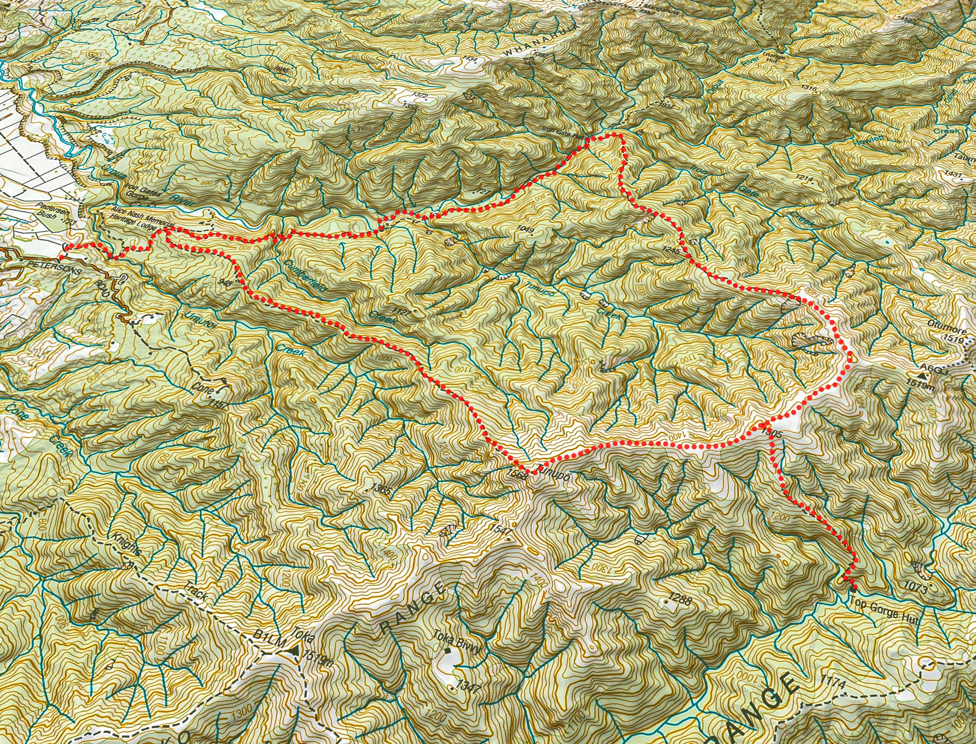
A two-day hike to the seldom visited Top Gorge Hut in the Ruahine Range, including a route map.
Top Gorge Hut is right in the middle of the Ruahine Range and doesn’t get many visitors because it’s not really on the route to anywhere in particular.
Anne was very keen to do a loop over the Ngamoko Range with a night in Top Gorge Hut as the track had just opened up again after being closed for an extended length of time due to flood damage. The weather forecast wasn’t looking the best but we were hardy souls.
On Friday night we had a short walk over farmland and then through bush to Alice Nash Memorial Heritage Lodge. The hut book had some comments about the bypass track over the slips with opinions ranging from that it wasn’t too much of a problem to some that sounded a bit more dramatic.
After reading all these comments we decided it may be wise to just avoid the bypass track and extra climbing all together and go straight up the river to rejoin the track after the slips.
So on Saturday we veered off the track before the slips (the bypass track starts where the track meets the Oroua River after a number of switchbacks and is marked by pink ribbons).
We initially followed a decent foot trail alongside the river and then cut the corner through the bush before dropping back into the river bed.
Walking across the bottom of the slips I could spot the bypass trip high up above us. DoC has an alert on their website that the bypass track is steep with few handholds and will have loose footing until it has had more use to establish the trail. Another club trip has indicated that their group got over it without any problems but it wouldn’t be great for anyone really worried by heights.
A benefit of going up the river was that I spotted two whio after hearing their characteristic ‘whio’ calls. It was two males identified by their high pitched calls unlike the low growl that females have. It was great to see them sitting there happily. Clearly all the work going into trapping to help keep them safe is working. Along the way I emptied a few traps that had rats in them and reset them.
We rejoined the track after walking up Tunupo Creek to meet it. From here it was a straight forward walk to Iron Gate Hut for lunch.
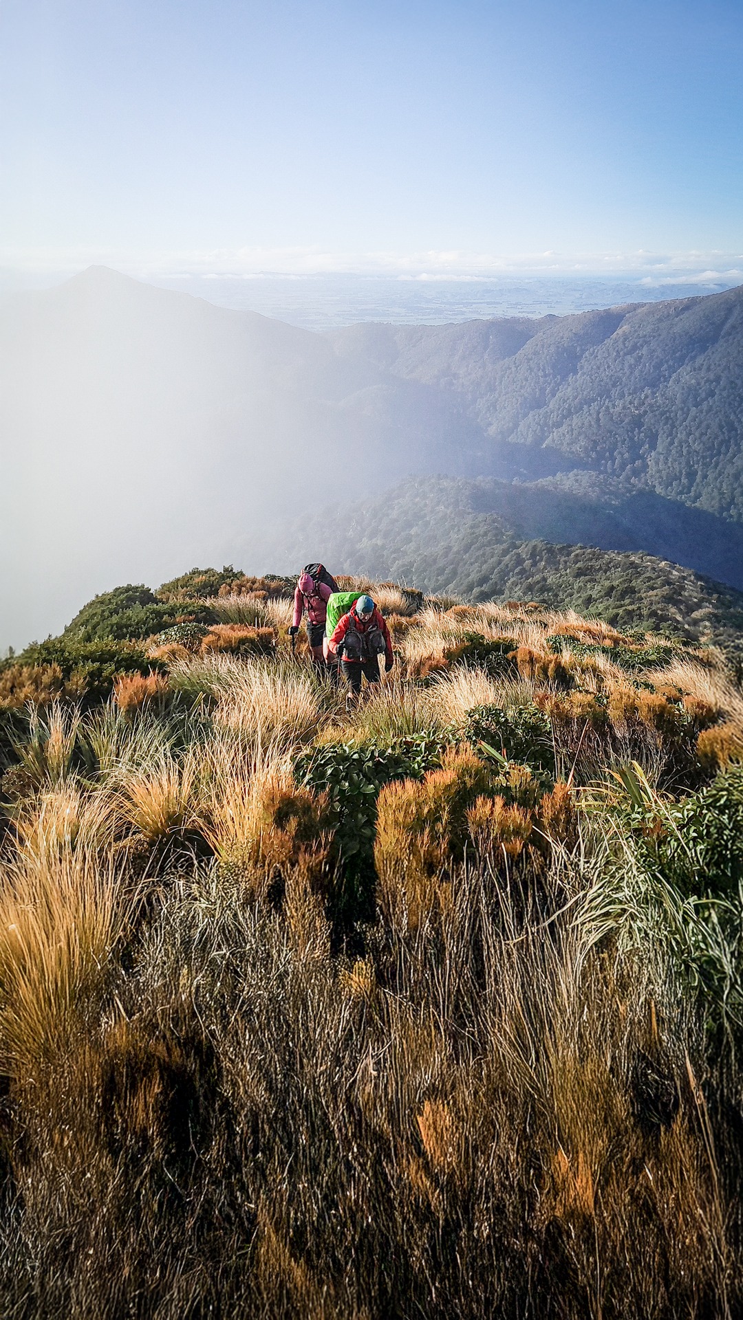
We then had a long climb with a few steep sections up to the Ngamoko Range. On the tops we experienced some light snow flurries and eventually the visibility reduced just as we got to the signposted junction for Top Gorge Hut.
There was a good foot trail down the spur to the hut and track markers started once in the leatherwood. The trail was very muddy with plenty of evidence of deer amongst all the mud.
The last part of the descent we did in the dark and it was a bit overgrown at times so I was having to really focus on following the track markers and it felt a bit like I was leading the others in a complete circle with the darkness and switchbacks in the track.
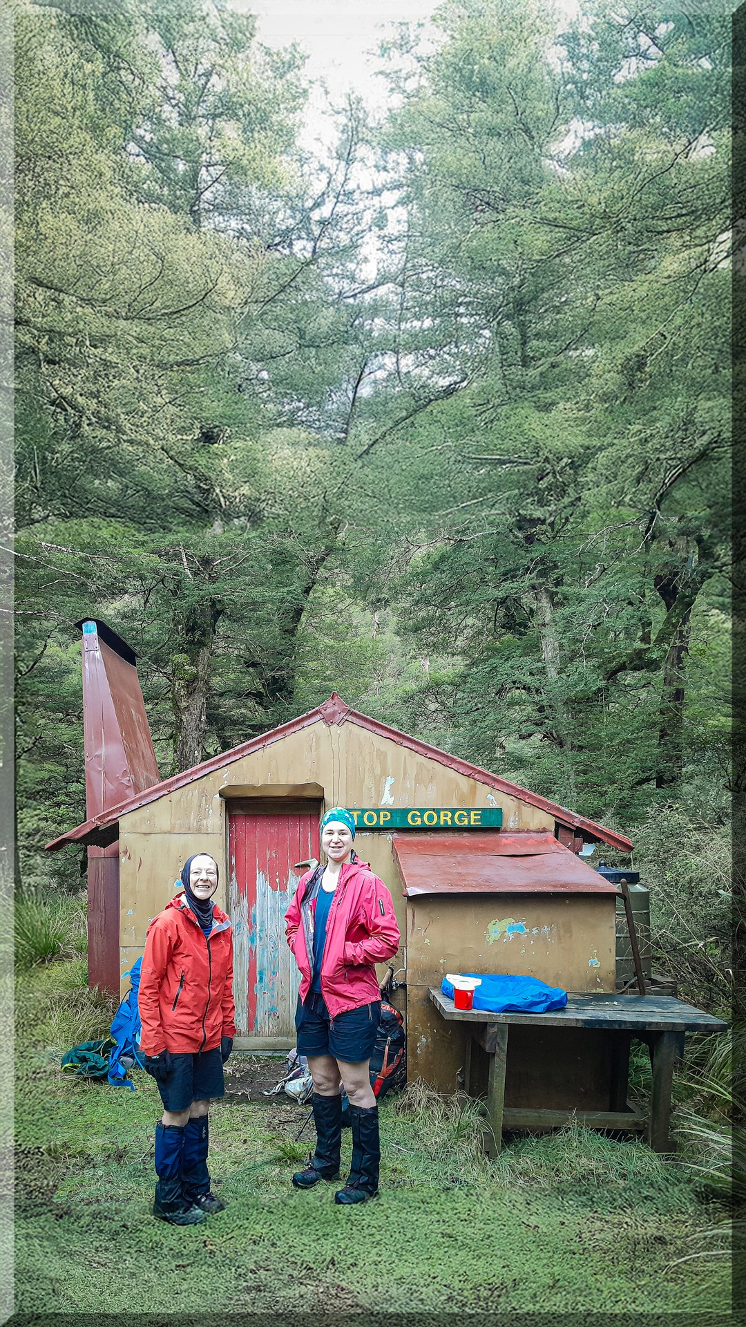
We found Top Gorge Hut empty which surprised me as I thought I had heard a gunshot on the descent but no one had been to the hut in a few weeks so I figured perhaps it was someone on the Longview Ridge.
The hut had a very smokey open fire, which we had to give up on after a couple of attempts. This didn’t stop us from having a nice evening thanks to good hut reading materials (a local Ruahine novel from FireStarter Press) an impromptu disco head torch light show and me laughing uncontrollably when I slipped over in the mud walking to the toilet.
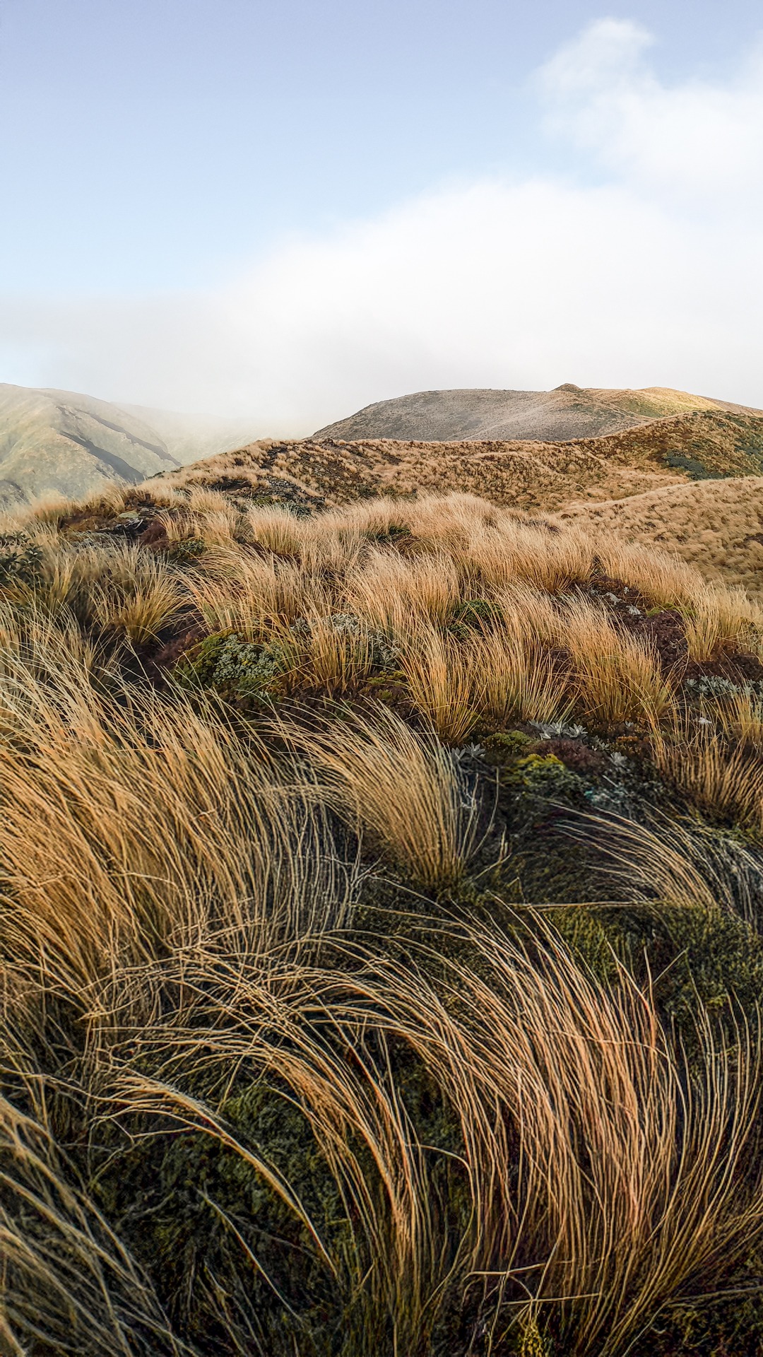
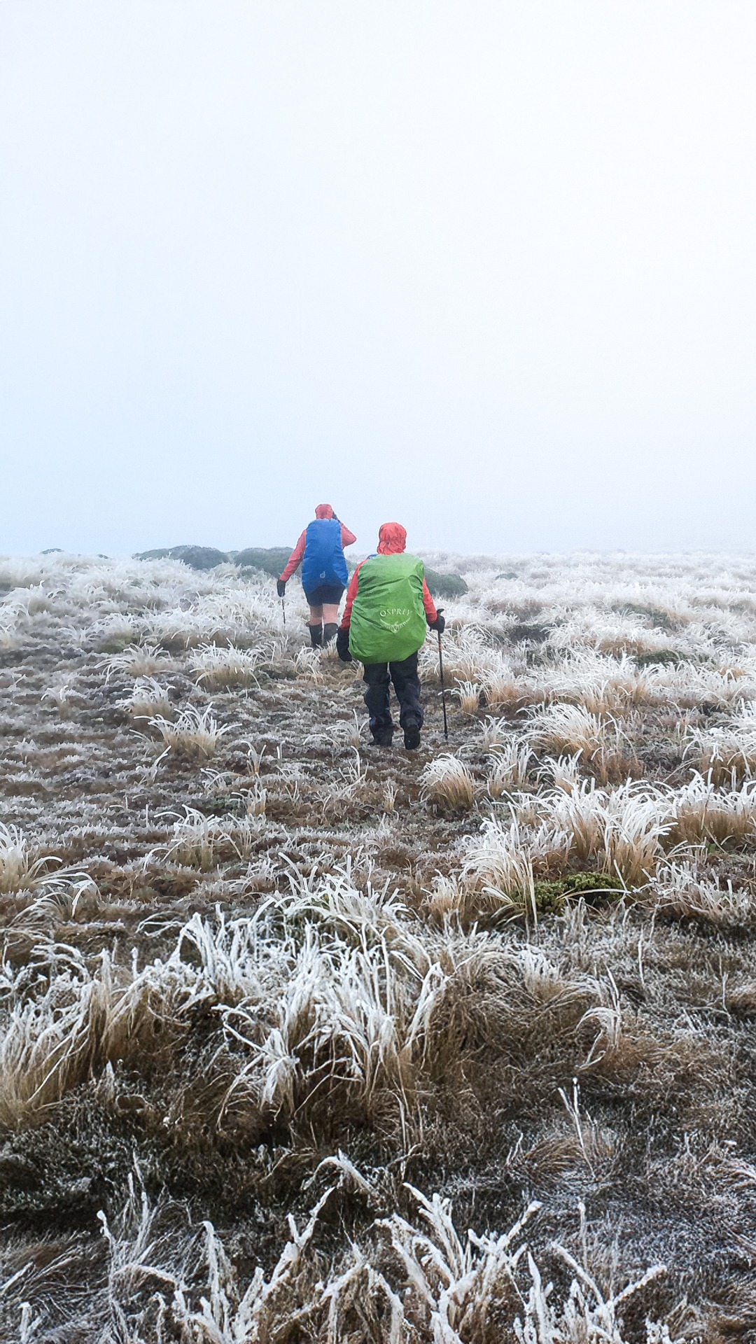
Sunday was a frosty start and we all got fairly damp pushing through the overgrown sections of the track but at least we had the climb to warm us up.
At the bush edge we layered up while admiring the rainbow that was forming next to us. We found there had been fresh snow overnight so the spur now looked completely different from the day before – quite magical.
There was a strong cold wind though so we couldn’t stop for too long, and when her legs froze Anne found the hard way that shorts weren’t quite cutting it in this weather.
We made a quick march along to Tunupo following a good foot trail where we could get back into the shelter of the bush. The descent from Tunupo was fairly gentle and a good way to finish the weekend’s tramp, with even glimpses of snowy Mangaweka in the distance.
Carpark to Alice Nash:
Distance: 2km
Time: 0.5hrs
Alice Nash Memorial Heritage Lodge to Top Gorge Hut via Irongate with river bypass:
Distance: 15.4km
Time: 7- 8hrs
Elevation: 1,461m
Top Gorge Hut to Petersons Rd Carpark via Tunupo:
Distance: 12km
Time: 4-5 hrs
Elevation: 1,028m.