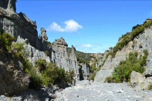
We left Wellington early, arriving at a sun-streaked Putangirua Pinnacles after a quick 30 minute walk from the road end. These badlands had a starring role as Dimholt Road in Lord of the Rings, the road to the land of the dead.
Heading up the ridge from the pinnacles, we quickly realised that this walk was going to involve much sweating and lots of water. The zigzag track brought us to the look-out, which was well worth the hike with stunning views of the pinnacles and the Cook Strait to the South.
From there the walk just kept going up hill. Taking full advantage of newly found bushcraft skills, Thomas and Claire tried in vain to determine how high they had to climb, but misread by 200 meters and missed many inclines and gullies. The walk wound through some fantastic views of the Aorangi Forest Park and beautiful groves of foxglove.
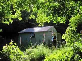
On and on the path went up, until most of the group had run out of water. Just when all seemed hopeless (like in the Lord of the Rings), the hut appeared out of the bush. Eager to soak in the lake that must surely be located closed to the so-named Washpool Hut, the group scurried/crawled on, only to find that the hut had no such lake and in fact not even a water cistern. After a quick moment of panic, the stream was located and the group was soon enjoying a much earned relax in the fresh water.
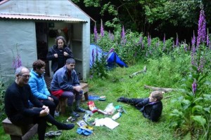
The hut was shared with two friendly hunters and their four excitable dogs, so fly was established amidst fields of stinging nettles. Considering the steep scramble the group took to get down to the hut, conversation turned to the way out and the hunters suggested taking the stream all the way to the ocean. This route was supported by comments in the hut book and our maps and so cunning plans for the next day were formulated while we feasted on Michelin star quality tramp food, Pad Thai with tuna.
The following morning saw an early wake up for Claire and Thomas, as the hunting dogs joined them for a good morning hug! Donning bags, the team prepared for their river journey.
The walk down Makotukutuku Stream was pleasant, with some of the team taking the time to plod through the tranquil waters – soothing their blisters – while other more energetic sorts engaged in some acrobatic boulder hopping. Light streamed off the trees making for a very peaceful walk.
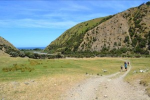
At long last the ocean appeared at the end of the valley and we were out! Tired but encouraged by the successful trek, we settled down to lunch by the sea while Rory selflessly hitch-hiked back to the club van, saving the rest of the group a further 6km walk along the coast.
All in all a great trip, it was hard going but with some amazing views of the pinnacles, and a beautiful walk down Makotukutuku Stream. Recommended for easy-medium trampers, but suggest you take loads and loads of water if undertaking on a hot day. Easier access via the stream but this would necessitate a separate trip to see the Pinnacles, which are further around the coast. Hats off to Kevin for leading us into the valley and back out again.
Trip leader notes: 2hr drive to start of track. Water is available at the pinnacles road end camping area unless tanks are dry. Walk into the Pinnacles for photos, there are two routes on the left that will take you up to the viewing platform (drop packs and come back “to the furthest one in” on the way back). Leaving the river bed both tracks lead up to the viewing platform, joining just above it. The trip in is along a ridgeline climbing to 700M (Reasonably well marked) 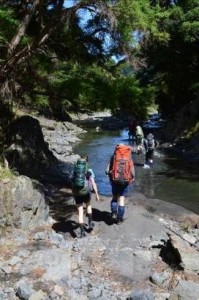 – some semi-obscured views. Allow 6hrs (EM). Water at washpool hut either from river 40 metres below or go straight ahead from the door of the hut where 30 metres on you will find a stream. Ground around hut is very rough for camping – space for 1 fly to the right of the hut. In good weather you can walk out via the creek (4hrs); there is the occasional section of path along the sides including one high sidle (look for DoC marker) on the true left early on (may not be required). Once you hit farmland about ½ way along there is a four wheel drive track to follow. On nearing the road take the left fork away from the homestead (towards the barn). The walk back to the carpark from here is not to be underestimated.
For more Putangirua Pinnacles go to Putangirua Pinnacles Closed? – not in 1948

