
On a Friday night in May 2006, a band of hardy WTMC M trampers ventured into Northern Tararuas. Three days later they emerged – scratched and broken by leatherwood, attempts at compass navigation in the dark and arguments about oversized watches. Their Haukura Ridge trip was to gain enduring life as a case study in our instruction courses.
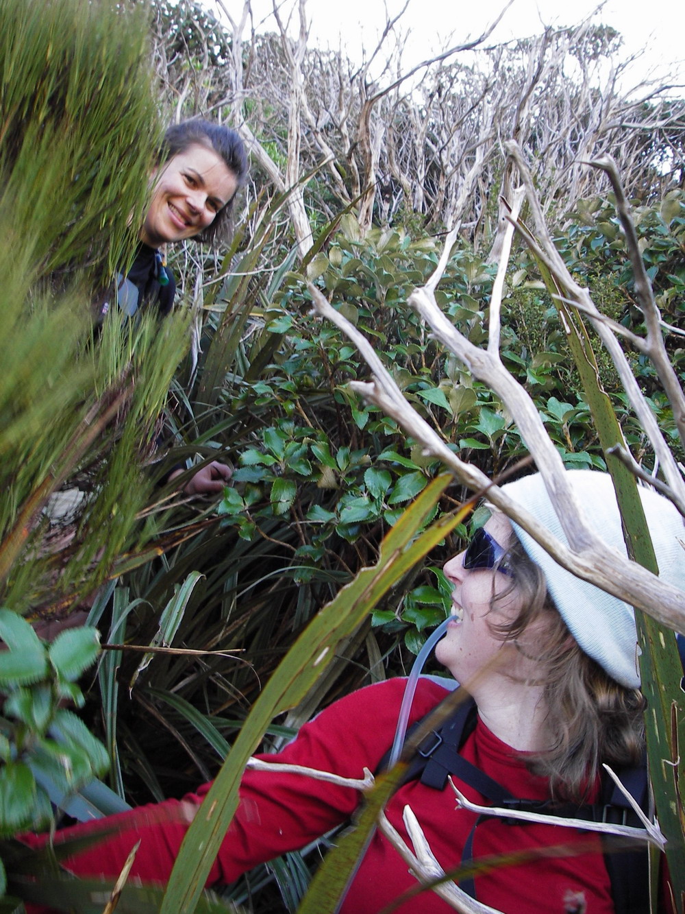
But this is not their story, which has already been told. Sadly my many house moves have meant the loss of that particular paper newsletter, and our electronic archiving on the website has not yet reached back that far. But I remember the newsletter account as a humorous, if slightly sanitised, recounting of the travails of that trip. All that remains in my possession is one photo, showing smiling faces poking out of leatherwood. Little did we know this was just the beginning…
It took eight years before I was even prepared to think about repeating this trip. To put this into perspective, when doing the Tararua Peaks in late 2006, I said ‘never again’, but was back less than four years later… On Haukura Ridge, that one hour spent moving 100m through head-high leatherwood and the bush bashing in the dark were haunting memories, as was the bivvying out on a sloping tree-clad hillside far from our intended destination of Roaring Stag hut.
Over the years I occasionally wondered whether we just did it wrong – whether there was a better route through that scrubby shrub – or whether it was just destined to be that hard. Others were keen to give it a try but for some reason or another their trips never happened. And I started to think maybe it was wrong to let the leatherwood win.
The internet proved dangerously inspiring. Others had ventured there, recently, and their trip reports did not tell of unspeakably shredding. One group even did part of the ridge as a day walk! Better routes were hinted at, and Google Earth seemed to corroborate these suggestions. It was time to venture again to Putara.
The first attempt late last year ended up in a desultory bit of navigation practice, after strong southerlies and hail pushed us off the tops. I put it on the schedule again, this time in March. Third time lucky?
Judicious email descriptions of the route whittled down an initial long list to a hardy three. Now more appropriately graded MF, the trip plan included exhortations to bring old overtrousers as defacto leg armour. I was joined by Paul and Allyn, one of whom I knew well and the other I knew by reputation and reading of remote Tararua hut books. I mentally designated myself the weakest link.
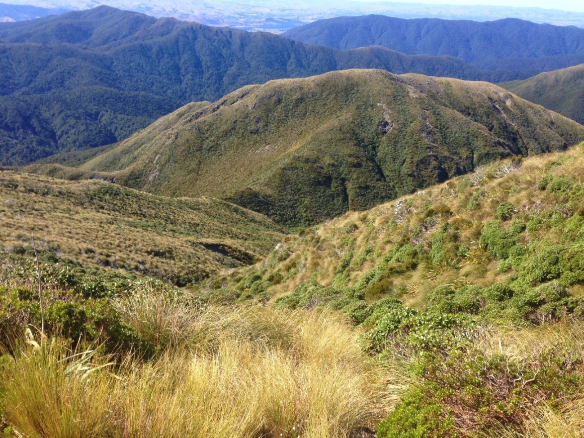 As we cruised into Herepai hut with David Jewell’s fearless Chamberlain Creek canyoning crew, the omens seemed promising. Heading off early next morning, we were engulfed in clag and a biting wind, but our pace was strong. We reached East Peak after 1.5 hours and took a careful bearing down Haukura Ridge. After only about 15 mins, we were out of the clag and glimpsing views of the rugged northern Tararua tops. The rocky part of the ridge is relatively easy, especially when you can see where you’re going. We passed the spot where our 2006 crew had stopped for lunch – but for us it was only just after 10. I started to feel a tempered optimism.
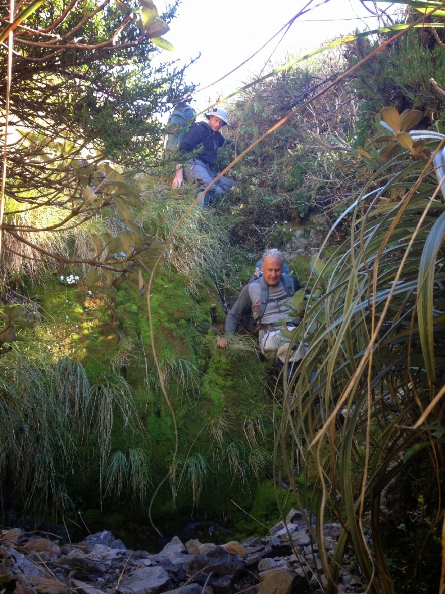 The section down from .1332 was the crux. This was where we had spent hours floundering in steep leatherwood. My research had indicated that the old route to the now-gone Haukura biv was not down the ridge, as we had previously assumed – but down the creek. We gingerly lowered our way into its steep headwaters. Given the recent lack of rainfall the bed was relatively dry and it was a fun, if slightly technical, scramble down. We stayed in the creek bed the whole way, limboing under leatherwood and sliding down the odd rock face (in retrospect, we could perhaps have stayed on the ridge slightly longer and avoided some of the steep creek headwaters).
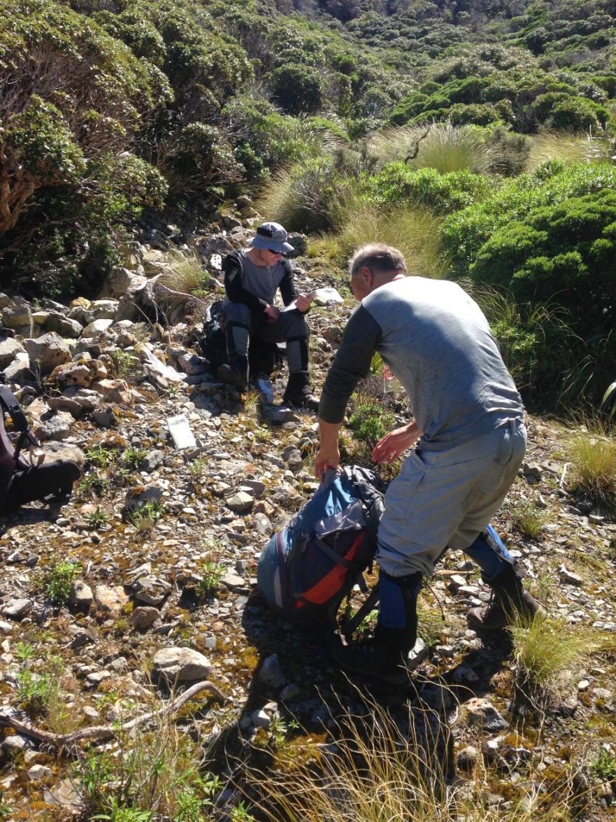 Despite a brief pause en route to first aid a nasty cut to Paul’s hand, we emerged into the basin just after 12. After a somewhat ill-advised circuit through the leatherwood, we located what seemed to be the old biv site next to the creek (near where on the map the creek appears to turn a sharp corner). It was lunch time, it was sunny and we were in happy spirits.
The next puzzle was how to gain the saddle behind the biv site and hence .1127. Previous accounts referred to ‘barely there’ old tracks. Paul spotted a potential starting point and, just like that, we were pushing our way through what would have once been a track (if you’re interested, it’s at the northern head of the biv site). Soon we were gaining height, easily. I looked back at the leatherwood cliff that had caused us so much difficulty in 2006… if only we had known about the creek route.
 At 1pm we were on top of .1127, enjoying a gorgeous view of the upper Ruamahanga and forks. We debated about the route ahead, and decided to stick to the ridge. With a lot of care, we were able to follow the old ground trail through the scrub and at about 2:15pm hit the treeline. Good bye leatherwood! But it wasn’t over yet. I knew from last time how tricky this bit of navigation could be – though obviously much harder in the dark. What’s not clear on the map is that ‘obvious’ ridge to the hidden lake is not obvious at all in reality – when you’re on the ridge, the most clearly defined direction is down the spur that branches off northeast at about 800m. Our ridge kept stopping and starting, and for a while we were heading much too far north. We made a long, compass-assisted correction that seemed intuitively wrong, heading much more across the slope than down. I was slightly comforted by the difficulty of this navigation – it helped explain why in 2006 we got so stuck. Though I still don’t quite understand how we ended up between the two creeks in the vicinity of 600 meters…. (and that’s where we ended up bivvying out). This time, we emerged at 3.30pm on to the flat, very close to our target of the hidden lake.
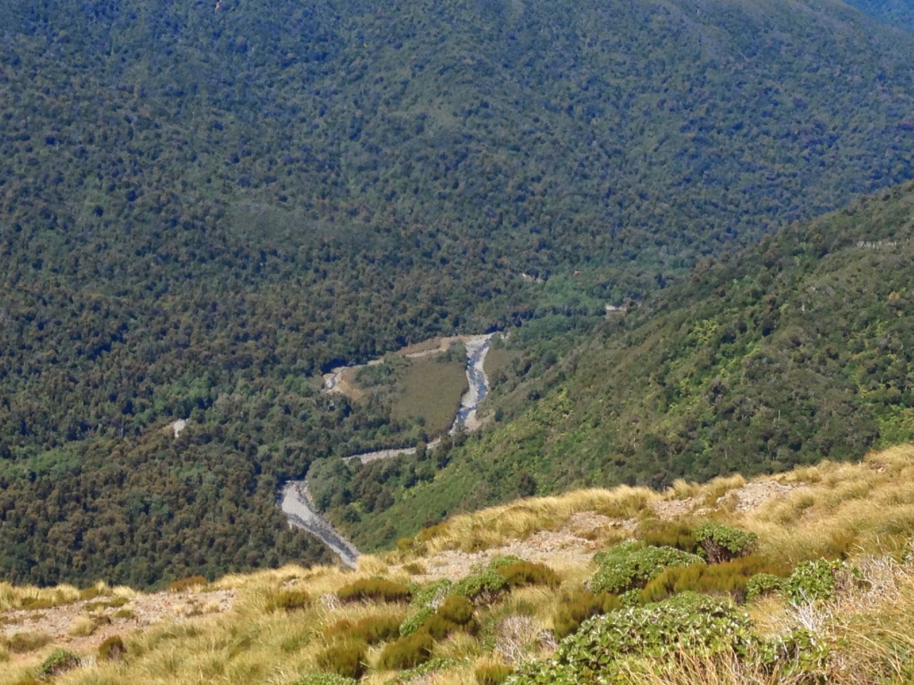
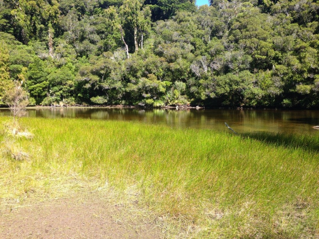 Despite the constrained rain fall, it still had plenty of water. We looked around for the supposed campsite at its west end, but it didn’t seem that great. Interestingly you can’t get down to the Ruamahanga here – the river is bordered by a large cliff. We headed south along either an old track or a very good animal trail, then ambled down the river towards the forks, looking for a nice sunny campsite. We found a few good options near Ruamahanga Forks, having already decided that the fine weekend would unpleasantly overload Roaring Stag hut.
Next morning we cut east, hitting the track out of Roaring Stag in about 15 minutes. It was a leisurely walk out as we knew the canyoners were behind us (spiderwebs!). At the bridge we reunited, and enjoyed hearing about their adventures. While ours might not have been as bold, it was one of the best tramps I’ve done for a while. Thanks to Paul and Allyn for their excellent bushcraft and company.