
A Bannister crossing had been on the to-do list for both Anne and I for a while. The Bannister Ridge, with its dramatic and imposing profile, had captured our imaginations on previous trips. Anne had planned a Cattle Ridge-Bannister-Dundas loop in autumn last year, however we didn’t get the weather window to do that trip. As part of the planning, Anne had researched the ‘spicy sections’ of the ridgeline and noted three particular hazards:
- “A first rock face that feels like the real deal”
- “A second rock face that makes the first one look like a joke”
- “A very narrow/knife edge section with a lot of exposure on each side”
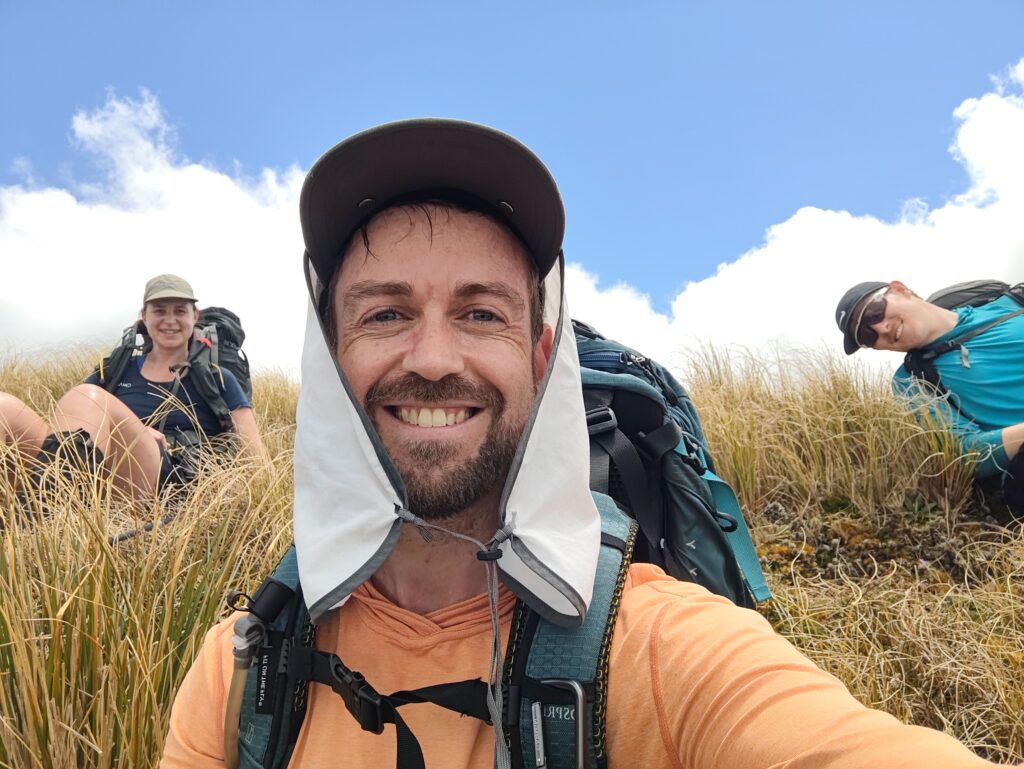
This time round I took a stab at leading a Bannister Crossing, as I have a pretty good track record for good weather on trips I lead. I planned for a weekend of sunshine and low wind – perfect conditions for tackling the Bannister scrambles safely – and this was exactly the forecast that was delivered. I envisioned a Bannister Ridge-Arete Forks Hut loop which we would cram into less than 48 hours. This would require long tiring days with lots of cumulative elevation (4,200m!) in order to build fitness for an upcoming sub-48hr SK attempt. Unfortunately for Anne and Matt, neither of them were planning on doing this SK, so the trip became a masochistic exercise for them.
Friday
We left the Wellington Railway Station at 5pm and headed for Kiriwhakapapa Road end. Both Anne and Matt were recovering from illnesses and I was wondering whether this trip would work, but we had contingencies in place and would use the climb to Blue Range Hut to assess fitness.
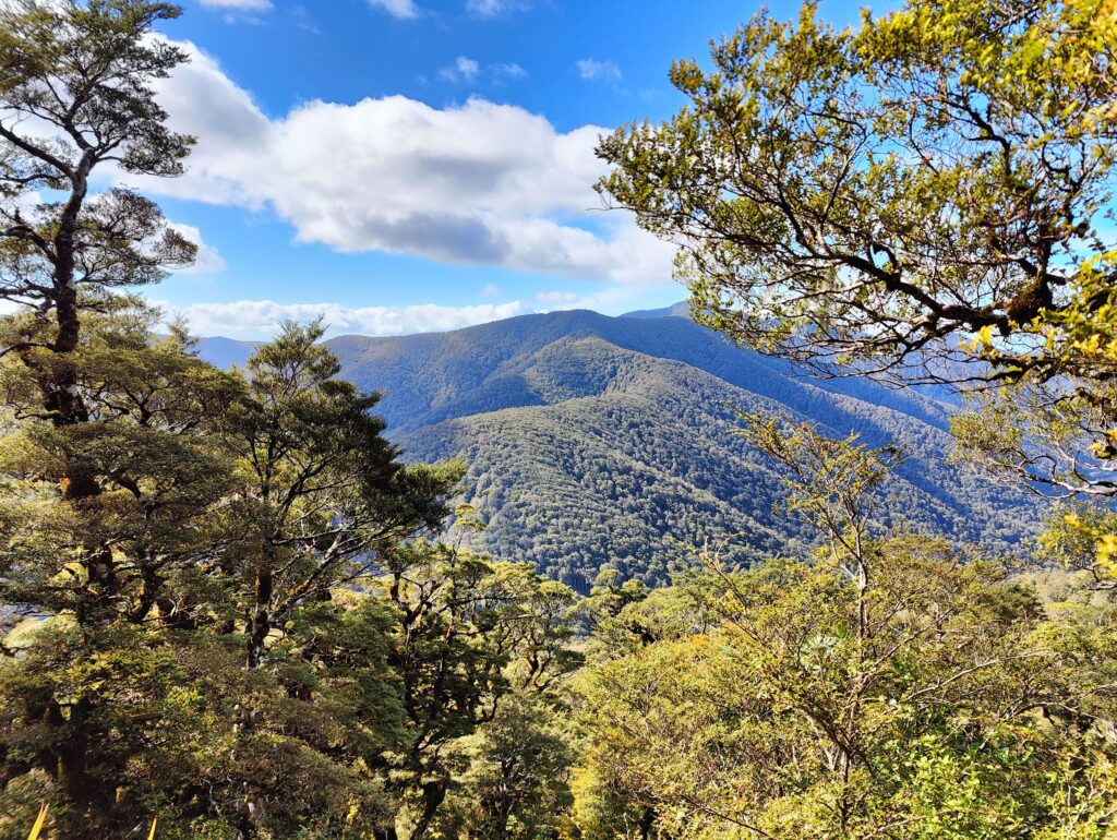
It was 8pm when we started our walk. Thanks to GWBN, the recently cut track was in excellent condition and easy to follow in the low light of dusk. The climb was steady and we arrived at the hut 90 minutes after setting out, covering the 670m elevation gain with surprising ease. Blue Range provided our first views: Waingawa and Bannister were a dark silhouette against a fading pink sky.
We had the hut to ourselves and made the most of the opportunity, sorting out our gear in preparation for an early start the next morning. Anne arranged a raised pillow to keep her head up and avoid coughing through the night, which seemed to work OK as I had a terrific night’s sleep.
Saturday
We awoke at 5:45am with daylight already streaming into the hut. More importantly, we saw Bannister Ridge was bathed in orange sunlight and the only cloud we could see were a few wisps clinging to the ridgeline south of Arete. From the vantage point of Blue Range Hut, the undulations of Bannister Ridge were conveniently hidden, although the route ahead of us still looked formidable for its sheer length.
We stocked up on as much water as we could carry (around 3L each), anticipating there would be no water sources until we reached Arete Hut, then set off at 6:30am.
Blue Range to Cow Saddle
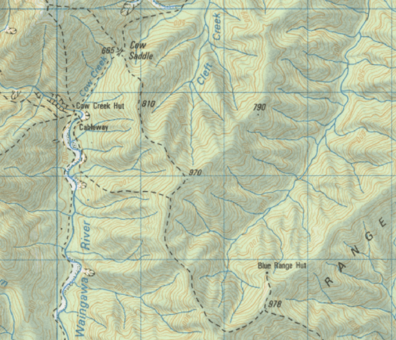
From Blue Range Hut, we returned to the Kiriwhakapapa-Cow Creek junction and followed the track beneath Te Mara Peak and past pt 910 to the turnoff to Cow Saddle. This junction is marked by a DOC sign pointing out the track down to the Waingawa River, and presumably there also used to be a second sign here marking the Cow Saddle route. Although not shown on Topo50 maps, the Cow Saddle route appears on older maps (1979-1999) and a decent ground trail still exists today. More importantly, there are permolat markers along the whole route and the odd bit of flagging tape.
It was easy to follow the track down the snaking spur without any significant navigation on our part. We made it to Cow Saddle two hours after leaving Blue Range Hut and took a break to down chocolate bars and dinosaur lollies in preparation for the climb up to Waingawa.
Cow Saddle to Waingawa
The climb was steep and it was becoming apparent it would be a hot day. I noticed we already had salt lines on our clothing from sweat. At the bushline, we fought through patches of tussock for a while, then the route began to open up, along with providing us superb views. We could clearly see the track running down Pinnacle Spur, which gave us some confidence that this section of track would be well cut and easy to follow later in the day.
The views also gave us a good excuse to take frequent short breaks and we talked about how rewarding it was to see familiar features like Mitre, Table Ridge, Tarn Ridge and Arete from a new perspective. There were many hidden climbs on the ascent, and it took a solid 2½ hours to reach Waingawa Peak which is marked with a weather station. It was now 11:30am and we had been going for five hours since leaving Blue Range Hut, but with a 12+ hour day planned, we decided to wait a little longer for lunch and only had a short snack break here.
Waingawa to Bannister
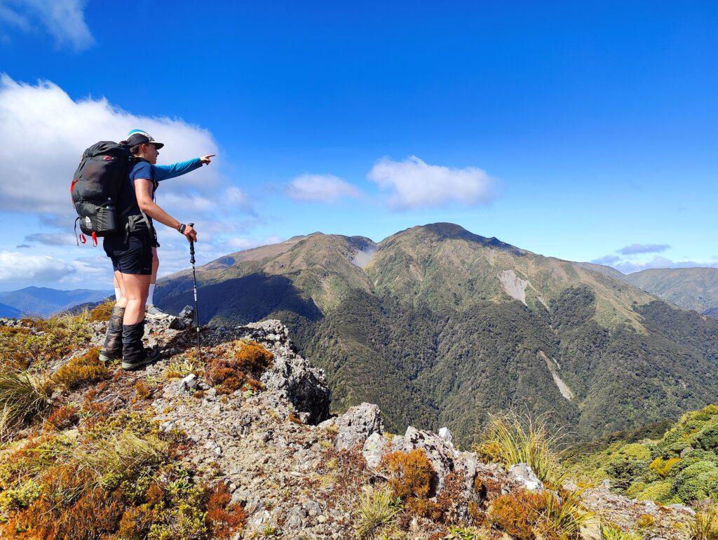
During the climb up to Waingawa, I had assumed the lack of wind was simply because we were being sheltered from the northwesterly. However, now that we were on the tops, it became apparent that there was almost no wind at all. Ahead of us, we could clearly see Bannister peak, which is a rounded top, and to its left, the sharp imposing peak of pt 1513. Pt 1513 is often referred to as Bannister’s low peak, however it is an unnamed high point on maps and indeed the only unnamed 1500m peak in the Tararua ranges. Mon has previously suggested the peak should be named Barnett in memory of Shaun Barnett, and, seeing as Barnett has a much better ring to it than ‘pt 1513’, this name quickly caught on among us.
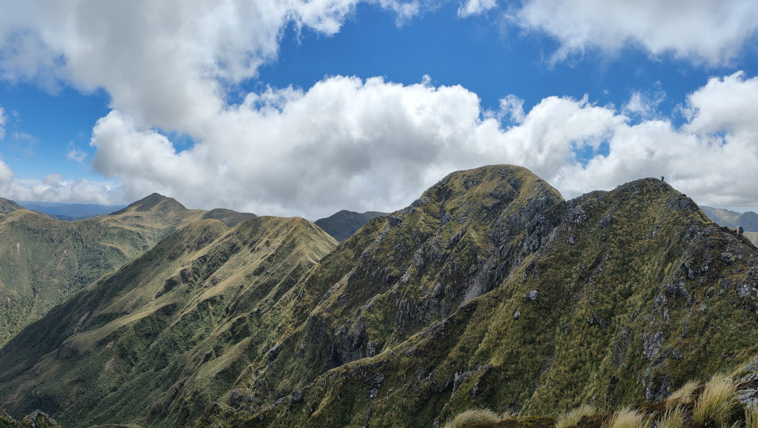
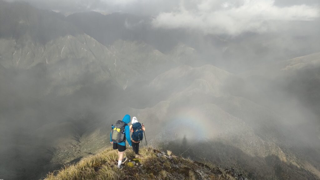
Leaving the broad features of Waingawa behind us, we enjoyed some high cloud cover for a while, which helped keep us cool on our way towards ‘Barnett’. The route became narrow and undulating, and around halfway to pt 1385 we encountered what must have been the first of Anne’s forewarned spicy sections: “a first rock face that feels like the real deal”. The rock face in question was a pinnacle jutting from the ridgeline, with no sidle path around. Matt led the way and climbed the face with ease, which was reassuring for Anne and I who followed. It was sufficiently easy that I doubted whether this indeed was one of the challenging sections!
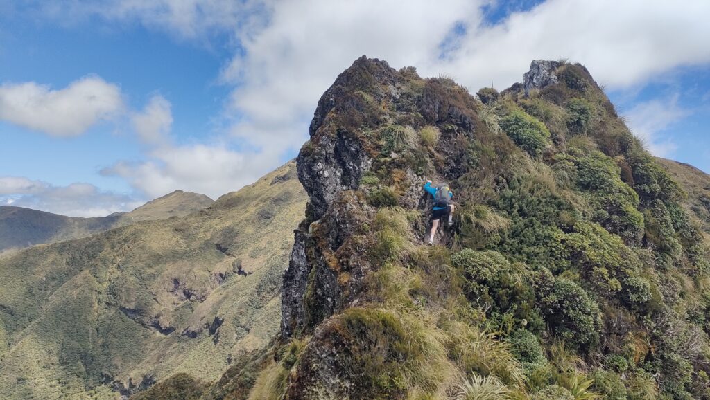
We made slow progress over what felt like many steep climbs and descents, before arriving at “a second rock face that makes the first one look like a joke”. This time, I had zero doubt about what I was looking at. Matt, who was still leading, turned around in disbelief to ask if the track really went up the face. From some distance back, I could see what looked like a route, but standing directly beneath the face it was hard to tell if there was a way up or not.
Again, Matt led the way, and scrambled up using good foot and hand holds in the rock, which higher up gave way to tussock that could be grabbed on to. I am a big wimp when it comes to exposure, however the good hand holds meant the climb didn’t seem scary at all in the calm conditions. Unfortunately, my legs were beginning to cramp in weird places and I had to maneuver myself up carefully with the muscles I still had use of. Anne had the same problem.
Once past this section, we stopped for a much needed lunch break around 1:15pm. The day had already required a lot of exertion and we were unable to stomach solid food until we had rested for five or ten minutes. But with an extended break we got in some much needed fuel and made a push for Barnett.
From here, Arete Hut was in plain view, but looked like an eternity away still. The ridge then dipped slightly, becoming narrow and rocky but non-technical in the still conditions, and we were soon atop Bannister at 2:15pm. We stopped for a short break to soak in our achievement and the outrageous views. We had the reassurance that all of the ‘spicy sections’ were behind us, although the cloud had disappeared and the hot sun was making things uncomfortable.
Bannister to Arete Forks Hut
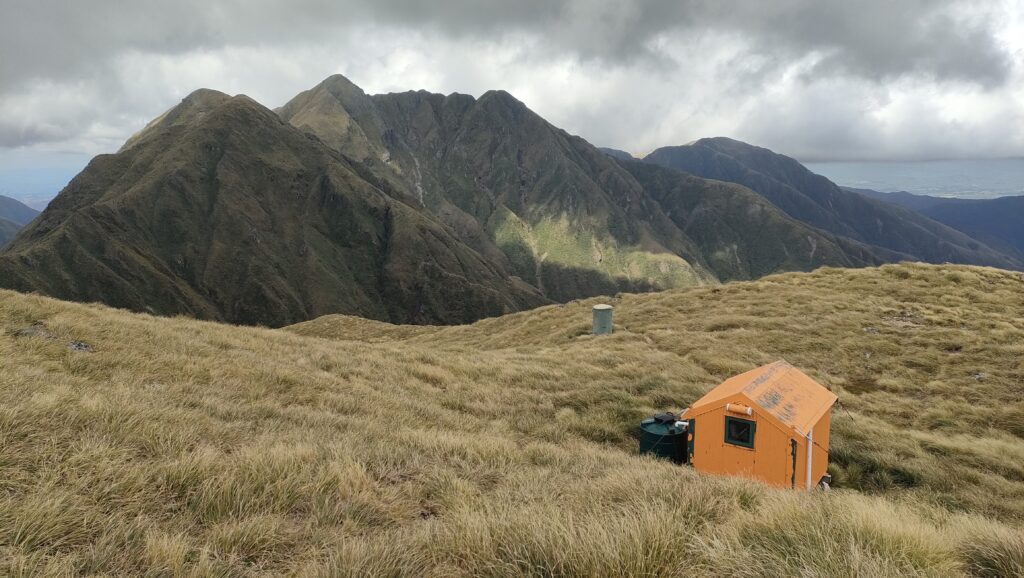
What should have been an easy drop down and 70m ascent up to the Twins was a struggle under the hot sun, which made the even bigger descent and 140m climb up to pt 1434 seem like an insurmountable challenge. Anne announced the day had officially entered type II fun territory. Matt, with the lightest pack of us all, was still going strong and sped on ahead to bag Arete peak. Anne and I meanwhile sidled around every inch of unnecessary elevation and took a direct path down to Arete Hut. Arriving at Arete Hut around 4:15pm, we met familiar faces, Frances and Henry, who offered us a hot drink from the billy while we refilled water bladders and inhaled sugar and electrolytes.
The final challenge of the day would be the descent from pt 1470 down Pinnacle Spur to Arete Forks Hut. From Arete Hut, we could see how dramatically undulating this spur was. It looked like someone had created one large and one small pinnacle next to each other, then copy-pasted this motif all the way down the spur. I warned Matt and Anne that this section would suck on tired legs, and we mentally steeled ourselves for a rough final few hours.
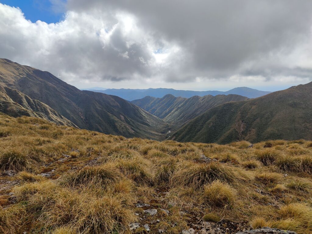
Between Arete Hut and pt 1470 we had stunning views of the Park and Waiohine Rivers, although each short climb was becoming progressively harder and we needed to stop for another snack break at pt 1470 where Anne announced the trip had spiralled catastrophically into type III fun. It was at this point that I began to feel guilty over the absurd route I had planned. Legs and even hands were cramping, dinosaur lollies didn’t seem to be providing much energy, and we had nearly 800m of descent before we would arrive at Arete Forks Hut.
The DOC sign pointing to Arete Forks Hut gave a suspiciously optimistic time estimate of 1-2h – this time estimate was on a sticker that had been placed over the originally painted time estimate of 1.5h. We assumed correctly that 1h to Arete Forks was a pipe dream and began the trudge down the spur.
Wispy cloud was beginning to gather and as the sun lowered we cast Brocken spectres in front of us. The track dropped precipitously down from pt 1470, but was thankfully non-technical for the gradient. The first of the pinnacles could be sidled, however most required frequent and steep climbs. The dry tussock was slippery underfoot, but bum sliding made short work of the steeper downhill sections.
Once we were past these pinnacles, the track dropped to the bush edge where we found ourselves walking on the well-cleared section we had seen from Waingawa some seven hours earlier. From here, we were treated to views of Bannister Ridge side-on and could retrace our day’s journey. The pinnacle that provided the first rock scramble after Waingawa was easily recognisable, and the dramatic ups and downs along the entire route explained why we were all so tired.
At 7:30pm, 13 hours after we had left Blue Range Hut, we rock hopped across the Waingawa River with dry boots to arrive at Arete Forks Hut. Exhausted and delirious, we got dinner started (Anne had brought homemade dehy dahl) and took turns going to bathe in the river. I found a fantastic deep pool behind two large boulders 30 metres downriver of the forks and had a brief but revitalising swim. Matt got brain freeze when he stuck his head under the water, so despite the day’s heat the river was far from warm.
Anne’s delicious and comforting dahl was accompanied by buttery roti crisped up in the frying pan, and followed by a block of chocolate. We fell asleep the second our heads hit our pillows.
Sunday
We treated ourselves to a lie in, getting up at 7am for what would be an ‘easier’ day. Our legs felt predictably tired, but not as sore as we had feared. The steep climb at the start of the sidle track to Cow Creek was manageable and the first few of the track’s many side streams went by quickly. Anne even admitted that the track wasn’t as unpleasant as she remembered. For the briefest of moments, we were back in type I fun.
I am a big advocate for the Arete sidle track and propose it should be rebranded as the ‘best track in the Tararuas’. Or at the very least, we should pass the title of the ‘worst track in the Tararuas’ onto the lowly Barra track. As the morning wore on, Anne went back on her words and both she and Matt argued there was ‘no point to the sidle track at all’ as there were ‘no views’. This is predictably small-minded logic from those who have no appreciation for sidle track full of fun obstacles and hidden elevation.
The last few side streams were, admittedly, a bit of a slog, but we made it to the Cow Creek-Table Ridge junction in good time (three hours) then descended down to Cow Creek Hut. It was developing into another very hot day and the desire to be at the road end was strong. Anne wrote in the hut book “are we there yet?”, while I eyed the area around Cow Creek Hut for a helipad.
We agreed to push on and have lunch at the Cow Saddle turnoff near pt 970, so we each settled into the grind and made our way up the 450m climb at our own pace. The sun made for a pleasant power nap under tree cover at our lunch spot, but not pleasant walking, and the small climb to the day’s high point around 1050m required another two short rest stops. Flat and downhill sections were fine, but the legs weren’t having a bar of the uphill and felt completely empty. We finished off dinosaur lollies and Whittaker’s slabs at the Blue Range Hut junction, then made one last determined push down to the road end, emerging from the bush just before 4pm. What had been an empty carpark on Friday night was today full of campers enjoying the sunny weather.
We made a beeline to the nearest dairy for cold drinks and pie warmer fare – I grabbed a 1.5 L bottle of Coke Zero, which didn’t last the journey back to the train station. On the car ride back the weekend caught up with us. Matt fell asleep in the back seat going over the Remutaka Hill Road, and Anne’s congested sinuses were a reminder she was still recovering from an illness! But we’d done it. We crossed the Bannister Ridge in near-perfect conditions, conquered the spicy sections, and suffered through some type III. It was one for the pool room.
Trip stats:
Day 1: 650 m elevation gain, 3.8 km
Day 2: 2,210 m elevation gain, 20.7 km
Day 3: 1,270 m elevation gain, 16.6 km
Timings:
Kiriwhakapapa Campsite to Blue Range Hut: 1 ½ hr
Blue Range Hut to Cow Saddle: 2 hr
Cow Saddle to Waingawa: 2 ½ hr
Waingawa to Bannister: 2 ¼ hr
Bannister to Arete Hut: 2 hr
Arete Hut to Arete Forks Hut: 3 ¼ hr
Arete Forks Hut to Cow Creek Hut: 3 ¼ hr
Cow Creek Hut to Kiriwhakapapa Campsite: 4 ¼ hr