
Avalanche-Lyell-Bealey Loop
The ‘Triple Crown’ in Arthur’s Pass National Park
The story of a winter traverse along the Avalanche Peak Mt Bealey Ridge in Arthur’s Pass, including a route map.
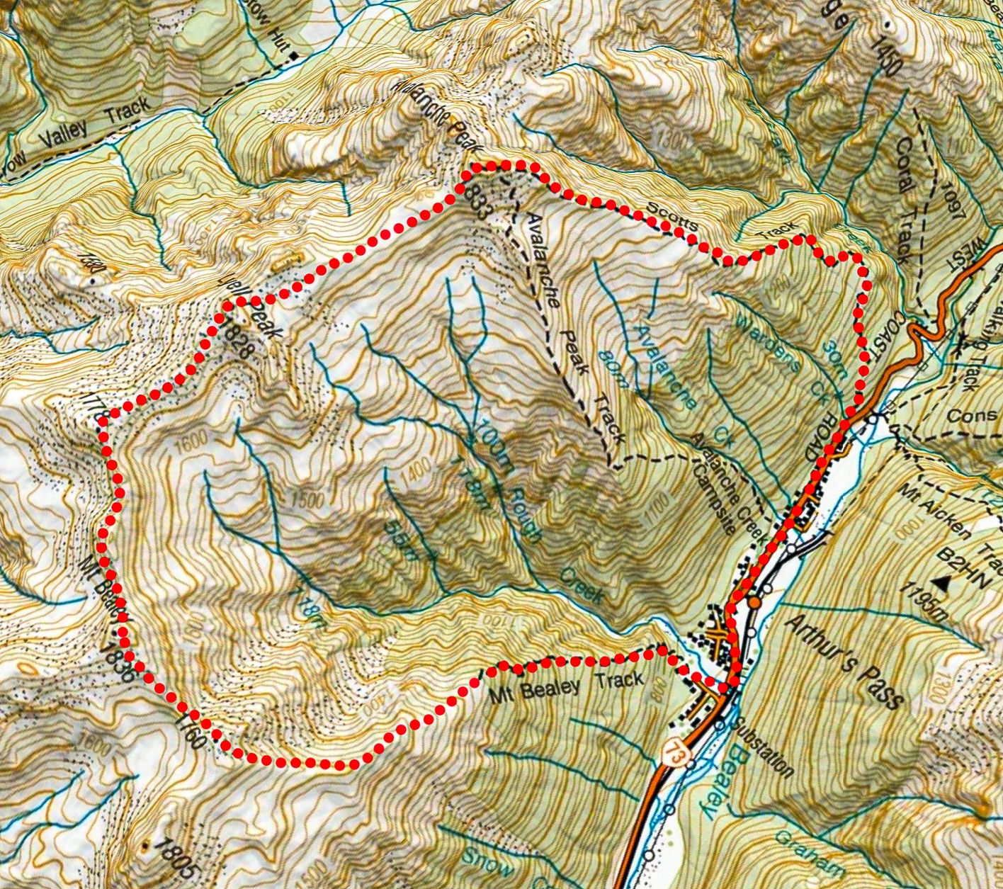
The Avalanche-Lyell-Bealey Loop had been something I had wanted to do for ages and there had once even been a race over Avalanche Peak but unfortunately the race stopped running before I had a chance to do it. While researching the route, I came across the term ‘Triple Crown’ for the loop which amused me and had to become the title for the trip report.
Despite the weather forecast predicting the possibility of strong wind gusts, we woke up to find a perfect morning and left the CTC lodge just before 7am.
The climb up through the bush on Scotts track went quickly (Scotts track is less steep than the Avalanche Peak track). There were a few icy sections on the track that could be easily diverted around. We got fantastic views across to the Devil Punch Bowl Falls and up to Mt Rolleston as the sun came up.
Despite it being July, there wasn’t much snow due to it being a warm winter. The snow only started at about 1600m and it was very soft. In the end we put crampons on just before the summit of Avalanche Peak.
The route up to the summit is well marked by snow poles with the Avalanche Peak Track joining Scotts Track just before the summit taking us about 3 hours to get there.
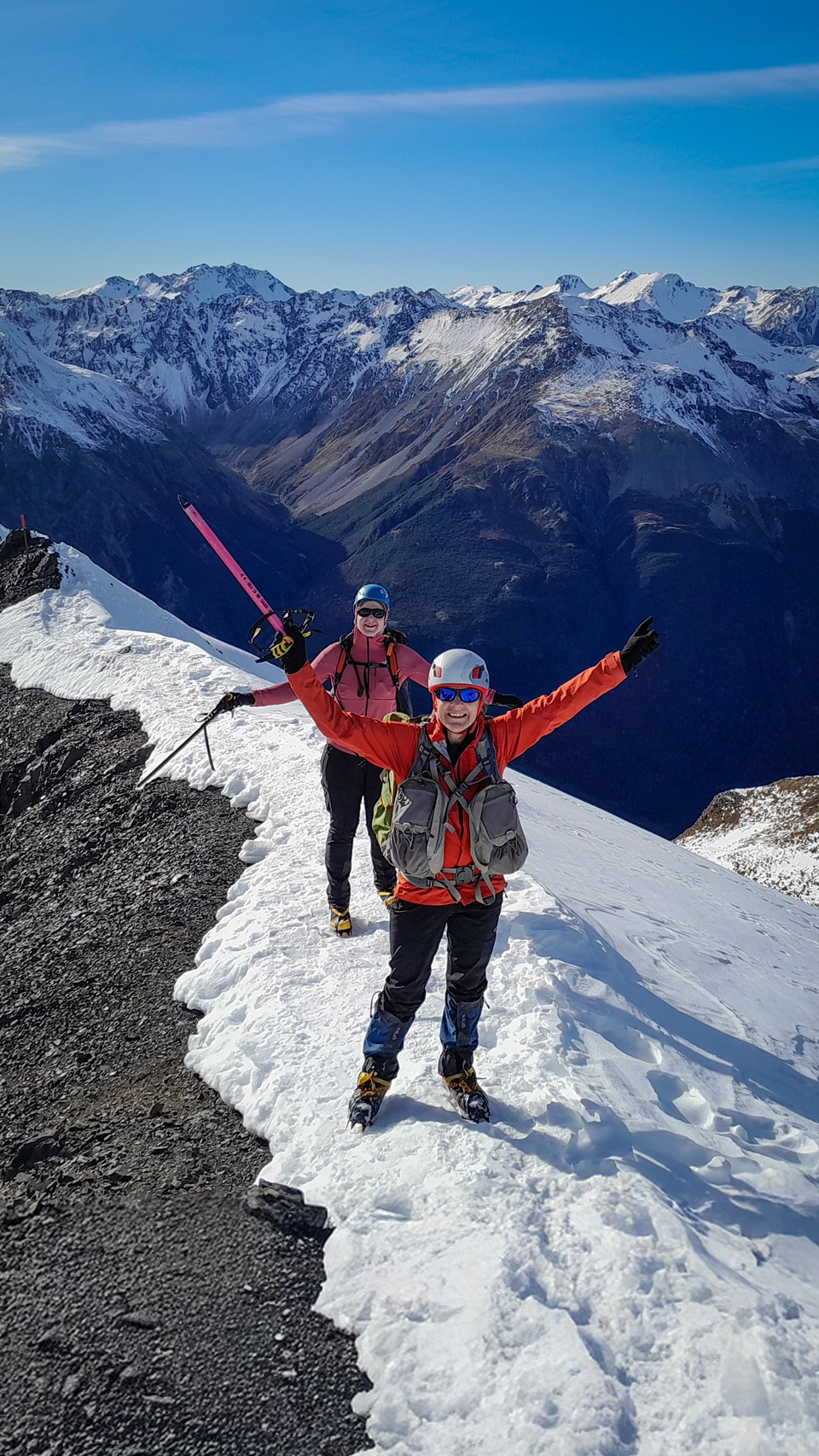
It was a bit windy on the peak but with perfect visibility, so we quickly enjoyed the views of Jellicoe Ridge including Mt Guinevere before descending. We decided to head towards Lyell Peak but an alternative is to head the other direction and descend to Crow Hut. DoC has a good route guide on their website.
.
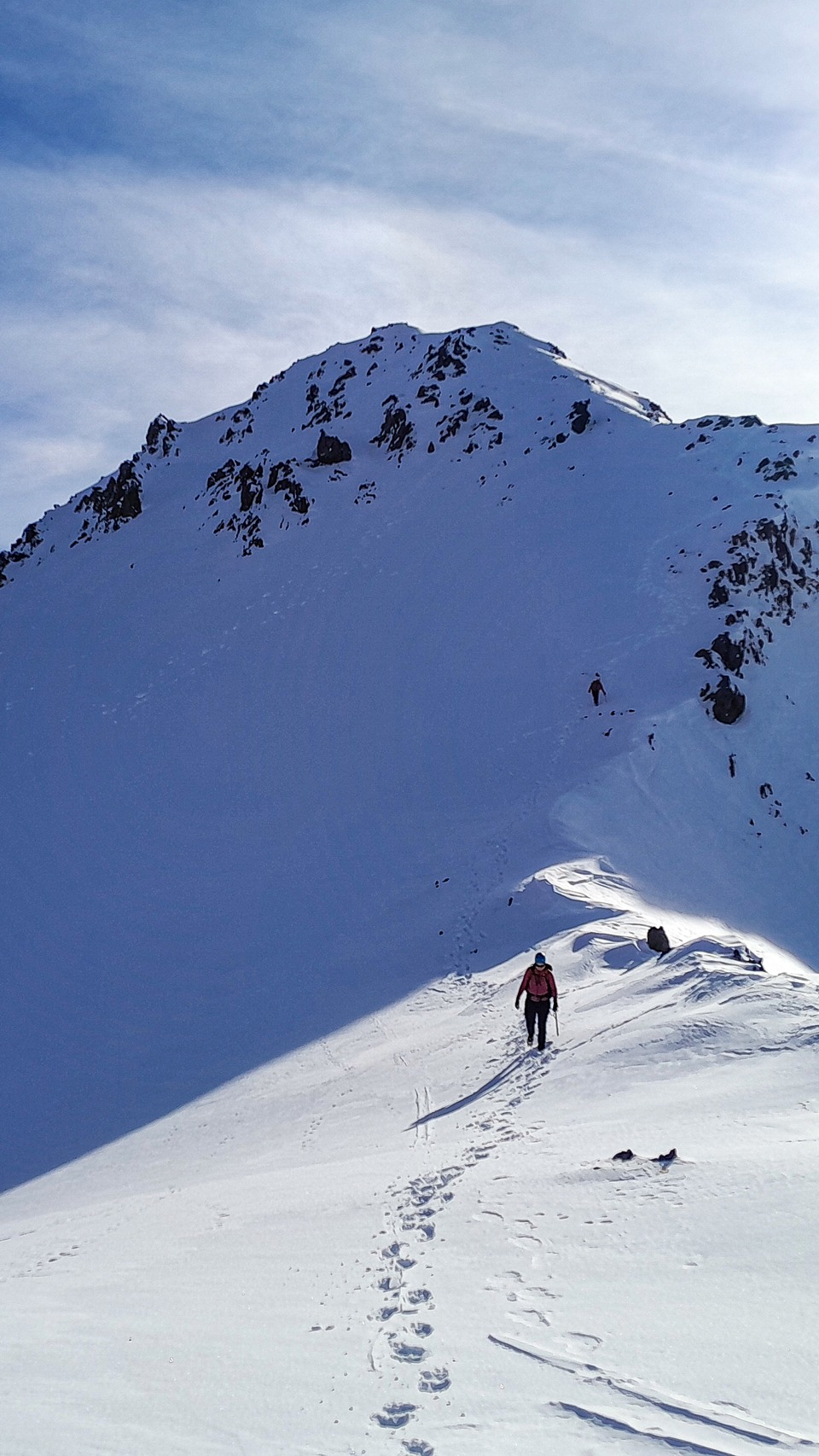
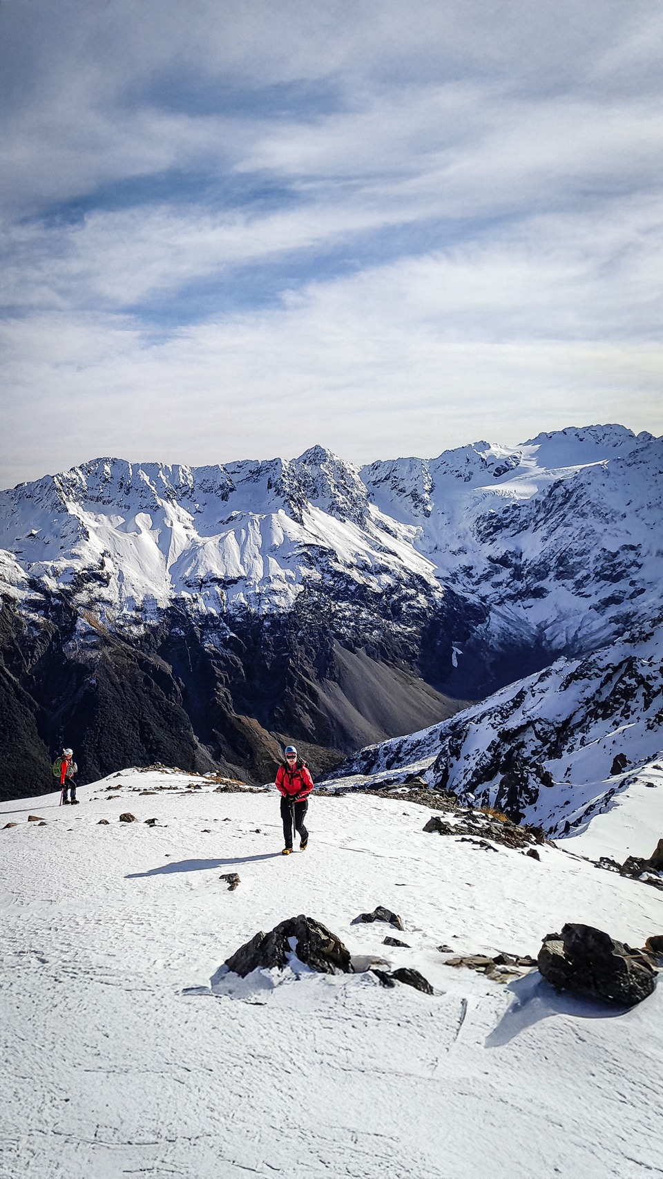
The walk towards Lyell was very easy on a broad ridge. I was out in front and sometimes post-holing through the snow but at other times it was firmer and that made for great cramponing.
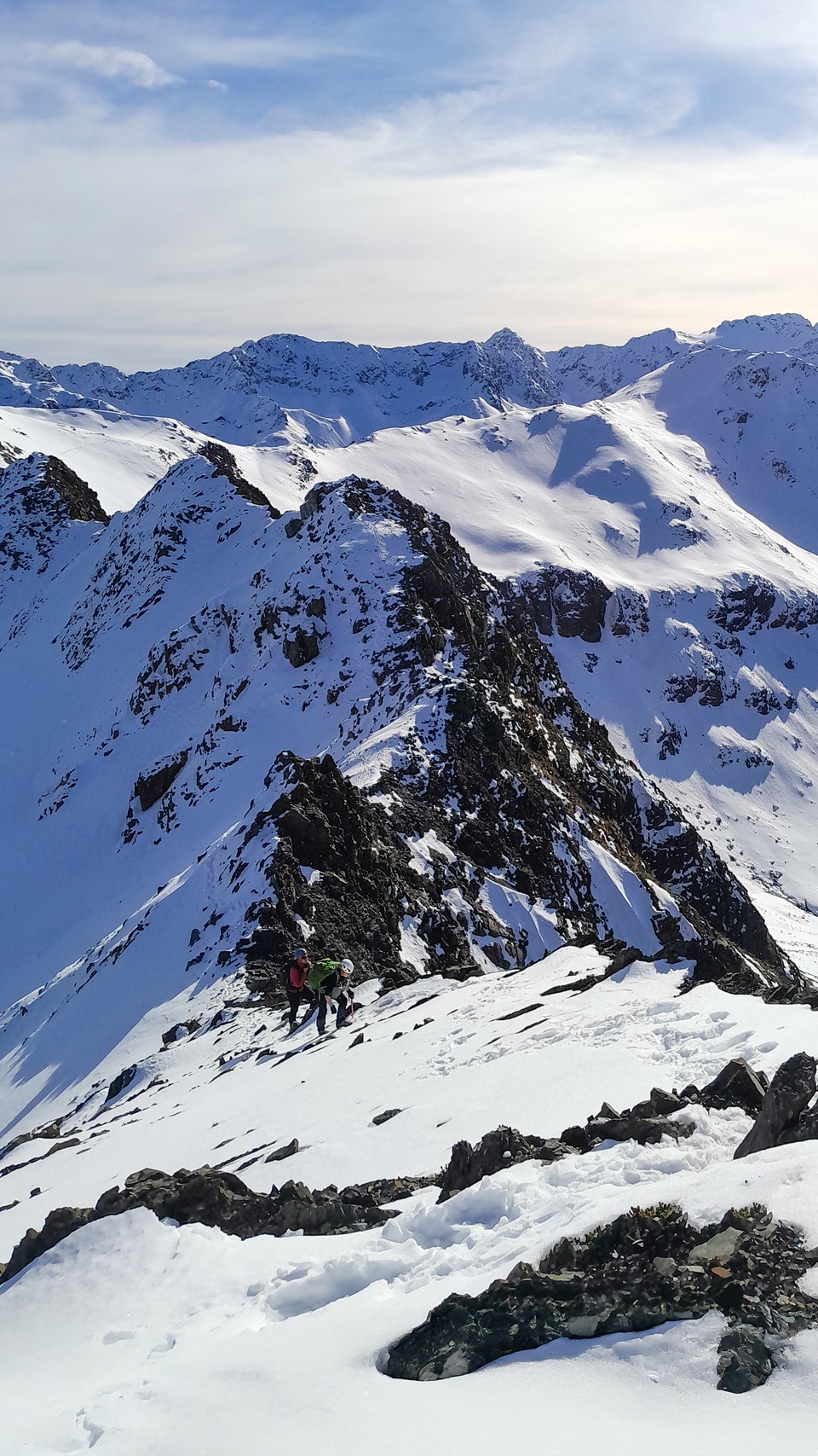
After Pt 1778, the ridge towards Mt Bealey became more interesting and this was my favourite part of the day. It involved some route finding and avalanche risk assessment. I really enjoyed the route finding along this ridge that sometimes involved some steeper shorter snow descents and sidling under the ridge on rocky and somewhat exposed terrain.
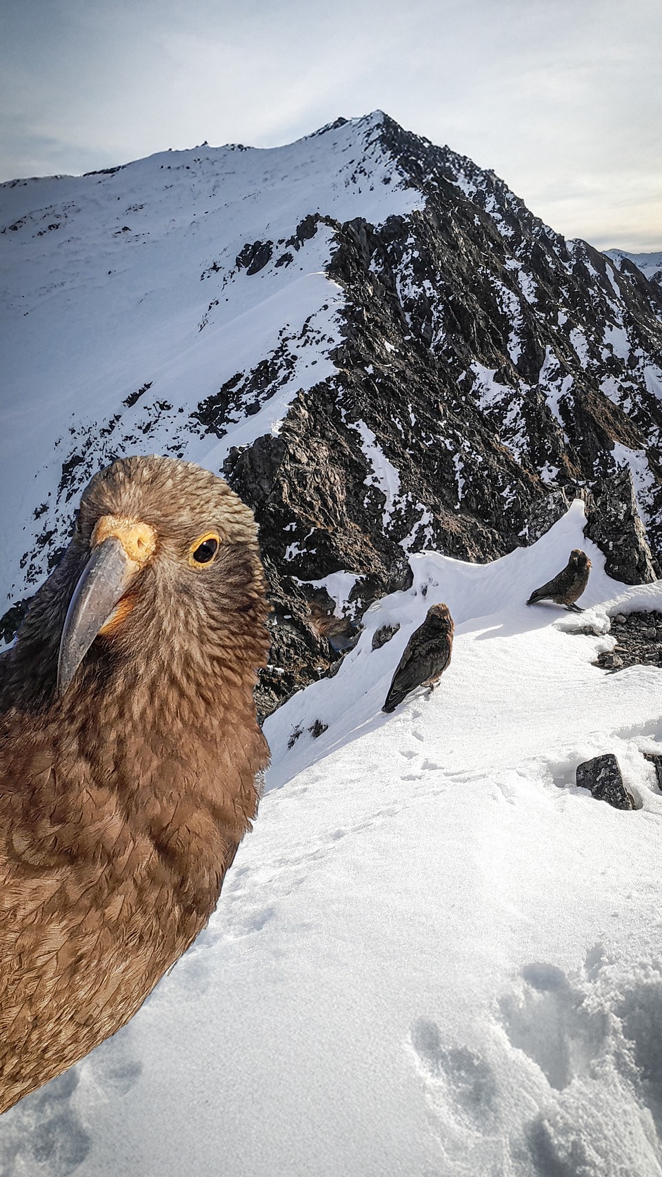
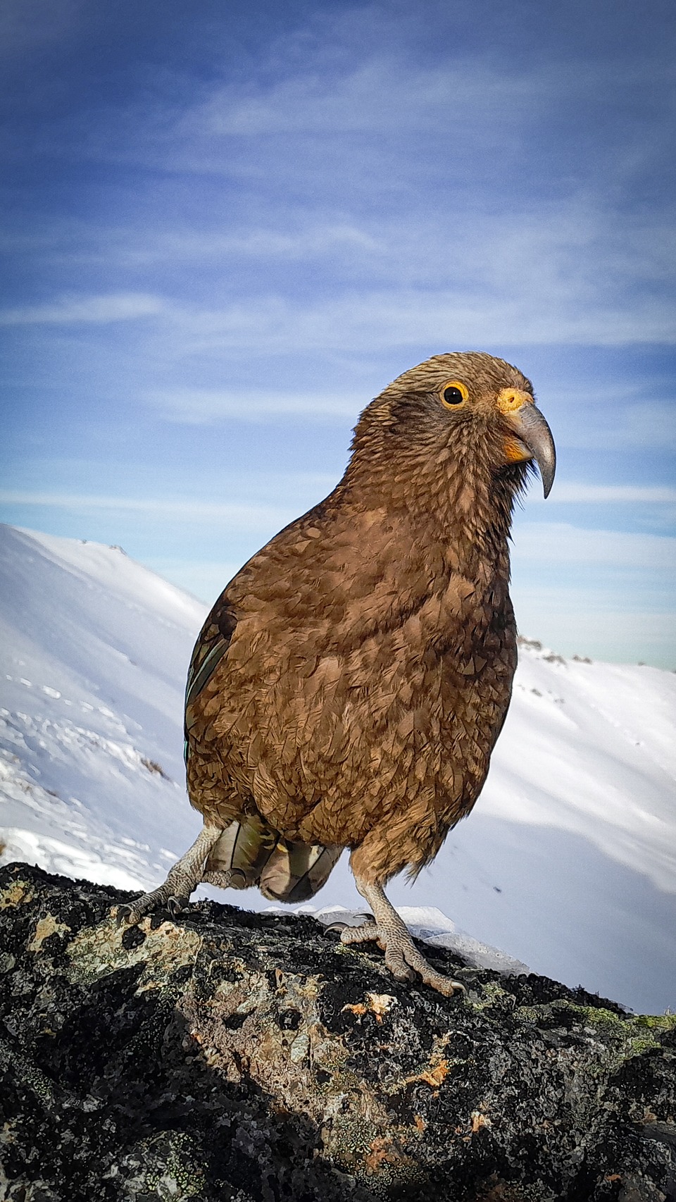
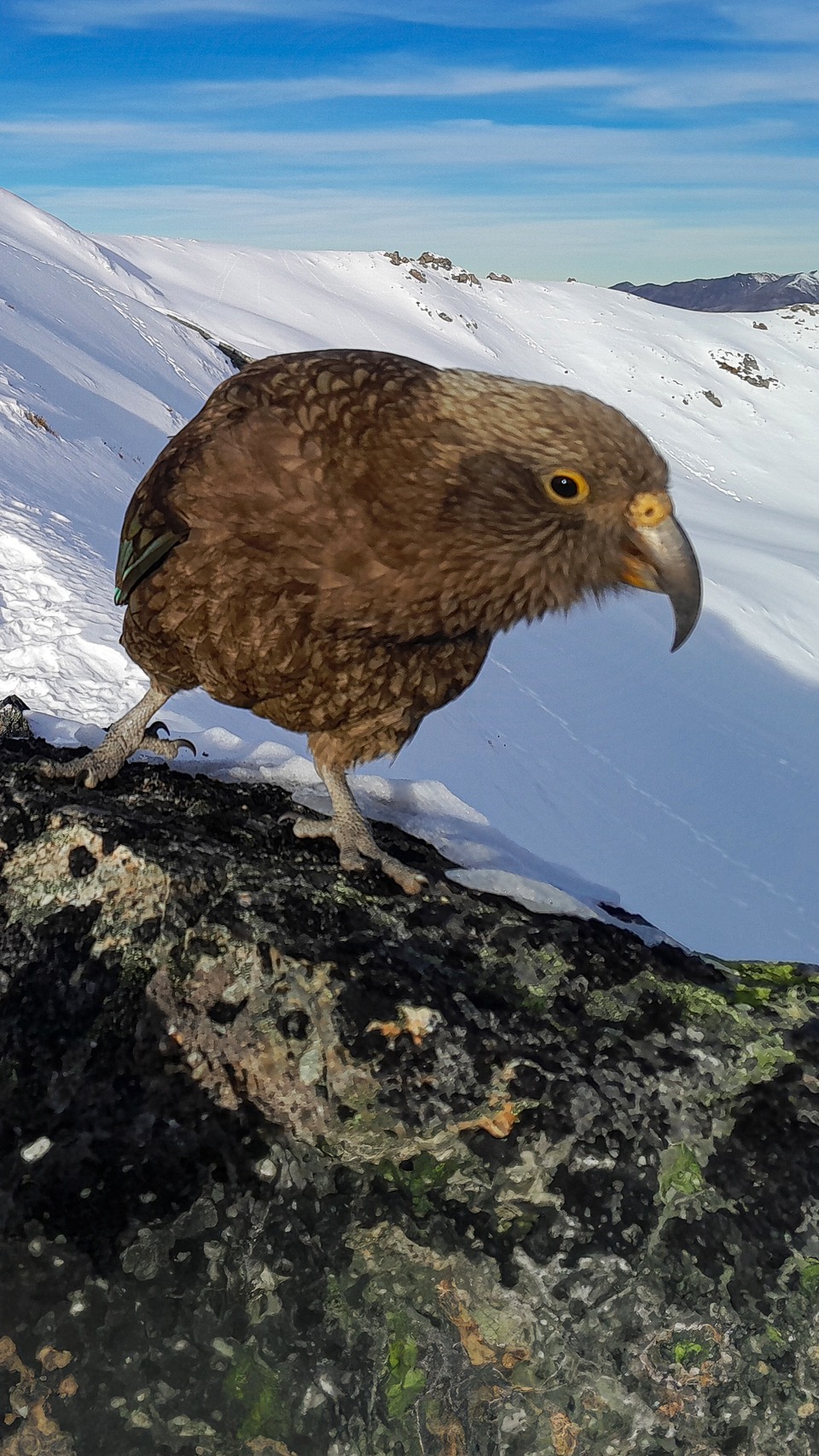
On the way to Mt Bealey, three juvenile kea turned up and took turns posing for photos and getting up to mischief. I saw one picking up rocks and it reminded me of my Mt Owen trip where the kea rolled rocks down the hill on us.
Another one tried to do a sneak attack on my ice axe. After dragging ourselves away from the kea, they followed us along the ridge all the way to Mt Bealey and on the descent for a while.
From Mt Bealey, the snow started to thin out and we took crampons off. The route down to the bushline was well marked by cairns and the descent through the bush wasn’t too steep or technical.
Time: 9-10 hours
Elevation: 1,727m
Distance: 13km
Grade: Grade 1 (WTMC ALP 1).
Other notes: There are some tricky sections along the ridge between Pt 1778 and Mt Bealey where there is some exposure and route finding that some may find challenging. In winter, alpine gear is required. In summer, beware of loose rocks and consider helmets if travelling in a group.