


Snow on Ruapehu!
Our journey began with a scenic drive on Desert Road – with a radiant full moon and snow was glittering on the peaks of Mount Ngauruhoe and Mount Ruapehu. Being the shortest day of the year (June 21), not many people were out tramping. After a skilled late-night drive through winding roads and numerous potholes, Jordan, our club van driver, parked at Clements Mill Road End Campsite. We were the only group at the site. We put our tents up and boiled a billy of water for those with hot water bottles – given that the overnight temperature was meant to fall to below zero degrees. And then we were off to bed.

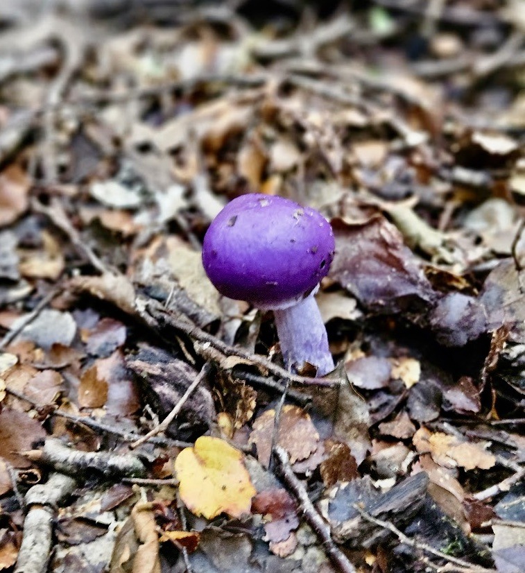
The mushrooms
We emerged from our tents the next morning at a leisurely pace, and ambled away from the campsite at 9 am. The temperature ended up being relatively mild the previous night and the predicted frost thankfully didn’t eventuate. There were mixed views about the value of the hot water bottles….maybe the water hadn’t been hot enough?
Good weather was forecast for our first day of tramping – and the weather did not disappoint. We began by collecting water from the nearby stream for some hot drinks later, as there didn’t appear to be any other water source at the camp. I was also prepared to top up my water, as needed, from the many streams marked on the NZ Topo Map for the area we were in.
Our first stream crossing was very simple – a lovely one person bridge. Right before the stream we saw a Violet Pouch Mushroom, which was a surprising sight for our group, who were mainly foreigners.
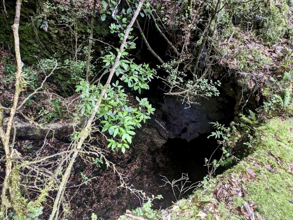
During the first hour of our walk, we came across a large cavernous hole in the ground. It was large enough to fit our entire group in. And if you shone a light through it, you could see the light coming out on other side of the track. This is a hazard to be aware of. The hole appeared to be eroding and would be a hazard in wet conditions.
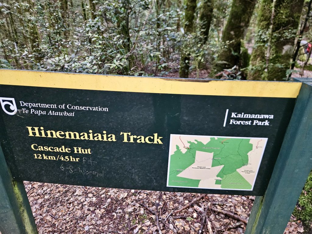
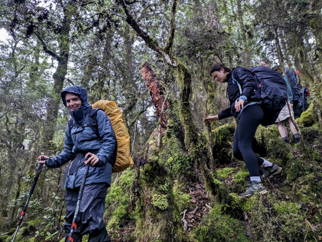
We climbed to approximately 1240 m (from 720 m at the campsite). Given that the track was well maintained, navigating our way was not as tricky as presumed it would be. Molly led us through some scrubby bush sections by expertly following a track and the occasional marker. The combination of streams, fog, and plushy wet bush created very temperate weather for the walk. We had an unhurried lunch break at the top of the hill. Unfortunately the famous Waikato fog did not disappoint – so we did not have a view.
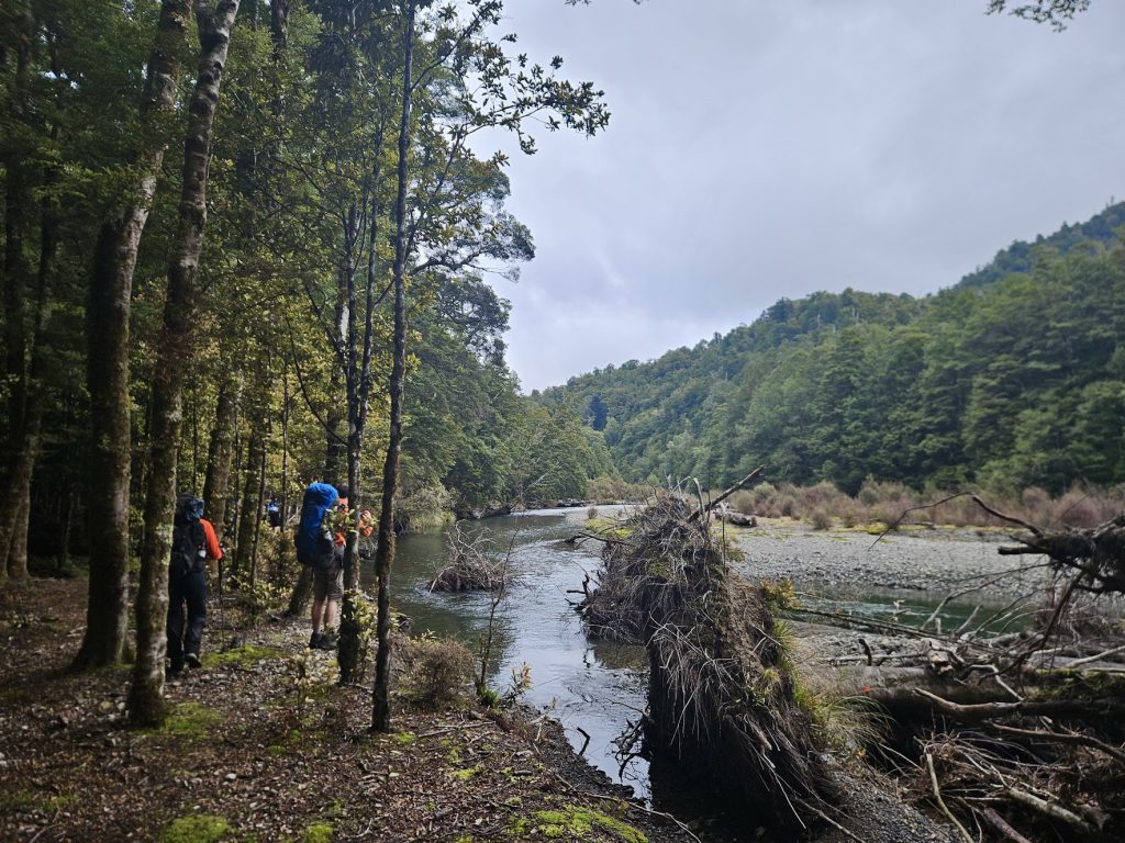
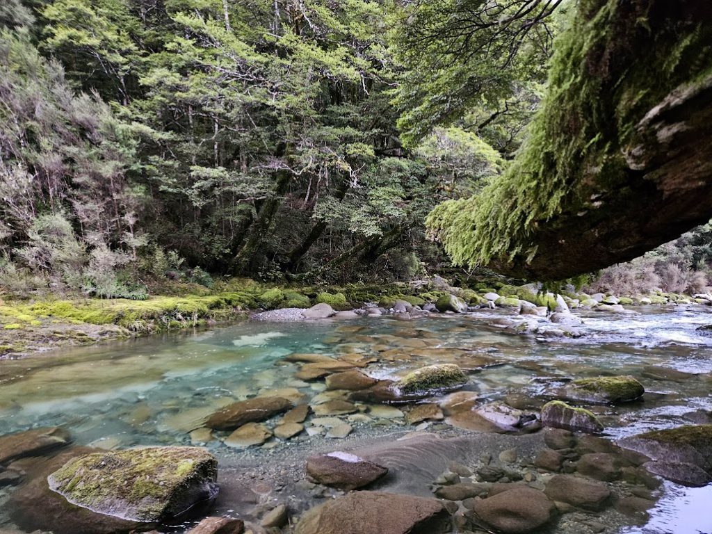
We arrived at the lovely Cascade Hut just before nightfall. No one had been at the hut for at least one month (at least according to the intentions book). Some of the group went for a short 20 min walk to the cascades – which Cascade Hut is named after. Some lovely waters were rushing there.

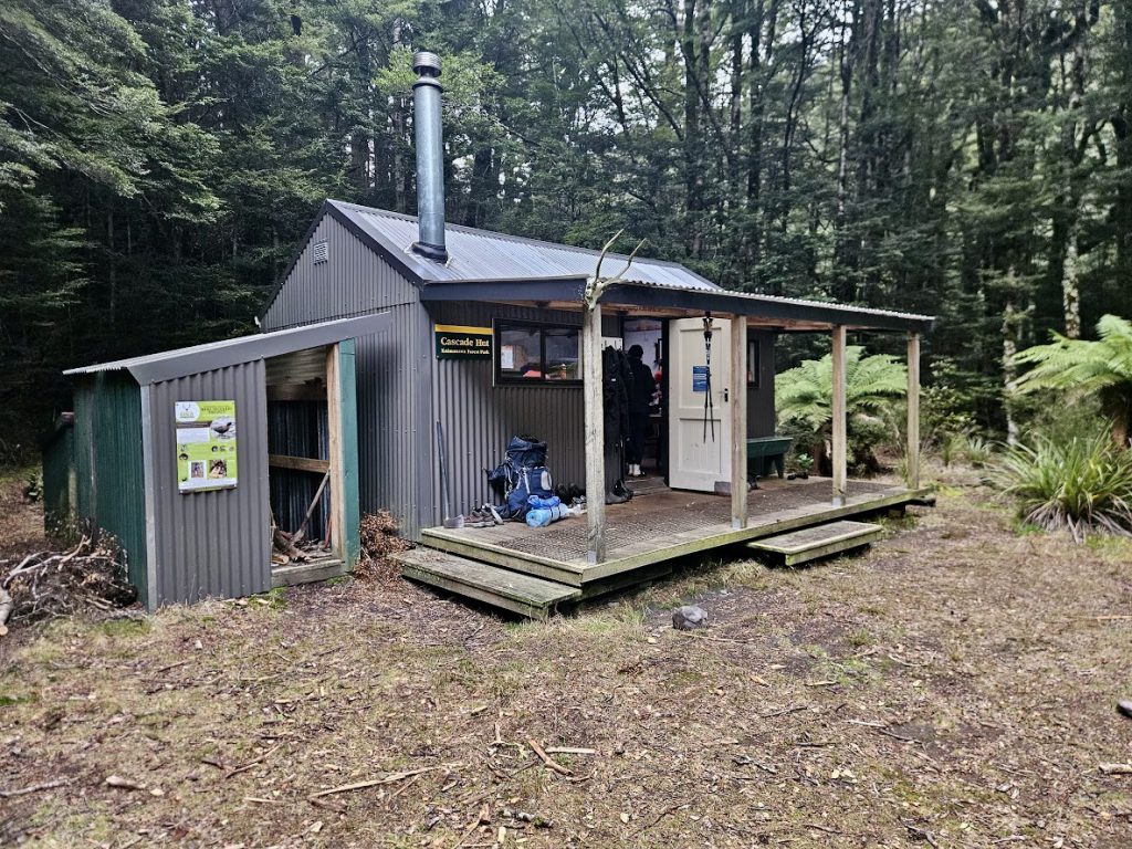
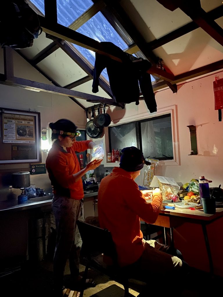
The six-bunk Cascade Hut was cozy with all the amenities (fireplace, mattresses, mess-table, and even some pots and spices). Jeremy, Michael, and Sara got the fire going, and Molly started making some dessert treats for us called ‘Bushcraft Chocolate Crackles’ (from the WTMC cookbook). By the time Molly and I had finished the food preparation, we were joined by a very fit, young couple from the Waikato. We had Red Lentil and Coconut Dhal (another WTMC cookbook gem) for dinner. I highly recommend both recipes – everyone in the group enjoyed them and they are vegetarian and gluten-free.
After dinner, Sara (our leader) told us about the following morning’s plan and forecast. The idea was to leave the hut by dawn (7.40 am), on the Winter Solstice. There was an attempt to play cards after dinner, but by that time the high carb dinner settled in, everyone became quite sleepy.
Distance: 12 km (approx.) Time: 6 ½ hrs (including lunch)
Rain rain go away
On the following morning, the weather had changed drastically. We woke up to a steady patter of rain drops. Luckily none of us had slept in our tents, so the morning preparations went relatively smoothly. We all donned our rain pants, rain covers, and raincoats, expecting a very wet day and headed off just before 8 am. Fortunately, though the rain was constant, it was more of a misting than a pelting of water.

Cascade Hut is located at 780m elevation, so the elevation change for the day was similar to the previous day (but a little less strenuous).
We returned to the van the same way we had walked in, so the team knew exactly what to expect, but with a little rain to add to the fun. Most of the uphill grind for the day was at the beginning, so we did the hardest part first.
Once we reached the peak, we had a very short lunch break (due to the weather) and then continued on our trek through the forest. We heard a few forest friends, including kereru and kākā, but did not see them. But there was a friendly robin that followed us around. We also saw many deer tracks on the ground.
We got back to the van just before 2 pm and were on the road as soon as possible to ensure we would be back in Wellington at a decent hour (via the kebab shop in Bulls of course!!).
Distance: 12km (approx.) Time: 5 ¾ hrs
