
Hiking in the Oxford Forest visiting Mt Oxford summit, Wharfedale Hut and Lower Salmon Biv
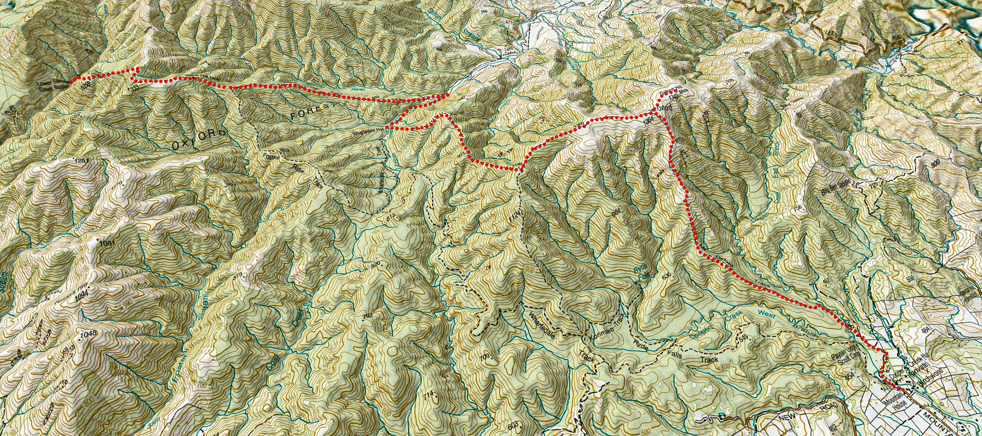
The story of a three-day winter hike in the Oxford Forest with visits to the summit of Mt Oxford, Wharfedale Hut and Lower Salmon Biv, including a route map.
There was a good weather window and I jumped at the opportunity to do a spontaneous trip when paired up with cheap flights to Christchurch.
I picked an easy front country loop since I was booking the day before and didn’t have much time to do any research, especially with going to work that afternoon.
This trip showed me that front country tramping can be fun and rewarding as this loop was especially right after the Canterbury storm the few days before. I had run around the Mt Oxford loop a few years before and always thought I would like to come back and explore the area a bit more.
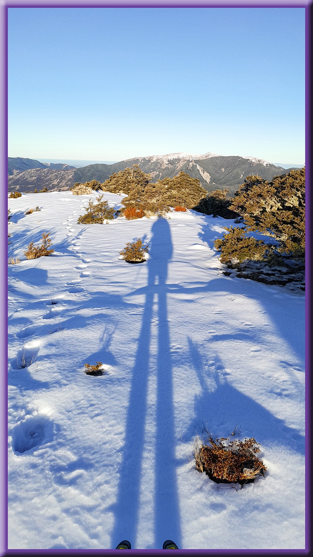
I started from Coopers Creek carpark with an easy walk along a four-wheel drive track before I entered beech forest and started the climb up to Mt Oxford. Once out of the tree line I had magical views and was surrounded by snow.
There were one or two more icy sections so I decided to put on my microspikes for better grip (not essential though).
I met one tramper descending who I had a long chat with. He was doing hill training for climbing Mt Arrowsmith in summer and I told him I had waved up at Mt Arrowsmith while crossing the Ashburton Glacier on a trip a few years back.
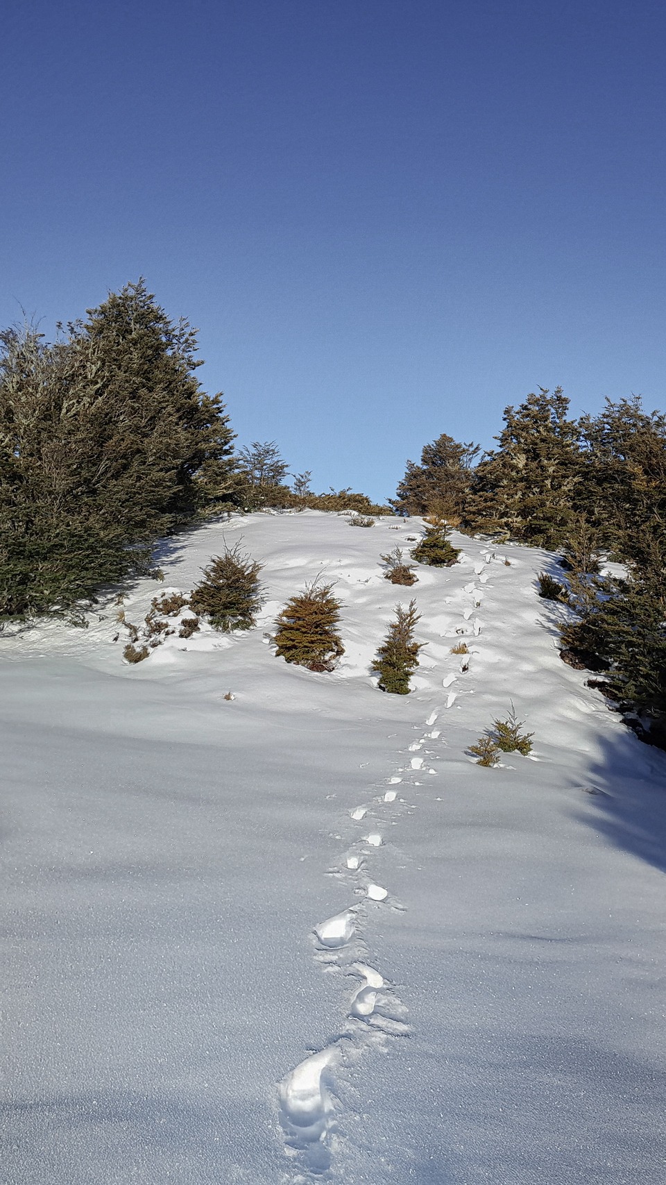
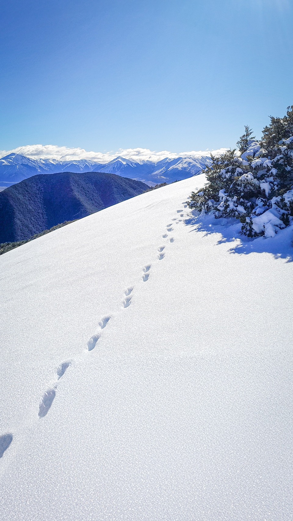
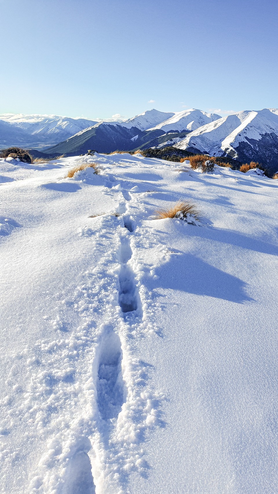
After Mt Oxford summit, I had to plug steps along the ridge as no one else had yet traversed along that section. The views from up there were magical.
I started the walk down the Mt Oxford Route. There was a bit of tree fall and the branches were packed with snow so I got pretty soaked especially when the branches kept trying to dump snow on my head.
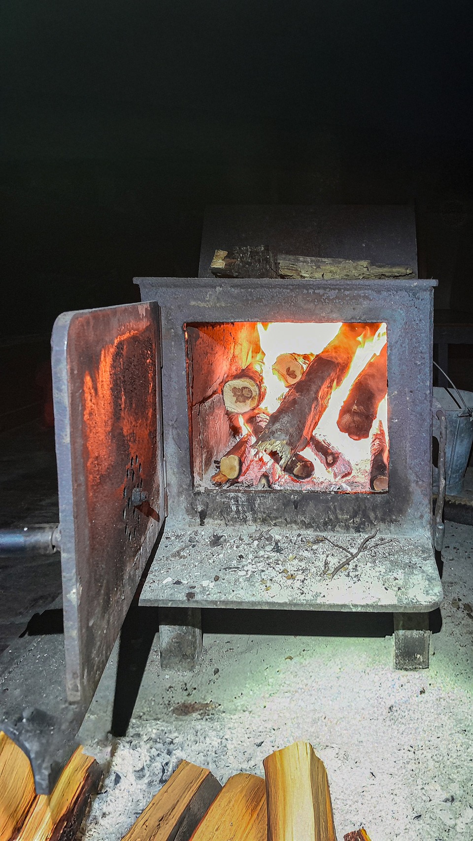
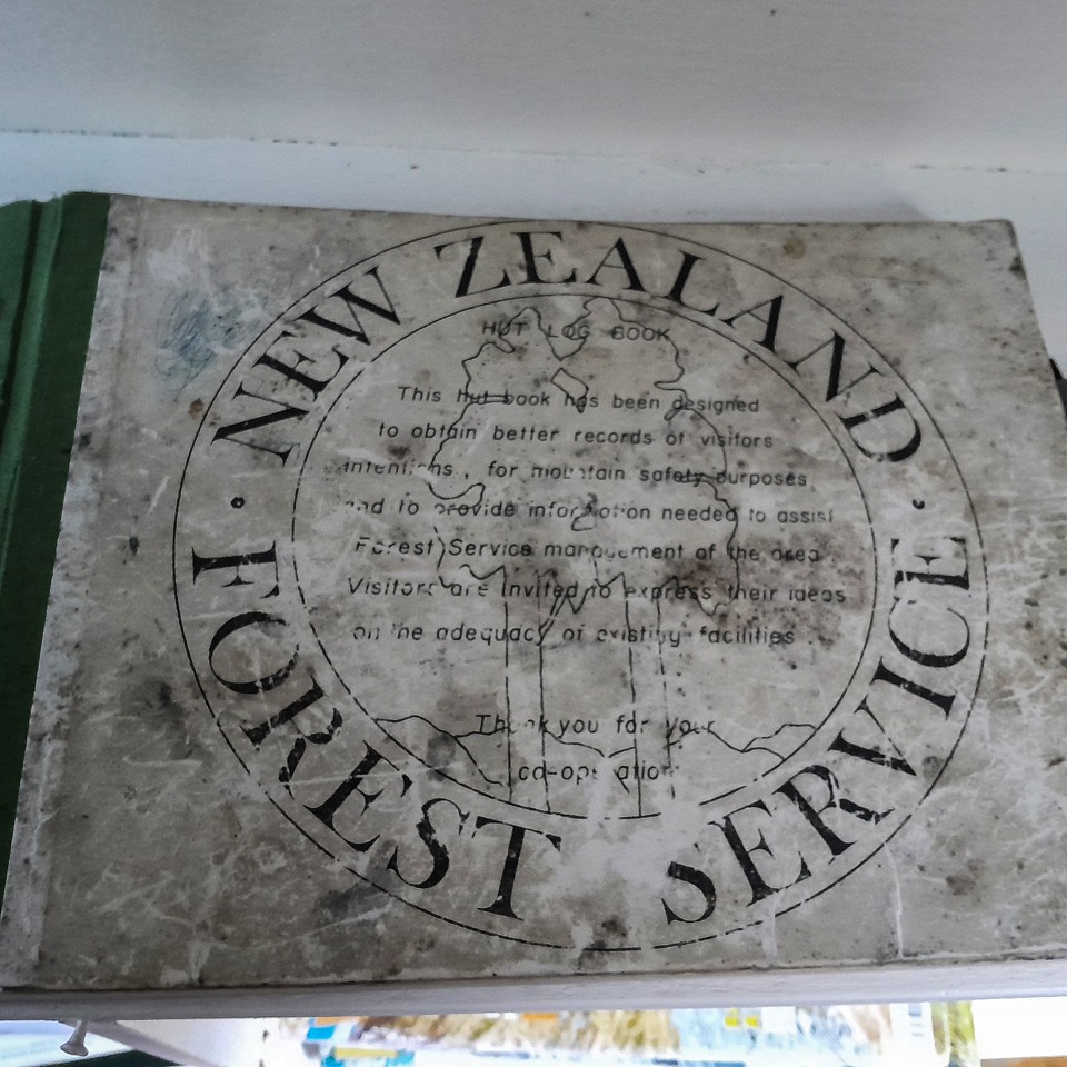
The route got a bit steeper as I descended and the last 10 minutes I did with my headlamp. I found Wharfedale Hut completely empty but unfortunately it was a bit messy with rubbish that people had left behind and needed a good floor sweep. After doing a bit of a tidy up, I went on a firewood hunt. There wasn’t much suitable dry wood around the hut but I found just enough and I had a helping hand from the firelighters in my pack. I quickly got a roaring fire going that warmed the hut up so much that I had to de-layer because I was roasting but I wasn’t complaining as it was a cold night with a low freezing level and it dried all my clothes out. Like always, I went out to star gaze before bed.
The next day my plan was to head up to Black Hill hut and then drop down to Lower Salmon Biv which would provide excellent hill training.
It was a nice easy flat walk out toward the Lees Valley along the Townshend track with a couple of stream crossings (there’s a flood detour if required) before a bridge that took me to the Black Hill track.
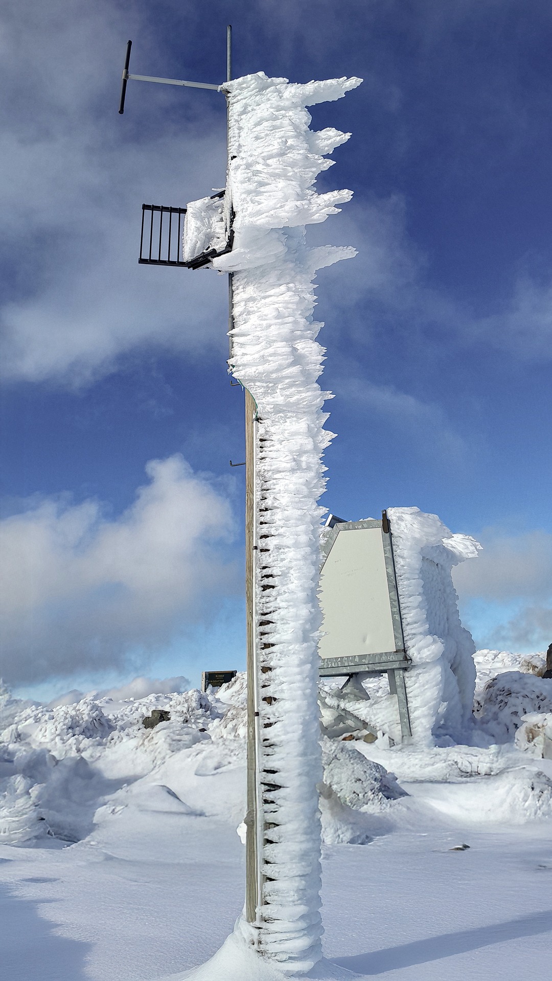
The Black Hill Track was a gentle climb through beech forest that I really enjoyed – nothing technical at all. The snow started appearing as I climbed and by the time I got to the junction of Fosters Ridge Track I was fully in snow.
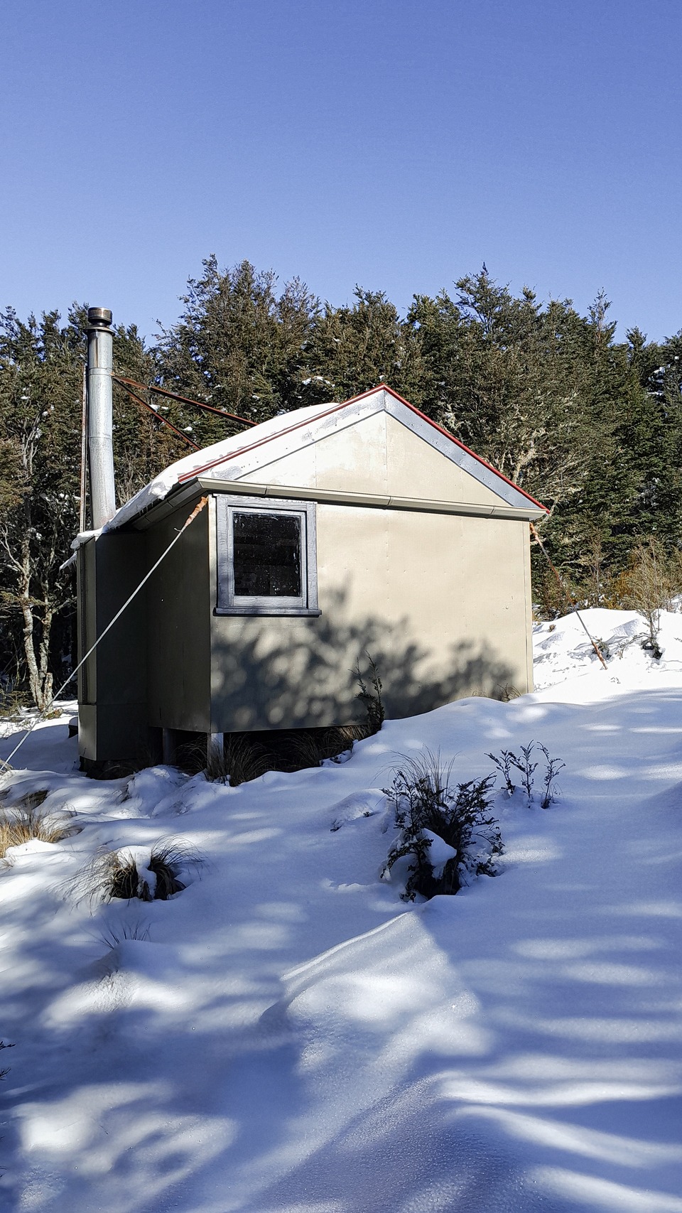
Black Hill Hut is a very tidy and cute hut in a beautiful clearing which looked even more beautiful surrounded completely by snow. I wish I had been able to spend a night there but unfortunately with my flight times I couldn’t.
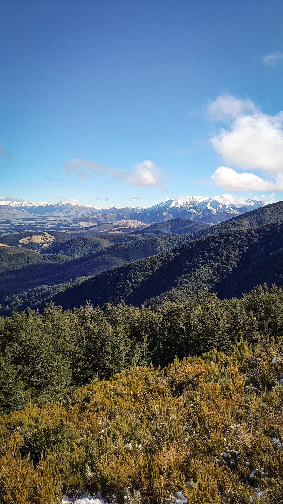
Up to Black Hill I was plugging steps through deep snow but it was a blue bird day so I wasn’t complaining. I was enjoying looking back to Mt Oxford and seeing where I had come from the previous day.
The snow was a bit deeper than I expected so it was slow going over the tops and the snow made the navigation a little more fun as everything was covered by snow including the track markers and the snow poles were sometimes quite spread out so I had to occasionally do map checks.
Again, as I descended, the track got progressively steeper—people had written in the Black Hill hut book about the steepness of the track. It really was a track that you “had to hold onto your pantaloons” going down (see here for origin of this comment). I think one person had described it as abseiling without a rope! It would certainly be good training when walking back up.
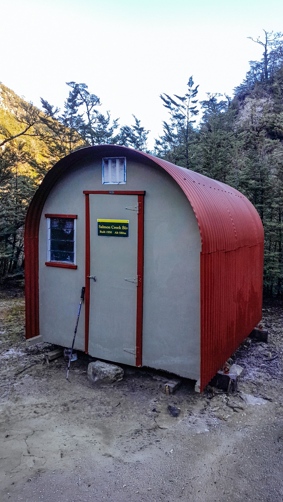
Eventually I arrived at Lower Salmon Biv. The Biv was also very tidy and such a peaceful spot that feels very remote despite being easily accessible.
I believe Honora Renwick and Frank King are responsible for keeping the biv in remarkable shape and the track down to it well maintained (Black Hill Hut book had mentioned some tree fall but I found the track mostly clear. Any tree fall could all be easily navigated over or around).
The care given to the biv reminded me of how much our backcountry huts, tracks and predator control work relies on many hours of hard work done by volunteers and why giving back through volunteer work is such an important value for me. Without all the volunteer work, we would not have all these wonderful places to enjoy.
The hut log book was an old Forest Service book that dated back to 1985. I was not surprised to see Joe, and his dogs Floyd and Casey had visited the biv just a few months before me.
I feel like I’ve been following Joe and Floyd around the country in hut books although never actually met them in person. Joe had even messaged after seeing one of my trip reports about Floyd retiring and said Floyd had considered taking up golf.
But clearly Floyd was still very active in his retirement—no surprise at all for a mountain dog with such an impressive resume. One of these days I hope I might meet Floyd rather than just seeing his pawprint in the hut books!
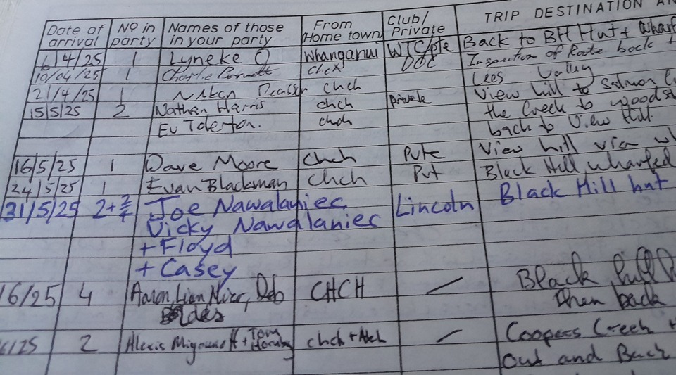
After enjoying reading some of the hut book with the most impressive entry I read being two trampers who did the climb up to the ridge three times just for training,
I reminded myself I still had a fair distance left to cover in the day and the 800 m climb back up the hill was not going anywhere with me sitting down. The climb went by remarkably quickly, and it seemed to be even quicker going up rather than down, no surprises there since I’m a downhill nana.
As I came back along the Townshend Track to Wharfedale Hut I started gathering some firewood since it was better offerings than what was around the hut.
Unfortunately, I got a bit enthusiastic and started picking it up too early and meant me lugging it up the track much longer than I intended!
As I approached Wharfedale Hut I was greeted by an odd growling sound. I debated whether it was a very crazy possum or hilariously the mythical South Island panther.
It turned out to be a dog in a tent camped next to the hut. It was only then that I realised there was someone else camping around the back of the hut too.
I abandoned my idea of getting a fire going as I realised I was going to cause too much disruption by making the doggo growl constantly so I decided to just settle myself in the empty hut quietly.
With the time constraint of my flight and uncertainty about how accurate the DOC times were, I decided to head back up the Mt Oxford Route rather than looping around on the Wharfedale Track.
It was another bluebird day so going over the tops again wouldn’t be a decision I would regret and I would have my steps I had kicked from two days ago.
During the climb I met two runners who thanked me for all the step kicking I had done for them! I put my microspikes on at the Mt Oxford Route junction as the track was a little icy. It was yet another magical day on the tops.
After a lunch stop at Mt Oxford, I decided that I couldn’t taunt Oxford Hill like Tony taunted “Brucey” (see here) any longer and would go off track to it. It was only 500m or so away but it was certainly a bit more energy sapping getting there as I was plugging through deep snow all the way to the slightly lower Oxford Hill peak.
On the way back there were a few sections of the track that had turned to ice and were like a bobsled but they could be easily avoided. Once back in the bush, it was a very easy descent to the car.
Day 1: Coopers Creek Carpark to Wharfedale Hut via Mt Oxford and Mt Oxford Route
13 km; 1,324 m elevation; 4-5 hr.
Day 2: Wharfedale Hut to Black Hill Hut via Black Hill Hut and Lower Salmon Biv and return via the same track
21.8 km; 2,068 m elevation; 8-10 hr.
Day 3: Wharfedale Hut to Coopers Creek Carpark via Mt Oxford
14.7 km; 1,175 m elevation; 4-5 hr.
Hi Sarah, I am planning to go tramping in the forest and was looking for the information – from Wharfedale hut to Mt Oxford route. I am glad you enjoyed the walk on snow under blue sky. Looking forward to the walk. Thank you for sharing your stories and photos.