
Kahurangi Keepers House is a DoC hut situated in a remote, beautiful location near the Kahurangi lighthouse on the far north of the West Coast. Access by land is either a multi-day bush bash from the Heaphy track via the Ministry of Works hut or a 3 to 4.5 hour beach walk from the north. The hut has long been a target destination for us but the logistics of travelling there kept getting in the way.
Then in 2025, Kahurangi Keepers house appeared on a draft club trip schedule. We thought this was our opportunity but it’s a long way to travel just for a weekend tramp. After considering our options and leave balances we made bookings to visit Golden Bay for a couple of weeks coinciding with the scheduled trip. Then the trip vanished from the final schedule and we were left with our bookings – we decided to go anyway.
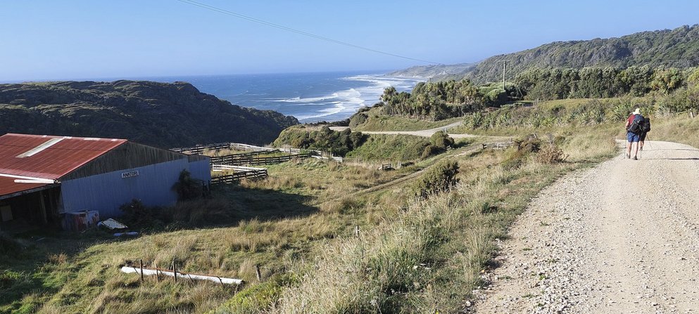
The walk from the north starts from the road end at Anatori which is reached by driving to Pakawau near the far end of Golden Bay then crossing over to the west and driving along a gravel road for about 40km. If you have a 4WD you can ford the Anatori River and travel a further 7km to the Turamawiwi river.
The beach walk can only be done at low tide and that meant we had a limited range of dates when the low tide occurred at a convenient time. Initially, we’d planned to walk to the hut on Thursday, returning Friday but the weather forecast for the Friday was for rain the entire day. We changed our plans to Saturday/Sunday and spent the Friday sheltering in the Mangarakau Lodge and enjoying coffee at the Nugget Cafe – a great advantage of having a flexible timetable!
Saturday dawned a fine day – the weather forecast was accurate. We drove to the Anatori road end for a 10am start to ensure we would reach Big River at low tide. The rain on Friday did not seem to have had a big effect on the river and we crossed easily at the ford – the water was only calf deep. Then it was up over the hills and along the gravel road. It was a straight-forward walk and we could see the lighthouse as a white speck in the distance as we followed the road over the hills. We made reasonable time and reached the Turimawiwi River at about 11:30. Again, we crossed easily at the ford.
Once over the the river we crossed over the sand dunes and started walking along the beach. A great day, the sun was shining, the waves were splashing gently and the sand was easy on our feet. The only downside was a brisk southerly blowing the sand against our legs and into our faces. Nearing the Anaweka River we stopped to talk with a couple on a quad bike who gave us some tips on where to cross.
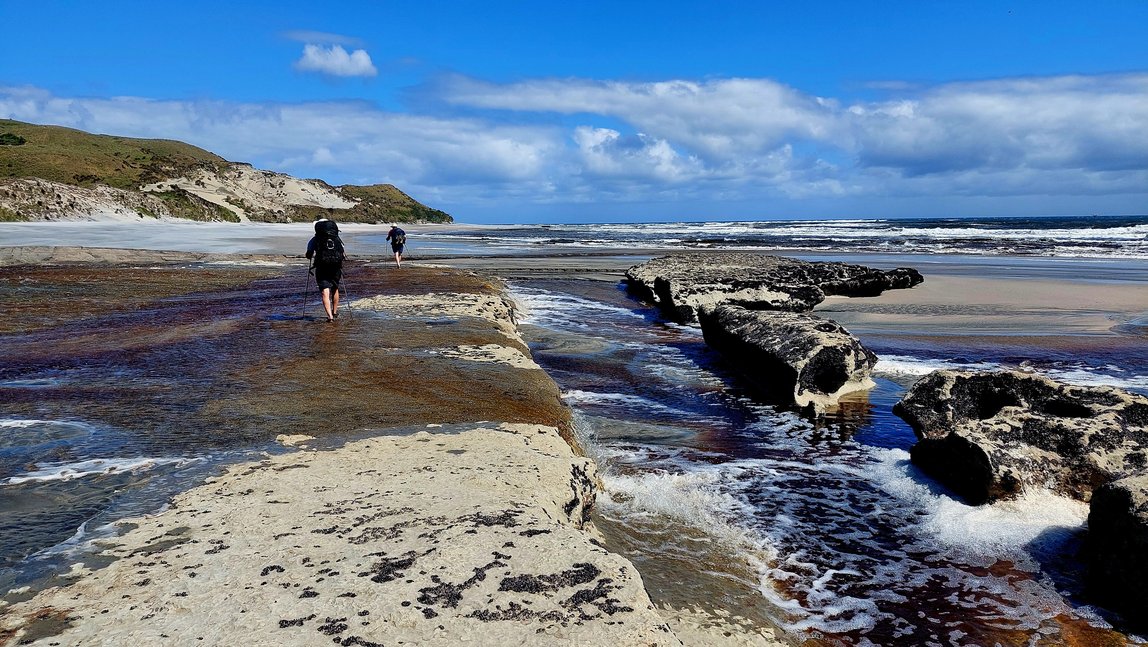
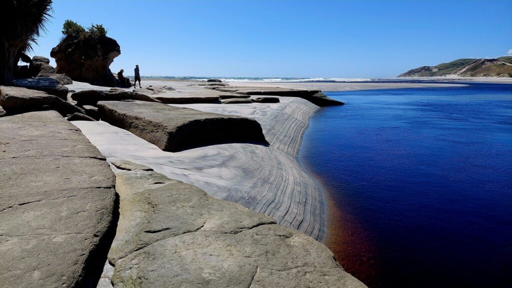
We reached the river about an hour and a half before low tide and scouted briefly for a suitable crossing point. In the end we crossed at the river mouth and found the water was only calf deep. Now onwards to Big River. By this stage Rory and I had swapped our shoes for sandals and it would have been easy to walk the beach in bare feet.
Big River lived up to its name; it was wider and deeper than the others. We paused and looked upstream for crossing points that other reports had mentioned. In the end, we returned to the river mouth and probed with our walking poles to find a viable crossing. We made it, although the water came up to our thighs. At that point, with the challenging part of the trip over, we stopped for lunch, enjoying the peaceful solitude and admiring the views.
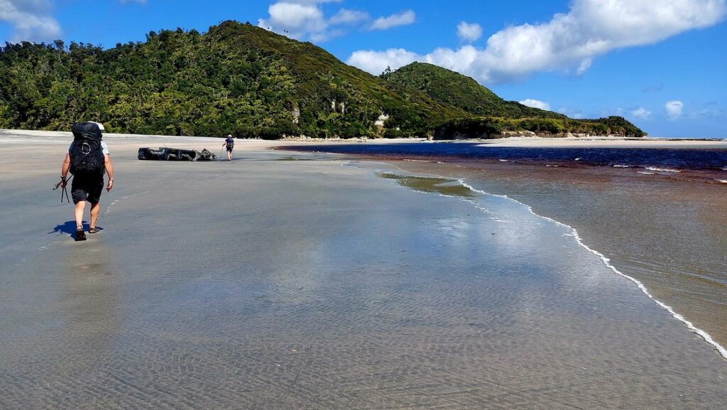
The final stretch was about an hour’s walk to the hut. By this stage the farmland had given way to a lush green forest that came down to the beach and at one point we found a beautiful lagoon behind a rise in the sand. We also noticed macrocarpa trees, a sign the hut was nearby. Then, just before a rocky outcrop, we saw the sign off to our left pointing the way to the hut.
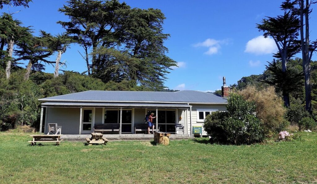
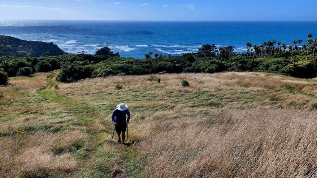
The hut is large, two old houses joined together, and has 25 bunks, a wet back to heat water for the bath and a flush toilet. We had the whole hut to ourselves! After settling in and making ourselves some hot drinks we went exploring some of the tracks near the hut, going up to the ridge and descending via alternate routes back to the beach. The tide was higher then, and access along the beach was more restricted than earlier in the day.
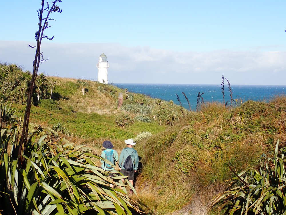
After dinner we spent the evening reading the hut books. These included a very interesting history of the lighthouse and its inhabitants and clear directions of how to walk to the lighthouse. Then it was off to bed falling asleep to the sound of the wind and the waves.
On the Sunday we needed to set out by 1pm to catch low tide at Big River so we had plenty of time for a walk to the lighthouse. The directions led us up the hill to the ridgeline with views to the south then down a gully and eventually around to the lighthouse. We returned to the hut and had an early lunch, then set off early towards Big River, arriving at the river about an hour before low tide.
The water was higher than on the day before and we spent some time investigating the crossing. I crossed in thigh deep water but Jane preferred to wait until the tide had gone out further. Eventually we were all across. The walk was similar to Saturday except the wind was now behind us.
We returned to the Turimawiwi River, crossing nearer the beach where the water was only ankle deep. We considered continuing along the beach but decided against that when the map showed cliffs beside the beach. So it was back along the gravel road, not nearly as appealing as the day before, and across the Anatori River to where we’d left the car. We camped for the night and then drove to Collingwood on the Monday for a coffee. Looking around the cafe I commented there were more people in the room than we had seen all weekend! Overall, a great trip to an interesting hut in good weather.
Detailed information
Tides: the beach walk can only be attempted at low tide. For long term planning there are web sites like https://www.linz.govt.nz/products-services/tides-and-tidal-streams/tide-predictions that show limited locations. We found https://tides.niwa.co.nz/map useful for planning closer to the day because you can select an exact location, but it only shows tides for one month in advance. Note that low tide levels can vary significantly. On the days we crossed at Big River, low tide was 1.43m and 1.24m. Over 30 days the low tide level varied from 0.3m to 1.55m.
Weather: rain can affect the river levels so check the weather. We were fortunate because it was the end of summer.
Accommodation: we stayed at Mangarakau lodge https://www.nfrt.org.nz/reserves/mangarakau-accomodation/. There is also a basic camp site at Anatori River.
Coffee: The Nugget cafe – at Magarakau about 400m from the lodge. It has limited opening hours. https://www.facebook.com/nuggetcafe/.
Further information: read other trip reports because conditions change.
That looks like a fabulous trip, thanks for reporting back and sharing photos