Prelude:
We had all been really looking forward to our planned Mt Owen trip in Kahurangi National Park. However, it turned out that when we arrived on site, the water level flowing over the Dart River ford (which you need to cross to access the track to Mt Owen from the North) was too high, and therefore unsafe for us to cross in the club van.
We had taken the afternoon ferry to Picton and immediately drove down to the Kahurangi National Park entrance (near Tapawera) closest to Siberia Flat campsite – where we had planned to camp that night. We had been keeping an eye on the relevant river flow data (see: https://www.tasman.govt.nz/my-region/environment/environmental-data/river-flow/walter-peak) while on the ferry. In light of the forecast, it seemed promising that we’d be able to camp on the side of the Dart River that night and then cross the ford in the morning when the weather (and water level) had improved.
We arrived at the Dart River ford at twilight and couldn’t find enough space for all of us to pitch our tents. Just before reaching the ford we’d passed a farm homestead. We decided to try our luck and see if the owner would allow us to pitch our tents on their property – as there was really nowhere else we could camp. Luckily the farmer agreed – and we set up all our tents on his front lawn. Needless to say, we were extremely grateful.
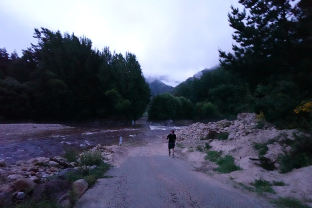
The next morning we returned to the ford and were really disappointed to see that the water level was still too high for us to cross. Sarah, one of our drivers, walked across the ford with a large stick, assessing the depth of the water and how strong the flow was. Both drivers then agreed they would not feel comfortable driving over the ford.
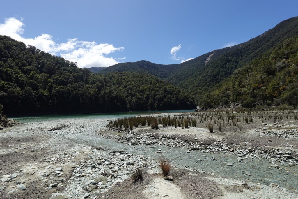
Accessing this entrance to Mt Owen has unfortunately been an ongoing issue for a number of years, due to flooding in the area causing gravel migration over the ford. As a result, the river typically flows over the ford. This is an important consideration when planning a trip to this area. See: https://www.stuff.co.nz/nelson-mail/123248499/residents-want-action-over-unsafe-river-ford-in-tasman?rm=a and DOC caution here: https://www.doc.govt.nz/parks-and-recreation/places-to-go/nelson-tasman/places/kahurangi-national-park/things-to-do/tracks/mt-owen-tracks-and-routes/)
Plan B: Lake Chalice – Mount Richmond Forest Park
Luckily we already had an excellent Plan B sorted for our trip, which all of us were happy with – a stay at Lake Chalice Hut and walking some of the surrounding tracks. So we headed off on the long drive (via Renwick) up to the northern end of Mt Richmond Forest Park.
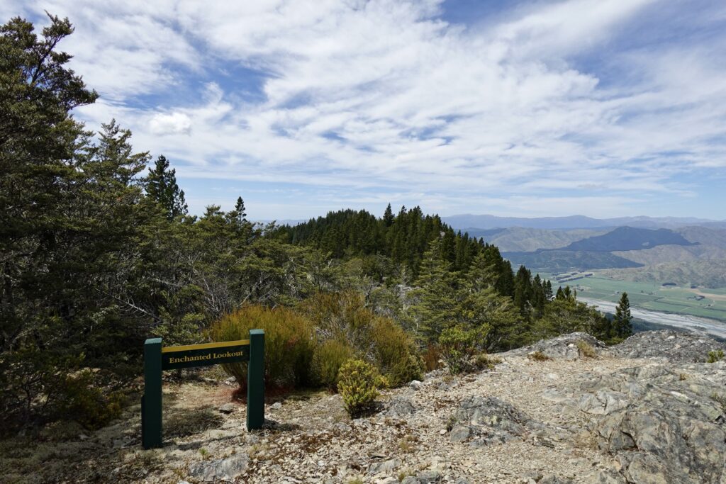
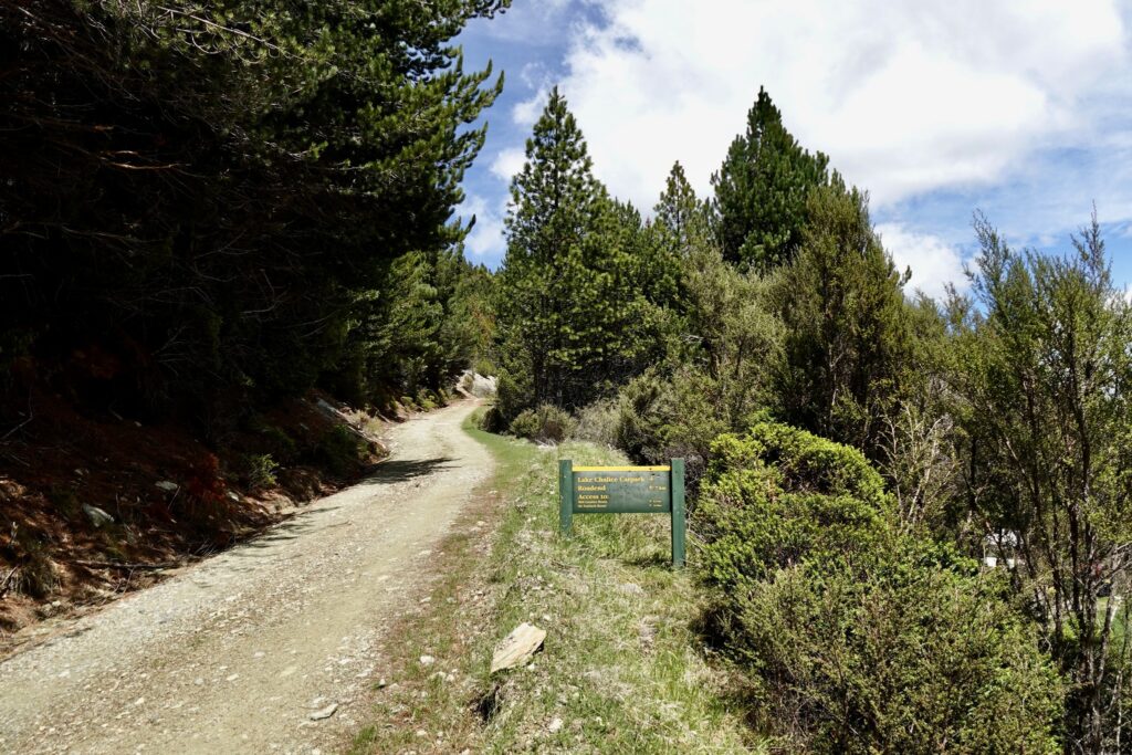
After driving down North Bank Rd (which runs alongside the Wairau River) and up Top Valley Rd, there is a very long, winding unsealed road called Staircase Rd (within Mt Richmond Forest Park) that you need to follow to get to the Lake Chalice carpark. It’s such a long road that you feel like you’re in a very remote area by the time you reach the carpark. On the way up we pulled over and did the 10 minute “Enchanted Lookout” track – at the end there are lovely views over the Wairau Valley and Wairau River.
We got to Lake Chalice carpark in the mid afternoon and followed the steep one hour downhill track to get to Lake Chalice Hut. The Hut is in a lovely setting – surrounded by a large grass area. There are very basic facilities – no water tank and no sink. You need to collect water from the nearby river.
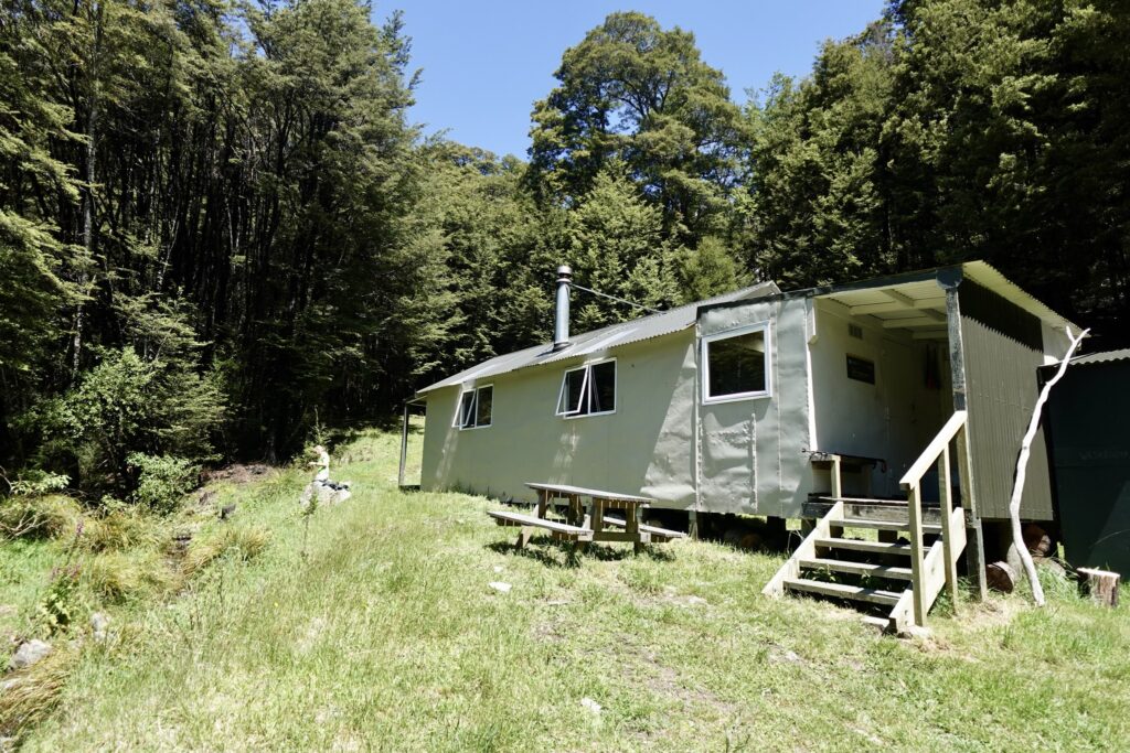
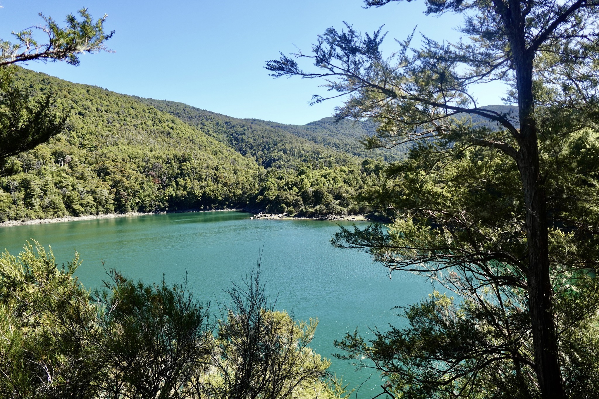
When we arrived we were stoked to see that we had the hut to ourselves. After settling in we did the 2 1/2 hour walk around Lake Chalice. Lake Chalice is about 2km in length and is the only lake in Mt Richmond Forest Park. It was created about 2000 years ago when a large landslide, possibly triggered by an earthquake, dammed the upper Goulter River. The track undulates and was a very pleasant and easy walk.
In the early evening a couple turned up at the hut for the night with their 2 young children.
The next day 4 of us headed off towards Mt Patriarch. One of the group started experiencing migraines and unfortunately was unable to come along.
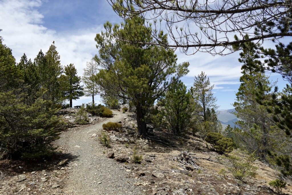
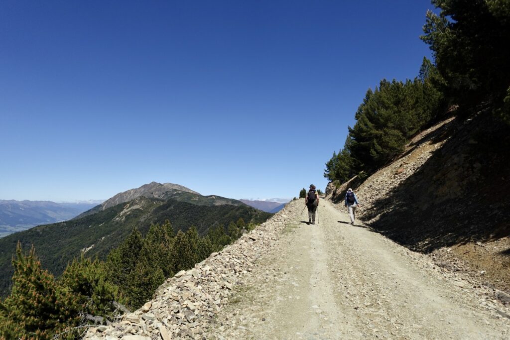
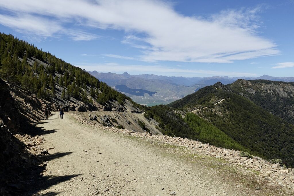
It was so nice to just be able to take daypacks with us. We left the hut at 8am and after climbing back up to the Mt Chalice carpark we continued on the 4WD road up the hill. It was a blazing hot day with no cover, the whole area and gravel road was bone dry and there were no water sources along the way. So it’s really important to take enough water with you if you’re heading to Mt Patriarch this way.
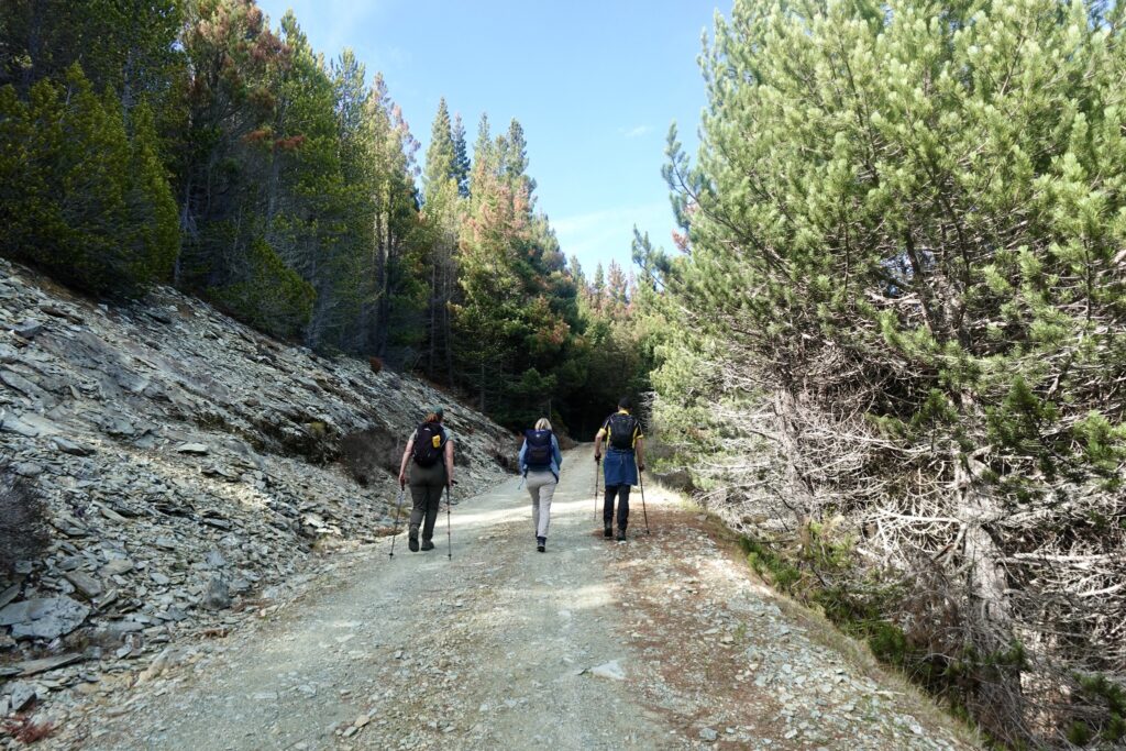
The road is at around 1200 m elevation, so there are peaks close by all around you. There were a lot of pine trees lining the road, which provided a wonderful pine scent the whole way.
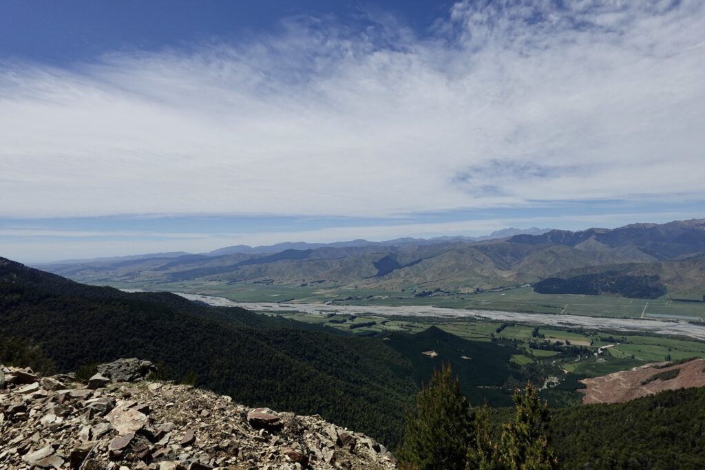
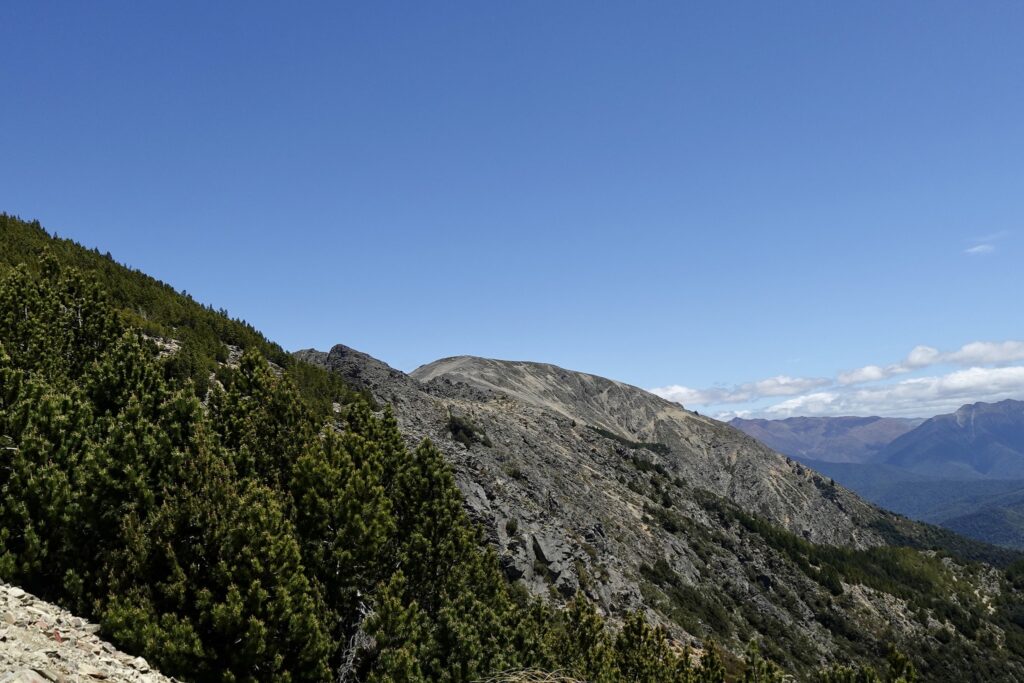
At times there were great views all the way along the Wairau Valley down towards Blenheim. At other points, if we turned around, we could see the full length of Lake Chalice below us.
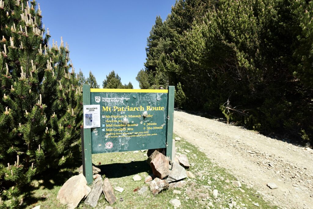
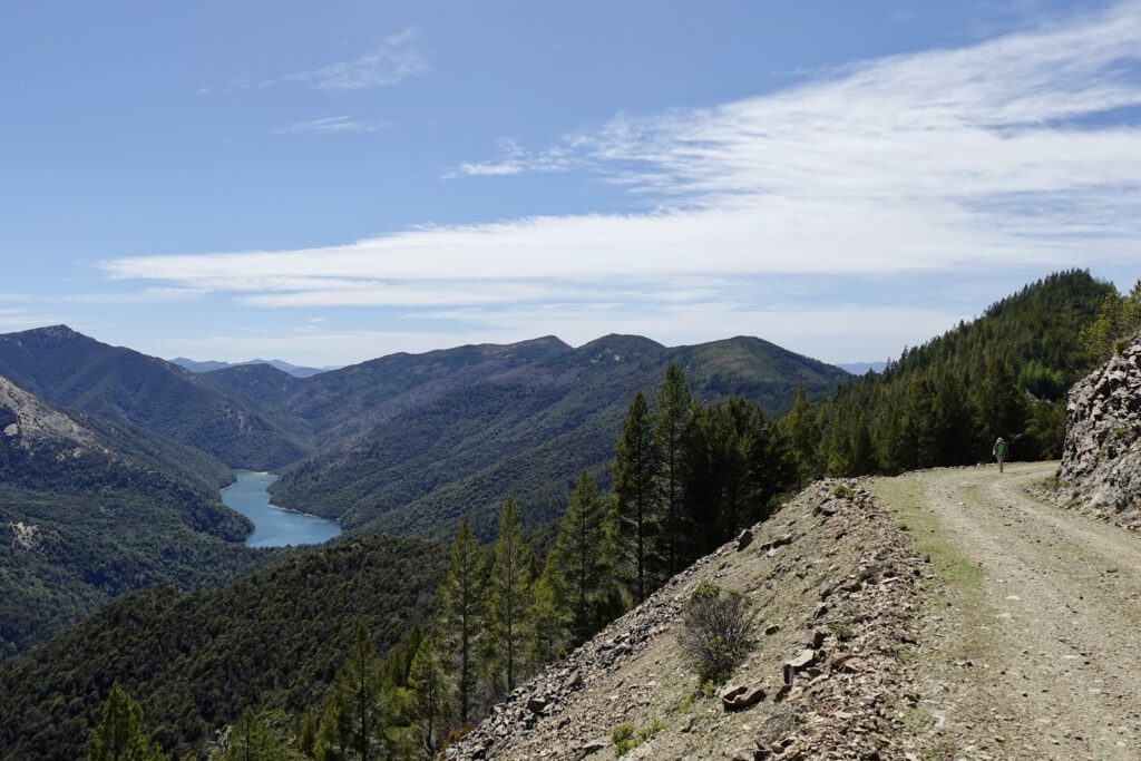
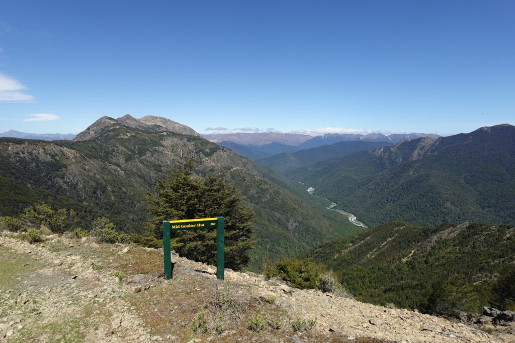
After heading along the 4WD road for some time you reach a “Mt Patriarch Route” DOC sign. A bit further along you come to an intersection where there is a DOC sign pointing out a downhill route to Mid Goulter Hut (3 hours away). Here you can also see the Goulter River stretching out into the distance below.
At this intersection we continued following the 4WD road, which turns a corner and begins descending quite steeply. Due to the very dry conditions and loose shingle covering the 4WD road, one of the group slipped and fell on this downhill section, grazing both knees.
At about 12.30 pm we stopped for lunch – we sat in the shade of some pine trees beside the road and were very grateful to be out of the sun for a bit.
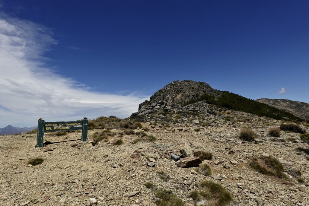
After lunch we continued on a bit further – to just beyond the “Route to Summit of Mt Patriarch” DOC sign – to pt 1516 m elevation on the topo map.
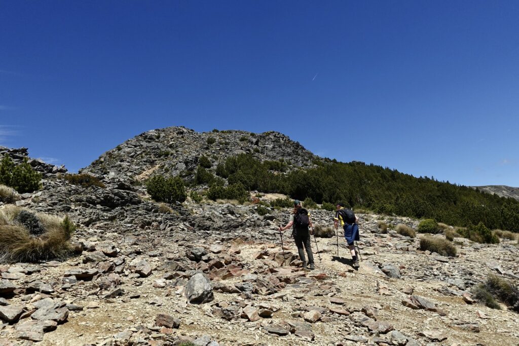
Even though we really wanted to keep going to get to the top of Mt Patriarch, we had been walking for about 5 hours already, it would take another 1.5 hours to reach the summit and we still had to walk all the way back to the Hut.
Tony and Debbie went on a bit further for a short time – traversing a patch of pine trees along the summit route, while Jacqui and Maj-Britt explored the plants and terrain around the DOC summit route sign. Once Tony and Debbie returned, we were back on our way to the Hut – arriving at around 5pm.
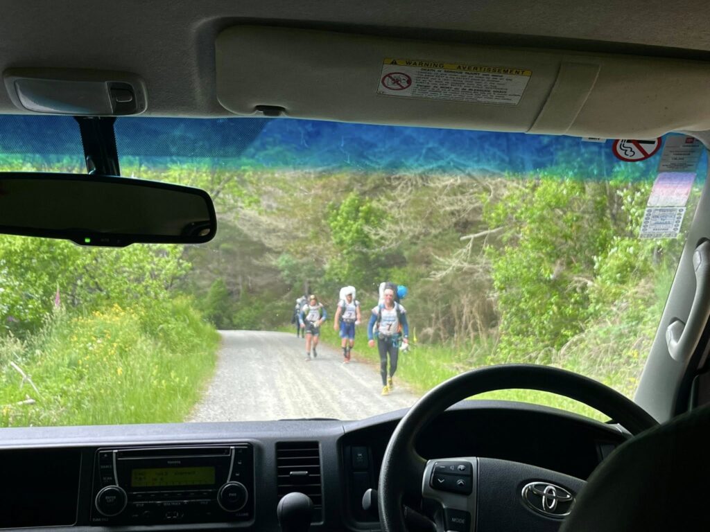
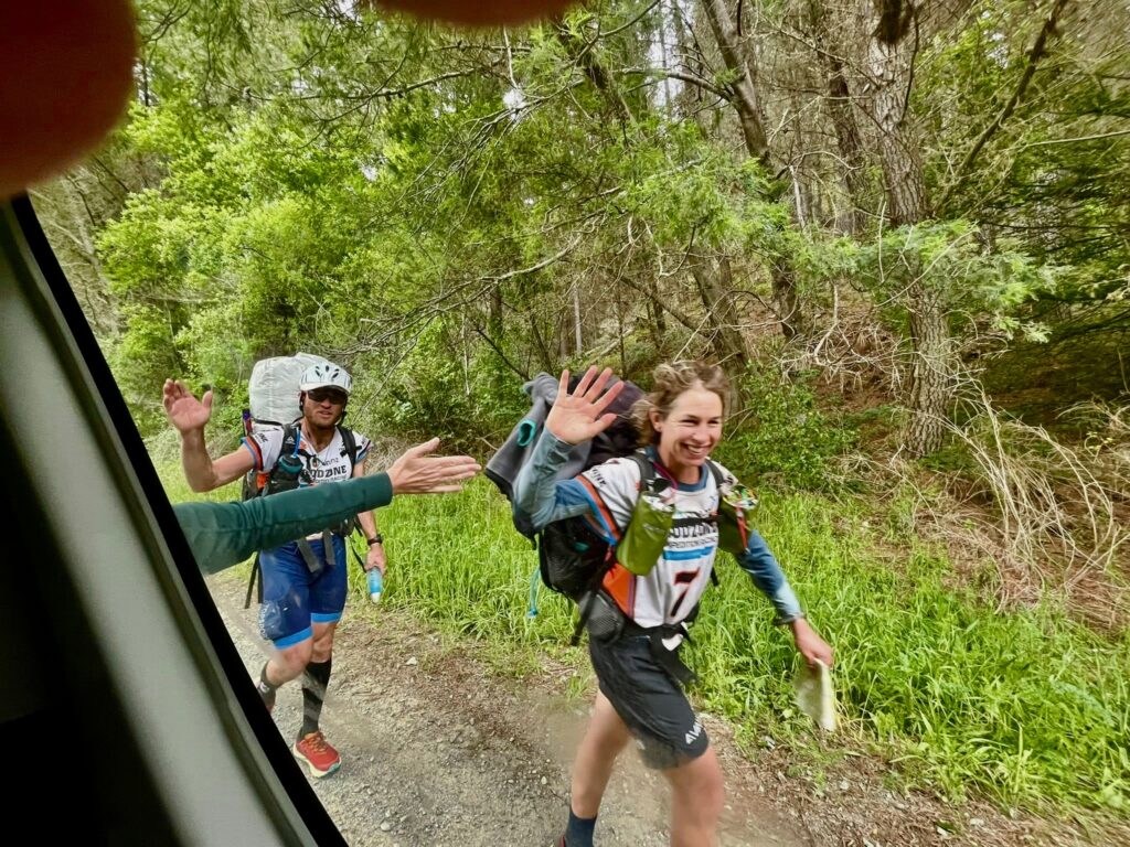
When we arrived back at the hut we were surprised to see that 2 tents had appeared on the lawn – with 2 small tinsel christmas trees and green tutu skirts. We then found out that Lake Chalice Hut was actually a checkpoint for teams competing in the Godzone Adventure race that weekend. The tents belonged to 2 women who were marshalls for the event and they told us the first teams would likely be arriving at about 2am that night and would be spraying the packrafts they would be carrying with a substance to kill Didymo. This had been the last thing we were expecting!
As it turned out, none of the race contestants arrived that night. However, on our way back down Staircase road in the van at the end of our trip the next day we did come across Team Rab. We cheered them on and Debbie, who was driving the van, even high-fived them as they went past (they actually went on to win the 2026 Godzone race!).