Poulter Valley
Minchin Pass
Binser Saddle
A 4 day hiking trip through spectacular mountain scenery in Arthur’s Pass National Park
I pulled my running poles out of my bag in surprise. I had forgotten to take them out before I packed at home. I wondered what else I had forgotten to take out and would be carrying for the next 4 days as extra weight training. A lightbulb it turned out! I had recently acquired a tramping lightbulb as a fun light for camping or staying in a hut but of course I had forgotten to put a battery in it. The lights were not on and nor was anyone home!
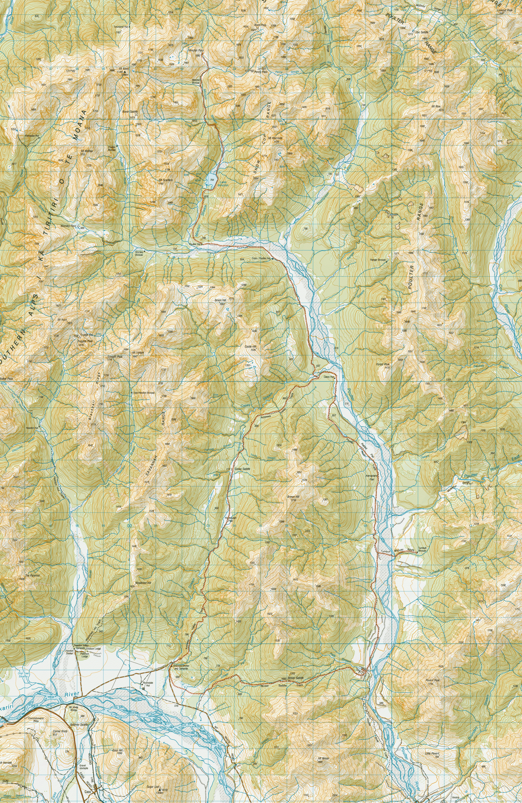
I had flown down to Canterbury for a week’s holiday and had made plans to meet up with Matt for a tramp for part of the week. Matt had suggested a 4-day loop in the Poulter Valley.
After driving from Christchurch, we started from Andrews Shelter about 11:30. The Andrews Valley Track started off with a bang with a quick sharp climb before settling into a nice easy walk up the valley through typical South Island beech forest that I love.
It was a warm day and the birds were out in force. We made quick time up the track to Casey Saddle and at the highpoint after Casey Saddle we got our first views down into the Poulter Valley before we started descending towards the Casey Hut Junction.
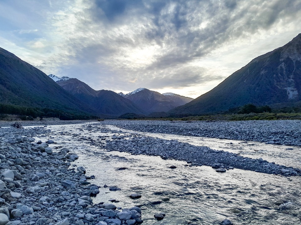
We thought we would be clever and cut off the corner of the track next to the Poulter River. False economies! We laughed at ourselves afterwards because we got fouled in a bush bash to get around a bluff next to the river and had to bash our way back to the track. Once back on the track, it was easy walking following a 4-wheel drive track.
We passed a weather station, or “fire station” as they had been called on a previous tramp when I misheard a comment, before finally coming to the junction for Trust/Poulter Hut. Rather than stopping here, we decided to keep the momentum going and power onto Poulter Hut which was another 45 minutes further up the valley.
We could see the hut up river but it was disappearing from sight intermittently. Even in the last 200m to the hut it would disappear from sight and we were left wondering if it had ever actually been there. Eventually, the door finally appeared and we gratefully dropped our packs and enjoyed the warm hut that had caught all the sun throughout the day.
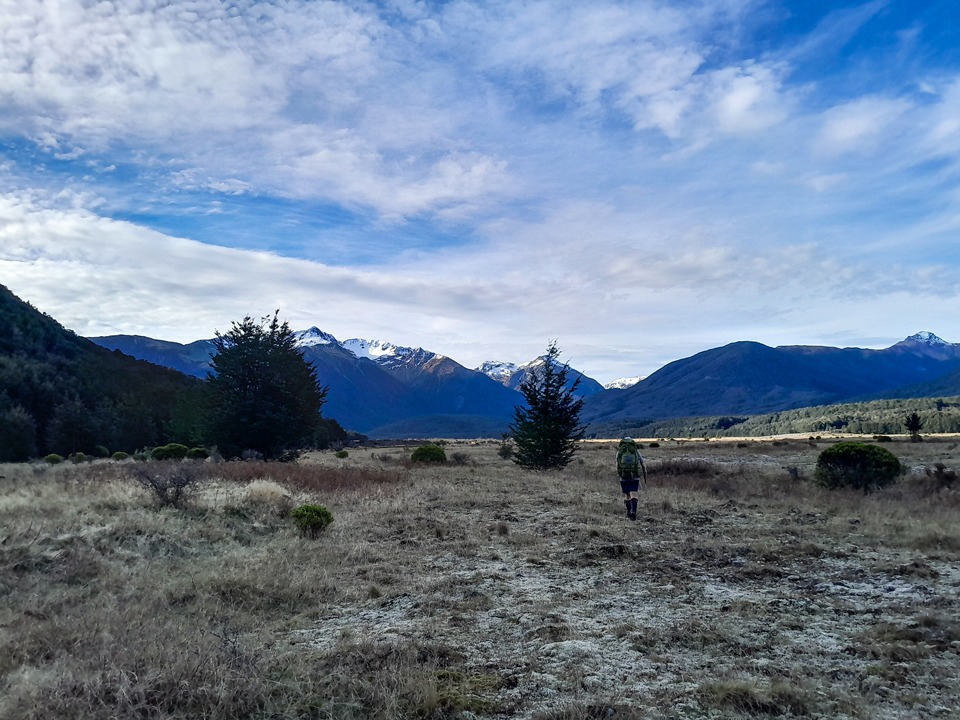
We enjoyed reading the history of the huts and information on Lake Minchin in a booklet that had been put together by Mt White Station owners.
The hut’s intentions books also provided good reading with everything from people advising not to take Trudge Stream (Peter sounded like he had a Type 2½ bordering on Type 3 fun day as he wrote it was serious canyoning terrain that he hadn’t anticipated) and hearing people talk about the birds they had seen or heard—whio, kiwi, kea, orange-fronted Kākāriki.
It took us a while to catch on to what DoC were doing when they wrote they were doing OFK work—orange-fronted Kākāriki!
These critically endangered birds are only found in two beech forests in Canterbury and this was one of them! They have also been thought to have become extinct twice and then being rediscovered! It was good to see the traps every 100m up the valley.
They are very much a boom-and-bust species that can breed for 18 months if food is plentiful but equally rapidly decline if environmental conditions are not optimal.
They are especially vulnerable to rat and stoat predation and 85% of one valley population was lost due to a single rat plague in 2001 so they are a species that needs all the help they can get.
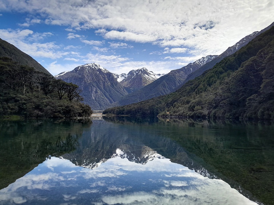
The next day we took day packs and walked up the track behind the hut to Lake Minchin. It was a nice easy gradient through a beautiful beech forest. The reflections of the snowy peaks in Lake Minchin were beautiful and we were lucky to get a good weather window as later in the day when we walked past again the wind had picked up and all reflections were gone.
We were hoping we might see one of the orange-fronted Kākāriki but didn’t get lucky enough this time. We crossed the crystal-clear Minchin Stream (whio territory) before climbing up to start towards Minchin Biv. It was a climb and then a drop down on a well-marked track to avoid the gorge in Minchin Stream.
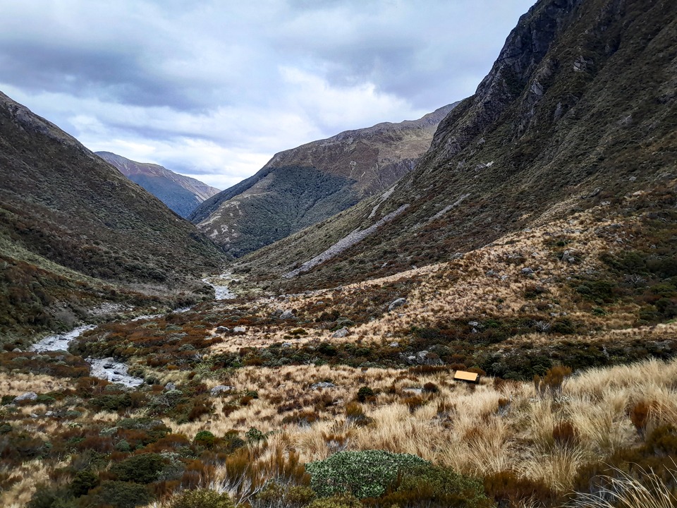
We could see Minchin Biv further up the valley with its bright orange roof and we thought it wouldn’t take long to get there. How wrong we were. Finding our way up Minchin Stream was slow going; clambering over boulders to avoid deep pools with the occasional rock cairn or tape. I nearly slipped off a large boulder and took a swim.
Eventually we hit the poled route again just before the Biv and finally arrived at Minchin Biv which is nestled in on a river terrace with the most amazing views. We had a late lunch before deciding to head towards Minchin Pass and see how we went with time.
The route was poled again and while slightly overgrown, was pretty easy to follow and got up to Minchin Pass just as a few rain drops made an appearance. Of course, it was that rain that was brief and passed as soon as we put our jackets on
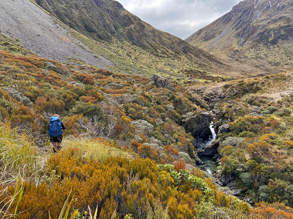
Going back down Minchin Stream seemed much quicker this time not only because we had got the route sorted this time around but because we were mentally prepared for it being a bit slow. Back at the head of Lake Minchin, we heard a kea happily call high above us. I called and it called back to me for a couple of minutes. We timed our arrival at Poulter Hut just as the rain returned.
The next morning we decided to venture further up the valley towards Worsley Biv complete with a little handmade bridge outside the door to help avoid the boggy ground. The Biv was in excellent condition and looked like a nice place to spend a night with sun streaming in the skylight.
After grabbing our bags from Poulter Hut, we were off back down the valley with a stop at Trust/Poulter Hut to enjoy sitting in the sun and then onto the new Casey Hut for lunch just as a helicopter went zooming past us.
Interestingly, we could see some buildings south west of Casey Hut that weren’t on the map. From Casey Hut, we continued following the 4-wheel drive that alternated between the open valley and going through beech forest. We finally bumped into our first people in 3 days—a couple of trampers and bike packers both heading towards Casey Hut.
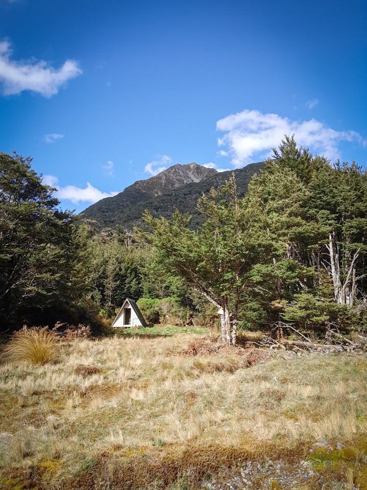
Despite Turnbull Biv being marked as a route on the map, there was no marked junction. We kept an eye on the map so we wouldn’t zoom past turning off for it as would have been easy to do. The Poulter River had changed course from the map and had several braids. We had to back out of our initial crossing point as the flow of the river was too fast and it was a bit deeper than we expected.
I was worried about taking an unnecessary swim. We walked further up river before finding a much easier place to cross. Once on the other side we found a cairn marking the turn up the stream, which was dried out.
It was full of tree fall and the track up to the river terrace had disappeared after the bank had given way so we climbed over and under trees, for longer than necessary it turned out, before eventually heading straight up the bank on an animal trail and coming out onto the open river terrace with marker poles.
I was really hoping the stream next to the Biv had water in it as I didn’t want to be battling down to the Poulter River for water again that night! Matt apparently was thinking the same thing.
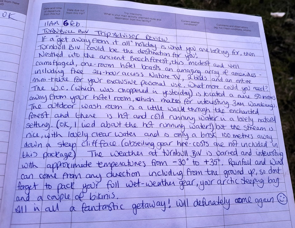
Turnbull Biv, or Turnbull Hotel as the delightful trip advisor review called it (see photo below) was in a prime spot with views both up and down the valley and surrounded by a beautiful beech forest that I decided to set my tent up in while Matt enjoyed the Biv.
The stream, was just down a “steep cliff face with abseiling gear required” according to the Trip Advisor review left in the hut book (a 5 minute walk from the hut that was a bit slippery but we managed without the abseiling gear just fine).
The next morning we found an easier way down to the stream that avoided climbing under and over all the trees from the day before—the poles led us to where the track had originally been and we just had to divert around some eroded bank.
The bikers went zooming past us just before we turned off to Binser Saddle—they were enjoying having a tailwind this time! The initial climb up the Binser Saddle track was steep to get up to the river terraces and I was glad we were going up rather than slipping down it.
Once in the beech forest, it was a nice gentle grind up to Binser Saddle. There were a few streams along the way to get water if running low. I had a korimako/bellbird spend a long time in front of me on the climb and then a visit from a pīwakawaka at lunch time.
We made it down to Mt White Road for just a short walk up the gravel road to Andrews Shelter where we got cheered in by a camper at the shelter.
On the drive back to Christchurch we made a detour to Lake Sarah and drove past Og, Gog and Magog since I had recently visited their twins on Rakiura.
Stats:
Day 1.
Andrews Shelter via Andrews Valley Track to Poulter Hut
Distance: 24.3km
Time: 6.25hrs
Elevation: 923m.
Day 2.
Day trip to Minchin Pass
Distance: 19.5km
Time: 5.5hrs
Elevation: 898m.
Day 3.
Trip to Worsley Biv then to Turnbull Biv
Distance: 25.67km
Time: 6hrs
Elevation: 342m.
Day 4.
Turnbull Biv to Andrews Shelter via Binser Saddle
Distance: 17.4km
Time: 4.25hrs
Elevation: 774m.

