

On Thursday 17th of April, two WTMC groups met at Wellington Railway station at 11.30am to catch the 1pm Interislander ferry to the South Island.
After arriving in Picton, we grabbed a quick dinner and then drove south to Murchison in the club van. The night was spent at Kiwi Park Motels and Holiday Park in Murchison. This was a good spot to get our groups close to the starting point of their walks for Friday morning.
Day 1: Friday
We drove for just over an hour to the St James Walkway (Lewis Pass) entrance of the track, where the Medium Fit (MF) group dropped us off. The MF group originally planned to do a trip on the other side of the highway, exploring around Brass Monkey Biv and Lucretia Hut, but due to the poor weather, decided to do the St James Walkway in reverse to our group.
After dropping us off, the MF drove the van down to Boyle Campsite and started walking from that end of the track. This allowed us to park the van in a secure parking spot for a small fee.
After the Medium group set off from the northern (Lewis Pass) end, there was 30 minutes of easy travel before crossing the first big bridge over the Maruia River to start heading up Cannibal Gorge.


The track was in good condition, and our group passed a few other parties exploring the area as the track sidled along the river. After 3 hours we reached Cannibal Gorge Hut.

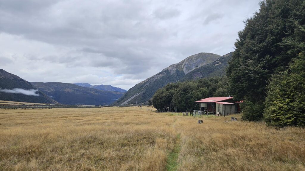
Cannibal Gorge Hut was a great little lunch spot and had 3 levels of bunks which was cool. After a 20-30 minute break, we set off for Ada Pass Hut. This section of track didn’t take very long (approximately one hour) and I enjoyed crossing “Billy Goat Gruff”bridge – located about 100-200 m before Ada Pass Hut.

Ada Pass Hut had an awesome view, and we all settled in for a relaxing evening watching the clouds roll in and around the mountains. Another party of six, which we had overtaken about 10 minutes into the start of the track, had also booked Ada Pass Hut for the night. However, we suspected that they stayed the night at Cannibal Gorge Hut, as we ended up having the hut to ourselves, which was quite pleasant, particularly as our next day was going to be our longest day – so an early start was expected.

Day 2 – Saturday
The track from Ada Pass Hut to Christopher Hut was probably my favourite section of the trip because of the wide-open valley and mountain views with low hanging cloud. The rain stayed away, with only a few sections of drizzle, which meant pack covers stayed on. Most of us didn’t bother with rain jackets as it was quite warm.


Coming around the corner, just before Ada Cullers Hut, there are some stunning views of the Christopher River valley. At Ada Cullers Hut, there is a sign indicating a further 1km to Christopher Hut.


Stopping at Christopher Hut, we enjoyed spotting the herd of wild horses in the distance and had a lunch break.

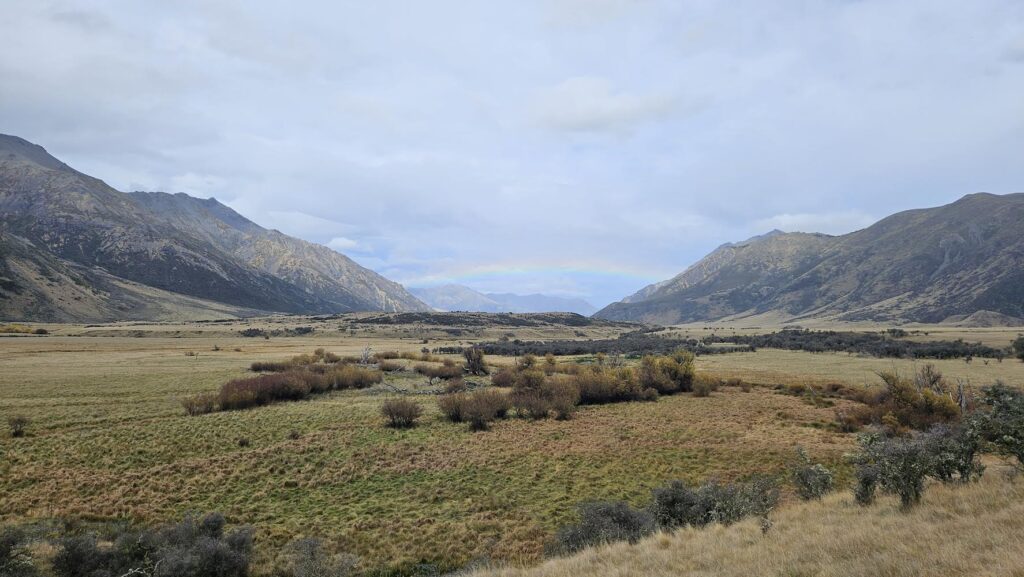
The walk continued, from Christopher Hut to Anne Hut, with the track sidling beside the river. After passing the Ada Homesteads we saw a rainbow in the Waiau Uwha River valley.


Shortly before reaching the track junction with the Waiau Pass Track we came across the MF group, who were walking from Rokeby Hut to Christopher Hut that day.
We had a quick chat to discuss a pickup time on Monday and also whether people wanted to check out the Maruia Hot pools on the drive back to Picton. About 5 minutes after leaving the group we came across the junction with Waiau Pass Track. From here we crossed another decent swing bridge and arrived at Anne Hut around mid afternoon.

Anne Hut was probably the nicest hut on the track. It was very busy, but also had a great vibe and was comfy and warm. Conveniently, there were doors on the bunk rooms. This was effective in muting noise, so we were able to get an early night’s sleep.
Day 3 – Sunday
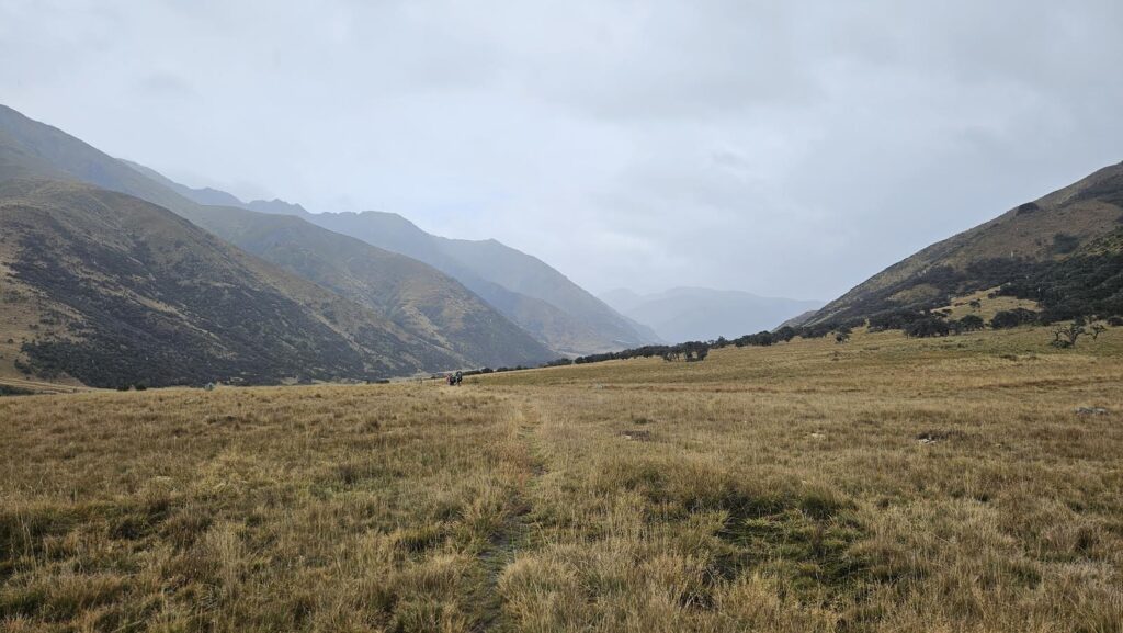
The track sidled alongside the Anne River, before gradually climbing to Anne Saddle. The climb was barely noticeable apart from the last 100 m – to reach the highest point of the track (at 1136 m elevation).

The track then descended steeply for about 800 m (horizontally) before levelling out into the open river valleys next to the Boyle River.
Along this section we came across two women who were trekking with their horses. This was quite cool to see, as there had been evidence of horses but up until then we hadn’t seen any. The pair had stayed at Magdalen Hut the previous night and were trekking around the South Island.

We eventually reached Rokeby Hut, where there were swarms of sandflies. We therefore decided to just have a quick snack and take a few photos before setting off on the final section of the day, to Boyle Flat Hut.
During their walk in the opposite direction, the MF group had tented at Rokeby Hut. It did look like a nice camping spot, and was scenic, but be aware that there is no toilet!

About 45 minutes – one hour on from Rokeby Hut, there is a swing bridge that takes you over the Boyle River to Boyle Flat Hut. This is another dark hut (similar to Ada Pass and Christopher Huts), but a pleasant spot to watch the rain roll through the valley.
Day 4 – Monday
In the morning, we set off as two groups. One group departed at 6.15 am to head to Magdalen Hut and everyone else left at 6.30 am. This was to allow enough time for all of us to get to Boyle Campsite by 11am, so we could then go and meet the MF group at the Lewis Pass entrance of the track by 11.30 am.
There had been a lot of rain overnight and I snapped a photo of the swing bridge over Boyle River, by Boyle Flat Hut, which we had crossed the previous day. The water level was now definitely a lot higher -it seemed that the river had risen about 1-2 metres since we had walked across the bridge the previous afternoon.


Trekking in the dark with our head torches on while the river raged alongside the track felt quite dramatic. Along this section there was a small slip. It was quite manageable as a small track has been cut above it.

We took a quick 40-minute detour from the main track junction to check out Magdalen Hut.
Once back at the main track junction, we crossed the Boyle River and there was then a final 10 km to complete the walk.
The rain overnight definitely had an impact on the streams (and there are some unbridged ones that you need to cross, as they flowed over the track) but they were manageable.

After crossing the last swing bridge over Boyle River, there is about 2km further to walk before you arrive at Boyle Campsite.

After a quick clothing change, we set off north to pick up the MF group who were finishing their traverse of the St James Walkway at the Lewis Pass end.
A few of us decided to have a quick dip at the Maruia Hot Springs, while the rest of us travelled up the road for a snack (and coffee!) at Springs Junction.
After everyone reassembled, we all had another quick stop at Springs Junction before heading north towards Picton.

Along the way we stopped at Maruia Falls, which are well signposted and worth a look. The carpark is located immediately beside the highway and the Falls themselves are only a 5 minute walk from the carpark. The Falls were looking quite dramatic after the recent heavy rain and a couple of whirlpools were visible.
We arrived in Picton before 5pm, with plenty of time to spare before our 7pm ferry sailing.
A PLB was activated on this trip, the link to the learnings can be found here: https://wtmc.org.nz/chief-guide/learning-from-easter-plb-activation-key-lessons-next-steps/
Statistics
Friday 18 April:
Lewis Pass Road end to Ada Pass Hut (via Cannibal Gorge Hut) – 13 km, elapsed time 4.5 hours, 480 m ascent, 345 m descent
Saturday 19 April:
Ada Pass Hut to Anne Hut (via Christopher Hut) – 25.3 km, elapsed time 7.5 hours, 440 m ascent, 540 m descent.
Sunday 20 April:
Anne Hut to Boyle Flat Hut (via Rokeby Hut) – 18.45 km, elapsed time 5.5 hours, 440 m ascent, 520 m descent.
Monday 21 April:
Boyle Flat Hut to Boyle Campsite (with a side trip to Magdalen Hut) – 15.7 km, elapsed time 4.5 hours, ascent 320 m, descent 510 m.