
The plan for the weekend was a Waipakihi Hut loop – heading in over Urchin and following the Waipakihi River to the hut on Saturday then out via the Umukarikari Range on Sunday. A perfect mix of tops and river travel. While this was a medium trip, I’d indicated to the group that we were looking at a 9-10 hour day on Saturday, based on the advice on Route Guides and various online sources. The forecast was great, with sunshine, low winds and little rain in the week prior providing excellent conditions to give the route a crack.
We left Wellington at 4:30pm on Friday with the EM group and after a dinner stop in Bulls, arrived at Urchin campsite at around 9:30pm. There are several campsites off Kaimanawa Road, but previous trip reports recommended staying at Urchin (which has some nice grassy areas) over Waikoko (a gravel carpark).
Urchin campsite was already quite full with cars and tents when we pulled up, but we all found tent sites (albeit spread apart from each other). The campsite itself doesn’t have water, but there’s a stream 150 metres from the campsite down the Tree Trunk Gorge Track. We fell asleep to the sweet serenade of two ruru hooting at each other from across the campsite.
On Saturday morning at around 7:45am, we left the van keys with the EM group and walked 20 minutes up the road to the start of the Urchin track. The track was well maintained and climbs steadily through the bush to reach 1392m. It took us just under two hours to reach the top and we were greeted with glorious views of Ruapehu and Ngauruhoe plus the surrounding Kaimanawa Ranges. After applying sunscreen and snapping some photos, we carried on for another 35 minutes along the ridgeline to reach the signposted fork leading down into the valley, where the marked track ends.
The descent is short and steep but easy to follow. From the start of the Urchin track, it took us 3.5 hours to reach the river, well within DOC times. Given our cracking pace, I was beginning to think my 9–10-hour estimate was overly generous (spoiler alert, it ended up being just right). This area is a popular camping spot for hunters and trampers, and looking at the wide flats nestled among the trees and the beautiful view of the river, it was easy to see why.
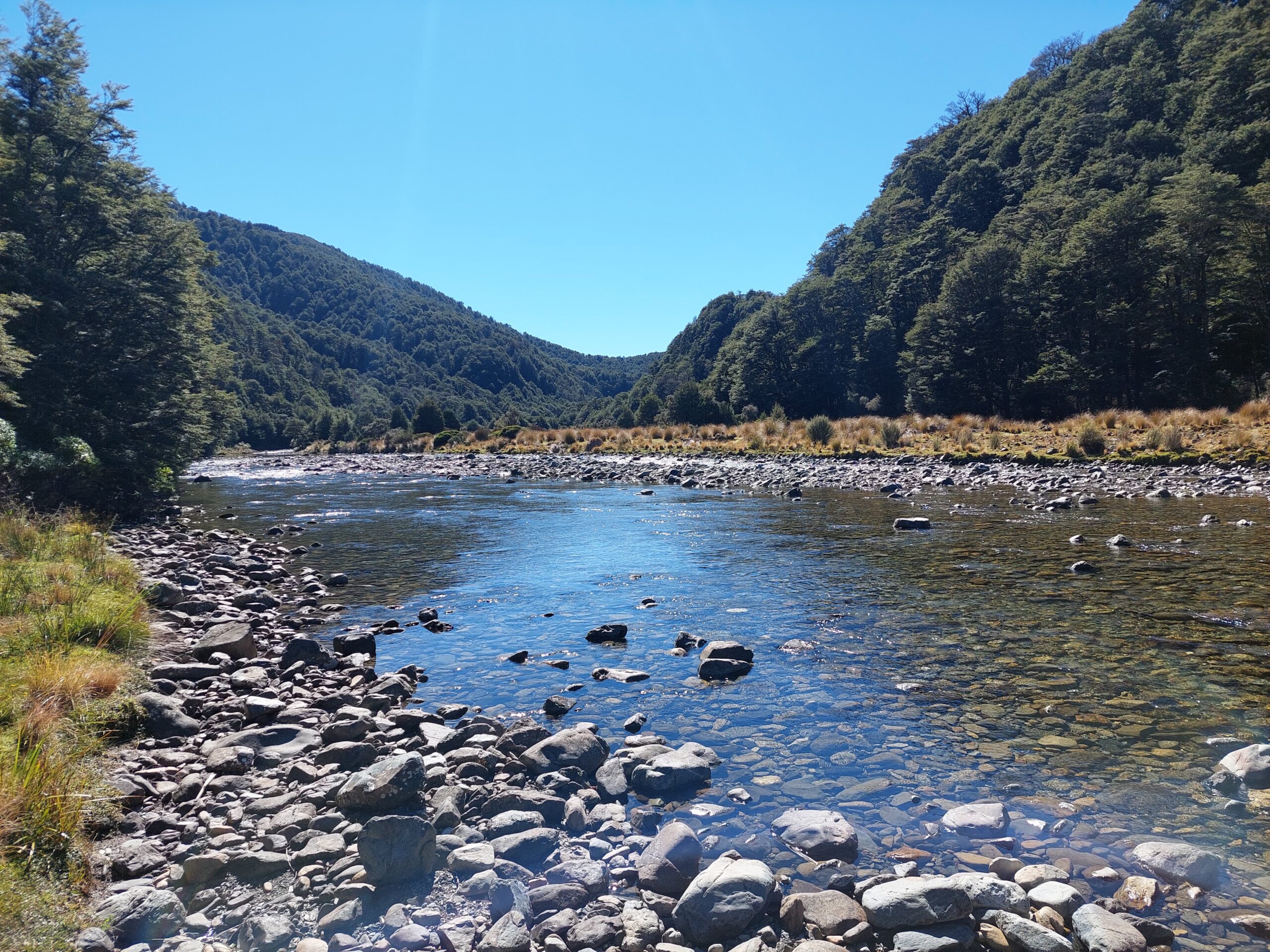
We had morning tea before crossing the river and beginning our adventure up the valley. Route Guides describes this section as “A great river valley walk upstream, on tussock flats with intermittent scrub and forest for roughly the first half then largely in the riverbed for the second half. Straightforward and enjoyable in normal flows, obviously not to be attempted after significant rain.” This was pretty accurate.
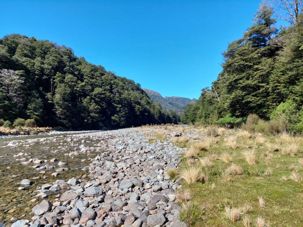
The tussock flats were pretty easy travel, with clear foot and deer trails. When we hit denser scrub, that was the cue to cross the river and carry on along the other side, then rinse and repeat. The river levels were low, ankle to just below knee deep in most places making crossing very straightforward. In some sections it was easier to stay in the riverbed.
At about 1pm, we stopped for lunch and James went for swim number one. Fuelled and refreshed, we carried on along the river flats, continuing our routine of crossing the river when the foot trail ran out. There were a few sections where the route led us up through the bush lining the sides of the river, a welcome reprieve from the baking sun, before dropping us back down to the river stones.
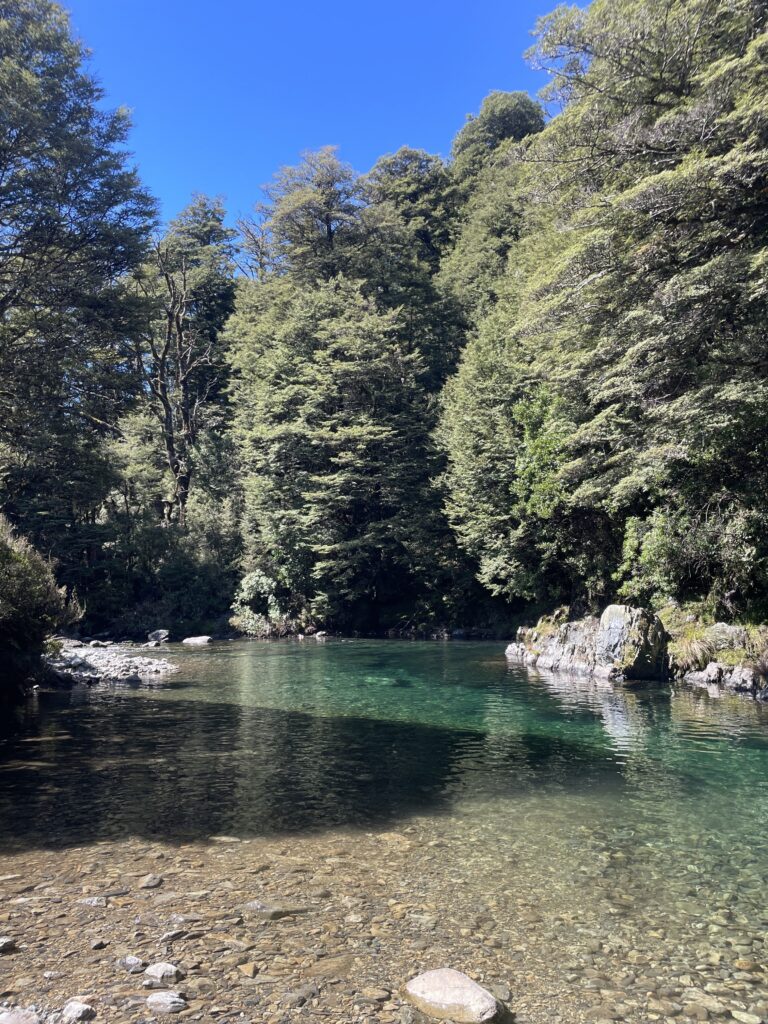
After passing several 7/10, and 8/10 swimming spots (not deep enough, not shaded enough, too hard to access) we reached a gorgeous blue pool that was too good to pass up. Ellie jumped in first, followed by James, Matt and myself. Confident that this was the pinnacle of swimming holes, I marked it in my Topo50 app as “The best swimming spot”.
As much as we wanted to linger, we still had 5km of river to go so we hoisted on our packs and carried on. We soon reached the turn in the river where the tussock flats stop, and the route is mainly riverbed and scrub. Matt and James took turns scouting ahead for the route and while there were a few 50/50 calls as to which way to go, it was pretty obvious most of the time. Ellie found a 10/10 pool (for a dragonfly).
At this point the sun was starting to take its toll and our pace was slowing. After spotting yet another beautiful pool, James suggested we stop for a morale boosting swim. With 1.5km to go, this proved to be an excellent suggestion and all five of us gratefully took a dip, letting the crystal-clear water cool us down for the final stretch.
The last 500 metres was a slightly marshy and muddy trudge, but seeing the hut on the hill above us was good motivation. At about 6pm, 10 hours after we left Urchin campsite we arrived at Waipakihi Hut. As expected, the hut was busy with the EM group, several other trampers and hunters and one dog.
Beth and Matt snagged the last two bunks and went for a final swim just below the hut, while the rest of us tented. There’s space for around three tents in front of the hut as well as several spots behind.
After our BYO dinners, James and I whipped up (with an actual eggbeater that we’d carried in, much to the others’ amusement) a dessert of lemon curd, crushed gingernuts and cream which went down a treat.
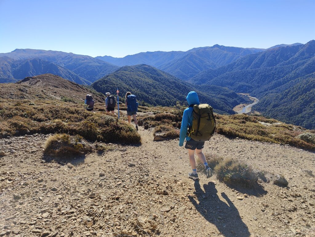
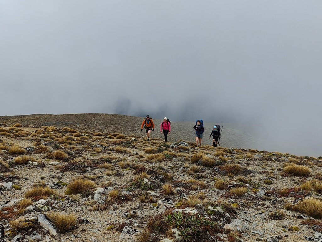
On Sunday we walked out via the Umukarikari Range. While it was much cloudier than Saturday, it was very calm and we still got nice pockets of views across the ridgeline. We arrived back at the van in time for lunch and then drove back to Wellington with the EM group.
All in all, it was an excellent loop with great company. The river section was pleasantly straightforward to follow and adds some nice variability to the usual tops track. Just make sure you leave some time for a swim.
Stats (including breaks)
Day 1
Urchin campsite to Urchin Track: 20 minutes
Urchin Track to Waipakihi River junction: 3.5 hours
Waipakihi River junction to Waipakihi Hut: 6 hours
Total distance: 20.91km
Total elevation gain: 919m
Day 2
Waipakihi Hut to Umukarikari Road end via Umukarikari Range: 4 hour 40 minutes
Total distance: 13.76km
Total elevation gain: 593m