Jam Hut and Hornby Biv – 3 days in the Seaward Kaikoura Range
A 3-day hiking loop trip through spectacular mountain scenery in the Seaward Kaikoura Range passing seldom visited Jam Hut and Hornby Biv
Jam Hut and Hornby Bivvy
by Megan Sety
.
We had booked flights to Christchurch with the plan to go over Ball Pass in the Mount Cook area. But the weather forecast was for rain throughout the main divide and high winds everywhere. The Seaward Kaikoura Range seemed about the only place that would be dry and not blowing a gale. When talking about alternative trips, Tony piped up that he knew a nice and easy 3-day trip to visit Jam Hut in the Kaikouras. He’d been there several times before. That sounded good to me and Fiona.
So it was that at 9 pm on Friday night, we were getting out of the car to inspect what looked like the Clarence Valley Road driving directly into the Clarence River. Tony was certain there was a bridge before, but there was no bridge now. There wasn’t even evidence that a bridge had once existed. We hopped back in the car, inspected the map a dozen times and concluded that the Kaikoura earthquake of 2016 must have wiped out the bridge, since there was a bridge on all of our maps at the exact place we had been.
This prompted a discussion that revealed Tony’s previous trips were pre-earthquake and other than Fiona checking Jam Hut still existed, none of us had done any research to verify that our intended trip was still possible post-earthquake. This would have been an opportune time to practice one of Ken MacIver’s communication pauses to consider our next decisions.
Instead we focused on finding a place to camp for the night since we were clearly not going to make it to our intended road end. Settling on the Puhi Puhi camping area, I did some googling on the way there.
We determined indeed the Clarence Valley Road bridge had been destroyed and as yet nothing had been replaced. Comparing District Council notes, a Stuff article and the map, we determined that we could still reach our road end by driving up the Waipapa Road, parking the car at the obvious ford over the confluence of the Wharekiri and Miller Streams, and walking an extra 5 km to the originally intended road end where Waiautoa Road meets George Stream. We’re trampers after all, so what’s a little walking.
The next morning on the way out, we happened on the Middle Hill Mountain Bike Park and decided to call in and confirm the road was publicly accessible. The guys confirmed indeed it was and they even thought we might get our 2-wheel drive car across the ford. When we got there, we thought better of risking an extra couple hours trying to tow our hire car out of the river, so we parked and walked the extra 5 kms. It’s not a bad walk as 4-wheel-drive roads go and we had a fantastic vantage of where the Clarence Valley Road and bridge once were. Though in the future I’d recommend asking the mountain bike park if they would offer a shuttle trip for a fair price!
We got to our proper road end and then started ambling up the George Stream which initially looks like a classic South Island braided river. But after 5 km turns into a nice little stream with boulders to clamber over. Slowly the banks steepen and the stream feels a bit more gorgy, both beautiful and fun to travel up.
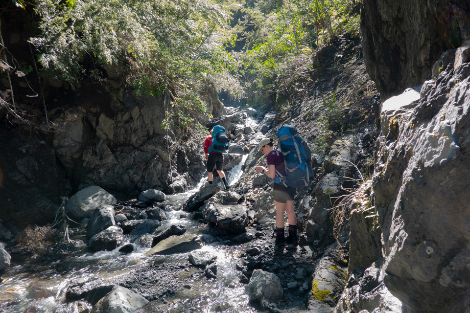
Eventually we got to the turn off point to head towards George Saddle. Tony had previously had some serious navigational fun getting to the saddle. So his memory of the best approach was pretty useful here. The headwaters of the George stream is a maze of streams. We’d suggest getting yourself in the stream marked in our GPS track and continuing up it until it looks better to get out of the creek and head up the true right of the stream. We stumbled across a few cut branches—you might get lucky and find those as confirmation or you might just bash your way all the same. The scree isn’t very good going on the approach to the saddle from the south side, so your best bet is finding a route up through the most solid looking vegetation.
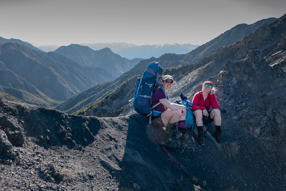
The wind was whipping when we got to George Saddle but we had fantastic views. The scree down the other side is perfect to descend in about 5 minutes. Since we were running a bit behind our schedule, we decided to end the day sensibly at 6pm and camped alongside the Doddemeade Stream—about 30 minutes down from the saddle.
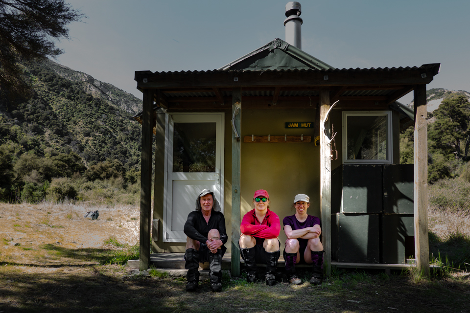
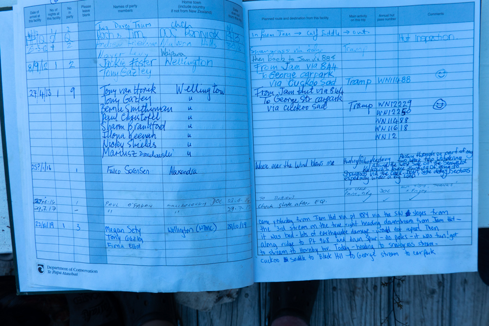
The next morning we had a dawn chorus of bellbirds and blue skies. We easily made our way down to Jam Hut for morning tea. It was empty but we scoured the hut book for reports related to our planned route to Hornby Bivvy. We were hoping for confirmation that it was do-able post-earthquake. So far we hadn’t seen too much to indicate significant changes to the terrain, but Fiona and I were still nervous about the uncertain nature of what was ahead. Tony was convinced it would be fine. He’d been here four times before and one of those included getting a WTMC group of 10 people along the same route.
The intentions book had an entry pre-earthquake that included our route to Hornby and some alternative options. I’ll let the entry speak for itself:
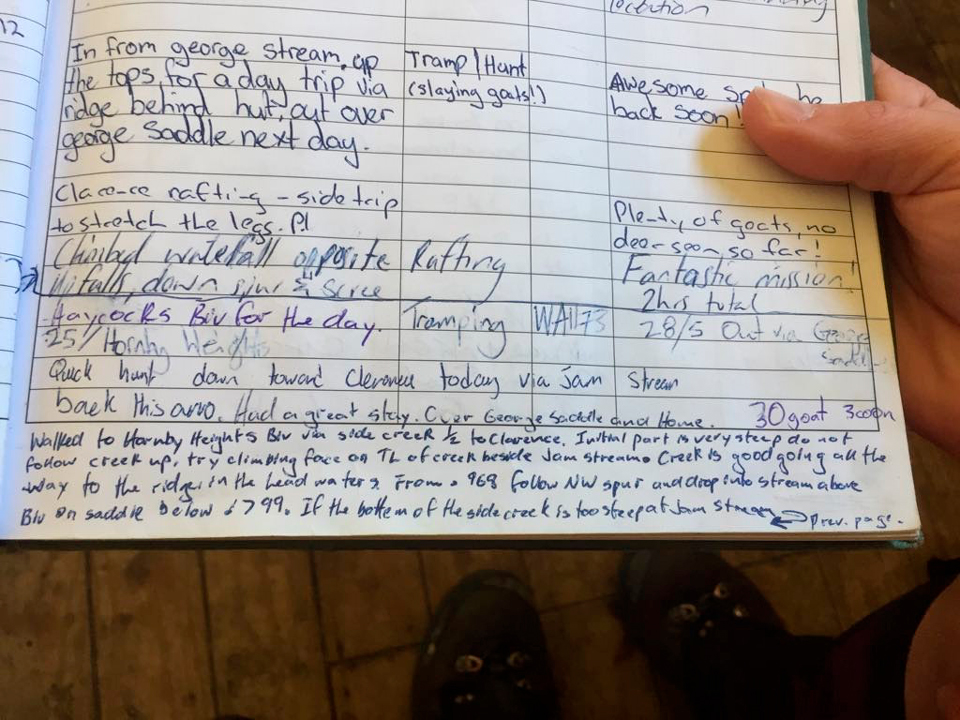
While it was pre-earthquake it was good to get some confirmation that Tony’s memory of the planned route was backed up by someone else. We had also read Mike Phethean’s trip report providing similar navigation tips.
So we set off for point 884. Before we left, we discussed whether to use Tony’s known route up the hill to pt 884 and along the ridge, or whether to go with the intention book entry of the slightly steep scramble but good travel in the stream. Thankfully Fiona suggested we go with the hill and ridge—a known route and different to yesterday’s travel in the stream.
As we approached pt 884, I asked Tony if the hillside I was looking at was the one we were planning to go up. He confirmed. I said “That looks awful, how can we possibly go up there?” Fiona agreed and both of us wondered what Tony was on about.
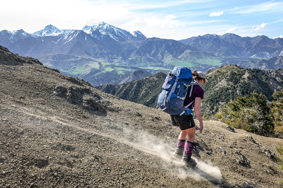
Yesterday we had quickly discovered that the bare hillsides were hard packed earth with tiny little loose gravel over the top. Unlike normal scree, stepping on this stuff felt like stepping on ball bearings on concrete. Looking up the SW face of the approach to point 884 there were limited bands of vegetation and huge amounts of bare ground where the whole hillside had just slipped away. We should have had another one of Ken’s communication pauses, but other than expressing our disbelief at the proposed route, Tony was certain it would be fine once we got there.
The initial 100 metres was just that and we relaxed. As we crested a little bump, we could see into the unmarked stream just south of pt 884—the one that had a so-called steep start. It was indeed steep, if that’s how you would describe an 80 metre waterfall. We were glad to have stuck with Fiona’s suggestion to stay out of the stream. In hindsight, we were starting to see evidence that the terrain had been dramatically affected by the 7.8 magnitude earthquake, but Fiona and I didn’t have anything to compare it to and so far, most of what we had covered was matching Tony’s memory of six years before.
But as we carried on, the wake-up call to the impacts from the earthquake became impossible to ignore. Most of the remaining 300 metres covered bare ground as if all the top layers had slid or broken away. What was left, was hard packed soil with loose pebbles strewn across at persistent 35 degree slopes. It was difficult to trust your feet and when you reached for something stable to hold on to, the rock crumbled like a sand castle and the dried dead vegetation just broke up and ripped the roots from the ground.
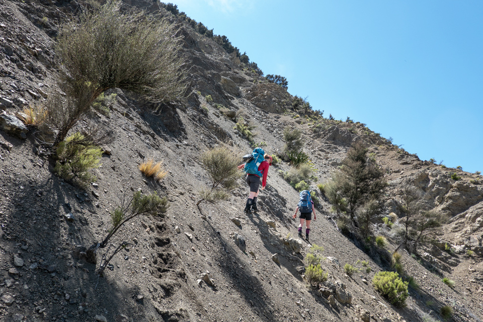
We would move up until we hit another terrifying slippery bare patch, then daintily sidle towards patches of vegetation that mixed matagouri and manuka. It was not Type 2 or even Type 3 fun.
When we neared the top, the sides of the hill had dropped away, leaving a narrow spur. It was a jumbled pile of newly broken giant boulders that looked pushed up from the ground and precariously perched. When there was soil, there were tension cracks splitting it right down the middle.
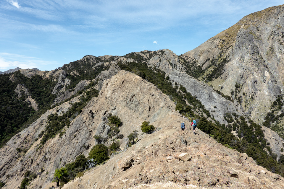
We moved quickly trying to get to pt 884 both for a sense of security and safety, but also quite uncertain if the true ridge beyond would even be passable. Finally hitting a secure place around 2 pm after about 3 hours from leaving the valley floor, we had lunch and regrouped. Tony admitted the terrain might have changed. Now we knew for sure that the rest of our route was completely uncertain. We just hoped we could get to Hornby Bivvy and could rest and rethink the last day and our planned route out.
We carried along the actual ridge from pt 884 towards pt 968. The entry in the intentions book had referred to a poled route here that was good and once again said the stream you land in was good going. Tony had seen the poles on past trips, but had decided against them thinking the route looked to go nowhere. However, Tony had previously navigated down more directly from pt 981 and found it mixed. Mike had also happened on the poled route in their trip, but had run out of time to explore the route. We decided to give it a go.
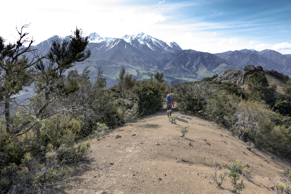
However there was no sign of poles. Either they had been removed or more likely disappeared in the damage of the earthquake. Initially the terrain down from pt 968 was quite good going, but before long we hit a massive bluff and sidled NE—aiming towards the stream that looked to go right past the bivvy. Overall the route down was far better going than the approach up pt 884, but it was clear in parts the ground had been affected by the earthquake and that subsequent erosion was causing large slips that were significantly changing the terrain. It seems likely the accessibility of the route will only further deteriorate.
We eventually hit the unnamed stream and felt a huge sigh of relief. Sadly it was a tiny stream with steep sides and was full of bush lawyer, matagouri and fallen dead manuka. The hillsides along the stream were more of the same, so we pushed on, poking and tearing our skin, and egos, along the way. After a couple hundred metres we used the GPS to locate the bivvy since the bush was quite thick.
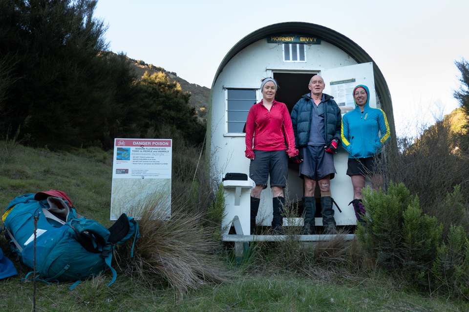
We were ecstatic to arrive around 5 pm after an intense and unsettling day of travel. The bivvy was in excellent shape. The number of cobwebs matched the hut book’s records that since the earthquake the only person to visit the hut was a DOC worker who had flown in to confirm it was still standing. In fact all of the entries going back to 2012 fit on one page, and no surprise Tony was half of those entries. Actually Hornby Bivvy was newly installed in 2006 to replace the former Hornby Hut and since then just a total of 17 parties have visited.
We dropped our packs and breathed a sigh of relief. Tony had remembered that previously the only hard part of the trip had been the descent from this hillside into the creek directly east of the bivvy that leads to Snowgrass Stream. He’d never consistently found a good route down. To save time for the next day, Tony and I went to scout out the possible route down. But we quickly realised it was going to take too much time. We did spot a pole, which Tony had seen before but had found led nowhere. Back to the bivvy to rest up for the night.
The next morning, we packed up and got ready to go. We then had the first really robust conversation about our intended route and the possible challenges ahead with the uncertainty of the terrain. Tony was still certain it would be fine, but Fiona and I didn’t quite have his confidence. We agreed there were at least four major problem areas ahead. We talked at length about whether to return the route we came or what options we had. Ultimately notes in the bivvy hut book and the topography on the map indicated there weren’t many other options to exit. The best bet was to follow the route that Tony has used before, and at each crossroads we would be open to the possibility that we might have to turn around or spend an extra day finding a route out.
We set off at 8 am, finding the pole we’d seen and used that as a loose guide to work our way into the unnamed stream. Our goal was to get as close as far downstream as possible before we actually got in the stream since there were previously known waterfalls that would bluff us out. It was more of the same terrible and precarious travel—ball bearings on concrete. Thankfully it was a much shorter and quicker descent. The stream itself seems to have been drastically changed by the earthquake and was finally the first easy travel. In fact we likely could have entered further upstream and been fine. First problem passed.
We easily dropped down into Snowgrass and then walked the 15 minutes to the second problem – a 4 metre waterfall that we needed to ascend. There was still a rope hanging along the steep true right side – the same rope that had been there eight years ago from the 2011 WTMC trip. The rope and that option looked terrible. The true left looked climbable—as in rock climbable. I decided to give it a go. With a little help from Tony and Fiona bracing my feet, I easily climbed on to the first ledge, but I wasn’t willing to risk the mantel move over the lip of the waterfall—the consequences were too great. Back down I went.
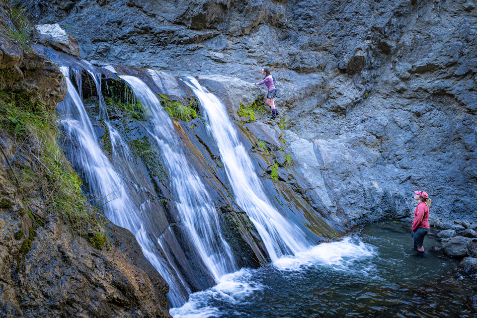
Tony gave the rope a big tug and it broke and came away from the tree branch it was tied to. We tried several times to scramble up the true right but it seemed just that little bit risky. Finally, taking the spare rope with us that we had brought just for this waterfall, I gave it one last go. In the end it was doable and we used the rope to haul our packs up the side and Tony and Fiona quickly followed. Two hours of problem-solving later, we and all three packs were safely over the waterfall. Another problem survived.
We carried on up the stream to where we would turn off and head up to Cuckoo Saddle. We stopped for lunch, and I think for Fiona and I, we started to feel an inkling of hope that we might reach the road end tonight.
The travel up to Cuckoo saddle again was heavily affected by the earthquake and previous descriptions of the route up bared no resemblance to the ground. It was again difficult but there was far more vegetation to help us gain the ridge. Problem three done.
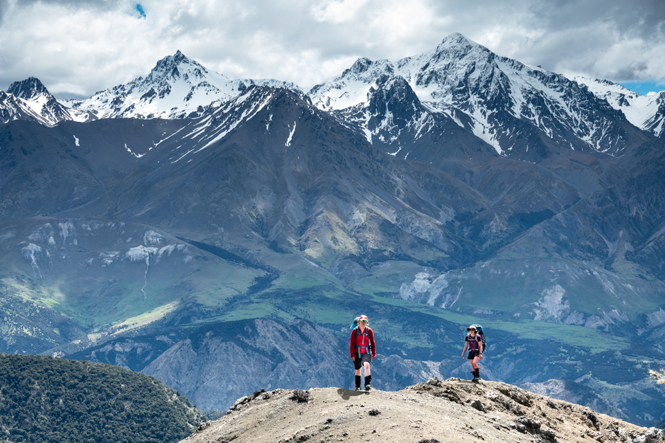
Now it was just the 4th problem, the ridge—we wondered if the narrow Ben Spur had become too narrow to pass, but onward we went. In the end the spur was fine, but similar to the other ridge, there were intimidating tension cracks and jumbles of boulders that seemed ready to tip off at any moment. We reached Black Hill and could see into George Stream and our route home. From there, the travel was easy and we could finally relax. It was still several more hours until we finally reached the car, but it was walking that we were happy to. A note that depending on your descent route, you’ll cross over private land and require permission—try DOC for the best contact details.
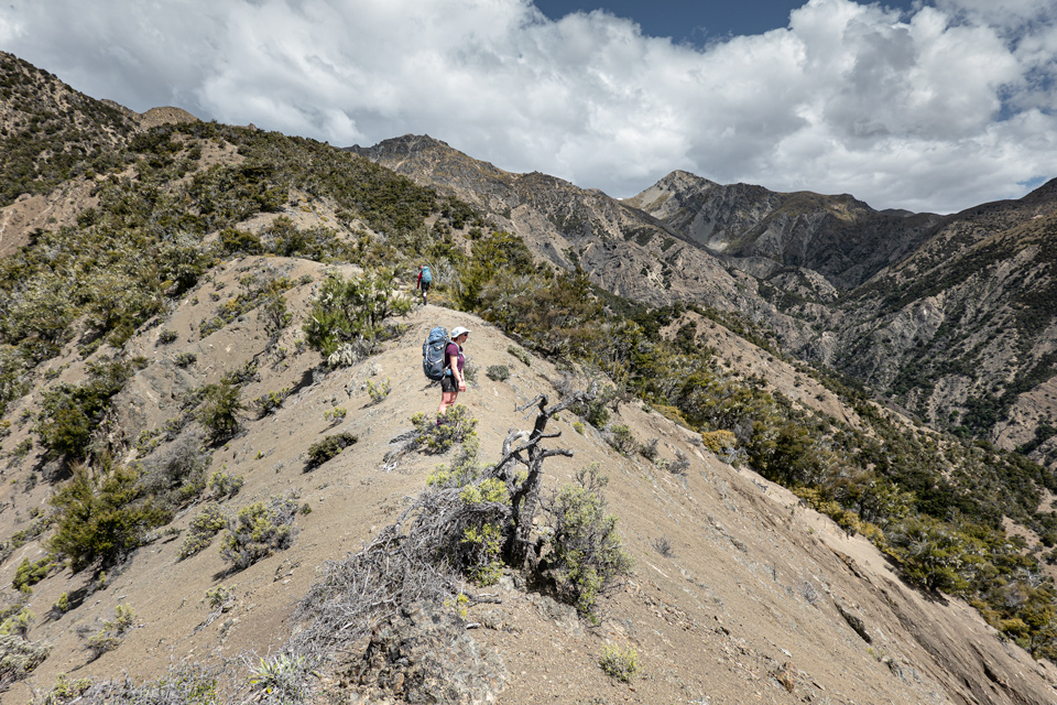
I think you could sum up the trip with Tony’s comments about the terrain “an incredibly fragile and dynamic area that’s already showing signs of tension cracks” or maybe my more succinct summary when writing in the hut book about our route “Would Not Repeat.”

An excellent trip report about an unusual, gnarly area!
I wrote a long report about the trip I lead there in 2011 (the one Mike Phethean was on). It’s in the 2011 Journal but unfortunately the online copy of the 2011 Journal appears to be corrupt and won’t open. (I have told both Tony and the website editor about this previously and it would be really, really good if it could be replaced by a non-corrupt version, assuming Tony still has one. It’s pointless and a bad look for the Club to have corrupt, unreadable journal files on our website. I think the online version of one of the other journals edited by Tony is also corrupt and unopenable, but I’d have to check to be sure.)
It sounds like the earthquake has made the terrain worse, but it was already tough and difficult and unpleasant even before the earthquake.
We did (or rather attempted to do) the circuit in the opposite direction to you and failed to get into Jam Stream from Hornby Bivvy. We first tried the spur west of Point 754 but it bluffs out. We then tried the route down the stream halfway between Jam Hut and the Clarence which you mention. Travel down the stream was scrambly but ok, but the route around the huge waterfall at the mouth of the stream looked suicidal – you have to follow a narrow ledge on the vertical face on the true left of the stream and then somehow descend the face. I think the best route is over Point 884, which you did, but then down the spur leading north-west towards the confluence of the Jam and the Clarence, rather than the spur leading south-west towards the mouth of that side-stream, which is what you appear to have ascended.
For your interest I have reproduced my 2011 trip report below, even though it is quite long.
In a bit of a Jam (from the 2011 WTMC Journal)
One thing I like about NZ is that you can find odd nooks and crannies of wild country that nobody has ever heard of, even serious trampers and outdoors people. Who has ever heard of Jam Hut, Hornby Bivvy and Cuckoo Saddle? Yet they are located little more than 100 km from downtown Wellington.
Jam Hut lies on the far side of the Seaward Kaikoura range, in Jam Stream, a tributary of the Clarence River. Years ago I did a trip there led by Allen Higgins, across the Seaward Kaikoura range via George Stream, George Saddle, and Doddemeade Stream. I like this Marlborough country – it’s big, remote, and rugged, dry and sheltered from the prevailing westerly weather, with unusual vegetation. There is none of your usual trudging knee-deep through Tararua mudbaths or getting tangled up in West Coast jungle. Upstream from Jam Hut on the way to Haycock Saddle we passed through an amazing gorge whose walls in places rose sheer for 200 metres or more above the stream bed. I was keen to visit Jam Hut again, to pass once more up this gorge, and this time to follow Jam Stream down to its confluence with the Clarence. And so it was that I put my name down on the trip schedule to lead a three-day trip there back in October 2011.
My original plan was just to go in and out over George Saddle and spend a day in the middle doing two half-day trips without a pack up and down the Jam. But the idea of doing a round trip was appealing. To the north-west of Jam Stream was a block of rugged country I had never been into before. Barry Dunnet’s guidebook to the Seaward Kaikoura Range gave a brief description of this area. It talked of old stock routes and said that in combination with George Saddle it would provide a good three-day round trip. Sven Brabyn in one of his guidebook also briefly described a trip through here, although he noted that it was “not a usual sort of tramping trip”. And so the plan evolved: we would do a three-day loop trip – day one over the tops from the mouth of George Stream to Hornby Bivvy, day two into Jam Stream and upstream to Jam Hut in the morning followed by a side trip up through the gorge to Haycock Saddle in the afternoon, and day three out over George Saddle and back down George Stream.
And so it was that on Friday morning we found ourselves following a farm vehicle track up the steep face of the range from the George Stream carpark towards Point 917. Strapped to my pack I sported one of the more unusual items of equipment I have ever carried on a tramping trip – a large pair of hedge-clippers! On our previous trip to Jam Hut with Allen Higgins we had encountered vast expanses of wild rose briar in the catchments to the south of the Jam. Rose briar is nasty stuff – it is like tramping through fields of barbed wire. It will rip you to shreds. We had only been able to get through one stretch by following along in a stream bed underneath it. Further south, on another trip, a bulldozed four-wheel-drive track provided the only way through. I remember one particular spot where we had to get into a stream bed and had a choice of bashing through rose briar or through matagouri. We unanimously chose the matagouri as the easier option, almost benign by comparison. Those who have had experience of bashing through matagouri will appreciate what that says about briar! I didn’t recall seeing any briar in the Jam itself but it seemed quite likely that we could encounter it in the unknown country we were heading for. I knew the enemy and had come prepared!
From Point 917 the range levelled off and we followed an old fenceline up broad, easy tussock ridges. We stopped for lunch just below Black Hill, four hours after leaving the carpark. So far we were right on schedule. The weather was magnificent and we had stunning views across the Clarence valley to Tappy and the other high peaks of the Inland Kaikoura mountains, rearing up into the sky, clear and snow-capped. The sun was shining and the trip was going like clockwork. All seemed right with the world. How little did I realise what was to come…
From Black Hill the map showed a choice of three possible routes to Hornby Bivvy:
1) Westward right along the range to Mackintosh Knob, then northwards down the major ridgeline leading over Point 1241. Barry Dunnet had talked about an old Black Hill Stock Route, and although his description was a bit cryptic, this seemed to be where he was saying it went.
(2) Westward along the range as far as Point 1348, then northwards down Ben Spur to Cuckoo Saddle, drop down from the saddle into Snowgrass Stream, and climb out up to the bivvy. Both Barry Dunnet and Sven Brabyn described the route between Cuckoo Saddle and Hornby Bivvy, although both descriptions were very brief.
(3) North along the range to Point 1184, then north-west down the spur into Bob Stream at the foot of Cuckoo Saddle, cross over Cuckoo Saddle to Snowgrass Stream, and climb out to the bivvy. Neither guidebook mentioned this route but the map suggested it might be a faster way to Cuckoo Saddle than Ben Spur.
As the weather was good we chose to take the route via Mackintosh Knob. It seemed the most direct, with the best views. And as it was following ridgelines all the way it would most likely be free of briar. We hadn’t actually encountered any briar yet, we were too high up for that, but Snowgrass Stream seemed a likely place for the enemy to be lurking.
The travel was easy at first, following a derelict old fenceline along rolling tussock tops. But at Point 1410 the fenceline and the tussock suddenly ended and the ridgeline ahead became a lot rougher-looking. To the left was a yawning vertical drop into George Stream, many hundreds of metres below. To the right the ridge dropped off in steep shaley slopes. You could probably get along it but you would have to be very confident and sure of your footing. If you slipped you could potentially slide a long way and do yourself a lot of damage. Further up ahead, the climb up onto Mackintosh Knob looked steep and nasty, although it was hard to be sure since we were looking at it face-on.
I looked at the ridge ahead, aghast. I hadn’t been expecting this! The map gave no indication that this was what it would be like. Nor had Barry Dunnet’s description. He had talked of an old stock route – if this was really a stock route, the shepherds must have lost a lot of sheep! Maybe it would go but there would clearly be a high risk factor. As far as I’m concerned, the first rule of trip leading is to get everybody back alive. The decision seemed clear. “Come back!” I called out, “we’ll drop down Ben Spur and go via Cuckoo Saddle instead”.
We retreated back along the range and headed down Ben Spur, which provided good travel. Geologically, this is unusual country. The mountains have been rising rapidly over the last few million years under the influence of strong tectonic forces. At the same time the rock is young and easily erodible. As the land has been rising, the rivers and streams have been cutting down. The result is a landscape of very steep-sided ridges and spurs, eroded faces and ribs, dissected by deep, entrenched streams and gullies. Larger streams have cut deeper than smaller ones, leaving hanging valleys with vertical lips. There is little bush, only some scrub, and most of the steeper slopes are bare of vegetation, making them completely impossible to travel up and down. In similarly steep country elsewhere you could at least hope to find somewhere where you could clamber up and down hanging onto the trees, but not here. The tops of the spurs tend to be bare and rounded, with a thin layer of ball-bearing-like scree on top of a hard under-surface – possibly my least favourite type of surface to travel on and one where it would be very easy to slip and injure yourself.
As we descended the spur I examined the far side of Snowgrass Stream opposite the saddle and it looked just awful – steep dissected cliffs and slatey ribs. It appeared vertical, or near enough, with no obvious route and nothing to hang on to. The side stream coming down from Hornby Bivvy descended out of a hanging valley, dropping into Snowgrass Stream over a large waterfall. Somehow we had to ascend those slopes if we were to reach the Bivvy. Barry Dunnet’s guidebook had said to “navigate carefully over the spur”, but God knows what that meant or how or where you could do it.
As we approached Cuckoo Saddle even the descent into Snowgrass Stream from the saddle seemed awful. At first it looked like we could get down in an open area free of scrub just before the saddle itself but we dismissed it as too steep. Then we found what looked like an animal track on the saddle heading in the right direction. It led out into the top of an open gully that dropped very steeply down into the stream 150 vertical metres below. David and Mike headed into the top of the gully to investigated, but I didn’t like the look of it. You might get down it, but it was very steep, and if you slipped you would bounce and slide a long way, and you probably wouldn’t live to tell the tale. Again I thought of the first rule of trip-leading: get everybody back alive. “Come back up”, I called out; “we’re not going down there”. Safely back up on the ridge, our options seemed to have all gone. Already I was contemplating an alternative plan. At the foot of the saddle down to our right was a large flat in Bob Stream where we could clearly camp, and from there we could do an alternative trip eastwards over Calf Saddle and Totara Saddle, down to McLean Stream and back out to the road, abandoning the trip to Jam Hut completely. It would be a complete defeat but I could see that it would go ok and be safe. But both Barry Dunnet and Sven Brabyn had described a route up to the saddle from Snowgrass Stream – surely it must be there! Unfortunately while I had read their route descriptions I hadn’t bothered to photocopy them and bring them with me and that now seemed like a serious mistake! What exactly had they said? We had one last try. We pushed on along the spur a bit over a small rise and found ourselves on a slightly lower point of the saddle. And there, leading out to the left, we spotted some track markers! Yes! We had found it!
The question now was, did we still have time to get to Hornby Bivvy today? It was now after 5 o’clock and we didn’t know what was ahead of us. If there was a marked route down into the stream, we reasoned, there most likely was a marked route up out the other side as well, but the other side still looked awful. And the stream itself looked narrow and would most likely offer no place to camp. Down the other side of the saddle, on the other hand, the broad open flat in Bob Stream lay beckoning. I was keen to at least drop down into Snowgrass Stream and investigate the route forward, but Mike persuaded me that it would be of little use, that we would most likely just end up having to climb back up out of it again, and that it would be better to head down into Bob Stream immediately, camp for the night, and come back up to the saddle and try Snowgrass Stream in the morning.
After a bush-bash down a gully into Bob Stream, Mike and David found a good camping site under some trees. We had dinner and Dmitri lit a nice campfire. So we were safe and secure for the night, but short of our destination. Hornby Bivvy was still a long way away across some difficult country. But the track markers on the saddle had given us confidence, and relaxing by the fire with a good meal and a hot cup of tea inside me I was sure that if we got away early the next morning we could still complete the trip as planned. How little did I know…
Next morning we headed back up to the saddle. This time we followed up an old fenceline up and it was much faster than the way we had come down. David led off down the other side following the markers we had discovered the day before, and although they soon vanished the going was relatively easy though steep bush and we soon reached the stream bed. As we headed off downstream my hopes were raised that the way to the bivvy would prove easy after all.
In this country that was clearly tempting fate too much! Rounded a corner, we were brought up short by the sight of the stream disappearing over a sizeable waterfall just ahead of us. Damn! An old iron peg hammered into the rock on the left indicating that people had used a rope to get down here, but we didn’t have a rope. Dmitri thought he could climb down, but I sure as hell knew I couldn’t, and I wasn’t prepared to let anybody else risk it either. Again I thought of the first rule of trip-leading: get everybody back alive. It appeared we were completely cut off. But there was one last option: a narrow ledge on the right. Investigating this we found a rope dangling down to the bottom of the waterfall from a tree! Saved again!
A short distance further on we came to the small side stream leading down from the Bivvy. A short distance up this sidestream was the waterfall which descended from the lip of the hanging valley above. Somehow we had to get up there! It seemed impossible, but we knew there must a way if Mr Dunnet and Mr Brabyn were to be believed, and scrambling up the stream was the only possible option, so up the stream we scrambled. Here we discovered a steep gully or runnel leading up the hillside to the left of the waterfall that looked like it would go. The others scrambled up and disappeared over the top. I was leading from the back (a polite way of saying I was going slow) and lost sight of where they had gone. I found myself wrong-footed on very steep ground slightly to the right of the easiest line. I carefully retreated a few metres with a curse and tried again. Soon I was at the top where the others were waiting for me. Beside them was a marker pole indicating the top of the gully! Again we had done it, finding the only possible route!
From the top of the gully a long traverse up and over bare spurs and bushy gullies eventually brought us out onto the easy grassy slopes of a pleasant little hidden valley, and there in the middle of it stood the bivvy. We had made it and it was time for lunch!
We were now half a day behind schedule, but sitting on the soft grass beside the neat and tidy bivvy contentedly munching lunch in the warm sunshine with the clear waters of the babbling brook twinkling in the sunlight below us in the bottom of the gentle pleasant valley, it seemed that all our problems were now behind us. We had conquered the difficult bits and what lay ahead would clearly be a doddle. Barry Dunnet promised us a good spur down to the confluence of the Jam and the Clarence, and I knew Jam Stream would be easy, open travel. Rafting parties on the Clarence walked up to Jam Hut all the time. If we travelled fast I reckoned we should still be able to get to the hut by mid to late afternoon, and we would still have time for a late afternoon jaunt up through the gorge we had come all this way to see. Perhaps by this stage I should not have been so confident…
From the bivvy we clambered up to Point 799 and the start of the obvious spur leading down over Point 754 to the confluence of the Jam and the Clarence. The top of the spur was flat but the sides were very steep and seemed to drop an awful long way, and an uneasy feeling began to creep over me. The contours on the map at the end of the spur were very closely spaced – would we be able to get down?
Abruptly the easy travel ended and the spur plunged steeply downwards. Far, far below us, we could see the Clarence flowing deeply entrenched between vertical walls. It looked completely awful, and once again I could do nothing but stop and stare, aghast. What more could this country throw at us? I would be having words with Mr Dunnet if I ever saw him about his good spur…
David scrambled down out of sight to investigate the descent ahead. He was gone for a long time and I began to fear the worst. A slip in this country would almost certainly be fatal. Eventually, to my immense relief, he did reappear and reported that the way ahead was hairy. But by now I had already decided that we were not going down there. The first rule of trip leading is to get everybody back alive and we were going back up. To hell with the spur! Sven Brabyn had described a different route into the Jam, down a sidestream leading west from Point 968, and we would go that way instead. This joined the Jam halfway between Jam Hut and the Clarence so we wouldn’t get to visit the confluence, but I could live with that.
Across a deep sidestream to the south of us was another spur, and I realised now that this must be the one Barry Dunnet had meant! The end of this one, though steep, looked relatively gentle by comparison to the one we were on, and was certainly doable. That’s where we should have been! But by now Sven Brabyn’s stream looked like it offered the simplest and quickest route. We climbed back over Point 799, dropped through the saddle at the head of Hornby Stream, and followed the ridgeline up towards Point 968 where we dropped into the head of the stream.
The stream proved slow and scrubby travel. By now any serious hope of getting to Jam Hut in time to do a side trip up through the gorge was clearly gone, but I was still quite confident of getting to the hut that day. Sven Brabyn had described the route and his was a more recent and clearly more reliable guidebook than Barry Dunnet’s. If he went down the stream then it was obviously a better, easier, more reliable route than Mr Dunnet’s spur.
By this stage I was feeling pretty tired and was looking forward to the end of the day. Not doing a side-trip up through the Jam gorge would be a disappointment but by now I would be happy just to get to the hut. After what seemed a long time travelling down the stream we suddenly spotted a marker pole in the distance, fifty metres ahead of us down the stream. Yes! We had done it! Sven Brabyn had mentioned a poled route up into the stream from the Jam, and this must be it. We stopped and had a rest. We chatted. We broke out the candy bars. I felt relaxed and happy. All my worries were over. All our troubles were now clearly behind us. We had come through ok. In a few minutes we would doubtless be in Jam Stream, and in another hour at the most we would be relaxing in Jam Hut at the end of a long and tiring and frustrating day. I was already mentally sipping a cup of tea in front of the fire in the hut, boots off and dinner on the boil.
Shouldering our packs, we merrily followed the marker poles down the last stretch of stream. Then we came to the end of the stream and I stopped dead in my tracks. All my joy and happiness drained out of me on the spot. I stared ahead, once again aghast at what I saw.
To our right the stream plunged 20 or 30 metres down a waterfall over a hideous vertical cliff. To our left an even higher and more hideous vertical cliff dropped down to the floor of the Jam itself. In between, a kind of narrow, rocky, sheer-sided relic spur curved out into empty space. Plonked on the very end of it, surrounded by vertical drops like one of those ludicrously inaccessible golf-hole marker-flags in those joke books about the world’s hardest golf courses, was another marker pole.
I looked at this in disbelief. My vision of soon being at the hut collapsed around me. This couldn’t be happening to us! Surely that couldn’t be the route! Surely we didn’t have to go out there! It was hard to see how you would even get to that ludicrously positioned pole, let alone what you would do beyond that. Surely this must be someone’s idea of a sick joke!
Looking around, we discovered a ledge leading around the right-hand side of the spur. This must be the route, there was no other possibility, but it looked absolutely awful – narrow and exposed with a sheer drop below it. David and Dmitri went out along the ledge to investigate while I just stood there, rooted to the spot, silently contemplating how much I was going to enjoy tossing Sven Brabyn onto the raging bonfire that was already consuming Barry Dunnet if I ever got out of this poxy hellhole alive.
After a long, worrying interval, David came back and reported that the route ahead was the hairiest thing we had encountered so far. And that was just getting to the marker pole at the end of the spur; from there he hadn’t been able to see any obvious route down into the valley below. Now David is a Serious Mountaineer, David has climbed Cho Oyu and lots of other serious mountains, and if David says something is hairy, it’s hairy. Actually, I didn’t really need David to tell me it was hairy, I could see it was hairy just by looking at it from a safe distance, but it was good that he had gone and taken a closer look and confirmed it. And again I thought of the first rule of trip leading: get everybody back alive. They say a man about to be hanged experiences a sense of calm and relief at the very end when he finally realises that it’s over, that no possible hope of escape exists, and so I felt now. This was final: we couldn’t get down, we wouldn’t even try and get down, we weren’t going to make it to Jam Hut – not tonight, not at all on this trip. By unspoken general agreement we turned around and headed back the way we had come, back up Sven Brabyn’s accursed stream. Jam Hut was now just a distant dream. We had passed a large grassy clearing about an hour ago on the way down and we could camp there. By this stage I was feeling completely knackered – this was my first tramp in months and I was unfit – but fortunately David and Mike in particular still seemed to have plenty of energy.
That evening I lay there in my tent wondering whether perhaps we had given up too easily. The route is in Brabyn, and there are marker poles – surely it must go! Maybe with an hour of careful work we could have made it down. And then we would have been in the Jam, it would have been an easy wander up the broad, open valley floor, and we would now be relaxing in front of the fire in Jam Hut instead of camping in a clearing in the middle of nowhere. But I knew that that hadn’t really been an option. David and Mike may have been able to do it, and possibly Dmitry, but I would have been trembling in my boots. And the risks were just too great. One slip and you were dead – it was as simple as that. If we had been fresh at the start of the day and had had a climbing rope to protect the route I would perhaps have been prepared to give it a go, but neither of those things were true. We were tired, we didn’t have a rope, and mistakes would have been very easy to make. One slip and you were dead. A quip from the great Earnest Shackleton sprang to mind, explaining why he had turned back 97 miles short of the South Pole: “I’d rather be a live donkey than a dead lion”. I was happy we had made the right decision.
The only question now was how the hell we were going to get out of this God-awful place. We had spent two hard days getting to this spot and we were due to get picked up at the George Stream roadend the next afternoon by Sharron Came and Tony Gazley, who were doing their own climbing trip to Mt Manakau. Short of calling up a chopper we seemed to have five possible options:
1) Have another look at the descent out of the mouth of the stream down into the Jam. Maybe it would look better in the morning when we would be fresh. But it almost certainly wouldn’t, so this would almost certainly just waste a couple of hours travelling back down to the mouth of the stream and coming back up yet again.
2) Head back up the stream and go down the other spur to the confluence of the Clarence and the Jam, the one that went over Point 884, go up the Jam to Jam Hut, and out the original intended route over George Saddle. I was sure now that this was the spur mentioned by Barry Dunnet and that it would go, but this would take a long time and would almost certainly involve an extra day by the time we got out.
3) Head back up the stream and up the leading spur to Macintosh Knob and hope we could get along the main ridgeline to Point 1410. This would be a quick route if it went, but the ridge between Point 1410 and Mackintosh Knob had looked pretty unpleasant when we had looked at it on the first day.
4) Head back up the stream and up the spur to Mackintosh Knob, descend down off the back of Mackintosh Knob to George Saddle and out down the George. This would avoid the ridgeline between Macintosh Knob and Point 1410, but would it be possible to descend from Mackintosh Knob to George Saddle? On my previous trip over George Saddle we had actually seen a couple of hunters apparently heading up that way from the saddle but it had looked very steep and slatey and unpleasant. It was an unknown and potentially dangerous option.
5) Head back up the stream and part-way up the spur towards Macintosh Knob, then cut across the headwaters of Snowgrass Stream to Ben Spur, thus avoiding the climb to the top of Macintosh Knob and the unpleasant traverse along the main ridgeline to Point 1410 completely. I was reasonably sure that Barry Dunnet’s Black Hill Stock Route went down the spur to the west of Hornby Bivvy, so if it didn’t go along the main ridgeline and over the top of Macintosh Knob itself it must go through here somewhere. I had looked at this possibility as we were coming down Ben Spur the previous day and it had looked like it may go, but it was hard to be sure, and even if it did, picking a route into and out of the headwaters of Snowgrass Stream might be slow going. But if it did go ok, it would offer a fast route out. We may even get out in time to get the ferry. (Barry Dunnet had thoughtfully referred his readers to the provisional 1942 mile-to-the-inch topo map, which apparently showed the position of the Stock Route, but curiously enough, copies of the provisional 1942 mile-to-the-inch topo map had been somewhat hard to find in the shops before the start of the trip.)
6) Retrace our steps completely and head back the same way we had come in. This was the safest and most reliable option, we knew it would go, but I was unsure whether we could get out in one day when it had taken us two to come in, and we may end up having to spend another night out. In addition, although it probably wouldn’t bother most of the others, I knew that I personally would not be looking forward to the descent down the steep slope beside the waterfall from Hornby Bivvy into Snowgrass Stream.
In the morning there seemed to be general agreement that the only serious option was to go back the way we had come in. We packed up and headed back up the valley. The travel seemed better now that we knew the route and were fresh, and by mid-morning we reached Hornby Bivvy for a quick stop.
As expected, I didn’t enjoy the descent from Hornby Bivvy. Thin scree on top of steep rock is unpleasant going and I was taking it carefully at the back. When we reached the final descent gully I noticed Mike had stayed back to wait for me at the top, and I was grateful for it. I took it slowly, sliding down most of it on the seat of my pants. It may have looked ungainly but I didn’t care – it was safe.
Once we were all safely down in Snowgrass Stream I relaxed. I knew now that we would get out ok. There was still the waterfall in the stream up ahead with the rope to clamber up, and the ascent back up to Cuckoo Saddle, but neither of those should present any problems. From Cuckoo Saddle it was still a long grunt back up Ben Spur to the main ridgeline and along to Black Hill, but it was completely straightforward. And we had been making good time compared to on the way in, since we knew the route and weren’t mucking around. My worries about having to spend an extra night out evaporated – we clearly weren’t going to get out on time, if we were slow we may still end up having to do the descent from Black Hill to the roadend by torchlight, but we were definitely going to get out that day.
From Cuckoo Saddle Mike went ahead, hoping to get a message out to Sharron and Tony if he could get cell phone coverage at the top of the spur. I staggered up in the rear, feeling my lack of fitness. For a while a strong wind came up, making it unpleasant going. At the top we paused for a rest and learnt that Mike had got through to the others. They had given up on us and had been heading back to Picton. Sharron had done some fast work and had managed to rebook us on a later ferry, and they were on their way back to pick us up. All that now remained was a wander back along the range to Black Hill and down to Point 917, and a long trudge out down the farm track to the carpark. Tony and Sharron turned up shortly afterwards in the van and we were able to relax on our way back to Picton.
And so ended an unusual and unexpected trip to a little known part of the country. Thanks to everyone on the trip for hanging together and not complaining when it didn’t quite turn out as intended, and to Sharron and Tony for coming back for us and rebooking the ferry! Now that I’m safely back in Wellington and several months have passed, I even feel generous enough to spare Barry Dunnet and Sven Brabyn from immediate immolation on that blazing funeral pyre!
But even though it didn’t go according to plan this is a trip that I would still do again. Now that we have a better idea of the country and know the route I am sure it would make a good three-day round trip, as originally intended. Day one – head through to Hornby Bivvy via Black Hill, Ben Spur and Cuckoo Saddle. I would take a rope in case the one at the waterfall in Snowgrass Steam goes missing or if anybody feels the need of one on the climb up out of Snowgrass Stream. Day two – take the spur over Point 884 (just about the only route we didn’t try!) down to the confluence of the Clarence and the Jam, then up the stream to Jam Hut. If you start at Hornby Bivvy in the morning I think you should get to Jam Hut in plenty of time for a side trip up the Jam through the gorge to Haycock Saddle in the afternoon. Day three – out over George Saddle and down George Stream.
Oh, and finally, what about the hedge-clippers? Well, sure enough, we did encounter some wild rose bushes on the trip. There were two of them in total – both beside the George Stream carpark…..
Punters: David Jewell, Mike Phethean, Dmitri Alkhimov, Marie Henderson, Harry Smith