
Mt Tongariro – a day walk from the WTMC Ruapehu Lodge
A loop day hike via the South Ridge to the summit of Mt Tongariro from the WTMC Lodge in the Tongariro National Park including a map of the route.
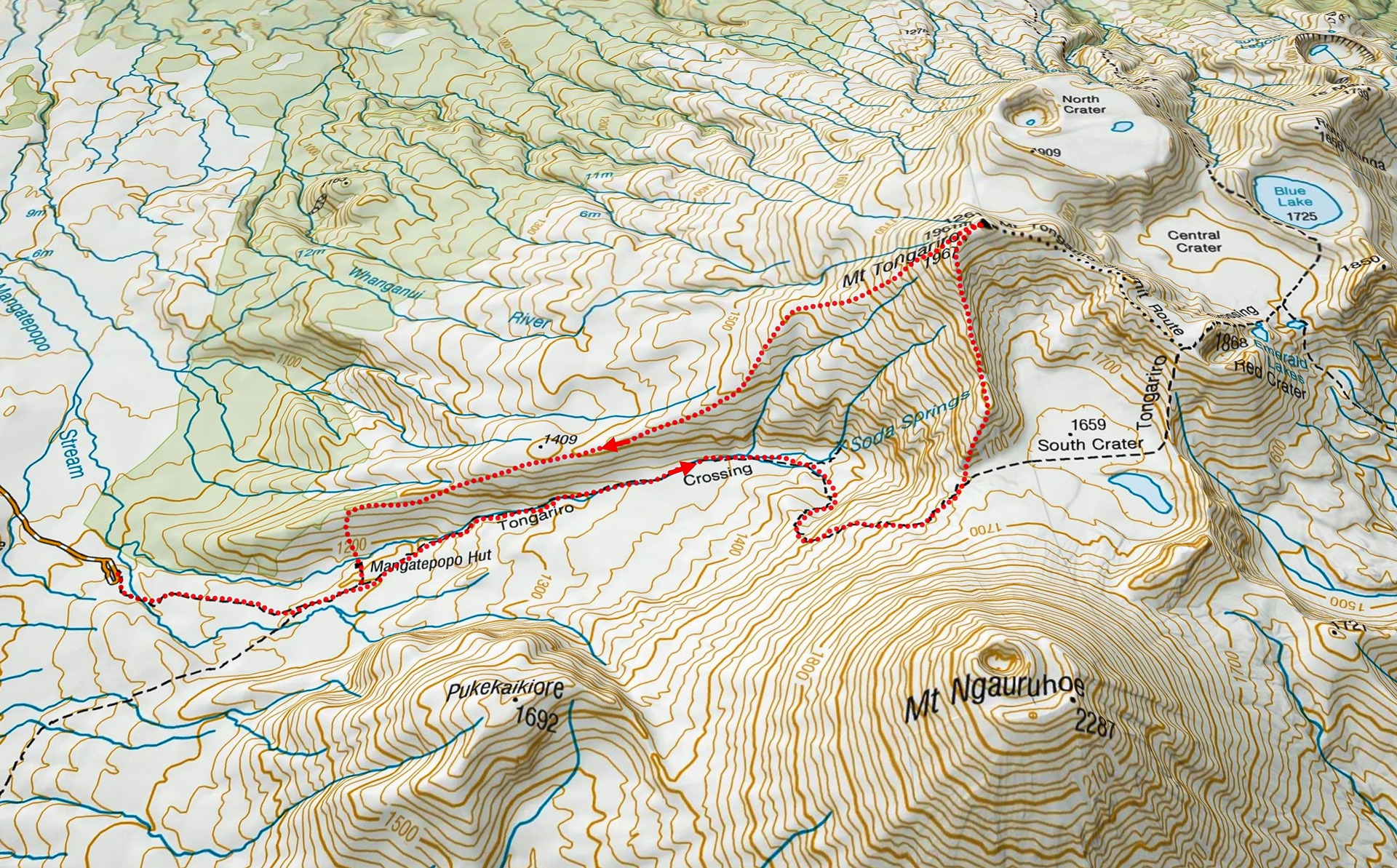

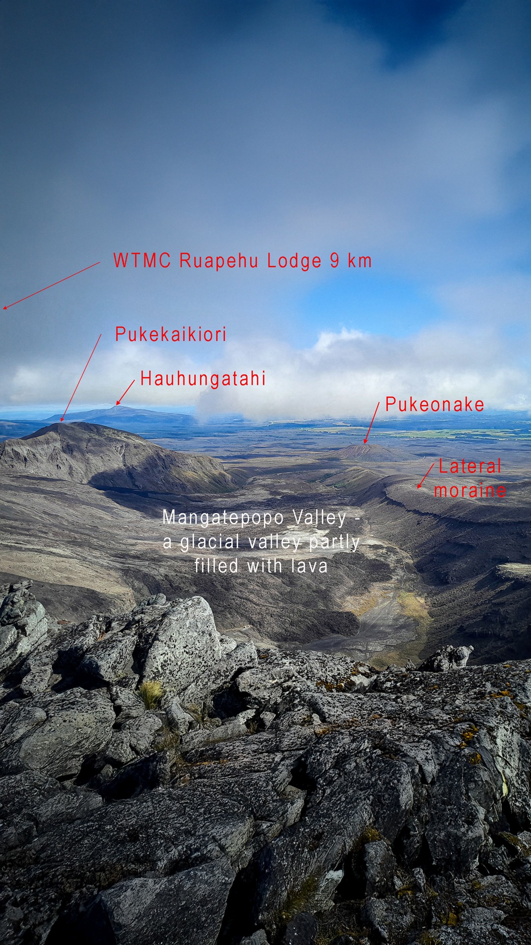
Having done a fair bit of exploring around Tongariro National Park using the WTMC lodge as a base, Tony mentioned that there was one place he had not yet tried. The Tongariro South Ridge is recognised by Climb NZ as a Grade 1 “blocky scramble.” It begins at Mangatepopo Valley at the entrance to the South Crater.
Tony and I arrive at the carpark to find two DoC workers checking Tongariro Crossing walkers were adequately prepared and advise them on conditions. They said over 500 walkers were in front of us on the Crossing. Luckily we were leaving mid morning so everyone was well in front of us. We enjoyed chatting with the DoC guys about our plans especially as one of them used to be a hut warden in the park so had done a lot around the area.
It was an easy walk up the Mangatepopo Valley although it was very hot. Once at South Crater we picked a line and headed up to our “blocky ridge.”
This indeed was a good description as the first part of the ridge is a scramble over rocks that feel very much like big building blocks. From here it was all pretty straight forward.
There were a few places that we could choose to either sidle or go straight over and sometimes Tony and I chose different routes. I think Tony was just trying to get in some extra elevation on me by dropping down a bit to sidle. There were a few small patches of snow so I managed to sneakily hit Tony with a snowball much to his surprise.

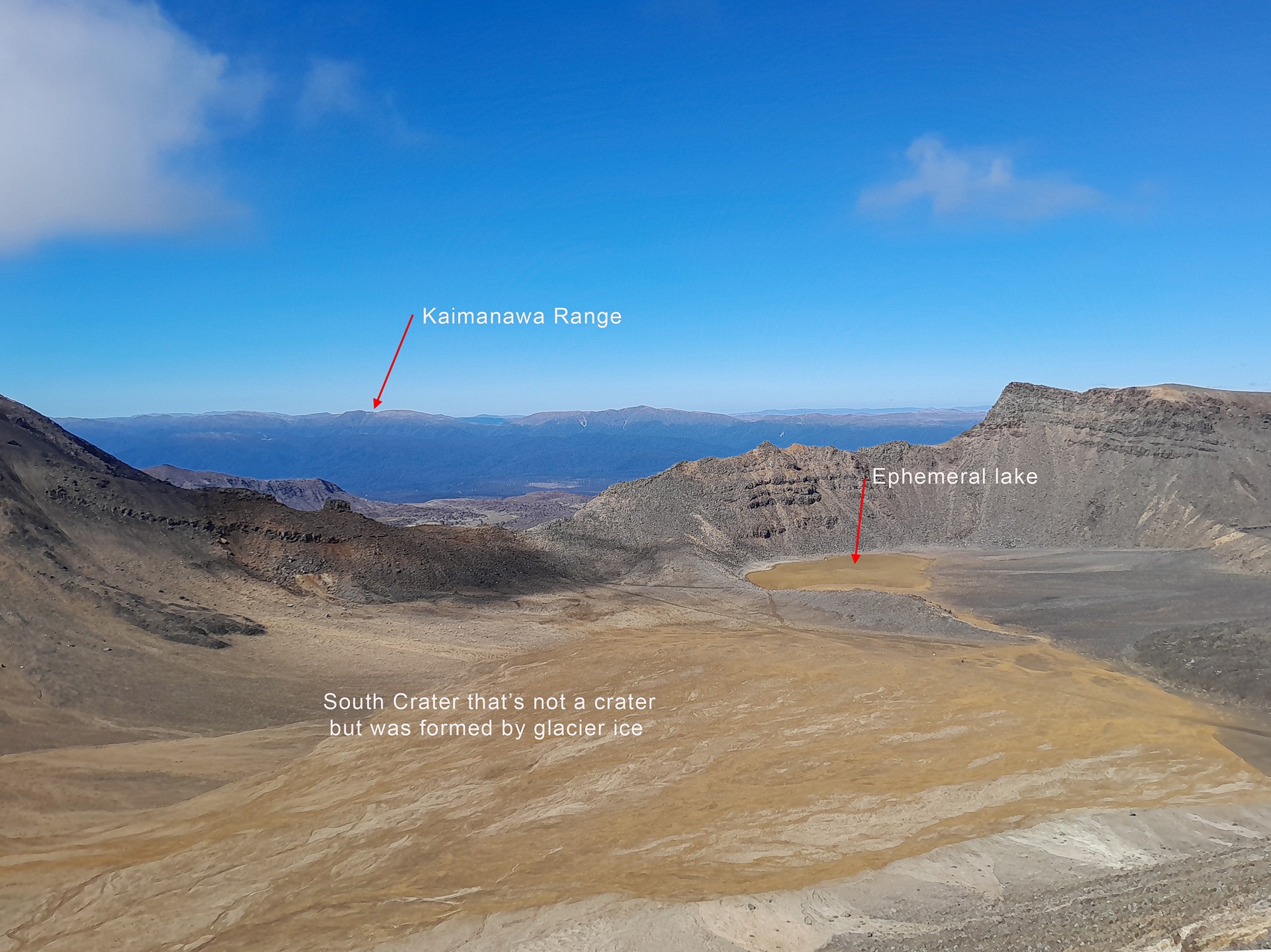
The mist rolled in intermittently, sometimes obscuring everything around us. We stopped for a late lunch under the summit of Mt Tongariro, watching the clag roll past to give us views of Blue and Emerald Lakes.

The South ridge curves around to the summit of Tongariro so heading back to Mangatepopo Hut, we had to head back west on a descending sidle to ensure we caught the ridge and didn’t end up in a gully. Once on Mangatepopo Ridge, or “Hardman’s Ridge” as it is often referred to, it was easy going. I enjoyed looking at all the vegetable sheep. Above Mangatepopo Hut there were a few cairns to mark the foot trail descending to Mangatepopo Hut.
We enjoyed looking at all the different styles of tents pitched in the campsite before trotting the final 1.6km back to the carpark.

Stats:
Distance: 14.8km
Elevation: 955m
Time: 5-6hrs.
Story and photos by Sarah Fisher.