
An ascent of Pukekaikiore – Ruapehu day walks from the WTMC Lodge
A guide for a hike from the WTMC Ruapehu Lodge to the summit of Pukekaikiore the fourth highest volcanic peak in the World Dual Heritage Tongariro National Park
Summer continues at Ruapehu. Until the snow arrives it’s a great time for daytrips from the WTMC Lodge into the wonderful landscape of the Tongariro NP.
Tony and I had enjoyed an off-track trip up Pukekaikiore a few years back and we decided to climb to the summit again but via a different circuit.
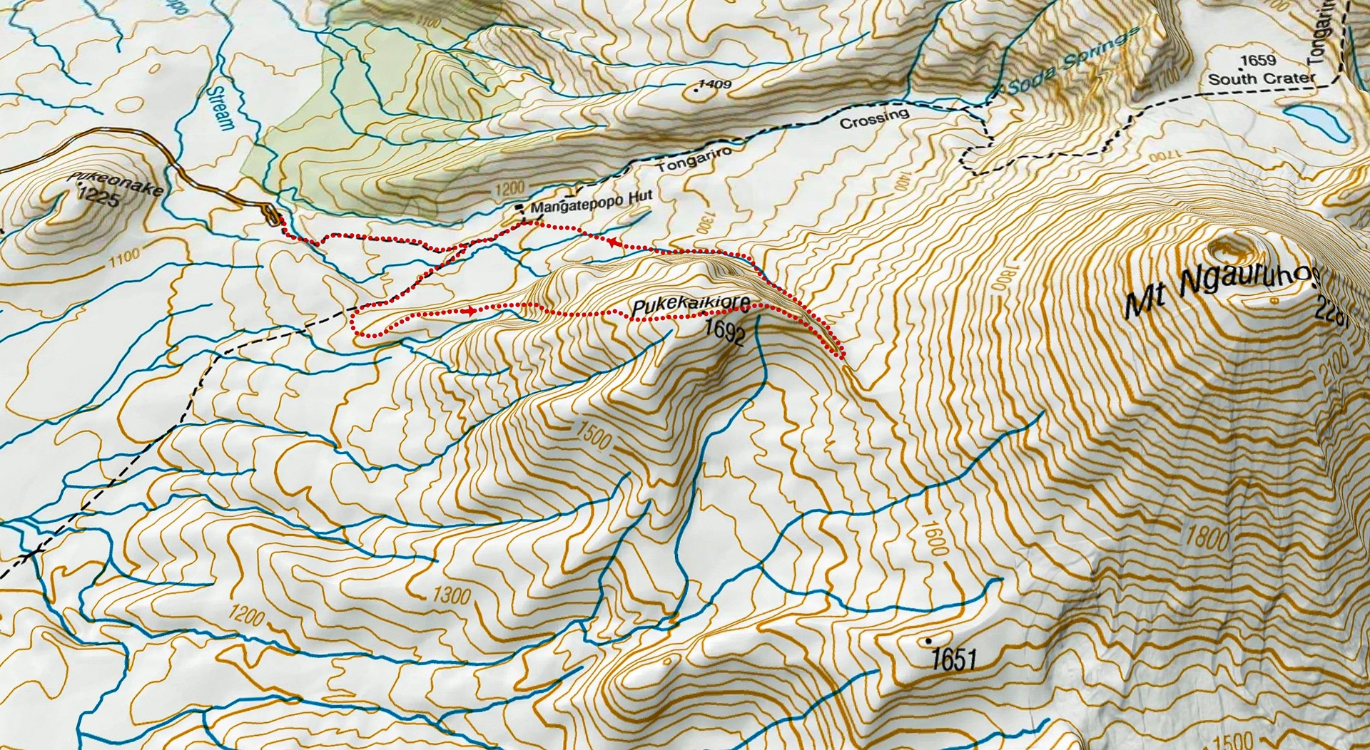
We started from Mangatepopo and then turned onto what DoC has now termed the “Ditch Track” (the Mangatepopo to Chateau Track).
We turned off this track and started up to the ridge leading to Pukekaikiore. To begin it was fairly easy making our way through low scrub.
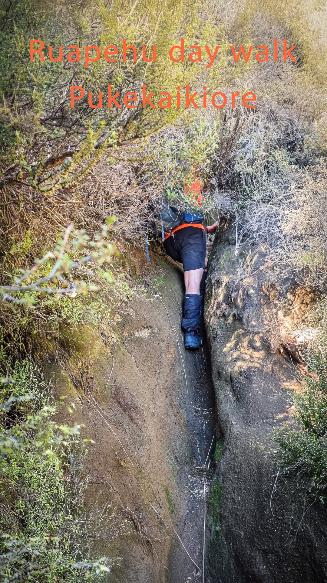
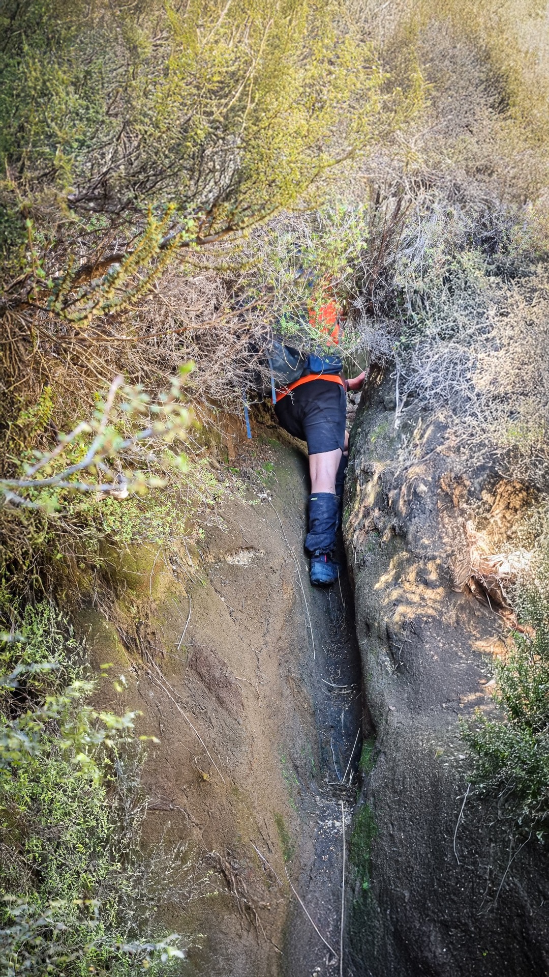
Once on the ridgeline there is a faint ground trail at times and then higher up the ridge it turns into a bit of a trench that becomes progressively deeper. Even with this trench to guide us, there was a lot of hard bush bashing through tall and dense scrub.

At one point we lost the trench for a couple of minutes and had some Type 2 fun making our way through a wall of scrub, and at one point crawling before finding the trench again.
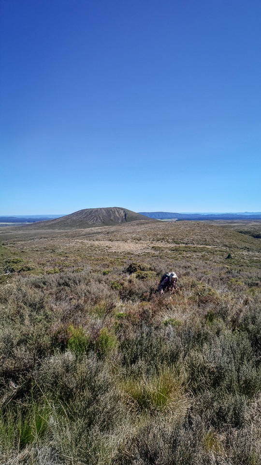
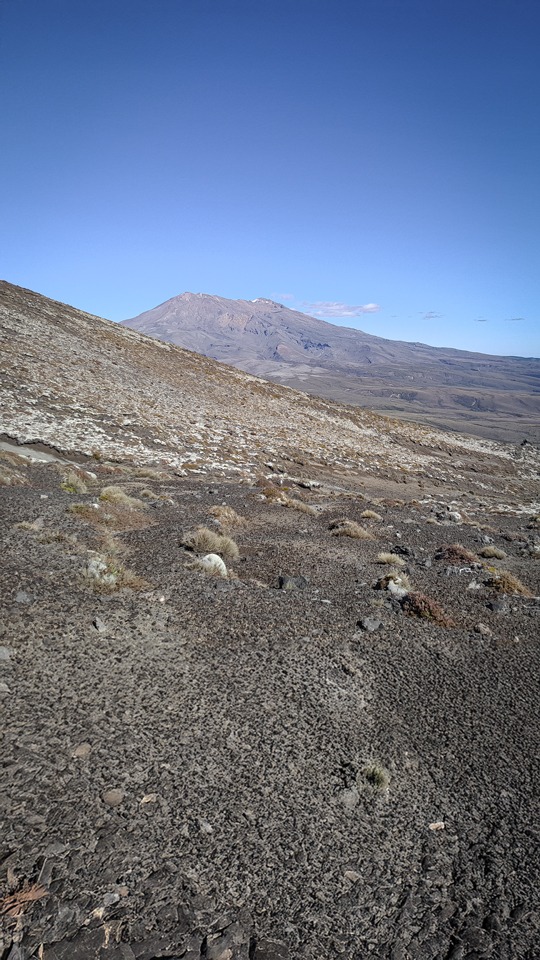
We were very glad to finally pop out above the scrub. After this it was very easy travel all the way to the summit of Pukekaikiore.
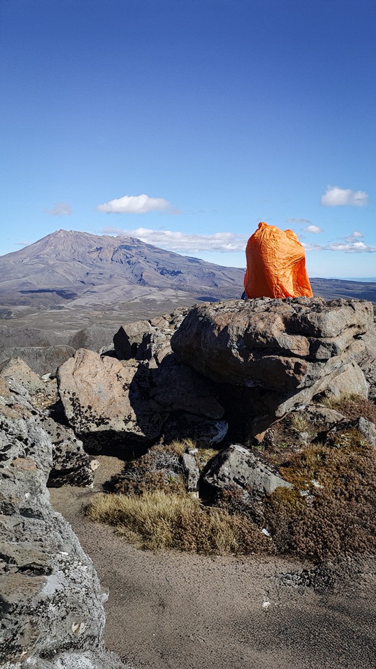
Tony challenged me to set up my bothy bag on a rock near the summit – challenge accepted!
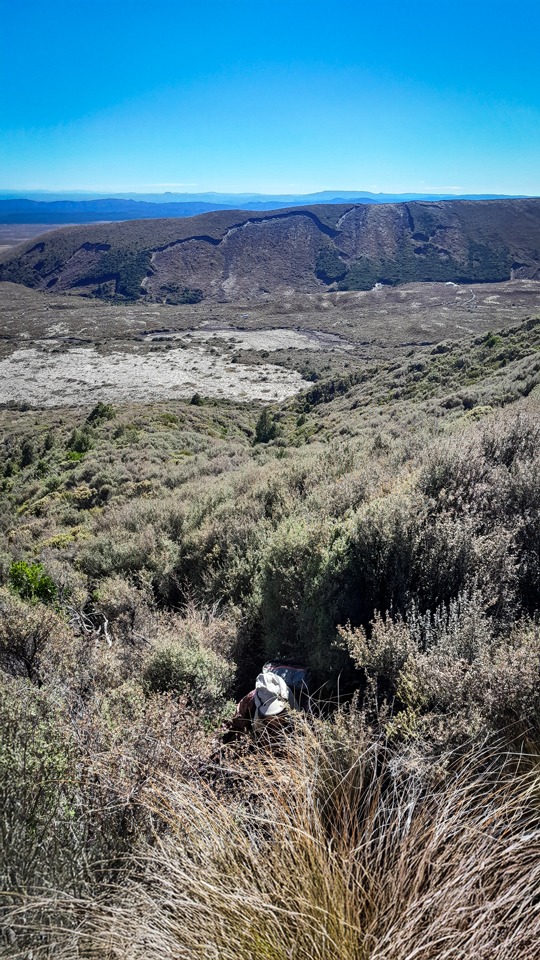
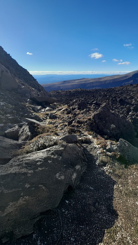
We followed the ridge off the summit to drop into the valley on the Mangatepopo side.
By pure chance we found a decent ground trail here – and the size 14 boot prints and huge strides in the sand we had seen coming down from the summit were also continuing here.
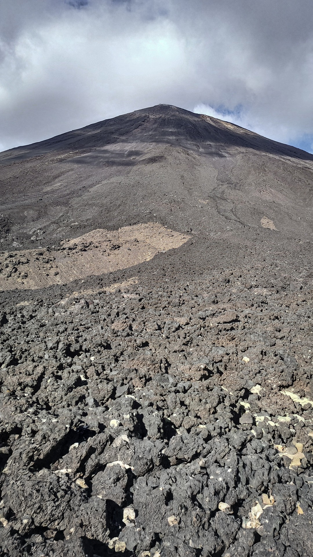
This giant was clearly in the know about where to go. Last time we had traversed higher up around Ngāuruhoe, and it was very challenging over razor sharp blocky lava.
We were both very glad not to be doing much of that this time. The foot trail here we found continued along the base of the ridge, only occasionally crossing very small patches of blocky lava.
Further down the valley, the foot trail crossed over and continued all the way down to just past Mangatepopo Hut, coming out just before the Mangatepopo track junction.
Distance: 9.5km
Elevation: 709m
Time: 5-6hr