
Friday
After a quick debrief (read: debate over where to stop for dinner), the crew set off from Wellington Railway Station at 3pm. The trip to North Egmont carpark was uneventful with two exceptions: a brief detour to mighty P-town (Palmerston North) when our driver missed a turnoff (sorry guys) and a top-notch feed in Bulls.
8pm saw us pull into North Egmont carpark and suit up for the chilly walk ahead. Despite the sage words “be bold, start cold” being said more than once, we all had to remove a layer mere minutes later. To complicate matters, we had no idea where the trail actually started. But none of us were to blame for this – just look at the Topo map! – why does the visitor centre’s name overlap the names of all the tracks in the area?
A wonderfully dense forest – complete with spiders galore – kept us cozy on our walk to Maketawa Hut. Ferns covered the rutted path, and this required careful concentration to avoid slips.
Along the way, we realised that each of us was wearing a Garmin (TM) watch. Hence the reference to Garmins in the trip report title. Bizarrely, each watch registered different elevation gain and distance walked information for our trip. In the end we chalked this up to whether or not participants were using walking poles (something about swinging your arms?) or a patchy GPS service.
We were confident that we’d have the 16-bunk Maketawa Hut to ourselves. We were wrong. The 19 pairs of boots outside the door at Maketawa Hut corrected that assumption and we quickly set up camp in the Hut’s kitchen.
Saturday
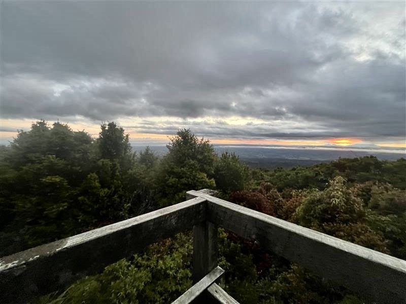
Saturday morning was… disrupted. We woke up to a stunning sunrise – views to Tongariro National Park to the East and forest all around. A dense layer of cloud to ~1300 m obscured our view of the bush-clad ridges. Less nice were the suite of rude awakenings: a summit crew leaving the Hut at 3:30 am, a little kid pointing their headtorch in other peoples’ eyes at 6 am and a birthday party that kicked off shortly afterwards. All of this served as motivation to get moving.
Due to sickness amongst people in our group and updated route information that we received from a local LandSAR member staying at the Hut, we decided to change our plan for the trip. Instead of traversing the poorly maintained Round the Mountain track to Ihaia Road, we elected to bomb it up Taranaki Maunga to Tahurangi Lodge and then check out the fancy new Manganui Gorge bridge.
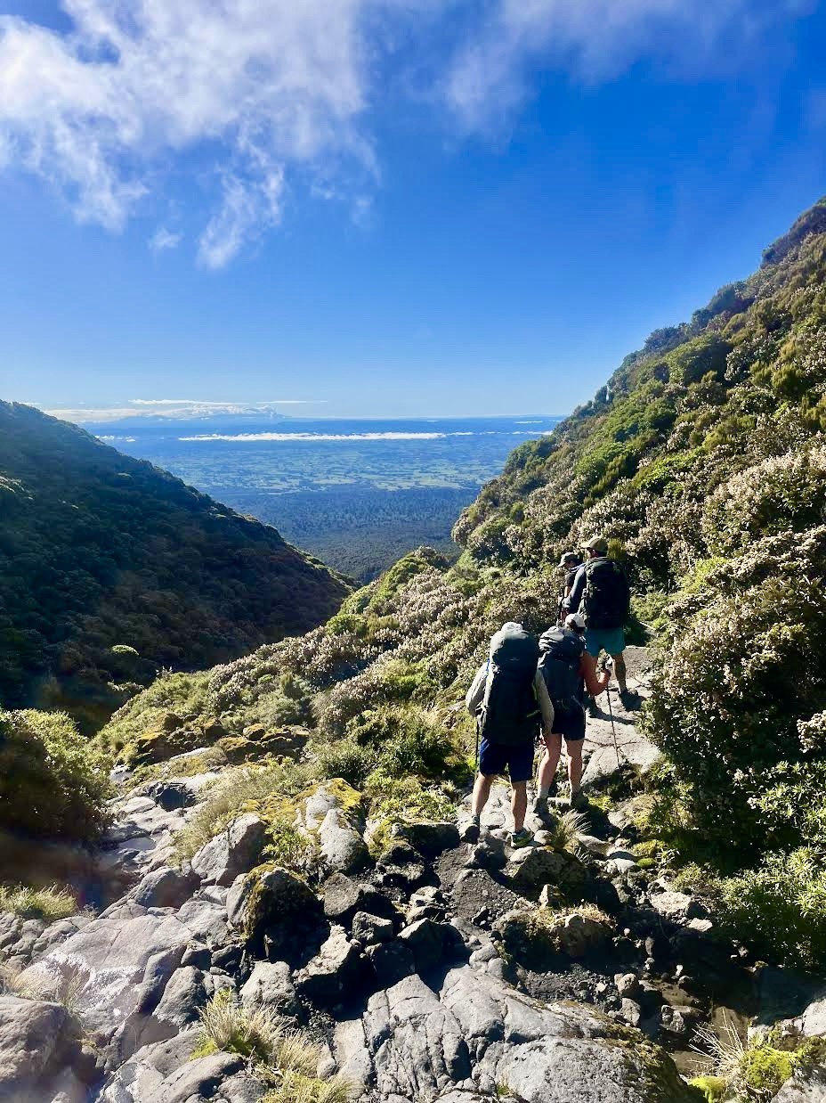
The clag soon lifted, affording us great views. As we sidled partway around Taranaki Maunga, we went past the large club ski field/lodge – another couple of huts bagged. The 110 m Manganui Gorge (suspension) bridge – spanning the river-eroded gorge – was impressive.

We then retraced our steps and lunched at Tahurangi Lodge before heading onto the Holly Hut Track.
The Holly Hut Track sidles around tussock at 1500 m and then drops into a thick scrub belt, complete with several impressive river-gorges. There was signage along the track warning of rockfall, so we kept a steady pace as we travelled around Ambury Bluff and across Boomerang Slip.
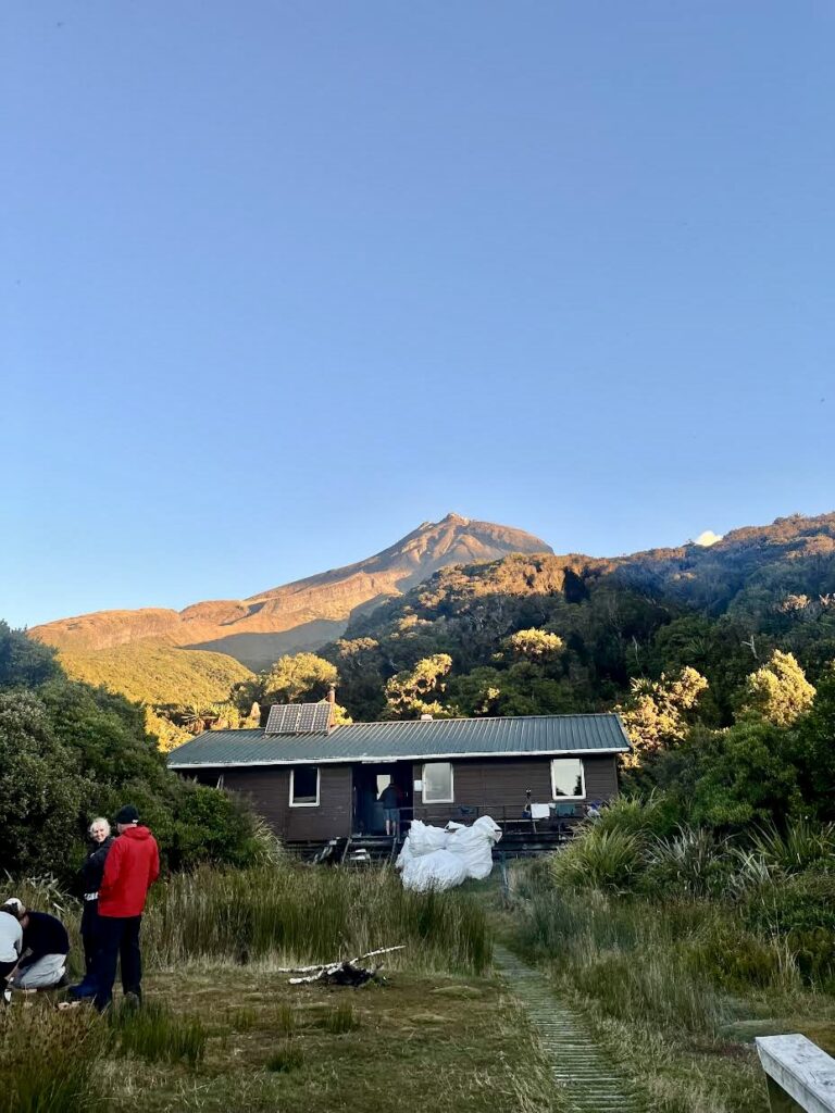
Soon enough Ahukawakawa (sphagnum moss) Swamp came into view, and shortly after that, Holly Hut itself. We spent the rest of the afternoon setting up camp and visiting Bells Falls nearby.
The other WTMC groups on the mountain – completing the nearby Pouakai Circuit – arrived in turn and there was a communal and social vibe at the packed hut.
Sunday
We left Holly Hut early the next morning after a drizzly sleep. The return trip passed quickly, with plenty of discussion on ultramarathons (hard), pest control (good) and the Government budget allocation for NZ’s Outdoors (riveting stuff).
The path we had missed on Friday night was clearly visible and obvious in the morning sun.
Neither of our vehicles had been nicked while we had been away and there were golden views out towards the surrounding plains.
All in all a nice weekend in the bush with great company.

Trip stats (from Garmin watch):
Friday: 4.83 km, 285 m elevation gain, 1:35 hr elapsed time
Saturday: 17.81 km, 970 m elevation gain, 7:40 hr elapsed time
Sunday: 8.42 km, 463 m elevation gain, 2:35 elapsed time