
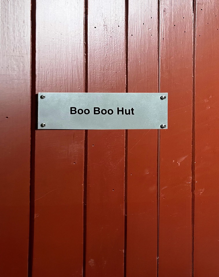
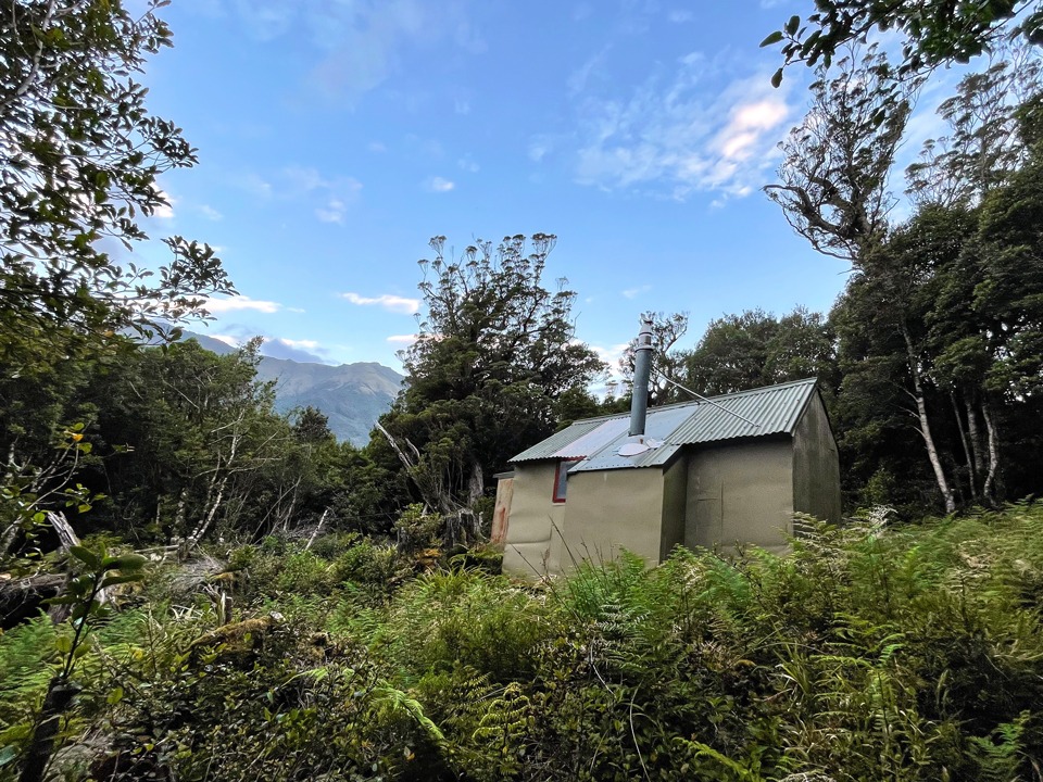
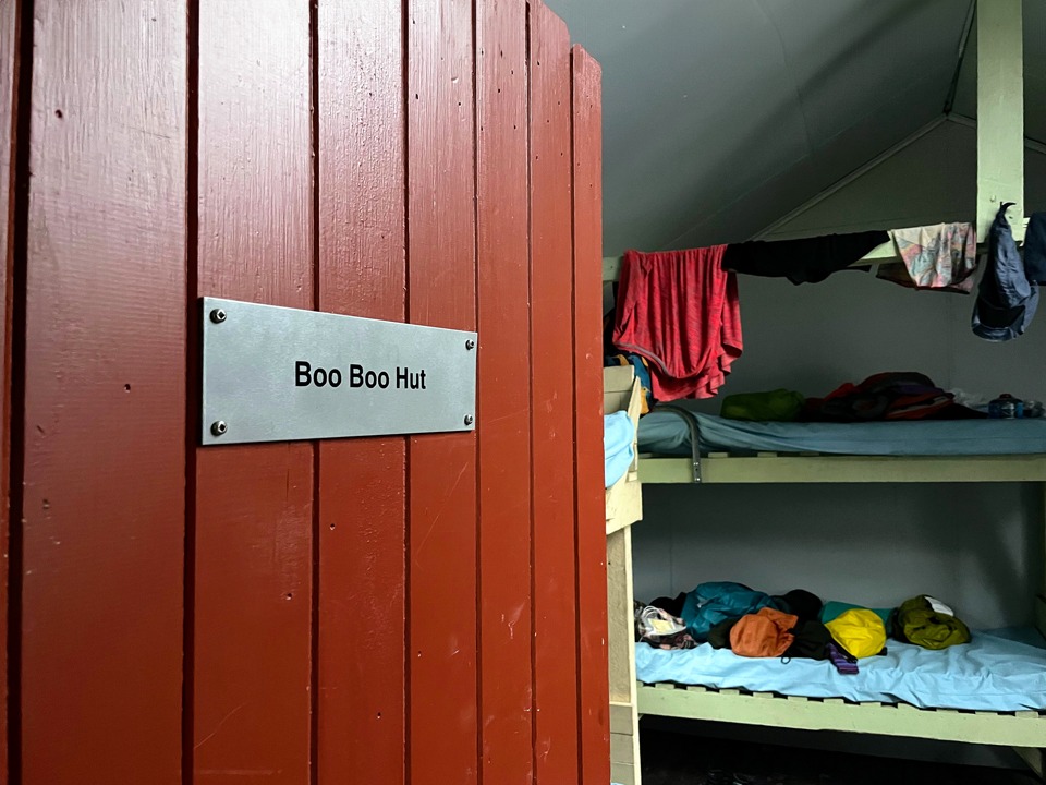
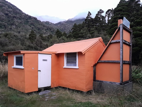
Boo Boo Hut
the Toaroha and Diedrichs Range bear hunt
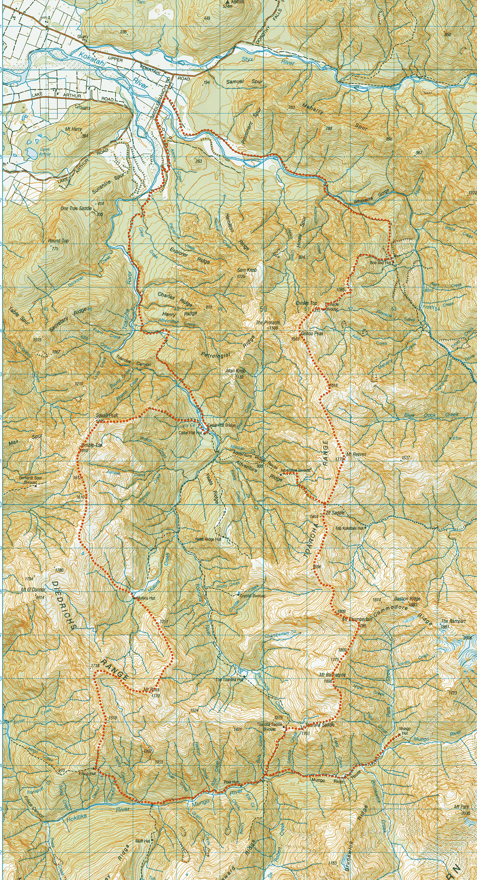
A 9 day hiking loop trip through the spectacular mountain scenery in the Toaroha and Diedrichs Range area of the West Coast of South Island.

#BearHunt Clue: A sleepover at the home of Yogi Bear’s friend.
Back in April 2020 during lockdown, some naughty teddy bears and their friends snuck off into the wilds while the rest of us were stuck in lockdown. Many of us spent hours searching through the online Topo Maps Competition with some clues to try and locate all the naughty bears. One of the clues, “A sleepover at the home of Yogi Bear’s friend” found me looking at Boo Boo Hut on the West Coast, and so began my fascination. I was determined I was going to visit Boo Boo Hut.
Finally an opportunity came up after there was a good weather window on the West Coast for once and my enthusiasm had also sparked Emily’s interest. While I was out tramping the Richmond Range traverse Emily created a challenging 9-day loop for us. We would be a team of three—I would be tramping with two of the strongest and most knowledgeable tramping woman friends I know, Emily and Illona.
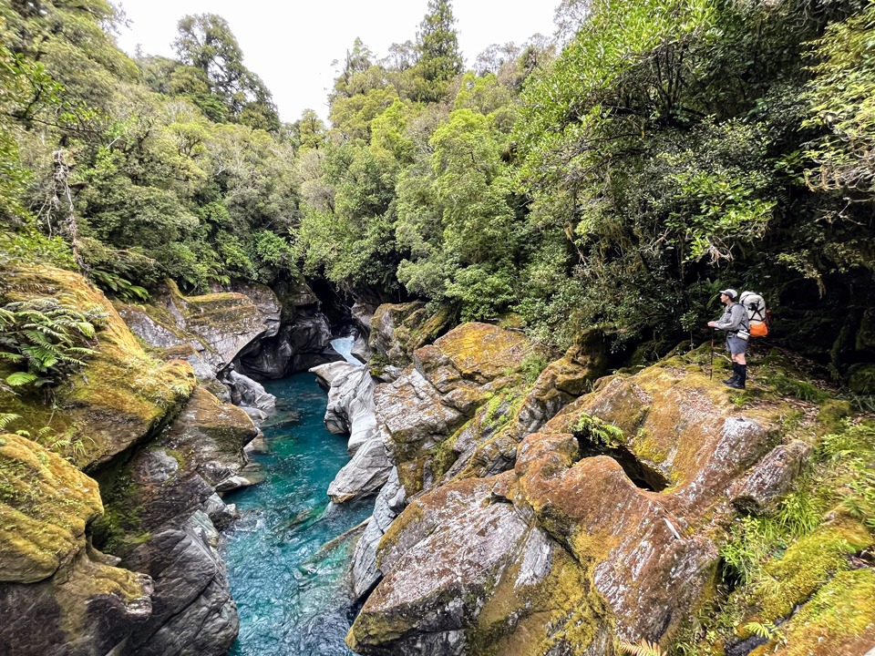
Tramping into Boo Boo Hut was magical. We were above a beautiful gorge with the clearest blue water I have ever seen and huge boulders that the water had carved out smooth lines in. It was a rainforest with rich green moss and lichen. I may have been tired climbing over and under all the fallen trees on the track after only finishing my solo traverse of the Richmond Range the day before, but my battery was instantly recharged by the magic that surrounded us. The three of us spent a lovely night in Boo Boo Hut after enjoying a shower under the nearby waterfall.
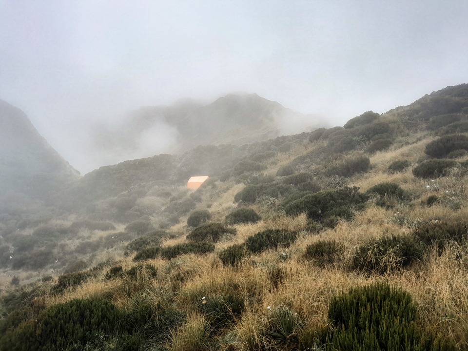
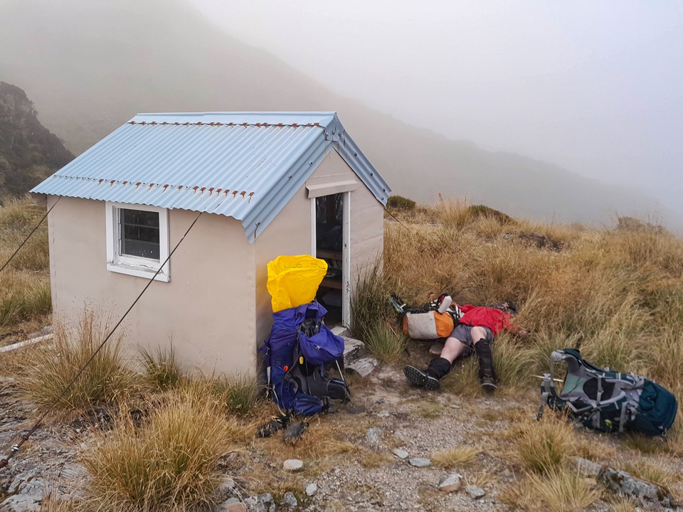
The next day it was all about the climb! It was a long climb up to Pinnacle Biv. There was a thick mist that was clearing intermittently. One minute the Biv was in my line of vision and the next minute it had disappeared amongst the clag leaving me wondering if it had ever been there at all—this seemed to be a bit of a recurring theme on the trip. After finding the bivvy did actually exist, I made my way back out into the cold clag to fetch water from the nearby tarn. As we had tea, we debated about whether to continue given the visibility.
We decided to make a go of it. Just as we were leaving with the kea flying noisily above us, we bumped into two locals. They asked us where we were going and our response left them rather alarmed when we said, “We don’t know.” In response to their worried looks, we immediately clarified that we weren’t clueless and just meant we were going to be more spontaneous and see how far we got with the weather we had. I think they were more reassured after that.
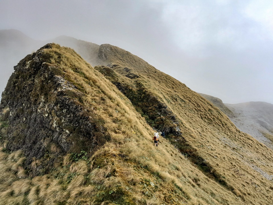
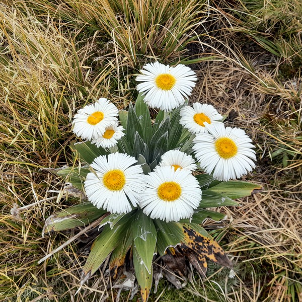
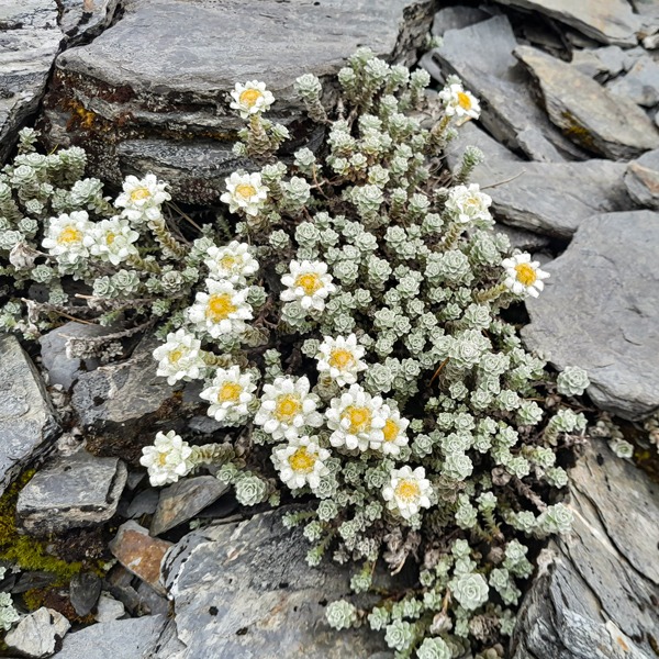
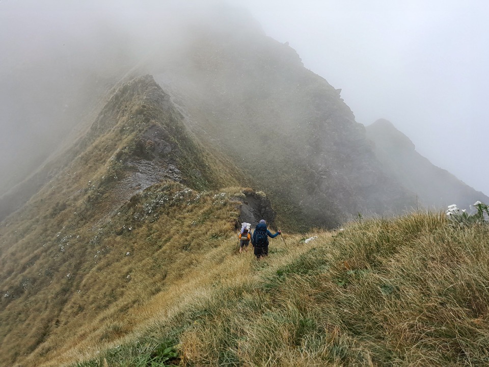
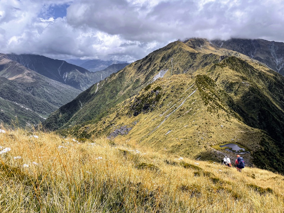
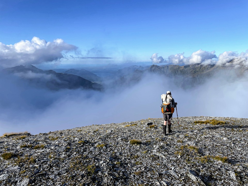
The mist continued with Crinkle Tops poking out occasionally making it feel very mysterious and dramatic. I was running around everywhere admiring the giant mountain daisies, buttercups and edelweiss. It seemed like everything on the West Coast was done on a more grand scale than elsewhere in NZ. After careful navigation we eventually came to Zit Saddle. It is important to note that the route down to Adventure Biv is not where it is marked on the map.
The route off Zit Saddle down to Adventure Bivvy was overgrown and the snow grass was wet and very slippery and we kept losing the marker poles. In a heart stopping moment, Illona took a fall and slid out of sight into the mist. A few moments Iater I heard her yelling that she had found a track marker. At that point though, I was more worried about Illona, imagining her to be in several pieces but she had already bounced back up (she did have extensive bruising). After eventually moving out of the snowgrass we were back on easier terrain but on what seemed to be a very circular route to the bivvy. We felt like we were just walking in circles but eventually it appeared.
It only had one bunk but we all squeezed into it with me lying across the door. We were so tired that when we found the water tank empty we just decided to make do with the leftover water we had in our packs and have breakfast back at the creek the next morning! We had had enough adventure for the day! Breakfast at Esma Creek the next morning involved a spirited conversation about what the loud bang on the roof of the bivvy overnight could have been. Was it a cheeky kea or a wily weka?
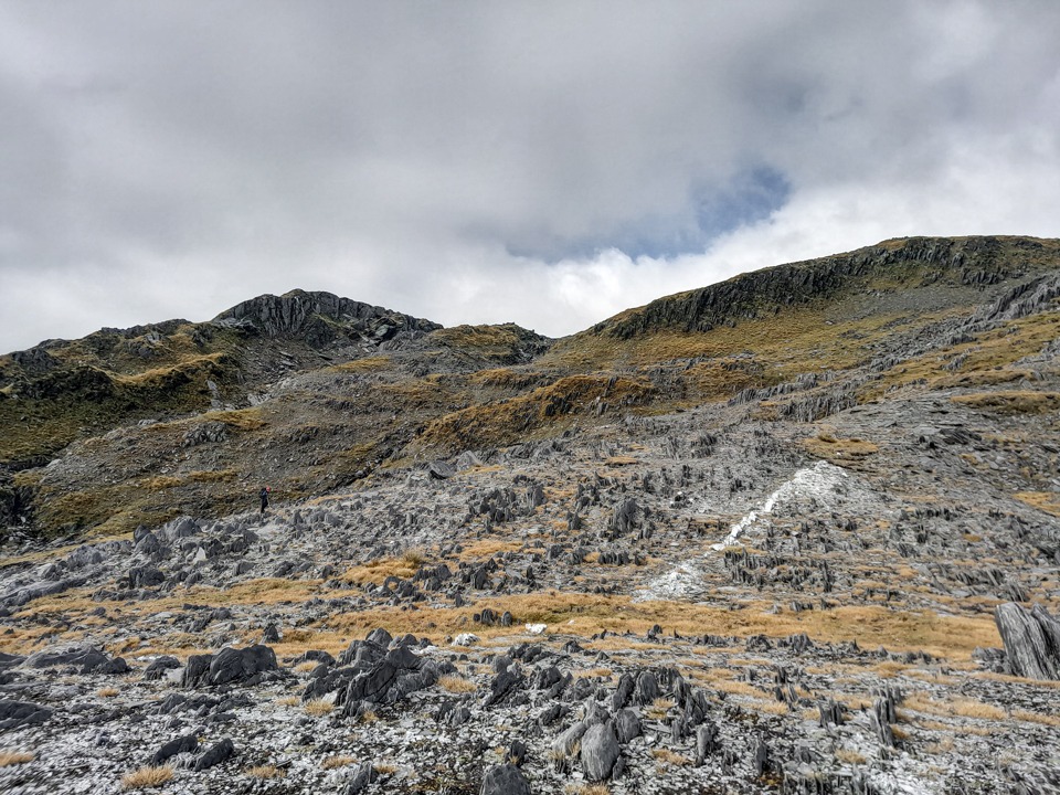
We had better visibility this time as we climbed back up to Zit Saddle so we could follow the route a lot easier. There were a few challenging sections along this ridgeline to navigate. One steep section that we had to climb up would feel safer with ropes to lower packs down if traversing in the opposite direction. There were some huge rock slabs near Mt Chamberlain that we had to find a way through or around. We thought you could possibly drop off Mt Chamberlain and go across the basin but we stuck to the ridge since our route notes described that.
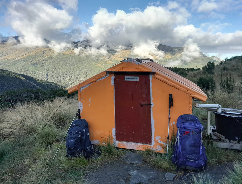
This turned out to be a good call as it meant we had the opportunity to see a rock wren close-up. There were a few tarns and snow patches around Mt Chamberlain to gather water since it was turning into quite a long day. It was a steep descent off Mt Bannatyne and the clag was so thick that we had to take a bearing to Toaroha Saddle Biv. We had nearly walked all the way into the Biv before we saw it as it was also white.
This highlighted to me how useful it is to have huts and bivs painted in the DoC rescue orange so they can easily be seen. As we collapsed in front of the Biv in a tired heap after a long day over tricky terrain, we had to defend our gear from the cheeky kea before we eventually settled into the Biv listening to the frogs in the nearby tarn.
We had a lazy start on Day 4 making the most of the sun to dry out our gear. We attempted to go down to Mungo Hut via a ridge on the true right of Topo Creek but decided to turn back as it had steep drop-offs. We saw a hilarious description written by some other trampers who had done the same and called it a “bit too sporty.”
We decided to continue on down to Poet Hut through big dracophyllum, rata, olearia and cedar trees. The fallen leaves made it very slippery and while Illona and I went slowly, Emily sped down like a mountain goat and made it down in half the time of us.
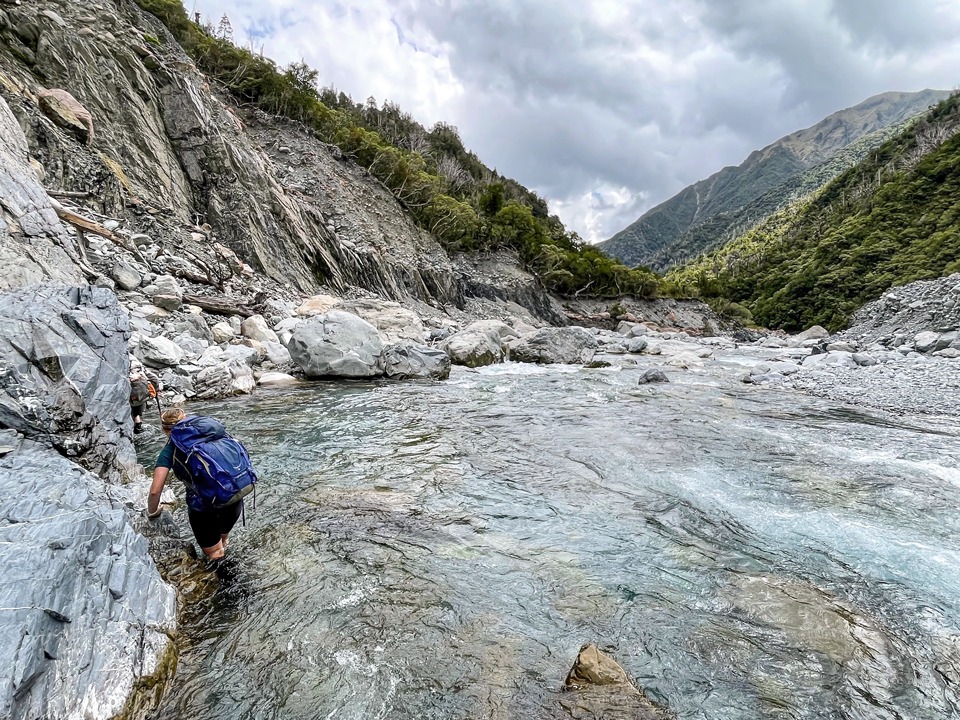
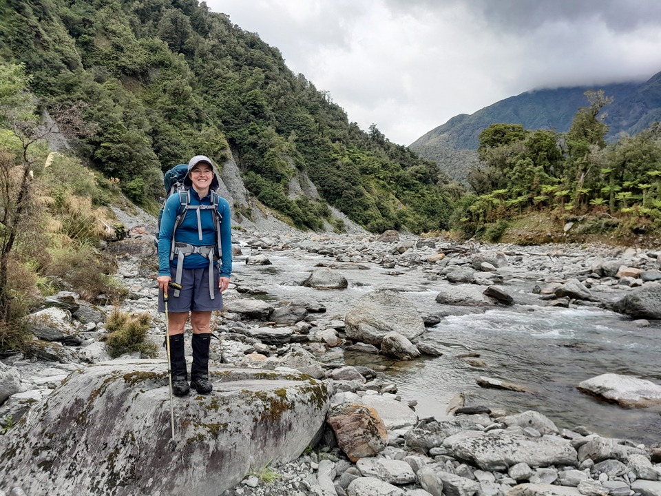
We decided to make a day trip to Mungo Hut. There had been heavy rain the previous afternoon while we were at Poet Hut and this meant we had to take more care as we walked up the Mungo River. At Brunswick Creek we did some bush bashing up the creek before finding a place which was safe enough to cross.
The Mungo River was my first big West Coast River and it was easy to see how deceptive they could be with the clear water making it look very shallow—in one place we did a linked-up crossing because the water was far deeper and swifter than it looked. There was a final climb up through bush to Mungo Hut and a permolat sign that helpfully reminded us to “Change Down. No overtaking.”
Getting to Mungo Hut was pretty satisfying as it is a less-visited place (often only 3-5 visits a year) and the fact that it’s still standing is pretty lucky as it was nearly burnt down by a fire started by some ashes in 2021. How close it came to being destroyed was still evident by the fire line surrounding the hut. On the way back we found some hot (actually lukewarm) pools marked by a shovel.
It was an early start the next day and straight into boulder hopping which I wasn’t the most impressed about—I thought it was too early in the day for that. I snailed behind over all the boulders until we were back into the bush and doing a detour around a slip to Bluff bridge. From there it was another bush bash to get around a large boulder because the river route was impassable. The notes said a 15 minute detour but as with permolat times you multiply it by four and we took an hour.
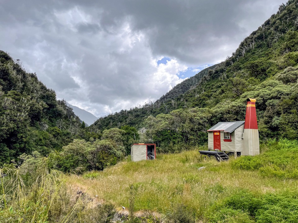
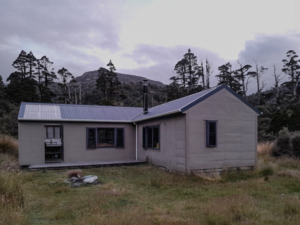
After climbing up from Darby Creek on a knife edge ridge, we finally made it to Frisco Hut. Here the highlights were the loo with an impressive view out over the valley and the hut book dated back to 1983. We were the first people in the hut book in a year. The hut also had a small kennel that was signposted for snorers!
After Frisco Hut it was a steep climb up a creek with giant step ups. I decided these West Coasters must have legs up to their ears. It was turning out to be another long day or as Emily described it a “3 scroggin day.” We saw more rock wren as we followed animal tracks up Mt Ross.
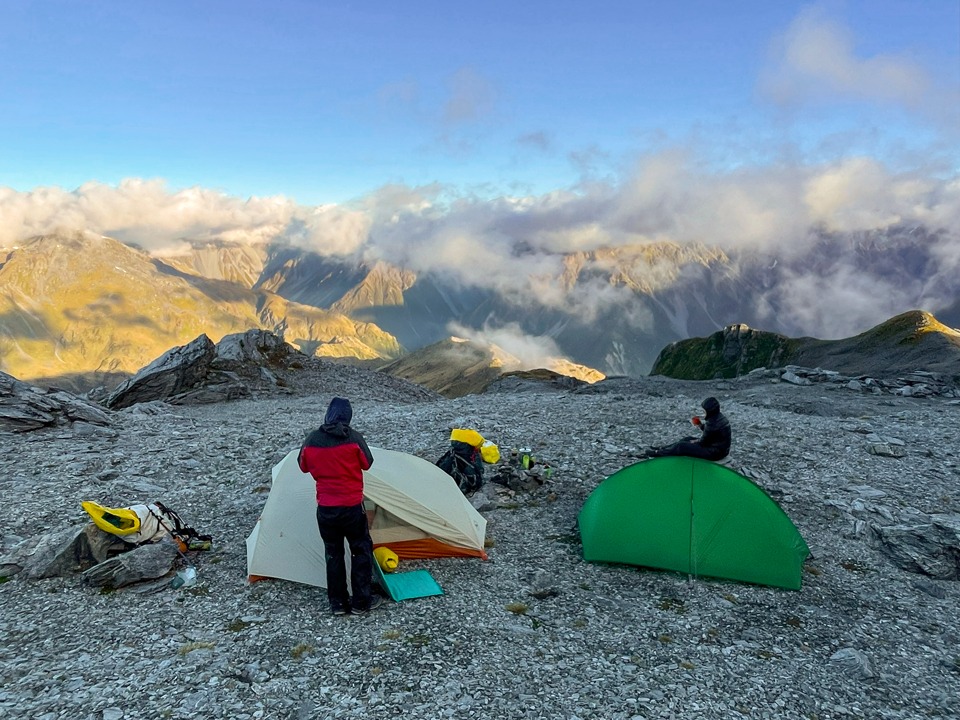
After reaching Mt Ross at 7:30pm, with heavy mist over the route to Mullins Hut, and feeling slightly weary after being on the go for 14 hours already, we decided to have a high camp on Mt Ross. We made little tent sites among the rocks and there was snow to melt for water so we had everything we needed, as well as being treated to a beautiful sunset and a view of where we had traveled over the last 6 days.
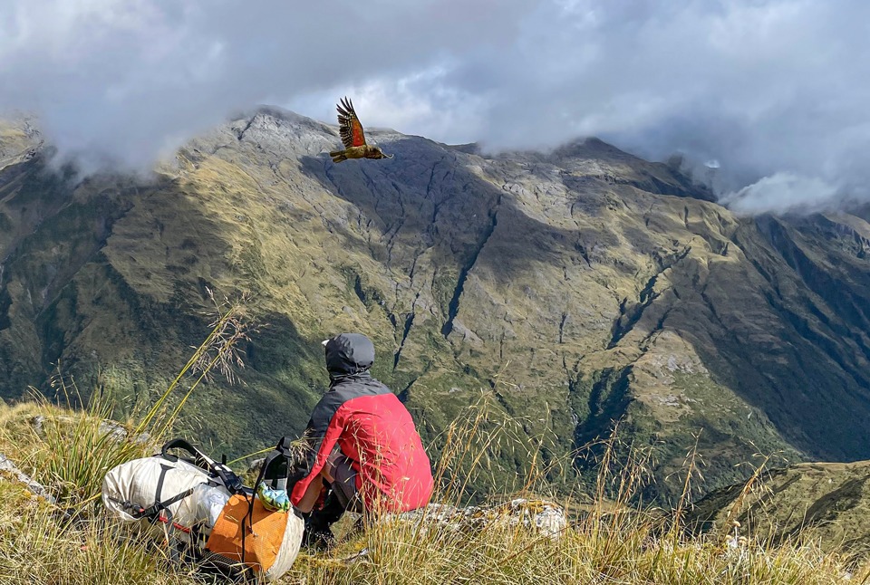
We woke up to a clearer day and the highlight of the trip for me—a circus of kea turned up as we were descending down to Mullins Hut. They dive bombed Emily and then we sat and watched them for a while and one tried to do a sneak attack on my tramping pack while I was distracted by its mates! Typical cheeky kea behavior. We counted nearly 20 with a mixture of adults and juveniles. I would have sat there all day watching them and listening to their raucous noise but we still had to find a way to Mullins Hut.
The descent to Mullins Hut was far from simple. Hilariously we could see the hut but would not get there for a fair few hours. There were so many spaniards and leatherwood. At one point I got completely stuck by my shorts in some leatherwood on a steep slope and declared I was not having any fun much to Emily and Illona’s amusement. After freeing myself but now with holey shorts, I started following Emily until I wasn’t—she disappeared down a waist deep hole. We finally made it to Mullins Hut and decided to have a lazy afternoon napping, reading and drying out our tents.
On day 8 there was a good Permolat trail to the true left of the gut that took us up to the Old Jumble Biv Site where we got views of the Hokitika River and Gerhardt Biv. There were a few tricky bits along the ridge again. Illona sacrificed her knee in finding a good route for us and we took a detour down the scree to avoid an exposed area of ridge just before Jumble Top. The name ‘Jumble Top’ certainly seemed appropriate as it was very much a jumble of rocks up there.
The clag came in again before Squall Peak so it took a bit of navigating with a bearing to ensure we got to the right place. After Squall Peak we were on a well trodden foot trail with poles and then a steep descent through the bush down to Toaroha River and Cedar Flats Hut.
As we got to the river, I said it would be nice to see whio and then as if the Universe had heard me, two whio suddenly appeared in front of us in the calm backwaters of the river—a rather unlikely place for them to be. We had prepared ourselves for a busy Cedar Flats Hut given it was the weekend but we still saw no one in either the new or historic hut. Emily and I walked to the nearby natural hot pools. Emily rated these better than the Welcome Flat ones and they were certainly quieter!
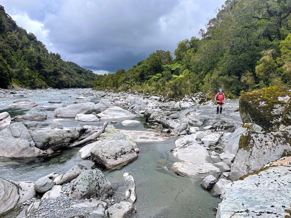
The next day we followed the Toaroha river out, seeing more whio along the way. We took the river route the entire way since the river was low and it was only just before the end of the track that we saw the first people we had seen in 8 days!
Helpful Info:
More route info can be found on the Remote Huts Website.
Day 1: Middlebranch Rd to Boo Boo Hut
- Elapsed Time: 5.25hr
- Distance: 11.5km
- Elevation: 735m
Day 2: Boo Boo Hut to Adventure Biv via Pinnacle Biv
- Elapsed Time: 11hr
- Distance: 11.6km
- Elevation: 1,593m
Day 3: Adventure Biv to Toaroha Saddle Biv
- Elapsed Time: 12.75hr
- Distance: 10.4km
- Elevation: 1,490m
Day 4: Toaroha Saddle Biv to Poet Hut (including recce of possible Mungo Hut Route)
- Elapsed Time:6.5hr
- Distance: 6.74km
- Elevation: 479m
Day 5: Mungo Hut day trip
- Elapsed Time: 8.5hr
- Distance: 12.6km
- Elevation: 920m
Day 6: Poet Hut to Mt Ross 1,700m campsite via Frisco Hut
- Elapsed Time: 14.5hr
- Distance: 12.4km
- Elevation: 2,106m
Day 7: To Mullins Hut
- Elapsed Time: 4hr
- Distance: 3.4km
- Elevation: 72m
Day 8: To Cedar Flats Hut
- Elapsed Time: 11.75hr
- Distance: 10km
- Elevation: 1,253m
Day 9: To Middlebranch Rd
- Elapsed Time: 3.5hr
- Distance: 9.6km
- Elevation: 255m.
Hi,
Seeing if this goes to any of the punters who did the Boo Boo Hut Trip WTMC tramp? I’m thinking of doing something similar and chasing some beta.
Hi,
Seeing if this goes to any of the punters who did the Boo Boo Hut Trip WTMC tramp? I’m thinking of doing something similar and chasing some beta.
Hi Michael, I sent you an email (could be in your junkbox). If you haven’t received it, let me know on here. Thanks, Sarah