
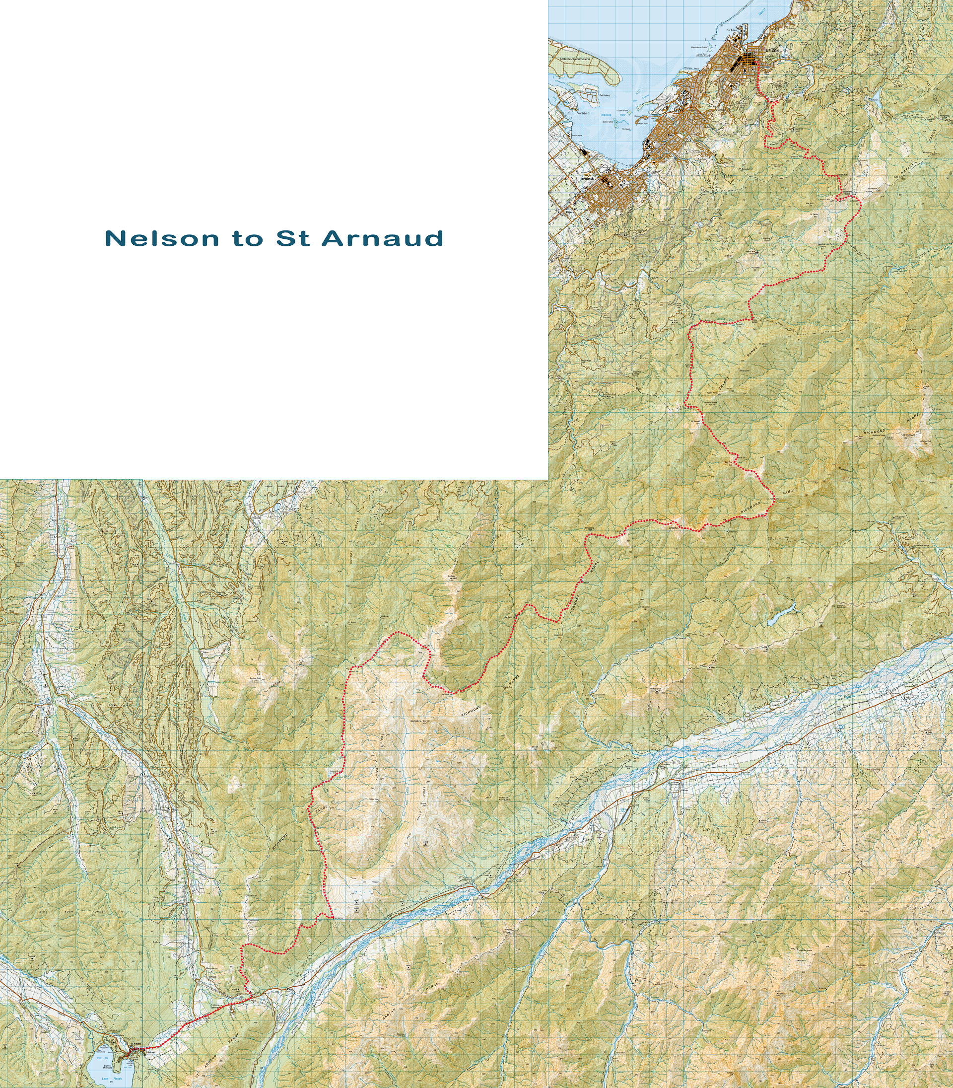
Richmond Range Traverse – Nelson to St Arnaud
“Am I going the right way to St Arnaud?”
I am suddenly alarmed as I look around to hear where this voice is coming from and find a Te Araroa (TA) walker who I had last seen many hours ago speeding away from Porters Hut …
Now he was coming towards me when I hadn’t expected to see him again at all! I was instantly on the alert and realised he looked a little pale, tired and disorientated. I got him walking in the correct direction and offered him some snacks and decided even though I was keen to walk solo, I would stick with him all the way into St Arnaud to make sure he got there safely.
Two years ago I had done a spontaneous solo tramp in the Richmond Range walking from Pelorus through to Nelson on the Pelorus Track (see here) and I always promised myself I would go back to complete a traverse on the Richmond Alpine Route. Here I was two years later almost exactly to the day spontaneously booking flights and quickly packing my tramping bag. Given I had already walked the Pelorus Track and to make it easier for transport logistics, I decided to fly into Nelson and then I could simply walk straight from Nelson City into the Richmond Range via the Dun Trail.
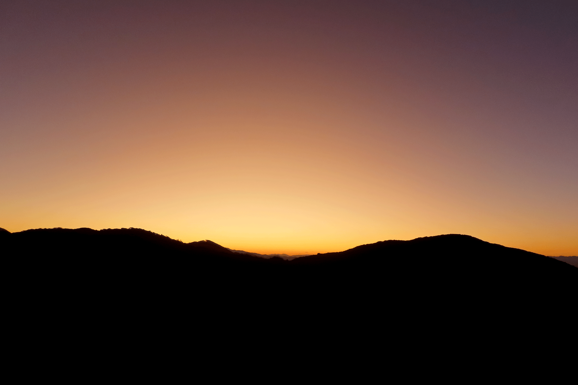
The Dun Trail had taken a bit of a hammering in the floods over winter so there were a few re-routes but it was an easy walk for Day 1 when I had a heavy bag. I had some extra items from clearing out my fridge including apples and strawberries. This fresh fruit was greatly appreciated over the next few days though. The Trail up to Dun Saddle is all very easy walking as it is a dual walking and mountain biking trail. I had done the climb up to Dun Mountain before so I bypassed it this time and continued on to Rocks Hut. It became a single tramping track after this and was quite muddy as the week before it had rained quite a lot. Even though Rocks Hut had plenty of bunks, I decided I wanted a quiet night and found myself a little camping spot amongst the trees before wandering up to the Rocks Lookout to watch the sunset over Abel Tasman NP.
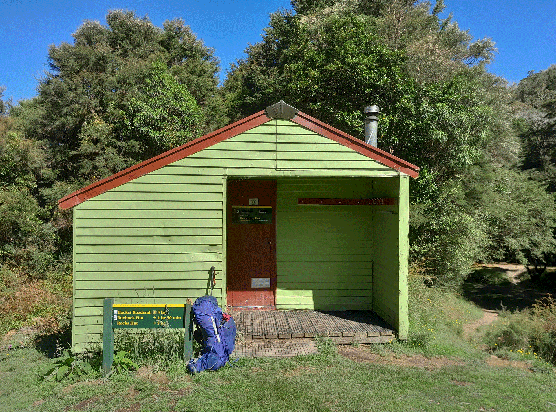
I started walking at 06:30 the next day with the intent of having a long day as I knew I had to be in St Arnaud to meet my friends by a certain day for another tramp. I had done the track to Browning Hut last time so knew what to expect for this bit—it’s a bit of a long climb followed by a steep descent which is a recurring theme for the Richmond Range! I eventually made it to Browning hut and had a quick break before continuing to Hackett Hut. The track to Hackett hut has had a fair few slips and there were a few detours and some trees to climb over. At Hackett Hut it was finally lunch time and a swim to cool down before the next long climb.
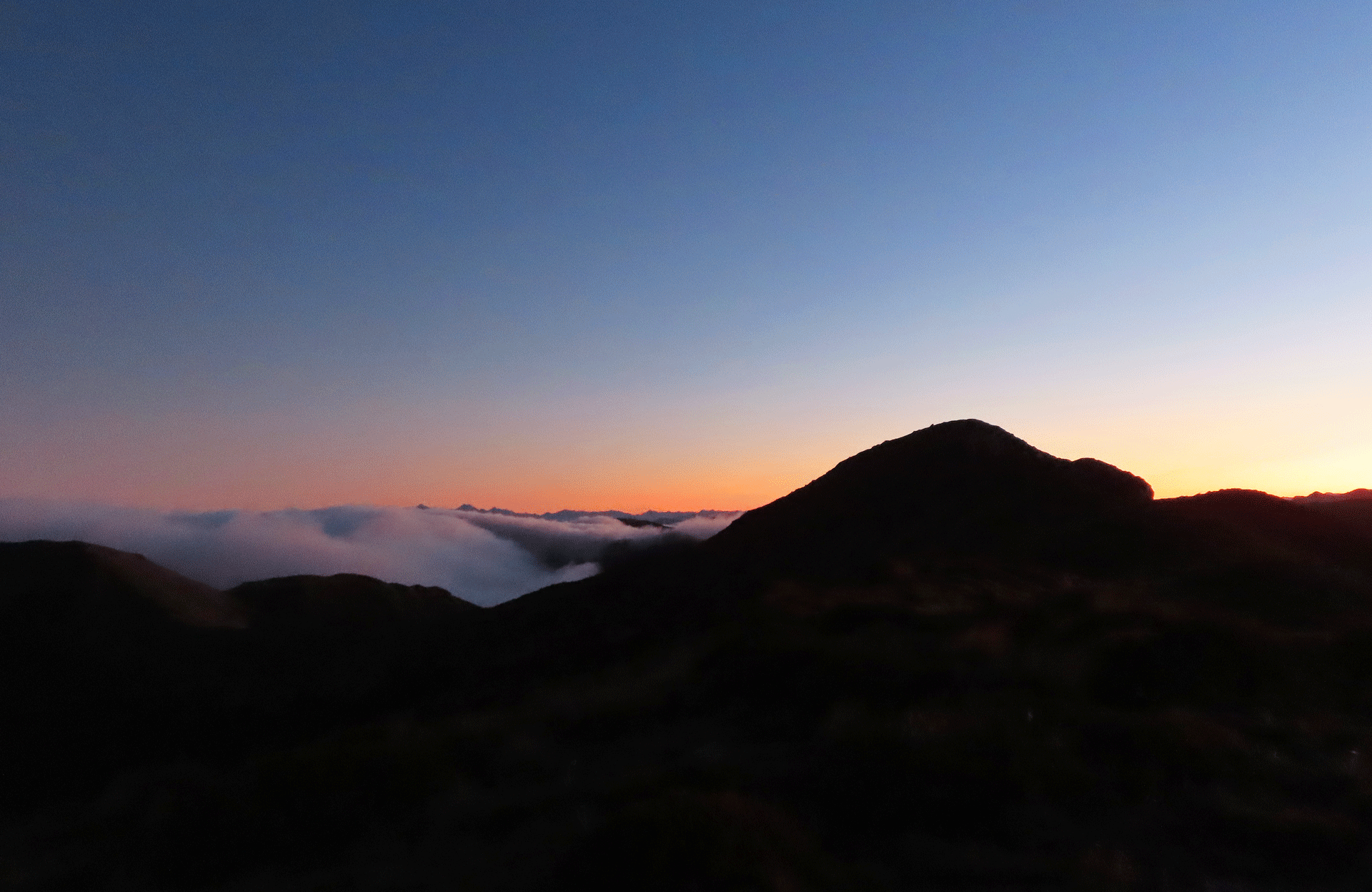
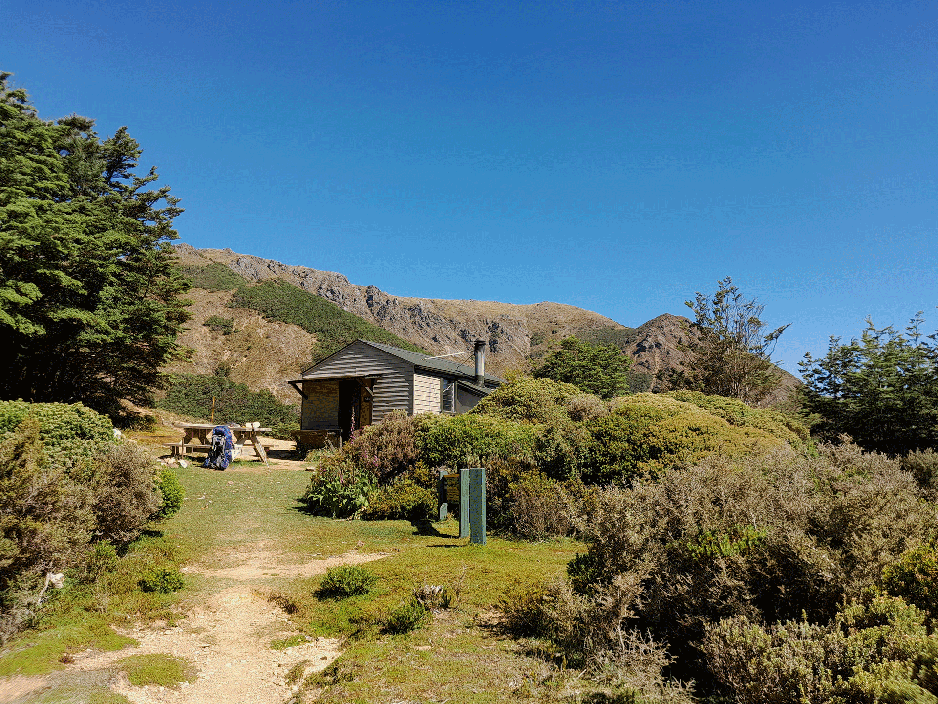
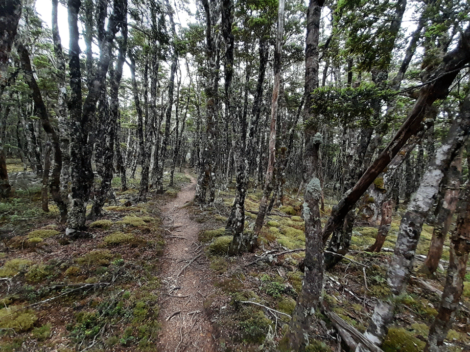
I was quite content to stay there longer but I got chased out by a bumblebee bee that took a special interest in my blue pack so I decided this was a sign that it was time to get moving up the hill. I have to admit I do love a good long steep climb though—there’s something quite rewarding about putting in the effort and then the achievement of reaching the top. The climb up to Starveall Hut certainly met this criterion and it was a sweltering day so I was glad I got my swim before the long climb. After about 3 hours I made it to Starveall Hut which almost looks like it has a little garden outside. I had a nice long chat with the lone tramper who was staying at the hut before I waved him goodbye much to his surprise and set off up yet another hill towards Mt Starveall. It was going to be a long day with a fair bit of climbing but it was such a beautiful day that I wanted to make the most of it. The beech forest was full of lush green moss that looked soft enough to lie down on (very tempting!) and I was visited by a couple of curious Toutouwai along the way. Slaty Hut was completely full on my arrival so I spent some time wandering around looking for a flat camping spot under the trees. The next morning I heard from my fellow campers that they had thought my footsteps were a ghost as they hadn’t expected anyone else to arrive after they had tucked themselves up in their tent for the night. Despite my long day, I still found energy to go up Slaty Peak to watch another amazing sunset. The Richmond Range was certainly delivering the goods on amazing views and sunsets.
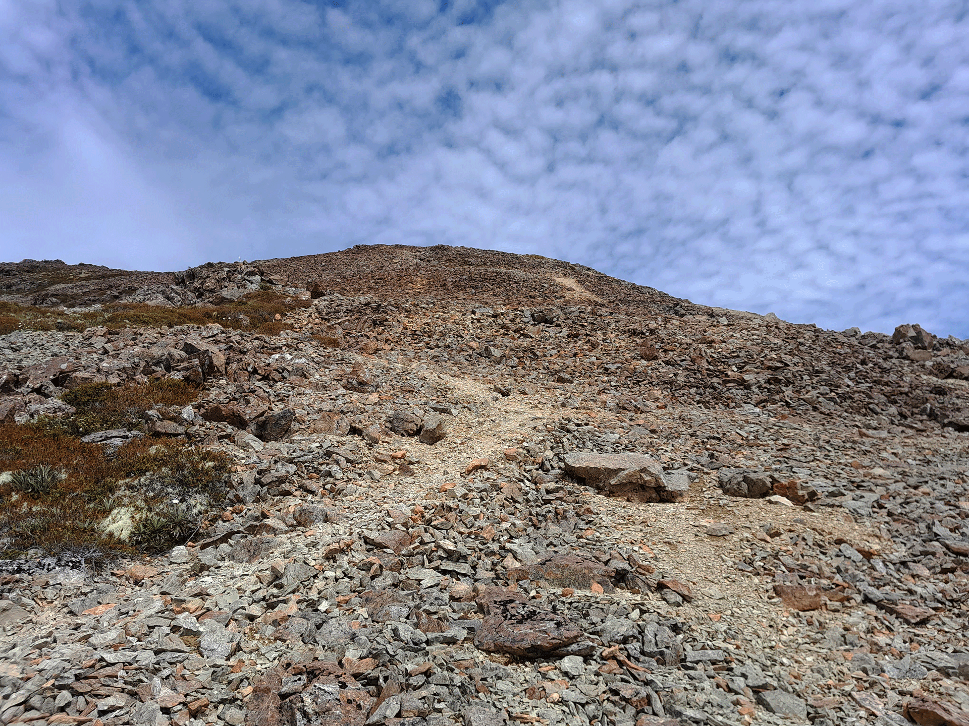
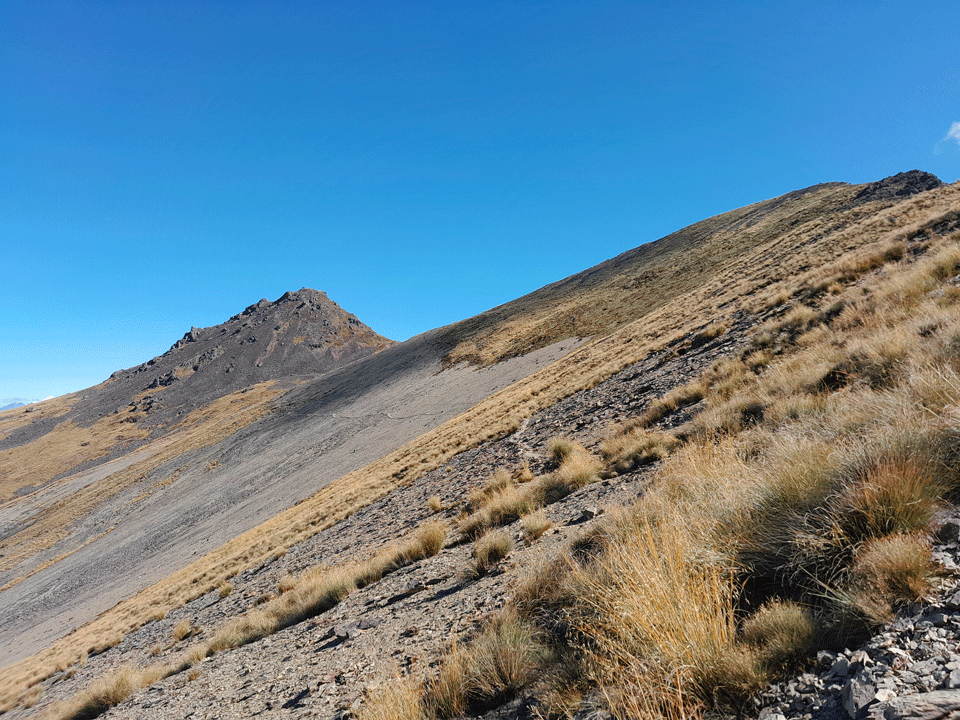
The next day was probably my favourite day as it was a real mixed bag of weather and variety of terrain. I left early on what seemed to be another fine day in the making but as I climbed up towards the spot height above Slaty Hut and Old Man peak it suddenly changed and became very cold and claggy with limited visibility and giving off a rather mysterious atmosphere. I had planned to drop down to Old Man Hut for water but there was a clearing in the weather and I knew I had to make the most of this opportunity to get over Mt Rintoul so I made the decision to power straight through and ration my water. I had been part of this way before when I had done the Old Man Loop with Tony (see here) so it was good to finally continue all the way over to Mt Rintoul. It is a bit of a steep rocky scramble with scree and larger rocks which I thrived on but I met some TA walkers who said they found it quite scary.
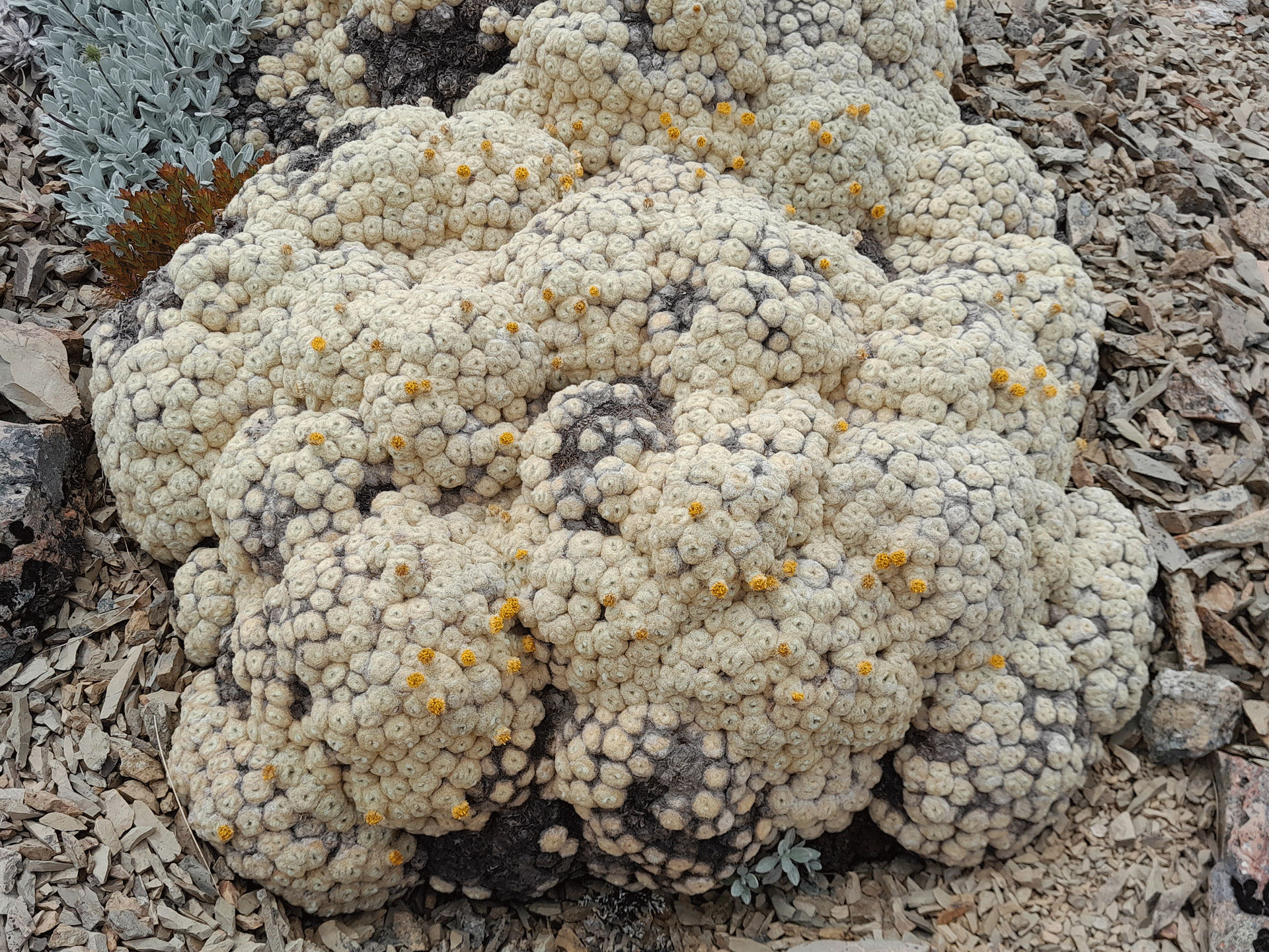
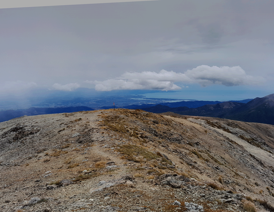
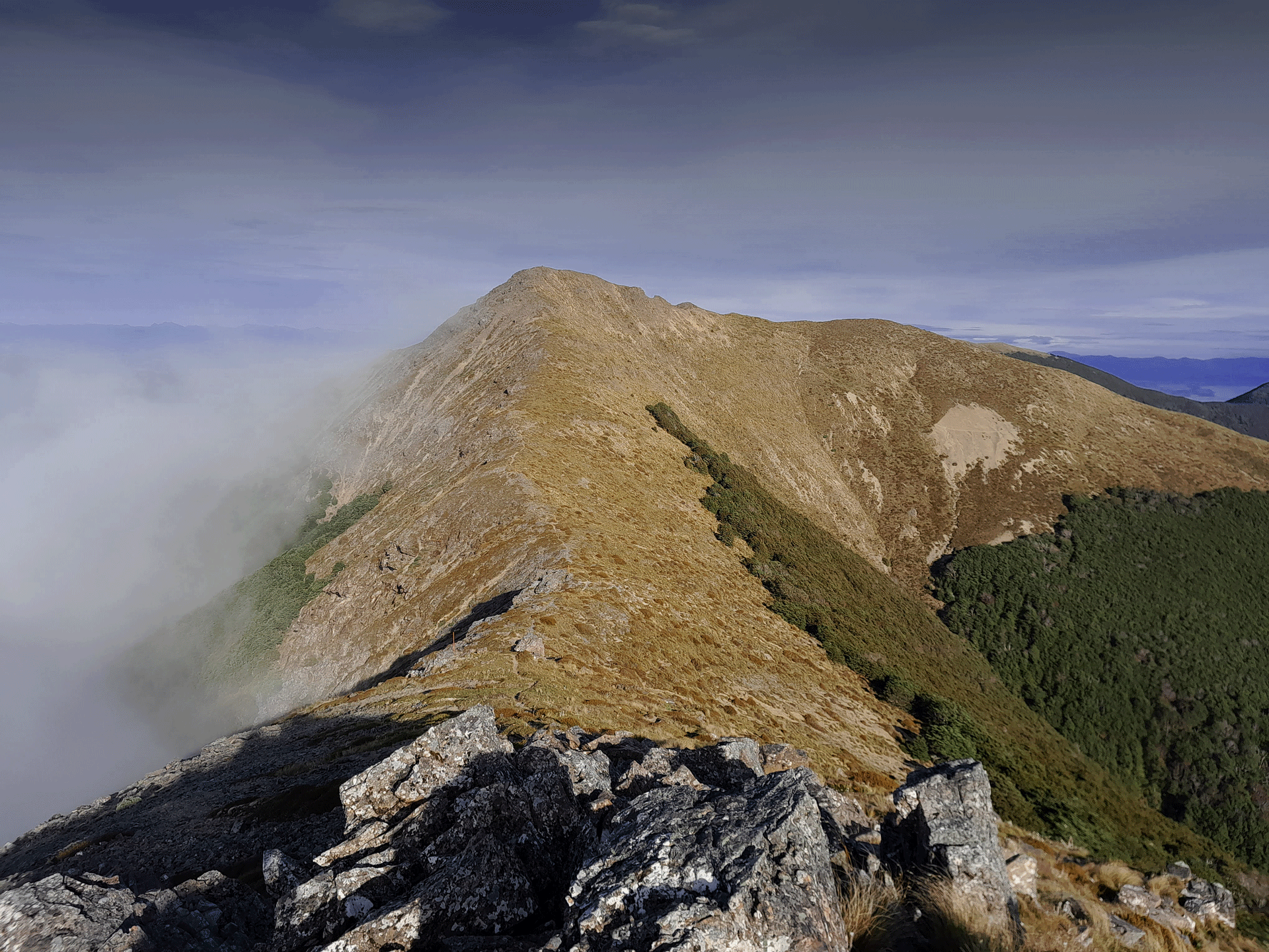
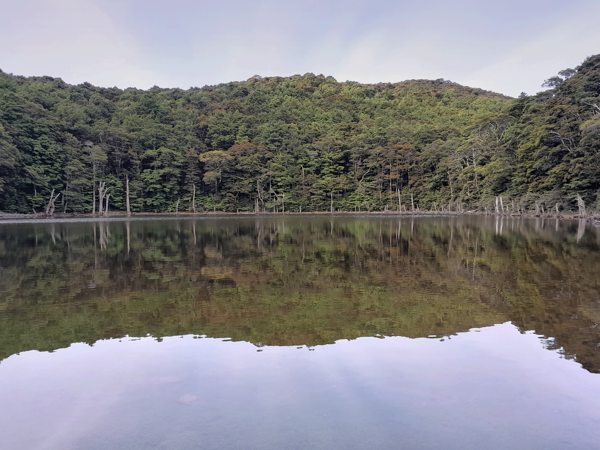
Up on Mt Rintoul I got views all the way down to Nelson and the coast before the clag started to roll in again just as I started the descent to Mt Rintoul Hut. I enjoyed looking at all the vegetable sheep (raoulia) along the way and even spotted a ladybird sitting on one. Mt Rintoul Hut was super busy and I decided that was enough motivation to have another long day and push on to Tarn Hut. This was a really good call as I got rewarded with the beautiful evening light in the beech forest. I can also confirm that the rocks did look a little purple up on Purple Top. Again I was lucky with my visibility on the tops on this section as it cleared just as I got there again. I got to Tarn Hut around 8pm much to the surprise of the other two TA walkers inside who hadn’t expected anyone else to turn up at that time. Tarn Hut was lovely as I could sit there having dinner listening to the frogs in the tarn and watching all the reflections of the trees in it.
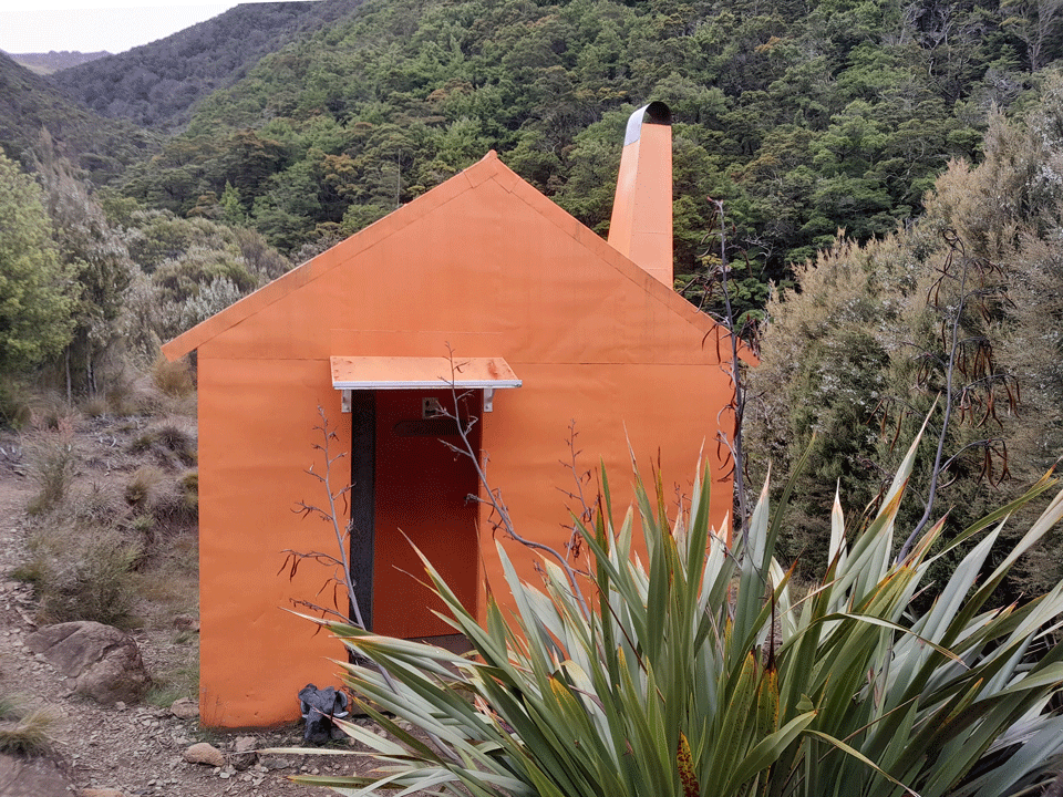
I found it quite hard to drag myself away from Tarn Hut the next day as I enjoyed listening to the frogs and the peacefulness of it but I had places to be—I was aiming for Top Wairoa Hut, which would be a shorter day. The walk to Mid Wairoa Hut is pretty easy going but the route to Top Wairoa Hut from Mid Wairoa is badly eroded in places and has a number of crossings of the Wairoa River so it is not one to be attempted in bad weather. At Mid Wairoa Hut one of my shoelaces snaps so I have to use some elastic from my first-aid kit to fix my shoes. A TA walker comes by and I offer to walk with them along the track to Top Wairoa Hut as they are really nervous about the track as apparently it has quite a reputation on the TA app due to the erosion. I enjoyed the technical nature of the track as it was a good break after the easier tramping of the last few days. I knew I was starting to get closer to St Arnaud now as the rocks were beginning to change colour and were starting to look more red. The Red Hills were coming! Top Wairoa Hut is the first hut painted in the stereotypical DoC Rescue Orange that I love and I have excellent company in the hut that night with four other TA walkers.
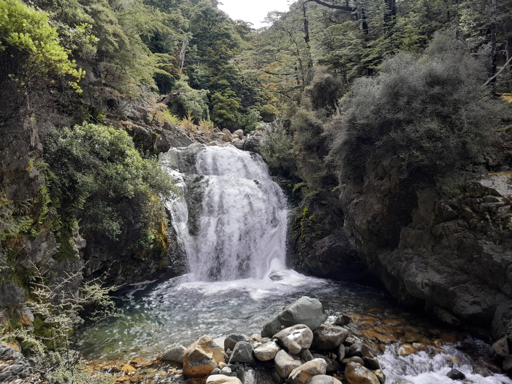
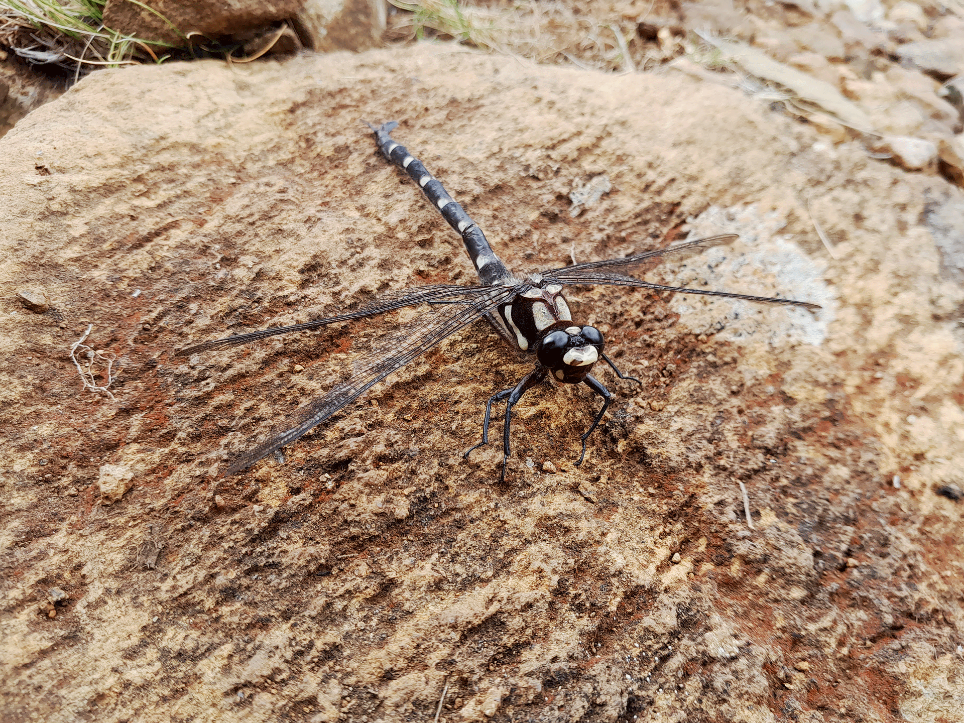
I left Top Wairoa Hut on yet another bluebird day, even the full moon was visible above the hut. It was another decent climb up to the saddle so I just cruised up before I deviated off route to climb Mt Ellis. I got great views of Red Hill/Maungakura and immediately decided that I would like to go back to explore the area with an off-track trip. It was a steep drop back down to the valley floor via a lovely beech forest and scree slope where I stopped for another swim in the creek to cool down before I continued along to Hunters and Porters Hut. The track does involve a bit of rock hopping here—it’s a mixture of bush and rock terrain scrambles. There’s a bit of mud to splash in before Porters Hut and I come across a large dragonfly that is one of the highlights of my day. Porters Hut had a good surprise in that there was a loud chorus of frogs again and getting on to the top bunk that night requires a good jump as for some reason DoC didn’t think to put ladders in to assist weary trampers. Once up safely on the top bunk, I’m not particularly keen to move again until the morning!
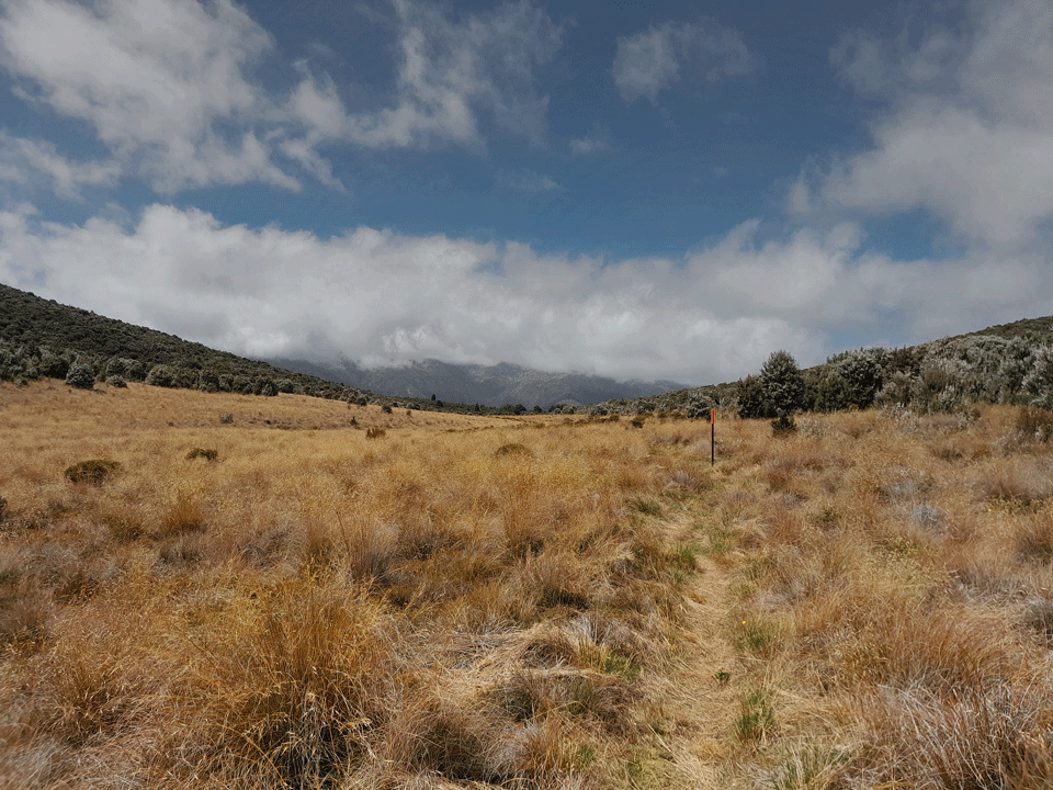
On my last day I left Porters Hut with the plan of heading all the way out to St Arnaud which would be a fairly long day. There were a few river crossings and climbs before I reached Red Hills Hut for my lunch stop. I see some wainuia snail shells and purple fungi (cortinarius porphyroideus) along the way. After lunch I head up the hill on the Maitland Ridge MTB track where I met the TA walker who had gotten a little disorientated. We walked together along this track which was full of flowing switchbacks as it also doubles as a mountain bike trail. Then it was just a road walk into St Arnaud where a group of TA walkers invited me to have pizza together with them to celebrate finishing the traverse of the Richmond Range and reaching St Arnaud.
- Day 1: Brook Street to Rocks Hut
- Distance – 22.5k
- Elevation – 1,219m
- Moving time – 5h
- Elapsed time – 6h
- Day 2: Rocks Hut to Slaty Hut
- Distance – 25k
- Elevation – 2,067m
- Moving time – 7.25h
- Elapsed time – 13h
- Day 3: Slaty Hut to Tarn Hut
- Distance – 22k
- Elevation – 1,859m
- Moving time -6.5h
- Elapsed time -12h
- Day 4: Tarn Hut to Top Wairoa Hut
- Distance – 17.4k
- Elevation – 1,046m
- Moving time – 6h
- Elapsed time – 9h
- Day 5: Top Wairoa Hut to Porters Hut
- Distance – 18.3k
- Elevation – 1,548m
- Moving time – 6h
- Elapsed time -10.5h
- Day 6: Porters Hut to St Arnaud
- Distance – 33k
- Elevation – 1,466m
- Moving time – 8h
- Elapsed time -10h
Date: 8 January 2023 – 13 January 2023
Trip type: Private – MF
Location: Richmond FP
Author: Sarah F
Trampers: Sarah F
More photos: https://photos.app.goo.gl/dSJQinkWTEAJ1fRm7