Dumb-bell Lake is a place I have wanted to visit for years, mostly because of its name. Having thoroughly enjoyed previous trips in the area to Gunsight Pass and Maitland Pass, a loop around Dumb-bell Lake quickly became next on the list
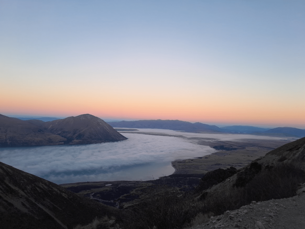
As we drove around Lake Ōhau, a thick valley fog blanked the landscape which initially disappointed me that I wouldn’t get any views to make the trip worthwhile.
The first section of the Freehold Creek Track travels through lovely beech forest—a stretch of the track I thoroughly enjoyed especially when I popped out above the inversion layer into a clear, bluebird day.
After leaving the main track near the Freehold Creek waterfalls, I stumbled across a foot-trail and a few yellow snow poles though the route itself through the Freehold Creek Basin is only very lightly marked.
I decided to challenge myself by aiming straight for the peak named Pinnacle rather than taking the easiest line. However, frozen scree quickly scuttled that plan.
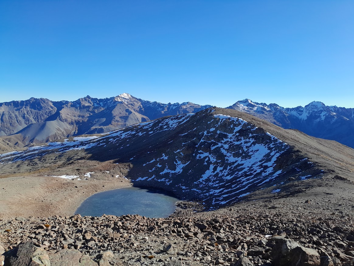
Due to the icy ground conditions, I ended up looping around the basin to point 1922 instead. It meant some extra elevation and excellent boulder-hopping practice!

It was then along a broad ridge to the summit of the Pinnacle. From the ridge, I decided to cut around the southern end of Dumb-bell Lake to traverse along its western side. The ridge leading to point 1887 looked like it could get a bit gnarly, and with winter daylight hours ticking away, I didn’t have a lot of spare time if I needed to retreat, especially after a later start.
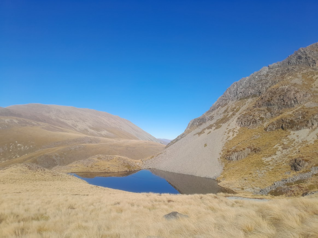
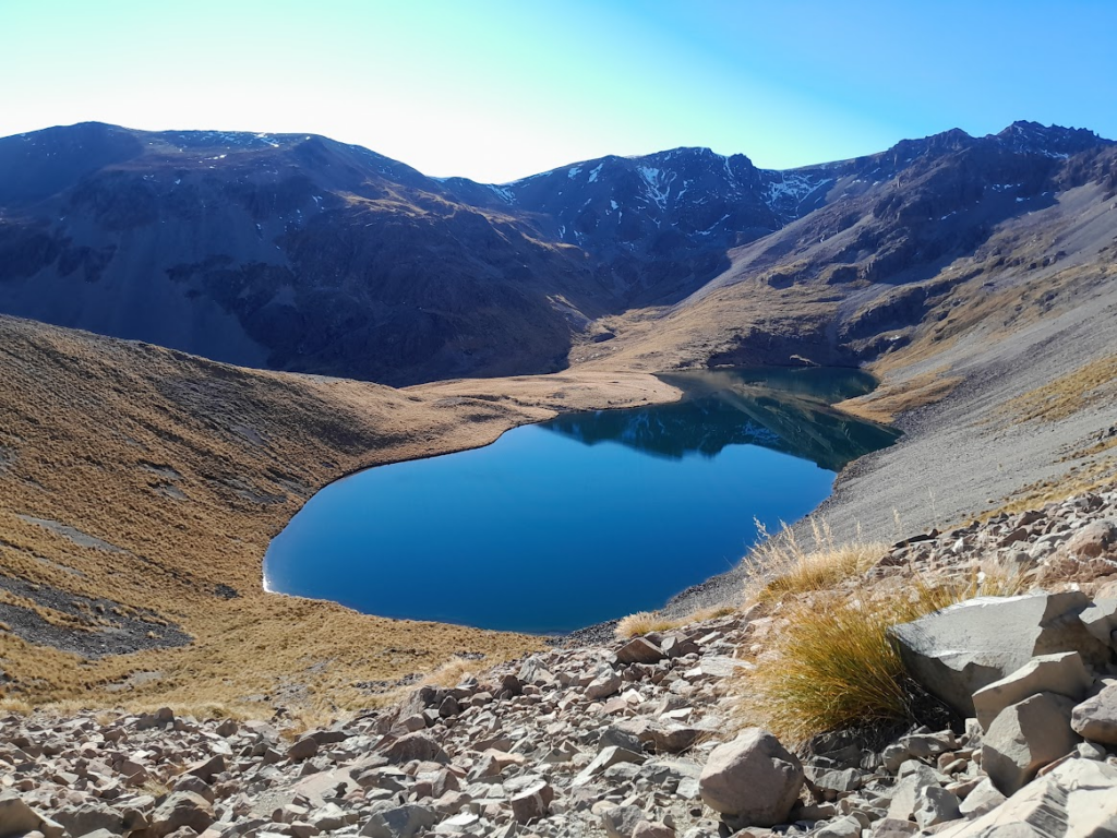
Dumb-bell Lake was every bit as beautiful as I had imagined. The northern end was skimmed with a thin layer of ice. The sun was hitting the water perfectly when I arrived, creating an incredibly serene atmosphere. I noted a few camping spots for possible future overnight trips.
The climb out of the lake basin presented a few icy patches, though these were easily avoided. While the most direct line is to climb straight through a steep basin towards Mt Sutton, this southern face was holding multiple patches of snow. I was worried about encountering frozen scree—which feels like trying to walk on marbles and can be incredibly dangerous.
Opting for a line I felt more comfortable with, I took a more circular route. I decided to head east and sidle the ridge south of Mt Sutton. While I was also on the southern aspect of this ridge, it had less snow and scree. I only had to put my crampons on once to safely cross a single section of hard snow that I couldn’t kick steps in.
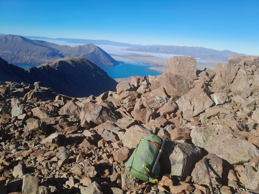
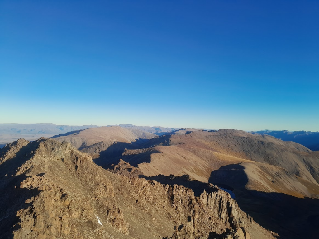
From there, it was an easy sidle back along on the northern side of the same ridge and along to the summit of Mt Sutton—a sneaky 2,000-metre peak. The summit views were phenomenal, stretching all the way down the lake toward the Hopkins and Dobson Rivers, with a clear view of Aoraki / Mt Cook dominating the horizon.
The descent from Mt Sutton to the Ōhau Skifield was straightforward, requiring just a bit of care to avoid icy patches around the stream.
Reaching the top of the skifield access road, I was actually looking forward to stretching my legs on the 9.6km downhill run, even if I was running with a heavier bag with alpine gear.
My timing couldn’t have been better. Just as I reached the locked gate at the base of the access road, Tony pulled up in the car to meet me.
Distance: 26.2km | Elevation: 2,041m | Time: Allow 8-10hrs
Full version of trip report: Dumb-bell Lake with the Flying Dumbo Elephant – Sarah Tramps NZ