
I first learned about Punga Hut a few years ago at a WTMC social night talk on the best huts and tracks not on the map. Ever since, it has been on my adventure wishlist.
When we did the number 1 canyon, I tried to convince the guys to make the short jaunt to visit Punga Hut, but they rightly pointed out we didn’t have time to go searching for a hidden hut.
Getting to Punga Hut from Scotts Road end isn’t too hard and there are plenty of trip reports on the internet that will land you mostly in the right spot. But it’s a long drive and includes a boring walk down a 4 wheel drive track through old forestry ground. It’s uninspiring.
I looked at the map and thought if you could get into the northern end of the Tararuas from Kopikopiko Road, you might have a short trip to Punga Hut, not to mention you could bag North Mangahao Bivvy, which has its own reputation of being hard to find since it had been marked about 500 metres in the wrong place on the NZTM topographical map for decades, and reports of the leatherwood in this area were pretty horrific.
Looking at the NZ topomap it was clear that the access via Kopikopiko Road would be through private property and would surely require permission. I started asking around before calling the Masterton DOC office, and they kindly did a bit of research to eventually help me track down the farm manager.
When a fine weekend with plenty of sunshine showed up in the forecast, I got the OK from the farm manager and then Emily and I did a bit of research. Actually, Emily did a heap of research and as you’ll soon read, that made a heap of difference.
We knew where the North Mangahao Bivvy was because it was now correctly located on current topomaps. We didn’t have GPS coordinates for Punga, but we had a number of trip reports giving us a general idea that it was situated near a stream junction.
We also knew that the leatherwood was horrendous in the area and that while many people had read of old routes between the two huts, no one had yet found the oft referred to ‘super highway.’ Most people had tales of terrible bushbashing and spending 3 to 4 hours to get between the bivvy and Punga Hut. One person even reported dropping into the stream only to run into a waterfall and chest high pools to wade across.
So we prepared. We took two GPS devices, two sets of topo maps and two compasses, a set of zoomed in topo maps, two phones with GPS mapping apps on them, and we downloaded maps and trip reports to our phones to be able to access when we were in the bush. We also wore our tramping clothes with the worst holes, ready for the worst leatherwood the Tararuas could serve up!
Despite the dozen trip reports Emily had found online, nobody actually detailed the route into North Mangahao Bivvy from Kopikopiko Road and anyone who detailed their route between the bivvy and the hut, said they wouldn’t do it again.
Let the adventure begin!
Kopikopiko road to North Mangahao Bivvy
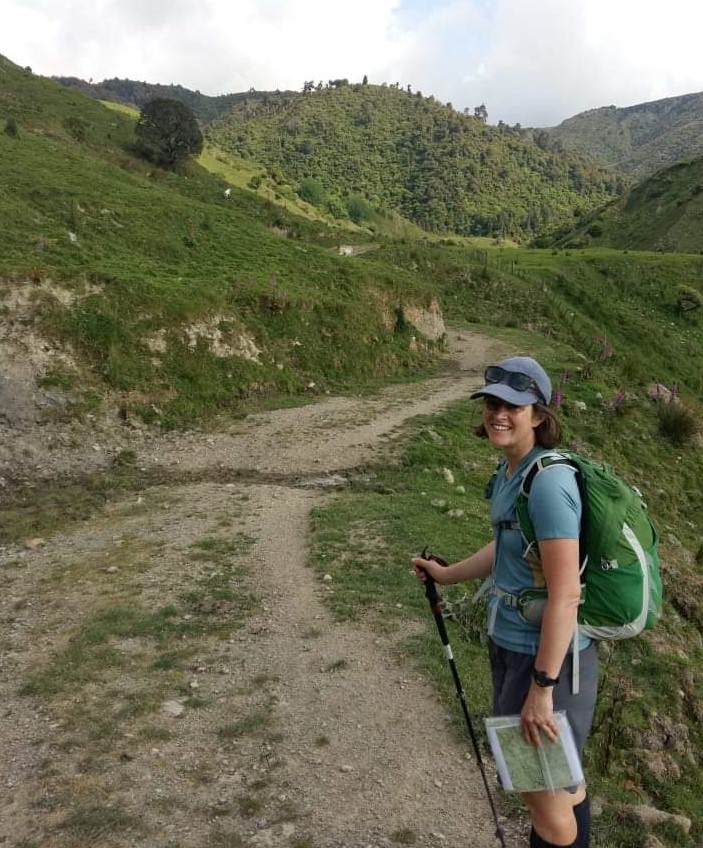
It took a little over 2 hours to get from Wellington to the end of Kopikopiko Road. We had a brief talk with the landower, who kindly gave us a few tips on the best route to start. About 30 minutes of walking through his paddocks, we reached 100 metres of elevation above the unnamed stream that flows west-east – towards the spur up to North Mangahao Bivvy. We carried on the remnants of a 4 wheel drive track now grassed over before it finally ran into the bush. We found old animal trails or ground trails (who knows?) that were reasonably easy to travel before hitting the stream junction at the base of the spur up to the bivvy – that took about 30 minutes.
We’d been using paper maps and phone GPS to check our route. When we got to the spur we set both a GPS and phone GPS app to record the track so we would have help to return. Emily set a compass bearing up the spur and we set off. Much of the time a clear ground trail was easy to follow but occasionally the spur would flatten our or undulate and animal trails would split off in every direction. Emily used a mix of the bearing and her nose for the best ground travel, and we carried on. About an hour or so later and we walked straight into the bivy. 2 hours total from car to bivvy at a comfortable pace.
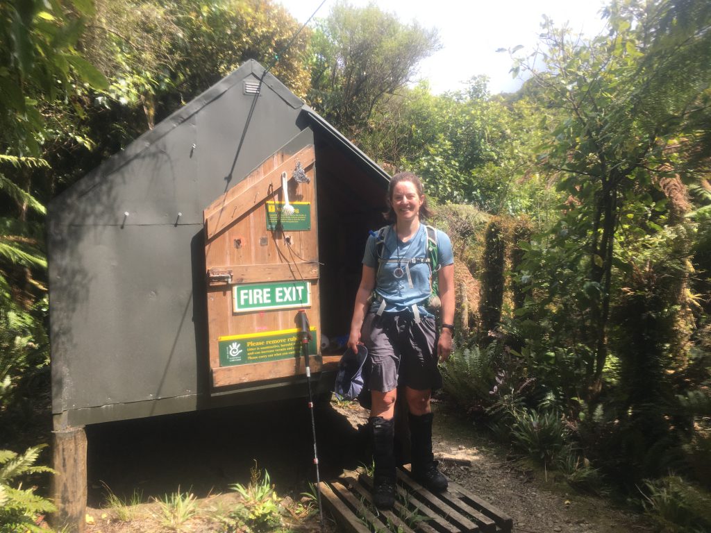
You could immediately see why it would be hard to find. It was painted a green colour that perfectly matched the vegetation. It was short (we couldn’t sit in it) and the vegetation was thick. Approaching it from any other angle and it would have been easy to walk within a few metres of it and not even see it. It’s handily situated about 1 minute from a trickle of a stream that is not marked on the map. Find the stream and you’ll likely find the bivvy.
We found a brand new hut intentions book and we were initially bummed that it appeared the old hut book had been removed. We were hoping to find previous trip reports to help us find Punga Hut. But a bit more digging unearthed an old school notepad in a plastic bag that had clearly been the previous hut book. We read through and it was just further confirmation of the 3 things we had gleaned from the compilation of trip reports found online:
- It would take 3-4 hours
- It would involve horrendous bush bashing
- No one had found a good route, but the least painful routes seemed to be between the 600 and 500 metre contour lines.
We took a short 15 minute break to snack and debate whether to carry on. We decided we would give it an hour and if it was terrible turn back.
North Mangahao Bivvy to Punga Hut
We followed the obvious ground trail which disappeared in 10 minutes and suddenly we bumped into tape, but Emily had remembered from a trip report, that Andrew had been led astray by tape in this area. In fact, several times, we remembered Andrew’s advice:
“I scramble up through the bush and come across some fresh pink ribbons. By now I’m a bit skeptical about the damn things and decide only to follow them if they match the compass.”
So we ignored the fresh tape. We set a bearing…only minutes later to slam into a wall of leatherwood that was chest and head height. We gave up the bearing and decided to use the GPS to mostly try to keep ourselves between the 500 and 600 contour line, and then set out picking the least painful route forward.
Amazingly, this mostly involved squatting down and walking like a duck under the bush, only occasionally having to stand upright and crash through.


It took only 15 minutes through the thickest brush and another 10-15 minutes through less thick (but loaded with bush lawyer) bush, before we came into taller trees and more open ground. We both agreed, it would have taken far longer and not been as easy to get through that scrub with either full overnight packs or if we were taller!
We had managed to hover around the 580 contour line most of the way. Emily took a bearing and I took the front with the GPS. I picked the least worst route forward and tried to keep the contour line, Emily used the compass to guide me on the bearing.
The terrain was fairly easy travel as off-track goes – tall trees and not much undergrowth. The area is obviously loaded with deer – as we saw endless signs, tracks and tons of animal trails – not to mention the group of 3 or 4 deer that Emily scared off earlier in the day.
We figured as long as the ground travel was good we would just motor on. We regularly stopped at obvious or confusing topographical features to reset bearings, check our location and confirm the route ahead.
But mostly, we just focused on hovering roughly around the 580 to 560 contour line. The next 20 minutes we headed directly West from the bivvy and crossed two streams and paused halfway to the next stream on what the map indicated was roughly a ‘spur’ or sorts that by all accounts would descend reasonably close to Punga Hut.
As we discussed the plan, Emily spotted some pink tape. Since it was going in the direction we were, we decided to follow it. At times it would disappear and we’d pick what seemed the most logical path on the ground only to find the tape.
It took only about 15 minutes to bump into the creek that we believed ran past Punga Hut and it was then that we realised I had assumed Punga hut was on the North side of the creek and through Emily’s reading she thought it was on the South side. We checked the downloaded maps from other trip reports and nothing was obvious.
We debated, and then remembered that everyone who had left Punga to the bivvy had reported that they initially started following tape. That meant it was likely the tape we had been following might just lead us to Punga hut. We backtracked to the last piece of pink tape, then spread out until Emily spotted the next piece and suddenly we were off on defined ground trail paralleling the stream and seconds later walked into Punga hut – it had taken 1 hour 45 minutes from North Mangahao Bivvy.
While we would not have described anything we walked as the super highway, we reckon the real reason it took us under 2 hours and most others reported 3 to 4 is how much easier and faster it is to travel with small lightweight daypacks and the fact that we didn’t dither with our navigation. We never bothered searching for a better route, an old cut track or tape. We occasionally came across old markers and tape, and just ignored them – heeding Andrew’s advice that unless the tape was going in the direction we were going, then the tape was useless. We committed to the direction and ground that would allow us to move, kept a solid pace and kept the navigation tools in-hand to verify – changing the tools as the navigational challenge changed.
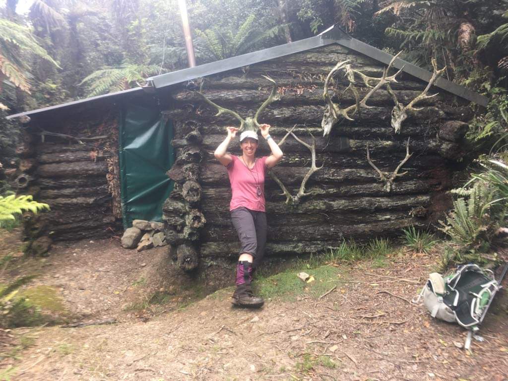
Clearly work has been done on Punga hut since the photos I had seen from just 2016 – it has all new cladding on the roof and even guttering, a good solid tarp to protect the door and even the chimney looks a little more stable. Overall, it looked in excellent condition, except the large amount of personal belongings that have been stashed there.
The notebooks said the hut, also known as Miro Valley Hut, had been built in 1958-59. Well into the 1970s the builders had always made sure it was clear they had first right to use the hut particularly during hunting season.
Another quick snack break, and we were ready to go. I was tempted to return by descending the stream that runs West to East past Punga Hut, but we only had half a day left, the change of an impassable drop on the stream was high, and we knew going back the way we came should only take 2 hours. We did find a second track marked with tape heading directly south and uphill from the hut, but again, we ignored it, opting for what we knew.
So, we followed the tape and track that had brought us here. This time we kept on with the tape markers up the ‘spur’ until it pushed us above 600 metres. We only took a split second to agree that it was best to just use the GPS and stick to our GPS track to return. We just did that and in 1.5 hours were minutes from dropping into North Mangahao Bivvy. We bumped into tape, again, and were relaxed enough to follow it…past the bivvy and wasted at least another 15 minutes making a full circle around the bivvy despite having the exact coordinates in our GPS, before arriving back at the bivvy. From there, it was an easy and quick 1 hour down the spur. From here we did opt to stay in the creek which was easy going until the paddock grass appeared. We climbed up back to the remnant 4-wheel drive track, and were back at our car, 9 hours later.
Our best advice if you want to repeat the trip:
- Call the DOC Masteron office to get details for permission to access the roadend, and call for permission at least a few days in advance. It’s a working farm so don’t expect year round access.
- Don’t bother following tape unless it’s going where your compass says you should go. The many bits of tape we ran into could be from any hunter, an old route that’s long overgrown or a wishful tramper thinking they found the best route.
- There is no best route. Don’t waste time looking for it. Stay just below 600 metres until you hit the spur.
Have fun!
Well done! Good well-planned tramp and well told.