
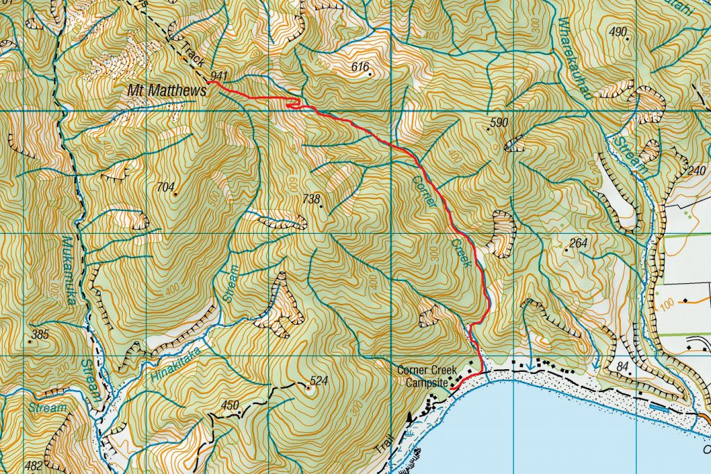
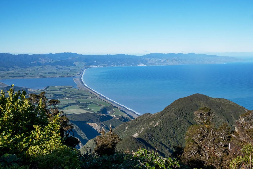
Mt Matthews from Corner Creek – Remutaka Forest Park
A 2 day hiking loop trip through some adventurous terrain on the eastern side of the Remutaka Range passing over the summit of Mt Matthews
With Covid-19 still limiting the club to day trips, and some of us desperate to sleep in a tent again, Tony provided the answer with an overnight camping trip to Corner Creek Campsite on the South Coast at Palliser Bay.
The Catchpool carpark was rather busy at 8.30 am on the Saturday. Not only were we heading out to make the most of a good weekend, but fellow club member Maarten was leading a very full day trip up to South Saddle and back again. All these chatterboxes descending on the Five Mile Track must have given the locals a fright!
I was using this trip to get familiar with a feature on my GPS. If you mark a point on your GPS (such as Corner Creek Campsite) and select the ‘navigate to’ function, the Trip Computer will tell you your ‘ETA’. This feature is useful if you need to know how fast to go to get to your destination by a certain time. However, its accuracy depends on the track being reasonably straight, level and uniform. It is not so useful when you have lots of zigzags ahead of you, and a giant Mt Matthews in the way! Even so, it was fun to check in with Mr Garmin every now and then to see what (highly optimistic) time he was giving us for our arrival!
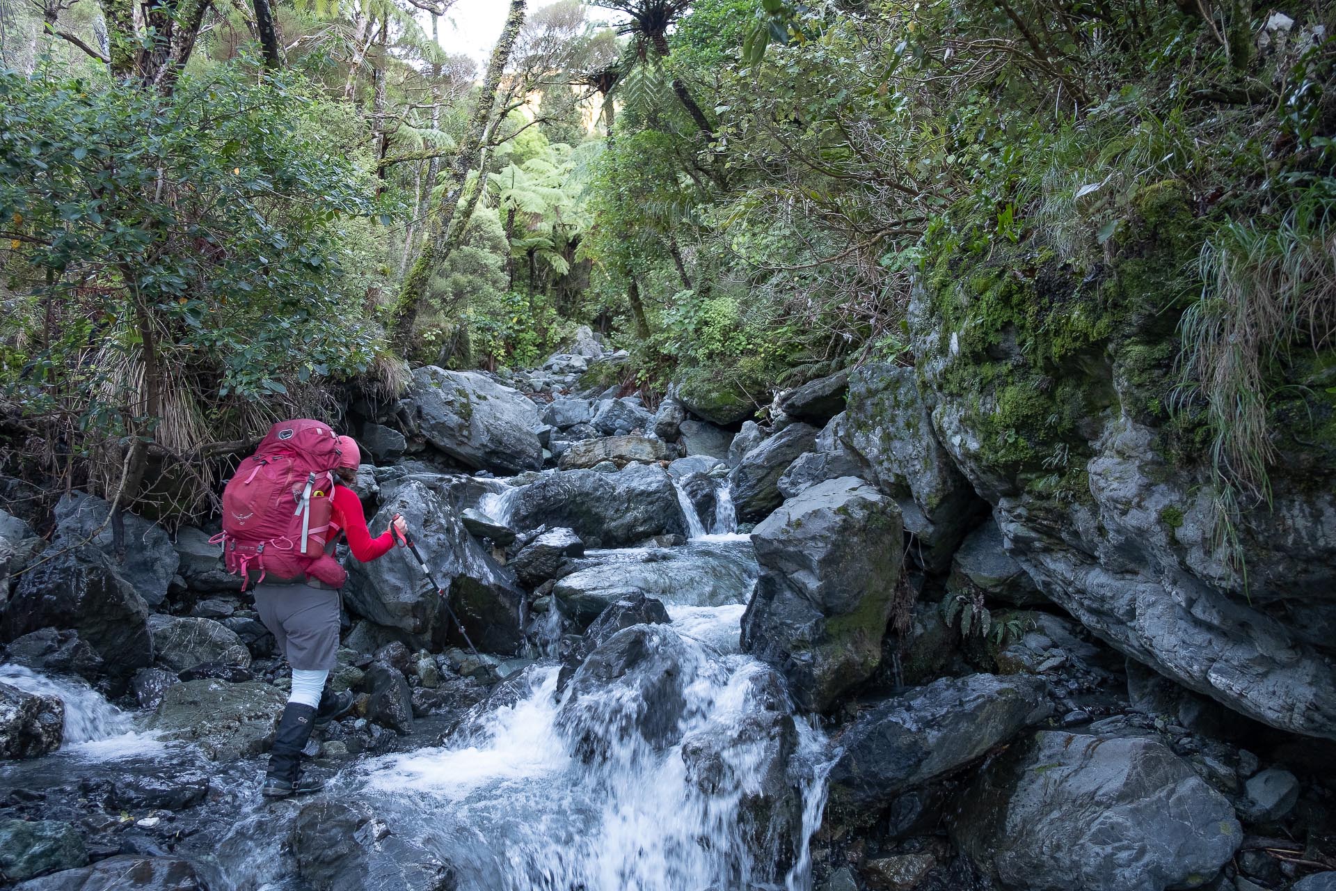
We meandered along the Five Mile Track, up the Orongorongo River to the start of the Mount Matthews Track. Here we had morning tea, before a climb up to the turn-off to South Saddle. On reaching South Saddle we found our day-tripping friends, hiding among the tussock and having their snack. Seating was limited, so we carried on a kilometre or so down the Mukamuka Stream to a wind-sheltered spot for lunch. This was my second time down the Mukamuka Stream. I mused on how my perspective has changed with more tramping. Whereas once upon a time I thought this was a super-challenging off-track scramble, I now see it as an easy and well-marked route!

The stream widens quite quickly as you descend, and before we knew it, we were on a very wide open gravel bed where we could fan out and pick our own routes. It was along here that we met fellow club member and world-famous James Johnston doing an extra long day trip up Mt Matthews and down the South Ridge. I am very grateful to James who, earlier in the year, found my lost spork on the Dragons Teeth.
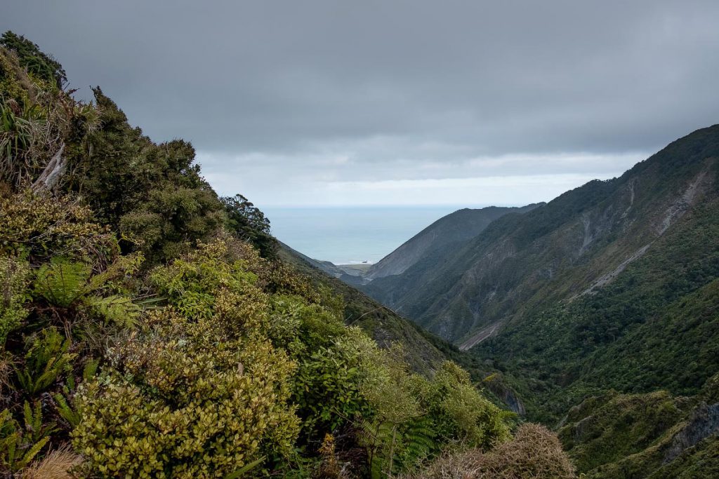
Another snack just before the coast road kept us going for the last stretch where we ran into more fellow club members, Amanda and Kate, out for a bike ride on the Remutaka Cycle Trail. WTMC sure is an active lot! Now that we were heading in a straight line toward Corner Creek, Mr Garmin’s accuracy improved, and he was only a minute out from a real arrival time of 4.15 pm.
Although we were pleased to be at our destination, we were sad to see that Corner Creek Campsite had a lot of rubbish left in some areas – a likely consequence of it being accessible by 4WD. We picked what we thought was the best campsite for a fire, and the preparations began!
Our goal for the evening was to recreate a culinary masterpiece, whipped up by Megan S and Tony G less than a year before. Tony was the fire engineer, and his job was to make a huge bonfire. He tried to help me identify dead manuka (the best wood for burning) but unfortunately I’m not a very strong or practical person, so I focused my attentions on the dinner.
Illona and I had pre-prepared two different types of oxymoronic vegetarian sweedish-chef meatballs, and each person had brought their own veggies. We added a spoonful of pasta sauce, a cabbage leaf, and copious amounts of tinfoil and created, in Ian’s words, the best meal ever had tramping (Whoooarrr!!!)

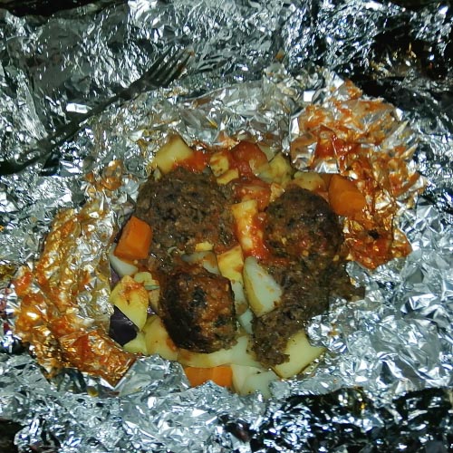
We had lots of fun talking about how long we should leave them on the glowing coals, when to turn them over, and when to shuffle them around. In the end Megan, who had very cleverly prepared a ‘tester’ packet, determined when the time was right to eat. After dinner we roasted marshmallows, and then crawled into our tents (or in Tony and Illona’s case, simply lay down under the stars!) for a good sleep.
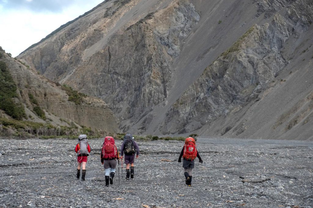
The next morning we were walking by 8 am. Very shortly after Corner Creek Campsite is the entrance to Corner Creek. Much like the Mukamuka, it starts off as a wide gravel bed, but very quickly slims down to ‘creek size’. We found the travel reasonably easy-going, and made good progress up the stream.
The next part of the story is a lesson for us all…Tony was leading the way based on his memory of his trip with Megan. He selected what he thought was the correct sidestream on the true right of Corner Creek to take us up to a saddle to the north-east of Mt Matthews summit. However, this was not the sidestream we intended to go up. It was in fact an earlier sidestream that was not marked on the map!
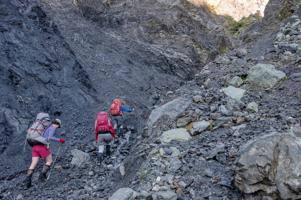
We soon encountered an impassable rocky section that forced us back down the stream and then onto a scrubby bush section on the true left of the sidestream. We pushed on up, with all others doing a valiant job of finding a way through very tight steep bush and occasional open scree. I took my customary place at the back, or near back, dragging my feet!

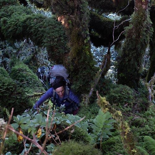
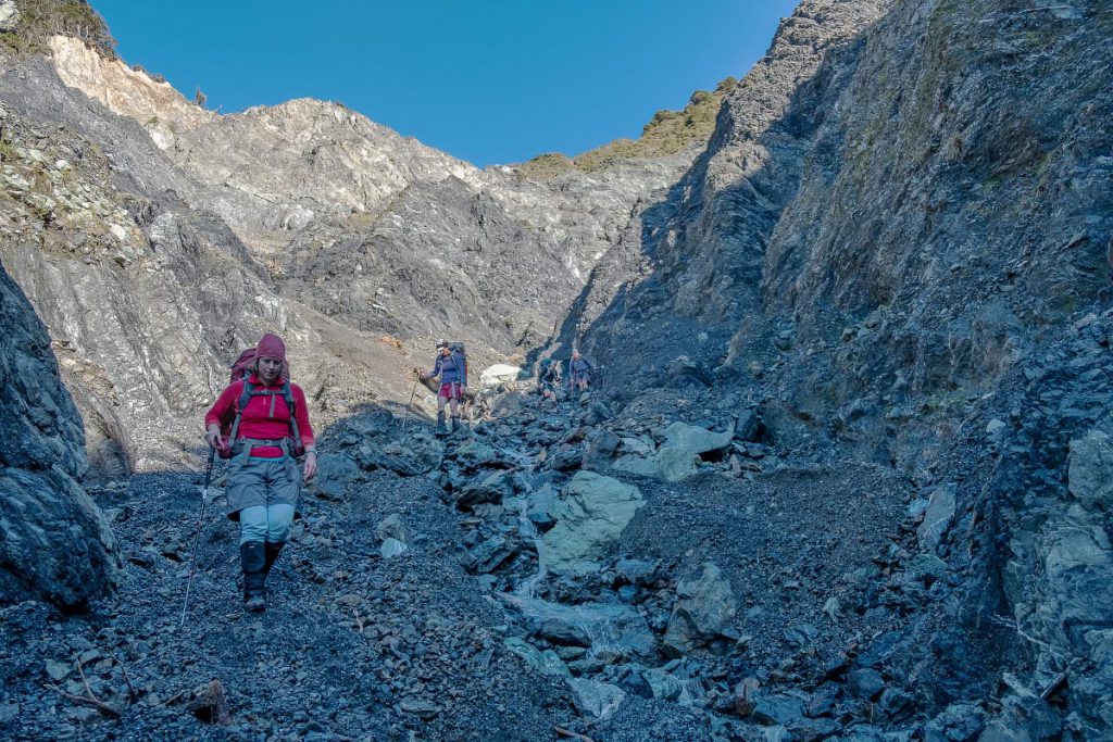
Not far off the point on the map where the map grid lines crossed, we stopped to check our position, and were all VERY surprised to find we were not where we thought we were! At this point, we were close enough to the summit that it made more sense just to continue on up (again through very steep and dense bush). We popped out onto a small trapping line (which I believe leads to North Saddle) just before the summit. I was very relieved to plonk myself down for a late lunch on the summit at 2 pm!
It wasn’t until later that night by email that we realized what had happened to create our confusion. I took from it that, when you are in a group, it is never just one person’s job to do the navigating, no matter how good they are at it (I at least had mentally checked out from the navigating…!) It is also good to stop at those natural decision-making points (such as sidestreams) to check your intended route. There was lots of ways I could have used my GPS to help – even just looking at the map to see we were not at a marked sidestream, or getting coordinates to plot on the paper map (you might well ask what I was doing with the GPS – I was of course busy laughing at the ETA’s Mr Garmin was giving us). Lots of good things to practice on the next navigation trip!
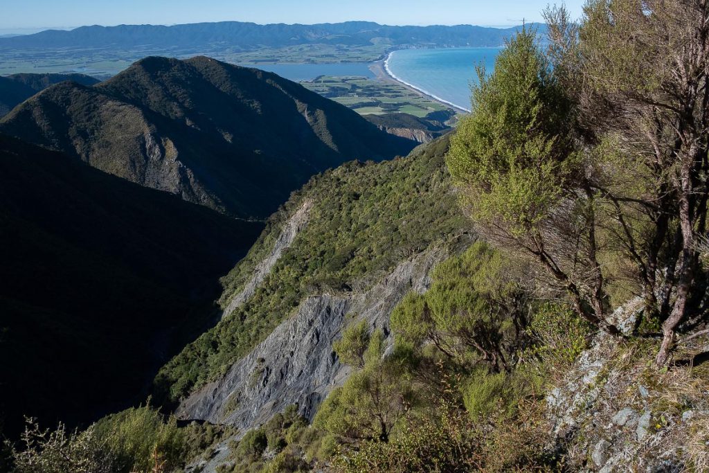
Our trip down Mt Matthews, back along the river and along Five Mile Track was pleasant and uneventful by comparison. We ended up at the carpark at the reasonable time of 7 pm. I was very satisfied with my first overnight outing after lockdown, and cannot wait for the next one!