
My hopes to complete a circuit in the Kawekas over King’s Birthday weekend were compromised by the ongoing impacts of Cyclone Gabrielle. Without being able to confirm road access or track conditions, we were onto plan B: a delightful off-track adventure in a remote part of Whanganui National Park. However, with heavy rain in the forecast the week before the trip, a sketchy river crossing and wet bush bash didn’t seem a good idea.
That’s how we scaled back to a day trip in the Tararuas – not quite as ‘spicy’, but it would still mean getting out and doing a bit of exploring off the well known tracks before the weather turned.
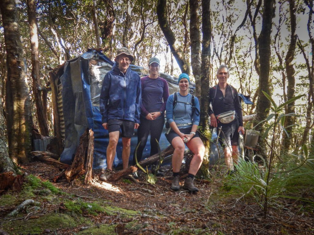
Pā Punanga and Carrington Ridge
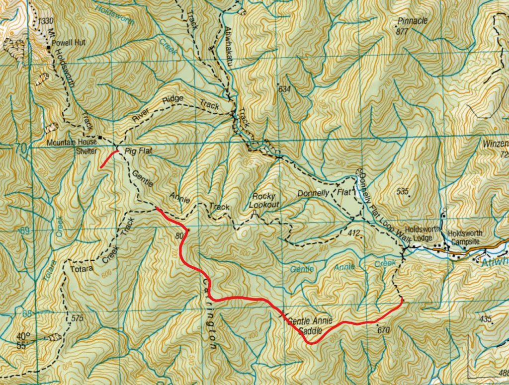
We arrived at the Holdsworth road end a bit after 9am. After crossing the first bridge, we followed the DOC sign to Pā Pununga, where we followed a marked track that quickly headed straight up the spur. It wasn’t long before we came across a sign indicating the area used to be where tangata whenua would hide from other iwi during intertribal warfare. A bit of additional research revealed that the Pā was established by Ngāti Kahungungu fugitives, with other local iwi also using the site as a refuge prior to 1840.
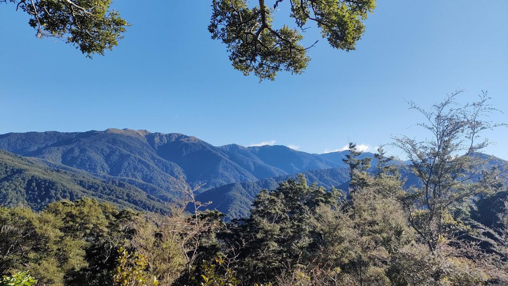
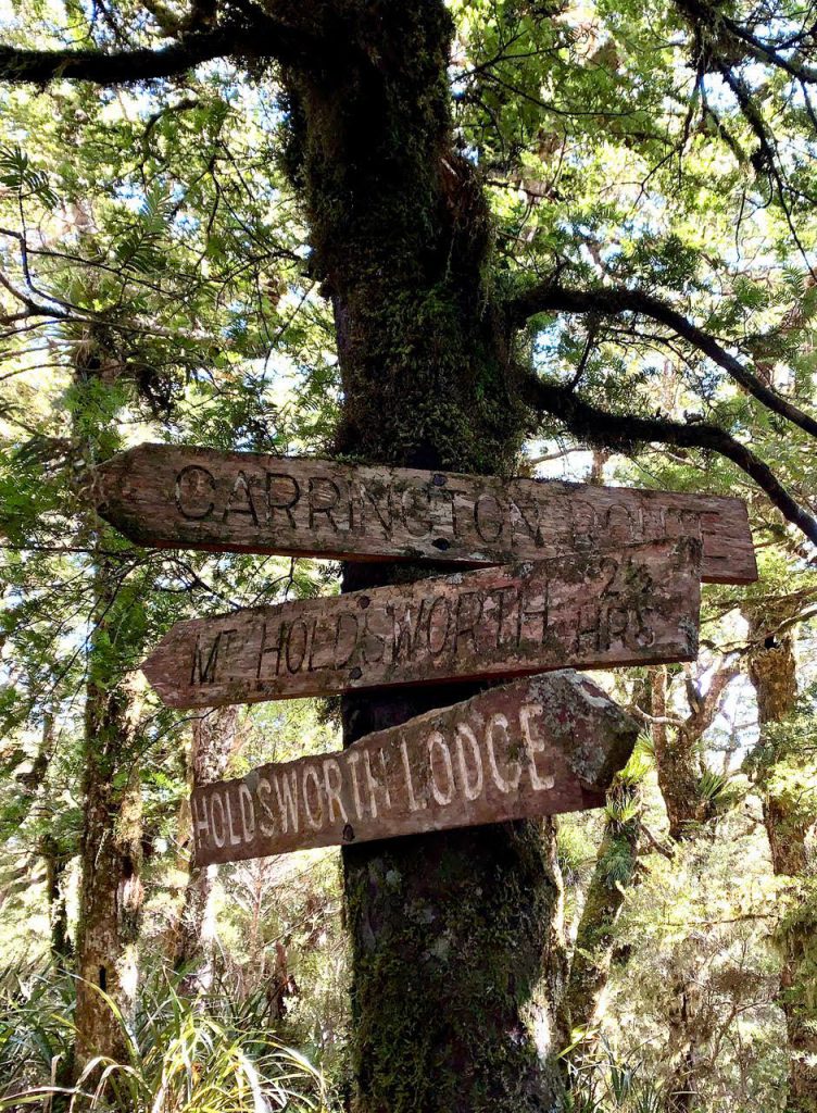
Once at the top of the spur, we had great views of the range and the Wairarapa, and easily spotted Powell Hut and Jumbo Hut on the horizon. We headed along an unmarked track following the spur to pt 670 on the topo map, after which we came across an unmarked intersection. Orange tape seemed to indicate a right turn, which was confirmed by taking a bearing and Paul doing a bit of exploring to confirm the overall direction of the track. We continued to follow the track to reach Gentle Annie Saddle and to join up with Carrington Ridge. At pt 801 we came across a junction and followed the old sign towards Mt Holdsworth.
Overall the unmarked track was in excellent condition and easy to follow, a nice alternative to the Gentle Annie Track.
Finding Pig Flat Hut
After setting foot on the Gentle Annie Track, we quickly made our way along the benched track. From there, we looked for a way off-track to Pig Flat hut. The bush is fairly dense, but we found a way through, between Pig Flat and the junction with the River Ridge Track.
We set a bearing and travelled down hill, with a bit of scrambling, but not too much difficulty, and quickly found the hut, with the hut book indicating many visitors from WTMC!
We took a slightly different way back to the track and encountered very thick bush towards the top, but not thick enough to stop us.
After a sunny lunch break at Pig Flat, where Paul offered us homemade muffins and revealed it was his birthday, we pondered our options – a stroll back to the road end? or a longer trip out to Atiwhakatu Hut and across Pinnacle Ridge?
We headed down River Ridge Track, and once at the bottom, quickly made the decision to skip Pinnacle Ridge and a potential scramble in the dark later. Instead, we headed back to the road end, where we reached the car at about 3pm.
Remutaka Trig
To fill in some more time, Tony S suggested we do the side trip to the Remutaka Trig on the way home – and what an excellent suggestion! The rest of us had driven passed many times, but never took the time to check out the trig.
The track is in excellent condition and zig zags up the hill, gaining about 200m elevation.

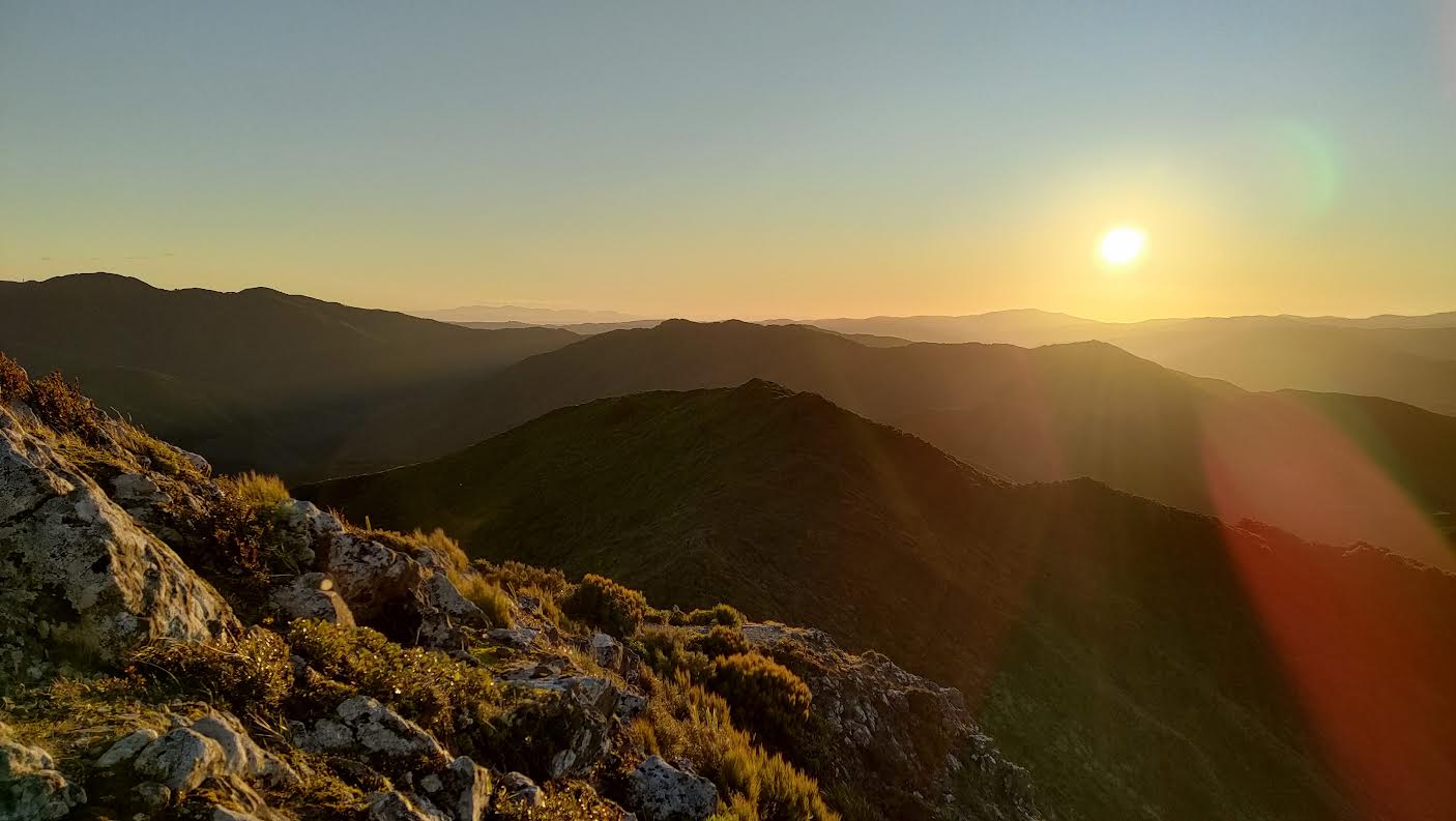
The views from the top – in the evening light – were simply stunning. We could see the Wairarapa, across the Remutakas and all the way out to the South Island, and into the Tararuas (Marchant Ridge and Quoin Ridge). A great way to end the day, and only a 40 min return walk from the carpark.
Times with breaks:
– Road end along unmarked track back and to Gentle Annie Track: 2h 30min
– To Pig Flat (on-track): 40 min
– Return off-track trip to Pig Flat Hut: 50min
– Lunch: 40min
– River Ridge Track down to river and back to road end: 1h 20min