

As is the tradition, we met at Wellington train station at 5pm, for a 5.15pm departure to Egmont National Park. We arrived at the Camphouse, our accommodation for the night, which is situated close to the Egmont National Park Visitor Centre (North Egmont)/ DOC office, at around 10.30pm. The Camphouse is located right beside the start of the track – if like us, you plan to do the Circuit in a clockwise direction.
Day 1
Timings – Saturday:
Left the Camphouse 9.05am
Bell Falls return walk 12.50pm – 2.05pm
Holly Hut to Pouakai Hut 2.30pm – 4.30pm
Total: 7.5 hours (incl breaks)
We woke up to a beautiful, sunny day and could see the magnificent Mt Taranaki (2518m) clearly, towering above the Camphouse as soon as we walked outside and turned around. It was also interesting to read the plaque on the Camphouse exterior which said the building was once used as barracks in the 1850s to house troops who provided protection when Maori tribes were at war.
We began walking at 9.05am – you start by going straight uphill, on the lower northern slopes of Mt Taranaki, through bush, and then you come out to a clearing with Mt Taranaki right in front of you. We stopped for a few snaps as the mountain’s perfect conical shape is so impressive! We continued on uphill – going up “the Razorback” (as it’s named on the map) and then the trail veers to the right and becomes Holly Hut Track.
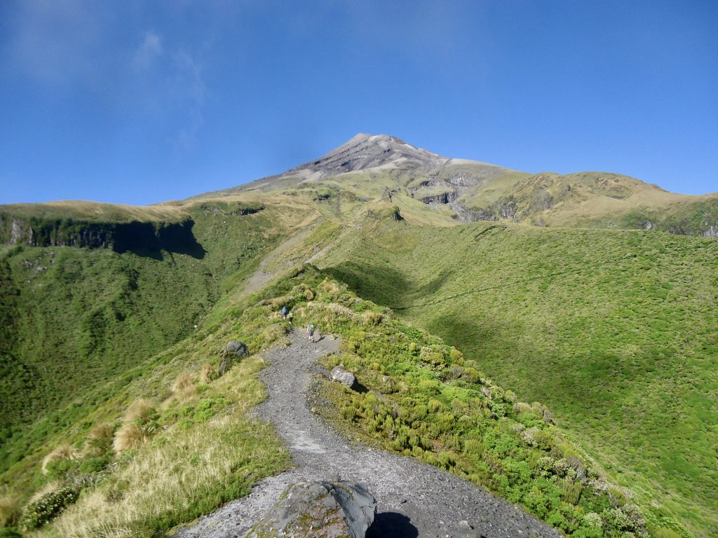
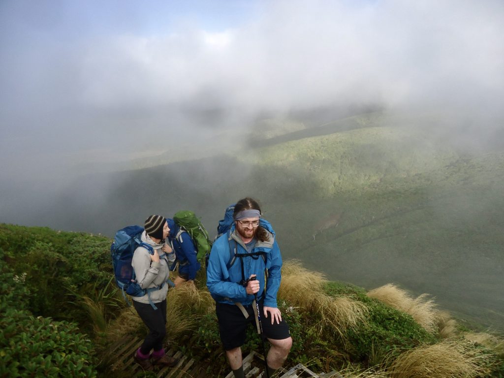
The views are just stunning – the Dieffenbach Cliffs above us on the left, reminded me a bit of Panekire Bluff at Lake Waikaremoana. They are large lava columns and are named after German explorer, Ernst Dieffenbach, who organised one of the first European climbs to the summit of Mt Taranaki, in 1839. There was dampness and mist just above us on this section of the track, which created a lovely atmosphere. And below us, there was green hillside and valleys.

You continue walking round the mountain and cross Boomerang Slip (named for its shape) – which felt like crossing a slip made of light gravel. Luckily the gravel was quite firm underfoot, so you didn’t feel like you were in danger of sliding down the hillside.
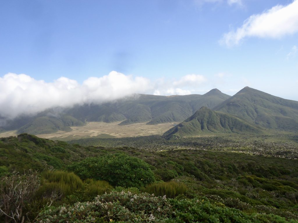
A bit further on we looked down the valley and saw a waterfall in the distance. As we continued along the track we spotted a large flat clearing in the distance (Ahukawakawa Swamp) and two mountains that looked a bit like pyramids – one of which was Henry Peak (1224m), which we would be climbing up and over on day 2.
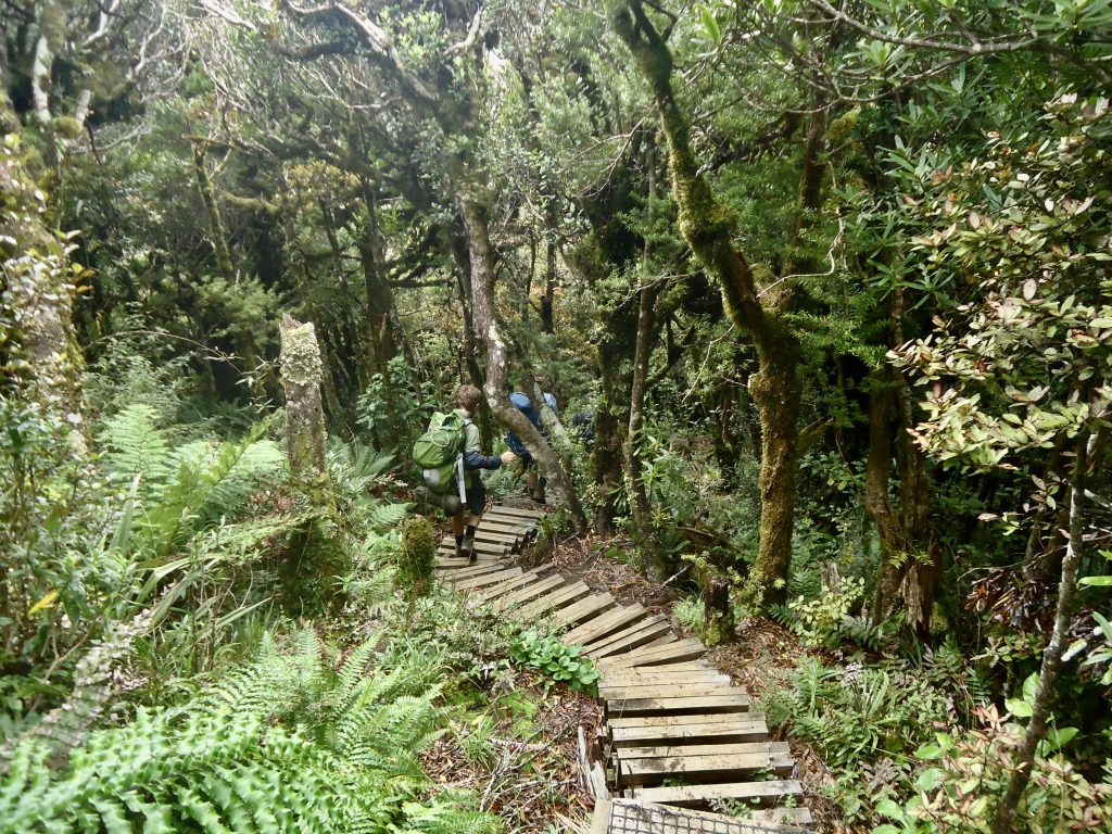
Along the track in this part there were a couple of interesting information boards which point out some nearby volcanic features and details about alpine plants growing in the area. And a bit further on there was a long, long section of boardwalk (covered in plastic mesh to help prevent you from slipping in bad weather) which led us closer towards Holly Hut. You then come to a junction on the track – you can turn left and walk a further 5 mins to get to Holly Hut or turn to the right to continue onwards on the Pouakai Circuit towards Ahukawakawa Swamp and the Pouakai Range.
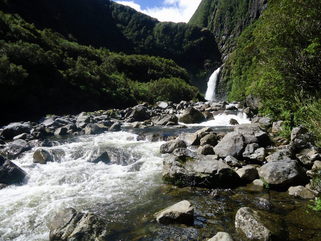
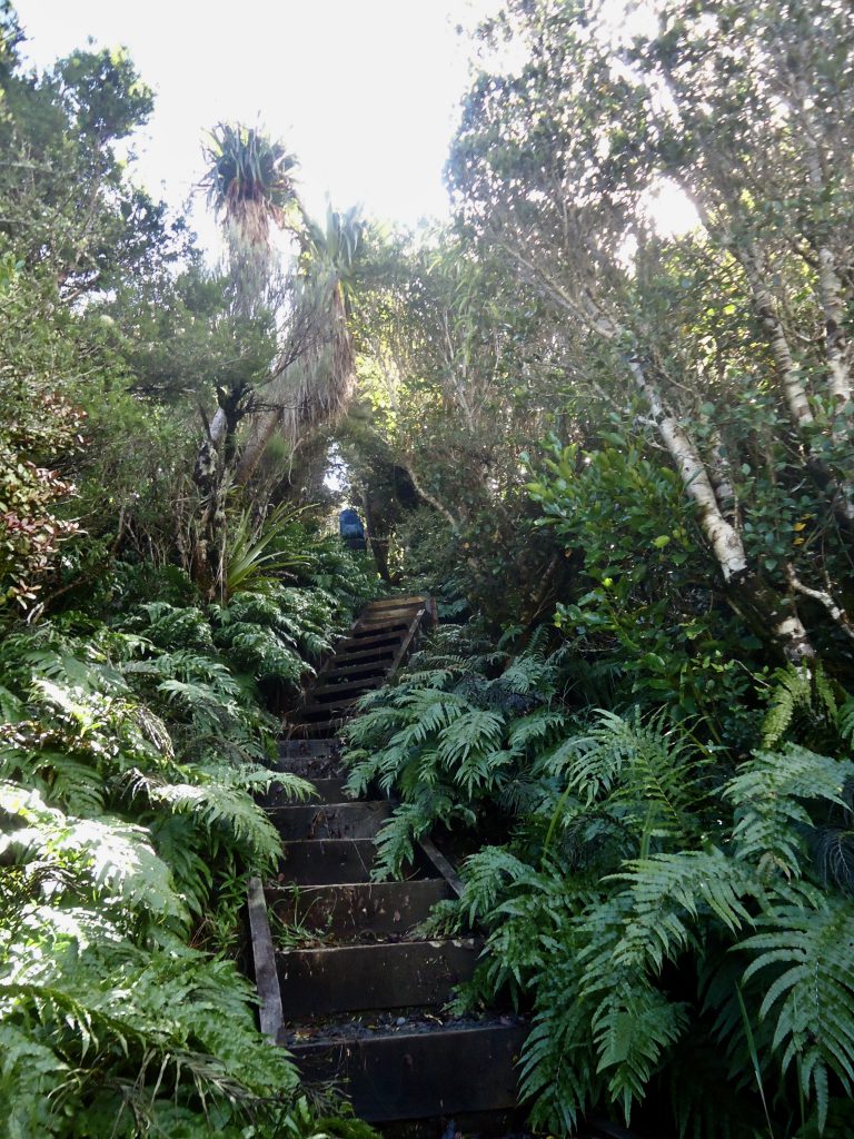
We headed left towards Holly Hut. There is an unbridged stream to cross just minutes before you reach the Hut. We had lunch at the hut and while James and Amanda decided to stay and have a rest in the sun, the rest of us decided to head down to Bell Falls. You follow a track from Holly Hut that sidles round the Dome (1052m) and then drops steeply for quite some way (a lot of deep steps) to reach a river. There are large rocks on the side of the river where you can stand or sit on to view Bell Falls. The Falls were clearly visible, but were a wee distance away, further up the river. There had been a lot of rain in the area the day before so the track down to the Falls was very muddy and boggy, and the Falls were very powerful – containing a lot of water.
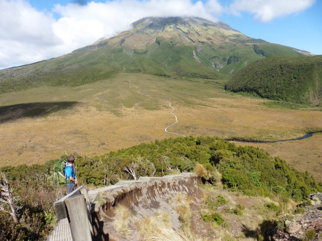
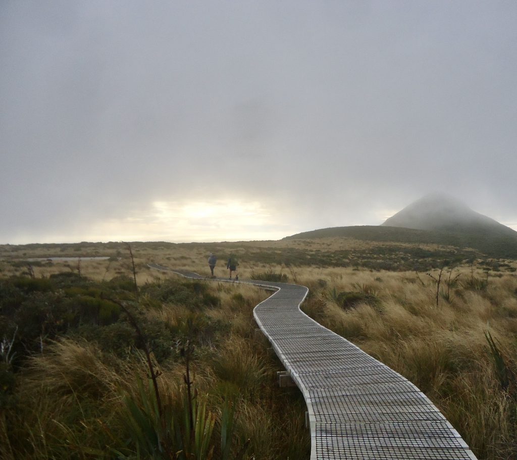
Once we got back to Holly Hut we all headed back onto the main Circuit Track, following Ahukawakawa Track. Very soon we were walking on a very long section of boardwalk which crosses the Swamp and takes you to the foot of the Pouakai Range.
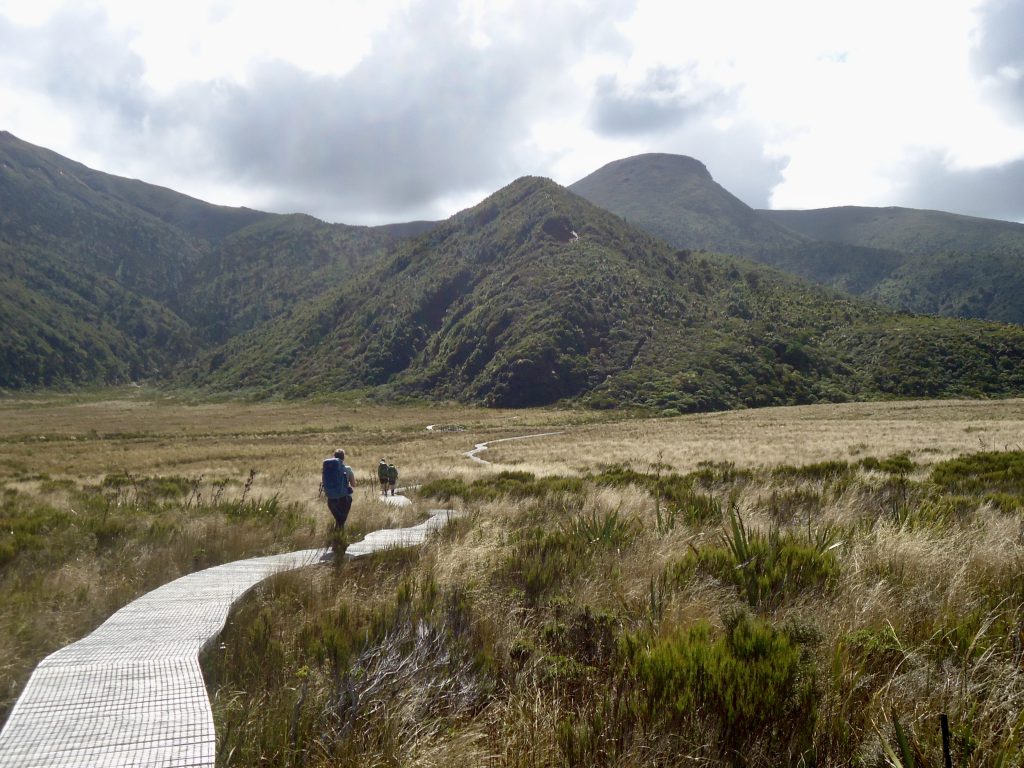
Part way along the boardwalk there is a viewing platform. A river called Stony River weaves through the Swamp and you cross it via a small bridge. Once you reach the foot of the Pouakai Range there are A LOT of steps and uphill to traverse.
In my view this was the gruntiest and hardest part of the whole Circuit. However, once you gain height here it was awesome to look back and see Mt Taranaki, Holly Hut in the distance and the long stretch of boardwalk we had just crossed – which now looked so far away.
Once the track levels off you begin to veer round to the right. We came across a couple of nice German girls on the track here and stopped to have a chat. They said they had climbed Mt Taranaki in the last couple of days and it had taken them 6 hours to do so from the Egmont National Park Visitor Centre (North Egmont).
The track then sidles round the left of “the Hump” (1292m) and then sooner than i’d expected we came to a flat plateau with a sign indicating Pouakai Hut was just 5 mins walk away downhill on the left. The bush in the area as you walk down to Pouakai Hut is very pretty. And once you reach the hut you can see New Plymouth and the coastline below – which you can enjoy viewing from the big deck at the front of the hut.
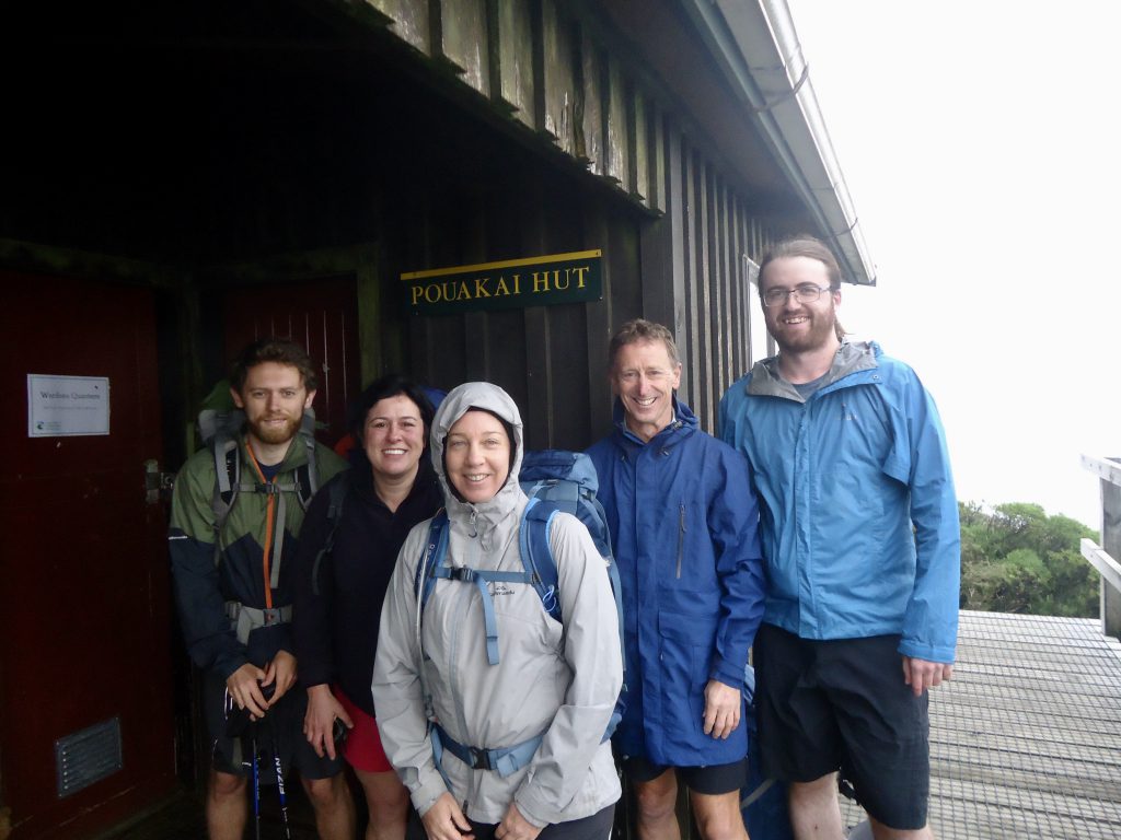
It was busy and full at the hut on this night. Some really nice people and everyone chatted amongst each other while Amanda and i started cooking our group’s dinner. When we were part way through, someone also staying at the hut came in and told everyone that Mt Taranaki was now visible and there was a clear reflection of it in Pouakai Tarn. Most people stopped what they were doing and rushed down to the tarn with their cameras (about a 15 min walk from the hut).
I was reluctant to do so – as i figured we would be passing by the tarn on our walk the next day anyway, but am so glad i did! As it turned out, the next morning when we passed the tarn, the fog was low, and we couldn’t see Mt Taranaki at all and there were waves on the tarn. So make sure you go and see the reflections while you’re up there as soon as you have a chance!
Pouakai tarn is much smaller than it looks in the photos – it’s more like a pond. There was a lovely vibe at the far side of the tarn that evening with lots of people gathered with their cameras taking shots of the breathtaking view of Mt Taranaki reflected in the still water of the tarn. It was a great way to spend a Saturday night! And as the sun went down and the small amount of cloud in front of Mt Taranaki turned into different shapes while we were there, we were able to get many different types of shots of this spectacular view.
Day 2
Timings – Sunday:
Left Pouakai Hut 8.25am – arrived Visitor Centre 2.30 pm (6 hrs incl breaks)
The next morning we left the hut at 8.25am to complete the circuit back to the Visitor Centre. As mentioned, the cloud and light was low and when we crossed the boardwalk past the tarn, the area looked quite eerie and completely different from the previous night.
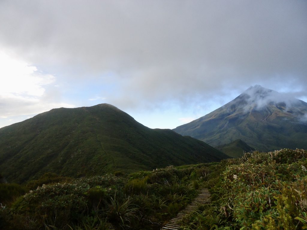
We were heading towards Henry Peak – and soon, as we looked to the left, we saw the distinct peaks of Mt Ngauruhoe and Mt Ruapehu shrouded in cloud in the distance.
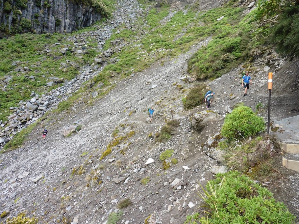
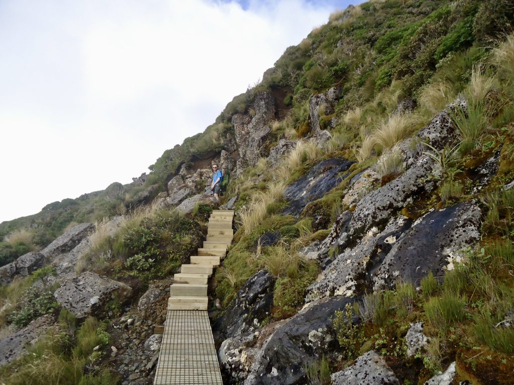
We then had the challenge of climbing up and over Henry Peak – there were steps the whole way up as well as a number of ladders to climb before you reach the top at 1224m, where there is a viewing platform. But due to all the cloud we couldn’t see Mt Taranaki at all.
We then ventured down the other side and caught glimpses of several tarns and the swamp on our right, and also Mt Taranaki, as the cloud became less dense with our descent.
There were then many, many steps taking us downhill steeply into a forest. It was actually quite hard going on one’s knees.
Eventually the track evened out, turning into a dirt track, and we found ourselves walking beside a river. We stopped at Kaiauai shelter for a 10 minute break. Straight after the shelter there is an aluminium ladder you need to descend to continue on the track (which i recommend going down backwards).
The track the whole way back to the visitor centre from here was under trees. There are a few swingbridges to cross and a few steep and muddy sections to climb. But the hardest part of the day had been climbing up Henry Peak.
It is possible to exit the circuit track at Kaiauai carpark – and you can then walk on the sealed road back to the visitor centre, saving you about 20 minutes. However, we didn’t want to feel like we were ‘cheating’! and wanted to complete the whole track. So we carried on, onto Ram Track, which is the final leg of the Circuit. At the end it felt awesome to complete the loop! I highly recommend this tramp for its stunning and varied landscape and features.
For a Pouakai Circuit day walk at night go to Pouakai Circuit day walk