
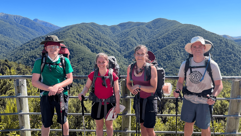
Our group of four decided to take advantage of the long Wellington Anniversary weekend to get up onto the Main Range of the Tararuas. Starting (and finishing) at Holdsworth carpark, we’d gain the Main Range via Powell Hut, Mid Waiohine Hut and finally a climb up onto Aokaparangi, before traversing the Main Range to Maungahuka Hut, heading down to Neill Forks Hut, and out via Totara Flats Hut – a loop with approximately 4,000m of climbing.
We were also scheduled to link up with James and Tereza’s Fit expedition to various aircraft wrecks at the end of the trip to share transport back to Wellington.
Day one – 22 January 2022
Holdsworth car park to Powell Hut – 8km, 792m ascent, 4hrs 15 mins elapsed time
A 7.45am departure from the Wellington railway station saw us start tramping at 9.15am. It was a hot morning but we made strong time up to Mountain Shelter. Unfortunately, Daniel started to have stomach problems (very embarrassing given it was his first time as a trip leader!), which made the climb up the steps to Powell Hut excruciatingly slow. The original plan was to continue onto Mid Waiohine Hut for that night, however the call was made to rest at Powell Hut and hope that Daniel was feeling better by the next morning.
We took advantage of the unexpectedly short day and spent the afternoon relaxing, chatting, and taking advantage of having mobile reception on the hut deck while enjoying views out over the Wairarapa. After a couple of hours, we (slowly) made our way up to the Mt Holdsworth trig and made the most of very calm weather, looking out to the Main Range and where we hoped we would be tomorrow, before heading back to a very full Powell Hut. Over dinner we had a very fascinating chat with a woman who was taking a short break from sailing and who regaled us with stories from all around the world.
Day two – 23 January 2022
Powell Hut to Maungahuka Hut – 16.7km, 1,681m ascent, 11 hrs elapsed time
We headed off at 7.15am. It was a clear morning but the wind had picked up, making us all pleased that we had decided to head up to the trig the previous day. The descent down from Mt Holdsworth and up over Isabelle went by quite quickly, and we enjoyed the relatively gentle descent through alpine tussock before we hit the bush line and the track got steeper. We made it to Mid Waiohine Hut around 10am, had a quick morning tea break and carried on. The day was heating up, so it was good to cross a few streams and get a chance to splash our face or dunk our hat in the water to keep us cool.
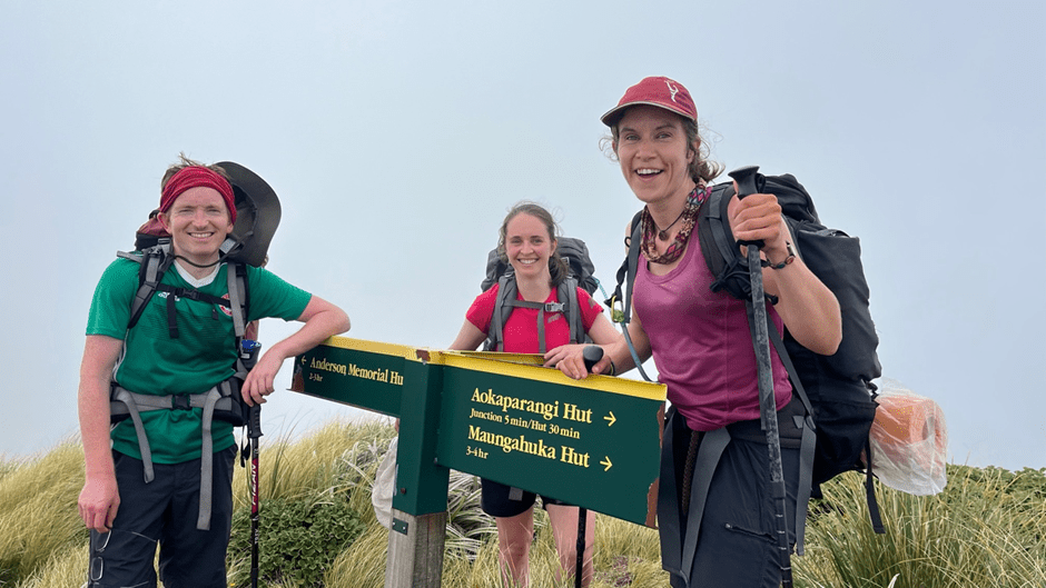
We took a relatively slow and steady approach to the 800m ascent up to Aokaparangi, taking regular breaks to ensure we remained fresh for the Main Range where we would be more exposed. Reaching the summit, we headed left along the Range and decided at the junction to leave our packs and drop down about 200m to Aokaparangi Hut and refill our bottles. We also decided, with this side trip, that it would be best to stay at Maungahuka Hut that night (the original plan had been to stay at Neill Forks Hut the second night).
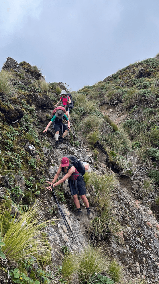
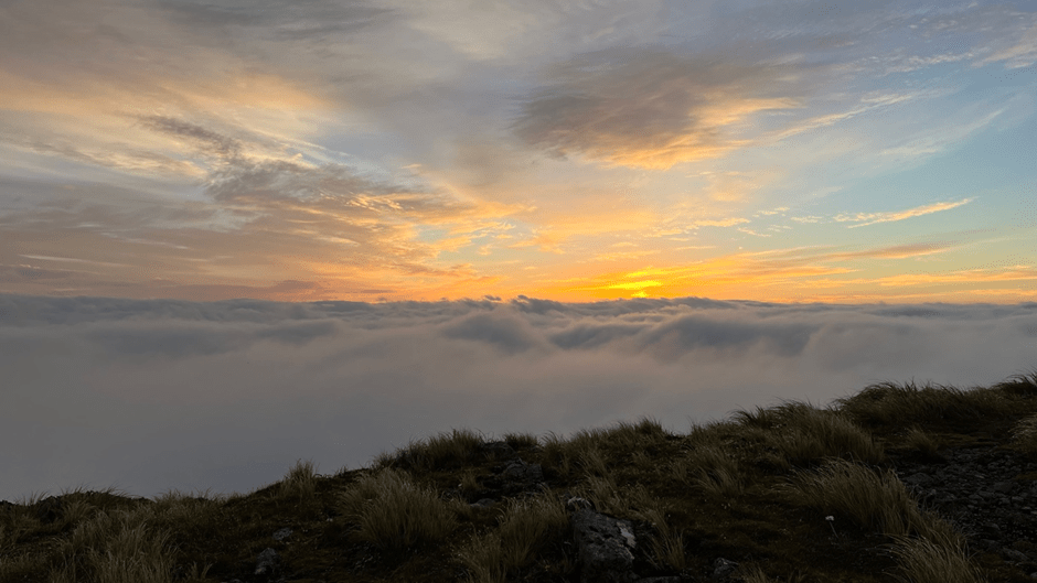
The terrain along the Main Range was definitely more technical and involved some scrambling on narrow ledges, but the views were incredible, the wind was low and we had some cloud cover to keep the heat down – perfect weather! Maungahuka looked a very long distance away, but we kept our pace up heading over Wright and Simpson. We took a short break before the final 200m climb up to Maungahuka Hut and Daniel, noticing he had two bars of (5G!) coverage, browsed the news to learn that the whole country was going into the Red traffic light setting at midnight.
By the time we reached Maungahuka Hut the fog had descended. We dropped our packs and relaxed for 30 minutes before some of us decided to go exploring and find the mythical ladder. The terrain became more technical and we were losing daylight, so we decided to turn back early and go enjoy our dinner. We didn’t get much of a sunset due to the fog but we did have the hut all to ourselves.
Day three – 24 January 2022
Maungahuka Hut to Holdsworth car park – 24.6km, 1,242m ascent, 12.5 hrs elapsed time
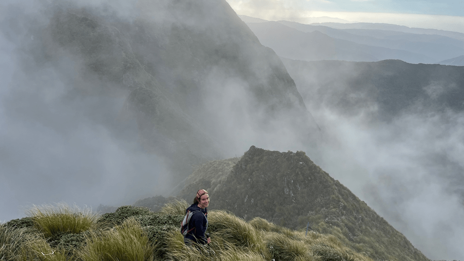
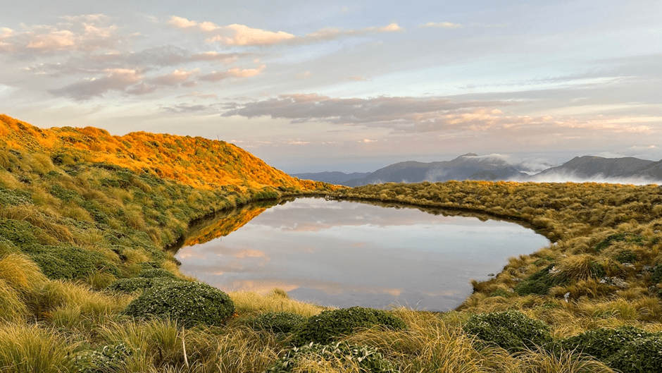
We were treated to a glorious sun rise. Looking north from the hut the Main Range and alpine tussock were bathed in golden light, and we could see the entire route we had walked the previous day.

We knew that we were scheduled to meet up with the Fit group at 4pm, and that this would be a tall ask given we hadn’t stayed the second night at Neill Forks Hut. DOC estimated the descent down to Neill Forks Hut would take two hours, so were hopeful that with a fast pace we’d only be leaving James and Tereza waiting for an hour or so.
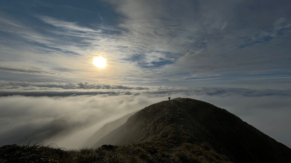
The descent ended up taking 3.5 hours. Admittedly, we did spend a fair bit of time marvelling at the views as we descended into the clouds and, getting back into the bush, we ended up off track and spent about 15 minutes re finding the orange markers. It had rained lightly overnight so every root and leaf seemed like a slip hazard as we descended, and kept descending, 1,000m all the way down to Neill Forks Hut, where we arrived at 10.30am. We all agreed that we were quite glad we decided not to push on to Neill Forks Hut the previous night.
The climb up to Cone Ridge was incredibly humid, and we were quite glad to gain the junction. Walking along the ridge was quite pleasant, with relatively flat terrain and it was much easier to navigate (with less tree fall) than had been anticipated. A steep descent brought us to Totara Flats Hut, where we had a quick break before the final climb up to the Gentle Annie Track. After the Main Range the terrain was very easy underfoot, but we were all pleased to see the junction, complete the loop and know that all of the climbing was done. All that remained was a quick walk back down the track to the car park. Getting to the van at 7.30pm (3.5 hours after our intended time), we saw a note from James and Tereza saying that they’d decided to hitch hike back to Wellington (sorry guys!).
All in all, it was a great weekend with a fantastic group and excellent weather. We adapted our trip plan as circumstances changed and were grateful that we were still able to complete the loop. The route has everything – big climbs and descents, technical tops travel, stunning views and takes in some of the most iconic huts in the Tararuas. It is definitely one of the best trips in the park.
According to Garmin – totals (including side trips): 54.63km, 4,120m ascent, 4,688m descent (Author note: the watch seems to have over clocked the descent by about 500m)
Another Aokaparanki Loop/ Maungahuka Hut trip is at Aokaparangi Loop Maungahuka Hut – my ‘why’ for tramping