
Saturday
By the time we pulled up at The Pines at 9am on Saturday morning, there was a stunning, but chilly, forecast for the following two days- with no wind. Yes, you read that correctly…no wind in the Tararuas!
The Waingāwa Valley was clagged in, so we set off with not much faith in the forecast. The Barra Track isn’t the most inspiring start to a trip, but it’s a necessary evil to reach Mitre Flats Hut (following the river makes a very nice alternative way out in warm summer conditions. Which takes about 3hrs, with at least one compulsory swim). Our walk is in June, so we knew we would have to walk the track back out tomorrow.
It takes us a full 3 hrs both on the way in and on the way out. I spent at least a quarter of this time considering whether I should just stay at Mitre Flats Hut and sleep the whole weekend- this was good entertainment for my brain, as my body got back into the swing of things, with many practical, social and psychological factors to weigh up.
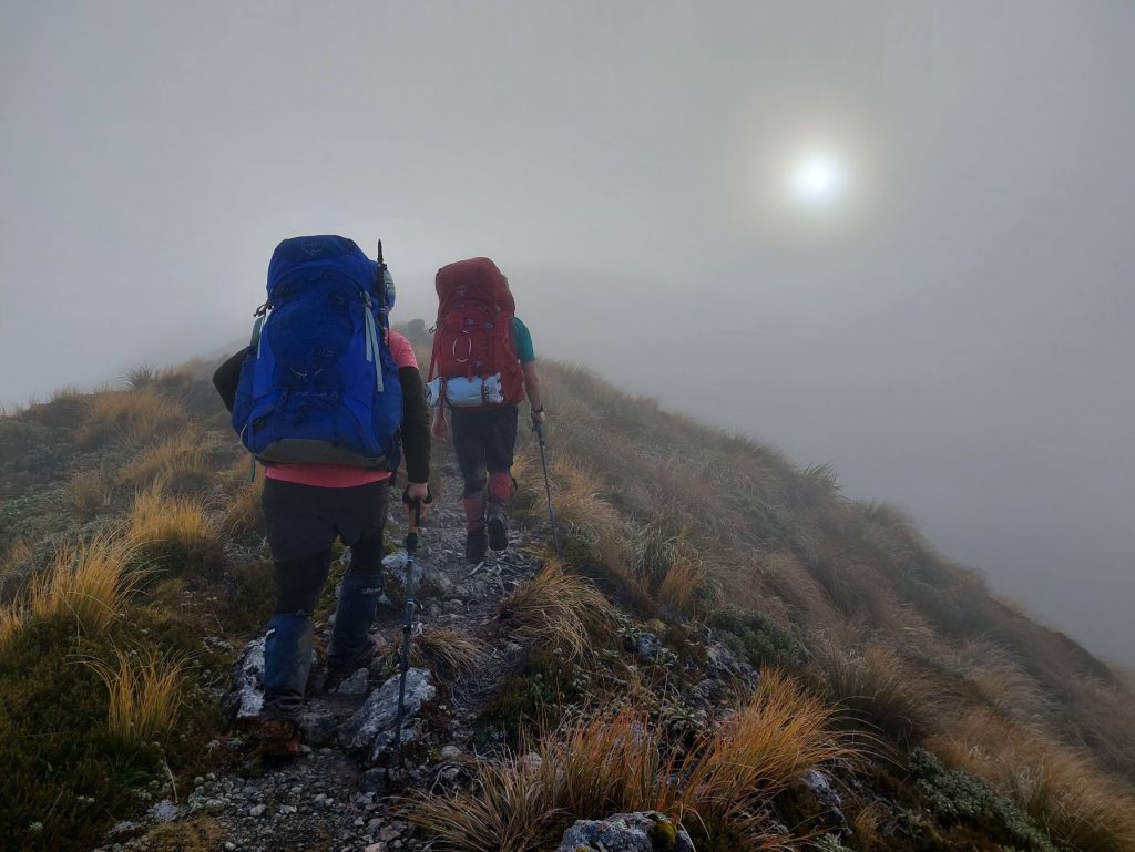
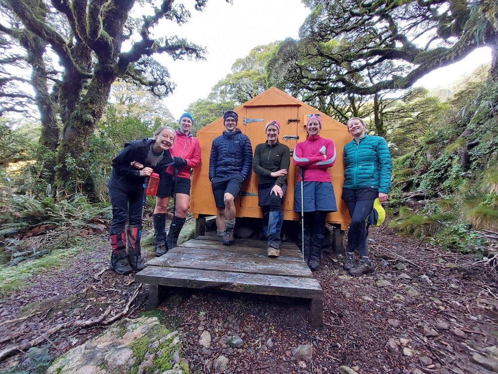
We had lunch at Mitre Flats Hut and discovered from the hut book that there are already three people heading to Dorset Ridge Hut. It’s still cloudy, and as we finish lunch we make bets on how long the 1100m climb up to the top of Pukeamoamo/Mitre Peak will take. We climb up, moving about 400m per hour, and pop out at the bushline into clag (but no wind). It looked like it was going to be a nice view of the inside of clouds all the way to Dorset Ridge Hut.
At this point it was very clear that at least some of our journey was going to be in the dark. And I thought about the annoying way head torch beams reflect back at you when you’re walking in clag, while pondering how chilly the inner porch of Dorset Ridge Hut would be if there are no spare bunks or floor space left in the Hut when we get there. The lure of red-line exploring unmarked tracks down into Dorset Creek and back up to South King still makes me want to push on to Dorset Ridge Hut tonight, despite the potentially reflective clag and late dinner. But there are five other people on the trip, and I’m not the trip leader, so I don’t get to decide.
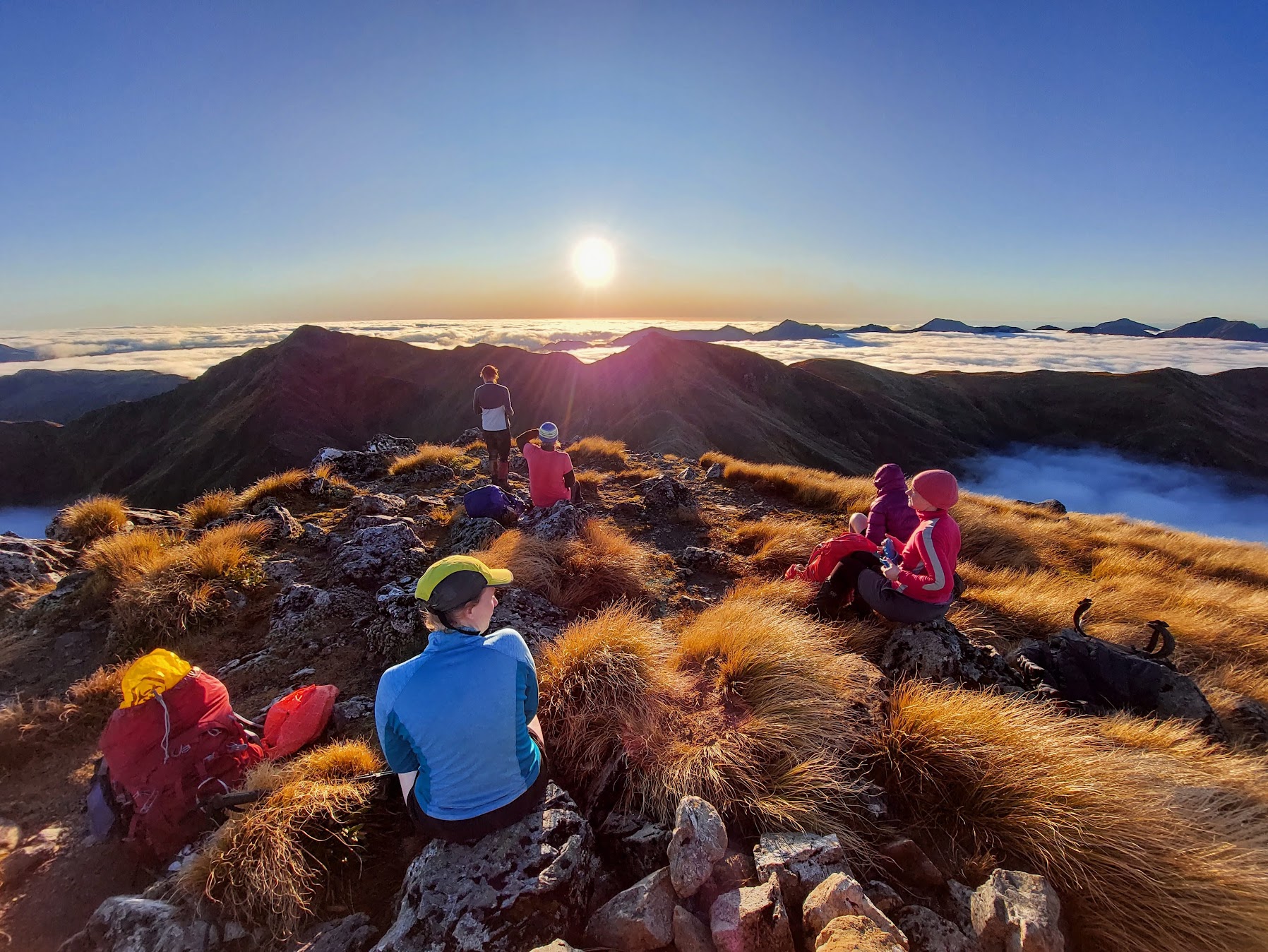
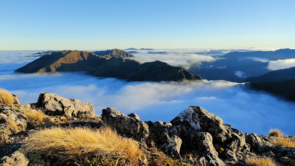
At about 1400m elevation, the cloud thins out above us, and we start to think we’re going to get a view – or at least a brocken spectre. And then just a few minutes later, we’re completely above the cloud and we’ve entered this magical world of inversion tramping.
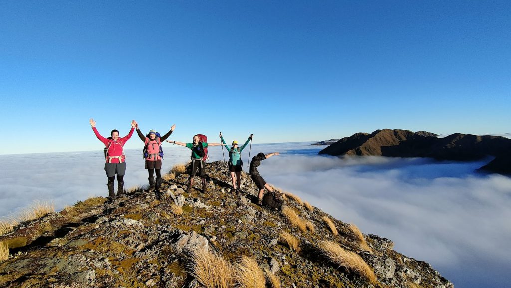
The North Island has almost completely disappeared, and it’s as if we’re the only people left in the world on a set of small, steep, spiny islands. Our spirits have heightened about 400% as a result of our entry into this new spiny world. And we’ve almost reached the highest point on our route – so the 1100m of climbing is almost over. We prance about with joy on Peggy’s Peak and somehow coordinate ourselves to spell out WTMC for a photo.
It’s 4pm when we reach the summit of Pukeamoamo/Mitre Peak, and we stop for a snack break. Anne has won the competition for travel time estimation – at 3.5hrs for the climb (including much reduced pace above the clouds – due to irresistible photo opportunities).
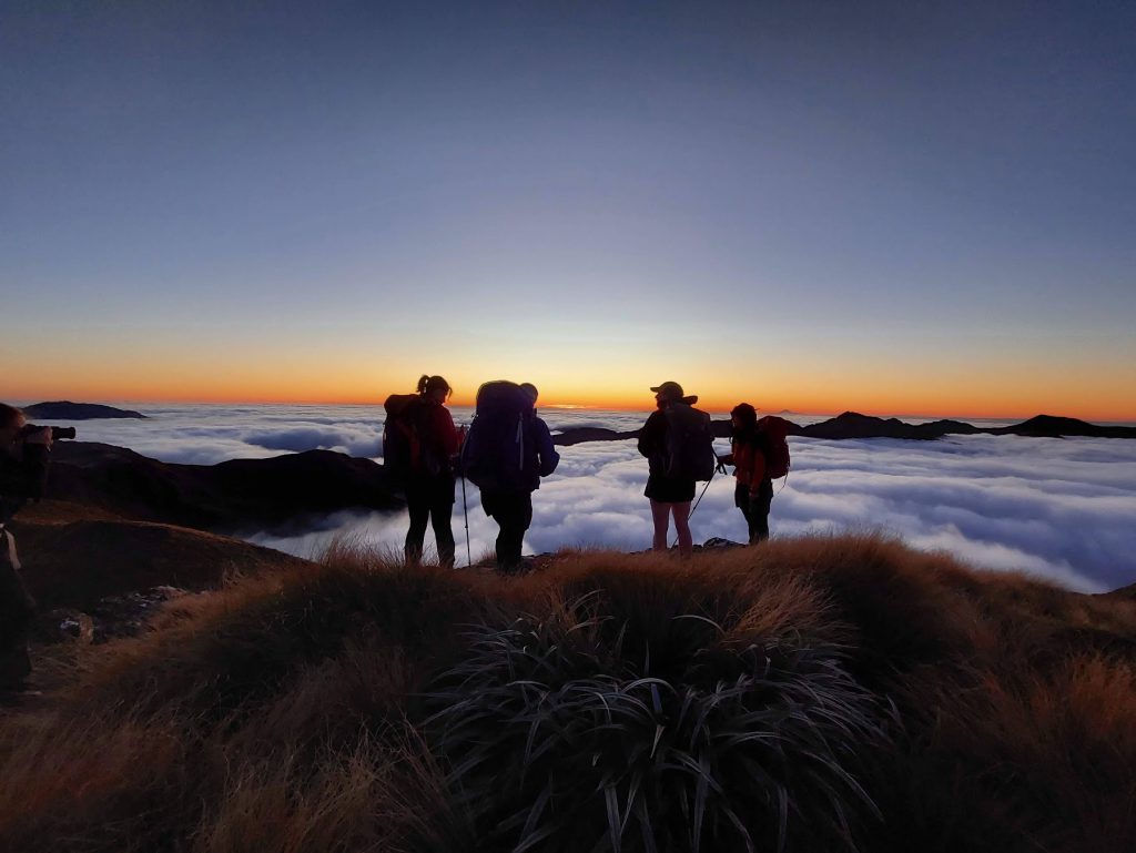
We can see Dorset Ridge Hut, which Mathew optimistically declares is only 2 hours away (of course he could make it there in 2 hours, but as a group of six, our pace was unlikely to be speedy. Especially once darkness falls). None of us care about forward progress as we’re in the magical kingdom of the windless Tararua Ranges, with views of Taranaki Maunga and Ruapehu. And golden hour is here. Many more photos are taken (perhaps even some WTMC Photo Competition entries) as we wind our way off Pukeamoamo/Mitre Peak, over Brockett and along to Girdlestone, watching the last of the sun’s rays disappear. We spot another group on the Table Ridge skyline and we also occasionally hear their voices – we’re not the only ones enjoying this magical inversion world or the only ones who will be out in the dark!
Before we leave the top of Girdlestone, Mathew had canvassed the group and made the call that we’d stop at Tarn Ridge Hut. We work our way along the spiky bits of the ridge beyond Girdlestone, and down to the hut. We converged with the other group and their dog, just as we arrive at the hut.
The tap on the water tank at the hut is broken and it takes us a while to work out the combination of moves necessary to extract enough water for a hot drink. In the meantime, dinner is well underway and we’ve spent some time discussing potential routes for tomorrow. The hut is pretty damp – many of the mattresses are mouldy. The toilet has no door and has an ice-rink for a floor. It’s all in need of some maintenance. But there’s no complaining as the sunset was unbeatable.
Sunday
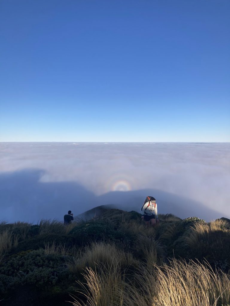
Morning arrives with clear skies and still no wind. We’ve decide on an exit via Mid-King Biv, so we climb back up towards Girdlestone as the sky lightens with beautiful dawn colours. The group remark on the exposure that was masked from us in the dark the previous evening.
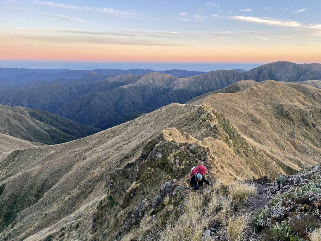
We hut, ridge and peak-spot with excellent visibility in all directions. In addition to Taranaki Maunga and Ruapehu, this morning we can also see Mt Tapuae-o-Uenuku. More importantly, especially for Club President Anne and her self-acknowledged obsession with it, we also spot Carkeek Hut.
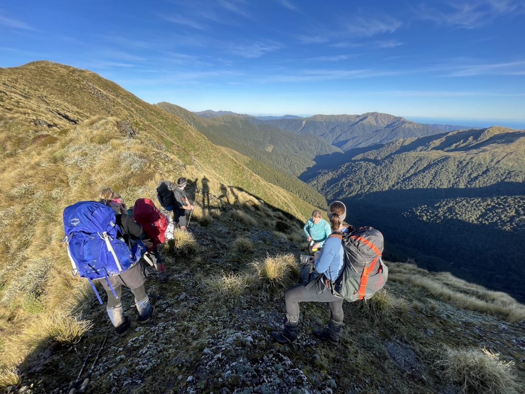
A helicopter keeps coming and going, but we don’t see it land. Perhaps they are just making the most of the perfect flying conditions. It hovers over McGregor Biv for a while, and then flies out more than once with something attached to the strops. Still a bit of a mystery. But fun to watch as we make our way over Adkin and The Kings to the sign pointing out the descent to Mid-King Biv.
The conditions were still so nice that it was tempting to sit around in the sun for way too long. But we do have a road end to make it to, so we continue down the spur to the Biv. On the way, there was a fair amount of scratchy leatherwood to push through. We lunch at the junction to the Biv, still in the sunshine, before going to bag the Biv, knowing it would be cold and damp.
Then there’s the unmarked track down to South Mitre Stream – which despite having followed several times, I still seem to lose the track at the same point each time. We picked the track up again pretty quickly for the rest of the descent, then skirted round to the swing bridge just before the hut. The fun stuff was over. We now just had the joys of the Barra Track to get us back to the van – with head torches needed for about half the way. The ups and downs of the track were muted by the boost we’d all had from the magical conditions on the tops. So I’ll have to remember that when I next consider whether to stay and sleep the whole weekend at Mitre Flats Hut!
Timings:
Saturday: Total 9h
Walk into Mitre Flat Hut: 3h 20
Up to Mitre Peak: 3h 30 (including photos!)
To Tarn Ridge Hut: 2h
16.8kms, 1923m ascent
Sunday: Total just under 12h
Tarn Ridge Hut to Adkin: 2h 30
Adkin to Middle King: 1h 40
Middle King down to intersection for Mid-King biv: 1 h
(30min lunch)
Return trip to Mid King Biv: 30 min
Walk down to Mitre Flats: 3h
Out to road end: 3h 20
16.74kms, 1073m ascent